Category: Applications

  • Part 2: Is It Legal to Fly Drones for Mapping in the United States?

    After I published last month’s Is It Legal to Fly Drones for Mapping in the United States? article, I received a bit of reader feedback and attended a small conference focused on UASs for mapping. I learned and experienced a few new thoughts about UASs for mapping in the United States, so I thought I’d share them in a second installment.

    In early December, I attended the UAS Precision Farming Forum, a local conference that was sponsored by Yamhill County (Oregon) and targeted at the agriculture market. Yamhill County covers 718 square miles (1,860 square kilometers) and contains a healthy number of agricultural and vineyard farms.

    The conference was filled to capacity with 120 attendees, a complete lineup of speakers, and even a couple of exhibitors — not bad for a county-hosted local conference. This, and other such conferences around the United States, speaks volumes about the intense interest in UASs for agricultural uses in the U.S. For instance, the Association of Unmanned Vehicle Systems International (AUVSI) hosts an annual conference that attracts more than 8,000 attendees.

    At the Yamhill conference, I was most interested in hearing what speakers, attendees and exhibitors were saying about the FAA rules on civilians flying UAVs. The FAA is pretty clear (at least when responding to me and others) about the rules for civilian use.

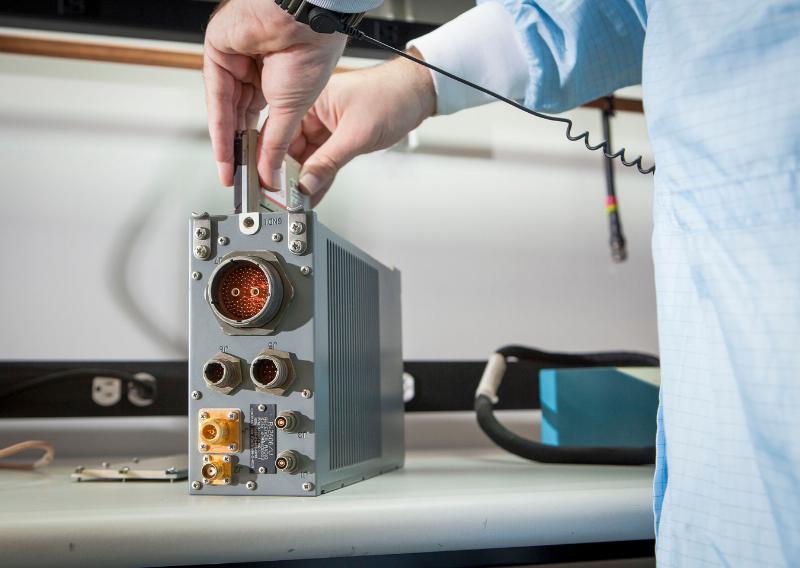
    First of all, the most prolific user of UASs for mapping in Oregon seems to be Oregon State University, who possess eight Certificates of Authorization (CoA) from the FAA (Federal Aviation Administration) to operate UASs for research purposes, according to Dr. Michael Wing, associate professor of Geomatics. Dr. Wing explained that applying for a CoA from the FAA is an intense process requiring a lot of detail.

    PROJECT SITE PLATFORM SENSOR PARTNERS
    Forest Canopy/Structure McDonald Forest Prioria Maveric EO n-Link
    Search and Rescue McDonald Forest Aerospace Vapor/VTOL EO/IR n-Link
    Xmas Tree Research OSU No. Willamette Mikrokopter VTOL EO OSU, n-Link
    Potato Research HAREC Lockheed/Procerus EO/IR Boeing, n-Link, USDA
    Potato Research HAREC Tetracam HawkEye EO/IR Boeing, n-Link, USDA
    Large Scale Potato Res. Boardman Lockheed/Procerus EO/IR Boeing, n-Link, USDA
    Large Scale Potato Res. Boardman Tetracam HawkEye EO/IR Boeing, n-Link, USDA
    Flight Research Olympia Tetracam HawkEye Boeing, n-Link

    Dr. Wing also presented the bill of materials (BOM) for one of the UASs they are using, a Zephyr II.

    RiteWing Zephyr II
    RiteWing Zephyr II – 54″ Wingspan

    Zephyr II components (per OSU):

    2.4GHz Tx/Rx radio $360
    4500mAh LiPo battery $30
    Airspeed sensor $25
    ArduPilot APM 2.5 $160
    Canon S100 $300
    RiteWing Zephyr II $325
    TTC Radio $86
    uBlox GPS module $76
    Voltage regulator $15
    Total: $1,377

    When I asked Dr. Wing about the CoA restrictions, he said the CoAs require him to have an FAA-licensed pilot on site for each mission.

    If you recall from last month’s article, the FAA was very clear in responding to my queries that civilian commercial operation of UASs in the U.S. are prohibited unless the operator possesses a CoA from the FAA. Furthermore, the FAA says that commercial operation of UASs in the U.S. airspace is not allowed. The FAA is working on rules to integrate commercial UAS operation into the U.S. NAS (National Airspace System). The local AUVSI president, in his keynote speech, essentially said the same thing.

    I went to the exhibition area because I wanted to talk to the exhibitors and understand who their target market was, since commercial operations of UASs are prohibited. Their answers were interesting. Their first answer was that “farmers can fly UAS as hobbyists.” Recall that hobbyists (or modelers as the FAA refers to them) can operate UASs up to 400 feet above ground level (AGL). I asked the FAA specifically about this. They say that any commercial usage of UASs is prohibited. For example, you can take the same UAS that you fly for fun, and you are permitted to fly it below 400 feet AGL. However, once you use the same UAS for commercial purposes (such as mapping your farm), you are violating the FAA rules.

    When I pushed the vendor about this, his next answer was “as long as the farmer only flies it above his or her farm, they are allowed.” While I can sort of understand the logic behind his first statement, this statement didn’t make sense to me. If he’s using it for a commercial purpose, what difference does it make if it is over his own property or not? The problem I have with the vendor’s attitude is that he has little risk. It’s not against the FAA rules to sell UASs for commercial purposes. FAA rules are only violated when someone uses a UAS for commercial purposes. The bottom line: caveat emptor (buyer beware). The FAA is likely not going to pursue the manufacturer or distributor of the UAS, only the operator (the farmer).

    But, is it really against FAA rules to operate commercial UASs in the U.S.? The vendor claimed that he asked the FAA, and said that you will get a different answer from the FAA depending on who you speak to. To some extent, I understand the confusion. Furthermore, when I asked the FAA to cite examples of litigation, enforcement actions, etc., I was told I would need to file a Freedom of Information Act request (FOIA), which I did about November 12. Beyond acknowledging my request, the FAA has sent nothing. I’m told from others that they have made similar requests (months ago) and have still not received the FOIA information. This certainly casts a cloud of doubt over the confidence the FAA has in its position.

    Has anyone actually tested the FAA’s position in court?

    Thanks to Twitter, I linked up with an attorney who is representing a UAS operator who is being sued by the FAA for flying a UAS for commercial purposes in the United States. Attorney Brendan M. Schulman says his client’s case is the first to test the FAA rules in court. Mr. Schulman says that the FAA has no basis on which to enforce the rules. He’s arguing that the “FAA’s position is based on policy statement and not an enforceable regulation.”

    Schulman’s client, Raphael Pirker, a Swiss citizen and resident, was assessed a $10,000 fine pursuant 49 U.S.C. §§46301(a)(1) and (d)(2) and 46301(a)(5). The FAA argues that Pirker:

    1. On or about October 17, 2011, you were the pilot in command of a Ritewing Zephyr powered glider aircraft in the vicinity of the University of Virginia (UVA), Charlottesville,

    2. The aircraft referenced above is an Unmanned Aircraft System (UAS).

    3. At all times relevant herein you did not possess a Federal Aviation Administration pilot certificate.

    4. The aircraft referenced above contained a camera mounted on the aircraft which sent real time video to you on the ground.

    5. You operated the flight referenced above for compensation.

    6. Specifically, you were being paid by Lewis Communications to supply aerial photographs and video of the UVA campus and medical center.

    7. You deliberately operated the above-described aircraft at extremely low altitudes over vehicles, buildings, people, streets, and structures.

    8. Specifically, you operated the above-described aircraft at altitudes of approximately 10 feet to approximately 400 feet over the University of Virginia in a careless or reckless manner so as to endanger the life or property of another.

    9. For example, you deliberately operated the above-described aircraft in the following manner:

    a. You operated the aircraft directly towards an individual standing on a UVA sidewalk causing the individual to take immediate evasive maneuvers so as to avoid being struck by your aircraft.
    b. You operated the aircraft through a UVA tunnel containing moving vehicles.
    c. You operated the aircraft under a crane.
    d. You operated the aircraft below tree top level over a tree lined walkway.
    e. You operated the aircraft within approximately 15 feet of a UVA statue.
    f. You operated the aircraft within approximately 50 feet of railway tracks.
    g. You operated the aircraft within approximately 50 feet of numerous individuals.
    h. You operated the aircraft within approximately 20 feet of a UVA active street containing numerous pedestrians and cars.
    i. You operated the aircraft within approximately 25 feet of numerous UVA buildings.
    j. You operated the aircraft on at least three occasions under an elevated pedestrian walkway and above an active street.
    k. You operated the aircraft directly towards a two story UVA building below rooftop level and made an abrupt climb in order to avoid hitting the building.
    1. You operated the aircraft within approximately 100 feet of an active heliport at UVA.

    10. Additionally, in a careless or reckless manner so as to endanger the life or property of another, you operated the above-described aircraft at altitudes between 10 and 1500 feet AGL when you failed to take precautions to prevent collision hazards with other aircraft that may have been flying within the vicinity of your aircraft.

    11. By reason of the above, you operated an aircraft in a careless or reckless manner so as to endanger the life or property of another.

    To view the entire complaint, click on FAA_Pirker_Complaint.

    Schulman argues:

    “In this proceeding, the FAA uses those same policy statements as a pretext for applying federal aviation regulations to the operation of model airplanes. This approach violates the most basic tenets of regulatory law and the Administrative Procedures Act which require a valid notice and comment rulemaking process before legislative rules are issued. Both at the time of Mr. Pirker’s model aircraft operation in 2011, and still today, there exist no enforceable federal aviation regulations concerning the operation of civilian “drones,” whether that operation is for commercial purposes or otherwise. For the reasons set out below, the Administrator’s civil penalty is improper as a matter of law and the Complaint must be dismissed in its entirety.”

    To view Schulman’s entire brief, click on FAA-v-Pirker. Per Schulman’s brief, he has asked the court to dismiss the case for reasons he outlines. He is awaiting the judge’s response. If the case is not dismissed, Schulman says the next step is discovery and a hearing.

    On a related note, Schulman’s law firm, Kramer Levin Naftalis & Frankel LLP, announced on December 18 that they launched a new practice group named Unmanned Aircraft Systems Practice Group. Following is the announcement:

    In light of the increasing use of drones for commercial purposes, Kramer Levin Naftalis & Frankel LLP has launched a practice group dedicated to providing counsel to clients in this rapidly growing industry. The Unmanned Aircraft Systems Practice Group is a multidisciplinary team of Kramer Levin attorneys who are versed in the legal complexities of the nascent commercial drone revolution.

    Emerging commercial drone technology presents a number of economic opportunities, as well as the prospect of enhanced worker safety in hazardous conditions, humanitarian benefits in search-and-rescue and disaster missions, and environmental advantages through improved agriculture, energy and infrastructure management. Kramer Levin’s new practice will provide sophisticated and creative problem-solving approaches in this uncharted legal territory.

    “Unmanned aircraft technology will define the next century in countless industries in the United States and will present new legal challenges in a number of areas including regulatory policy, aviation law, property rights, and intellectual property law, to name a few,” said Paul S. Pearlman, Kramer Levin’s managing partner. “As the definitive leaders in this field, we saw an opportunity to formalize a practice area led by informed attorneys who can advise clients in a wide range of industries.”

    The firm is currently representing Raphael Pirker, the world’s foremost civilian drone pilot, in the first federal case ever involving the operation of commercial drones in the United States. Kramer Levin attorneys also regularly advise individuals, corporations, venture capital firms, educational institutions and robotics developers worldwide on the use of unmanned aircraft technologies in commercial, educational, public interest and scientific applications.

    “The landmark case we are litigating will have enormous regulatory and economic implications for the industry’s future,” said Brendan Schulman, special counsel at Kramer Levin who has two decades of hands-on experience with unmanned aircraft and understands how the technology works and how to apply it safely and effectively. “This is a game-changing moment for forward-thinking businesses, and we are here to assist our clients navigate legal issues so they can become the next decade’s pioneers in their industries.”

    In addition to Mr. Schulman, the new practice area will include attorneys from a number of existing firm practice areas including corporate, environmental law, litigation, intellectual property, insurance, government relations, and regulatory issues.

    I’ll keep you updated on the FAA v. Pirker case as it evolves.

    Thanks, and see you next month. Happy Holidays!

    Follow me on Twitter at https://twitter.com/GPSGIS_Eric

  • 2013: A Positive Year for Location Industry


    2013 was an up-and-down roller coaster of a year for the location industry…and 2014 appears to be more of the same. What was the big story? Google buying Waze? While it is easy to predict what will happen, the harder thing to do is to predict when it will happen. With that in mind, LBS Insider reached out to industry veterans to discuss the big buzz in 2013 in the industry — and what the future holds, next year and beyond.

    It’s that time of year — to assess the big deals and trends — good, bad and ugly — in the worldwide location industry. Some of the stories seem obvious, such as the Google acquisition of Waze for more than $1 billion.

    “The valuation remains a mystery to many in the mapping community, but it is always nice to see a truly great exit in this business.  There haven’t been enough for an industry that is both foundational in mobile and online, and really hard to do well,” said Marc Prioleau, president of Prioleau Advisors.

    Prioleau says one of the big stories of 2013 was the reemergence of Apple Maps.  “For all the flak they took, they’ve worked hard to make them better.  Their default position in iOS has given them traffic, as has the extension to OSX in the Maverick’s release,” he said.  “Last year you saw Apple start to buy companies that could extend the features (like HopStop), a sign that they think they’ve fixed the major problems and are working on moving forward. They are also hiring aggressively and have brought in some very good people.”

    Last year, Prioleau predicted that the combination of data with location to derive better location-based context would be a big thing.  “I think a lot has happened in that area with much more to come.  It’s happening in apps (see Foursquare recommendations), advertising (PlaceIQ and others), CRM (SAP Precision retailing as an example),” he said. “There is a lot more to come here, and we should expect many new applications, most of which will do things badly, but some — likely the ones with the most targeted data — will do things that really change the model.”

    Prioleau says MapBox is making mapping cool again (and Prioleau is a director at the company).  “Just when all was going to be subsumed by the Google Maps juggernaut, MapBox is doing new interesting data visualization work,” he said.

    Crowdsourcing being embraced by the wider mapping community is another big trend Prioleau has identified.  “Everyone knows about OSm, but then you add Waze for crowdsourcing real-time traffic plus map corrections. Google is in deep with MapMaker, and even Nokia is pushing crowdsourced input,” he said.  “It’s no longer the battle between crowdsourced maps and professional maps. It’s how to make the two work together.”

    Prioleau sees the location industry having a few benchmarks in 2014.  “I’ll stick with the same prediction as last year:  Data + location for better location context. Google Now is a great benchmark,” he said. “Break out in location-based ad targeting. The technology is better, and the providers really understand the advertising market now. Complementary ad technologies like Real Time Bidding are maturing, and these will fit in to a model that really works. And if for no other reason, if we keep predicting it, it will be right one year, right?”

    Prioleau believes Google Map domination will begin to show cracks. “Google has a great platform, but as they monetize it more aggressively, more companies will look for alternatives,” he said. “Apple maps will be one. HERE will be another. But solutions from MapBox and others will grow as well.”

    In terms of connected car and other automotive technology, Prioleau says new and interesting applications will come from local search, driver services, and diagnostics — rather than just basic navigation.

    Another industry insider, Mike Dobson, president of TeleMapis, said 2013 was a quiet year for location-based services.  “Even the biggest deal, Google’s acquisition of Waze, does not look as if it will have much impact, other than as a defensive strategy. Perhaps the most interesting aspect of the year was the stream of patents covering LBS and GIS-like applications from both Apple and Google, not to mention those of several start-ups,” he said.

    From his perspective, Dobson said 2013 was yet another year in waiting, but 2014 looks like it might actually be exciting. “It appears that Google will finally make its move into the in-car navigation market. Apple is beginning to play with the idea of allowing its users access to a more GIS-like parsing of its map database,” he said. “Perhaps the biggest change will be a new focus on thematic maps that aim not to be navigation aids, but to perform the function of information devices for travelers and others using directed search technology. I suspect that 2014 will be another slow year for indoor positioning, but maybe it will flourish as a subset of BIM.”

    Indoor Mapping Still Considered Trend for Location Industry

    While many in the location industry have seen new companies and products coming to the indoor positioning market, at least one analyst says that Wi-Fi positioning has been weak.

    “The biggest trend in 2013 was indoor mapping, the beginning of the hockey stick adoption curve in my opinion. Major retailers like Home Depot, Lowes, etc., launched indoor maps with product search/locator,” said industry veteran Kris Kolodziej. “What was overblown was indoor Wi-Fi positioning. The latency and accuracy is not good enough for micro location. It’s good enough to know what store/venue you’re in, but that’s about it.”

    Kolodziej said that the big deal in 2014 will be ibeacons or Bluetooth low energy (BLE) for micro location and proximity services. “BLE solves the many shortcomings Wi-Fi has,” he said.

    Prioleau says that in-door location will be big, but it is where outdoor location was in the early 1990s:  many technologies and technology providers all pushing different solutions — and most will not succeed.

    “Beyond the location technology, the market needs to figure out how the money will flow from beneficiaries of the market (retailers, brands) to the providers of indoor location technology (mostly semiconductor companies and tech companies).  There is no natural connection,” he said.

  • Nautiz X1 Ultra-Rugged Smartphone Is Now Shipping

    Nautiz X1 Ultra-Rugged Smartphone Is Now Shipping

    The Nautiz X1.
    The Nautiz X1.

    Handheld Group, a manufacturer of rugged mobile computers, PDAs and smartphones, has started shipping the Nautiz X1. The Nautiz X1 is a rugged enterprise smartphone — it’s waterproof, dustproof, shock-resistant and can handle extreme temperatures, yet it’s also slim, lightweight and smartly designed for both work and play, the company said.

    The Nautiz X1 is now shipping to customers worldwide. Interest in Handheld’s ultra-rugged smartphone has been tremendous, and the first batches are completely sold out, the company said.

    The Nautiz X1 is part of the Nautiz product family of rugged and ultra-rugged PDAs and smartphones. It has an IP67 ingress protection rating, which means it’s fully dust- and waterproof and can withstand immersion in water, and it also meets stringent MIL-STD-810G military test standards for enduring humidity, vibration, shock and extreme high and low temperatures.

    “As a company specializing in rugged computers, we know our customers expect all our products to be built rugged from the inside out. The Nautiz X1 is no exception — it comes with the reliability and sturdiness of an ultra-rugged computer,” says Product Manager Johan Hed of Handheld Group. “People are increasingly using their smartphones all the time, everywhere, and they’re expecting mobility and connectivity anytime, anywhere, and in all environments and weather conditions. The Nautiz X1 ultra-rugged smartphone is a natural choice, as it’s built to survive these challenges.”

    “This is the toughest smartphone ever built,” said Jerker Hellström, CEO of Handheld Group. “We see a huge demand for truly rugged smartphones among field professionals and outdoor enthusiasts who want to be constantly connected. We’re excited to see the great response this product receives from the market.”

    The Nautiz X1 is slim and lightweight, weighing in at less than 180 grams (6.3 ounces). It has a 4-inch special sunlight-readable capacitive touchscreen and ultra-durable Gorilla Glass. It runs on a powerful 1 GHz dual-core processor and has 1 GB of RAM. It features Bluetooth, Wi-Fi, a compass, a professional u-blox GPS, and a 5-megapixel camera. The Nautiz X1 comes with Android 4.0 (Ice Cream Sandwich) or Windows Embedded Handheld 6.5 operating system, and runs on both GSM and CDMA networks. Multiple battery options enable a full day’s work in the most demanding environments.

  • Raytheon Receives $16M Contract for Miniaturized Airborne GPS Receivers

    Raytheon Receives $16M Contract for Miniaturized Airborne GPS Receivers

    The open architecture design of MAGR 2000-S24 allows modernization and upgrade of GPS functional capabilities through replacement of a single electronics module.
    The open architecture design of MAGR 2000-S24 allows modernization and upgrade of GPS functional capabilities through replacement of a single electronics module.

    Raytheon Company has received a $15.8 million contract order for its MAGR 2000-S24 miniaturized airborne GPS receiver. The order, which includes new production and sustainment of existing systems, is the first under an Indefinite Delivery-Indefinite Quantity (IDIQ) contract awarded to the company in September 2013 by the U.S. Air Force Space and Missile Systems Center.

    Raytheon recently completed its 2,000th delivery of MAGR 2000 systems to the U.S. military and its allies in Europe, the Middle East and the Asia Pacific region. Flown on 20 types of fixed- and rotary-wing platforms, the MAGR 2000-S24 provides unparalleled navigation accuracy and resistance to interference and jamming. Its open architecture design allows for insertion of future GPS modernization enhancements, such as the new military code signal, without having to replace the unit itself.

    “With the increasingly sophisticated threats posed by potential enemy nations, our customers recognize Raytheon as the gold standard for highly secure, highly adaptable GPS receivers for the airborne military environment,” said Sharon Black, director of GPS and Navigation Systems for Raytheon’s Space and Airborne Systems business. “Our innovative MAGR 2000-S24 design makes future unit replacement virtually unnecessary. Capability enhancements are as simple as swapping out the electronics module card, providing a highly cost-effective path for keeping fleets up-to-date with the latest GPS technology.”

    The current MAGR 2000-S24 IDIQ contract extends through September 2017. The first order of 323 production units is scheduled for completion in June 2015.

  • Proliferation of GPS-enabled Smartphones Spurs Growth of Global Location-based Applications Market

    The global market for location-based applications is poised for rapid growth, as the mass adoption of global positioning system (GPS)-enabled smartphones is encouraging developers to introduce numerous advanced applications, says market research agency Frost & Sullivan.

    New analysis from Frost & Sullivan finds that indoor connectivity, augmented reality, big data and wearable devices are the key technology trends likely to fuel the uptake of location-based applications. Location-based technology and data can then be combined to facilitate the development of smart spaces in every city and community.

    “Location-based application developers have so far focused on the development of outdoor applications due to the adoption of GPS positioning in smartphones,” noted Frost & Sullivan Information & Communication Technologies Research Analyst Shuba Ramkumar. “However, as individuals spend more time indoors, there is a need to roll out indoor location-based applications that capitalise on various functionalities such as mapping, navigation and geo-fencing.”

    According to the announcement, augmented reality technology could also be used to make location-based applications more interactive. Further, the widening ecosystem of wearable devices such as Google Glass and Samsung Galaxy Gear infuses technology into the daily lives of individuals, widening the scope of context-aware applications. However there are several challenges restricting the growth of the location-based applications market. The lack of standardisation in indoor positioning technologies such as Wi-Fi, sensors and Bluetooth is complicating the development of indoor applications. Location-based application providers will need to wait until wearable device manufacturers address the issues of limited battery life and dependence on smartphones for outdoor connectivity.

    Frsot & Sullivan reports that market participants also find it difficult to monetise applications due to the absence of a clear business model. In this scenario, application developers should seek to identify new sources of revenue. They can expedite market expansion by establishing contracts with indoor venues to provide customised applications, and by working with wearable device manufacturers to create related applications.

    “Stakeholders should work together to identify the most reliable and accurate indoor positioning technologies that can steer the indoor connectivity market forward,” said Ramkumar “The In-Location Alliance is one such initiative formed by market participants to discuss and resolve issues concerning indoor positioning technologies.”

  • Topcon Ag Introduces X14 for Entry-Level Guidance

    Topcon Ag Introduces X14 for Entry-Level Guidance

    Topcon's X14 touchscreen display for precision agriculture.
    Topcon’s X14 touchscreen display for precision agriculture.

    Topcon Precision Agriculture is introducing a new 3D color touchscreen display, the X14. The precision farming in-cab display offers entry-level guidance with the look and feel of TPA’s larger, easy-to-use X30 touchscreen console, the company said.

    The 10.9-cm (4.3-inch) full-color 3D touchscreen offers moving map visualization and an on-screen, software-based virtual lightbar. For low-cost guidance, the X14 can be paired with Topcon’s SGR-1 GNSS receiver featuring TruPass technology.

    For high-accuracy autosteering, the X14 can be paired with Topcon’s new AGI-4 GNSS receiver/steering controller, which provides autosteering performance and modular upgradeability to add high-accuracy inertial sensors or RTK correction communication.

    “The X14 offers a simple, icon-based, user-definable interface with a full range of guidance patterns including boundary and U-turn recognition,” said Kevin Cobb, TPA director of product management. “The bright, sunlight readable display offers easy setup on leading market vehicles, and is an outstanding addition to our growing line of innovative, easy-to-use, full-featured color touchscreen consoles.”

  • Averna DP-360 DOCSIS Protocol Analyzer Supports 16×4 Channel Bonding

    The Averna DP-360 protocol analyzer.
    The Averna DP-360 protocol analyzer.

    Averna has issued a new software release for the DP-360 DOCSIS Protocol Analyzer, featuring support for 16×4 channel bonding for broadband testing.

    Averna’s DP-360 provides functional DOCSIS and EuroDOCSIS network analysis, allowing for exceptional visibility into all layers of the network, the company said. Multiple system operators (MSOs), chipset manufacturers, product developers and certification bodies use the DP-360 to quickly find and correct trouble spots.

    New DP-360 release highlights:

    • Supports up to 16 single or bonded downstream channels for testing 16×4 configuration.
    • Upstream gain control, MER reading and power reading available in the remote API for automated power adjustment.
    • Automatic detection of modulation type (64-QAM or 256-QAM) and DOCSIS on downstream channels and lock on 4 upstream frequencies for faster setup and analysis.
    • Support for DOCSIS 3.0 Energy Management messages (EM-REQ & EM-RSP).

    DP-360 clients also have access to Averna’s new DOCSIS 3.1 Early Adopter Program, which offers MSOs and equipment vendors a smooth and cost-effective transition to Averna’s next-generation solution for testing their cable equipment based on the new DOCSIS 3.1 standard. Contact us for more details.

    “Our DOCSIS 3.1 Early Adopter Program covers current D3.0 as well as upcoming D3.1 testing needs and is specifically designed to make the technology switch as easy and cost effective as possible for our clients and partners,” commented Alex Pelland, Director of Broadband Test Strategy for Averna. “The DP-360 is the most advanced DOCSIS protocol analyzer available today and, with our forward-looking transition program, it will provide a substantial return on investment for years to come.”

    The new DP-360 software release is available at no cost to customers with a valid DP-360 maintenance and support agreement.

  • skobbler Updates GPS Navigation App for iOS 7

    skobbler has launched a new version of GPS Navigation optimized for iOS 7. The app now includes a travel guide, hyperlocal search, and mapping technology provided by skobbler’s NGx map engine.

    Powered by data from the OpenStreetMap — a free and editable map of the world built by over 1 million voluntary contributors and map enthusiasts — GPS Navigation delivers true “hybrid” functionality, allowing users to switch between online or optional offline access through in-app purchases of downloadable maps, regardless of location or cellular connection, skobbler said.

    Offline functionality allows for fast and reliable results using only a device’s GPS receiver rather than a network connection, meaning turn-by-turn navigation, alternate routing and various search capabilities are provided in full without a data connection.

    GPS Navigation now features a comprehensive in-app travel guide and hyperlocal search via Wikitravel — which provides users with more than 90,000 pages of worldwide travel information in the English language alone — and TripAdvisor integrations.

    Much like GPS Navigation’s online-offline mapping functionality, users can also access travel guide information with or without Internet connectivity, allowing access to the app’s travel features without roaming charges by opting for offline usage.

    GPS Navigation is available for a one-time purchase of $0.99 via the iTunes App Store.

  • Proteus Provides Satellite-Derived Bathymetric and Seafloor Maps for Military Exercise

    Proteus FZC, a provider of satellite-derived mapping solutions, has delivered accurate bathymetric and seafloor classification maps for a joint UK-France amphibious military exercise on the Island of Corsica. In the pilot managed by the UK Hydrographic Office (UKHO), Proteus partnered with DigitalGlobe to derive accurate bathymetric measurements and identify four seabed types to a depth of 12 meters from multispectral satellite imagery without ground control.

    “We completed the Corsica coastal marine mapping project at about one-tenth the time and cost of traditional sonar or LiDAR,” said Proteus CEO David Critchley. “Because the data is derived exclusively from satellite imagery, we leave no environmental footprint and face no airspace restrictions.”

    For the joint military operation, the British and French armed forces requested detailed information about water depth and the submerged seabed along specific sections of the Corsican coastline so that amphibious military vehicles could be launched from larger vessels anchored offshore and safely landed on the island’s beaches. The custom maps created by Proteus were used by the military to select precisely where the landings would occur.

    “The vertical accuracy of our bathymetric maps was verified at 10-15 percent of water depth,” said Critchley. “If ground truth data were available, the measurements would have been accurate to a solid 10 percent of depth.”

    Working with eight-band multispectral image data with two-meter resolution collected by DigitalGlobe’s WorldView-2 satellite, the Proteus-led team achieved the bathymetric measurements in Corsica’s Mediterranean coastal zone to a total depth of 12 meters. In a separate processing procedure, the team also extracted four critical seafloor types from the imagery – sand, rock/debris, vegetation and mixed seabed.

    Since 2011, Proteus has been producing seafloor survey and seabed classification projects using multispectral satellite imagery. The product generation technology that can be carried out in a fraction of the time and cost of traditional methods. These mapping projects have been delivered for environmental, oil and gas, marine biology and other coastal zone applications in Europe, the Middle East and Caribbean. Derived products have high accuracy, meeting the requirements of engineering, environmental monitoring and strategic geospatial planning applications.

    The project was written up in the January/February 2013 issue of Hydro International magazine.

  • Meitrack Offers MT90 Personal Tracker

    Meitrack Offers MT90 Personal Tracker

    The Meitrack MT90.
    The Meitrack MT90.

    GPS tracking company Meitrack is offering the MT90, a GPS personal tracker for elderly, children, patients and lone workers. It can be hung around the neck or carried in a pocket or bag. The MT90 weights 65 grams and is 77 x 47 x 20 millimeters in size.

    The MT90 can last 16 hours in normal mode and up to 60 hours in power-saving mode. It is waterproof to IP66 standards, and can handle 5% to 95% air humidity, which ensures it is reliable in the case of unexpected rain or accidents with small children.

    MT90 is Meitrack’s first GPS tracker that works with SiRFStar IV GPS and quad band GSM 850/900/1800/1900 Mhz base station, facilitating bi-module positioning technology. Using this advanced technology, the MT90 can more accurately and precisely track its location.

    Equipped with an SOS button, people using the MT90 tracking device are only one click away from calling the Rescue Service Center for help. In addition, the SOS button can be programmed to call multiple emergency numbers until one picks up. This device can facilitate two-way communication along with the option to listen-in, which can be helpful when discretely trying to locate a missing person.

    The MT90 GPS tracker uses Meitrack’s protocol to track by SMS and GPRS. The MT90 has an built-in motion sensor, built-in battery, GPS blind area alarm, low-battery alarm and speeding alarm.

  • Galileo Achieves First Airborne Tracking

    Galileo Achieves First Airborne Tracking

    Aircraft position as obtained by Galileo-only receiver during Netherlands flight.
    Aircraft position as obtained by Galileo-only receiver during Netherlands flight.

    The European Space Agency’s Galileo satellites have achieved their first aerial fix of longitude, latitude and altitude, enabling the inflight tracking of a test aircraft. ESA’s four Galileo satellites in orbit have supported months of positioning tests on the ground across Europe since the first fix in March.

    Now the first aerial tracking using Galileo has taken place, marking the first time that Europe has been able to determine the position of an aircraft using only its own independent navigation system. The milestone took place on a Fairchild Metro-II above Gilze-Rijen Air Force Base in the Netherlands at 12:38 GMT on November 12. It was part of an aerial campaign overseen jointly by ESA and the National Aerospace Laboratory of the Netherlands, NLR, with the support of Eurocontrol, the European Organisation for the Safety of Air Navigation, and LVNL, the Dutch Air Navigation Service Provider.

    A pair of Galileo test receivers was used aboard the aircraft, the same kind employed for Galileo testing in the field and in labs across Europe. They were connected to an aeronautical-certified triple-frequency Galileo-ready antenna mounted on top of the aircraft.

    Fairchild Metro-II aircraft used for Galileo airborne testing.
    Fairchild Metro-II aircraft used for Galileo airborne testing.

    Tests were scheduled during periods when all four Galileo satellites were visible in the sky – four being the minimum needed for positioning fixes. The receivers fixed the plane’s position and, as well as determining key variables such as the position, velocity and timing accuracy; time to first fix; signal-to-noise ratio; range error; and range–rate error.

    Testing covered both Galileo’s publicly available Open Service and the more precise, encrypted Public Regulated Service, whose availability is limited to governmental entities.

    Flights covered all major phases: take off, straight and level flight with constant speed, orbit, straight and level flight with alternating speeds, turns with a maximum bank angle of 60º, pull-ups and push-overs, approaches and landings.

    They also allowed positioning to be carried out during a wide variety of conditions, such as vibrations, speeds up to 456 km/h, accelerations up to 2 ghorizontal and 0.5–1.5 gvertical, and rapid jerks. The maximum altitude reached during the flights were 3000 m.

    NLR’s Fairchild Metro-II has previously performed initial European GPS testing in the 1980s, and the first tests of the European Geostationary Navigation Overlay Service, EGNOS, which sharpens GPS accuracy and monitors its reliability over Europe for high-accuracy or even safety-of-life uses.

    The definition and development of Galileo’s in-orbit validation phase were carried out by ESA and co-funded by ESA and the EU.

    The Full Operational Capability phase is managed and fully funded by the European Commission. The Commission and ESA have signed a delegation agreement by which ESA acts as design and procurement agent on behalf of the Commission.

  • Loctronix Ships ASR-2300 Software-Defined Radio Module for Indoor/Outdoor Positioning

    Loctronix Ships ASR-2300 Software-Defined Radio Module for Indoor/Outdoor Positioning

    Loctronix ASR2300 module.
    Loctronix ASR-2300 module.

    Loctronix Corporation, a provider of unified positioning solutions for GNSS-challenged environments, announced that it has begun shipments of its new software-defined radio (SDR) module, the ASR-2300, for developing high-performance positioning, navigation and timing (PNT), and communication applications.

    “The ASR-2300 delivers advanced SDR capabilities in a small, mobile form-factor enabling developers to readily create and field complex SDR-based solutions. Featuring a 2×2 multiple-input, multiple-output (MIMO) RF transceiver and an array of inertial sensors, the open-source ASR-2300 is an ideal platform for tapping advanced, multi-sensor/signals of opportunity for high-performance PNT,” said Michael Mathews, Loctronix’ CEO and founder.

    Loctronix ASR-2300 kit.
    Loctronix ASR-2300 kit.

    “Unique amongst the growing number of SDRs, Loctronix’ ASR-2300 provides multiple, fully-integrated RF paths supporting reception of GNSS, cellular, ISM band, and UHF signals of opportunity, making it well-suited for demanding scientific, military, aerospace and commercial/industrial applications, such as UAV/UAS navigation, GPS-challenged or -denied tracking and navigation, combined communications and navigation radios, and GPS integrity monitoring and validation,” Mathews noted.

    The MIMO transceiver module incorporates two wideband Field Programmable RF (FPRF) transceivers (300 MHz to 3.8 GHz), 10-axis accelerometer/gyro/compass/barometer sensors, and a large programmable FPGA capable of over 300 MiB/sec sustained communications with a host processor via USB 3.0 interface.  The module’s nine integrated RF path options and low size, weight, and power characteristics contribute to ease of integration and portability, Loctronix said.  Accommodating both internal 1 PPM TCXO or external frequency reference, multiple ASR-2300s can be inter-connected via an expansion port and/or UART interface, supporting real-time reception / transmission of 4, 6, 8 or more signals without the need for significant additional hardware.

    Developers looking to create solutions for demanding military, scientific and industrial applications will realize greater functionality with the ASR-2300, thanks to its multiple sensor and multiple frequency capabilities, Loctronix said. Additionally, access to a variety of user-friendly development tools facilitates waveform experimentation and helps speed the creation of these new solutions, resulting in shorter development times and lower development costs for high-performance PNT applications.

    Bundled kits, which include the module, housing, and power/data communications/RF interfaces, are priced at $1,600 with a special educational discount available for qualified institutions.  The ASR-2300 SDR is available directly from Loctronix.