NAL Technologies (Naltec), a provider of assured positioning, navigationand timing (APNT) solutions, has added to its Alternative Location and Timing Module (ALTM) family with ALTM-T. The ALTM-T module is engineered for applications and infrastructure demanding precise location, timing and synchronization redundancy with other APNT sources.
Critical network infrastructure — power grids, financial markets, transportation, data and centers — are heavily reliant on GNSS/GPS signals where precise timestamps, synchronization and transaction integrity, and operational continuity are key.
ALTM-T is an ultra-low size, weight and power (SWaP) receiver ptimized for precision timing at <50ns RMS. It also conforms to the M.2 3042 B-key standard form factor and uses less than 600MW consumption, making it suitable for SWaP-constrained systems.
“APNT technology complements GNSS/GPS, which is the invisible backbone of modern infrastructure,” said APNT Solutions Director, Rob Gillette, NAL Technologies. “Without additional timing sources such as APNT by Naltec, a failure of GNSS/GPS can trigger consequences that could cascade rapidly across utilities, transportation and financial markets. With ALTM-T, users will benefit from enhanced performance delivered from APNT by Naltec, to ensure resilient precision timing synchronization.”
The embeddable ALTM-T receiver leverages the Iridium PNT signal to provide a complementary APNT source that is approximately 1,000 times stronger than GNSS/GPS. The APNT signal can penetrate indoor environments as well as mitigate intentional and unintentional GNSS interference for ultimate reliability.
Naltec provider of Iridium PNT-enabled modules, with more than 13,000 receivers deployed since its first ALTM launch in 2019. ALTM-T is commercially available and now shipping.
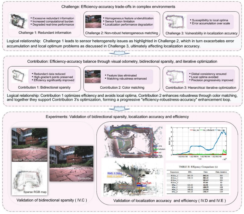
Visual localization is widely used as a low-cost solution for autonomous driving, robotics, and mobile navigation. However, monocular systems remain vulnerable to illumination changes, weak texture, occlusion, motion blur and long-term drift.
Existing map-based methods can reduce that drift by aligning camera observations with a prebuilt global map, yet many still struggle with redundant computation, weak cross-modal matching between camera images and point clouds, and optimization errors in large-scale or repetitive scenes.
The challenge is especially important for lightweight platforms that cannot afford onboard lidar, inertial measurement unit (IMU) and heavy computing. Because of these problems, deeper research is needed on camera-only map-based localization that can stay accurate, efficient and stable in complex real-world environments.
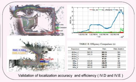
Overview of the proposed camera-only map-based localization framework. (Credit: Satellite Navigation)
On April 20, researchers from Wuhan University and Chongqing University reported (DOI: 10.1186/s43020-026-00196-x) in Satellite Navigation a camera-only localization framework that uses prebuilt colored point cloud maps, a dual-sparsity matching strategy that retains high-gradient features in both the map and image observations, and hierarchical geometric–photometric optimization to improve both positioning accuracy and computational efficiency in GNSS-challenged environments.
The system is built around two connected stages. First, the researchers generate a sparse colored point-cloud map from a denser map produced by lidar–IMU–camera mapping, keeping only high-gradient points that preserve visually salient structures while removing weak or redundant information.
They apply a similar sparse selection process to online camera images, creating what the team calls “dual-sparsity matching” between map and observation. During localization, the method uses Lucas–Kanade optical flow to track sparse 2D image features and associates them with 3D map points, while hidden-point removal helps retain only the map points actually visible from the current viewpoint.
The pose is then refined through an iterated error-state Kalman filter in two stages: a geometric PnP-style correction for stable coarse alignment, followed by photometric refinement using image intensity consistency for sub-pixel accuracy.
Tests on the R3live and WHU-Motion datasets showed major gains over existing methods. Compared with direct sparse localization (DSL), the new approach cut absolute trajectory error (ATE) by 52% to 95% across challenging sequences, including a drop from 1.883 m to 0.152 m on R3live_5. It also improved accuracy by up to 76.6% over I2D-Loc++, reduced total processing time by as much as 47.7%, and remained robust in degenerate scenes where geometry-only localization deteriorated to 9.23 m while the proposed tracker held an ATE of 0.076 m.
Ablation results further showed that colored maps, bidirectional sparsity, and hierarchical optimization each played a distinct role in achieving the final balance of speed, robustness, and precision.
The authors said the main advance is not simply adding color to a map, but treating the global colored point cloud map as a continuous observation within the visual odometry framework. They said the framework shows that a monocular camera can localize far more robustly when paired with a prebuilt colored point cloud map and a coarse-to-fine optimization design that avoids poor local solutions.
In their view, the study offers a practical middle ground between fully sensor-rich systems and fragile vision-only pipelines, preserving much of the accuracy benefit of map-based localization without demanding equally heavy hardware on the client platform.
The work could have immediate value for indoor logistics robots, underground inspection platforms, warehouse vehicles, parking-garage navigation systems, and other low-cost autonomous agents operating where GNSS is weak or unavailable. Because the mapping can be completed offline and reused, the online platform needs only a monocular camera, which lowers sensing requirements while retaining strong global constraints.
That makes the method especially attractive for scalable deployments in structured but challenging spaces such as tunnels, campuses, hospitals, and industrial facilities. More broadly, the study suggests that future navigation systems may become both lighter and more dependable by making better use of the information already shared between maps and images, rather than relying only on ever-larger sensor stacks.
Hexagon has successfully completed acquisition of Inertial Sense, strengthening its assured positioning, navigation, and timing (PNT) portfolio with tactical-grade GNSS+INS technology.
The acquisition reinforces Hexagon’s long-term commitment to innovation in high-performance navigation technologies. Inertial Sense strengthens Hexagon’s positioning portfolio and further enhances its assured PNT capabilities.
Headquartered in Provo, Utah, Inertial Sense will continue supplying inertial navigation solutions and will be integrated into Hexagon’s Aerospace & Defence Division.
“Inertial Sense brings exceptional GNSS+INS innovation that advances our assured PNT roadmap and expands resilient positioning capabilities in GPS-challenged environments,” said Stig Pedersen, president, Aerospace & Defence Division, Hexagon. “Their compact, cost-effective solutions meaningfully enhance our ability to serve aerospace and defence applications.”
Inertial Sense is a provider of high-performance navigation solutions, with more than 30,000 inertial systems deployed worldwide across defense and commercial applications.
Inertial Sense was founded in 2013 by Walt Johnson, who started Inertial Sense 10 years ago to make precision navigation lightweight and affordable so that it could be deployed anywhere and accessible to any business. This includes the rapidly emerging industries of drones, mobile robotics, aerospace and defense, autonomous vehicles, and automated manufacturing, all of which would require scalable and affordable navigation solutions.
The National Physical Laboratory (NPL) and Vodafone have successfully completed a set of trials using the NPLTime service as an alternative to GPS-timing signals.
Requirements for precise time delivery have driven the telecoms sector toward the increased use of GNSS for accurate timing. There are various alternatives to GNSS, each with their own capabilities, but GNSS has become the default mechanism for most sectors to access timing signals.
As the telecommunications industry rolls out 5G networks and prepares for 6G, it’s important there is a range of diversified timing signal sources that are resilient and secure. All major telecommunications providers in the UK and Europe share this requirement.
In the UK, VodafoneThree is the first mobile network operator to test the performance of a terrestrial NMI-provided time source as an alternative to GNSS-based time in their network timing infrastructure.
Vodafone is accelerating 5G coverage and improving data service performance across Europe and emerging markets by deploying 5G standalone networks, launching enterprise-grade slicing services, and 5G Advanced programs.
Vodafone is positioning itself as a future-ready connectivity platform for both consumers and industries, making it a must to protect the 5G network and future networks. Vodafone is actively reducing reliance on GNSS for time synchronisation for the VodafoneThree network in the UK and other Vodafone markets around Europe in collaboration with European Metrology Institutes.
The partnership will support the reliability and resilience of VodafoneThree’s £11bn network investment program to create the UK’s best network, reaching 99% 5G standalone population coverage by 2030, and 99.96% by 2034.
For the past 30 years, NPL has been operating the UK’s national time scale, UTC (NPL), and for the past eight years it has been disseminating NPLTime, an end-to-end fibre-based timing service that has been supporting the finance sector with regulatory compliance.
The partnership between NPL and Vodafone will develop a telecom version of the NPLTime service that meets stringent ITU standards for signal accuracy, stability, resilience and traceability. More specifically, the new service will deliver a terrestrial reference signal that is traceable to UTC (NPL) and can maintain accuracy within 40ns.
At the end of the trial, the new service will meet the accuracy requirements of most sectors in the UK and offer the potential for telecommunications operators to extend the reach of a UK sovereign time source to other industries. Vodafone intends to replicate the same telecom timing infrastructure across all Vodafone markets.
The partnership builds on the UK government’s efforts to increase resilience for position, navigation and time (PNT) for the UK’s digital infrastructure as well as on NPL’s role in delivering the National Timing Centre (NTC) program.
“Our work with the National Physical Laboratory marks a significant step in reducing over reliance on GPS-based timing and strengthening the foundations of our future-ready 5G Standalone network,” said Andrea Donà, chief network officer, VodafoneThree. “By testing a terrestrial timing solution we’re helping to ensure that our £11 billion investment delivers a network that is not only faster and more reliable, but also more secure and resilient for our customers.”
ICAO Secretary-General Juan Carlos Salazar told delegates at the 2026 World Overflight Risk Conference in Vallarta, Malta, that emerging military technologies — including long-range weapons systems, unmanned aircraft systems (UAS), GNSS radio frequency interference, and advanced air defense systems — pose growing risks to civil aviation.
“We must now reach beyond the boundaries of aviation as we have known it,” Salazar said, adding that increasingly sophisticated weaponry is creating conditions in which civilian aircraft face a heightened risk of being targeted or caught in crossfire.
While praising the aviation industry’s ability to reroute flights and maintain operations during the recent Middle East crisis, Salazar said operational flexibility alone cannot address the underlying security threats posed by weapons systems.
He commended states and airspace users for measures taken to mitigate safety and security risks during the escalation in the Middle East, noting that more than 10 states partially or fully closed their airspace, significantly disrupting international air transport.
“This commitment to resilience, adaptation, safety and security is the foundation of our industry,” he said, calling for concrete steps to prevent civil aviation facilities, airports and aircraft from being targeted.
Salazar cited ICAO Assembly Resolution A42-4 and Article 3 bis of the Chicago Convention — which prohibit the use of weapons against civilian aircraft — as the legal basis for stronger protections. He said, however, that international law alone has proven insufficient as regional conflicts intensify.
Following ICAO guidance, Salazar urged states to take three immediate actions: rapidly share threat intelligence when activities pose risks to civilian aircraft; strengthen risk assessment and timely decision-making; and improve coordination between military and civilian authorities to prevent misidentification of civilian aircraft as military targets.
ICAO is finalizing a Global Crisis Management Framework to coordinate responses when civil aviation faces threats. Salazar said the reactive framework must be paired with proactive measures to prevent attacks.
The organization is also updating its Manual Concerning Safety Measures Relating to Military Activities and its Risk Assessment Manual for Civil Aircraft Operations Over or Near Conflict Zones, with a focus on improving how authorities, airlines and air navigation service providers assess threats from malicious activity.
Recent disruptions during the Middle East crisis demonstrated both the industry’s adaptability and the economic impact of operating in an increasingly militarized airspace environment. ICAO regional contingency frameworks have supported rerouting when airspace becomes unsafe, but officials said such measures are costly and temporary, not solutions to underlying security risks.
The two-day Malta conference, which opened April 21, brought together aviation officials and security experts from multiple regions to discuss implementation of safety protocols and information-sharing mechanisms. The Safer Skies initiative also serves as a framework for those discussions.
Salazar’s remarks mark one of ICAO’s most direct acknowledgments of growing risks to civil aviation arising from conflict zones, reflecting the organization’s core mission to maintain safe and secure international air travel amid rising geopolitical tensions.
Following the conference, Salazar met with Myriam Spiteri Debono to discuss global and regional developments affecting aviation, with a focus on the role of multilateral cooperation in addressing emerging challenges, including conflict-zone risks. He also commended Malta’s aviation sector.
Salazar was accompanied by Nicolas Rallo, director of ICAO’s European and North Atlantic Regional Office.
BAE Systems has entered production and started initial deliveries of its NavGuide GPS receiver, a portable, field-installable device designed to provide secure positioning, navigation and timing (PNT) for vehicle, handheld and sensor applications.
NavGuide serves as a drop-in M-code upgrade to the company’s Defense Advanced GPS Receiver (DAGR), which has concluded production after more than 20 years in service. The new receiver is backward-compatible with existing DAGR installations and is designed for rapid integration into current mounts and accessories without interrupting operations. It is available to U.S. armed forces and allied partners through foreign military sales.
“NavGuide is more than just a replacement for DAGR,” said Luke Bishop, director of navigation and sensor systems at BAE Systems. “Built on the same trusted foundation for easy installation and transition, it delivers a more resilient, user-friendly M-code GPS solution.”
NavGuide uses the military’s M-code GPS signal to enhance protection against jamming and spoofing while delivering reliable PNT in challenging environments. The compact receiver features a full-color user interface with waypoint navigation and a moving map display.
More than 650,000 DAGR units have been deployed worldwide since 2004. NavGuide maintains the same form, fit and function, while adding enhanced security and performance. BAE Systems said it has integrated NavGuide on more than 30 vehicle platforms, with installation averaging less than two minutes and requiring no changes to existing cables, mounts or vehicle software.
The company will continue to support legacy DAGR units.
BAE Systems has delivered selective availability anti-spoofing modules to more than 45 countries and has begun fielding M-code GPS receivers in multiple form factors for U.S. and allied forces.
Development and production of the company’s military GPS products take place at its engineering and manufacturing facility in Cedar Rapids, Iowa.
Patented software visual-inertial cooperative navigation technology has potential to target defense, counter-drone (C-UAS), electronic warfare, and autonomous unmanned aircraft systems markets
NorthStrive Defense Tech LLC has secured a license option in connection with a proprietary U.S. patented autonomous navigation technology through an exclusive option agreement with a corporation.
The technology is designed to enable autonomous positioning and navigation for unmanned aircraft systems and drones operating in GPS-jammed, GPS-spoofed and GPS-denied environments, addressing a core capability gap identified by the U.S. Department of Defense (DoD) and allied defense programs worldwide.
NorthStrive Defense Tech LLC is a wholly-owned subsidiary of PMGC Holdings Inc.
The option agreement provides NorthStrive Defense Tech with an exclusive option, within the aerospace and defense technologies field, to obtain an exclusive license as to certain patent rights for U.S. Patent No. 12,277,716 B2, covering a cooperative navigation system for unmanned aircraft systems, also known as drones, operating in GPS-denied and GPS-degraded environments.
The option is also for a non-exclusive license in the field as to certain know-how connected to these patent rights, as further set in the option agreement. On NorthStrive Defense Tech’s exercise of this option, the parties will enter into negotiations for a definitive license agreement.
The technology has the potential to enable drones to navigate accurately without GPS by using onboard cameras and inertial sensors to estimate position relative to the local environment. The approach applies visual-inertial odometry (VIO) and sensor-fusion techniques, including an Extended Kalman Filter (EKF) for real-time state estimation and cooperative multi-vehicle data sharing, which together represent foundational building blocks of next-generation autonomous systems.
When multiple drones operate, they share positional data in real time to collectively improve each vehicle’s accuracy, with performance formally evaluated under real-world GPS-denied conditions.
GPS-denied navigation has emerged as one of the most urgent challenges in modern drone operations. Conflicts in recent years have demonstrated that GPS signals cannot be relied upon in contested environments, where jamming and spoofing are routinely deployed to disable unmanned systems.
Vulnerabilities in GNSS signals have made anti-jamming and anti-spoofing capabilities a top priority within U.S. defense modernization programs, the Pentagon, the DoD and allied NATO forces. That operational reality has driven substantial investment across the defense sector, with the GPS-denied drone navigation market projected to grow at a CAGR of 31.7% through 2030, according to Technavio.
Key potential capabilities include:
Vision and inertial-based navigation requiring no GPS signal (visual-inertial odometry / VIO with Extended Kalman Filter (EKF)-based state estimation)
Cooperative swarm localization through inter-vehicle range sharing, a foundational capability for drone swarm and counter-drone (C-UAS) operations
Scalable architecture supporting operations from individual drones to full swarms, with an architecture positioned for integration with AI-enabled autonomous systems
Technology formally evaluated for accuracy and performance under real-world GPS-denied conditions.
The system’s modular design keeps flight-critical estimation onboard each drone while requiring minimal data exchange between vehicles, making it practical for contested environments where communications bandwidth is limited or actively degraded.
Turkish UAV maker Baykar demonstrated its next-generation Kamikaze UAV K2 and Sivrisinek (Mosquito) loitering munition, showcasing AI-supported swarm autonomy, GNSS-independent navigation, automatic target detection, and strike capabilities during a demonstration held at the Keşan Flight Training and Test Center.
The K2 Kamikaze UAV and the Sivrisinek loitering munition will make their public debut at SAHA 2026, which takes place in Istanbul May 5-9.
The April 17 demonstration opened with the sequential takeoffs of five K2 Kamikaze UAVs within five minutes. Once airborne, the platforms conducted patrol flights in “right echelon,” “line,” “V,” and “Turan” formations.
Ten Sivrisinek loitering munitions — a new platform developed by Baykar — then joined the operation, forming a swarm beneath the K2 Kamikaze UAVs. The Bayraktar TB2, TB3, and AKINCI UCAVs accompanied the swarm flight, recording the operation from the air.
Credit: Baykar
AI-supported visual navigation Among the key technical highlights of the demonstration were the solutions developed to counter electronic warfare environments. Using AI-supported visual navigation software, the platforms demonstrated the capability to perform positioning and navigation independently of GNSS.
Having successfully showcased autonomous navigation in a GNSS-denied environment, the K2 and Sivrisinek Kamikaze UAVs also demonstrated AI-supported automatic target detection and automatic strike capabilities.
As part of the demonstration, a fleet of Sivrisinek loitering munitions executed a dive on the designated coordinates. A K2 Kamikaze UAV then broke off from the swarm and performed a high-speed dive on the designated coordinates, conducting a pass. In the final phase of the demonstration, a swarm group composed of 18 unmanned aerial vehicles across different classes — 5 K2s, 10 Sivrisinek, 1 Bayraktar TB2, 1 TB3, and 1 AKINCI — came together in a “V” formation to salute the delegation observing the flight.
Developed by Baykar, the next-generation Sivrisinek loitering munition raises operational depth to a range exceeding 1,000 kilometers. Capable of uninterrupted communication within the swarm through AI support, Sivrisinek platforms can instantly share detected targets with one another.
Performing its missions through AI-based visual positioning even in the most challenging environments — including areas where GNSS signals are unavailable or subject to intensive jamming — Sivrisinek stands out in strategic missions to be conducted on the battlefield thanks to its high autonomy capability.
FastXY can transform standard mobile devices into professional-grade data collection tools for geospatial information systems (GIS) and architecture, engineering and construction (AEC) professionals. FastXY offers professionals the ability to collect point, line and polygon data, and delivers advanced capabilities including 3D basemaps, construction staking, topographic surveying, on-the-fly datum transformations and survey-grade elevations. A built-in Bluetooth data parser allows users to configure the app to collect data from virtually any instrument supporting BLE Bluetooth or RS-232 — including echosounders, radiation sensors, laser rangefinders, barcode scanners and more — and marry that data instantly with precise GNSS coordinates. Available in free and premium versions.
Handheld scanner: Designed for BIM, indoor scanning and reality capture
The RS7 handheld SLAM (simultaneous localization and mapping) scanning solution was built for BIM documentation, indoor surveying, renovation planning and complex spatial analysis. It is designed to help professionals capture high-density 3D data efficiently and convert it into practical deliverables through CHCNAV’s software and cloud ecosystem. The RS7 integrates a next-generation lidar scanner capable of measuring up to 1.15 million points per second. Its wide field of view (360° x 189°) supports comprehensive coverage of floors, walls and ceilings, helping reduce the need for repeated passes and complex capture maneuvers in tight or cluttered spaces. The scanner also includes a high-precision inertial measurement unit with bias stability better than 0.5°/h. By combining lidar and inertial data, the system is designed to maintain stable motion estimation and consistent point-cloud quality in environments that challenge many mobile workflows, including long corridors, repetitive structures, and feature-limited interiors.
Mobile scanner: All-in-one system offers SLAM, LIDAR, RTK and 360 degree imagery
The GX1 is an integrated, highly accurate all-in-one mobile scanning system combining simultaneous localization and mapping (SLAM), lidar, real-time kinematic (RTK) georeferencing, cameras and software. It supports a seamless workflow, from capture to deliverable, and can reduce the time required to survey a site by up to 95%. The independently validated global accuracy of 5 mm to 10 mm delivers the precision needed for topographic and road surveying, scan to building information models, construction progress tracking, and more. These capabilities are supported by integrated RTK georeferencing with real-time quality monitoring, four 20MP cameras for 360° panoramic imagery, and a proven SLAM algorithm. The GX1 has four deployment modes — backpack, survey pole, vehicle mount and supported handheld.
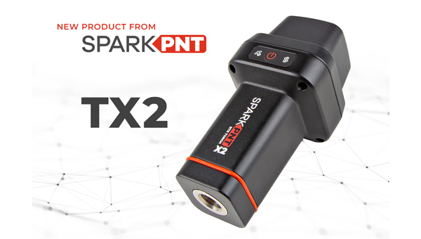
Quad-band GNSS rover: With support for Galileo high accuracy service
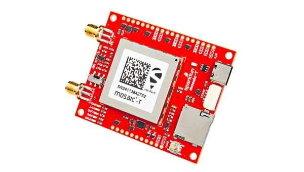
The SparkPNT TX2 quad-band GNSS rover combines an IP67-rated aluminum enclosure with support for Galileo’s High Accuracy Service (HAS) and standard RTK correction workflows. The receiver is built around the Quectel LG290P quad-band GNSS engine and supports multi-constellation tracking. Galileo HAS support provides sub-20 cm accuracy globally without subscription-based correction services, while RTK workflows via NTRIP or u-blox PointPerfect can achieve centimeter-level positioning. Battery life is rated at 50-plus hours, positioning the TX2 for multi-day field campaigns without recharging. The unit connects to iOS and Android devices via Bluetooth and WiFi, with compatibility reported for common GIS and data-collection applications. A notable design choice is the open-source firmware, which gives users visibility into how positioning data is processed and allows for customization and third-party integration. SparkFun has positioned this as an alternative to closed GNSS ecosystems where firmware and processing pipelines are not user-accessible.
Mobile
GNSS platform: Provides ultra-low power GNSS for all environments
The u-blox F11 platform provides L1/L5 dual-band standardprecision GNSS to improve positioning accuracy while reducing power consumption to as low as 7 mW in typical configurations. It combines ultra-low power operation with intelligent signal management to meet the evolving demands of tracking, wearables, telematics and mobility applications — including micromobility solutions and drones. The platform enables device manufacturers to achieve longer battery life, faster and more reliable position fixes, and greater design flexibility. Its situationally aware GNSS architecture, with integrated geofencing and indoor detections, dynamically balance accuracy and power consumption. By selectively using dual band L1/L5 operation only when it helps maintain positioning performance, the platform reduces energy use while providing resilience and maintaining confidence in location data.
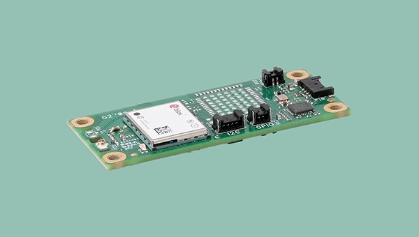
The Iridium 9604 is a compact, threein-one internet of things (IoT) module that integrates Iridium short burst data satellite service, LTE-M cellular connectivity, and GNSS positioning into a single platform. The Iridium 9604 seeks to make dual-mode IoT connectivity viable for price-sensitive, high-volume deployments. Built on the u blox SARA-R5 platform, the module comes in a compact 16 mm x 26 mm x 2.4 mm form factor, suitable for dual-mode IoT deployments across industrial, infrastructure and mobility applications.
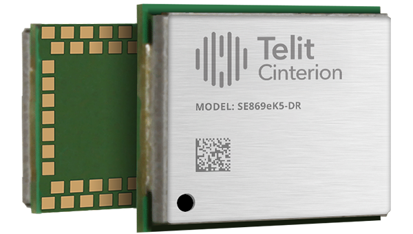
L1+L5 GNSS modules: For trackers and high-precision IOT
Two dual-band positioning modules built on Airoha’s AG3335 chipset series are available: the ultracompact SE873K5-D and the high-end SE869eK5-DRK. Both support space- and power-constrained IOT devices and use cases that require continuous, ultraprecise positioning. The modules provide a scalable path to adopt dual-band L1 + L5 GNSS.
Timing
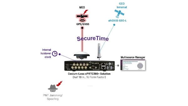
Cesium-less clock: An alternative to cesium-accuracy holdover clocks
The patent-pending Cesium-less ePRTC360+ holdover solution is designed to safeguard atrisk infrastructure against the increased threat of GNSS timing disruptions. It is the only alternative to Cesium clocks to meet ITU-T G.8272.1 standards. It can protect critical power grids; transportation, aviation and public safety systems; 5G mobile networks; and AI data centers. It meets the international ITU-T G.8272.1 standard and has been successfully tested across a range of livesky defense and commercial jamming/spoofing environments. It has been integrated into VIAVI’s SecurePNT 6200 product series and can maintain 100 ns accuracy during GNSS-denied threats through the resilient altGNSS GEO-L service with no time limit.
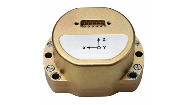
The U4930 series is a reliable and cost-effective six-axis microelectromechanical system (MEMS) and inertial measurement unit (IMU) module for navigation, control and measurement of vehicles, ships and drones. Applications include vehicle/ship attitude measurement, UAV attitude reference and trajectory control, mobile mapping, track inspection and underwater highprecision navigation. The U4930 series integrates high-performance MEMS gyroscopes and accelerometers within an independent structure. The three-axis MEMS gyroscopes sense the angular motion of the carrier, and the three-axis MEMS accelerometers sense the linear acceleration of the carrier. The system internally performs compensation for zero bias, scale factor, non-orthogonal error and acceleration-related terms across all temperature parameters, maintaining high measurement accuracy over a long period of time. The module supports custom communication protocols and provides synchronization for GPS/GNSS time data and pulse per second (PPS) signals.
Underground navigation: For navigating mines and unmapped environments
Chimera Land is a 3D laser velocity sensor (LVS) designed to solve the primary challenge for underground mining: maintaining precise vehicle positioning in deep, dark and unmapped environments where GPS cannot reach. When fused with an Advanced Navigation inertial navigation system (INS), Chimera Land allows underground vehicles to maintain stable navigation over extended distances and time. Instead of needing to query an external beacon or satellite for its location, the sensor uses specialized lasers to measure a vehicle’s ground-relative 3D velocity with high accuracy. By feeding this precise data into the vehicle’s INS, the sensor eliminates the drift that typically comes with standalone INS. Using AdNav Intelligence, the result is a resilient, high-performance, infrastructure-light positioning solution that excels in the highdust, zero-light conditions typical of underground mines.
Simulators
GNSS test tool: Provides real-world testing with signals from the field
The SimXTRACT GNSS test tool bridges the gap between field and laboratory. It enables signals captured in field environments to be comprehensively decomposed into individual, discrete signals and applied to lab simulation for realism at every stage of the development test cycle. Developers usually rely on either RF record-and-playback or lab simulation for testing and validation of PNT systems and devices. SimXTRACT takes real signals captured in field environments and performs complex signal decomposition, breaking down each received signal into discrete line-of-sight and multipath ray paths, along with metadata such as Doppler offset, code error, power level and angle of arrival. This decomposed environment is then automatically converted into fully controllable simulation scenarios for Spirent GNSS simulators.
Autonomous
Inertial measurement unit: For unmanned air, land and sea
Honeywell launched the HGuide i700, an inertial measurement unit (IMU) that delivers high-accuracy performance for unmanned air, land and sea vehicles. By pairing near navigation-grade capability with a nolicense-required (NLR) classification, the HGuide i700 provides integrators worldwide with a new option for critical sensing and navigation. The HGuide i700 uses high reliability sensors and electronic architecture found in Honeywell’s HG3900 inertial measurement unit (IMU). Compact and low power, the HGuide i700 delivers near-navigationgrade accuracy and reliability while being optimized to support longer range navigation in GNSS-denied environments. The HGuide i700 offers strong GNSS-denied performance for by limiting maximum acceleration and spin rates in a license-free package. The latest in Honeywell’s HGuide suite of no-license inertial solutions, the HGuide i700 allows customers to streamline development cycles, simplify system architecture and transition to field deployment quickly. The HGuide i700’s rugged design, compact size and low-power profile make it suitable for diverse commercial, industrial and defense applications, including autonomous vehicles, mapping and surveying.
Anti-jam antenna system: Provides multi-constellation, multi-frequency GNSS signal protection
The GAJT-AE3 protects all major GNSS constellations from jamming with full multiconstellation, multi-frequency coverage, ensuring reliable PNT in demanding airborne environments. Its antenna electronics mitigate interference by creating up to seven nulls per band in the direction of jammers, providing significant anti-jam protection even in dynamic multi-jammer scenarios. The output is a protected radio frequency signal, free from jamming and suitable for input to modern and legacy GNSS receivers. The GAJT-AE3 protects and supports all GNSS frequencies, including L-band corrections and Iridium PNT.
OEM
GNSS board: All-band multifrequency reception and HAS-ready
Syslogic’s new all-band GNSS expansion board for rugged embedded computers is powered by the u-blox X20 receiver. It supports all major GNSS constellations and frequencies, including L1, L2, L5, L6 and L-band, and enables the use of the Galileo High Accuracy Service (HAS). It provides centimeter-level positioning, opening up new applications across industries such as autonomous field management, operation of construction machinery in remote areas, or navigation of automated guided vehicles and autonomous mobile robots. The GNSS board is designed for worldwide use. The integrated u-blox receiver supports modern correction techniques such as RTK, PPP-RTK and PPP. For the first time, it has been fully optimized for PointPerfect Global, u-blox’s proprietary high-precision GNSS correction service, delivering centimeter-level positioning anywhere in the world. This is particularly useful in remote areas without cellular coverage.
GNSS L1/L5 breakout: For meter-level positioning in embedded applications
The SparkFun GNSS L1/L5 Breakout – NEO-F10N (SMA) is a compact GNSS module designed for meter-level positioning accuracy in embedded applications. It uses dual-frequency L1 and L5 bands, with the L5 signal offering improved performance in urban environments due to reduced RF interference within the protected ARNS spectrum.
The board supports concurrent reception of GPS, Galileo and BeiDou, and uses u blox dual-band multipath mitigation to enhance accuracy in challenging conditions. It features a single UART interface, with an onboard CH340 USB-to-serial converter for easy connection to a computer, and standard pin headers for integration with external systems.
The module includes an SMA connector for secure antenna attachment and is configurable using u-blox u-center software.
The 23rd International Flight Inspection Symposium (IFIS) will gather experts in San Salvador May 4-8. There, Rohde & Schwarz will demonstrate its test and measurement solutions for ground-based navigation aids. The exhibits address the rising traffic volumes and stricter safety requirements.
Rohde & Schwarz will take part in the conference’s technical sessions with a presentation on “Challenges for UAV Operations in RF Dense Aerodrome Environments.”
The aviation sector today faces increasing air traffic density, rapid technological advancements and heightened security concerns, the company explained. Operators need test equipment that delivers laboratory level precision while tolerating the harsh environment of an airport runway or a remote navigation site.
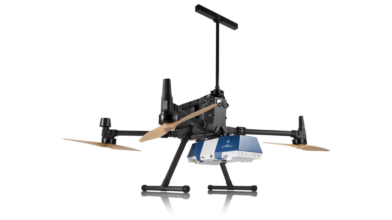
Among the exhibits at the Rohde & Schwarz booth is the R&S EVSD1000 VHF/UHF Nav/Drone Analyzer, designed to conduct GBAS, ILS and VOR measurements in line with ICAO Doc 8071 and ICAO Annex 10. The receiver delivers laboratory precision, supports an air to ground Wi‑Fi datalink and gapless measurements with improved location accuracy during flight inspections. Customers benefit from a device that can be mounted on a drone, reducing the need for manned flights and lowering operational expenses.
Rohde & Schwarz gives airlines, airport operators and navigation service providers a reliable way to certify and maintain ground‑based aids under today’s demanding conditions. By combining high measurement accuracy, easy operation and durability, Rohde & Schwarz aims to help the industry keep pace with growth.
As Brazilian farmers face increasing pressure to improve efficiency while managing rising input costs, Topcon Agriculture has announced a new set of innovations designed to expand access to precision technology across Latin America.
At Agrishow 2026, taking place April 27–May 1 in Brazil, Topcon will showcase solutions for row crop, coffee, citrus and sugarcane growers, including an expansion of its Value Line portfolio into vineyard and orchard spraying applications, as well as the introduction of a new modular GNSS receiver for precision agriculture.
XR-1P GNSS receiver
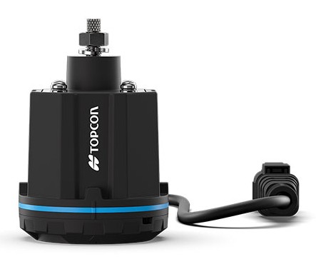
Modular GNSS receiver. Topcon is introducing the XR-1P GNSS receiver, designed to deliver reliable positioning and manual guidance in a cost-effective, durable unit. Engineered with modular architecture, the XR-1P can be used as a standalone solution or integrated into broader Topcon systems, offering flexibility for a wide range of farming operations.
The receiver is designed to bridge the gap between entry-level positioning solutions and high-performance precision agriculture systems, making advanced GNSS technology more accessible without compromising reliability.
CM-20 V spray controller
Expanding precision spraying for specialty crops. The CM-20 V Spray Controller, part of Topcon’s vineyard and orchard spraying control portfolio, is now available for use with the Value Line Steering solution. Designed for front-wheel-drive, mid-range tractors, the system offers an economical and scalable approach to precision spraying for specialty crops such as coffee and citrus.
The universal ISOBUS electronic control unit (ECU) integrates easily with existing farm equipment, regardless of brand, while on-the-go sensor-based control adjusts application rates based on crop density. This helps reduce input waste, minimize over- and under-application, and improve overall crop health and operational efficiency.
Sugarcane solution preview. An advanced look at a pre-commercial Sugarcane Yield Monitoring Solution will be showcased at the event. In development with the specific needs of Brazilian agriculture in mind, the solution will provide accurate, real-time yield visibility designed to maximize harvester efficiency, optimize logistics and support precision agronomy. By enabling more precise decision-making, the solution will help reduce input usage while increasing productivity in one of the country’s most strategic crops.
Boom height controller
Brazil is a strategic market for Topcon Agriculture, as it is one of the world’s leading food producers. Topcon supports the region not only through innovations tailored to local agricultural needs but also through a strong and expanding network of distributors that provide access to technology, training, and ongoing support. Authorized dealers, including Agrosure, Alagro, Coopercitrus and WiseAgri in Brazil, as well as Nievas in Argentina and Gestecner in Paraguay, will be at the Topcon stand during Agrishow.
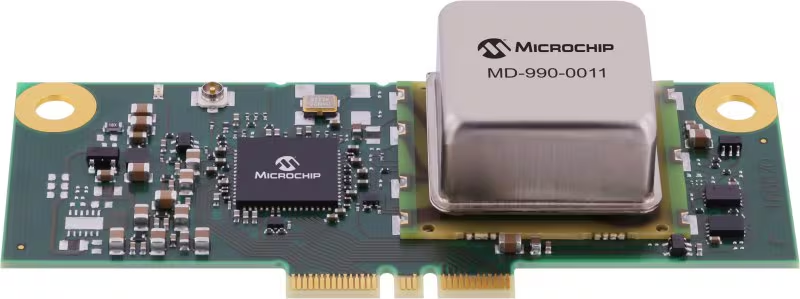
Microchip Technology has released its MD-990-0011-B family of plug-in timing modules, delivering turnkey, high-precision synchronization for data center servers and 5G virtualized radio access networks (vRAN).
Developed in collaboration with Intel, the MD-990-0011-B timing module is designed for seamless compatibility with Intel Xeon 6 SoC-powered server platforms, supporting both OEMs and ODMs in building future-ready systems. By leveraging Intel’s foundational vRAN architecture, the module enables robust, low-latency time synchronization, which is essential for distributed AI workloads and real-time applications.
Engineered for the reliability and scalability required by cloud infrastructure, virtualization and high-availability deployments, the MD-990-0011-B supports automatic source selection and locking across GNSS, synchronous Ethernet (SyncE) and precision time protocol (PTP). This flexibility supports continuous, accurate timing even as network demands evolve.
The MD-990-0011-B timing modules are available in two variants. MD-990-0011-BC01 offers eight hours of holdover performance; MD-990-0011-BA01 offers four hours of holdover performance. These timing modules consolidate several of Microchip’s advanced technologies into a single, highly integrated solution. Key components include:
Synchronous Ethernet (SyncE) synthesizer (ZL80132B). Two independent digital phase-locked loop (DPLL) channels for flexible and resilient synchronization
Oven controlled crystal oscillators (OCXOs, OX-22x). Provide up to eight hours of holdover, ensuring stable timing during GNSS outages or network disruptions
MCP9808 temperature sensor. Supports enhanced, environmental monitor 24LC024 EEPROM implementing board configuration and VC-820for low jitter performance
By unifying these critical timing components into a single plug-in module, the MD-990-0011-B streamlines server architecture, reduces design complexity and simplifies the supply chain. Its modular design enables rapid installation and simplified maintenance, minimizing downtime and facilitating effortless upgrades, key advantages for dynamic data center and 5G network environments.