Category: Transportation

  • Finnair cancels flights amid increased GNSS jamming

    Finnair cancels flights amid increased GNSS jamming

    Photo: Finnair
    Photo: Finnair

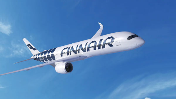
    Finnair, the sole international airline operating flights to Tartu, Estonia, has suspended its daily service to the city from April 29 to May 31, 2024. The decision comes in response to ongoing GNSS interferences and disruptions, including two instances where flights had to return to Helsinki, Finland, due to excessive jamming in the region.

    The current approach methods at Tartu Airport rely heavily on GNSS signals, which have been disrupted frequently in the area. To address this, Finnair plans to use the one-month flight suspension period to develop and implement alternative navigation methods at Tartu Airport that can operate independently of GNSS. Finnair aims to enhance the safety and reliability of operations, preventing similar incidents in the future.

    This suspension of flights highlights a broader issue of increasing GNSS jamming and spoofing, which has been a growing concern since the start of the Ukraine war in 2022 — specifically near Kaliningrad, the Black Sea, the Caspian Sea and the Eastern Mediterranean.

    On December 31, 2023, parts of Finland experienced significant jamming, which affected aviation and low navigation integrity reports from ADS-B systems. These were displayed on the GPSJam.org website.

    Estonian Foreign Minister, Margus Tsahkna, points to Russia as the source of the interference. Tsahkna told The Baltic News Service that jamming carried out by Russia is so dangerous that sooner or later it will cause a plane crash, ultimately endangering civilians.

  • Spirent launches PNT simulation system

    Spirent launches PNT simulation system

    Photo: Spirent Communications
    Photo: Spirent Communications

    Spirent has released PNT X, a positioning, navigation and timing (PNT) simulation system. The platform is designed to meet the escalating demands of testing complex PNT systems, which are crucial in autonomy, safety, efficiency and precision.  

     PNT X integrates a variety of signal sources including L-band, S-band and alternative navigation signals, along with Regional Military Protection (RMP) support. The system allows for the concurrent operation of multiple signals from different sources, which enhances the flexibility and efficiency of PNT testing.  

     It is tailored for future mission-critical systems including patented I/Q spatial awareness capability, an upgraded interface for controlled reception pattern antenna (CRPA) testing — the highest available continuous dynamic range for assessing jamming impacts — and a standard update rate of 2 kHz suitable for hardware-in-the-loop (HIL) simulations and high-dynamics vehicle testing. 

  • Rohde & Schwarz, IPG Automotive unveil HIL automotive radar test solution

    Rohde & Schwarz, IPG Automotive unveil HIL automotive radar test solution

    Photo: Rohde & Schwarz
    Photo: Rohde & Schwarz

    Rohde & Schwarz (R&S) has partnered with IPG Automotive, a virtual test-driving company, on an automotive radar hardware-in-the-loop (HIL) integration test system.

    The HIL radar test system combines IPG Automotive’s CarMaker simulation software with the R&S AREG800A radar object simulator and QAT100 advanced antenna array. This gives vehicle manufacturers the ability to simulate advanced driver assistance systems (ADAS) and autonomous driving scenarios, such as those defined in the European New Car Assessment Programme (Euro NCAP). It can be used for validation and real-time, closed-loop characterization of radar sensors and enables compliance with ASAM open standards.

    IPG Automotive’s CarMaker simulation solution is designed for the development and end-to-end testing of cars and light commercial vehicles. The open integration and test platform allows vehicle manufacturers, engineering services companies and Tier 1 suppliers to implement virtual test scenarios in powertrain, vehicle dynamic chassis functions and ADAS applications.

    The high-resolution 3D engine offers details in the simulation of the complete sensor stack, while the R&S AREG800A, combined with the R&S QAT100, generates multiple artificial objects, each with independent range, radar cross section (RCS), angle (azimuth/elevation) and radial velocity.

    The ASAM open simulation interface (ASAM OSI) links R&S AREG800A with the CarMaker HIL test automation, creating a comprehensive test setup.

    The HIL chain also includes a scenario editor specifically designed for non-simulation experts. This feature seeks to simplify the process of testing maneuver-based driving scenarios and associated complex traffic-related configurations.

    CarMaker also features a test manager, which can build or run automated test sequences. It can run tests individually or simultaneously, locally or in the cloud for flexibility and scalability. Additionally, it automates the calculation and evaluation of key performance indicators and generates reports automatically.

    The Model Manager CarMaker helps define the configuration of virtual vehicle prototypes, which is designed to improve the realism and accuracy of simulations for testing and development.

  • Topcon, Bentley Systems partner for GNSS technology integration

    Topcon, Bentley Systems partner for GNSS technology integration

    Photo: Topcon Positioning Systems
    Photo: Topcon Positioning Systems

    Topcon Positioning Systems has entered a strategic partnership with Bentley Systems and Worldsensing to integrate Topcon’s GNSS technology into the companies’ software and connectivity solutions to improve geospatial data accuracy and operational efficiency.

    Under the agreement, Topcon’s web-based GNSS processing engine will be incorporated into Bentley’s iTwin internet-of-things (IoT) monitoring solutions, offering users real-time geospatial intelligence for better decision-making and operational effectiveness. According to Steve Bentley, senior director of infrastructure IoT at Bentley Systems, the system is designed to advance the capabilities of infrastructure digital twins.

    It is a connect-and-collect solution that allows for real-time detection and analysis of potential risks. GNSS technology is the core component, which aims to make ground-movement monitoring applications more cost-effective and efficient while reducing the initial investment required for GNSS monitoring.

    It is available for commercial use in the United States, Canada, Australia, Europe, the Middle East and Africa. According to Bentley Systems, the solution will expand its reach to South and Latin America.

  • GEODNET concludes $2M investment round

    GEODNET concludes $2M investment round

    Image: GEODNET
    Image: GEODNET

    The GEODNET Foundation has received more than $2 million of strategic investments from new investors including CoinFundPanteraVanEck and Santiago R. Santos. The additional funds raised will support the Foundation’s near-term objectives of decentralization and developer accessibility.

    GEODNET, the company’s blockchain-based global navigation network, has more than 5,000 GNSS reference stations added to its real-time kinematic (RTK) network, designed to enhance location and intelligent autonomy services. Standard GPS is typically off by two meters; however, devices connected to GEODNET’s global RTK network are designed to achieve instant accuracy within 1 cm to 2 cm.

    The network can be used in agriculture, UAVs, consumer robotic devices and commercial global positioning services such as PPP precision point positioning (PPP), automotive-focused PPP-RTK services and low-Earth orbit satellite tracking.

    GEODNET has more than 4,000 registered reference stations in more than 2,500 cities across 120 countries. It is designed to provide robust precision navigation systems to a variety of industries, including self-driving cars, agriculture, consumer robots, and more. An additional 2,000 stations are being delivered and installed.

  • Autonomous vehicle testing program to launch in New York City

    Autonomous vehicle testing program to launch in New York City

    Photo: Waymo
    Photo: Waymo

    Mayor Eric Adams and the New York City Department of Transportation (DOT) Commissioner Ydanis Rodriguez have introduced a new permit program designed to oversee the testing of autonomous vehicles in New York City. The program is part of the city’s initiative to ensure the safe and responsible exploration of autonomous vehicles. With safety as the primary concern, the program mandates that a trained driver must be present behind the wheel of any autonomous vehicle being tested, ready to take control at any moment.

    The permit application process requires companies to demonstrate preparedness for testing in New York’s challenging urban environment through detailed plans for technology deployment and safety. This includes showcasing prior testing experience, technological capabilities and comprehensive safety plans detailing how the technology will be safely operated on city streets.

    Companies interested in participating in the program must follow industry best practices for the recruitment and training of safety drivers, obtain approval from the New York State Department of Motor Vehicles, and coordinate closely with the city’s emergency services. They must also comply with cybersecurity best practices and provide detailed reports on the automation level and safety performance of their autonomous vehicles and technology.

  • EUSPA launches EGNOS Safety of Life Assisted Service

    EUSPA launches EGNOS Safety of Life Assisted Service

    Image: EUSPA
    Image: EUSPA

    The European Geostationary Navigation Overlay Service (EGNOS), Europe’s regional satellite-based augmentation system (SBAS), has added Safety of Life Assisted Service (ESMAS) for maritime users. 

     Designed to complement ground-based augmented signals, ESMAS aims to add a layer of protection against GNSS signal errors while increasing signal accuracy and ensuring integrity. 

     While GNSS remains the primary means of obtaining positioning, navigation and timing (PNT) information while at sea, users in the maritime realm generally employ augmentation services provided by ground-based technologies such as Differential Global Navigation Satellite System (DGNSS), which correct GNSS errors to provide more accurate positioning information. 

    ESMAS is delivered via existing EGNOS space-based and ground-based facilities and does not require any additional infrastructure. It is well-positioned to support navigation on the open sea and in coastal waters, covering harbor approaches and entrances. 

     ESMAS is provided openly and is accessible without any direct charge. It is available via all satellite-based augmentation system (SBAS) enabled GNSS receivers developed following International Electrotechnical Commission (IEC) standards. With such a receiver, users can navigate with increased accuracy and get GNSS error warnings. 

    EGNOS also interfaces with NAVAREA coordinators to provide timely maritime safety information (MSI), including navigation warnings and other urgent safety-related messages that are broadcast to ships through conventional channels. 

    According to Rodrigo da CostaDa Costa, EUSPA executive director, ESMAS is targeted towards aiding merchant vessels, but it is also available to all other SOLAS-conforming vessels from EU Member member States states and EGNOS contributing countries, including Iceland, Norway and Switzerland. Unlike other EGNOS services — which are delivered by European Satellite Services Provider (ESSP) under contract with EUSPA, ESMAS is to be delivered directly by EUSPA. 

  • Hexagon, CMC Electronics advance GNSS aviation platform

    Hexagon, CMC Electronics advance GNSS aviation platform

    Image: CNW Group / CMC Electronics
    Image: CNW Group / CMC Electronics

    CMC Electronics has partnered with the Hexagon Autonomy & Positioning division, which includes the Hexagon | NovAtel brand, to release a multi-constellation, multi-frequency (MCMF) GNSS platform.

    The MCMF GNSS platform combines CMC’s certification with the digital signal processing expertise of Hexagon | NovAtel. Designed to detect GNSS signal spoofing, it is lightweight and compact. 

    The increasing threat of GNSS signal jamming and spoofing is not limited to military concerns. It has started to impact global commercial aviation and civilian sectors as well. In response, CMC Electronics and Hexagon | NovAtel seek to introduce a new era of MCMF GNSS positioning and assured positioning, navigation and timing (APNT). The collaboration aims to provide maximum reliability and dependability in solutions for the military, commercial aviation and unmanned aerial systems (UAS) sectors.  

    Under the partnership, CMC Electronics’ new receiver, which is certified to the exacting DO-254 Level A standards, is integrated with Hexagon | NovAtel’s GNSS measurement technology.  

    Based in Montreal, Canada, with additional facilities in the U.S., CMC Electronics designs and manufactures cockpit systems integration, avionics, display solutions and high-performance microelectronics for the military and commercial aviation markets. Hexagon’s Autonomy & Positioning division delivers comprehensive solutions for assured positioning across various applications, designed to progress autonomous technologies in essential industries. 

  • Canadian Coast Guard awards contract to Zighra

    Canadian Coast Guard awards contract to Zighra

    Credit: cullenphotos / iStock / Getty Images Plus / Getty Images
    Credit: cullenphotos / iStock / Getty Images Plus / Getty Images

    The Canadian Coast Guard (CCG) has awarded a contract to Zighra, an artificial intelligence (AI) solutions and cybersecurity provider, for its GenesysInsights platform. This technology will enhance the safety and security of Canada’s maritime territories by providing a previously unattainable level of analysis.

    GenesysInsights combines AI interpretability and multi-sensor fusion, designed to offer automated threat detection and comprehensive situational awareness in maritime environments. The platform synthesizes information from Global Navigation Satellite System (GNSS) signals and terrestrial and space-based Automatic Identification System (AIS) data, which aids the CCG in detecting and responding to maritime threats. This initiative is part of the Innovative Solutions Canada program.

    Position, navigation and timing (PNT) technology — integral to a range of critical applications, from military operations guidance to everyday smartphone navigation — has propelled commercial advancement. Despite its widespread utility, the susceptibility of these systems to manipulation presents significant threats, including unauthorized vessel activities and sophisticated cyber-attacks, such as jamming and spoofing.

    GenesysInsights aims to transform the security of government infrastructure and operations by creating a cyber-secure digital environment across land, sea and space. The platform uses advanced machine learning algorithms to analyze a variety of sensor data inputs. By monitoring ship movements and communications alongside satellite signal integrity, the technology will detect unusual patterns or anomalies indicative of potential risks.

    This pilot project will significantly improve real-time monitoring and analysis of maritime activities to boost safety and security across Canada’s maritime waterways.

    It can quickly detect and respond to maritime threats, including sophisticated cyber-attacks, and has an integrated operational command system with automated alerts to enhance decision-making and coordination.

    The CCG’s successful implementation of GenesysInsights could lead to broader adoptions in various critical infrastructure sectors such as aviation, ground transportation, logistics, space operations and national security, the company said.

  • Swift Navigation, Telit Cinterion enhance precise positioning

    Swift Navigation, Telit Cinterion enhance precise positioning

    Photo:Swift Navigation has partnered with Telit Cinterion to enhance the precision of GNSS positioning in low-power consumption devices such as wearables, robotic lawnmowers and vehicle tracking systems.

    Under the collaboration, Telit Cinterion’s GNSS receivers will use Swift’s Skylark precise positioning service, which is designed to deliver consistent precision across vast areas while prioritizing energy efficiency, reducing processing demands and minimizing data transmission costs. It aims to provide accurate location information quickly, even in difficult environments such as urban centers and canyons where signals can be obstructed.

    This partnership seeks to enhance location-based applications by allowing these devices to achieve centimeter-level accuracy. This level of accuracy is crucial for the safe operation of autonomous vehicles and industrial robots, but integrating it into small, battery-powered devices has been a complex challenge until now.

    The solution is designed to comply with industry standards, making it interoperable with various GNSS chipsets, modules, receivers and applications.

  • Abracon releases GNSS RF antennas

    Abracon releases GNSS RF antennas

    Image: Abracon
    Image: Abracon

    Abracon has introduced a new series of GNSS RF antennas designed to elevate location-based services with enhanced accuracy and precision. This new lineup aims to outperform conventional GPS technologies by offering faster signal acquisition, improved tracking capabilities and reduced power consumption.

    The antennas support a full spectrum of bands, including L1, L2, L5, and L-band data correction services. It can be used in a variety of sectors — such as agriculture, surveying, the Internet of Things (IoT), mapping, defense and aviation.

    The technology is designed to meet the rigorous demands for precise location data across various applications. These antennas offer multi-band and multi-constellation support to ensure broad compatibility. With centimeter-level accuracy, these antennas are crucial for aerospace, defense, asset tracking, geolocation, precision agriculture and industrial IoT.

  • OxTS enhances autonomous vehicle validation solution

    OxTS enhances autonomous vehicle validation solution

    Image: OxTS
    Image: OxTS

    OxTS’ GNSS-aided inertial navigation systems (INS) are now supported on the NVIDIA DRIVE autonomous vehicle (AV) development platform. The software plug-in, developed in-house by OxTS using the NVIDIA DriveWorks SDK, runs on the NVIDIA DRIVE AGX Orin developer kit.

    The plug-in gives developers using NVIDIA DRIVE the ability to feed OxTS GNSS/INS data directly into the platform to access accurate reference localization data as ground truth and validate the performance of the other sensors or algorithms under test.

    A GNSS/INS is only one of several sensors required for an AV to operate. These sensors create a vast amount of data that must be synchronized, calibrated and centrally processed for the vehicle to operate safely. The OxTS GNSS/INS offers precision time protocol (PTP) time synchronization and can serve as the reference to calibrate all the other sensor data back for data analysis.

    The OxTS RT3000 series is the GNSS/INS device supported on the NVIDIA DRIVE platform. It is currently being used as an advanced driver assistance system (ADAS) and vehicle dynamics ground-truth reference system for automotive test and validation teams across the globe.

    The NVIDIA DRIVE platform is built on the DRIVE Orin system-on-a-chip and can process up to 254 trillion operations per second (TOPS) of sensor data from a variety of camera, lidar and radar devices.