Category: Defense

  • Honeywell launches new resilient navigation systems

    Honeywell launches new resilient navigation systems

    Photo: Honeywell
    Photo: Honeywell

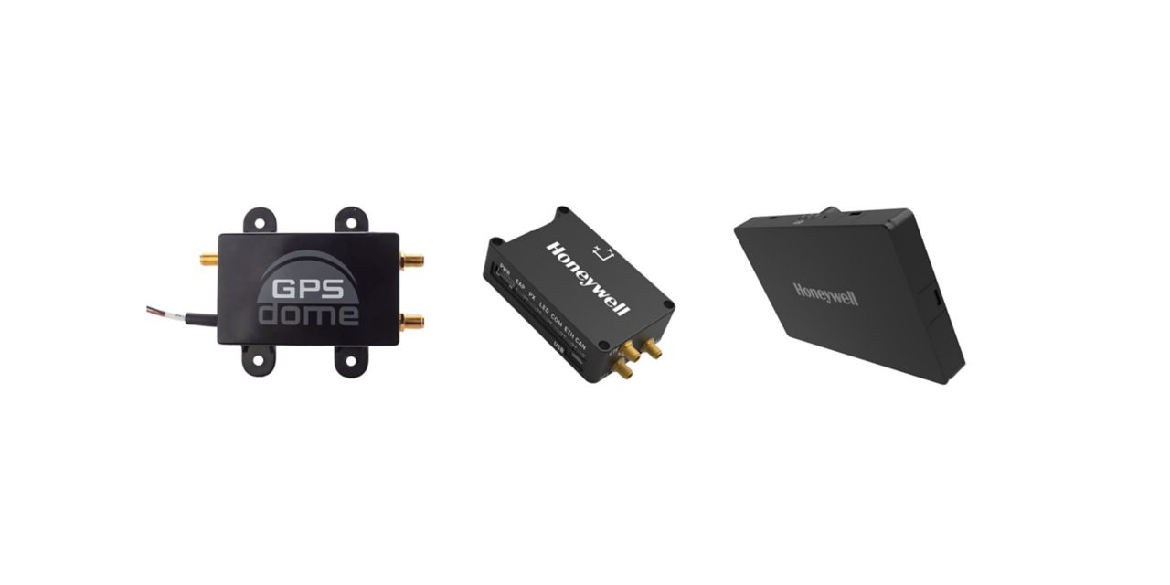
    Honeywell has launched two new resilient navigation systems: the Honeywell Compact Inertial Navigation System and Honeywell Radar Velocity System. These systems, jointly with GPSdome, an anti-jamming system developed by Honeywell’s partner InfiniDome, are designed for commercial and military customers needing reliable navigation solutions that are small and light and have a low power consumption.

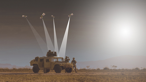
    The systems will provide multiple layers of protection that allow continued operations even in GNSS-challenged or denied environments.

    Honeywell’s philosophy of resilient navigation revolves around multiple layers of resiliency achieved by a combination of GNSS anti-jamming, inertial navigation and alternative navigation systems.

    The GPSdome is a small add-on device that provides the first layer of protection against GNSS jamming attempts, ensuring continuity of operation during low-power jamming conditions and the ability to achieve the crucial first GPS lock even in GPS-challenged environments. The device is compatible with any off-the-shelf GNSS receiver and antenna. Honeywell signed a collaboration agreement with infiniDome in August to jointly develop and deliver GPS signal protection systems.

    The new Honeywell Compact Inertial Navigation System is about the size of a deck of cards and uses tactical-grade inertial sensors to provide accurate position information to commercial and military customers. This second layer of resiliency provides the ability to navigate during shorter GNSS outages. This is especially useful in urban canyons where GNSS availability is intermittent or in strong jamming environments where anti-jamming systems are not enough.

  • PNT Advisory Board to meet Dec. 9-10

    PNT Advisory Board to meet Dec. 9-10

    After several delays, the first GPS III satellite has successfully deployed from the SpaceX Falcon 9 rocket, which launched from Cape Canaveral Air Force Station in Florida at 8:51 a.m. EST on Dec. 23. (Photo: Lockheed Martin)
    (Photo: Lockheed Martin)

    The U.S. President’s National Space-based Positioning, Navigation and Timing (PNT) Advisory Board will meet on December 9 and 10 at the Sheraton Pentagon City Hotel in Arlington, VA, according to a post on the group’s website.

    The meeting is open to the public. Interested parties are encouraged to attend.

    The agenda, while still not finalized, is expected to include a full day public meeting on Thursday,  December 9, and a half day on Friday, December 10.

    Previous in-person meetings have included program updates from government departments and briefings on cutting edge government and industry projects on the first day. The second day normally sees updates from international representatives and open discussion of current issues among the board members.

    The Advisory Board’s size is expected to increase at this meeting with three previous members leaving and nine newly appointed members being added.

    A formal announcement of the meeting is expected in the Federal Register on Monday, November 15. Confirmation of the new membership roster is expected at about the same time.

    The PNT Advisory Board was established in 2004 by National Presidential Security Directive 39, “U.S. Space-Based Positioning, Navigation, and Timing Policy.” It operates under the rules of the Federal Advisory Committee Act and is tasked with providing advice “… on U.S. PNT policy, planning, program management, and funding profiles in relation to the current state of national and international space-based PNT services.”

    The Advisory Board has regularly advised the government on all aspects of space-based PNT, including the need for a holistic “PTA” approach – “Protect” signals, “Toughen” user equipment, and “Augment” services with alternative PNT sources.

    This will be the first in-person meeting of the board since November 2019. A virtual meeting was held in July 2020.

    After the conclusion of the government Advisory Board meeting on Friday, December 10, the non-profit Resilient Navigation and Timing Foundation will hold its annual membership meeting and lunch at the same venue.

  • Spirent Federal launches flex power capability

    Spirent Federal launches flex power capability

    Spirent Federal announced a new positioning, navigation and timing (PNT) test capability commonly referred to as programmable power — or flex power — available at no additional cost to qualified customers under support. The new capability allows the user to apply flex power configurations to existing scenarios.

    Flex power is the reallocation of transmit power among individual signals in GPS satellites, providing a countermeasure against GPS jamming. Spirent simulators fully support programmable power for M-code, Y-code and C/A (coarse acquisition) code.
    “From the time that we ascertained the need for flex power simulation, to the delivery of a completed easy-to-use utility, was a very short time,” said Ellen Hall, president and CEO of Spirent Federal. “It is this kind of responsiveness that we strive for here at Spirent Federal, so we can pass along the benefits to our customers.”

    Flex power is available on the Spirent GSS9000 GPS / GNSS constellation simulator.

  • Thales inertial navigation system boards French Navy vessel

    Thales inertial navigation system boards French Navy vessel

    The TopAXYZ inertial navigation unit by Thales. (Image: Thales)
    The TopAXYZ inertial navigation unit by Thales. (Image: Thales)

    Thales and CS Group partner to offer navies a cybersecure, jam-resistant navigation system inspired by civil aviation

    Thales and CS Group have partnered to offer a complete navigation system for navy surface ships. At the heart of the system is the Thales TopAxyz inertial navigation unit, which is integrated with CS Group’s real-time computer to combine high-level performance and resilience in an electronic warfare environment. The system provides high-precision pointing, gyrocompass, location and navigation functionality for all types of naval platforms, from surface combatants and submarines to autonomous vehicles.

    The TopAxyz inertial navigation unit has delivered outstanding performance in the rigorous conditions of civil aviation, clocking more than 20 million hours of operation. The naval version of the unit was integrated on a French Navy vessel in less than a day by CS Group, and has already proven its operational value for maritime navigation in a sea trial.

    “After proving their value on board aircraft, space launchers and French Army land vehicles, Thales inertial navigation systems are now available for naval platforms,” said Tristan Grivel, vice president business development and sales for Thales’s flight avionics business.

    “CS Group has supplied real-time navigation computers, military-grade GPS receivers and other solutions to the French Navy and Naval Group for many years, explained Gilles Rigal, director of CS GROUP’s naval systems business line. “This partnership with Thales allows us to offer an innovative, robust and resilient maritime inertial navigation system for surface ships,” Rigal said.

    Countering electronic warfare

    In today’s constantly changing naval environment, crews need to contend with the threat of cyberattacks, electronic warfare activity and the high risk of jamming and spoofing of GPS-based radionavigation solutions. Accurate navigation data, real-time data distribution and resistance to external threats are crucial for every mission conducted by a naval vessel today.

    Thales and CS Group have worked together for more than 20 years to address these issues. Drawing on their combined expertise across all the key navigation system technologies, the two companies are now proposing a new approach to maritime navigation based on more trustworthy and reliable navigation data.

    The TopAxyz inertial unit uses accurate, reliable navigation information that is independent of sea state and vessel location, combined with a function that detects attempts to spoof GPS signals. The navigation data calculated by TopAxyz is distributed in real time by the NDDS (Navigation Data Distribution System) developed by CS Group’s onboard computer.

    The computer uses the latest technological advances in cybersecurity, guaranteeing the best level of resilience to attacks. Its architecture offers three key advantages: safer navigation, reduced costs and integration risks, ease of use and simplified maintenance of the system. No calibration is required during the service life of the system, reducing the total cost of ownership.

    The new maritime navigation system are now available, and are being manufactured at the companies’ production and integration facilities in Châtellerault and Aix-en-Provence in France.

  • Editorial Advisory Board Q&A: The fate of the SAASM P(Y) code

    Editorial Advisory Board Q&A: The fate of the SAASM P(Y) code

    Photo: Editorial Advisory Board

    The U.S. military is transitioning to M-code. When the transition is complete, what will become of the SAASM P(Y) code? What should be done with it? Should the U.S. government use it as a public authenticated service?


    Jules McNeff
    Jules McNeff

    “In my opinion (not speaking on behalf of the Defense Department), eventual use of the P(Y) code as a public authenticated service is not feasible based on both time and accessibility. Even with the transition to M-code, the legacy P(Y) code will continue to be used by the U.S. military and by U.S. allies and partner nations as long as there are military requirements for it. More importantly, public access to the encrypted P(Y) code would require general distribution of classified cryptographic keys and associated hardware/software by the DOD. That will not happen, even if the P(Y) code use is discontinued.”
    Jules McNeff
    Overlook Systems Technologies


    Bernard Gruber
    Bernard Gruber

    “Broadly speaking, GPS user equipment security architectures transition every 10 years (such as PPS-SM/AOCs to SAASM to Modernized CGM/MSI.) It can be argued that implementation of these security measures generally takes 10 years or longer to implement. SAASM P(Y) receivers will be around for a long time, implementation can be expensive, backwards compatibility is critical. Personally, I would like to see SAASM architectures evolve to support critical services within other U.S. government departments first, and then determine a path that supports a public service as threats, unfortunately, move forward.”
    Bernard Gruber
    Northrop Grumman


    Photo: Orolia
    John Fischer

    “Why not? Authentication protects against spoofing. I don’t know all the obstacles involved, but even if an internet connection is required to overcome the one-way limitation of GPS, that isn’t a problem for most applications. Our credit card transactions are secured this way, why not our PNT information? Decades ago, the U.S. Air Force gave the world a gift with the open GPS signal; they could do it again with a secure signal. The world would be a better place.”
    John Fischer
    Orolia


    F. Michael Swiek
    F. Michael Swiek

    “It’s premature to forecast when military operations will transition from P(Y) code even after M-code operations achieve Initial and Final Operating Capability (IOC and FOC). SAASM P(Y) code will continue to support military operations for an extended period since all MGUE receivers (both increments 1 and 2) are YMCA capable, meaning they support P(Y) code, M-code and C/A code operations. As a military-encrypted signal with military utility, military leaders must carefully weigh any potential P(Y) code transition and its impact on military operations.”
    Michael Swiek
    GPS Alliance


    Ellen Hall
    Ellen Hall

    “If P(Y) code is offered as a new service to the public, it will have to be maintained. This carries a great cost. This is a legacy product that had a specific military need, which has been replaced and improved upon by M-code. In today’s uncertain times, we need to be wise with our tax dollars. The cost to continue both SAASM and M-code is greater than the benefit to the public, in my opinion.”
    Ellen Hall
    Spirent Federal Systems


    Feature photo: U.S. Marine Corps/Capt. Joshua Hays

  • NGA awards HawkEye 360 contract for RF mapping

    NGA awards HawkEye 360 contract for RF mapping

    Up to five-year contract follows a successful pilot program that demonstrated the value of commercial RF geospatial intelligence

    HawkEye360 logoHawkEye 360 has been awarded a contract by the National Geospatial-Intelligence Agency (NGA) to help the agency discover, characterize and map activities that emit energy in the radio frequency (RF) bands of the electromagnetic spectrum.

    HawkEye 360 specializes in RF data and analytics from space-based satellites.

    HawkEye 360 will provide NGA the means to develop global datasets, enabling users to discover and monitor a broad range of RF activity across large geographic areas.

    The $10 million one-year contract includes an option for four more years. It will support users throughout the NGA enterprise, including the combatant commands and other mission partners.

    HawkEye 360’s data will support a variety of analytics missions for NGA, including military activity and the trafficking of military, nefarious, non-state and transnational criminal (or illicit) activity. The company’s growing constellation of satellites will provide insight into developing events in a timely manner, and the company will work collaboratively with NGA on an ongoing basis to effectively meet the agency’s mission needs.

    “We’re pleased to be moving from the pilot into an NGA long-term operational contract, which showcases the value of unclassified, shareable commercial RF insights,” said HawkEye 360 CEO John Serafini.

    “This program is an excellent example of agile acquisition rapidly delivering high-impact GEOINT to the warfighter,” said Alex Fox, the company’s executive vice president for business development, sales and marketing.

    NGA leveraged a National Reconnaissance Office commercial integration study contract with HawkEye 360 in September 2020 to execute a test and evaluation contract with the company.

    NGA then issued a competitive RFP in March 2021 and awarded the contract in July 2021. “We are excited to continue working with NGA to address current mission requirements and expand the RF GEOINT tradecraft to address an even larger set of mission requirements, much like NGA has done with their pioneering use of commercial imagery,” Fox said.

    HawkEye 360 operates a constellation of nine RF-monitoring satellites. Twenty-one additional satellites are fully funded and scheduled for launch in 2021 and 2022. Once complete, this baseline constellation of 30 satellites will provide collection revisits as frequently as every 20 minutes.

    Following the establishment of the baseline constellation, HawkEye 360 plans to launch a second-generation constellation of 30 additional satellites by 2025 to satisfy projected capacity and operational requirements.

    The company’s RF data and analytics produce actionable insights for national, tactical and homeland security operations, maritime domain awareness, environmental protection and a growing number of new defense and commercial applications.

  • Orolia to acquire Seven Solutions for resilient PNT

    Orolia to acquire Seven Solutions for resilient PNT

    Photo:

    Merger to deliver high-end performance and ultra-accurate timing and frequency products for commercial, critical infrastructure and defense markets worldwide

    Orolia has entered into a definitive agreement to acquire Seven Solutions, a global innovator in White Rabbit sub-nanosecond time transfer and synchronization technology. This transaction is subject to customary closing conditions and approvals required by the Spanish government and is expected to close before the end of the year.

    This is Orolia’s 11th acquisition in the past seven years.  

    The merger with Seven Solutions, based in Granada, will enhance Orolia’s portfolio for defense, aerospace, data centers, telecom, financial services, smart grids and other critical infrastructure industries, and will enable the next-generation applications dependent on ultra-precise, resilient timing and frequency technology.

    GPS World published an article about Seven Solutions and its White Rabbit technology in its October issue.

    “Orolia and Seven Solutions under one umbrella will combine our world-leading technologies to draw a new frontier in network timing to sub-nanosecond levels, delivering the most robust and accurate resilient PNT solutions for our customers,” said Orolia CEO Jean-Yves Courtois. “Seven Solutions’ long history of delivering cutting-edge time distribution solutions to sectors like telecommunications, smart grids, aerospace, defense and scientific facilities aligns perfectly with Orolia’s DNA.”

    Orolia and Seven Solutions will integrate global sales, marketing, product development and operations.

    Orolia’s full-scale, modular approach to resilient PNT includes atomic clocks with a combination of GNSS signals protected with interference detection and mitigation technology, together with low-Earth-orbit secure alternative signals. The addition of Seven Solutions’ products will deliver terrestrial sub-nanosecond time distribution from distant and potentially redundant locations.

    “We believe the union of our companies will produce the future of time transfer and frequency distribution solutions in terms of accuracy, reliability and interoperability,” said Rafael Rodriguez, chief technology officer and co-founder of Seven Solutions. “Finance, 5G telecommunications, data centers and hyperscalers have new and upgraded functionalities requiring ultra-accurate time distribution accuracy. To maximize interoperability, our solution for time transfer is based on the White Rabbit concept that has been pushed over the last decade to become the basis of the standard high accuracy time transfer profile (within the recent release of IEEE 1588 of precision time protocol).”

    Orolia and Seven Solutions are members of the Open PNT Industry Alliance. The international organization focuses on market concepts that strengthen economic and national security by supporting government efforts to implement resilient PNT capabilities for critical infrastructure.

  • DHS offers resources to protect critical infrastructure from GPS vulnerabilities

    DHS offers resources to protect critical infrastructure from GPS vulnerabilities

    DHS logoThe U.S. Department of Homeland Security (DHS) Science and Technology Directorate (S&T) has published a GPS Receiver Whitelist Development Guide and a new release of the Positioning, Navigation, and Timing (PNT) Integrity Library to protect against GPS spoofing.

    The free resources are intended to advance the design of PNT systems and increase resilience of critical infrastructure to PNT disruptions.

    The GPS Whitelist Development Guide presents a software assurance approach to addressing potential vulnerabilities and increasing reliability of GPS receivers. The guide addresses data-related requirements in the Resilient PNT Conformance Framework, which provides guidance for defining expected behaviors in resilient PNT equipment.

    “We hope this guide and related resources will help industry advance towards a cybersecurity-based approach to PNT resilience,” said S&T Technical Manager Ernest Wong.

    Originally released in March 2021 as open source on GitHub, the PNT Integrity Library provides users with a method to verify the integrity of the received GPS data. The update includes:

    • A compliance check on Interface Control Document (ICD) IS-GPS-200, which is a formal means of establishing, defining and controlling communication between the GPS space and other user systems; and
    • A Do-It-Yourself (DIY) Toolkit, which describes how a perspective end-user of the PNT Integrity Library can assemble a demonstrational toolkit with commercial-off-the-shelf (COTS) hardware.

    “Since GPS signals can be jammed or spoofed, critical infrastructure systems should not be designed with the assumption that GPS data will always be available or will always be accurate,” said S&T Project Manager Brannan Villee. “Application of these tools will provide increased security against GPS disruptions. However, DHS also recommends a holistic defense strategy that considers the integrity of the PNT data from its reception through its use in the supported system.”

  • ViaLite supports Raytheon with mission critical, extended length GPS over fiber

    ViaLite supports Raytheon with mission critical, extended length GPS over fiber

    ViaLite GPS Link: Blue OEM module and rack chassis card hardware formats shown. (Photos: ViaLite)
    ViaLite GPS Link: Blue OEM module and rack chassis card hardware formats shown. (Photos: ViaLite)

    ViaLite is supplying Raytheon Technologies with its GPS over Fiber Extension Kit for Microchip GPS servers. The kit provides mission-critical GPS timing and synchronization for systems requiring extremely accurate clock signals.

    Standard transmission distances for the extension kit can be up to 10 km, while solutions are available for distances as long as 50 km.

    “The ViaLite kit was chosen for its unique performance with Microsemi’s S650 timing server, along with our best-in-class quality, reliability and support,” said Craig Somach, ViaLite director of Sales North America.

    The ViaLite GPS link is designed to provide a remote GPS/GNSS signal or derived timing reference to equipment located where no signal is available, such as inside buildings or tunnels. By using optical fiber instead of traditional coaxial cable, extreme distances are possible with no radio frequency loss and zero introduction of noise.

  • Maxar 3D data integrated into Swedish fighter jet for GPS-denied navigation

    Maxar 3D data integrated into Swedish fighter jet for GPS-denied navigation

    Saab, the Swedish defense and security company, and Maxar recently demonstrated a solution to GNSS-denied navigation by integrating Maxar’s 3D Data and Precision 3D Registration (P3DR) technology into the fighter jet software for the Swedish Gripen E fighter jet.

    Saab develops and manufactures the fighter jet for Sweden and other countries.

    A camera on the jet captures a livestream of its flight path. Maxar’s P3DR compares that incoming livestream to the Maxar 3D Surface Model of the area stored on the jet. By matching scenes in the livestream to the 3D data in real time, P3DR can determine the jet’s precise location, enabling the pilot to navigate and carry out the mission without GPS.

    Maxar 3D Surface Model, immersive 3D data with superior accuracy and global coverage, offers a highly accurate representation of Earth. The data is produced with unique automated technology, delivered rapidly and with high precision. It is based on Maxar’s high-resolution, unclassified commercial satellite imagery, without the need for ground control points. Maxar’s 3D Surface Model product is a key input to the company’s Globe in 3D, a worldwide foundation of 3D data with resolution of 50 cm or better and 3 m accuracy in all dimensions.


    The chart across the top of the video indicates the accuracy of the P3DR matching of the livestream video to the Maxar 3D Surface Model. When the camera encounters clouds, it lowers the accuracy of P3DR’s match; however, as long as there is some view of the ground, the accuracy is relatively high.

    Maxar’s P3DR is a standalone software solution that automatically geo-registers imagery from any source to Maxar 3D reference data. This real-time capability enables navigation in a GPS-denied environment, safeguarding against signal jammers in an anti-access area denial (A2AD) environment.

    Saab put the GPS-denied navigation technique to the test with a Gripen flight demonstration over Sweden. The GIF below demonstrates how P3DR closely overlays the livestream image on the Maxar 3D Surface Model, allowing the pilot to understand where they are on the map.

    During the flight demonstration, the Gripen’s GPS receiver was on to monitor the accuracy of the results. The GPS receiver verified that the demonstration’s results were accurate.

    The Gripen E jet fighter built by Saab. (Photo: Saab)
    The Gripen E jet fighter built by Saab. (Photo: Saab)
  • RedTail delivers lidar for DoD explosive ordnance disposal

    RedTail delivers lidar for DoD explosive ordnance disposal

    RTL-450 (Photo: RedTail Lidar Systems)
    RTL-450 (Photo: RedTail Lidar Systems)

    RedTail Lidar RTL-450 integrated onto Teledyne FLIR SkyRaider for tactical operations

    RedTail Lidar Systems has delivered six lidar systems to the 707th Ordnance Company stationed at Joint Base Lewis-McChord. The systems will provide explosive ordnance disposal (EOD) technicians an opportunity to assess how lidar can be used to enhance their operations.

    The RedTail Lidar Systems RTL-450 was integrated onto the Teledyne FLIR SkyRaider unmanned aerial system (UAS) to address a broad range of the EOD community’s 3D mapping needs. Captain William R. Hartman, the commander of the 707th EOD Company, stated that the highlight of the testing was using the lidar system to map terrain.

    The RTL-450 also can be used to calculate crater volumes from improvised explosive device (IED) blasts, perform route planning for unmanned ground vehicles, aid in mission planning, and conduct surveillance. The 3D point clouds generated allow operating areas to be viewed from any perspective using the rotation and zoom capabilities provided within the viewer software.

    The underlying lidar technology used in the RTL-450 was licensed from the Army Research Laboratory (ARL). The micro-electromechanical (MEMS) mirror-based design provides enhanced 3D imagery suitable for applications where artificial intelligence and machine learning (AI/ML) algorithms can be used for target detection and classification, because of the high point density of the point clouds.

    The system can operate in either a raster scan mode for surveillance missions or a side-to-side line scan mode for area mapping while the UAS is flying. The intuitive command and control, high brightness display integrated into the ground control station (GCS), and real-time 3D map generation allows operators to begin mission planning and analysis even before the mapping or surveillance missions are completed.

    “Delivering these six lidar systems to EOD technicians for test and evaluation is a significant step forward in using MEMS mirror-based lidar technology to address a broad range of Department of Defense 3D mapping needs,” said said Brad DeRoos, president and CEO of RedTail Lidar Systems. In addition, this delivery represents a true success story in transitioning a technology out of a Department of Defense laboratory and back into the hands of military operators.”

  • Hexagon | NovAtel enhances performance of GAJT-710

    Hexagon | NovAtel enhances performance of GAJT-710

    Photo: Hexagon | NovAtel
    Photo: Hexagon | NovAtel

    Hexagon | NovAtel has updated its GPS Anti-Jam Technology (GAJT) portfolio with the new GAJT-710 product line, which features several enhancements over the previous generation.

    The GAJT-710 product line is the next evolution of NovAtel’s battle-proven anti-jam technology for land and marine platforms. The new jammer direction-finding capability of GAJT enables situational awareness and a new silent mode feature reduces its thermal signature. These improvements, including enhanced GNSS tracking performance, are achieved while maintaining the same form and fit of the previous generation product.

    GAJT units are deployed worldwide, providing anti-jam protection on land, at sea and in the air. Across these environments, GAJT protects GNSS navigation and precise timing receivers from the growing threats of intentional jamming and unintentional interference. GAJT reliably provides APNT for allied forces no matter the scenario.

    “NovAtel has proven itself as a leader for assured PNT through our GAJT portfolio,” said Steve Duncombe, executive vice president of aerospace and defense at Hexagon’s Autonomy & Positioning division. “The new GAJT-710 builds on that success by providing new features combined with existing mission-proven technology to continue providing evolutionary APNT capabilities for the warfighter, national infrastructure and other mission-critical applications.”

    NovAtel’s commitment to APNT is central to its product design approach. Deep GNSS expertise and lean manufacturing capabilities enable the delivery of high-performance products like the GAJT-710 in large volumes with minimal production and delivery times, the company said.

    The GAJT-710 product line is available for land vehicles, marine vessels, positioning networks and timing infrastructure.