Category: Complementary PNT

  • Navigation tools aim to compliment GPS

    Navigation tools aim to compliment GPS

    News from the Chicago Quantum Exchange

    Quantum technologies may offer a solution to GPS jamming and spoofing, according to the University of Chicago. Already, prototypes are being tested of a suite of sensor-based techniques that do not rely on satellite signals. 

    GPS jamming and spoofing have emerged as growing threats in recent years, according to the Chicago Quantum Exchange, based at the university. In 2024 alone, more than 1,000 commercial flights per day were affected by GPS spoofing, especially while flying through regions like the Middle East and Eastern Europe. 

    During these incidents, in-flight instruments show pilots that their aircraft is flying higher or lower than they truly are or that they are miles off their actual location. In maritime settings, spoofed GPS signals have even caused ships to veer off course or run aground. These are not isolated glitches but the result of deliberate electronic warfare tactics.

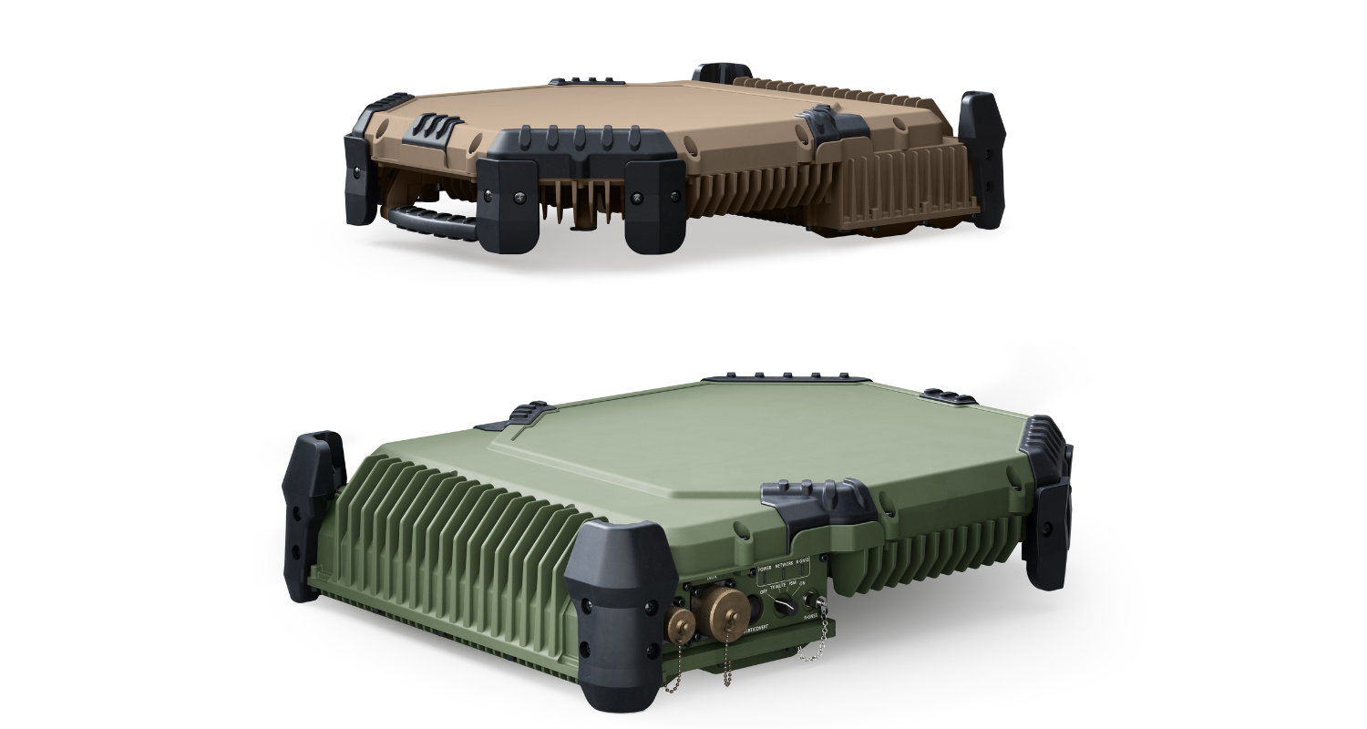
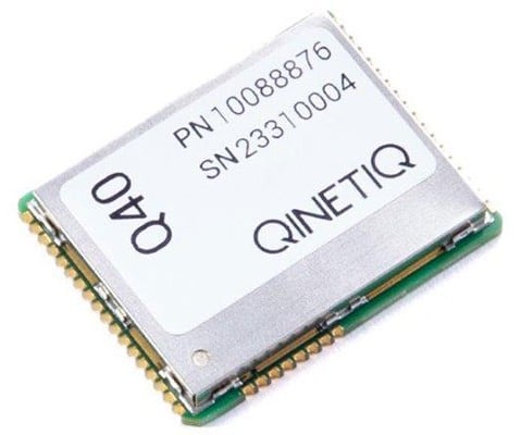
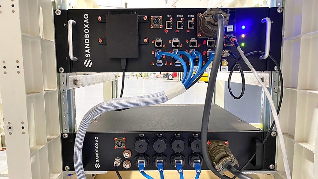
    Corporate partners of the Chicago Quantum Exchange, including BoeingInfleqtion and SandboxAQ, are among those developing applications. The CQE is a hub that connects leading universities, national labs, and industry partners to advance quantum technology.

    “Governments and the commercial industry are in dire need of this technology,” said Ken Devine, senior product manager for quantum navigation at SandboxAQ. “The geopolitical issues happening across the world, and the ramp up in both jamming and spoofing — Russia, Ukraine, the Middle East, Israel, Iran — everyone’s getting super disruptive, and that’s not going to go away anytime soon. Everyone is saying, ‘We basically need this yesterday.’”

    In May 2023, SandboxAQ completed the first of many flight tests for the United States Air Force and its commercial aviation partners, including two major Air Force exercises that year. 

    In 2024, Boeing completed the world’s first recorded flight using multiple quantum navigation systems, testing the ability of these sensors to navigate across the central U.S. for four hours without GPS. 

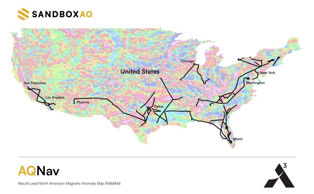
    The Boeing test incorporated two different technologies. The first is a magnetic field-based navigation system called AQNav from SandboxAQ, It uses map matching, though the map that they use is of the Earth’s crustal magnetic field rather than terrain. Infleqtion is investigating both techniques. The second is an inertial navigation system from quantum sensing technology company AOSense

    Jay Lowell, principal senior technical fellow at Boeing, said it was vital to consider “whether and how” the different technologies could be used together. “Maybe that means a tradeoff of performance between sensors in moments where one struggles and the other’s strong,” Lowell said. “Fundamentally, it means we just need to understand whether their combined data is better than either one alone.”

    Detecting tiny changes 

    Inertial navigation depends on accelerometers and gyroscopes — which respectively measure acceleration and rotation — to measure movement. An inertial sensor tracks how an object moves from a known starting point by recording changes in its speed and direction.

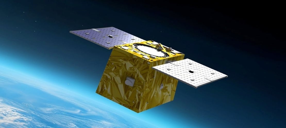
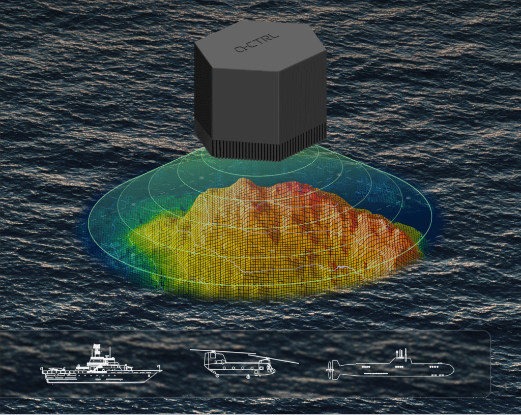
    While basic accelerometers are common in smartphones and fitness trackers, quantum inertial sensors can detect changes in motion down to the femtometer — less than the width of an atom — making them extraordinarily precise. Inertial sensors have applications in space-based technology, since they do not need maps or fixed points to navigate. 

    Infleqtion recently completed commercial flight trials of inertial-based quantum navigation in the United Kingdom and plans to conduct tests in the U.S. as well. Infleqtion’s Chicago office is also developing an AI-powered tool called SAPIENT that won first place in the U.S. Army’s xTechScalable competition.

    “[SAPIENT] is focusing on the software side, taking the outputs of multiple kinds of sensors and stitching them all together with AI to provide a more robust navigation signal,” said Pranav Gokhale, general manager of computing at Infleqtion. “There is a big gap between an inertial measurement unit and a full inertial navigation system, so we’re using AI to fill that gap.”

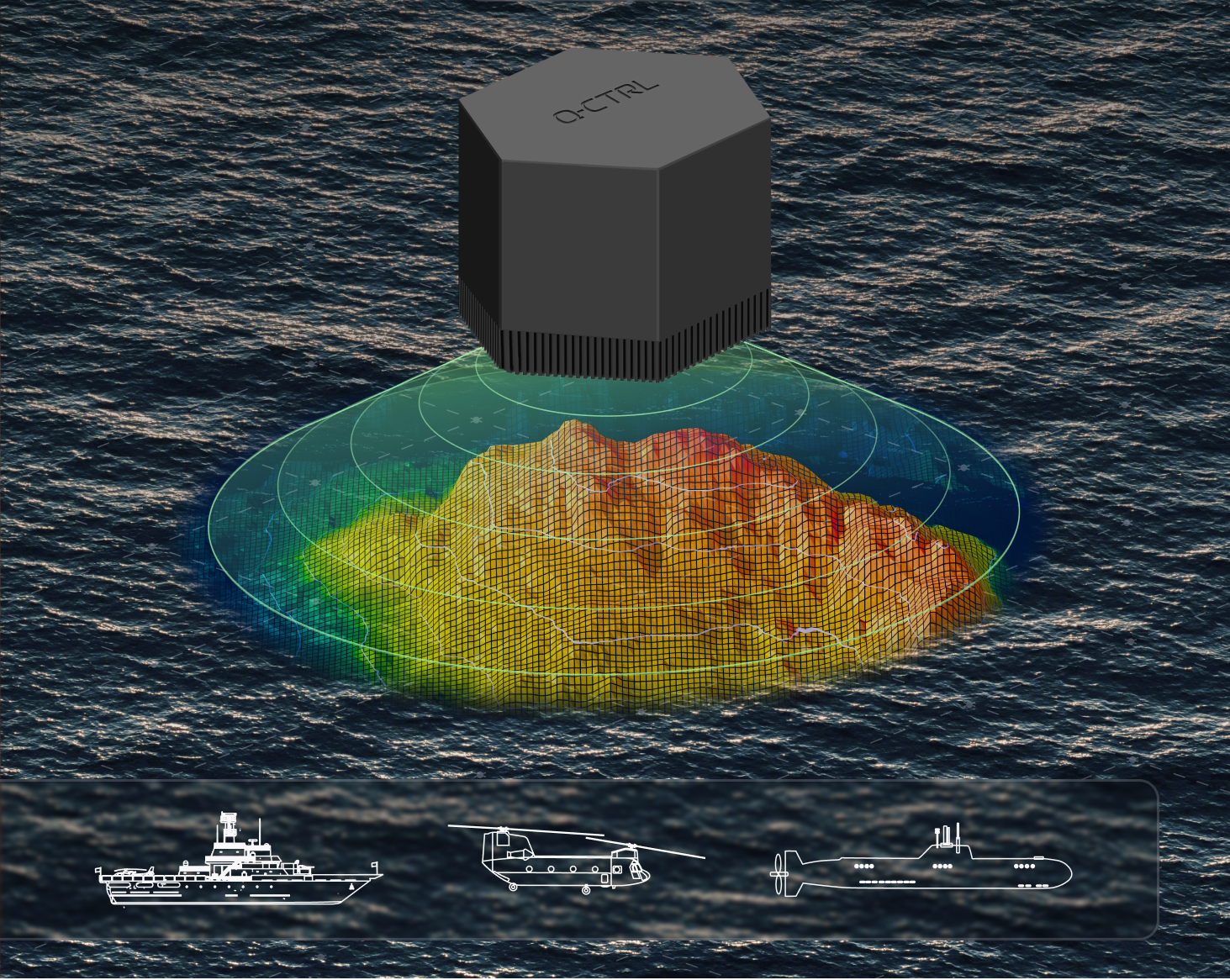
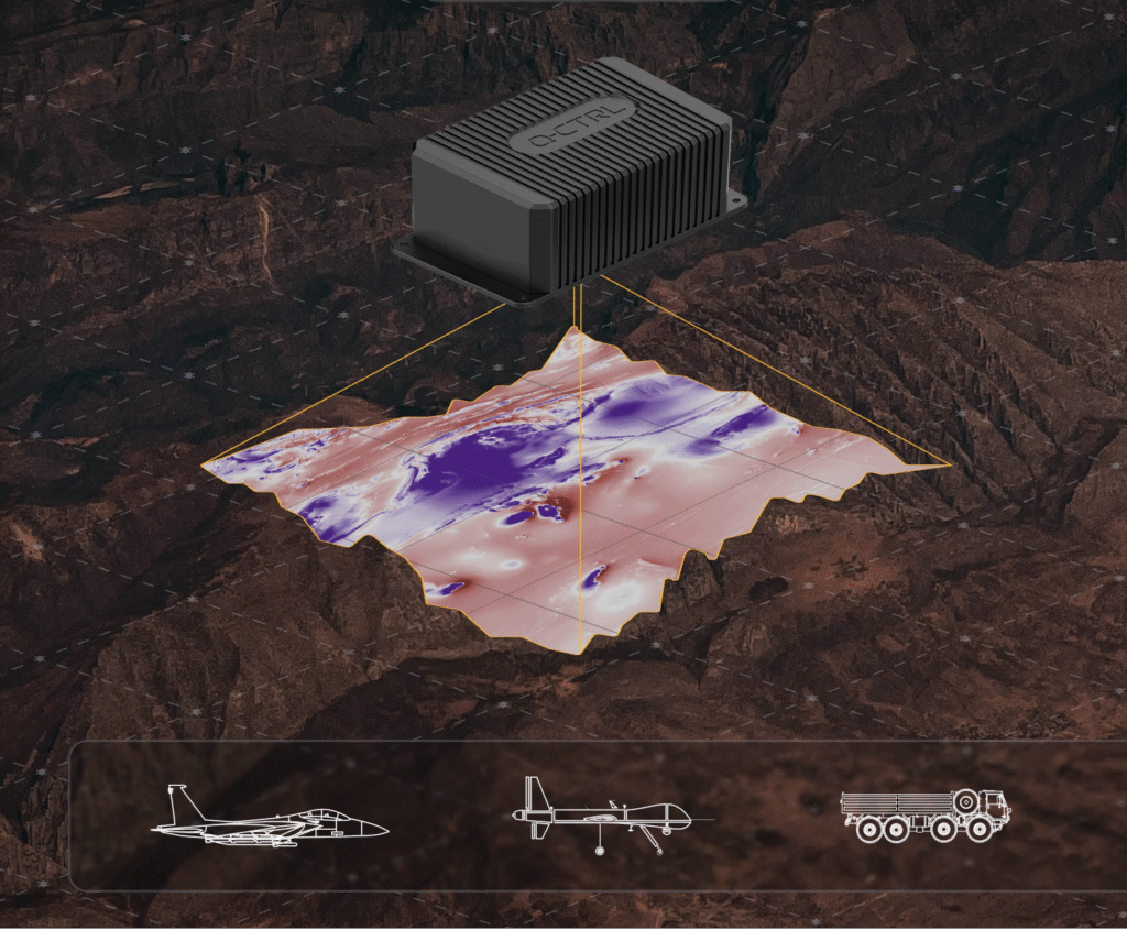
    Alternatively, magnetic navigation, or MagNav, works much like terrain-following radar, comparing real-time sensor data to a known map to pinpoint location. 

    But instead of elevation, the aircraft senses subtle magnetic fluctuations in the Earth’s crust — variations caused by geology, mineral deposits and even human infrastructure — and compares its measurements to a corresponding map of that field. 

    Scientists believe that birds can use their ability to sense the Earth’s magnetic field to navigate in a similar way. Magnetic field maps of the globe are frequently done for mineral, oil and gas surveys, as small anomalies in the field can indicate resources underground. But there are areas where high-resolution maps can be hard to come by. 

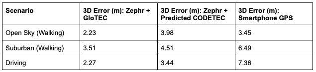
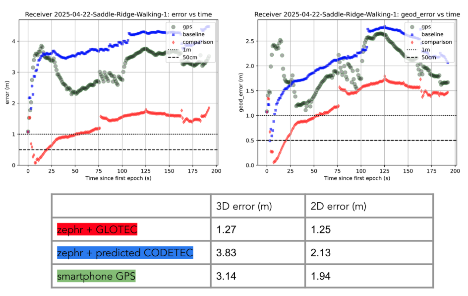
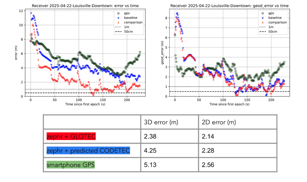
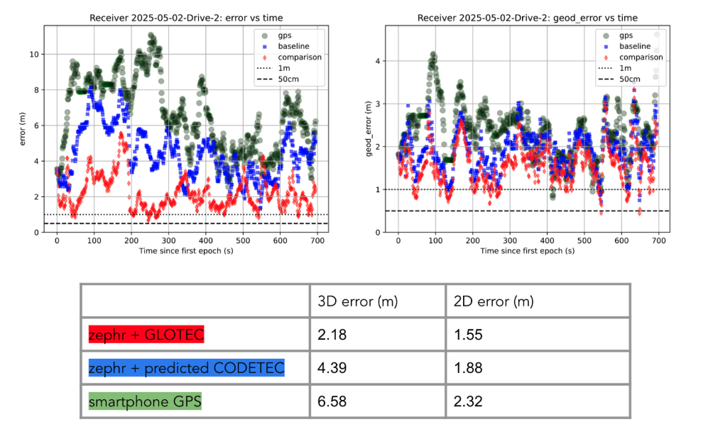
    “Map quality in the region you’re going to is definitely a factor that gets plugged into how well magnetic navigation can perform,” Devine said. 

    He identified a list of other key variables, such as the type of aircraft being used, plus its altitude and speed, as additional points of consideration for MagNav technology. At the same time, he said the importance of these tools is likely to grow as electronic warfare strategies become even more entrenched.

    “We’ve validated that we can do real-time navigation with this technology,” Devine said. “And that’s huge, because the need for it is only going to increase.”

  • Intellian, Eutelsat develop portable military-grade terminal for alternative PNT

    Intellian, Eutelsat develop portable military-grade terminal for alternative PNT

    Intellian Technologies Inc., a leading global provider of satellite communication antennas and ground gateway solutions, and Eutelsat, a GEO-LEO operator in satellite communications, have developed a portable, fully integrated military-grade Manpack for Eutelsat’s OneWeb low-Earth orbit (LEO) network.

    With auto detected resilient GNSS (R-GNSS), the military-grade unit enables external support of an alternative positioning, navigation and timing (Alt-PNT) to ensure operation in GPS-denied environments.

    Developed for defense and government, the unit provides the uninterrupted, dependable Eutelsat OneWeb LEO connectivity. It was created to address the urgent need for next-generation LEO capabilities within the broader military satellite communications domain.

    Designed for rapid deployment, the Manpack is small and light to fit a standard military rucksack. It features one-touch network acquisition for immediate operation even in demanding and high-pressure conflict regions. It is optimized for low power consumption to maximize mission duration for up to five hours on external batteries depending on usage.

    Built to battlefield-ready specifications, the Manpack is designed for Ingress Protection (IP67), as well as the U.S. Military Standards for Environmental Engineering (MIL-STD-810H) and Electromagnetic Compatibility (MIL-STD-461). This ensures exceptional durability for Communications-On-The-Pause (COTP) to personnel on front lines and mission-critical operations.

  • QinetiQ and Xona increase resilience of GPS using new satellites

    QinetiQ and Xona increase resilience of GPS using new satellites

    QinetiQ and Xona Space Systems have demonstrated how GPS navigation can be bolstered by using low Earth orbit (LEO) satellites, in the first UK tests of Xona’s new satellite navigation system, Pulsar.

    This marks a major milestone in the development of next-generation positioning, navigation and timing (PNT) capabilities, increasing resilience against jamming and spoofing, as well as improving GPS availability in congested or challenged environments.

    In the tests, QinetiQ’s Q40 multi-constellation GNSS receiver acquired and tracked signals from Xona’s first production-class satellite, Pulsar-0. The tests demonstrated that, by supplementing GNSS with LEO satellite signals like the Pulsar X1, enhanced resilience in contested or poor-signal environments can be achieved.

    The Q40 GNSS receiver. (Photo: Qinetiq)

    A recent software upgrade to QinetiQ’s Q40 was developed under the European Space Agencies’ Navigation Innovation and Support Program (NAVISP) in the GNSS Receiver with Advanced Pulsar Enhancement (GRAPE) project.

    GRAPE is a collaboration between QinetiQ and Xona, supported by the UK Space Agency and European Space Agency. Its goal is to explore how new LEO-based signals can be integrated with existing GNSS, to enhance the accuracy and resilience of navigation services for defense, critical infrastructure and future autonomous applications.

    “For the first time, we have demonstrated how signals from new LEO satellites can be used alongside existing GNSS to give users stronger, more resilient timing and position information,” said Chris Walker, Managing director, Mission Systems Division, QinetiQ. “This is a huge step in increasing the protection of our defence, critical infrastructure and future autonomous systems against interference.”

  • Q-CTRL, Lockheed to Develop Quantum Navigation for DARPA

    Q-CTRL, Lockheed to Develop Quantum Navigation for DARPA

    DARPA selects Q-CTRL to develop next-gen sensors for advanced defense platforms.

    Quantum software company Q-CTRL has been awarded two contracts under DARPA’s Robust Quantum Sensors (RoQS) program. The Defense Advanced Research Projects Agency (DARPA) is an independent research and development agency within the U.S. Department of Defense.

    The contracts, valued at $24.4 million, will augment Q-CTRL’s field-validated quantum sensing technologies for demanding real-world use cases in high-performance military vehicles. 

    Navigational technology that is resilient to denial, jamming, spoofing and other denials in the environment has become increasingly critical to defense applications, from battlefield operations to intelligence and surveillance. With conflict zones expanding, the risks to crewed and uncrewed defense missions are growing daily. Quantum sensing offers a complementary solution to  GPS that is resilient against external interference while filling coverage gaps.

    Quantum sensing offers a complementary solution to  GPS that is resilient against external interference while filling coverage gaps.

    Q-CTRL will develop next-generation quantum sensors for navigation based on their success in field trials of airborne, maritime, and ground-based quantum navigation augmented by their proprietary AI-powered software ruggedization. The technology enables sensors to operate reliably on moving defense platforms subject to challenging real-world conditions, without the need for traditional shielding or isolation.

    Q-CTRL will be joined by Lockheed Martin as a subcontractor on one aspect of the RoQS program, leveraging its expertise in GPS and quantum technology.

    Photo:
    Software-ruggedized quantum magnetometer. (Image: Q-CTRL)

    DARPA established RoQS to accelerate the development, testing and validation of quantum sensors for real-world defense applications, which include maintaining stability against environmental interference, mechanical vibrations and heavy g-forces. 

    Some sectors and organizations are fast-maturing quantum navigation for use on land, sea, in space, and in the air. The aerospace industry is actively exploring the potential for magnetic navigation technologies, with companies like aircraft manufacturer Airbus pursuing their development. 

    Additionally, Q-CTRL’s programs target the complementary missions of geophysical mapping of gravity and magnetic fields, as well as positioning based on matching detected signals to the pre-generated maps. This approach provides huge advantages in navigational missions and delivers new insights into minerals prospecting and underground target detection.

    Photo:
    Software-ruggedized quantum gravimeter. (Image: Q-CTRL)

    Ironstone Opal, the company’s quantum-assured navigation system, recently outperformed a high-end inertial navigation system (INS) in flight for the first time, achieving up to 111x greater positioning accuracy when GPS was unavailable – a significant step forward for real-world applications of quantum sensing to defense missions. In these tests, the company’s proprietary AI-driven, software-level innovation was the key to the removal of platform interference.

    Ironstone Opal’s navigation system was also recently validated in maritime trials on board the Royal Australian Naval vessel, MV Sycamore.

    In March, Lockheed Martin and Q-CTRL were awarded a contract by the U.S. Department of Defense’s Innovation Unit to prototype a quantum-enabled inertial navigation system.

  • Xona Pulsar satellites to leverage Astroscale tech for resilient and secure navigation

    Xona Pulsar satellites to leverage Astroscale tech for resilient and secure navigation

    Astroscale of the UK will provide Xona Space Systems with next-generation docking plates for integration into Xona’s growing constellation of low Earth orbit (LEO) satellites. The collaboration supports two critical goals: building a resilient positioning, navigation and timing (PNT) infrastructure and keeping Earth’s orbit safe and sustainable.

    Xona is developing Pulsar, an advanced PNT satellite infrastructure based in LEO. Pulsar operates alongside legacy systems like GPS, delivering stronger signals, centimeter-level precision, and built-in protection against interference including jamming and spoofing. As threats to global navigation escalate, a more resilient and secure PNT architecture has become essential for national security, critical infrastructure and connected devices around the world.

    “Resilient PNT is a national and economic priority,” said Giorgio Taylor, Director of Business Development, Xona UK & Europe. “Pulsar delivers stronger, faster, and more secure navigational intelligence designed for the threats we face today. Our work with Astroscale reinforces our belief that space infrastructure should evolve to continue meeting user needs, not remain frozen in time.”

    Astroscale will provide docking plates for Xona’s future Pulsar satellites as the company scales to launch its full constellation, allowing for future in-orbit servicing, upgrades or safe deorbiting. This supports a more flexible and responsive satellite architecture and helps prevent space debris. These are both key parts of responsible space operations.

  • NextNav, Oscilloquartz partner to bolster 5G-based timing solutions for critical infrastructure

    NextNav, Oscilloquartz partner to bolster 5G-based timing solutions for critical infrastructure

    New collaboration to demonstrate how terrestrial 5G-based timing can provide scalable solutions to complement and backup GPS.

    NextNav and Oscilloquartz, a division of Adtran, have partnered to demonstrate how 5G-powered terrestrial positioning, navigation, and timing (PNT) technology combined with Oscilloquartz’s established synchronization systems can serve as a scalable complement and backup to GPS. The initiative aims to maintain the operation of critical infrastructure, such as data centers, utilities, and emergency services, during GPS outages by distributing precise, coordinated universal time (UTC) over existing 5G networks for both indoor and outdoor environments.

    The collaboration integrates Oscilloquartz’s synchronization technology with NextNav’s terrestrial 5G PNT platforms to introduce an additional timing source, thereby reducing end-user dependence on GPS alone. This effort addresses increasing demand for secure and redundant timing solutions in light of threats to GPS reliability. The companies are aligning their technologies with ongoing Federal Communications Commission initiatives to encourage complementary PNT solutions.

    According to the companies, this approach responds to national security and public safety concerns by prioritizing the development of resilient infrastructure. The demonstration of these integrated terrestrial timing capabilities is intended to provide a practical example of how industry can build more robust timing networks and reduce the risks associated with relying solely on GPS.

  • Capitol Hill event spotlights urgent need for GPS backup systems

    Capitol Hill event spotlights urgent need for GPS backup systems

    Government, industry and public safety leaders call for action on PNT resiliency as threats escalate.

    GPS is the invisible backbone of modern life, supporting America’s national and economic security in ways both recognized and overlooked. While other countries have developed competing systems, GPS remains far ahead of its rivals. Yet that dominance is also a vulnerability. GPS is a single point of failure, and the U.S. lacks complementary positioning, navigation and timing (PNT) solutions. A successful disruption could cost the U.S. economy $1.6 billion per day and impact everything from first responders to our energy grids.

    As threats to GPS reliability mount, policymakers and industry leaders gathered on Capitol Hill to underscore the urgent need for backup systems to protect America’s PNT infrastructure.

    Last month, I hosted an event on Capitol Hill called: “The Race to GPS Resiliency: What the US Can Do Today to Strengthen National Security.” It brought together senior officials from the Department of Defense (DOD), the Federal Communications Commission (FCC), Congress and industry to make the case for a layered approach to PNT resiliency. These experts examined the technical vulnerabilities of GPS, the increasing frequency of jamming and spoofing incidents, and the policy measures required to expedite the deployment of complementary technologies.

    GPS: Foundational and Fragile

    The first panel focused on how federal agencies are addressing growing vulnerabilities in GPS. Thomas Rondeau, Ph.D., principal director for FutureG at DOD, shared some eye-opening insights, including how a DARPA project demonstrated that, for less than $300 in parts from Amazon, one could “create a very bad day for the American military.” He called GPS disruption one of the easiest threats to develop and warned that adversaries are already exploiting this vulnerability as part of modern conflict.

    From left to right: Diego Areas Munhoz, Reporter, Punchbowl; Dr. Thomas Rondeau, Principal Director for FutureG, U.S. Department of Defense; Arpan Sura, Senior Counsel, Chief AI Officer, FCC.
    From left to right: Diego Areas Munhoz, reporter, Punchbowl; Thomas Rondeau, Ph.D., principal director for FutureG, DOD; Arpan Sura, senior counsel, chief AI officer, FCC.

    Rondeau shared how GPS disruption is now a feature of modern warfare, as he witnessed firsthand during his time at DARPA: “We were seeing massive loss of capabilities, and ordnance, because they were dependent on GPS. And as soon as they flew there, the tent turns on, capability goes away, we lose… assets.”

    Arpan Sura, senior counsel and chief AI officer at the FCC, walked through the FCC’s process for evaluating GPS alternatives and discussed how the agency is considering complementary PNT technologies.

    “National security is one of his (Chairman Carr’s) top priorities. And we recognize, as Tom mentioned, that GPS remains vulnerable to jamming and spoofing. But also, non-national security threats like solar flares, environmental risks like orbital debris. And there is heavy reliance on it in the U.S. economy,” Mr. Sura said.

    Lives on the Line

    From left to right: Mariam Sorond, Board Chair & CEO, NextNav; Adam Eldert, Director of Public Safety for Fairfax County, Virginia.
    From left to right: Mariam Sorond, board chair and CEO, NextNav; Adam Eldert, director of public safety for Fairfax County, Virginia.

    During the second panel, the conversation shifted from global conflict zones to local communities. Adam Eldert, director of public safety for Fairfax County, Virginia, emphasized the life-saving value of resilient PNT technologies in emergency response.

    “Technology should be carrying us forward, allowing us to make better decisions with the information we have to affect life-saving measures faster, get to places quicker and avoid any sort of potential problems,” said Eldert.

    Mariam Sorond, CEO and president of NextNav, pointed out that GPS limitations can delay locating 911 callers and responding to active threats like a mass shooting situation she and Eldert had previously discussed. “It’s not just to save somebody’s life, but it’s also about preventing disasters.”

    She then highlighted the company’s 5G-powered 3D terrestrial PNT solution, which is currently being considered by the FCC’s ongoing Notice of Inquiry on PNT and in a separate Petition for Rulemaking specific to NextNav. She explained that the company is working to address a national security challenge with a near-term, future-proof solution that delivers a widescale terrestrial PNT solution without relying on taxpayer funding.

    Congressional Support

    The closing panel featured Rep. Richard Hudson (R-NC), Chairman of the House Energy & Commerce Subcommittee on Communications and Technology, and former Rep. Greg Walden (R-OR), who previously chaired the full committee.

    Both Hudson and Walden warned that the United States is lagging behind adversaries such as China and Russia in deploying terrestrial backup systems to GPS.

    Chairman Hudson reflected on how the issue hits close to home: “I represent Fort Bragg, the largest army base in the world. We call it the epicenter of the universe. Our special forces and airborne troops that deploy out of Fort Bragg rely on GPS for almost everything they do. So, real-life scenarios with them keep me awake at night.”

    Chairman Walden spoke about another high-profile case in San Diego. “[T]here was a naval exercise between two ships, and they jammed GPS… which caused some issues, ” said Walden. “It also speaks to the problem we have, in America, where, unlike China and Russia, two of our adversaries, they have terrestrial-based systems for GPS backup.”

    What Comes Next

    The event made clear that action is needed — and possible. Mr. Sura told the crowd that he believes the FCC’s Notice of Inquiry will help drive a conversation about a holistic approach to PNT resiliency, exploring the economics of how these systems will work, and how to foster competition in a way that will yield multiple outcomes. When asked about next steps, Mr. Sura encouraged the group to “stay tuned.”

    Speakers throughout the event called for continued public-private collaboration to accelerate development of a more resilient PNT system — one that combines space-based and terrestrial technologies to safeguard national security, critical infrastructure, and public safety.

    Congressman Hudson closed with a note of urgency and optimism: “It’s clear the FCC understands the urgency, and they’re conducting thorough reviews right now.”

    Full event details and videos are available here.


    Diane Rinaldo of Peake Advisors, which sponsored the event, is one of the country’s leading authorities on 5G, telecommunications supply chain security and privacy. She served as Acting Administrator of the National Telecommunications and Information Administration and Acting Assistant Secretary of Commerce for Communications and Information in the first Trump Administration.

  • Companies partner on resilient navigation for commercial ships

    Companies partner on resilient navigation for commercial ships

    NAL Research is partnering with SGM Technology, a maritime technology company, and Tschudi Shipping, a maritime logistics company, to deliver a resilient navigation and tracking product line for the commercial shipping industry enabled by Iridium’s low-Earth orbit (LEO) satellite network.

    NAL Research is a U.S.-based firm specializing in assured positioning, navigation and timing (APNT) solutions.

    The partnership aims to provide reliable asset tracking and assured navigation in high-risk maritime environments. Threats to GPS and GNSS signals —  such as jamming, spoofing and interference —  are reaching unprecedented levels worldwide. In some regions, maritime authorities reported a 350% increase in affected vessels over the past six months, according to NorthStandard. These disruptions are leading to serious consequences, including collisions, delays, financial impacts on global trade, and heightened security risks for crews at sea.

    Under the partnership agreement, the companies are leveraging NAL Research’s 25+ years of expertise in APNT, tracking, and connectivity to develop solutions built on the Iridium PNT service, a powerful and fully authenticated L-band signal resilient to spoofing and jamming.

    The partnership will also benefit from SGM’s 15+ years of experience delivering technology to the commercial maritime sector and Tschudi Shipping Company’s global presence and 140+ years in commercial shipping and logistics. Together, the collaboration aims to provide maritime users with unmatched resilience and reliable navigation for GPS/GNSS-compromised environments. Trials of this state-of-the-art solution are underway.

  • SandboxAQ and Acubed advance magnetic navigation 

    SandboxAQ and Acubed advance magnetic navigation 

    As GNSS denial, jamming and spoofing threaten aviation safety, SandboxAQ and Acubed, the Silicon Valley innovation center for Airbus, have released real-world test results from a five-month, nationwide project designed to test the accuracy of AQNav.

    AQNav is an artificial intelligence-driven magnetic navigation (MagNav) system. AQNav uses advanced quantum magnometers to read Earth’s crustal magnetic anomalies, like a geoohysical fingerprint, then employs large quantitative models (LQMs) to filter out electromagnetic interference and precisely determine an aircraft’s position without relying on satellite signals.

    These new results come from a nationwide initiative with Acubed’s Flight Lab to test the navigational accuracy of AQNav. Meeting the aviation industry’s Required Navigation Performance (RNP) standards is necessary for deploying the system on military, commercial and civilian aircraft.

    AQNav’s performance was tested under various opertional scenarios and demonstrated advanced precision, accoding to SandboxAQ. The goal was to determine whether magnetic anomaly-aided navigation could broadly meet navigation requirements for commercial aircraft. AQNav’s capabilities exceeded the accuracy required for en route travel between airports — even on the program’s longest flight.

      Accuracy

      RNP StandardRequired Accuracy (meters)% of Flight Time Met
      RNP 0.355064%
      RNP 11,85295%
      RNP 23,704100%

      To demonstrate how the real-time capable system would operate in real-world conditions, flight data was collected, reprocessed, and streamed in real time to produce statistical insights, offering representative capability data for joint team evaluation. 

      Real-World Impact

      SandboxAQ and Acubed focused on designing tests to mirror authentic, real-world aviation scenarios. For example: 

      • Standard aircraft platform: AQNav was tested using publicly available magnetic maps aboard a standard Beechcraft Baron 58 – rather than a compensated geosurvey platform. This aircraft was modified only to accommodate the additional AQNav instrumentation – no extensive electromagnetic shielding or specialized noise isolation were used. All sensors were positioned inside the aircraft, powered by AQNav’s software to deliver a clean magnetic signal. 
      • Use of a publicly available map. For all flights, AQNav researchers used the publicly available North American Magnetic Anomaly Map (NAMAM), which covers the U.S., Canada, parts of Mexico and surrounding oceanic regions. 
      • Unfiltered flight paths: Flight operations spanned diverse, operationally relevant routes between 200 airports across the entire continental U.S. (Fig. 1), without filtering based on magnetic anomaly strength, magnetic map quality, or favorable geomagnetic gradients. More than 150 hours of flight data was collected.
      • Diverse geophysical environments: Data was collected over a full range of conditions, from magnetically-rich mountains to sparsely featured plains, reflecting real-world geographies where aircraft might operate without GNSS. 
      • True operational noise: Onboard, AQNav successfully filtered out the real-world interference generated by the aircraft, including electromagnetic, vibrational and other airframe-induced noise. 
      Fig. 1: Acubed Flights with AQNav (Credit: AQNav
      Fig. 1: Acubed Flights with AQNav (Credit: AQNav

      Elijha Williams, AQNav’s technical engagement manager, said: “Our campaign was not about demonstrating proof of concept performance under ideal conditions, it was about proving AQNav’s viability under the noisy, messy, and unpredictable environments real pilots face every day.” 

      During test flights exceeding two hours, AQNav outperformed the Inertial Navigation System (INS) without GNSS 100% of the time. During a one-hour flight over the challenging mountainous and forested terrain of California, AQNav achieved its best-observed accuracy of less than 74 meters, or roughly two-thirds the length of an American football field. 

      Precision, Scale and Autonomy for the Future 

      This campaign marks a significant step toward widespread adoption of AQNav in aviation. By consistently maintaining accuracy in an uncontrolled, national testbed, SandboxAQ demonstrated AQNav’s operational robustness under real-world conditions.

      Andrew Sosa Sosanya, a quantum navigation machine learning engineer at SandboxAQ, highlighted the impact of the data collected: “Thanks to Acubed, the U.S. Air Force, and other partners, we’ve accumulated a highly relevant MagNav dataset. This creates a flywheel effect—the more data we gather, the faster we can improve model accuracy across diverse mission profiles.”

      AQNav is also undergoing testing with Boeing, a U.S.-allied air force, and as part of NATO’s 2025 DIANA cohort.

    • UK, France partner to protect GNSS for critical infrastructure

      UK, France partner to protect GNSS for critical infrastructure

      United Kingdom and French experts will work more closely to increase the resilience of both countries’ critical infrastructure to the signal jamming experienced in the war in Ukraine. The agreements are part of a suite of joint science and tech work.  

      The conflict in Ukraine has shown how new technologies — in some cases, small handheld devices — can be used to disrupt positioning, navigation and timing (PNT) services, potentially causing major disruption.

      As part of a raft of UK-France joint science and tech efforts announced July 10, researchers from both countries will work together on technologies that complement GPS, which are highly resistant to this sort of jamming.  

      For instance, the e-LORAN program, driven by the UK government, is working closely with the National Physical Laboratory and private sector companies. The system uses ground-based radio towers, which are much more challenging to block, for a reliable “backup” to GPS, so that UK infrastructure can keep running even when GPS fails.  

      The UK’s Science and Tech Secretary Peter Kyle used a joint visit to Imperial College London, with French President Emmanuel Macron, to set out how such a collaboration makes both the UK and France stronger and safer. While speaking at Imperial, Kyle pointed out the tens of millions of pounds in investment being brought into the British tech sector through UK-French trade, as well as the new jobs and growth that this partnership creates.

      These efforts will bolster the economic and national security of both countries, according to Kyle, which are foundational pillars of the Plan for Change.

      The UK and France also are launching a partnership on supercomputing. The partnership will be led by the Bristol Centre for Supercomputing, the home of Isambard-AI, and the French computing centre GENCI, who lead France’s AI Factory.  

      Closer ties between both nations’ compute power and sharing AI best practice will turbocharge the breakthroughs in AI, transforming public services and improving lives, Kyle said. These efforts build on the AI Opportunities Action Plan, the UK government’s blueprint to fuel the use of AI across the economy. It builds on the strong existing UK-France cooperation on AI. The UK’s AI Security Institute and France’s INESIA have committed to further technical workshops to deepen their collaboration on frontier AI research to support national security. 

    • Nowcasting the ionosphere: Evaluating GloTEC for real-time GNSS corrections

      Nowcasting the ionosphere: Evaluating GloTEC for real-time GNSS corrections

      One of the most persistent sources of GNSS error — ionospheric delay — has been challenging to correct in real time, especially for mass-market devices. While dual-frequency receivers and commercial correction services can mostly mitigate this issue, they remain too costly and impractical for the billions of smartphones and IoT devices that rely on single-frequency GNSS. Even for dual-frequency systems, the commonly used ionosphere-free linear combination amplifies multipath and receiver errors and reduces data redundancy — yielding only two usable combinations from four original measurements.

      This landscape may be shifting with the introduction of GloTEC, a real-time global Total Electron Content (TEC) map from NOAA’s Space Weather Prediction Center (SWPC), released in February 2025. GloTEC assimilates both ground- and space-based observations to provide real-time global ionospheric corrections without relying on error-prone linear combinations.

      Unlike coarse models such as the broadcast Klobuchar algorithm or forecast-only products such as the predicted IGS Global Ionosphere Maps, GloTEC updates every 10 minutes using real-time measurements. This high refresh rate establishes a new benchmark for open-access ionospheric nowcasting in GNSS applications.

      Originally designed to monitor and mitigate space weather impacts on aviation and communications, GloTEC may also deliver a broader benefit: enabling precise, scalable GNSS corrections for low-cost, single-frequency devices, making high-accuracy positioning more accessible and democratic.

      Why Nowcasting Matters for GNSS

      The GNSS community has long had to choose between accuracy and latency. Predictive models, such as those from NASA CEDIS or CODETEC, can offer reasonable approximations but may fall short when real-time corrections are required, particularly in the context of navigation, asset tracking or autonomous systems.

      Post-processed products (such as rapid/final IGS GIMs) provide excellent fidelity but are typically delayed by hours, days, or even weeks. This makes them useful for research or auditing, but not for real-time navigation needs.

      Commercial correction services, such as Trimble RTX and Hexagon’s TerraStar, have filled the gap for high-value applications. These systems interpolate ionospheric corrections in real time, but at a significant cost and they typically require specialized GNSS receivers.

      GloTEC bridges this gap by delivering a publicly accessible, high-refresh ionospheric product that can support near real-time corrections. Updated every 10 minutes with a 2.5° latitude and 5° longitude spatial resolution, GloTEC represents a major step forward for public sector GNSS capability, particularly in contexts where accuracy, reliability and scale are all crucial. The data has also been supporting the United States Space Force and is accessible through their Unified Data Library (UDL).

      Technical Approach: Adapting GloTEC for Practical Use

      While the potential of GloTEC is exciting, turning it into usable corrections for consumer-grade devices isn’t straightforward. TEC maps represent volumetric electron density, while most mass-market GNSS chipsets, especially in smartphones, expect simplified models, such as the eight-parameter Klobuchar model broadcast by GPS satellites. GloTEC is a three-dimensional data assimilation system that uses a Gauss-Markov Kalman Filter to estimate electron density in the ionosphere. It ingests slant TEC measurements from ground-based GNSS receivers and space-based radio occultation data, using the IRI-2016 model as its background state.

      To bridge this mismatch, Zephr’s team has been exploring regional fitting techniques, whereby a local subset of GloTEC data is used to generate custom Klobuchar coefficients. These can be transmitted to devices via standardized protocols, such as the LTE Positioning Protocol (LPP), enabling improved ionospheric delay estimation with minimal changes to device-side computation. Even with a regionalized Klobuchar fit and LPP encoding, there is still the problem of accessing the GNSS chip to apply the corrections. To solve this problem, Zephr has created a virtualized positioning engine that takes the raw GNSS measurements from the chip and provides a purely software-based solver. This approach allows the team to implement a variety of more advanced positioning techniques using commodity hardware such as smartphones.  

      Field Testing: A Quantitative Step Forward

      To evaluate the efficacy of GloTEC in improving GNSS accuracy, engineers at Zephr used the virtualized positioning engine to conduct 51 real-world campaigns across various conditions – including urban, suburban, static, walking, and driving – using a Pixel 8 smartphone and an RTK unit for ground truth.

      The results were promising, as shown in Figure 1:

      Figure 1: GloTEC vs. CODETEC vs. Android Native across multiple scenarios. (All figures provided by author)
      Figure 1: GloTEC vs. CODETEC vs. Android Native across multiple scenarios. (All figures provided by author)


      We can break down these results using detailed graphs for each scenario as examples. This will provide a more in-depth look at the positioning for specific traces through the outlined scenarios in Figure 2, Figure 3 and Figure 4:

      Figure 2: GloTEC vs. CODETEC vs. Android Native for an open sky walking scenario
      Figure 2: GloTEC vs. CODETEC vs. Android Native for an open sky walking scenario
      Figure 3: GloTEC vs. CODETEC vs. Android Native for a suburban downtown walking scenario.
      Figure 3: GloTEC vs. CODETEC vs. Android Native for a suburban downtown walking scenario.
      Figure 4: GloTEC vs. CODETEC vs. Android Native for a mixed sky driving test.
      Figure 4: GloTEC vs. CODETEC vs. Android Native for a mixed sky driving test.

      Across all categories, the GloTEC-based regional fitting approach significantly outperformed both the default GNSS solution (which uses broadcast data plus a Klobuchar mode) and the competing IGS products. Accuracy improved by up to 69% in driving scenarios and 46% in walking scenarios, compared to standard smartphone GPS.

      While the Pixel 8 used in testing supports dual-frequency GNSS, smartphones face several practical limitations that hinder effective use of ionosphere-free dual-frequency combinations. These include limited signal availability (due to antenna constraints, L1/L5 support gaps, and partial constellation coverage), elevated multipath and noise (especially from omnidirectional antennas in dynamic conditions), and unstable clock biases that complicate error modeling. In fact, iono-free combinations can amplify multipath effects, potentially degrading accuracy in some conditions.

      Despite these constraints, the results show that meaningful improvements in positioning are possible using a software-based approach with publicly available corrections. GloTEC, when paired with cooperative or cloud-based GNSS engines, offers a substantial step forward without requiring expensive commercial correction services or specialized hardware.

      Broader Implications and Next Steps

      While these results are promising, several challenges remain before GloTEC-based corrections can be broadly deployed:

      • Connectivity Requirements: Real-time access to GloTEC requires periodic downloads over cellular or Wi-Fi connections, raising questions about reliability in low-bandwidth or disconnected environments.
      • Global Calibration: The accuracy of regional fitting depends on local coverage density and VTEC variability. Further tuning may be needed in equatorial or polar regions, where ionospheric behavior is more volatile.

      Nevertheless, the availability of GloTEC marks a significant milestone. For the first time, a free, real-time, high-resolution ionospheric correction product is accessible to developers, researchers, and engineers seeking to improve GNSS accuracy at scale. NOAA SWPC has plans to integrate more low-latency space-based and ground-based data into GloTEC in the near future. The new version of the model outputs will be released to the public once the results are validated. As techniques for applying it to mobile and IoT devices mature, the GNSS community may see a broad shift toward more precise, resilient, and cost-effective positioning systems.

      GloTEC may have been designed to help forecasters monitor the response of the ionosphere due to space weather events, but its potential to provide an advanced tool for positioning on Earth is just beginning to be understood. In a world where nearly every mobile application depends on location, and where the cost of poor accuracy is rising (from package delivery failures to navigation errors), this kind of public infrastructure is invaluable.

      Researchers and industry developers alike should explore how this NOAA capability can be integrated into their positioning systems. If properly supported, GloTEC could become one of the most impactful GNSS innovations of the decade.

    • Xona satellite begins tests for commercial LEO navigation

      Xona satellite begins tests for commercial LEO navigation

      Xona Space Systems’ Pulsar-0 satellite, the company’s first production-class asset for a commercial navigation constellation, is now operational and undergoing in-orbit testing. Launched in March 2024 on SpaceX’s Transporter-10 mission, Pulsar-0 is designed to assess the performance of Xona’s Pulsar architecture, which aims to provide high-accuracy, resilient positioning, navigation and timing (PNT) services from low-Earth orbit (LEO).

      According to Xona, Pulsar-0 is transmitting LEO-based PNT signals using a payload built to support signal authentication and increased resilience against interference — capabilities that have become more important as concerns about vulnerabilities in traditional GNSS systems grow. The system’s encrypted and authenticated signals are intended to mitigate risks from jamming and spoofing, and deliver stronger, more reliable service in environments where legacy GPS may be degraded.

      Xona’s Pulsar constellation is being developed as a commercial complement to GNSS, offering centimeter-level accuracy and greater resistance to interference through modernized signal design and LEO deployment. The company reports that its initial signal waveforms are already being used by select government and commercial partners for prototyping and validation.

      Pulsar-0’s technical objectives include:

      • High-precision GNSS corrections: Real-time correction data from LEO, targeting position accuracy within 10 cm.
      • Signal authentication: Cryptographically verifiable signals to reduce the risk of spoofing.
      • Jamming resistance: A signal strength up to 100 times greater than GPS, enhancing reliability in contested or congested radio frequency environments.
      • Stronger signals: Stronger signals designed to perform in obstructed locations, such as indoors or in dense urban areas.

      The Pulsar-0 mission is primarily focused on validating Xona’s core technology and enabling live sky testing with early partners, paving the way for future launches and eventual commercial operations. The company aims to launch a constellation of hundreds of satellites to provide persistent, redundant PNT coverage for sectors including defense, logistics, mining and autonomous systems.

      Further details on Pulsar-0’s performance are expected as data collection and testing continue throughout the year.