Category: Galileo

  • First Galileo IOV Satellite Producing Full Spectrum of Signals

    Galileo team at Redu receiving signals.

    Europe’s first Galileo satellite appears to be functioning as expected, transmitting test signals received by the European Space Agency’s ground station in Redu, Belgium, across the whole of its assigned radio spectrum, ESA reports.
     
    The first two Galileo satellites were launched by Soyuz from Europe’s Spaceport in French Guiana on October 21. They are currently in the midst of a rigorous campaign to check that their highly sophisticated navigation payloads are operating as planned, unaffected by the strains of launch.

    Testing is centered on the first Galileo satellite for now, and expected to progress to the second satellite early in the new year.

    The Galileo system offers various groups of users a total of 10 different modulated signals across three spectral bands, known as E1, E5 and E6. The weekend before Christmas, all Galileo signals were activated simultaneously across these bands for the first time, following the switch-on and outgassing — warming up to vent potentially harmful vapours — of power amplifiers in the remaining E6 band.

    The signals were received by Galileo Test User Receivers deployed at the Redu ground station, within Belgium’s Ardennes forest, as well as by identical receivers at ESA’s Navigation Laboratory, in ESA’s ESTEC technical centre in Noordwijk, the Netherlands.

    These test receivers work in the same way as operational receivers will once Galileo begins its initial services in 2014. They are capable of processing the Open Service, Commercial Service and Safety-of-Life Service signals from the Galileo constellation.
     

    Galileo combines multi-frequency signals with the most accurate atomic clock ever flown in space for navigation, accurate to one second in three million years, ESA said. Its signals should open up a large number of commercial applications by combining this accuracy with the increased reliability of dual- or triple-frequency measurements. Receiver developers can choose among the variety of Galileo signals on offer to meet the needs of their customers in the most efficient way. They can also combine the processing of Galileo signals with GPS or Russian GLONASS signals to offer more robust positioning information in challenging environments such as city center urban canyons.

    First Galileo triple band signals. (Click to enlarge.)
     

  • The System: Galileo in Its Glory


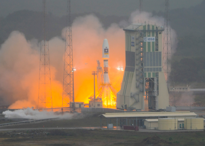
    GALILEO PROTOFLIGHTMODEL satellite began transmitting E1 and E5 signals in early December. ESA reports them well within power and shape specifications, and suited for interoperability with GPS.

    The Galileo ProtoFlightModel (PFM) in-orbit validation (IOV) satellite GSAT0101 began transmitting E1 signals on December 10 using the E11 ranging code, and E5 signals early on December 14. Launched at the same time, Flight Model 2 (FM2), GSAT0102, has not yet started transmitting navigation signals. Several companies and laboratories around the world immediately began processing the PFM signals. This story briefly aggregates their reports.

    The European Space Agency (ESA) proudly released a statement: “Europe’s Galileo system has passed its latest milestone, transmitting its very first test navigation signal back to Earth. [. . . . ] The turn of Galileo’s main L-band (1200-1600 MHz) antenna came on the early morning of Saturday 10 December. A test signal was transmitted by the first Galileo satellite in the E1 band, which will be used for Galileo’s Open Service once the system begins operating in 2014.  [. . . . ]

    “The signal power and shape was well within specifications. The shape is especially important because its modulation is carefully designed to enable interoperability with the L1 band of U.S. GPS navigation satellites: Galileo and GPS can indeed work together as planned.

    “The test campaign is concentrating on the first satellite for the reminder of the year, with the focus moving to the second Galileo satellite from the start of 2012. The plan is to complete In-Orbit Testing by next spring.

    “The next pair of Galileo In-Orbit Validation satellites will also be launched next year, to form the operational nucleus of the full Galileo constellation. Meanwhile the next batch of Galileo satellites are currently being manufactured for launch in 2014.”

    Thales Avionics. Thales Avionics has developed a Galileo receiver capable of processing the Open Service, Commercial Service, and Safety of Life service of the Galileo constellation.

    Figure 1 shows a screenshot of the Thales Avionics receiver interface program, highlighting the L1 signal energy (top right) and the pilot secondary code (bottom). The satellite Doppler and C/N0 values have been recorded and are provided in Figure 2.


    Figure 1. Screen of Thales Avionics receiver interface highlighting L1 signal energy (top right) and the pilot secondary code (bottom). (Click to enlarge).


    Figure 2. Satellite doppler and C/N0 values from the Thales Avionics receiver.

    Thales has developed a coherent processing of the Galileo E5 AltBOC(15,10) signal compatible with hardware architecture designed for independent processing of both E5a and E5b. This processing is fully compatible with the mismatch between the two RF channels on E5a and E5b, thanks to real-time calibration based on satellite signals. This processing only requires software implementation, without additional recurrent costs. The technique is relevant for future receivers operating in the E5 band, in order to significantly enhance the accuracy, with respect to thermal noise and multi-path, and to improve the cycle slip probability.

    CONGO. Several COoperative Network for GIOVE Observation (CONGO) stations, including one at the University of New Brunswick, are tracking both the E1 and E5 signals. Figure 3 shows C/N0 values collected at UNB.


    Figure 3. C/N0 values in dB-Hz of PFM 1-Hz data collected at the University of New Brunswick, on December 10. Time axis runs for 24 hours starting at 01:00 UTC. Receiver is a Javad Delta-G2T.

    JAVAD GNSS. On December 12, JAVAD GNSS announced that it has tracked the Galileo in-orbit validation satellite, temporarily designated PRN-11.

    “An important point is that we tracked it with our units that are already in the market,” said Javad Ashjaee, CEO. “This is not a lab tests. Our customers can track it too.”

    Figure 4 shows the company’s tracking results of PRN-11: plots of pseudorange (in chips), doppler (in Hz), and SNR (relative number).


    Figure 4. JAVAD GNSS tracking results of Galileo PRN-11 for now, plots of pseudorange (in chips), doppler (in Hz), and SNR (relative number).

    Calgary PLAN Group. The University of Calgary sent a detailed report. (See Figure 5 and next item.)

    Figure 5. Raw correlator values for the E1 B/C, E5aI/Q and E5bI/Q signals. The bit periods can be clearly seen on E1B, E5aI and E5bI. The secondary code can be observed on E1C while the pilot signal can be seen on singals E5aQ and E5bQ. (From the Calgary Report.)


    Galileo E1 and E5: the Calgary Report

    By James T. Curran and Aiden Morrison

    Researchers in the Position, Location and Navigation (PLAN) Group at the University of Calgary recorded E1 and E5 data using a single dual-channel front-end and subsequently acquired and tracked E1 B/C, E5a and E5b signals in the early morning of December 15.

    Using a dual channel front-end designed in-house, a Novatel GPS-703-GGG antenna and a laptop computer, IF data was collected to examine these new signals. This data was processed by GSNRx, a reconfigurable a multi-system, multi-frequency software receiver developed by the PLAN Group.

    At approximately 03:20 MST (UTC – 7:00) more than 20 GNSS satellites were visible from a rooftop mounted antenna. Having reconfigured the front-end to accommodate the E5 band, IF data was collected which included Galileo E1 B/C and E5 A/B, GIOVE-B E1 B/C and E5a, GPS L1 C/A and L5, and GLONASS L1 C/A. Following some last-minute modifications to GSNRx to include the Galileo E5b signals, the samples were processed, simultaneously tracking GPS and Galileo on both the L1/E1 and L5/E5 frequencies and GLONASS on L1.

    A subset of the raw correlator values for the E1 B, E1 C, E5a I and E5a Q signals are shown in Figure 5 above. Note that the E1 C values have been offset by -2.0×10⁵ for clarity. A data-rate of 250 symbol/s is clearly visible on the E1 B and E5b signals while a 50 symbol/s stream can be observed on the E5a I signal. The 25 chip secondary code is also evident on E1 C at a rate of 250 chip/s.

    All six components of the Galileo-PFM signals shown above (transmitted on PRN 11) were tracked independently and their signal modulations were found to agree with the Galileo Open Service ICD. A trace of the measured carrier-to-noise floor ratios for the Galileo signals is shown in Figure 6. As indicated by the ICD, the E5b signals were observed at 2 dB lower power than the E1 B and C signals. The E5a signals, however, were expected to be received at the same power as E5b and yet were observed at approximately 4 dB lower power. This is believed to be a combination of the antenna and IF filtering within the front-end as the E5a center frequency is located relatively near the pass-band edge of both.  This front-end was initially designed for 40 MHz bandwidth, but used in this experiment at 50 MHz, as will be discussed later.

    Figure 6. C/N0 for Galileo-PFM signals.

    The software receiver was once again reconfigured, this time to produce signal correlator values spaced along a delay of approximately 700 m and 70 m for the E1 A/B and E5 A/B signals, respectively, such that the cross-correlation of the received and local-replica PRN sequences could be examined. The signals were tracked for 10 seconds and the 1 ms correlator values averaged, to produce estimates of the code cross-correlation function. The characteristic ripple of the CBOC modulation on E1 B/C can be seen in Figure 7 (left), particularly on the right-most ascending feature of the envelope. Likewise, the alt-BOC cross-correlation of E5a Q in Figure 7 (right) is as expected. It is noted that the E5a I signal has suffered some distortion due to the filtering effects mentioned above.

    Figure 7. Measured cross-correlation functions for the Galileo PFM E1 B and C signals (left) and E5a I and E5b I signals (right).

    For details of the PLAN group’s front-end, a flexible GNSS signal capture tool, and other specifics on the process employed, see the full-length article.


    GPS III Testbed Sat Delivered

    Lockheed Martin delivered the the GPS III Non-Flight Satellite Testbed (GNST), the program’s pathfinder spacecraft, to its Denver-area facility. The pathfinder will now undergo final assembly, integration, and test activities.

    The GNST is a full-sized, flight equivalent prototype of a GPS III satellite used to identify and solve development issues prior to integration and test of the first space vehicle. According to the company, the approach reduces risk, improves production predictability, increases mission assurance and lowers overall program costs. In Denver, the GNST will be mated with its core structure, navigation payload, and antenna elements before completing pathfinding activities and checkout of environmental test facilities. The GNST will then be shipped to Cape Canaveral Air Force Station, Fla., for pathfinding activities at the launch site.

    GPS III satellites, when launched as scheduled to being in 2014, will replace aging on-orbit GPS satellites to deliver better accuracy and improved anti-jamming power, while enhancing spacecraft design life and adding a new civil signal designed to be interoperable with international global navigation satellite systems.

    In parallel with the GNST, progress on the first space vehicle is progressing on schedule. Lockheed Martin received the core structure for the first GPS III satellite in Stennis, Mississippi, on August 4, and is now integrating the space vehicle’s flight propulsion subsystem. The integrated core propulsion module will be shipped to the GPF in the summer of 2012 and will then undergo final assembly, integration and test in order to meet its planned 2014 launch.

    The GPS III team is led by the GPS Directorate at the U.S. Air Force Space and Missile Systems Center. Lockheed Martin is the GPS III prime contractor with teammates ITT, General Dynamics, Infinity Systems Engineering, Honeywell, ATK and other subcontractors.


    Drone Downed

    Press reports speculate that GPS spoofing was used to get the RQ-170 Sentinel Drone to land in Iran. According to an Iranian engineer quoted in a Christian Science Monitor story, “By putting noise [jamming] on the communications, you force the bird into autopilot. This is where the bird loses its brain.” At that point, the drone relies on GPS signals to get home. By spoofing GPS, Iranian engineers were able to get the drone to “land on its own where we wanted it to, without having to crack the remote-control signals and communications.”

    “The GPS navigation is the weakest point,” the Iranian engineer told the Monitor, giving a detailed description of Iran’s electronic ambush of the highly classified pilotless aircraft.

    In 2011, the U.S. Air Force awarded two $47 million contracts to BAE Systems and Northrop Grumman for development of a navigation warfare sensor to replace military GPS receivers on aircraft and missiles, and designed to maintain freedom of action under extreme GPS countermeasures.


    GLONASS Fully Operational

    For the first time in more than 15 years, GLONASS is fully operational, with 24 satellites in their designated orbital slots, set healthy, and providing world coverage.

    GLONASS 744, an M-class satellite and one of three launched from Baikonur on 4 November, was set healthy December 8, bringing the number of healthy operating satellites to the full complement of 24.

    GLONASS briefly achieved a 24-satellite constellation in early 1996 but it degraded rapidly due to Russia’s economic difficulties following the break-up of the Soviet Union coupled with the short lifetime of the GLONASS satellites. Since 2002, the GLONASS constellation has slowly but surely been rebuilt with the Russian government’s commitment to provide a global positioning and navigation system comparable to that of GPS.

    Luch SBAS. Roscosmos also launched the Luch-5A geostationary relay satellite on December 11.

    Luch-5A is the first in a series of new data relay satellites designed to rebuild the Luch Multifunctional Space Relay System, which had ceased operating by 1998. Among other functions, 5A hosts a wideband satellite-based augmentation system (SBAS) transponder.

    The SBAS transponder will transmit correction and integrity data for GLONASS and GPS on the GPS L1 frequency with a C/A pseudorandom noise code to be assigned by the GPS Directorate. The data will be provided by the System for Differential Correction and Monitoring or SDCM, which uses a ground network of monitoring stations on Russian territory as well as some overseas stations.

    As the SDCM primary service area is Russian territory, the main lobe of the SBAS antenna beam will be directed to the north with an angle of 7 degrees relative to the direction to the equator. Transmitted power of 60 watts will give a signal power level at Earth’s surface roughly equal to that of GLONASS and GPS signals, about –158 dBW.

    The current international SBAS data format has a limited capability for broadcasting corrections for both GLONASS and GPS satellites combined. There is space for only 51 satellites, insufficient for the current number of satellites on orbit. As a result, studies are being carried out in an attempt to resolve this problem. One option is to use a dynamic satellite mask, where an SDCM satellite would only broadcast corrections and integrity data for those GLONASS and GPS satellites in view of users in the territory of the Russian Federation.

    Luch-5A is the first of three MSRS/SDCM satellites. Luch-5B will be launched in 2012 into a slot at 95 degrees east longitude and Luch-4, in 2014, into a slot at 167 degrees east longitude.


    Beidou Launch Fills Regional Nav System

    The Beidou-2/Compass IGSO-5 (fifth inclined geosynchonous orbit) satellite was launched on December. According to a Chinese government announcement, this launch completes the construction of the basic regional navigation system for service to China and will be operational by the end of the year. However, completion of the Phase II development, to provide service to the Asia/Pacific region, will require further satellite launches in 2012. Phase III global coverage, with a 30-satellite system, will be achieved by 2020 according to the Beidou website.

    The GNSS community outside China still awaits a Compass interface control document (ICD), which has been promised by the end of 2012.


    LightSquared Incompatibility Declared

    U.S. government tests conducted in November showed that 75 percent of GPS receivers examined were interfered with at a distance of 100 meters from a LightSquared (LS)base station.  The report states that “No additional testing is required to confirm harmful interference exists,” and “Immediate use of satellite service spectrum for terrestrial service not viable because of system engineering and integration challenges.”

    The tests showed interference by the LS Low 10 terrestrial signal with an overwhelming majority of general-purpose GPS receivers. Data from LS handsets was collected, analysis is underway, but no results were given. Wideband and military receivers were tested, but neither specifications nor results were presented; a classified session was convened for that purpose.

    Of the 92 receivers for which full data sets were compiled, 75 percent of them failed a 1db test, showing harmful interference at 100 meters from a LS base station. These 69 receivers failed at a broadcast level of around -15dBm from the LS transmitter.

    In a December 7 filing with the FCC, LightSquared further revised its public plans to say that it would “limit its power on the ground when transmitting in the lower 10 MHz from 1526-1536 MHz to no more than –30 dBm until January 1, 2015, –27 dBm until January 1, 2017, and –24 dBm thereafter.” According to test data, at –30 dBm, approximately 17 percent of GPS receivers would be disrupted; at –27 dBm, 25 percent; at –24 dBm, 36 percent. Proceeding with this scenario would require the assumption that the FCC, or indeed anyone, believes anything that LightSquared says at any given instant, for any given duration.

  • Galileo Broadcasting Satellite Identified

    On Saturday, December 10, at about 06:00 UTC, one of the two Galileo In-Orbit Validation (IOV) satellites launched on October 21 started transmitting navigation signals on the L1/E1 frequency using the E11 ranging code.

    According to prediction visibilities based on NORAD/JSpOC tracking information, the transmitting satellite is PFM, the ProtoFlight Model (GSAT0101). The FM2 (Flight Model 2) satellite (GSAT0102) has not yet started transmitting navigation signals.

    Stations of the COoperative Network for GIOVE Observation (CONGO) were among the first to track the satellite. Results have also been reported by Thales Avionics, JAVAD GNSS, Politecnico di Torino's NavSAS group, and Thales Alenia Space.

    The following figure shows C/N0 values in dB-Hz of PFM 1-Hz data collected at the University of New Brunswick CONGO station on December 10. Time axis runs for 24 hours starting at 01:00 UTC. Receiver is a Javad Delta-G2T.

  • The System: EGNOS Toolkits Enhance GPS Accuracy

    EGNOS Toolkits Enhance GPS Accuracy

    Free downloadable software Toolkits at www.egnos-portal.eu can help cell-phone and handheld receiver developers enhance location and timing applications with GPS corrrection data from the European Geostationary Navigation Overlay Service (EGNOS) satellite-based augmentation system.

    The Toolkits include software packages, demo applications, and supporting materials, enabling application developers, researchers, university students, and others to create, use, and maintain EGNOS-capable positioning applications.

    For handheld receiver manufacturers and mobile-phone developers, the Toolkit contains free source code for easy integration of EGNOS capabilities into a smartphone, and all the necessary files for the demonstration application, for use as a basis for a new application, as well as core libraries, to integrate enhanced EGNOS positioning capability into an existing application.

    For the simply curious, an EGNOS Toolkit provides a means of exploring and understanding the entire chain from the raw GNSS satellite signal to enhanced EGNOS positioning data.

    The development kit provides an easy way incorporate all EGNOS corrections and integrity capabilities, allowing developers to perform real EGNOS integration directly into a smartphone. It works with different operating systems, including Android, Apple, and RIM.

    Static and kinematic tests show that EGNOS performs well in both cases: “The EGNOS SDK provides an average increase of 30 percent in position accuracy over GPS alone,“ according to developer DKE Aerospace.


    EGNOS Software Development Kit provides a software receiver to enhance GPS positions, displaying position accuracy increases on average of 30 percent.


    DOT Blank Stare on LightSquared

    The U.S. Department of Transportation (DoT) responded to a Freedom of Information Act (FOIA) request by GPS World for its recommendations to the National Telecommunications and Information Administration (NTIA) regarding LightSquared interference with GPS. The DoT wrote, “We are withholding two pages [of thirteen relevant pages] in part and eleven pages in their entirety,” and enclosed two completely blacked-out pages.
    Kathy Ray, DoT FOIA officer, added,  “We have determined that the release of the redacted and withheld portions would foreseeably cause harm to the government’s deliberative process.”

    The blacked-out DOT letter is dated August 25, 2011. How it differs from the agency’s July 21 “LightSquared Impact Assessment,” publicly available courtesy of the U.S. House of Representatives Committee on Science, Space, and Technology, cannot, of course, be known.

    The Department of Homeland Security wrote in response to GPS World’s FOIA request, “We conducted a comprehensive search of files with the Science and Technology Directorate’s Homeland Security Enterprise and First Responders Group, and Cyber Security Division for records that would be responsive to your request. Unfortunately, we were unable to locate or identify any responsive records.”

    The National Institute of Standards and Technology of the Department of Commerce replied, “NIST has no documents that are responsive to your request.”

    The Department of the Interior provided the same documents that were previously made public by the House committee.

    The National Aeronautics and Space Administration made a similar determination, but did not send a document, referring instead directly to the committee’s public website.

    PNT Board Hears Proposal for LightSquared Solution

    The  November 9 meeting of the National Space-Based Position Navigation and Timing (PNT) Advisory Board in Alexandria, Virginia got several earfulls regarding the LightSquared/GPS controversy. One of seven speakers on a two-hour panel, Javad Ashjaee, president and CEO of JAVAD GNSS, demonstrated his company’s newly developed filter technology that he said could protect GPS receivers from LightSquared broadband network interference.

    As Ashjaee stated, the proposed solution does not protect against interference from the so-called high-10 signals, one of two bands (the other is known as the low-10) for which LightSquared has received a conditional waiver. Unless and until a solution for the terrestrial high-10 signals is found, LightSquared transmissions in that band will still interfere with the GPS signal. The technical solution proposed by JAVAD GNSS addressed only the low-10 band.


    Proposed filter to “harden” high-precision GPS receivers against Lightsquared Lower 10 (click to enlarge.)
    The JAVAD GNSS proposed fix consists, in simplified form, of a ceramic filter followed by a series of surface acoustic wave (SAW) filters.
    A PDF of Ashjaee’s 76-slide Powerpoint demonstration, without his verbal explanations and commentary, along with other presentations from the board meeting, are available at www.pnt.gov/advisory/2011/11/. A December 8 GPS World webinar reprised the same presentation, and the download at env-gpsworld-integration.kinsta.cloud/webinar includes audio of Ashjaee’s remarks.

    Ashjaee said that his company’s testing of its own filter methodology found no GPS signal loss due to a low-10 (10L) signal power of –10 dBm. An “Ultimate Test: Special Zero Baseline” put receivers on a Moscow skyscraper with multipath from both above and below. One antenna fed two receivers (zero baseline). One receiver used standard filtering and the other the new filters. He said that over 15 hours of testing the average carrier-phase error between the two receivers was 0.2 millimeters, and the average code difference was about 5 centimeters.

    JAVAD GNSS has started production of what Ashjaee calls “LightSquared-compatible” Triumph GNSS receivers. He brought 40 units to the PNT Board meeting. The company will begin manufacturing “LightSquared-integrated” receivers in May 2012, for RTK positioning using the proposed LightSquared broadband network for high-speed communication, if and when it is deployed.

    Fellow presenter Jim Kirkland, vice president and general counsel for Trimble Navigation, pointed out that such filters represented a potential solution only for one class of high-precision receivers. Whether it would work for other classes of high-precision receivers had yet to be verified. Kirkland said that even if further independent testing shows that the filter solution is viable at the lower 10 MHz of the spectrum, retrofits would be costly and time consuming.

    Questions regarding cost and responsibility of retrofit, should the solution prove practical, were not discussed at length at the meeting, nor was any solution proposed.

    LightSquared executive vice president Martin Harriman did not directly answer a question as to whether his company intends to develop the upper 10 MHz for which it has been given a conditional waiver.

    Scott Burgett, software engineering manager for Garmin International, said, “It is almost impossible to design new products compatible with LightSquared’s proposed system without knowing its technology’s end state.” He estimated 10–15 years to properly retrofit Garmin devices, which are widely distributed in general aviation, personal navigation, car navigation, and other sectors, so that they could coexist with LightSquared.

    The panel was moderated by Tom Stansell of Stansell Consulting, who concluded, “I think we learned, thanks to Javad, about a very clever solution to a particular problem for a particular range of products — the products he is most familiar with. It may or may not fit in some of the other applications.

    “What we have not addressed is the elephant in the living room,” Stansell continued. “That is the cost, and time delay, and changeover process if LightSquared is allowed to go forward. Will it be the lower 10, upper 10? That has to be resolved. There are very large questions remaining to be discussed, and [they] may or may not be fully solved in a short period of time.”

    Constellation Updates

    Where Is Compass ICD?

    The long-awaited signal interface control document (ICD) for China’s Beidou/Compass GNSS has not yet appeared, despite an announcement at the ION-GNSS conference by Chinese delegates that ICD document v1.0 will be published in 2011, “probably” in the month of October. When it does appear, it should be available for download on the Compass website, www.beidou.gov.cn (as yet without an English version), also at www.compass.gov.cn.

    The delay in publishing a document may reflect a system very much in formulation, with ongoing discussions among the principal parties to its design, with different views on system architecture and possibly even final signal structure. This was one possible conclusion that could be inferred — a dynamic system in formation and growing rapidly — from varying reports given by different Chinese representatives, governent and academic, at the ION Compass session.

    There was some disagreement among panelists at that time as to, for example, the final targeted number of satellites in the system: either 30, or 35.

    The ICD has been rumored to be available previously to receiver manufacturers within China, creating some disgruntlement among companies outside the country. One of the ION panelists affirmed that GPS/Compass chips and receivers are being actively developed by many Chinese manufacturers and research institutes.

    The next BeiDou/Compass launch, which will be for the system’s fifth inclined geosynchronous orbit satellite, is expected during the first few days of December, according to web discussions. As of press time for this magazine, there had been no official announcement on the Chinese official government BeiDou website, www.compass.gov.cn.

    The site has posted Chinese and English versions of a document titled “Report on the Development of BeiDou (COMPASS) Navigation Satellite System (V1.0)” by the China Satellite Navigation Office. The pages are viewable as separate images.

    Galileo Under Control

    Europe’s first two in-orbit validation satellites reached their final operating slotss 23,222 kilometers above Earth, have been activated, and are now undergoing tests of their navigation payloads, reports the European Space Agency (ESA).

    Marking the formal end of their Launch and Early Operations Phase, control of the satellites passed on November 3 from the French space agency (CNES) center in Toulouse to the Galileo Control Centre in Oberpfaffenhofen, Germany.

    Oberfaffenhofen, operated by the German Aerospace Center (DLR), will be in charge of the satellites’ command and control for the whole of their 12-year operating lives. The navigation signals are being checked out by ESA’s ground station in Redu, Belgium, where a 20-meter antenna measures the shape of the signals to a high degree of accuracy. Once the navigation payload is fully checked out and activated, a second Galileo Control Centre in Fucino, Italy, will oversee all navigation services. All activities are performed under contract to SpaceOpal, a joint subsidiary of DLR and the Italian company Telespazio.

    GLONASS as Expected

    The Satellite System Mission Control Center of the Russian Ministry of Defence, with the ISS-Reshetnev Information Computation Center, established communication with the three GLONASS satellites launched November 4. The satellites are earth- and sun-oriented, and their subsystems are functioning properly.

    According to NORAD tracking, the three satellites were inserted into Plane 1. This was expected as there are only seven active satellites in this plane, whereas the other two planes have a full complement of eight satellites. Orbit slot 3 in Plane 1 is currently vacant. According to Nikolay Testoyedov, ISS-Reshetnev general designer and director general, the new satellites will ensure the operation of a complete 24-satellite GLONASS constellation, and allow creating the necessary orbital reserve.

    GPS GEO-MEO Floated

    In a presentation titled “Analysis of Alternatives  for Future GPS Architecture; Considerations for Constellation Sustainment,” made to the U.S. PNT Advisory Board on November 9, Kirk Lewis, senior advisor from the Institute for Defense Analyses (IDA), put forth the concept of “boosting” GPS III payloads onto commercial geostationary Earth-orbit (GEO) satellites.

    After concluding that the current program of launches and orbit costs extending into the Block III-C generation is not sustainable, Lewis presented several alternatives, but quickly eliminated two that involved low-Earth-orbit satellites and non-space options, due to technical, scheduling, and performance issues. Remaining in play are “potential and realistic” GEO and mid-Earth orbit (MEO, the configuration of the present GPS constellation) options, used individually or in combination.

    IDA analysis found that two GEO satellites, separated by 15 degrees or more longitude, supplied almost the same signal performance as adding six MEO satellites. The presentation is available at www.pnt.gov/advisory/2011/11/.

  • The Good, the Bad, and the Really Ugly

    The Good, the Bad, and the Really Ugly

    The Good

    This month there is good news — great news, actually — where GPS and PNT (Position, Navigation and Timing) systems are concerned. On October 22, a Russian Soyuz rocket placed in orbit the first two validation satellites, built by EADS Astrium Germany, in the Galileo PNT constellation after making its maiden launch from Kourou. Don’t confuse these recent satellites with the earlier experimental satellites, GIOVE-A launched in 2005 followed by GIOVE-B launched in 2008. These initial satellites served to preserve the Galileo ITU frequency filings and test the first-ever space borne Hydrogen Maser atomic clock, which by all accounts is proving to be extremely accurate.

    21102011-_SCO3184-W-1
    The Soyuz launch of two Galileo IOV satellites.

    While it is interesting the Europeans decided on a Russian vehicle for the first Galileo dual launch, the U.S. recently pinned its hopes on a European Ariane Five (pictured at right) to launch a commercially hosted U.S. government payload known, appropriately enough, as the “Commercially Hosted Infrared Payload” or CHIRP sensor, which was specifically developed by the U.S. government as a test payload to test both the payload sensor capability and the commercially hosted options for sensor payloads in GEO. The CHIRP sensor features a fixed telescope that can view one quarter of the Earth from geosynchronous orbit. So it appears that hosted payloads and international launch cooperation efforts are growing and are apparently working successfully.

    The two newest Galileo satellites deployed four hours after the Soyuz rocket lifted off from Kourou, in French Guiana.

    The Soyuz launched the first two of four validation Galileo satellites designed to validate the Galileo concept by testing both space and ground operations. Two additional validation satellites are scheduled to follow in the summer of 2012. Once the In-Orbit Validation (IOV) phase is completed, an additional 12 satellites will be launched to reach an Initial Operational Capability (IOC) of 16 satellites sometime in 2014, and that date looks extremely doubtful.

    According to our own Richard Langley, “During initial operations, the [Galileo] satellites will be controlled by a joint ESA and CNES French space agency team in Toulouse, France. Once that week-long phase ends, the satellites will be handed over to the Oberpfaffenhofen Galileo Control Centre near Munich, [Germany], operated by the DLR German Aerospace Center, which will be responsible for routine operations. Operating the satellite payloads to provide navigation services will be the task of the Fucino Control Centre, near Rome, operated by Telespazio.”

    Now, does that sound like a confusing and expensive ground support system? Everybody and every country insist on their piece of the pie, regardless of efficiency and continuity of operations. Who knows this might work; only time will tell.

    The approximately $7.5 billion Galileo constellation will eventually, hopefully, comprise a retinue of 27 operational satellites with three on orbit spares by 2020.

    The PNT business is obviously good for the Russian launch business. Russia successfully launched a GLONASS-K1 test satellite back in February, followed by three GLONASS-M satellites this month into a constellation that finally, after 29 years, accounts for 23 operational and three hopefully soon-to-be operational satellites. The first operational GLONASS-K1 is not scheduled to be launched until sometime early in 2012. GLONASS satellites have historically proven to be fragile affairs with extremely short lifespans; it remains to see how long this number and capability will be maintained. Hopefully the new K1 and M generation GLONASS satellites have resolved many of the longevity issues. Only time will tell when and if the Russian GLONASS will ever regain Full Operational Capability (FOC), which requires 24 simultaneously operating satellites. The Russians were briefly FOC in December 1995, but unfortunately only for a few months. The word “simultaneous” is important as Russian scientisst frequently state they have 25 or 27 GLONASS satellites in orbit, but unfortunately only 22 or 23 of them are operating. But it is possible, miracles still happen, that by the time you read this GLONASS may actually legitimately have achieved FOC once again.

    Now on the Boeing IIF side of the house, more good news as it was announced this week that the second IIF satellite (IIF-2), which has been operational with an elevated signal strength for several months, now has its signals back within the specified signal strength and is good to go. GPS IIF-3 was originally scheduled for launch this coming summer, but the latest launch schedules show the launch in September 2012, about 11 months from now. With 30+ operational GPS satellites on orbit plus residuals, hopefully this will be soon enough.

    Apple & GLONASS

    Always betting on the come, we now know that the late genius Steve Jobs directed his enterprising engineers to include GLONASS PNT software in the latest iPhone 4S; the latest version iPhone that sold 1.3 million units in one day. This effectively gives the iPhone 55 potential satellites to choose from for PNT information as well as the Wi-Fi, cellular tower, and SkyHook Wireless PNT information. With the addition of the GLONASS PNT resources, the iPhone may now well be the most versatile and capable general-purpose PNT platform that exists today. Is that a sad commentary for other GPS and mobile phone providers, a marketing challenge, or merely a positive sign of the technologically advanced times in which we live? It may in fact simply be a true reflection of the capabilities of the most recognized and profitable corporation in the world today. Apple is doing many things right, and one of them is listening to the consumer and giving them more than they expect. Consequently, customers are loyal and Apple Inc. surpassed Microsoft in market capitalization in 2010, and in 2011 became the most valuable consumer-facing brand in the world. Apple is a company Fortune magazine has named the most admired company in the United States for the last three years running. Apple iPhones and numerous PNT applications are certainly in use by thousands of our warfighters in and out of theater. Interesting, to say the least, plus food for thought and a topic for a future column.

    The Bad

    The bad news not surprisingly comes via the U.S. government and no, it is not about LightSquared, because that situation continues to be worse than merely bad. No, the bad news comes in the form of a recently released but curiously out-of-date publication concerning GPS by the Congressional Budget Office (CBO).  In late October 2011, the CBO released a publication entitled The Global Positioning System for Military Users: Current Modernization Plans and Alternatives.

    I was unfortunate enough to receive both a soft and hard copy; and to make matters worse I don’t own a parakeet. The good news is we do have several fireplaces in our home and winter is rapidly approaching. Truthfully, the report is that bad and out of date, but at least it is boring and long. Fortunately hardly anyone is likely to actually endure the pain and suffering required to read through the entire document. However if you are a masochist and/or suffering from acute insomnia I highly recommend this CBO report as a possible cure. Some of you might justifiably complain I have no business giving medical advice because I am not a medical subject matter expert (SME) and I wholeheartedly agree, just as I agree that the CBO is definitely not a GPS SME and should stay with what they do know. Whatever that is.

    I can assure you when and if the military needs advice concerning future GPS operations and options the last place they will or should turn is to the CBO. For example, the preface of the document clearly states, “In keeping with CBO’s mandate to provide objective, impartial analysis, this study makes no recommendations.” Contrary to what you may think this is actually good news, since now we don’t have to waste valuable time dealing with flawed recommendations; garbage in, garbage out. Now if only the analysis were impartial or objective, which it is decidedly not. I would even settle for accurate, which it is definitely not. The information in this document is in some cases, as in M-Code satellites, erroneous and confusing; it is out-of-date where the GPS III nomenclature and options are concerned, especially the spot-beam; and it is always misleading concerning objectivity that presents facts not in evidence. There is so much erroneous and misleading information in this report that I sincerely hope no one else reads it, especially our military users.

    Seriously, all kidding aside, if you must read this document, consider it to be retitled as: The Global Positioning System for Military Users: Outdated Modernization Plans and Alternatives Not Currently Being Considered by the DoD.

    Against my better judgment I am including a link to the CBO document for those of you who practice self-flagellation. I truly regret the number of tree lifespans cut short to produce this confusing, misleading, out-of-date, and totally unnecessary document. Sometime I will tell you how I really feel.

    The Really Ugly

    The “really ugly,” as you have probably surmised by now, refers to LightSquared and the clueless FCC. Can you believe we have been dealing with this fiasco for more than 12 months? You are probably tired of it all, I know I am, but I see that as a true danger signal. The situation is very clear technically, the LightSquared signals, both from the terrestrial transmitters and receivers, will significantly impair and jam GPS signals to the detriment of all GPS users. Of course the political and business ineptness continues apace so who knows how long we will be dealing with this issue, but we cannot afford to let down our guard. Although this is exactly what LightSquared, the FCC, and the current administration, in an upcoming Presidential election year, obviously hope will happen. They hope we will all just get tired of dealing or even hearing about this LightSquared mess and then they win by default. We all have more important matters demanding our attention, right? Of course we cannot and are not going to allow that to happen. We will continue to use LightSquared as a verb when necessary and keep the real facts front and center, right here in GPS World, until all aspects are resolved. You can count on it.

    Until next time, happy navigating.


  • Expert Advice: Realizing Europe’s SatNav Ambitions

    Exp-Adv-NovBy Axelle Pomies and Gard Ueland

    The 21st century today faces and will continue to encounter many new societal challenges, all mutually interdependent: health, environment, agriculture, ageing population, personal security, public and civil protection, safe and efficient transport and mobility, citizen rescue, land management, energy (supply, security, and efficiency), full employment, new consumer services, high-tech industry, business security, connectivity, globalization, intellectual property management and protection.

    All these challenges have a common denominator: the economic health of Europe: growth, competitiveness, and job creation. Along these lines, the European Union (EU) created the Europe 2020 strategy for smart, sustainable, and inclusive growth. Its goal is to achieve growth by “developing an economy based on knowledge and innovation, promoting a more resource-efficient, greener, and more competitive economy, fostering a high-employment economy delivering social and territorial cohesion.”

    The role of European institutions in the growth process is especially decisive at a time when all organizations struggle to borrow, spend, and invest in the current economic situation. The need to stimulate the economy and to ensure competitiveness and return on investment in Europe is more important than ever. Among the growth-enhancing items identified in the EU2020 strategy, research and development (R&D) and innovation are part of the top priorities: “3 percent of the EU’s gross domestic product (GDP) should be invested in R&D” is one of five top EU targets. The European Commission also put forward the Innovation Union concept initiative “to improve framework conditions and access to finance for research and innovation so as to ensure that innovative ideas can be turned into products and services that create growth and jobs.”

    Given EU budgetary restrictions, as stated in the EU2020 strategy, the financial framework must be “devised to maximize impact, ensure efficiency, and EU value-added.” This is why the EU budget must be carefully invested in research and innovation areas that both have strong growth potential and satisfy Europe’s political, societal, and economic interests.

    The domain of satellite navigation applications, rapidly becoming a pillar of 21st-century society, offers a splendid opportunity among the most promising ones!

    Key GNSS Applications

    • Transport. Increased safety and efficiency for aviation, maritime and inland waterways, rail, road transport, and more.
    • Environmental protection. Support to environmental driving, car parking, waste control, low-cost sensors for landscape monitoring, resource monitoring. and land administration through surveying and mapping…
    • Health. Tracking and tracing of medical goods, assistance to elderly and disabled people.
    • Agriculture. Precision agriculture, livestock management…
    • Mobility. Navigation, road tolling and charging, location-based services, multi-modal transport services…
    • Security and Safety. Pay-as-you-drive insurance, law enforcement, protection of intellectual property rights, secure asset and personal tracking, unmanned vehicles, integration of GNSS, satellite communications, and global monitoring for environment and security, customs and freight monitoring…
    • Timing and Networks. Synchronization of smart grids, telecommunications, banking, and digital video broadcast networks…

    Public Funding Requirement

    EU public funding is necessary for Europe to attain excellence, compete in a global market, and expect future commercial and societal benefits.

    GNSS positioning, navigation, and timing technology is fast becoming a mature commodity, but major improvements are still required. Without EU public support, such as the Framework Programs for R&D, GNSS development will continue to follow a purely economic approach from industry, that is, maximizing return on investment rather than seeking to innovate technology. Industries will naturally look to combine commercial off-the-shelf sensors and functions, with minimal effort on R&D, rather than improving GNSS technology’s ability to meet evolving needs.

    This approach jeopardizes both European excellence in the GNSS field and the future take-up of European GNSS infrastructure.

    Foster Knowledge, Create Jobs. There is a compelling need to foster European knowledge and capability to reach excellence in the GNSS field, in order to maximize competitiveness, growth, and job creation in Europe. The purely commercial approach will continue to place the U.S. GPS as a standard; this constitutes a major risk for Galileo and for the EU economy as a whole, as it would continue to rely on a GNSS service over which it has no control.

    Therefore, EU public funding, through such initiatives as framework programs (FPs), competitiveness and innovation programs, and Horizon 2020, is essential to ensure the use of European infrastructures and the generation of benefits for Europe. This will give the means to the EU industry to get a better share of the global GNSS downstream market.

    It is a question of business, growth, employment, and return of EU investment in the European GNSS programs. As an example, most non-aviation applications of the European Geostationary Navigation Overlay Service (EGNOS) infrastructure exist solely from the stimulation of FP6 and FP7 projects.

    Finally, the cycle of EU public funding — which creates projects that link people not used to working together, to stimulate creativity and foster innovation — also must be underlined. Through these programs, small-to-medium enterprises (SMEs), large companies, academia, and research institutes from EU countries and beyond can meet and work together. To link people and brains and stimulate creativity is a perfect springboard for new ideas and market opportunities.

    We emphasize at this point the huge risk of the absence of FP7 GNSS applications R&D budget until 2014 — the dedicated FP7 budget being exhausted due to extensive cuts, leaving only ϵ100 million in the GNSS FP7 budget line, instead of the ϵ350 million granted at the outset. A lack of public support for R&D effort would significantly limit the potential of innovation and growth as well as European ambitions in GNSS.

    The European Parliament Resolution of June 7, 2011, on “Transport applications of Global Navigation Satellite Systems: Short- and Medium-term EU Policy” revives hope among European downstream research and innovation actors. Among other things, Parliament calls on the European Commission (EC) “to ensure that the ϵ100 million likely to be underspent in payment appropriation for research within the 7th FP is made available for the development of GNSS applications.”

    Applications a Promising Market

    GNSS-based positioning/timing technologies and services must be part of the long-term growth priorities of the European Union. As part of the solution to the next generation of challenges, GNSS technology can contribute significantly to all major EU policies.

    GNSS applications and services development can bring immediate benefits — creation of new industrial activities and hundreds of thousands of jobs — and enhance daily life and well-being of Europe’s citizens; the core vocation of GNSS applications is fully in line with the Lisbon Treaty.

    Further, GNSS applications and services constitute one of the most promising sectors for European growth. The global GNSS market amounted to around ϵ130 billion in 2010 and is expected to reach ϵ240 billion by 2020. This corresponds to a sustained growth rate of more than 11 percent per year.

    EU public funds invested in GNSS applications R&D would catalyze growth, enabling market development and maximizing the efficiency of EU budget. With only a small part of its budget dedicated to GNSS applications R&D, the EU would see both an important and decisive impact on the GNSS market and a snowball effect, seminating further applications and domains with GNSS technology.

    The 2010 FP7 budget for GNSS R&D was ϵ30.5 million. Assuming that EU27 member states made similar contributions at the national level and that two-thirds of GNSS R&D investments come from the private sector, the total EU investment in GNSS applications R&D totalled ϵ180 million in 2010.

    Since the EU GDP of GNSS applications and services amounted to around ϵ26 billion in 2010, the rate of GNSS GDP to investment in applications R&D’ corresponds to a factor more than 100. In other words, ϵ1 invested by in GNSS application R&D generates about ϵ100 of revenue.

    The Need for Dramatic Increase

    As stressed in the EU2020 strategy, “R&D spending in Europe is below 2 percent [of GDP], compared to 2.6 percent in the United States and 3.4 percent in Japan.” The Barcelona EU goals specify that R&D financing should be shared between public (one-third) and private sectors (two-thirds).
    In 2011, EU public investment in GNSS applications R&D is expected to be 0.1 percent of EU GNSS GDP — well below the required threshold. If the R&D budget is not restored, this rate will come very close to zero until 2014.

    In the Barcelona and Europe 2020 goals, the level of EU contribution to GNSS applications R&D investments can be computed (Figure 1). Ensuring EU benefits would require annual public support to GNSS applications research rising from ϵ100 million in 2011 to ϵ200 million in 2021.

    Schema_HD
    Figure 1. Minimum level of EU public funding required for GNSS applications R&D from 2011 to 2021.

    Increased investment would enable Europe to boost its current 20 percent market share to reach the 33 percent share that Europe enjoys in other high-tech sectors. This would mean creation of more than 400,000 new jobs in 2020.

    Contrary to the United States, China, and Russia, the EU lacks a large military applications R&D program, which elsewhere helps support industry investments in commercial and civil applications. Given European investments in other sectors and investment of other countries in GNSS application R&D, a level of EU public investment between ϵ100 million and ϵ200 million per year is essential.

    Horizon 2020

    Galileo Services makes the following recommendations for the EU program Horizon 2020.

    GNSS technologies and services.

    • Support European industry in investing and developing critical technologies, applications, and services based on end-user requirements: security, reliability, robustness, and high performance;
    • Pursue research to improve GNSS performance, mainly multi-constellation multi-sensor receivers;
    • Encourage innovative ideas, whatever the domain may be, through very open calls for proposals.

    Market penetration and development.

    • Adequate value-added content (such ashigh-precision or indoor digital maps) to leverage application development;
    • Market analyses and business cases, with a focus on new uses of GNSS;
    • Promotion and awareness activities;
    • Standardization in relevant domains;
    • A certification process for safety- and security-critical applications;
    • Demonstrations and pilot projects, focusing on implementation of GNSS solutions tightly integrated in the user workflow, involving all value chain actors;
    • Use of large European companies  — industry locomotives — and SMEs’ innovative capability to penetrate markets and spin off new business opportunities;
    • International cooperation established by: favoring EU industry interests within bilateral discussions between EU and non-EU countries, involving non-EU partners only if providing opportunities for market penetration beyond EU boundaries or specific skills and/or technology not available in Europe, and setting up adequate intellectual protection rights (IPR) policy.

    Other support.

    • Expectations of significant public-sector funding and regulations will stimulate private GNSS investment. Such tools are widely exploited in America, Russia, and Asia;
    • Regional and national procurement plans would benefit from coordination at the EU level;
    • A close dialogue has been established between European institutions and GNSS downstream industry, represented by Galileo Services, in recent years. In this framework, crucial issues such as licensing rules, IPR policy, and international cooperation can be discussed. This initiative must be pursued and even reinforced.

    Galileo Services is a non-profit organization founded in 2002 as a major partner for the Galileo program and GNSS application development. Although Galileo is a key area of interest for Galileo Services, the association focuses on all types of PNT systems such as GPS, GLONASS, Galileo, EGNOS, WAAS, and so on. Having merged with OREGIN (the Organization of European GNSS Industry of equipment and services) in 2009, Galileo Services network represents more than 180 member organizations from Europe, North America, and Asia, ranging from SMEs to large companies. Gard Ueland is president of Galileo Services, and Axelle Pomies is its permanent representative.

  • Galileo IOV Satellites Succesfully Launched into Orbit

    21102011-_SCO3184-W

    The first pair of satellites for Europe’s Galileo global navigation satellite system has been lofted into orbit by the first Russian Soyuz vehicle ever launched from Europe’s Spaceport in French Guiana in a milestone mission, reports the European Space Agency.

    The launch occurred one day after initially scheduled to resolve a problem with the ground-support fueling system.

    The Soyuz VS01 flight, operated by Arianespace, started with liftoff from the new launch complex in French Guiana at 10:30 GMT on October 21. All of the Soyuz stages performed as expected and the Fregat-MT upper stage released the Galileo satellites into their target orbit at 23,222 km altitude, 3 hours 49 minutes after liftoff. A launch replay is available. A look inside the IOV satellite is available on the BBC website.

    The two Galileo satellites riding the Soyuz are part of the In-Orbit Validation (IOV) phase that will see the Galileo system’s space, ground and user segments extensively tested. The satellites are now being controlled by a joint ESA and CNES French space agency team in Toulouse, France. After these initial operations, they will be handed over to SpaceOpal, a joint company of the DLR German Aerospace Center and Italy’s Telespazio, to undergo 90 days of testing before being commissioned for the IOV phase.

    The next two Galileo satellites, completing the IOV quartet, are scheduled for launch in summer 2012.

    “This launch represents a lot for Europe: we have placed in orbit the first two satellites of Galileo, a system that will position our continent as a world-class player in the strategic domain of satellite navigation, a domain with huge economic perspectives,” said Jean-Jacques Dordain, director General of ESA.  “Moreover, this historic first launch of a genuine European system like Galileo was performed by the legendary Russian launcher that was used for Sputnik and Yuri Gagarin, a launcher that will, from now on, lift off from Europe’s Spaceport.

    “These two historical events are also symbols of cooperation: cooperation between ESA and Russia, with a strong essential contribution of France; and cooperation between ESA and the European Union, in a joint initiative with the EU. This launch consolidates Europe’s pivotal role in space cooperation at the global level. All that has been possible thanks to the vision and commitment of ESA member states.”

    This was also the first Soyuz to be launched from a site outside of Baikonur in Kazakhstan or Plesetsk in Russia. A new site for Soyuz in French Guiana, operated by Arianespace, adds to the flexibility and competitiveness of Europe’s fleet of launchers.

    Soyuz is a medium-size vehicle, complementing ESA’s launchers: Ariane 5 handles large payloads, and the new Vega, planned to debut in 2012, will lift smaller satellites.

    Launching from close to the equator allows the European Soyuz to offer improved performance. From French Guiana, Soyuz can carry up to 3 tonnes into the ‘geostationary transfer orbit’ typically required by commercial telecommunications satellites, compared to the 1.7 tonnes that can be delivered from Baikonur.

    Source: GPS world staff
    The launch profile of the Galileo IOV satellites.


  • Galileo Launch Scrubbed; Possible on Friday

    UPDATE: Following the work performed on the Soyuz launch facility and the associated additional checks, Arianespace has decided to restart the countdown operations for the launch VS01, Soyuz STB – Galileo IOV-1. Liftoff of the Soyuz ST-B launcher is now set for Friday, October 21, at
    exactly:
    10:30:26 a.m.  (UTC) Friday, October 21
    07:30:26 a.m.  (French Guiana time)
    12:30:26 p.m.  (Paris time)
    06:30:26 a.m.  (Washington, D.C., time)
    02:30:26 p.m.  (Moscow time)


    Galileo's Soyuz awaits it's flight.

    A problem with the ground-support fueling system for the rocket carrying two Galileo in-orbit validation (IOV) satellites has delayed their launch either until Friday, October 21, or perhaps indefinitely.

    A statement from launch operator Arianespace said, “A ground support system leak during third-stage fueling of the Soyuz launcher was the cause of today’s delay for this medium-lift vehicle’s inaugural flight from French Guiana. Arianespace Chairman & CEO Jean-Yves Le Gall said the leak was in a launch pad pneumatic system that activates the pre-planned disconnection of fueling lines to Soyuz’ third stage before the vehicle lifts off."

    “During the final phase of third-stage fueling, there apparently was a change in pressure in this pneumatic system, and we observed the unplanned disconnection of the two connectors that enable the fueling of Soyuz’ third stage with liquid oxygen and kerosene,” Le Gall told reporters during a briefing at the Kourou Spaceport’s Jupiter mission control room. “The problem apparently is due to a valve leak in this pneumatic system, and we have taken the decision to empty the launcher and replace the valve.”

    Le Gall underscored that the identified anomaly is in the ground-based pneumatic system, not on the launch vehicle. Fueling of the Soyuz is performed inside the mobile service gantry, which continues to remain in place on the launch pad. The launcher and its payload of two Galileo IOV satellites are in a safe mode, as is the ELS launch site.

    Le Gall said a decision is to be made later today on whether to reschedule the liftoff for tomorrow. “We will confirm this once the valve is replaced; the decision also will take into account the launch team members — who worked all night during the original countdown.” If the launch is approved for tomorrow, October 21, the lift-off time would be four minutes earlier — at 7:30 a.m. local time.

    One scientist who is following the situation from afar commented that possibly lyrics by the rock group Queen would be appropriate for the launch watch:

    "Open your eyes. Look up to the skies and see
    Thunderbolt and lightning, very, very fright'ning me
    (Galileo) Galileo (Galileo) Galileo
    Galileo figaro – magnifico"


    Artist's depiction of a Galileo satellites being ejected from the dispenser.
     

  • Compass ICD in October; Harmonizing GNSS

    China’s GNSS, Compass or Beidou, intends to publish its signal interface control document (ICD) in October. Representatives of the system made an unprecedented showing at ION GNSS in Portland, and referred frankly to “internal deliberations” that may be at the root of much of the public uncertainty about the system’s planned structure and timeline. Meanwhile, representatives of other navigation satellite systems also delivered updates on their status and plans. Everyone is concerned about LightSquared interference, but everyone continues to move forward.

    This month’s column is a two-parter: a guest appearance by Len Jacobson, editorial advisory board member for GPS World magazine and president of Global Systems and Marketing Inc.  Len writes on the “Harmonizing GNSS” aspect, the briefings by all systems and their efforts to achieve compatibility and interoperability. Then I’ll return with an account of the Compass panel that formed part of the CGSIC meeting immediately preceeding ION.


    len_jacobsonHarmonizing GNSS

    by Len Jacobson

    Representatives of the International Committee on GNSS (ICG) participated in briefings and a panel discussion at the ION-GNSS Conference in Portland on Thursday, Sept. 22, 2011. The ICG is a committee formed under the auspices of the United Nations Office of Outer Space Affairs. The purpose of the panel was to acquaint the audience with the activities of the ICG and to allow the global and regional satellite navigation systems providers to describe their policies and efforts with regard to interoperability and compatibility among the various GNSS and to advise how multi-GNSS services could be harmonized.

    Rick Hamilton from the U.S. Coast Guard Navigation Center organized the panel, and Jeffrey Auerbach, from the same U.S. Department of State (DOS) office as the U.S. ICG representative Dave Turner, moderated it.

    The first speaker was Sharafat Gadimova, from the ICG Executive Secretariat. She described the functions and make-up of the ICG and suggested visiting their web site www.icgsecretariat.org for further information. The next meeting of the ICG is scheduled for December 4–9, 2012 in China.

    David Turner, the deputy director of the Office of Space and Advanced Technology in the DOS, reiterated the President’s 2010 Space Policy and in particular the addition emphasizing international cooperation and more use of foreign systems by the U.S. government to enhance GPS. Turner co-chairs Working Group (WG)-A on compatibility and interoperability. He discussed a Multi-GNSS Monitoring Network using new and existing GNSS monitoring receivers and networks. He stated that the various GNSS geodetic and timing references can be found on the ICG web site.

    Dr. Sergey Revnivykh, deputy director-general, GLONASS Information and Analysis Center, stated his desire that all GNSS be considered equal. In this sense, Russian policy differs from U.S. policy, which considers GPS as the premier GNSS. Dr. Revnivykh discussed the GLONASS System of Differential Correction and Monitoring (SCDM), the Russian version of WAAS. It will augment both GLONASS and GPS. He had to leave after his presentation so was not able to participate in the ensuing panel discussion.

    Independently, we have learned from GLONASS communications that the launch of GLONASS-M No. 42 from Plesetsk is scheduled to take place on October 1 at 20:19 UTC. The launch of GLONASS-M Nos. 43, 44, 45 from Baikonur may occur as early as November 2. The launch of GLONASS-M No. 46 from Plesetsk is now scheduled for November 22. The launch  of the next-generation GLONASS-K1 No. 12 from Plesetsk will likely slip to 2012. Additionally, Luch-5A, a Russian geostationary communications satellite that includes an SBAS payload, will launch together with Amos-5, a Russian-built Israeli communications satellite, on December 10 from Baikonur.

    Next we heard a short briefing by Xavier Maufroid from the Galileo Implementation office of the European Commission in Belgium. He stressed compatibility with all services, and then interoperability. He stated that the European Union (EU) is concerned about LightSquared (LS) because LS transmissions could affect Galileo reception in the United States and also could expand to provide a similar disruption in Europe if they were to expand into that area. And if not LS, then someone else could attempt a similar broadband service over Europe with the same potential to interfere with Galileo. He later added that 7 billion euros are budgeted for Galileo between 2014 and 2021.

    From the Chinese Electronics Technology Group came Dr. Xiancheng Ding, the deputy director-general. He described Beidou (Compass) as having nine satellites with five more to be launched in 2012. This will provide regional service by the end of 2012, including over Australia and New Zealand. Beidou has a communications capability for short messaging, which is needed in rural China.

    Dr. Ding said the Beidou signal interface control document (ICD) would be released soon. Other sources indicate it to be as early as October 2011. He indicated that Beidou is fully funded for phase 2 (regional system) and will probably be funded for phase 3 (global system).

    The final briefer was Dr. Satoshi Kogure from the Japan Space Ageny. He gave a QZSS update similar to one given in other ION GNSS sessions.

    During the panel interchange and answers to questions from the audience, various combinations of signals were discussed as needing to be compatible. That is, to not interfere in same frequency band and to comply with International Telecommunications Union (ITU) regulations. Specific signal pairs mentioned in this context included: GPS L1 and L5 with Galileo; Compass and future GLONASS CDMA; the QZSS LEX with Galileo; and others.

    A WG-A workshop proposed jointly to ICG to study the potential noise impact of too many satellites. By 2020, more than 100 satellites are expected to be transmitting the myriad of GNSS signals, with up to 35 in view at any one place. This could cause mutual interference, which in turn could cause degradation in the levels of service of the various GNSS.

    Dr. Kogure described a Multiple GNSS demo campaign sponsored in part by the Japanese Space Agency consisting of tens of receivers monitoring GNSS signals over Asia and the Western Pacific. For multi-GNSS testing there is better availability in these region as there are initially more GNSS signals in view. This experiment is a prototype of a multi-GNSS monitoring network with 20 QZSS receivers by March of 2012 and 40 by a year later. China will supply Beidou receivers to Japan for the multi-GNSS Monitoring Network in cooperation with the ICG. There will be a workshop on this topic in November in Korea.

    There is still an issue between China and the EU on frequency compatibility for authorized services, but Dr. Xiancheng said a technical solution is known. Negotiations are still ongoing.

    All members of the panel were cognizant of the LS problem and are focused on providing interference detection and mitigation for their GNNS.


    Compass ICD in October

    The long-awaited signal interface control document (ICD) for China’s growing GNSS will appear this month, according to representatives of the system who spoke in a “Compass: Progress, Status, and Future Outlook” workshop as part of ION GNSS and the CGSIC meetings in Portland in September.

    The ICD has been rumored to be available previously to receiver manufacturers within China, creating some disgruntlement among companies outside the country. One of the workshop panelists affirmed that GPS/Compass chips and receivers are being actively developed by many Chinese manufacturers and research institutes.

    The ICD announcement came among many valuable pieces of information presented during the pre-ION workshop, sponsored by the International Association of Chinese Professionals in Global Positioning Systems. The workshop was chaired by Jade Morton, professor of electrical and computer engineering at Miami University, Ohio.

    Dr. Xiancheng Ding of the Beidou Program Office described Compass as a demo system in transition to an operating navigation system. Two more satellites will launch in 2011, making a total of five new space vehicles this year,as part of a total “simple navigational system” of nine satellites that has been built up, and what is termed a “test system” over the Asia-Pacific region, to be complete by the end of the year.

    Five more satellites will rise into orbit in 2012, and the system will graduallly extend its coverage and improve its performance. Compass will start official regional service by the end of 2012, meeting user requirements in the Asia-Pacific region.

    ICD document v1.0 will be published in 2011, and probably in the month of October. It will be available for international download on the Compass website, www.beidou.gov.cn (as yet without an English version), also at www.compass.gov.cn.

    There was some disagreement among panelists as to the final targeted number of satellites in the system: either 30, or 35. Subsequent comments indicated that much of the structure may still be under discussion. The impression given was very much of a dynamic system in formation and growing rapidly.

    In a presentation on “preliminary Results of GPS/Compass Integrated Positioning and Navigation,” Dr. Uanxi Yang of China’s National Administration of GNSS and Applications reported integrated navigation with a Unicore UB 240 Compass/GPS receiver, and also mentioned a Shanghai Huace Compass/GPS receiver. Some systematic errors in Compass positioning were reported, and attributed to the sparse satellite distribution currently.

    Dr. Yang concluded with the exhortation, “Reasonable Wishes for Compass!” emphasizing the desire of the delegation to continue working hard on, but with realistic expectations for, the new system.

  • First Galileo Satellite Arrives in French Guiana for October Launch

    The first Galileo navigation satellite has arrived in Europe’s Spaceport in French Guiana, ready to begin preparations for launch on October 20, reports the European Space Agency (ESA). Packed within a protective, air-conditioned container, the satellite known as Flight Model 2 (FM2) landed at Cayenne Rochambeau Airport aboard an Antonov aircraft at 06:45 local time on Wednesday after departing from Thales Alenia Space Italy’s Rome facility where it was built.

    A Thales and ESA team stood ready to receive FM2, having flown into French Guiana the previous week, along with all the testing and support equipment. The team loaded the satellite container on a lorry for transport to the Guiana Space Center, where it arrived at 10:00 local time and was moved into the preparation facility. It stayed there overnight for the temperature to settle before it was taken out of its container the following morning.

    The FM2 satellite is due to be launched aboard a Soyuz ST-B vehicle on October 20, together with a second Galileo satellite called the Proto-Flight Model (PFM), now being readied for its own flight to French Guiana.

    This will be the first launch of Russia’s Soyuz rocket from French Guiana, and the first Soyuz launch from a spaceport outside of Baikonur in Kazakhstan or Plesetsk in Russia. The launch will take place from a new facility 13 km northwest of the Ariane 5 launch site. French Guiana is much closer to the equator, so each launch will benefit from Earth’s spin, increasing the maximum payload into geostationary transfer orbit from 1.7 tonnes to 3 tonnes.

    The first four Galileo satellites, built by a consortium led by EADS Astrium Germany, will form the operational nucleus of the full Galileo satnav constellation.

    For more information, see the ESA website.

    Source: GPS world staff
    Galileo IOV satellite in its protective wrap.
    Source: GPS world staff
    Artist’s concept of Galileo IOVs in orbit.


  • LightSquared Goes Global; GLONASS, Galileo May Be at Risk, Too

    Recent events, some of them summarized here, may appear to have dealt setbacks to LightSquared, the boundless opportunist of wireless broadband that just happens to interfere with GPS. But the company has not run out of moves yet. Would you, if you had $20 billion at stake? The latest gambit, led by lawyers and cloaked in jargon, appears to be an end-run around the U.S. government to appeal to the International Telecommunications Union, which has ultimate and international authority over spectrum. Watch out, GLONASS and Galileo — and U.S. troops operating in foreign theaters.

    GPS World has received copies of three “fact sheets” authored by two lawyers and a strategic consultant. The documents are addressed to ITU-R WP 4C, the International Telecommunications Union Working Party that handles mobile satellite services (MSS) and radio determination satellite service (RDSS spectrum) and orbits. One document is titled “ Compatibility between Complimentary Ground Componenet in the 1525–1559 Mhz and 1626.5–1660.5 Mhz Bands and Other Service.” All three documents appear to be cover sheets for longer treatises, and their language and citations are not entirely clear to me, as my legal and regulatory background leaves something to be desired.

    However, they announce their purpose as “to modify and refine the example methodology to calculate aeronautical mobile satellite (route) service spectrum requirements,” and “to address ongoing Integrated Mobile Satellite Service Complimentary Ground Component compatibility matters,” and finally “to update the Integrated Mobile Satellite Service Complimentary Ground Component technical characteristics based upon the most recent information regarding CGC deployment plans in this frequency band.”

    One source familiar with the documents, who did not wish to be named, commented that “One should interpret what LightSquared is doing with ITU as a bellwether indication of intent to use the whole band at the full authorized power, no matter how they spin ‘protect GPS’ in their press releases. 


    “At first blush, the filings look innocuous; let me assure you, they are not. This is the first salvo. Watch what they do, much more than what they say.


“These are fact sheets intended to inform the U.S. government that LightSquared intends to develop papers with the intent to get the U.S. government to approve the papers to be sent to the ITU WP-4C, the Working Party that handles MSS and RDSS spectrum & orbits. The ultimate goal is to work internationally to allow LightSquared to allow ancillary terrestrial component (ATC) broadcast globally.”

    The three so-called fact sheets are appended here.

    In other developments, going now in reverse chronological order, from most recent to early June:

    Congressional Activity

    On June 23, the U.S. House of RepresentativesAppropriations Committee approved the fiscal year 2012 Financial Services and General Government Appropriations bill. One amendment to the bill prohibits funding for the Federal Communications Commission (FCC) to remove conditions on or permit certain commercial broadband operations until the FCC has resolved concerns of harmful interference by these operations on GPS devices. The amendment was adopted on a voice vote. More details here.

    Previously, on May 27, the U.S. House of Representatives passed a bill stating that the FCC shall not provide final authorization for LightSquared operations until Defense Department concerns about GPS interference have been resolved. The bill then went to the U.S. Senate for its action.

    The House actions and a letter to the FCC signed by 32 U.S. senators may presage a showdown over the issue between Congress and the president, who has promised increased broadband access. A 4G wireless network providing this access could be facilitated by LightSquared sales of service via its tower transmitters to wireless carriers. LightSquared has already signed a $20 billion, 15-year deal with Sprint.

    Money Talks

    A report on “The Economic Benefits of Commercial GPS Use in the United States and the Costs of Potential Disruption” was presented by during a June 21 webinar sponsored by the Coalition to Save Our GPS.  The report estimates that “the direct economic benefits of GPS technology on commercial GPS users are . . .  over $67.6 billion per year in the United States,” but also that ““the direct economic costs of full GPS disruption to commercial GPS users and GPS manufacturers are estimated to be $96 billion per year in the United States.”

    Final Report Withheld

    At the last minute of a June 15 deadline for the final Working Group report on interference, LightSquared asked for a two-week extension. Federal regulators granted the request, and the final report is now due on July 1.

    A spokesperson for the Coalition to Save Our GPS revealed that “The Working Group results show devastating interference to GPS and no proven method of mitigation. Delay will not change these results. These results are the same results the FCC had had before it granted the waiver.”

    Some Solution. Three days after requesting the delay, LightSquared announced it had solved the problem, by proposing to broadcast only from the lower end of its permitted spectrum band. GPS experts countered that this would still disable the functioning of high-precision receivers.

    “This comes out of the blue, without the knowledge, agreement or consensus of the industry group studying the problem,” riposted the Coalition to Save Our GPS. “That may well be because virtually nothing has actually changed in this “new” proposal relative to what LIghtSquared pledged at the outset of testing. The power levels don’t change. Nor do the frequencies. In fact, the only thing that has changed is the order in which the channels within the band adjacent to GPS would be deployed.

    “LightSquared’s announced “solution” has two components:

    “1. LightSquared acknowledges that “[e]arly test results indicated that one of LightSquared’s 10MHz blocks of frequencies poses interference to many GPS receivers.” LightSquared states that for “the next several years” it would not operate in this band – which is directly adjacent to GPS spectrum and is referred to as the “upper MSS band.” During this period, LightSquared would commence operations in a second 10 MHz block of the MSS band , referred to as the “lower MSS band,” slightly further away from GPS.

    “2. According to the proposal ‘LightSquared will modify its FCC license to reduce the maximum authorized power of its base-station transmitters by over 50 percent. This action will limit LightSquared to the power it was authorized to use in 2005.’

    “This so-called solution is not a solution in any shape, form or fashion,” continues the Coalition. “This is not a move to an alternative frequency band. Nor is it a reduction in power relative to what has been tested from the beginning. The “solution” would cause massive disruption to many critical U.S. economic sectors, initially including public sector users of high precision GPS, later followed – af
    ter “the next several years” — by other GPS users. The only real solution to the LightSquared interference problem is to move out of the MSS band altogether."

    Click here for the full document, “New ‘Solution’ Is a Non-Starter.”

    Air Transport Opposes Waiver

    The Air Transport Association and the Aircraft Owners & Pilots Association told Congress that the only acceptable mitigation is for LightSquared’s operations to be moved outside of the L-band and away from GPS. “With so much of the early evidence showing that LightSquared’s proposed network would potentially endanger nearly every flight operating in U.S. airspace, it seems evident that no further development of this system can be allowed.”

    Military Report Calls for FCC Retreat

    The National PNT Engineering Forum concluded after testing classified and GPS receivers under LightSquared terrestrial transmission conditions: “Significant concerns remain that operation of an ATC integrated service as originally envisioned by the FCC cannot successfully coexist with GPS.”

    The NPEF report calls for rescinding the FCC waiver for LightSquared terrestrial transmissions, conducting more thorough studies on impacts, and revisiting the 2003–2010 authorizations. The group tested a variety of military receivers under classified categorization, also known as “government receivers.”

    Rebuttals Distort Record

    Claims by LightSquared’s Carlisle and FCC chair Julius Genachowski, that the GPS industry knew long ago about LightSquared’s plan for powerful terrestrial transmitters, contradict the truth. Examination of FCC filings show that the GPS industry knew about and agreed to a plan by a previous ownership of the company, for a different purpose, with a different business concept, and employing a completely different technological approach, one that would not have harmed GPS transmissions and disabled GPS users the way the current LightSquared plan does.

    The terrestrial broadband operations first unveiled in November 2010 cannot be described as ancillary to the purpose for which Lightsquared predecessors Motient, MSV, and SkyTerra received their spectrum and licenses — that is, to provide a service that was primarily a mobile satellite service. The November letter to the FCC described a new business model that turns the original concept on its head. LightSquared for the first time revealed plans to build a “nationwide network of 40,000 terrestrial base stations,” and stated that “the capacity of its fully deployed terrestrial network across all base stations will be tens of thousands of times the capacity of either of [its] satellites.”

    The deviations from established policy required to accommodate LightSquared’s new business model are not technicalities. They represent a fundamental change to a complex and interrelated set of rules that were carefully designed to protect GPS users from interference.

    The predecessor companies had to protect their own primary satellite operations from interference. The protection that their own satellite operations required was also sufficient — at that time — to protect GPS receivers. The terrestrial network and powerful signal LightSquared now proposes bear no resemblance to the operations the FCC authorized in 2003.

    For further commentary in this vein, see LightSquared, FCC Rebuttals Distort Record.

    PNT Advisory Board: Move ATC

    At its June 9–10 meeting, the National Space-Based Positioning, Navigation and Timing (PNT) Advisory Board found that GPS services cannot be assured if the LightSquared plan is approved, and that the only viable option for continued availability of GPS as well as new wireless broadband is to find another spectrum for LightSquared not adjacent to the GPS frequency.

    The formal recommendation reads: “The provision of GPS services cannot be assured if the LightSquared proposal for satellite and terrestrial broadband provision using the MSS L-Band receives final approval.

    “The only reasonable and viable option to continue ubiquitous availability of GPS and the provision of a new 4G wireless broadband capability would be for the FCC to assign an alternate frequency spectrum to LightSquared that has little or no probability of affecting the delivery or utilization of GPS/GNSS services.”

    During its meeting, the Advisory Board heard directly from one representative of LightSquared, the company’s executive vice president, regulatory affairs and public policy, Jeff Carlisle, and from Jim Kirkland, vice president and general counsel, Trimble Navigation, speaking on behalf of the Save Our GPS Coalition.  
"Without knowing otherwise," commented one observer, "one might have thought they were talking about two different sets of FCC actions. Their interpretations of FCC actions were completely orthogonal to each other."

    During the discussion, one Advisory Board member, a former governor of the state of Wyoming, told presenter Jeff Carlisle of LightSquared, “Your definition of mitigation seems more tied to a legal argument than a common-sense argument.”

    
Other speakers on the LightSquared/GPS panel included Dean Bunce, co-chair of the National PNT Engineering Forum (NPEF), which has had responsibility for testing various classified GPS receivers under LightSquared conditions; and Robert Frazier of the Federal Aviation Administration (FAA) Spectrum Planning and International Office. 


    Most of the presentations from the meeting are now posted online.

    Another observer at the Advisory Board meeting opined of the LightSquared presentation and subsequent replies to questions from board members, “I’ve seen weasels before, but not like this. Misinformation, mis-statements, reversals and take-backs, outright lies.”

    Tests Slam Hi-Precision Receivers

    Data from Las Vegas field tests show that wide-bandwidth, high-precision GPS receivers started feeling the effects of the LightSquared transmission about 1,800 meters from the tower. Medium-bandwidth high-precision GPS receivers started feeling the effects of the LightSquared transmission at about 1,200 meters from the tower. In each case, there was about a 200-meter buffer from when the GPS receivers started to feel the effects of the LightSquared transmission to the GPS receiver being jammed, at 1,600 meters and 1,000 meters respectively. For further details, see this article.

    GPS World has received further details of the tests but not an authorization to publish them yet.

    Deere & Company, a major provider of precision agriculture equipment and services, notified the FCC on May 26 of substantial interference with its GPS receivers by the LightSquared signal. Deere receivers registered impact of and interference by the LightSquared signal as far away as 22 miles from a transmitter. Further, the company has found no practicable technical solution to the problem.


  • European Commission Awards Final Contracts Making Galileo a Reality

    The European Commission (EC) announced that the final two contracts, out of six, for Galileo, Europe’s global navigation satellite programme will be signed at 16.00 by the European Space Agency on behalf of the EC at the prestigious Le Bourget Aerospace Fair in Paris. The combined valued of the two contracts is €355 million. The contract signed with Thales Alenia Space (FR), for a value of €281 million, ensures the formatting of navigation information for broadcast by the satellites. The contract signed with Astrium (UK), for a value of €73.5 million concerns the "housekeeping" of the satellites including the maintenance and correct positioning of the satellites in orbit. Signature of these contracts is essential for the deployment and provision of three initial services by Galileo in 2014:

    1. The free Open Service basic signal, which everybody can use.
    2. The Public Regulated Service comprising two encrypted signals with controlled access for specific users like governmental bodies.
    3. Search-and-Rescue Service for humanitarian search and rescue activities.

    For Vice President Antonio Tajani, European Commissioner for enterprise and industrial policy, “The award of the contracts to French and UK companies once again underlines the true cross-border European collaboration which is Galileo. Signature of the contracts marks the end of a rigorous procurement process, and the beginning of a new chapter for Galileo. Rigorous – because I personally insist on reducing costs wherever possible throughout the Galileo programme. A new chapter for Galileo – because we are now well and truly on the road to putting in place the infrastructure leading to the provision of vital services to citizens in 2014. We are all looking forward to the launch of the first two operational Galileo satellites on 20th October from French Guiana Space port”.

    According to the announcement, the procurement of services essential for Galileo’s full operational capability is divided into six contracts. In January 2010, three contracts were awarded to ensure system engineering support, satellites and launchers (see IP/10/7) A fourth contract was signed in Brussels in October 2010 with SpaceOpal for operating the space and ground infrastructure (IP/10/1382). Galileo will underpin many sectors of the European economy through its services: electricity grids, fleet management companies, financial transactions, shipping industry, rescue operations, peace-keeping missions will all benefit from the free Open Service, the Public Regulated Service and the Search-and-Rescue service.

    The EC reports that in addition, Galileo will make Europe independent in a technology that is becoming critical, including for such areas as electricity distribution and telecommunication networks. Galileo is expected to deliver €60 billion to the European economy over a period of 20 years in terms of additional revenues for industry and in terms of public and social benefits, not counting the benefit of independence.

    Galileo will provide three early services in 2014/2015 based on an initial constellation of 18 satellites, says the EC: an initial Open Service, an initial Public Regulated Service and an initial Search-and-Rescue Service. Further services to follow later will cover a Commercial Service combining two encrypted signals for higher data throughput rate and higher accuracy authenticated data.