Laser Technology, Inc. (LTI) announced it will be unveiling two new TruPulse models July 9, 2013, at the Esri User Conference in San Diego, CA.
Currently in pre-production, LTI reports the new lasers will expand LTI’s TruPulse laser series that are already being used by tens of thousands of professionals worldwide. Listening to key market feedback, LTI has responded by addressing the need for both a lower cost professional measurement laser rangefinder and one that produces a higher level of accuracy.
Be among the first to see the newest additions to the TruPulse laser rangefinder family by visiting LTI’s Esri UC booth number 2517. Another new product to be showcased will be an LTI exclusive FotoMapr L100 GPS unit that integrates with the TruPulse and stores remote offset data. This is low-cost alternative to other GPS handheld devices.
LTI will also be demonstrating other mobile mapping solutions that delivers efficiency to field work, such as LaserGIS for ArcPad, ArcGIS for Mobile, a new LaserSoft Measure app for the iPhone and MapSmart that is packaged with a new lower-cost BAP data collector.
Esri UC attendees can learn how to map with smartphones, tablets and lasers by attending a lunch and learn session Wednesday, July 10 from 12:00– 1:00 p.m., in Room 28C. LTI will be co-hosting the session with GeoSpatial Experts, the leader in photo mapping software.
The presentation will walk through the entire process of capturing geo-tagged photos, remotely positioning your target and measuring additional height data using GeoJot+ and a TruPulse laser.
The field data can then be synced to the cloud and GeoJot+ Core can process everything in the office to create ArcGIS and Google Earth compatible files.
Professionals in forestry, natural resource management, public works, utilities, mining, telecommunication or any other discipline that collects and reports GIS data, will walk away from the Esri UC with knowledge about the most advanced laser measurement and mapping tools available.
Earlier this week, I stepped outside of the box I’ve resided in for many years when I wrote a GPS World article about a specific product. It was unusual because for the more than seven years I’ve been writing for GPS World, I’ve never written specifically about a certain product. No, I’m not caving into advertiser (or potential advertiser) pressure or influence. I don’t play that game. I’ve chosen to write about specific products or services when I feel they represent significant industry changes.
Now, for Geospatial Solutions this week, I’m in the same predicament. So, for the second time in a week, I’m stepping outside of my box.
Since its incorporation, Trimble Navigation’s name has been synonymous with GPS devices. Its mission, at least to me, was to build GPS receivers and software solutions to sell its GPS receivers. Historically, the company has made it difficult for other companies to utilize their technology. I recall back in the 1990s when I was in charge of GPS mapping hardware/software for one of Trimble’s competitors. Trimble submeter GPS base stations blanketed the U.S. (and many parts of the world) and the company kept the data in the proprietary SSF format so that none of its competitors could use its base-station data. Trimble’s GPS/GIS ecosystem was closed to their competitors and their market share for GPS mapping devices (such as GeoExplorer or GeoXT/XH) dominated the GPS/GIS mapping industry. Trimble’s distribution channel thrived, which further contributed to its market dominance.
For a long time, the device-centric marketing strategy worked well for Trimble employees and shareholders. However, every party must come to an end, and this case is no exception.
In Trimble’s latest financial release (April 30, 2013), the company reported that GIS revenues declined in its third quarter and that “Non-GAAP operating margin was down primarily due to product mix in GIS sales.”
The days of high-end GNSS receivers dominating the GIS data-collection market are coming to an end. Yes, there will be some innovative new features like inertial positioning, MEMS and other positioning technologies that will allow manufacturers to command a higher price, but the cost of mainstream, high-precision GNSS devices is declining and will continue to decline. Furthermore, tablets and mobile phones muddy the waters as they are increasingly more powerful devices that can run powerful data-collection software.
What is Trimble doing about this?
This week, the company introduced the Trimble TerraFlex software ecosystem.
I saw a sneak preview of the concept a couple of months ago. When I saw it, I knew it was a paradigm shift from the classic Trimble device-centric ecosystem to a device-agnostic, workflow-centric ecosystem.
Translated: You can use any mobile device and/or GPS receiver of your choosing within Trimble’s TerraFlex ecosystem.
Perhaps the coolest feature of the software is that you can run it on an Apple (iOS 5 or later), Android (4.x or later), or Windows Mobile (6.5 or later) device. In these days of BYOD (Bring Your Own Device) to work, that’s a powerful feature. Support for Windows Phone devices is missing, but that’s understandable because of the lack of traction for those devices to this point.
TerraFlex supports iOS (5 or later), Android (4.x or later), and Windows Mobile (6.5 or later)
Of course, it’s still an ecosystem, so although the mobile apps are free, you must subscribe to Trimble’s cloud service ($250/year per user), much like using the free ArcGIS for Android/iOS/WindowsMobile apps requires an Esri cloud subscription. However, at $21/month it’s very affordable and flexible. Use any GPS/GNSS receiver you like and use the mobile device you are comfortable with.
With the desktop software, you can build the data-collection form for the mobile device, complete with attributing.
TerraFlex Form Editor for designing mobile device data-collection forms
In speaking with the Trimble marketing folks about the ecosystem, their intent is not only to reach the traditional people involved in GIS data collection, but also those who aren’t, such as a city public works crew, a utility worker, a construction worker or others who are already comfortable with the mobile device they carry. Will it work? Perhaps, but it will take someone at the enterprise level to assume the lead in designing the forms. Either way, it’s probably got the best potential to reach the non-GIS market that I’ve seen so far.
However, building a better mousetrap doesn’t always work. In 1960, Jerome McCarthy published Basic Marketing: A Managerial Approach, which discussed the four Ps of marketing: product, price, promotion, place (distribution). With geospatial technologies, especially geospatial hardware, place (distribution) has played an important role. In fact, dealer support can make or break a new product or deny a company access to the market. In thinking about Trimble, its mapping and GIS division (in its various forms) has built a strong dealer network over the past 20+ years, and salespeople in its distribution channel have been selling device-centric products since the beginning. This is going to be a serious issue in promoting Trimble’s TerraFlex software. Trimble dealer salespeople are accustomed to selling hardware, not services. Furthermore, Trimble dealers are accustomed to receiving 20 percent margin on GPS receivers that sell for thousands of dollars, and sales of those devices has been pretty easy due to Trimble’s market dominance. That won’t be the case with TerraFlex. It’s a new concept that will require the salesperson to sell the concept, not a device that one can hold in one’s hand. How seriously will salespeople promote a service that sells for $250/year per device? How can one convince and transform a dealer salesforce from being device-centric to workflow-centric? That task may be more difficult to accomplish than the effort it took to design and write the TerraFlex software.
Summary: A look at the challenge of dealing with horizontal datums in your GIS. We are moving into a new era in dealing with datum transformations. Geodata 2.0 is coming, and it can create big headaches when attempting to combine disparate geospatial databases. Sensors such as GPS receivers, remote sensing imagery, and 3D scanning provide much more accurate data, setting up a collision with outdated and mismatched legacy horizontal datums.
Speakers:
Kevin Kelly, Geodesist, ESRI, Inc.
Kevin Kelly is a Geodesist with ESRI in Redlands, California where he researches and implements geodetic algorithms and applications for the ArcGIS software. His experience spans over 35 years in hydrography, geodesy, surveying and most recently, geographic information systems. He has held the posts of Manager of Geodetic Services for the Province of Ontario, Chief Geodesist for the Kingdom of Saudi Arabia’s Military Survey Department and Senior Project Surveyor for The Keith Companies (now Stantec, Inc.). Mr. Kelly received a Master of Applied Science in Geodesy at the University of Toronto, Canada and holds an Honors Diploma in Hydrographic Surveying Technology from Humber College in Toronto. He is also a licensed Geodetic Surveyor in the Province of Ontario, Canada.
Craig Greenwald, Technical Director, GeoMobile Innovations
Craig Greenwald is the Technical Director and a principal at GeoMobile Innovations Inc. He has worked in the GPS and Mobile GIS industry for over 13 years, including seven years for GIS software leader, ESRI and is well known for his work on the ESRI ArcPad team. Craig leads the GeoMobile software development and consulting team specializing in Mobile GIS and field data collection applications and technology providing Mobile GIS software, consulting, and training services to GeoMobile Innovations? clients. Craig has real world experience designing, implementing, and consulting on all sizes of projects, ranging from local campground trash mapping to the U.S. national census, and has been a key developer in GeoMobile?s commercial applications such as LaserGIS for ArcPad and Geo-Photo Inventory Tool for Garmin GPS solutions.
Michael L. Dennis, RLS, PE, Geodesist, NOAA
Michael L. Dennis, RLS, PE, is a geodesist at NOAA’s National Geodetic Survey (NGS) where his duties include analysis of geometric (“horizontal”) and vertical datums; evaluation of data processing and survey network adjustment procedures; development and promotion of standards and guidelines; integration of NGS products and services with GIS; and public outreach. Mr. Dennis is also a registered professional engineer and surveyor with private sector experience, including ownership of a consulting and surveying firm. Mr. Dennis is an officer of the American Association for Geodetic Surveying (AAGS), an American Congress on Surveying and Mapping (ACSM) Fellow, and a member of the Arizona Professional Land Surveyors Association and the Geomatics Division of the American Society of Civil Engineers.
Moderator:
Eric Gakstatter, Editor of Geospatial Solutions Monthly and Survey Scene
Eric Gakstatter has been involved in the GPS/GNSS industry for more than 20 years. For 10 years, he held several product management positions in the GPS/GNSS industry, managing the development of several medium- and high-precision GNSS products along with associated data-collection and post-processing software.
Trimble has introduced TerraFlex, a new software and services platform to manage data collection activities for everyday geospatial projects. Trimble TerraFlex helps managers maintain control of the flow of geo-enabled field data, the company said.
According to the announcement, two essential components comprise the TerraFlex platform — cloud services and a mobile app. With an online data repository and streamlined toolset for creating custom form templates, TerraFlex Cloud services provide managers and team leaders with a centralized system to configure and manage the data collection process. In the field, the TerraFlex Mobile app provides a common interface for users of a range of common mobile and smart devices. The result is more flexibility in the field and streamlined integration of data into the office environment.
Trimble reports that regardless of the type of mobile device preferred — iOS, Android or Windows Mobile — the TerraFlex interface provides a consistent experience. For dedicated data collection activities, a user can choose a professional field device such as a Trimble Juno GPS handheld. For ad-hoc fieldwork, the user can also use a standard smartphone to access the same flexible form templates. Managers responsible for integrating field data can now be confident that all users, regardless of field hardware platform are following trusted field workflows.
With the evolution of smartphones, more field workers now have access to basic positioning technologies and can contribute to the geospatial initiative. Trimble TerraFlex provides an intuitive interface for capturing data in the field, standardizing workflows and streamlining integration of data with the office.
“With Trimble TerraFlex, organizations can deploy a common workflow to collect or inspect their assets,” said Daniel Wallace, general manager of Trimble’s GIS Data Collection Division. “Designed for simplicity in a mobile environment, Trimble TerraFlex can enable a new generation of field workers to contribute to geospatial initiatives.”
Regardless of whether mobile workers are using Trimble devices or smartphones, virtually everyone can be both a producer and consumer of geospatial data. With minimal or no training required for field crews, managers and project leaders can get diverse teams working together fast. All field data is captured via the cloud for integration into a GIS, database or mapping application.
Trimble TerraFlex is available online now. The Mobile apps are available in Apple’s App Store and Google’s Play store. TerraFlex is also available through Trimble’s authorized GIS and Survey distribution channels. To learn more about Trimble TerraFlex and register for a free 30-day trial of the system, visit www.trimble-terraflex.com.
A new office software program, Leica Infinity, has been launched by Leica Geosystems for easy management, visualization, processing and georeferencing of combined total station, imaging and scanning data from the Leica Nova MS50 MultiStation. Part of an extensive portfolio of software that completes the Leica Nova solution, Leica Infinity provides users with custom deliverables and helps them make informed decisions, Leica said.
With a simple user interface, optimized data organization and dynamic data visualization, Leica Infinity gives a project overview and ensures streamlined workflows, Leica said, Scan data can be inspected, cleaned up automatically to remove outliers and re-calculated together with the total station setups. Multiple scans can be combined for the creation of information-rich surfaces.
The instant access to raw data at all times allows users to combine and cross-check scans against processed or archived data and survey results with only a couple of clicks in order to make the right decisions. Leica Infinity offers all the tools to document and report on individual steps and final results before data can be exported for further processing to a broad choice of CAD software packages.
All of us in the GPS industry know someone who only thinks of GPS as a feature of their smartphone. You might direct them to a new YouTube video presented by the U.S. Air Force, which summarizes the worldwide role of GPS. It also touches on the GPS modernization program and new signals.
The seven-minute video explains in simple terms how important GPS has become to everyday life — for aircraft and ship navigation, global financial transactions, precision agriculture, weather forecasting, disaster relief, and, of course, smartphones.
MicroSurvey, the maker of MicroSurvey CAD and the MapScenes System, announces the release of three new software versions optimized to make full use of datasets from the new Leica Nova MS50 MultiStation. MicroSurvey CAD Ultimate 2013, MicroSurvey CAD Studio 2013 and MapScenes PointCloud 2013 provide complete point cloud and Leica Nova MS 50 support in an intuitive interface that allows users to quickly and easily integrate 3D point cloud data into their workflows, the company said.
MicroSurvey CAD Ultimate 2013, a complete desktop survey and design software solution for surveyors, contractors and engineers, provides a field-to-finish CAD survey solution with the Leica Nova MS50 MultiStation. Users can import datasets from the Leica Nova MS50 complete with all TPS measurements, pictures, points and scan data. For users who need to enhance their data visualizations with fly-through movies and animations, MicroSurvey CAD Studio 2103 includes all the functionality of MicroSurvey CAD Ultimate plus a powerful animation module capable of creating movies.
MapScenes 2013, a powerful drafting, point cloud data visualization and animation tool for forensic investigators, accident scene reconstructionists and other public safety professionals, now includes the ability to take advantage of the rich 3D datasets captured by the Leica Nova MS50 MultiStation, MicroSurvey said. MapScenes 2013 lets the user quickly and easily draw in the point cloud view for extremely fast, accurate linework as well as use the scan data from the Leica Nova MS50 in animations for accurate and compelling reconstructions.
Newly released Leica GeoMoS 6.0 software includes automatic scanning and deformation analysis integrating the new Leica Nova MS50 MultiStation to scan areas of inaccessible manmade and natural structures. The monitoring data is also processed automatically with the new n.Vec technology implemented by Leica Geosystems. Color-coded, visualized 3D deformation clouds enable easy analysis and interpretation of movements so users can make the right decisions to rectify static problems or protect peoples’ lives.
Leica Geosystems announced version 6.0 at a media event held during the HXGN Live conference in Las Vegas today.
Leica GeoMoS Scanning is an automatic scanning solution fully integrated into Leica GeoMoS Monitoring Solution. This ensures fast integration with existing Leica GeoMoS projects and an easy start for new users, Leica said. In addition to total stations, GNSS, tilt and geotechnical sensors, highly detailed scanning can now be added to the automated measurement cycle. The new scanning module is easy to configure and provides the complete workflow for automatic acquisition and processing of the data to visualize deformations and to notify key personnel in the case of an event. With Leica GeoMoS Web, the data can be accessed anywhere at any time. Leica GeoMoS 6.0 enhances conventional monitoring methods with automatic scanning of surfaces with the Leica Nova MS50 MultiStation. Used for inaccessible places or locations where prisms cannot be installed, e.g. a road cover, a roof, a pipeline or a natural structure, Leica GeoMoS real-time scanning solution monitors any deformation and makes sure that no movement is undetected. The big advantage of using the Leica Nova MS50 MultiStation is that it combines laser scanning and prism monitoring, and therefore the measurements to stable control points guarantee highly accurate setup corrections, including orientation and translations. Additional imaging functionality complements the set by providing yet another information source for better deformation analysis. The implemented scan wizard allows the image-assisted definition of scan areas using different parameter settings and different scan result types. Once defined, the scan area can be scanned manually and via the automatic measurement cycle.
Leica GeoMoS 6.0 enhances conventional monitoring methods with automatic scanning of surfaces with the Leica Nova MS50 MultiStation.
The new scanning feature uses all current automatic functionalities such as automatic measurement cycle scheduling, real-time notification via e.g. SMS/email, automatic limit level check, etc. In addition, the embedded point cloud and image viewer assures powerful 3D visualization of all results using color-coded deformation clouds with a fully traceable history of deformations of the scanned area.
The new n.Vec technology in Leica GeoMoS 6.0 provides automatic scan cloud processing to deliver the real-time information about deformations. The data can quickly and easily be interpreted for informed decisions. Leica Geosystems’ unique n.Vec processing technology uses normal vectors to determine movements in man-made and natural structures through color-coded deformation maps. The deformation maps are created by comparing normal vectors from a reference epoch and the current epoch. To ensure maximum deformation interpretation quality, in an iterative and fully automatic procedure, n.Vec removes non-surface related scan artifacts to ensure uncontaminated surfaces and hence correct normal vectors.
The United States Geological Survey announced that US Topo maps now have a crisper, cleaner design – enhancing readability of maps for online and printed use. Map symbols are easier to read over the digital aerial photograph layer whether the imagery is turned on or off. Improvements to symbol definitions (color, line thickness, line symbols, area fills), layer order, and annotation fonts are additional features of this supplemental release. Users can now adjust the transparency for some features and layers to increase visibility of multiple competing layers.
According to the announcement, the new design is launched on new US Topo quadrangles for Kentucky (671 maps) and Tennessee (694 maps), which replace the first edition US Topo maps for those states. The replaced maps will be added to the USGS Historical Topographic Map Collection and are also available for free download from The National Map and the USGS Map Store website.
“The new Kentucky and Tennessee US Topo maps demonstrate our commitment to improving the product design to meet our users’ needs”, said Mark DeMulder, Director of the USGS National Geospatial Program. “I encourage you to download these maps, compare them against the previous US Topo map and drop us your comments on the US Topo map product. Your input is important to us.”
US Topo maps are updated every three years, with the initial round completed last September. Maps for Hawaii are currently in production with Alaska production starting later this year.
Re-design enhancements and new features:
Crisper, cleaner design improves online and printed readability while retaining the look and feel of traditional USGS topographic maps
New functional road classification schema has been applied
A slight screening (transparency) has been applied to some features to enhance visibility of multiple competing layers
Updated free fonts that support diacritics
New PDF Legend attachment
Metadata formatted to support multiple browsers
New shaded relief layer for enhanced view of the terrain
Military installation boundaries, post offices and cemeteries
US Topo maps are created from geographic datasets in The National Map, and deliver visible content such as high-resolution aerial photography, which was not available on older paper-based topographic maps. The new US Topo maps provide modern technical advantages that support wider and faster public distribution and on-screen geographic analysis tools for users.
The new digital electronic topographic maps are delivered in GeoPDF image software format and may be viewed using Adobe Reader, available as a no cost download.
Wealth, breadth, and depth. That’s what this issue brings you, in signal simulation- and testing-related content. Unfortunately, the wealth on offer has to large extent elbowed out our two news sections, The Business and The System. The former is given short shrift in this issue and the latter even shorter herewith, in pithy precis with website shortcuts. And our apologies.
Let’s all remember, brevity is the soul of wit.
GPS III Flexible Signal Generator. With completion of the Delta Preliminary Design Review for the GPS III satellites, Lockheed Martin and the U.S. Air Force announced that “an innovative new waveform generator permits the addition of new navigation signals after launch to upgrade the constellation without the need to launch new satellites.”
IGS Real-Time Service. The International GNSS Service, a worldwide federation of agencies involved in high-precision GNSS applications, announced the launch of its Real-Time Service (RTS). The RTS is a global-scale GNSS orbit and clock correction service that enables real-time precise point positioning and related applications requiring access to IGS low-latency products. The RTS is offered in beta as a GPS-only service for the development and testing of applications.
QZSS Will Grow to Four. The Japanese government has ordered three navigation satellites from Mitsubishi Electric Corp. to expand the Quasi-Zenith Satellite System, currently orbiting the sole Michibiki. QZSS augments GPS navigation signals for users in the Asia-Pacific region. NEC Corporation has been awarded a contract for the QZSS ground control segment.
Real-Time PPP with Galileo. Fugro Seastar AS achieved this task within a week of all four Galileo satellites being activated. Fugro is now generating Galileo orbit and clock corrections, which can be used in conjunction with the Fugro G2 decimeter-level corrections associated with its GPS/GLONASS PPP service.
BeiDou Ground System Approved. The BeiDou Ground-Based Enhancement System (BGBES), a network of 30 ground stations, an operating system, and a precision positioning system, was approved by a Chinese government evaluation committee. The system is expected to improve BDS positioning accuracy to 2 centimeters horizontal and 5 centimeters vertical via tri-band real-time precision positioning technology, and to 1.5 meters with single-frequency differential navigation technology.
CNAV Test on GPS L2C and L5. The U.S. Air Force Space Command announced that CNAV capabilities on the GPS L2C and L5 signals will be tested in June. The civilian navigation message to be carried by modernized GPS will have similar data to the existing NAV message, but its structure will be different, with increased message bandwidth for greater information density. L2C and L5 users and receiver manufacturers are encouraged to review the test plan, provide comments, and participate in the evaluation process.
GPS at the Smithsonian. Brad Parkinson’s presentation, “GPS for Humanity — The Stealth Utility,” is now available as video on UStream.The talk helped introduce the new Smithsonian National Air and Space Museum exhibit, “Time and Navigation: The Untold Story of Getting from Here to There,” which is now open and free to the public in Washington, D.C.
At the Carlson Software Annual User Conference, Carlson announced that the newest version of Carlson Software’s SurvCE 3.0 GPS/GNSS data collection software.
Featuring hundreds of additions and improvements, Carlson SurvCE 3.0 supports the widest range of popular and new release RTK GPS and conventional/robotic total stations of any other data collection software on the market. Newest instrument drivers added for Total Stations and GPS receivers include: Geomax Zoom 80, Carlson CR2/CR5 robotic, Topcon PS, Sokkia SX/50RX and South OnBoard total stations, and 20 or more new models of GPS from Carlson, Hemisphere, Datagrid, Topcon, Leica, Altus, CHC, Hi-Target, Navcom, Stonex, Javad, Geomax, Satlab and even including the Spectra Epoch 50.
“SurvCE 3.0 continues to set the standard in data collection,” says Carlson. “While Carlson is well known for its surveying and roading features, especially in the U.S. and Australia, the new options in SurvCE should also appeal very strongly to the European market with its emphasis on precision occupation for total stations, and expanded reporting of GPS localization and measurement data.”
SurvCE 3.0 is available now in more than two dozen languages. These include: English, Spanish, French, French (Canadian), Portuguese, Czech, Dutch, simplified Chinese, Korean, Greek, Italian, Polish, Hungarian, Swedish, Latvian and more.
Now over 12 years in production, with incremental updates along the way, Carlson SurvCE 3.0 features an optional icon-based interface and new Cloud-based messaging, file transfer, NGS monument recall, simplified stakeout methods and powerful GPS measurement averaging and blunder detection in the field (with accuracies in-between RTK and post-processing). The Carlson SurvCE 3.0 upgrade is offered for just $150 for Carlson customers already using SurvCE. The price to purchase SurvCE remains the same as it has since 2007.
“The main and universal advantages of SurvCE are retained—a simple interface, quick learning curve, now even stronger graphics, and a rich set of features to complete any work from building and highway stakeout, to property surveying, TOPO, control, and GIS data collection,” adds Carlson.
According to the announcement, those upgrading to SurvCE 3.0 will find new camera integration among its many improvements. This integration will provide the ability to attach pictures to points and lines and store in KMZ and EXIF files containing relevant data such as position and description.
Other top new features include:
Ability to stake roads by complete LandXML Road Model—a new method augmenting “By Sections,” “By Templates,” and “From Map;”
Ability to use point “blocks” from drawings as point symbols or as objects to snap to for stakeout or for creating alignments, with GIS attributes associated with blocks recognized;
Large Point ID and Description Fields – expanded to 256 characters;
Use of RTCM 3.1 messages from virtual reference stations to auto-compute grid and geoid shifts.
TomTom announces its annual 2012 Congestion Index, a report comparing congestion levels in 2012 versus 2011 in 161 cities and across five continents. The Annual Congestion Index finds Moscow the most congested city.
According to the announcement, on average, journey times in Moscow are 66% longer during non-congested periods when traffic is flowing freely, and 106% longer during morning rush hour. TomTom’s Congestion Index, including individual continent and city reports, can be found at www.tomtom.com/congestionindex.
TomTom’s Congestion Index is a barometer of congestion in urban areas. The Index is uniquely based on real travel time data captured by vehicles driving the entire road network. TomTom’s traffic database contains over six trillion data measurements and is growing by five billion measurements every day.
The top ten most congested cities, ranked by overall Congestion Level, in 2012 are:
1. Moscow 66%
2. Istanbul 55%
3. Warsaw 42%
4. Marseille 40%
5. Palermo 39%
6. Los Angeles 33%
7. Sydney 33%
8. Stuttgart 33%
9. Paris 33%
10. Rome 33%
“TomTom’s Annual Congestion Index provides accurate insight into the world’s most congested cities,” said Ralf-Peter Schäfer, Head of Traffic at TomTom. “This detailed knowledge of the entire road network helps businesses and governments to make more informed decisions about how best to tackle, and avoid congestion. TomTom’s world-class traffic information also helps drivers get to their destinations faster. Significantly, when used on a large scale, TomTom HD Traffic has the potential to ease congestion in cities and urban areas by routing drivers away from congested areas.”
About the TomTom Congestion Index
The methodology used in the Congestion Index compares measured travel times during non-congested periods (free flow) with travel times in peak hours. The difference is expressed as a percentage increase in travel time. The Index takes into account local roads, arterials, as well as highways. All data is based on actual GPS based measurements.
As well as assigning and ranking the overall congestion levels of over 161 cities around the world, the report analyses the congestion levels in cities at different times of the day and on different days of the week. TomTom analysed capital cities as well as cities with a population of over 800,000. In addition, a selection of key cities with smaller populations was included based on their regional importance to the transportation network. The purpose of adding these smaller cities was to provide a better understanding of congestion levels within individual countries.
Individual city reports include more detailed information such as the most congested day, time delay per year for commuters and congestion levels on main and secondary roads.
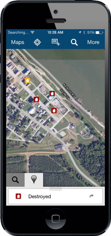
Esri introduced Collector for ArcGIS, which allows users to capture and report spatial and/or tabular information directly from their iPhone or Android smartphone in the field.
The Collector for ArcGIS application simplifies data collection in the field. Data can be recorded using GPS or by tapping on the map. The Collector app provides the ability to plan routes, generate directions, capture photos and video, and seamlessly integrate information back into an organization’s GIS. The app can also be configured for use with various tools to help tailor data collection workflows to users’ specific needs.
The Collector for ArcGIS is available for download from the Apple App Store and Google Play (formerly Android Market).
The Operations Dashboard and Collector applications are available to organizations that have either a 30-day trial or have purchased an ArcGIS Online subscription..


 Esri introduced Collector for ArcGIS, which allows users to capture and report spatial and/or tabular information directly from their iPhone or Android smartphone in the field.