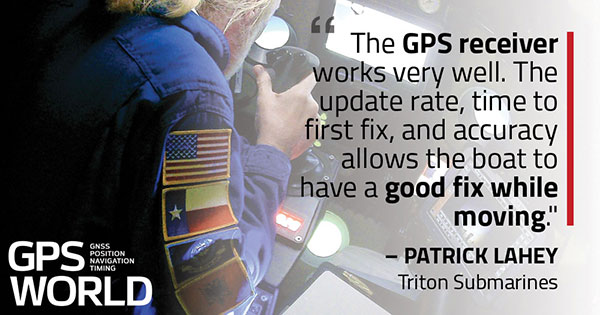
Triton Submarines — famous for underwater explorations including that of the Titanic — has replaced large, outdated computers onboard with rugged tablets. Each sub is equipped with two Panasonic Toughpad FZ-G1 tablets to monitor depth, light, voltage, gases and alarms, as well as input data and run analytic software. On the surface, a Toughbook 54 is used for tracking and communication.
Photo: Caladan Oceanic
Integrated GPS receivers simplify mapping, allowing teams to plot the location of a vessel in real time. “We use the GPS receiver inside the Toughbook 54 for positioning of the surface boat to aid in tracking of the sub,” said Patrick Lahey, president of Triton Submarines. “The GPS receiver works very well. The update rate, time to first fix, and accuracy allows the boat to have a good fix while moving, and for a quick restart during operations at sea.”
Photo: Caladan Oceanic
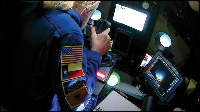
Once the sub is submerged, it loses all radio communications including GPS. An underwater positioning system based on acoustics is used instead, Lahey explained. The USBL system uses a surface base station mounted on a boat and GPS to determine its location. Then, using an array of acoustic transducers, it sends a ping to the sub and the sub pings back. The surface unit then measures the travel time to each transducer to find the sub’s position.
F. Michael Swiek, president, Mike International LLC
It is often said that “Behind every successful man there is a woman.” Likewise, if we look behind every significant event, policy statement, technological achievement and milestone in GPS history, there are people. They make the textbook chronologies of impressive progress both personal and human.
My own 30-year association with GPS has tracked closely with that of GPS World. Here are vignettes that sit most warmly in my “family snapshot album” of great moments in GPS.
In December 1994, the Civil GPS Service Interface Committee (CGSIC) held its first international meeting in Edinburgh, Scotland, hosted by the Northern Lighthouse Board (NLB). The small team of Americans attending the meeting were invited the following day to participate as the “International Team” in the annual NLB quiz competition held in a venerable pub. The competition is hotly contested each year among the NLB divisions, with the winning division commemorated with a brass medallion on a large wooden plaque kept for decades in NLB headquarters. To everyone’s chagrin, the Americans won. The good humor and boisterous camaraderie of that evening laid the foundation for close and candid dialogue between U.S. and European institutions on a wide variety of satellite navigation issues for years to come.
In 1996, Charlie Trimble was to introduce Vice President Al Gore in a ceremony at the White House to announce a Presidential Policy Statement on GPS. On the scheduled day, Charlie was unable to enter the White House, despite being vouched for by White House officials, because he was carrying no photo ID. White House security asked me if I had anything official with Charlie’s picture. They finally accepted a copy of the Trimble Navigation annual report, because in the words of one security officer, “I’ve heard of fake driver’s licenses, but not fake corporate annual reports.” Charlie was admitted.
On September 11, 2001, all of us attending CGSIC and ION in Salt Lake City sat stunned in our conference room watching the news reports from New York. Our meeting sessions were canceled, but we came from our hotel rooms because we needed to be together as friends in our shock and confusion, worrying about our families and friends and what the days ahead would be like. Anyone with a cell phone able to get a line out gladly shared it.
“I’ll only be a minute, just want to check with my family.”
“Talk as long as you want.”
In the mid-1990s in the ION exhibit hall, I was walking and talking with Charlie Trimble, Randy Hoffman (founder of Magellan Systems) and Gary Burrell (co-founder of Garmin), who were engaged in good-natured trash talking about each others’ companies, products and personalities. Glen Gibbons, founder of this esteemed publication, came across us, smiled, and said he was surprised to see such a congenial group of competitors. Charlie responded that in the marketplace they were competitors, but at ION they were all colleagues.
Glen added, “So, all friends!”
All three blurted, “Don’t go that far!” amid more laughs and grins.
The Japan GPS Council became one of the earliest and most influential industry groups in helping to guide the evolution and growth of GPS policy and industry, due to the personal passion of Hiroshi Nishiguchi. When meetings were held in Washington, Nishiguchi, other international representatives, industry and government officials would be guests in our home for convivial dinner chats. Nishiguchi became so comfortable, we considered him like family. He would leave a cardigan sweater in our coat closet between visits, and upon entering our house would remove his tie and suit jacket, go to the closet, and put on his sweater — like Mr. Rogers — before relaxing for the evening. He performed this ritual even when accompanying senior Japanese officials.
So, while technological milestones and policy commitments tell a great deal of the story of GPS, there are also the unique and cherished people, and the privilege it has been to know them as friends.
I spent much of the 1980s working for Magnavox Government & Industrial Electronics Company, which held a number of patents on the GPS system and also developed prototype GPS user sets for the military. I, and others at the company, often gave presentations to industry groups talking about the many commercial and consumer applications for which GPS would be used as the cost and size of GPS receivers declined. By the early 2000s, the applications we had envisioned had been far surpassed.
In the early 1990s, I spent several years at Teletrac, now Teletrac Navman, which was beginning to market a vehicle tracking solution based on its own proprietary time-difference-of-arrival (TDOA) technology, using in-vehicle devices and metro-area-based receiving/transmitting towers. One day, the co-founder and chairman of the company roamed into my office for an update on sales and marketing progress. I changed the subject and, at some risk to my job, said “Dennis, the future of location technology is GPS. It will not just be used to locate vehicles, but even cellular phones. With teams of talented engineers focused on reducing the size and cost of receivers and adapting them to specific applications, ‘the sky is the limit’.” He didn’t fire me, but spent the rest of our discussion telling me why I was wrong — that GPS receivers would always be too large, too expensive, too susceptible to signal blockage, and other limitations.
Thirty years later, the applications I had envisioned for GPS have been greatly surpassed and are constantly expanding. In recent years, my primary focus has been on researching the growth and trends of the commercial telematics market in the U.S. and abroad. Today, in the U.S. alone, some 16 million GPS devices are being used to monitor fleet vehicles and assets, such as trailers and heavy construction equipment. Even in the face of the COVID-19 pandemic, the market remains stable and is on track to grow for the year.
In the future, GPS will play an essential role in the deployment of autonomous vehicles, with help from other technologies needed to optimize location accuracy and reliability. My hat is off to the founding fathers of GPS who include some of the most brilliant technologists of this era.
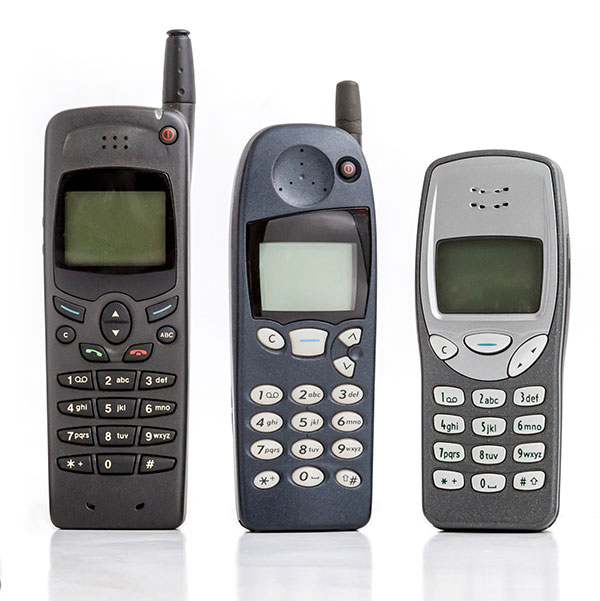
GNSS has had a major impact on many different industries and market segments, but I believe that the incorporation of GNSS into cell phones has impacted more people around the world than any other. It’s almost hard to remember back in the last millennium when the idea of putting a GPS receiver into a cell phone was first contemplated. Back then, we were just starting the transformation from 1G phones (analog) to 2G phones (digital), and the whole idea of 911 for mobile phones was a huge hurdle facing the entire industry. Three small startups (SiRF, SnapTrack and Global Locate) were all founded with the seemingly impossible dream of putting GPS into every cell phone to provide location information for E911 and other commercial applications. Back in those days, we were trying to convince operators and the FCC that GPS could provide location accuracy better than the 150-meters 67% of the time that the cellular industry was leaning toward with other technologies.
Can you hear me now? A sampling of early cell phones. (Photo: yktr/iStock/Getty Images Plus/Getty Images)
Fortunately for everyone, we were able to convince the industry that GNSS was an answer that should be considered. Today, we see billions of phones around the world with embedded GNSS. Those early phones from Motorola, Nokia, Ericsson and RIM (Blackberry) were truly marvels of engineering development to tightly couple GPS and cellular. Interestingly, none of those phone makers — nor any of those three pioneering companies — exist today, having been subsumed into larger entities due to their success in solving this incredibly complex problem. Those early GPS L1 C/A-only phones have added GLONASS, Galileo, QZSS and BDS, and we are now starting to see support for L5 showing up in smartphones. This has all led to improved availability and accuracy — now not only can we locate E911 calls to the correct civic address for emergency responders, but commercial applications rely on <10-meter accuracy for driving directions, ride sharing and social media applications. Every time I think there is nothing new to do, something always comes along. I’m excited to see what’s next.
Believe it or not, I remember clearly when one of my colleagues, at the beginning of 1990 in my office, made me aware of the upcoming GPS World journal. He went through the list of the already-appointed members of the editorial board and found some key names; Vidal Ashkenazi comes now to my mind. Later on, we received the first issue which, I am sure, must be carefully stored in the library of, at the time my employer, the Institute of Cartography of Catalonia (ICC).
I also remember the day we were processing GPS kinematic measurements of an aerial survey conducted with Sercel NR52 and TR5SB C/A-code L1 GPS receivers (one was 33 x 38 x 33 cm3 and 18 kg; the other was even bulkier, and both operated on valves). That was for the new GPS aerial triangulation method.
Shortly after, the application to airborne laser scanning came, and then INS/GPS integration for airborne remote sensing and mobile mapping. Then came the reinforcing high-speed loop of new applications, technology and challenges. The rest is history. An invariant of these 30 years has been that on our tables there were always one or more issues of GPS World. GPS World issues are always around us, part of our offices’ landscapes.
Last but not least, I cannot tell apart the early days of the journal from its founding editor, Glen Gibbons, who has to be credited for about half the life of the magazine. He brought me onboard GeoConvergencia and, later on, when GeoConvergencia was stopped, to GPS World. I used to share with him ideas and results, and he used to scold me about not publishing them in his journal.
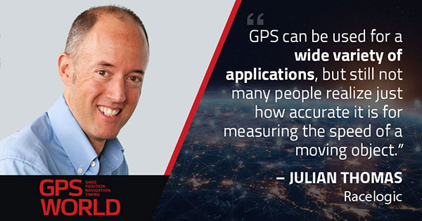
When I started Racelogic nearly 30 years ago, I could not have foreseen how intrinsically embedded GPS would become in my life. I started out with the goal of supplying electronic control systems to the motorsport world. From traction control systems to paddle shifters for automatic cars, our technology rapidly built a reputation for quality and accuracy. It was this pursuit of accuracy that led me to GPS.
GPS can be used for a wide variety of applications, but still not many people realize just how accurate it is for measuring the speed of a moving object. It was whilst looking for a solution to measure ground speed to use as a reference for a traction control system for a 4-wheel drive rally car that we came across an Ashtech 20-Hz GPS engine and were amazed to find out just how accurate the speed output was. This was a turning point in Racelogic’s history, which led to the development of one of our best-known products, the Velocity Box (VBOX), which is used to measure speed, distance and acceleration of vehicles for use in the test and development of new cars.
It is undoubtedly an exciting time for GNSS. New signals and constellations are delivering a huge improvement in performance, which has spurred the release of new, lower cost, game-changing products into the marketplace. With cm-level position now becoming affordable for almost any application, it will be fascinating to follow how this changes the face of the positioning market, and see what innovations and novel applications will appear.
Delivering solutions to these emerging applications will require agility and flexibility to integrate GPS with sector-specific technology. If this can be combined with solutions that overcome some of the limitations of GPS, then the opportunities are boundless. I for one am excited to see where the next 30 years takes us.
Miguel Amor, chief marketing officer, Hexagon’s Autonomy & Positioning Division
GPS World celebrates its 30th anniversary, and together we’ve seen huge leaps of innovation over the years. Reflecting on these developments, I wanted to share some of the contributions Hexagon | NovAtel made to support the evolution of the GNSS industry.
We began in 1978 in Alberta, Canada, in the telecommunications industry. In the 1990s, we shifted our focus to satellite receivers, choosing to forge ahead in GPS/GNSS technology. This decision would see NovAtel become one of the world’s leading manufacturers of high-precision GNSS components and systems developing multiple new patents and innovative solutions.
Our engineers have seen first-hand the growth of GPS and other satellite positioning systems worldwide, GNSS adoption across industries from aerospace to agriculture, and the present-day developments of precise positioning in autonomous applications. A rising tide raises all boats, and we helped foster the evolution of the industry through our goals of assured autonomy and positioning.
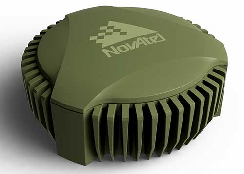
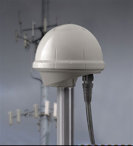
GAJT-710ML anti-jam antenna. (Photo: Hexagon)
Assured positioning means a reliable and robust solution you can trust. Technologies we’ve contributed to the broader industry include our GPS Anti-Jam Technology (GAJT) protecting users’ positioning, time and navigation, and SPAN technology, which expertly combines GNSS and inertial navigation systems (INS) measurements for seamless motion observations and a robust positioning solution. The capabilities of these technologies have been major contributors to the evolution of the GNSS industry.
Hexagon acquired NovAtel in 2007, and we’ve continued to grow and develop exciting new opportunities around the world where GNSS can grow, strengthen and improve applications in agriculture, automotive, defense, marine and many other industries. Our mission of assured autonomy and positioning encourages us to continue providing assured positioning in the most demanding environments and begin bringing autonomy to these markets.
GPS World has been a key player in covering these technological advancements for the past three decades. Together as an industry, we’ll continue innovating positioning and autonomy, and I’m excited to see how the industry will evolve over the next 30 years.
The document covers a number of details regarding the Ligado Networks and the advancement of 5G.
According to the document, former NASA Administrator Daniel Goldin claims that FCC’s approval of the proposal by Ligado Networks to repurpose satellite spectrum in the L-Band for high-power terrestrial use should be upheld because it will help advance American leadership in 5G technologies.
“Winning the race to 5G — against China and other countries — is important, but Ligado’s proposed network is largely irrelevant to 5G,” the GPS Innovation Alliance said in response. “The availability of Ligado’s spectrum for terrestrial use will not contribute to the advancement of 5G but will instead undermine U.S. Global Positioning System receivers and devices that are foundational to wireless technology in general, including 5G.”
In addition, the GPS Innovation Alliance’s stated in its ex party that the use of L-Band spectrum is not critical for 5G services.
Other points mentioned in the document include that Ligado’s spectrum is not internationally harmonized, significantly diminishing its effectiveness as a 5G band, and that Ligado’s proposed network simply will not offer a 5G service. According to the GPS Innovation Alliance, Ligado merely proposes to offer limited internet of things services, primarily delivered over custom private networks to specific geographic areas for limited vehicular and utility operations. Not only is this not a 5G service offering, but similar services are already being provided by wireless service providers, the alliance added.
Jules McNeff, vice president, strategy & programs, Overlook Systems Technologies
I welcome the opportunity to contribute and congratulate GPS World on your 30th anniversary. Over those 30 years, I have watched GPS influence how the world works. Early on, along with its vital contributions to U.S. and allied military operations, there was great optimism that sharing civil GPS technology openly would bring improved safety and efficiency to people around the world. However, that sense of optimism has dimmed as GPS, and the GNSS construct and PNT enterprise that it spawned, confront evolving real-world events.
Several years ago, I wrote a paper positing that in terms of dual-use utility and risks, GPS and related PNT capabilities are analogous to two other technology innovations that have occurred since the Second World War: atomic energy and the internet. The paper considered GPS/PNT in the context of each, reflecting our experiences with those two dual-use extremes.
The paper concluded that, unlike atomic energy, which has been fairly well controlled, GPS/PNT more closely resembles the internet, which has for better or worse been allowed to grow into a global capability virtually without constraint. For GPS/PNT, a fixation on civil, commercial and scientific uses enabled civil authorities uncomfortable with the military side of the dual-use equation to ignore that reality and focus only on “peaceful” civil and scientific endeavors. Unfortunately, the international comity that participants had hoped for, and that appeared for a time to be real, can no longer be assured.
Where the U.S. has been open and transparent regarding a dual-use GPS, others have not. Now, the open sharing of information that has been the hallmark of the civil GNSS community over the years must be viewed seriously and candidly through the clear lens afforded by the overt actions of GNSS providers.
Collective efforts to improve GNSS for peaceful uses ignore the reality that the information shared can equally and dangerously undermine international security. As with the internet, those who have become dependent on precise GPS/PNT services must now reactively create protections and remediations to deal with increasingly real threats from those we had considered colleagues.
So, naivete and optimism must finally yield in the face of hard reality.
Ellen Hall, president & CEO, Spirent Federal Systems
The history of GPS is fascinating. In 1957, a study by JHU’s Advanced Physics Laboratory (APL) utilized the Doppler effect to monitor the recently launched Sputnik, allowing researchers to pinpoint the satellite’s position. This endeavor led to the development of the Navy Transit program, the first satellite navigation system, which was successfully testing in 1960. The United States Global Positioning System (GPS) was officially launched in 1973 as a worldwide solution designed to overcome previous limitations. The U.S. Air Force developed the GPS, which designated 24 satellites for full operational capability (FOC) in 1995.
As a result of a horrific incident in 1983, in which Korean Air Lines Flight 007 wandered into Soviet airspace due to a navigation error and was subsequently shot down by the Soviets, the Reagan administration ordered worldwide access to GPS to ensure a tragedy like this could never happen again. The Clinton administration discontinued Selective Availability to make GPS more responsive and accurate to civil and commercial needs. This led to prolific global use and dependence on GPS for everything from providing data for precision farming applications to the critical timing of financial transactions. This increasing demand for and dependence on GPS has accentuated the importance of securing and safeguarding the system. Vulnerability testing, anti-jamming measures and alternative navigation solutions have become vital in both augmentation and backup for this critical utility.
As often happens with inventions created through government-sponsored studies, civilian uses become so ubiquitous that the original studies that led to GPS are long forgotten. It is as if GPS has simply always existed. Accordingly, the ground-breaking contributions of certain individuals should be remembered, such as Gladys West for her work in the development of computational techniques necessary for GPS precision. Pioneers such as Roger L. Easton of the Naval Research Lab, Ivan A. Getting of The Aerospace Corporation and Brad Parkinson of APL are credited with inventing GPS and changing, quite literally, how the world works.
I cannot imagine the world without GPS in some form. The content of what was once only in sci-fi movies is quickly becoming reality with driverless cars, pilotless aircraft and spacecraft. There are no limits on the possibilities in this field. The excitement about the future motivates brilliant minds from classified military installations to the latest civilian laboratories financed by the “Rocket Billionaires,” such as Elon Musk and Steve Bezos.
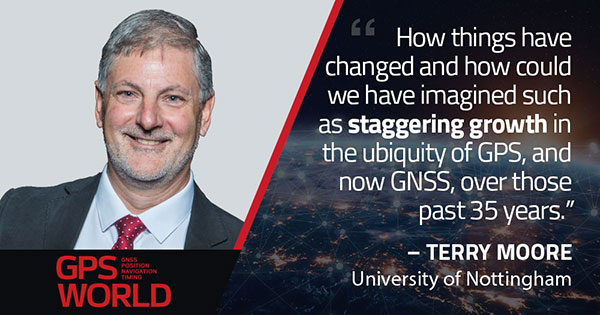
Terry Moore, professor emeritus, University of Nottingham
The end of July was quite a momentous occasion for me as I accepted the offer of voluntary redundancy from the University of Nottingham after almost 35 years of employment. If I then add the six years I spent at Nottingham as an undergraduate and then as a postgraduate student, that totals almost 41 years of my life spent at the university.
I guess it is not surprising that recently I have spent some time reflecting on those years and the changes that have occurred in positioning and navigation throughout that long period. My first degree was in civil engineering, although I did specialize in land surveying in the final year.
Professor Ashkenazi. My first contact with satellite navigation was early in 1981, when Professor Vidal Ashkenazi, later my mentor and good friend, brought a JMR-1 Transit Doppler NAVSAT receiver into our second-year surveying lectures. That gentle repetitive beep as the receiver tracked the Transit satellites had me hooked for life. I don’t think I realized then that navigation and positioning would be the focus of my working life, but I was fascinated by the technology and prospects, and it really was one of those life-changing moments.
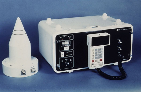
1984: Texas Instruments TI-4100. (Photo: NOAA National Geodetic Survey)
My Ph.D. continued in surveying and geodesy, and the focus was on the precise orbit determination of the LAGEOS geodetic satellite using Satellite Laser Ranging measurements. The goal was to investigate the determination of Earth Rotation Parameters (the Polar Motion and diurnal spin of the Earth) as part of an international collaboration known as Project MERIT.
Using Transit. I remember taking a Magnavox MX 1502 Transit receiver down to a conference at Herstmonceux Castle, and over the weekend I set up the instrument in my parent’s back garden in Sheffield, much to their amazement.
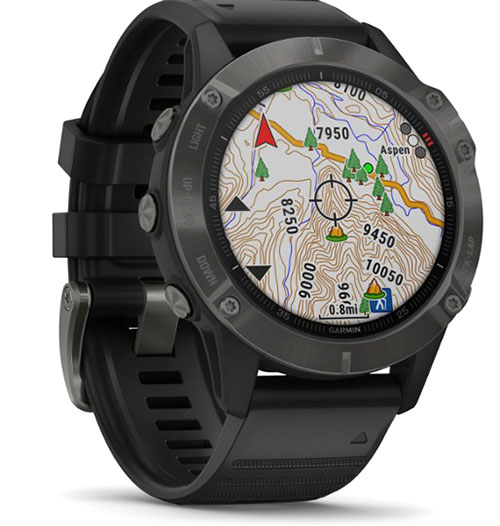
2020: Garmin Fenix6 smartwatch. (Photo: Garmin)
I did not start working on GPS until 1985, through my post-doc research position, sponsored by British Petroleum. This was investigating the first uses of GPS within the oil-and-gas sector for precise offshore positioning on platforms and survey vessels. The early GPS receivers we used were the Texas Instruments TI-4100 receivers, of which we borrowed five for the first long survey campaign to measure precise heights down the East Coast of England and Scotland. What a “pleasure” they were to use. I remember manually typing in the elements of the almanac for the receiver to acquire one satellite at a time.
Soon after we bought our first two Wild-Magnavox WM-101 receivers, which looked to be masquerading as Samsonite luggage. And now here I sit typing this article with GNSS receivers in the Garmin watch on my wrist and the Samsung phone beside me on the desk.
Last weekend, I was walking in the Lake District of England with my wife and daughter, and I did a quick count of our GNSS receivers. We had eight GNSS receivers (in watches, phones and handheld receivers) between the three of us, and of course there were others in our cars and the cycling GNSS receivers all nearby. How things have changed and how could we have imagined such as staggering growth in the ubiquity of GPS, and now GNSS, over those past 35 years.
John Fischer, vice president, advanced R&D, Orolia
In 1990, I had just left the military electronics industry (radars, electronic warfare) and entered the growing wireless telecom industry. Recall, this was at the end of the Cold War with shrinking U.S. defense budgets. Alas, after eagerly waiting for the full operational performance of GPS throughout the 1980s, I unfortunately missed its early successes.
I spent the 1990s in startups, working to provide wireless alternatives to dial-up and leased lines. We founded Clearwire, which eventually became WiMax — the broadband wireless on-ramp to this new “information superhighway” we now call the internet.
However, within a few years, we started to look for a way to synchronize our adjacent basestations to avoid interference at overlapping regions. Those of us who came from the military navigation sector turned to GPS. We began to use a GPS receiver to give us a 1PPS sync.
This worked well, although we had to train our installers not to put the GPS antenna high up on the tower with all the others, but low, away from the transmission beams. It was hard for them to believe we got better reception on the ground than up high!
The Trimble Accutime 2000. (Photo: Trimble)
By the late 1990s, Trimble had introduced its Accutime 2000, which made our lives easier. (Everything futurist in those days was called Something-2000 — the new millennium was approaching). Today, it is the standard for time sync, but back then, it was novel.
When I think of the progress in terms of Moore’s Law (semiconductor performance doubles every 18 months), we have been through 20 doublings since 1990. That is an improvement factor of a million!
However, technological advancement alone does not account for GPS’ huge success. The fact that the U.S. military opened its system for use by everyone in the world, and the continued cooperation of all nations in making all GNSS systems interoperable, is mind blowing.
We are living in the world that John Lennon only “Imagine(d)”: all the people sharing. In 2020, we are now focused on GNSS vulnerabilities and protecting the integrity of GNSS signals, which are such an integral part of our daily lives. GPS is truly a modern miracle.