Intellian Technologies Inc., a leading global provider of satellite communication antennas and ground gateway solutions, and Eutelsat, a GEO-LEO operator in satellite communications, have developed a portable, fully integrated military-grade Manpack for Eutelsat’s OneWeb low-Earth orbit (LEO) network.
With auto detected resilient GNSS (R-GNSS), the military-grade unit enables external support of an alternative positioning, navigation and timing (Alt-PNT) to ensure operation in GPS-denied environments.
Developed for defense and government, the unit provides the uninterrupted, dependable Eutelsat OneWeb LEO connectivity. It was created to address the urgent need for next-generation LEO capabilities within the broader military satellite communications domain.
Designed for rapid deployment, the Manpack is small and light to fit a standard military rucksack. It features one-touch network acquisition for immediate operation even in demanding and high-pressure conflict regions. It is optimized for low power consumption to maximize mission duration for up to five hours on external batteries depending on usage.
Built to battlefield-ready specifications, the Manpack is designed for Ingress Protection (IP67), as well as the U.S. Military Standards for Environmental Engineering (MIL-STD-810H) and Electromagnetic Compatibility (MIL-STD-461). This ensures exceptional durability for Communications-On-The-Pause (COTP) to personnel on front lines and mission-critical operations.
A joint report by Sweden and five neighboring countries warns that nearly 123,000 flights were disrupted between January and April by Russian jamming and spoofing of satellite navigation systems, according to EU Today. The countries submitted their report to the International Civil Aviation Organization (ICAO).
The disruptions were traced to Kaliningrad, St. Petersburg, Smolensk and Rostov. They affected flights operated by 365 airlines over Poland, the Baltics, Finland and Sweden. In April, more than 27% of flights in the region experienced interference, with some areas experiencing rates above 40%. Effects range from false position indications to cascading system faults that can persist for the remainder of a flight, even after leaving the most affected zones.
Authorities have issued warnings to airlines, while Sweden’s defence minister said the government is prepared for continued threats.
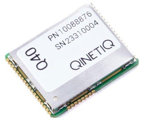
QinetiQ and Xona Space Systems have demonstrated how GPS navigation can be bolstered by using low Earth orbit (LEO) satellites, in the first UK tests of Xona’s new satellite navigation system, Pulsar.
This marks a major milestone in the development of next-generation positioning, navigation and timing (PNT) capabilities, increasing resilience against jamming and spoofing, as well as improving GPS availability in congested or challenged environments.
In the tests, QinetiQ’s Q40 multi-constellation GNSS receiver acquired and tracked signals from Xona’s first production-class satellite, Pulsar-0. The tests demonstrated that, by supplementing GNSS with LEO satellite signals like the Pulsar X1, enhanced resilience in contested or poor-signal environments can be achieved.
A recent software upgrade to QinetiQ’s Q40 was developed under the European Space Agencies’ Navigation Innovation and Support Program (NAVISP) in the GNSS Receiver with Advanced Pulsar Enhancement (GRAPE) project.
GRAPE is a collaboration between QinetiQ and Xona, supported by the UK Space Agency and European Space Agency. Its goal is to explore how new LEO-based signals can be integrated with existing GNSS, to enhance the accuracy and resilience of navigation services for defense, critical infrastructure and future autonomous applications.
“For the first time, we have demonstrated how signals from new LEO satellites can be used alongside existing GNSS to give users stronger, more resilient timing and position information,” said Chris Walker, Managing director, Mission Systems Division, QinetiQ. “This is a huge step in increasing the protection of our defence, critical infrastructure and future autonomous systems against interference.”
The GEO-3 satellite Eutelsat 5 West B (PRN 121) is now part of the European Geostationary Navigation Overlay Service (EGNOS) operational platform and broadcasts the Operational Signal-in-Space.
PRN 121 began broadcasting operational signals Aug. 25 as part of EGNOS System Release 2.4.3. The upgrade seeks to strengthen service continuity and prepare the system for future enhancements.
The transition involved swapping satellite roles within the EGNOS constellation. On Sept. 5, the GEO-2 satellite ASTRA 5-B shifted from operational to test status, creating a new configuration with GEO-1 and GEO-3 handling operational duties while GEO-2 serves as the test platform.
The changes will not disrupt service or affect coverage areas, officials said.
“Eutelsat is proud of its long-standing collaboration with EUSPA,” said Arlen Kassighian, chief engineering officer of Eutelsat. “We are delighted to host this payload, which will continue to significantly enhance the performance of global navigation satellite systems across Europe in the coming years.”
The system release represents preparation for EGNOS V3, the next-generation platform that will offer enhanced performance, improved robustness and dual-frequency multi-constellation capabilities for European satellite navigation services, according to Jean-Marc Pieplu, head of EGNOS Exploitation Department.
The European Union Agency for the Space Programme manages the EGNOS space segment, system upgrades and service provision. The agency’s integration of the GEO-3 satellite ensures EGNOS continues providing reliable augmentation services for safety-critical and professional applications throughout Europe.
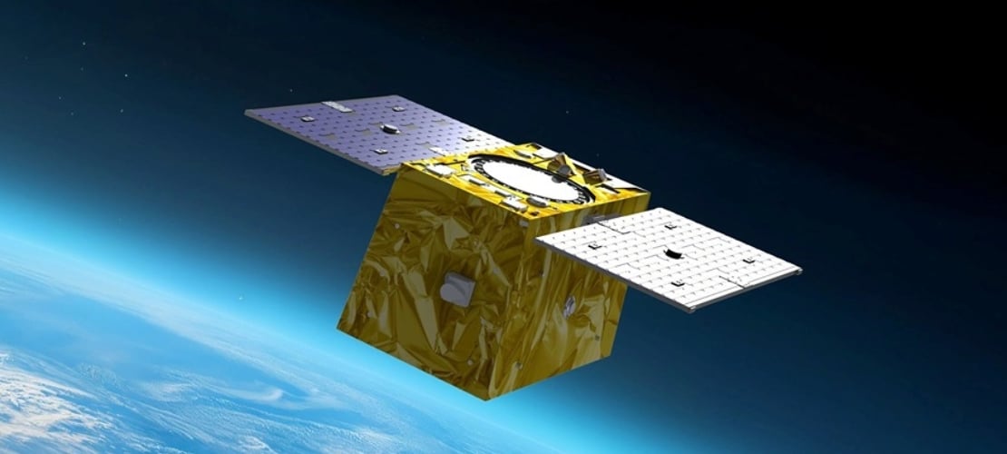
The European Space Agency (ESA) has confirmed plans to launch the first two satellites in its low-Earth orbit (LEO) positioning navigation and timing (PNT) constellation in the second half of December 2025. The launch will use a Rocket Lab Electron Vehicle, marking Europe’s first venture into LEO-based satellite navigation.
The LEO-PNT in-orbit demonstrator mission, called Celeste, aims to test satellite navigation capabilities in LEO and evaluate its integration with existing medium-Earth orbit (MEO) systems.
Celeste features a constellation of ten satellites that will fly close to Earth to test innovative signals across various frequency bands. The first two Celeste satellites, built in parallel by GMV and Thales Alenia Space, are set to launch in the coming months.
The dedicated Electron rocket launch will place both satellites in orbit at 510 km altitude. The launch window extends for three months beginning in mid-December 2025, with operations conducted from Rocket Lab’s New Zealand facility.
ESA Director of Navigation, Javier Benedicto, said, “We are thrilled to see the LEO-PNT demonstration advancing so quickly, with less than two years between mission kick-off and launch. This launch ensures the first European LEO-PNT satellites are in space before spring 2026, crucial for bringing the frequencies into use in compliance with the International Telecommunications Union.”
Galileo’s “Daughter Mission”
The name Celeste pays homage to Maria Celeste, Galileo Galilei’s daughter, as the two shared a strong emotional and intellectual bond, with the daughter honoring her father’s astronomical interest. This symbolic connection links the pioneering work of the father of modern astronomy to contemporary navigation systems, with Celeste serving as a bridge between Galileo’s groundbreaking discoveries and today’s satellite-based positioning technology.
The demonstrator satellites for Galileo, launched in 2005 and 2008, were called GIOVE, after the Italian word for Jupiter. This name also paid tribute to Galileo’s achievements in discovering the planet’s four largest Moons which were used to determine longitude from anywhere on Earth.
System Advantages
The initial Pathfinder A satellites are CubeSats measuring 12U and 16U formats, comparable to suitcase size and weighing approximately 20 kg to 30 kg. These satellites will broadcast in L-band and S-band frequencies and operate for at least six months following orbital commissioning.
The larger, more complex Pathfinder B satellites will follow, incorporating additional payloads to test innovative signals across multiple frequency bands and demonstrate expanded services.
LEO-PNT satellites will supplement existing GNSS constellations by providing enhanced coverage in challenging environments. The system aims to improve navigation services in deep urban areas, under heavy foliage, in polar regions and potentially indoor locations where current MEO satellites face limitations.
The complete demonstrator constellation, expected to be operational by 2027, will assess how LEO navigation systems can integrate with existing GNSS infrastructure. The mission will also test interoperability with 5G and 6G communication standards.
Preparing for Launch
Satellite integration and testing of Pathfinder A hardware and software continues ahead of the December launch. ESA and industrial teams plan to complete testing during summer 2025, with qualification and acceptance reviews scheduled for autumn.
“Pathfinder A satellites have already paid off, even before launch,” said Roberto Prieto-Cerdeira, ESA’S LEO-PNT project manager. “The experience gathered during their development is helping to identify critical technologies, system design trade-offs, design choices and optimised approaches and processes, paving the way for future phases of LEO-PNT. Having them in orbit and validating their signals and algorithms is a major additional achievement.”
Future Plans
Following the demonstrator mission, ESA plans to propose an in-orbit preparatory phase at the agency’s November Ministerial Council meeting. This phase would focus on technology development and industrialization, potentially leading to an operational system integrated with EU GNSS infrastructure.
The Celeste demonstrator is part of FutureNAV, an ESA Navigation program designed to maintain Europe’s position at the forefront of satellite navigation technology.
The mission receives backing from 15 ESA member states: Austria, Belgium, Finland, France, Germany, Hungary, Italy, Norway, Poland, Portugal, Romania, Spain, Sweden, Switzerland and the United Kingdom. More than 50 entities from 14 countries participate in the two development consortia awarded contracts in 2024.
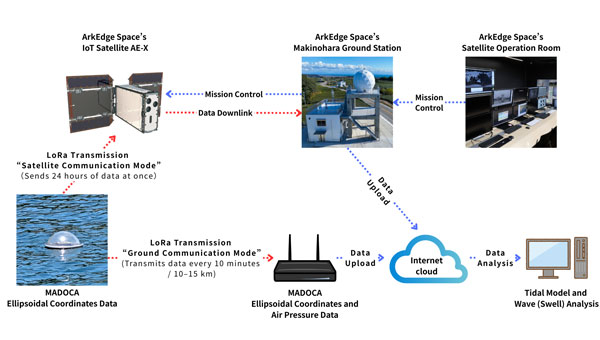
ArkEdge Space Inc. has been selected for Japan’s fiscal 2025 QZSS Utilization Demonstration Project. The initiative is jointly organized by Japan’s Cabinet Office and Quasi-Zenith Satellite System Service Inc.
The company will deploy next-generation tide monitoring buoys across island nations in the Asia-Pacific region. The buoys will use MADOCA-PPP, a high-precision GNSS augmentation service provided by Japan’s Quasi-Zenith Satellite System known as Michibiki. The devices will collect sea level data and transmit information through ArkEdge Space’s Internet of Things satellites.
ArkEdge Space specializes in designing, developing and operating micro-satellites while integrating communications technologies including IoT and VDES (VHF Data Exchange System) for observation and positioning applications. The company plans to use this demonstration project to address challenges in developing regions related to disaster preparedness, tsunami and storm surge monitoring, port infrastructure development and climate change adaptation.
Field operations are scheduled to begin in November 2025. The company plans to host a regional seminar at the Asia-Pacific Regional Space Agency Forum. Additional announcements regarding buoy deployment and project updates will be made separately.
The project aims to promote global adoption of Japan’s Michibiki satellite positioning technology and advance sustainable marine observation infrastructure using IoT-enabled satellite services.
The QZSS Utilization Demonstration Project is a public initiative conducted by Japan’s Cabinet Office and Quasi-Zenith Satellite System Service Inc. to promote early adoption of commercial services and products using Japan’s QZSS Michibiki system.
MADOCA-PPP is a real-time high-precision positioning augmentation service developed by Japan’s Cabinet Office and the Japan Aerospace Exploration Agency. The service delivers centimeter-level accuracy of 10 centimeters or less both horizontally and vertically via the L6 signal of the Michibiki constellation and is compatible with multi-GNSS receivers.
VDES is a next-generation maritime communication system that extends the functionality of the Automatic Identification System to enable high-speed, bidirectional data exchange. In Japan, ArkEdge Space is part of the Satellite VDES Consortium with IHI Corporation and Japan Radio Co. Ltd. In July 2025, the company launched a test satellite and began in-orbit demonstrations of VDES technology.
DARPA selects Q-CTRL to develop next-gen sensors for advanced defense platforms.
Quantum software company Q-CTRL has been awarded two contracts under DARPA’s Robust Quantum Sensors (RoQS) program. The Defense Advanced Research Projects Agency (DARPA) is an independent research and development agency within the U.S. Department of Defense.
The contracts, valued at $24.4 million, will augment Q-CTRL’s field-validated quantum sensing technologies for demanding real-world use cases in high-performance military vehicles.
Navigational technology that is resilient to denial, jamming, spoofing and other denials in the environment has become increasingly critical to defense applications, from battlefield operations to intelligence and surveillance. With conflict zones expanding, the risks to crewed and uncrewed defense missions are growing daily. Quantum sensing offers a complementary solution to GPS that is resilient against external interference while filling coverage gaps.
Quantum sensing offers a complementary solution to GPS that is resilient against external interference while filling coverage gaps.
Q-CTRL will develop next-generation quantum sensors for navigation based on their success in field trials of airborne, maritime, and ground-based quantum navigation augmented by their proprietary AI-powered software ruggedization. The technology enables sensors to operate reliably on moving defense platforms subject to challenging real-world conditions, without the need for traditional shielding or isolation.
Q-CTRL will be joined by Lockheed Martin as a subcontractor on one aspect of the RoQS program, leveraging its expertise in GPS and quantum technology.
DARPA established RoQS to accelerate the development, testing and validation of quantum sensors for real-world defense applications, which include maintaining stability against environmental interference, mechanical vibrations and heavy g-forces.
Some sectors and organizations are fast-maturing quantum navigation for use on land, sea, in space, and in the air. The aerospace industry is actively exploring the potential for magnetic navigation technologies, with companies like aircraft manufacturer Airbus pursuing their development.
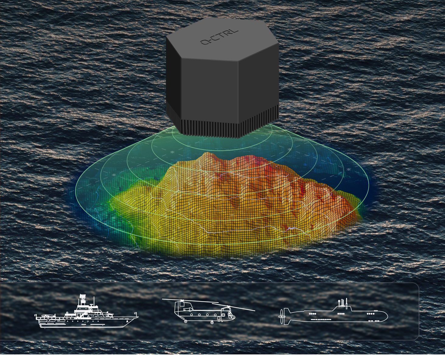
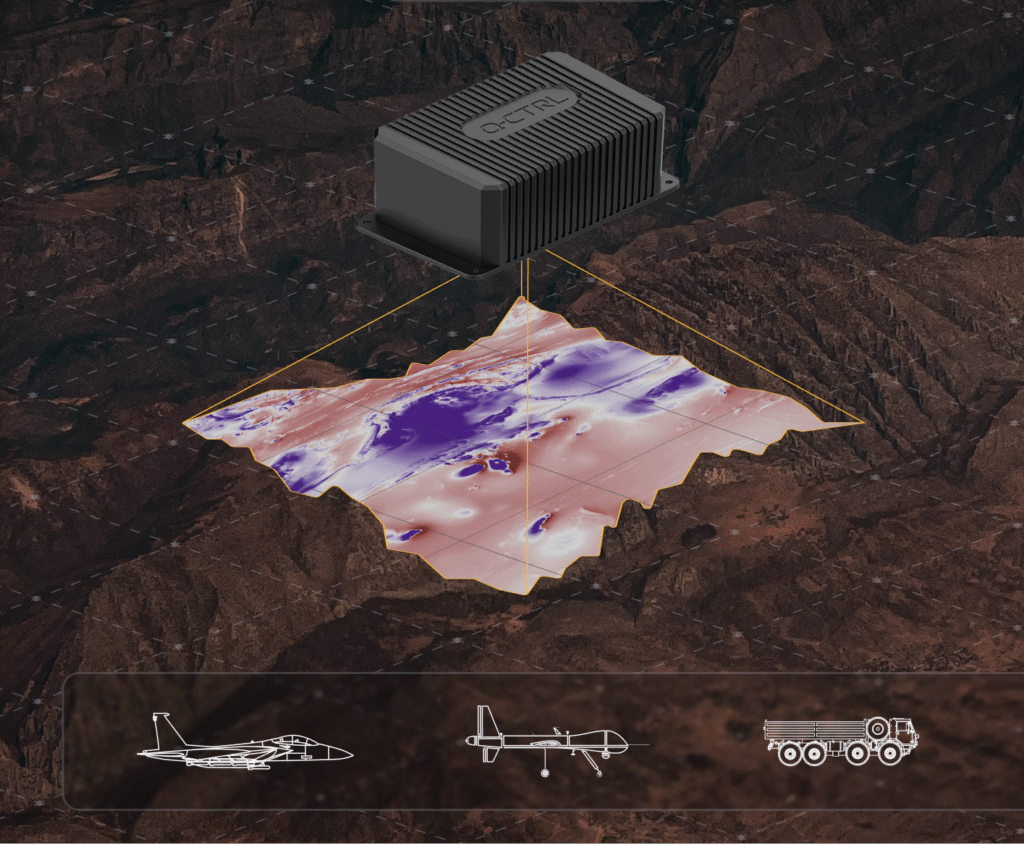
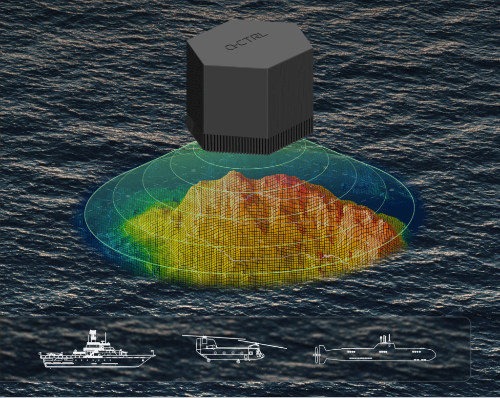
Additionally, Q-CTRL’s programs target the complementary missions of geophysical mapping of gravity and magnetic fields, as well as positioning based on matching detected signals to the pre-generated maps. This approach provides huge advantages in navigational missions and delivers new insights into minerals prospecting and underground target detection.
Ironstone Opal, the company’s quantum-assured navigation system, recently outperformed a high-end inertial navigation system (INS) in flight for the first time, achieving up to 111x greater positioning accuracy when GPS was unavailable – a significant step forward for real-world applications of quantum sensing to defense missions. In these tests, the company’s proprietary AI-driven, software-level innovation was the key to the removal of platform interference.
Ironstone Opal’s navigation system was also recently validated in maritime trials on board the Royal Australian Naval vessel, MV Sycamore.
In March, Lockheed Martin and Q-CTRL were awarded a contract by the U.S. Department of Defense’s Innovation Unit to prototype a quantum-enabled inertial navigation system.
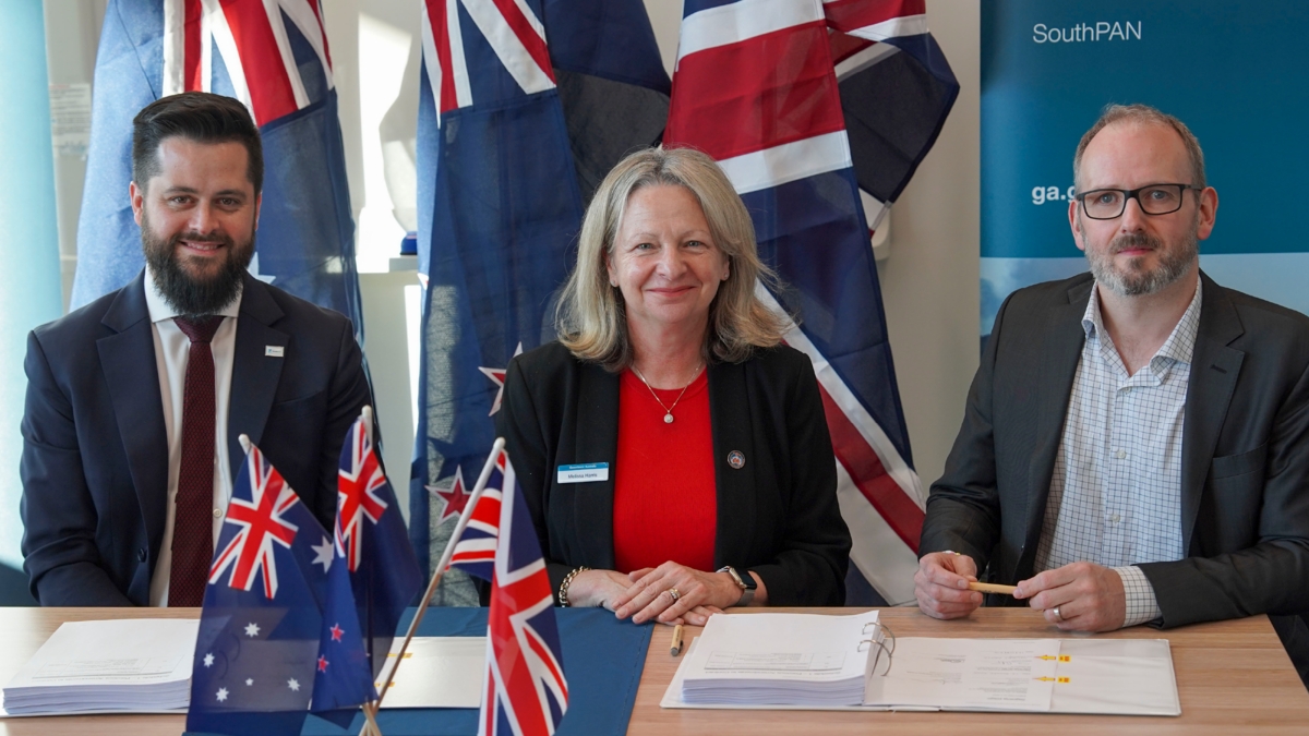
Viasat Inc. has received $252 million AUD from Geoscience Australia and Toitū Te Whenua Land Information New Zealand (LINZ) to deliver additional satellite services for the region’sSouthern Positioning Augmentation Network (SouthPAN).
SouthPAN is a collaborative satellite-based augmentation system developed jointly by Australia and New Zealand. It provides precise positioning and navigation services to support aviation, maritime, agriculture, surveying and emergency response.
This is the second contract award for Viasat, after Inmarsat — which has since combined with Viasat — was awarded a contract in May 2023 to deliver a satellite payload for SouthPAN. The new agreement, which amends the previous award and comes under Viasat’s Communication Services segment, covers the continuation of services from Viasat’s existing in-orbit satellites as well as a new payload, marking a significant extension of Viasat’s partnership with both governments.
The agreement secures satellite service and ground infrastructure to deliver precise positioning across Australia, New Zealand and the region’s maritime zones.
SouthPAN is delivered by Geoscience Australia in partnership with Toitū Te Whenua Land Information New Zealand, with early services available to both countries since 2022.
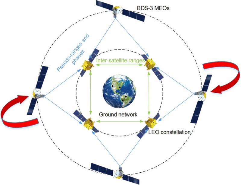
The rotation-corrected integrated POD method holds significant promise for global navigation augmentation, autonomous LEO-based navigation systems, and real-time positioning services.
Modern satellite constellations such as OneWeb, Starlink and CENTISPACE promise global communications and navigation capabilities using low-Earth orbit (LEO) constellations. However, their precise orbit determination (POD) requires dense ground station networks — costly and often limited by geopolitical or geographical constraints.
Inter-satellite links (ISLs) help reduce ground dependence but suffer from “rotational unobservability,” where the entire constellation drifts in orientation due to the lack of an absolute spatial reference. Existing fixes often require additional infrastructure or high-quality GNSS products, which increase latency and operational complexity.
Because of these challenges, a more autonomous, low-latency approach that leverages existing onboard capabilities is needed to ensure reliable, high-accuracy orbits for mega-constellations.
Wuhan University researchers have developed and validated a rotation-corrected integrated POD method that fuses ISL measurements with onboard BeiDou-3 (BDS-3) GNSS observations. Published (DOI: 10.1186/s43020-025-00175-8) in Satellite Navigationon Aug. 4, the study demonstrates how the technique simultaneously estimates the orbits of LEO and BDS-3 medium-Earth-orbit (MEO) satellites, corrects systematic rotation using BDS-3 broadcast ephemerides, and achieves centimeter-level precision.
The approach significantly reduces reliance on ground stations, making it well-suited for real-time applications in large-scale LEO constellations, the researchers said.
The team simulated a 66-satellite LEO constellation equipped with ISLs and onboard BDS-3 receivers, alongside 24 real BDS-3 MEO satellites. Two processing strategies were tested: using BDS-3 data from all LEOs, and from only a subset. In both cases, ISL and GNSS data were jointly processed to form a unified high–low constellation.
Due to internal-only measurements, the initial solutions exhibited significant systematic rotation — up to 40 cm cross-track error for LEOs and over 1 meter for MEOs.
This innovation could become a cornerstone technology for integrating LEO constellations with existing GNSS systems to enhance global navigation and timing performance.
The researchers derived rotation angles between the integrated POD coordinate frame and the BeiDou Coordinate System implied in broadcast ephemerides, then applied a Helmert transformation to correct the orbits. After correction, LEO along-track and cross-track errors dropped from 22.7 cm and 39.3 cm to 1.3 cm and 4.2 cm, respectively. MEO errors fell from over 1.2 m to about 13 cm.
Even when only 36 of 66 LEOs carried GNSS receivers, ISL connectivity propagated the correction across the constellation with minimal accuracy loss. Tests also examined the influence of predicted Earth rotation parameters and residual errors in broadcast ephemerides.
“This method tackles one of the most stubborn issues in autonomous constellation orbit determination — systematic rotation caused by the lack of absolute spatial reference,” said Kecai Jiang, corresponding author of the study. “By harnessing readily available BDS-3 broadcast ephemerides and inter-satellite measurements, we can deliver centimeter-level precision without waiting for post-processed GNSS products or building extensive ground networks. This approach is not only efficient but also scalable, paving the way for real-time, high-accuracy navigation services in future mega-constellations.”
The rotation-corrected integrated POD method holds significant promise for global navigation augmentation, autonomous LEO-based navigation systems, and real-time positioning services. By dramatically reducing reliance on ground infrastructure, it enables resilient operations in remote or geopolitically constrained regions. Its scalability makes it suitable for next-generation satellite constellations supporting broadband internet, disaster response, and precision agriculture, the researchers said.
Moreover, the ability to achieve near-uniform accuracy across all satellites — even when only part of the constellation carries GNSS receivers — lowers hardware requirements and operational costs. This innovation could become a cornerstone technology for integrating LEO constellations with existing GNSS systems to enhance global navigation and timing performance.
The Department of the Air Force (DAF) has successfully launched the Navigation Technology Satellite-3 (NTS-3) Vanguard aboard the United Launch Alliance (ULA) Vulcan rocket on the USSF-106 mission from Cape Canaveral Space Force Station, Florida, on August 12, 2025. This mission marks the first U.S. national security payload launched on the Vulcan Centaur rocket, which represents a new era of launch vehicle capability for national defense.
“We have a strategic imperative to deliver science and technology that enables and accelerates a resilient hybrid space architecture for the space capabilities that the joint force depends on,” said Air Force Research Laboratory (AFRL) Commander and DAF Technology Executive Officer (TEO), Brig. Gen. Jason E. Bartolomei.
NTS-3’s Advanced Architecture
NTS-3 is an experimental integrated navigation satellite designed by the AFRL to enhance the robustness, resilience and responsiveness of space-based positioning, navigation and timing (PNT) services, crucial to both military and civilian applications. The satellite aims to advance the capabilities of existing global navigation satellite systems, such as GPS, through innovative technology that includes an advanced atomic clock timekeeping system, a reprogrammable receiver compatible with both legacy and advanced signals (the Global Navigation Satellite System Test Architecture), and Chips Message Robust Authentication, which defends against GPS spoofing.
NTS-3 features a fully reprogrammable software architecture that spans the space-based satellite, ground-based control system, and agile user receivers. This enables rapid software updates either on orbit or in the field, a significant departure from previous GPS satellites that required hardware changes for upgrades. This approach delivers not only military advantages in contested environments but also substantial benefits for civilian users who rely heavily on GPS for banking, agriculture, telecommunications and air traffic control.
“We rely on GPS so much, in ways that we don’t always think about,” said Rachel Gleichmann, NTS-3 deputy program manager, AFRL Space Vehicles Directorate. So, to make sure that it is resilient and that it’s always available and always accurate — or, as the military likes to say, ‘assured’ is extremely important to your average American.”
Industry partner L3Harris Technologies serves as the prime contractor, working alongside AFRL on the design, development, integration, testing, launch vehicle interface, and on-orbit operations of the satellite. The collaboration embodies a comprehensive ecosystem approach that leverages resources from government, industry, academia, and venture capital to foster innovation in national security space.
Astroscale of the UK will provide Xona Space Systems with next-generation docking plates for integration into Xona’s growing constellation of low Earth orbit (LEO) satellites. The collaboration supports two critical goals: building a resilient positioning, navigation and timing (PNT) infrastructure and keeping Earth’s orbit safe and sustainable.
Xona is developing Pulsar, an advanced PNT satellite infrastructure based in LEO. Pulsar operates alongside legacy systems like GPS, delivering stronger signals, centimeter-level precision, and built-in protection against interference including jamming and spoofing. As threats to global navigation escalate, a more resilient and secure PNT architecture has become essential for national security, critical infrastructure and connected devices around the world.
“Resilient PNT is a national and economic priority,” said Giorgio Taylor, Director of Business Development, Xona UK & Europe. “Pulsar delivers stronger, faster, and more secure navigational intelligence designed for the threats we face today. Our work with Astroscale reinforces our belief that space infrastructure should evolve to continue meeting user needs, not remain frozen in time.”
Astroscale will provide docking plates for Xona’s future Pulsar satellites as the company scales to launch its full constellation, allowing for future in-orbit servicing, upgrades or safe deorbiting. This supports a more flexible and responsive satellite architecture and helps prevent space debris. These are both key parts of responsible space operations.
New collaboration to demonstrate how terrestrial 5G-based timing can provide scalable solutions to complement and backup GPS.
NextNav and Oscilloquartz, a division of Adtran, have partnered to demonstrate how 5G-powered terrestrial positioning, navigation, and timing (PNT) technology combined with Oscilloquartz’s established synchronization systems can serve as a scalable complement and backup to GPS. The initiative aims to maintain the operation of critical infrastructure, such as data centers, utilities, and emergency services, during GPS outages by distributing precise, coordinated universal time (UTC) over existing 5G networks for both indoor and outdoor environments.
The collaboration integrates Oscilloquartz’s synchronization technology with NextNav’s terrestrial 5G PNT platforms to introduce an additional timing source, thereby reducing end-user dependence on GPS alone. This effort addresses increasing demand for secure and redundant timing solutions in light of threats to GPS reliability. The companies are aligning their technologies with ongoing Federal Communications Commission initiatives to encourage complementary PNT solutions.
According to the companies, this approach responds to national security and public safety concerns by prioritizing the development of resilient infrastructure. The demonstration of these integrated terrestrial timing capabilities is intended to provide a practical example of how industry can build more robust timing networks and reduce the risks associated with relying solely on GPS.