Technology developed as part of Europe’s satellite navigation-augmenting EGNOS system has been sold to South Korea to serve its national equivalent system.
Thales Alenia Space has signed a contract with South Korea’s space agency, the Korea Aerospace Research Institute, to supply ground infrastructure for the Korea Augmentation Satellite System (KASS) on behalf of the South Korean Ministry of Land, Infrastructure and Transport.
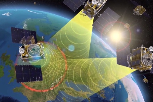
EGNOS is Europe’s first venture into satellite navigation. EGNOS broadcasts augmented information through a trio of geostationary satellites linked to a network of monitoring ground stations, to sharpen the accuracy and reliability of GPS signals across the continent.
The infrastructure is derived from that developed by Thales Alenia Space under contract to ESA and in its role as prime contractor for EGNOS, which has been operational since 2009 for general use and since 2011 for safety-of-life applications, including aviation.
Designed by ESA and being exploited by Europe’s Global Navigation Satellite System Agency, EGNOS improves the precision of GPS signals over most European territory, while also providing continuous and reliable updates on the integrity of the GPS signals.
A network of 40 ground monitoring stations throughout Europe performs an independent measurement of GPS signals, so that corrections can be calculated and then passed to users immediately via a number of geostationary satellites.
The result is that the EGNOS-augmented signals are guaranteed to meet the extremely high performance standards set out by the International Civil Aviation Organisation standard, adapted for Europe by Eurocontrol, the European Organisation for the Safety of Air Navigation.
Satellite Based Augmentation Systems (SBAS) such as EGNOS and the U.S. Satellite Wide Area Augmentation System (WAAS) operate by ensuring the integrity and positioning accuracy of GPS, as well as, in the decade to come, the European Galileo, Russian GLONASS and Chinese BeiDou systems.
KASS is projected to be the ninth regional SBAS in service when it becomes operational at the end of the decade. The various systems are designed to be fully interoperable, ensuring air traffic safety as aircraft move between different zones, and jointly providing an almost worldwide service.
“Now that we can rely on the powerful Ariane 5, we can anticipate the quicker completion of Galileo deployment, permitting the system to enter full operation,” said Paul Verhoef, ESA’s Director for the Galileo Programme and Navigation-related Activities, following the successful launch Nov. 17 of four satellites at once.
Verhoef made the following further remarks to GPS World regarding Galileo’s future. The full text of his article will appear in the December issue.
Paul Verhoef, ESA Director Satellite Navigation, at the Kourou launch site to witness Thursday’s liftoff.
“The European Union is set to declare Galileo operational for initial services at the end of this year, bringing the system to the point where it can start serving users.
“November’s launch has been years in the making, employing a specially customized variant of Europe’s heavy-lift workhorse rocket called the Ariane 5 ES (Evolution Storable) Galileo. It has more powerful lower stages and a reignitable upper stage, first used in 2008 to supply the low-Earth orbiting International Space Station.
“Two further Ariane 5 SE Galileo flights are planned to follow, one each for the remaining orbital planes.
Ariane 5 ES on liftoff from Kourou, French Guiana
“This new launcher design, adapted beginning in 2012 for Galileo, carried a lower mass payload — four fully-fuelled 738-kg Galileo satellites plus their supporting dispenser — but hauled it to the much higher altitude of medium-Earth orbit, 23,522 km. This precisely targeted orbit actually lies 300 km above the Galileo constellation’s final working altitude, leaving Ariane’s upper stage in a stable graveyard orbit, while the quartet of satellites maneuver themselves down to their final height.
“The four-satellite dispenser, the interface between the satellites and its launcher, is a wholly new design by Airbus Defence and Space. Its first role is to hold the satellites safely in position during their orbital flight and then to gently release them in separate directions. Its structure has been specially tuned to prevent harmful oscillations being triggered by the vibration and noise of launch. Its design was validated using complex finite -element-modeling software, followed by practical testing of the dispenser together with dummy satellites.
Launcher. “Ariane’s interstage Vehicle Equipment Bay, hosting the rocket’s avionic brain, underwent a redesign to reduce mass. Engineers also had to take into account this Ariane ES version’s flight time, much longer than any of its predecessors, more than four hours in all. This involved a reworking of the launcher’s electronics and thermal subsystems, to ensure it maintains an optimal operational environment throughout a ballistic coast phase of more than three hours, between two firings of its EPS storable propellant upper stage.
Ground Control. “This launch marked the first time that ESA carried out launch and early operations (LEOP) for four satellites simultaneously. Usually, simply shepherding a spacecraft through the first critical days in orbit is a demanding enough task. A combined team from ESA and France’s CNES space agency based in Toulouse will make contact, establish control, and then see the four satellites through their initial critical activities. Within the combined team, each position is paired with a counterpart from the other agency to provide three mixed shifts around the clock for these first crucial days. This same team has conducted all Galileo early operations to date alternately from Toulouse or ESA’s ESOC control center in Germany.
“The work starts with an initial check of on-board health and attitude, progressing to ensure each satellite’s pair of 1 x 5-meter solar wings are deployed and tracking the Sun, and then to point their antennas back towards Earth. Next comes a series of thruster firings to set the satellites onto a drift course into their final orbit, at which point they can be handed over to the Galileo Control Centre in Oberpfaffenhofen, Germany, for routine operations, and to ESA’s Redu Centre in Belgium to commence a few months of detailed payload testing.
Galileo at Your Service
“Around the same time as this key launch, GSAT-210 and GSAT-211, the two previous satellites launched in May of this year, will have completed their in-orbit testing, allowing them to be formally certified as operational members of the constellation. The four new satellites should follow them into operational status by mid-2017. However, the Galileo system will reach initial operational status without these latest six satellites. The European Commission on behalf of the European Union expects to declare the system operational and ready to offer initial services before the end of this year.
“This will mark a major milestone in the programme, awaited by many citizens in Europe and around the globe. Everyone with a Galileo-enabled receiver will be able to benefit from improved positioning, supplementing the already operational GPS constellation. ESA and the European GNSS Agency (GSA) have been working with European manufacturers of mass-market satnav chips and receivers to ensure that their products are Galileo-ready, offering detailed laboratory testing to close the loop between Galileo and industry.
Transition. “In parallel to the declaration of initial services, there will also be an institutional change, as the GSA takes up its role overseeing the exploitation of Galileo. At the start of 2017, the formal handover of Galileo infrastructure will be initiated, targeted to conclude by the middle of the year. This mission includes not only the Galileo satellites in space but also the far-flung ground stations located on every continent, essential to the continued high-performance operations of the Galileo system. It also includes the two European Galileo control centers, with the signals overseen from Fucino in Italy and the platforms monitored from Oberpfaffenhofen, plus the communication infrastructure connecting them all together.
Upgrade. “2017 will see the upgrade of various elements of the Galileo Ground Segment to reinforce its robustness, including updated releases to the Galileo Control Segment overseeing the satellites and the Galileo Mission Segment, overseeing the navigation signals. A new release of elements of the Galileo Security Facility, for security monitoring of the system, as well as the secure Public Regulated Service, will be deployed at the two Galileo Security Monitoring Centres. The Galileo Ground Segment will gain a sixth tracking telemetry and control facility, for monitoring the satellite platforms in Papeete, Tahiti, and additional processing chains for increased redundancy will be deployed across the Uplink Stations in Kourou, Reunion and Noumea used to update the navigation message information. Similar redundant chains will be finalized for all 15 current Galileo Sensor Stations, which perform continuous collection of Galileo signals to identify the tiniest clock error or satellite drift.”
GNSS-R Data collections. The measured reflection tracks are shown in yellow over the Globe. A sequence of Delay Doppler Maps from one track is shown below — the spread of each is related to the sea surface roughness and surface wind speed.
New weather datasets, which could prove highly valuable for weather forecasting and for longer term climate monitoring, have just been made available from the Space GNSS Receiver-Remote Sensing Instrument (SGR-ReSI) instrument on board TechDemoSat-1, a small technology demonstration satellite launched by Surrey Satellite Technology Ltd (SSTL) in 2014.
With support from the European Space Agency, SSTL and the National Oceanography Centre (NOC) are continuing to work on the data received from TechDemoSat-1 and have been steadily improving the calibration of the measurements and researching new techniques and applications.
New data, including delay Doppler maps and wind speed analysis over oceans, has been released on the MERRYBS website (Measurement of Earth Reflected Radio-navigation Signals By Satellite).
Looking to the future, the NASA CYGNSS mission due to launch later this year will fly eight satellites carrying SSTL’s SGR-ReSI instrument to measure the winds within cyclones, hurricanes and typhoons.
The SGR-ReSI instrument was developed by SSTL and is able to calculate TechDemoSat-1’s position and speed in much the same way as does a car-based SatNav, by measuring ranges and triangulating its position from high-altitude GNSS satellites orbiting 20,000 km above the satellite itself. The SGR-ReSI also carries a high-gain nadir (downward-pointing) antenna to utilize GNSS reflectometry, a technique where the GNSS signals scattered off the Earth’s surface are collected and measured.
A calm ocean will give a clean reflection, while a rough, wind-driven ocean will spread the signal out. SSTL’s partner, the National Oceanography Centre in Southampton, has developed an algorithm that calculates from the signals the ocean roughness and in turn estimates the wind speed at the surface of the ocean.
To validate the algorithm, NOC has compared the wind speed measurements from the SGR-ReSI against radar measurements from EUMETSAT’s MetOp satellite. These wind speed measurements are valuable for weather forecasting, and could also prove to be of significant benefit to the scientific community for climate monitoring.
The GNSS reflections off ice are much stronger than reflections off the ocean, and it has been possible to demonstrate from the results a new method for measuring the changing location of ice edges over time, and the potential for a new method of measuring ice height and thickness.
GPS reflections are not only collected by the SGR-ReSI over the ocean, but over land, where measurements to date show strong variations that could contain valuable geophysical information about the land surface. For instance, healthy vegetation will absorb more of the signal while damp soil can cause stronger reflections. Soil moisture is considered an essential parameter for climate monitoring, and is not currently measured with sufficient coverage over the globe.
TechDemoSat-1 was in part funded by Innovate UK and is jointly operated by SSTL in Guildford and by the Satellite Applications Catapult in Harwell.
SSTL received funding to support the development of the SGR-ReSI and ground processing from the UK CEOI, SEEDA, Innovate UK and the European Space Agency.
The below videos show processing and application of the SGR-ReSI data.
Video 1: This video shows in about 20 times real-time speed the motion of the TechDemoSat-1 satellite over an orbit, indicated by a white cross on the world map. The specular reflections targeted by the SGR-ReSI are shown by yellow spots, and the measurement tracks are shown in yellow.
The four Delay Doppler Map channels from measurement tracks are shown in yellow. The four Delay Doppler Map channels from the SGR-ReSI are shown at the top right.
The spreading horseshoe shape is caused by reflections being received away from the specular point, and a rougher ocean causes more spreading. When reflections are received from over land and over ice, there is much less spreading.
The red band on the map indicates the collection of “raw” unprocessed data, which takes a few minutes to transfer before the processed Delay Doppler Maps resume.
Video 2: This video shows reflections over the Northwest Passage, with and without ice.
GPS World Editor and Publisher Alan Cameron will deliver the keynote address at IGNSS 2016, which will be held Dec. 6-8 at the Colombo Theatres, UNSW Australia, Sydney. Cameron will speak on “The Future — Navigated Autonomously.”
The International GNSS Society (IGNSS) hosts the event, which is the Southeast Asian region’s premiere conference on GNSS and related position, navigation and timing (PNT) technologies.
The conference will bring together leaders in GNSS and PNT to examine the latest technology, present cutting-edge research and discuss in open forums the implications for policy, market development and positioning infrastructure deployment.
IGNSS 2016 will showcase a number of contemporary topics including, the role of PNT in automated land and aerial vehicles, the growing range of commercial precise positioning services, hard infrastructure issues such as space based augmentation systems, and soft infrastructure issues such as datum modernization and mitigation of system vulnerabilities. These hot topics will be discussed in the context of the latest system developments fueling the multi-GNSS era.
Topics will include the following:
Emerging Application Areas for GNSS
Key Industries and their Reliance on GNSS
Aviation and Avionics
Cooperative Intelligent Transport Systems
Maritime Applications
Unmanned Aerial Systems
Alternatives to GNSS
National Positioning Infrastructure
Policies and Standards
GNSS Augmentation including SBAS
Datums and Geodesy
National and International GNSS Developments
Embracing the Multi-GNSS Era
GNSS Receiver Development
GNSS Vulnerability
Machine Guidance in Agriculture, Construction and Mining
The Institute of Navigation is now seeking abstract submissions for its largest annual conference, ION GNSS+.
ION GNSS+ is the world’s largest technical meeting and showcase of GNSS technology, products and services. This year’s conference will bring together international leaders in GNSS and related positioning, navigation and timing fields to present new research, introduce new technologies, discuss current policy, demonstrate products and exchange ideas.
ION GNSS+ 2017 will take place Sept. 25-29, 2017, at the Oregon Convention Center in Portland, Oregon.
The abstract deadline is March 10, 2017
ION GNSS+ features two unique tracks, each with its own abstract and manuscript submission requirements: the Applications and Advances Track and the Research and Innovations Track. Visit the website for details.
By Rui Sun and Hongyang Bai, Nanjing University of Aeronautics and Astronautics, and Ke Han, Jun Hu and Washington Y. Ochieng, Imperial College London. Presented at ION GNSS+ 2016.
An Integrated Algorithm Based on BeiDou/GPS/IMU and its Application for Anomalous Driving Detection
This paper introduces an integrated algorithm for detecting lane-level anomalous driving. Lane-level high accuracy vehicle positioning is achieved by fusing GPS and Beidou feeds with Inertial Measurement Unit (IMU) using Unscented Particle Filter (UPF). Anomalous driving detection is achieved based on the application of a newly designed Fuzzy Inference System. Computer simulation and real-world field test demonstrate the advantage of the proposed approach over existing ones from previous studies.
Galileo satellites 15-18 being deployed from their dispenser, two at a time. (Artist’s rendering: ESA)
An Ariane 5 rocket has launched four additional Galileo satellites, accelerating deployment of the new satellite navigation system.
The Ariane 5, operated by Arianespace, lifted off from Europe’s Spaceport in Kourou, French Guiana, at 13:06 GMT (14:06 CET, 10:06 local time) carrying Galileo satellites 15-18. The first pair was released 3 hours, 25 minutes after liftoff, while the second separated 20 minutes later.
The Galileos are at their target altitude, after a flawless release from the new dispenser designed to handle four satellites.
Over the next few days, engineers will nudge the satellites into their final working orbits and begin tests to ensure they are ready to join the constellation. This is expected to take six months or so.
Europe’s next four Galileo satellites lifted off at 13:06 GMT on Nov. 17 from Europe’s Spaceport in French Guiana atop an Ariane 5 launcher. (Photo: ESA)
This mission brings the Galileo system to 18 satellites.
The satellites already in orbit will allow the European Commission to declare the start of initial services, expected towards year’s end.
The previous 14 satellites were launched two at a time using the Soyuz–Fregat rocket.
“Now that we can rely on the powerful Ariane 5, we can anticipate the quicker completion of Galileo deployment, permitting the system to enter full operation,” said Paul Verhoef, ESA’s director for the Galileo Programme and Navigation-related Activities.
Two additional Ariane 5 launches are scheduled in 2017 and 2018. The full system of 24 satellites plus spares is expected to be in place by 2020.
“With this 75th successful launch in a row, Ariane 5 sets a new record within European developed launchers and proves once more its reliability,” said Daniel Neuenschwander, ESA’s director for Launchers.
Watch a replay of the launch below.
Liftoff of Ariane flight VA233, carrying four Galileo satellites. (Photo: ESA)
By Carles Fernandez–Prades, Javier Arribas and Pau Closas, Centre Tecnologic de Telecomunicacions de Catalunya, Spain. Presented at ION GNSS+, September 2016.
This paper addresses both the efficiency and the portability of a computer program in charge of the baseband signal processing of a GNSS receiver. Efficiency, in this context, refers to optimizing the speed and memory requirements of the software receiver. Specifically, the interest is focused on how fast the software receiver can process the incoming stream of raw signal samples and, in particular, if signal processing up to the position fix can be executed in real-time (and how many channels the host computer executing the receiver application can sustain in parallel).
Diagram of Typical Code and carrier tracking loops in a GNSS receiver. Colored dotted-line boxes show functions implemented in SIMD technology. Lanes “16ic” are data streams whose items are complex numbers with real and imaginary components represented with 16-bit integers, whereas “32fc” indicates those with complex numbers with real and imaginary components in 32-bit floating point representation.
This is achieved by applying the concept of parallelization at different abstraction levels. The paper describes strategies based on task, data and instruction-level parallelism, as well as actual implementations released under an open source license and the results obtained with different commercially available computing platforms. At the same time, the proposed solution also addresses portability, understood as the usability of the same software in different computing environments.
This week’s Arianespace flight with four European Galileo navigation system spacecraft has been approved for a morning liftoff on Nov. 17 following the launch readiness review held Monday at the Spaceport in French Guiana.
Paul Verhoef, ESA Director Satellite Navigation, at the Kourou launch site to witness Thursday’s liftoff.
Designated Flight VA233 in Arianespace’s numbering system, the launch will deploy its quartet of Galileo spacecraft during a nearly four-hour flight, with liftoff set at exactly 10:06:48 a.m. local time in French Guiana on Thursday.
All four Galileo satellites are mated to the dispenser in readiness for the upcoming launch.
Monday’s launch readiness review validated the “go” status of the Ariane 5 ES launcher version, its Galileo passengers, as well as the Spaceport’s launch site infrastructure and the network of tracking stations.
As a follow-up to Arianespace’s previous missions that used the medium-lift Soyuz to orbit Galileo satellites in pairs, the heavy-lift Ariane 5 enables four of the global positioning spacecraft to be accommodated on a single launch vehicle.
The four satellites are numbered Galileo 15 through 18.
Arianespace previously deployed 14 Galileo in-orbit validation and full operational capability spacecraft from the Spaceport in French Guiana on seven Soyuz missions, along with performing two other Soyuz flights from the Baikonur Cosmodrome in Kazakhstan with the GIOVE-A and GIOVE-B experimental satellites for the Galileo system.
Galileo will offer a guaranteed, high-precision positioning service for Europe under civilian control. Its constellation will comprise 24 operational satellites, along with spares.
The European Commission funds — and has overall responsibility — for Galileo’s management and implementation, with the European Space Agency assigned design and development of the new generation of systems and infrastructure.
OHB System in Bremen, Germany built the satellites to be orbited by Arianespace’s Flight VA233, and their navigation payloads were supplied by UK-based Surrey Satellite Technology Limited (SSTL), which is 99 percent owned by Airbus Defence and Space.
Launch kit
The four spacecraft carried by Ariane 5 are called Antonianna, Lisa, Kimberley and Tijmen – with their naming for winners of a European children’s drawing contest.
A video of the launch will be streamed here. Streaming starts at 12:36 GMT (13:36 CET)
Arianespace has entered the final phase of preparations for its next Ariane 5 launch — the company’s first heavy-lift mission to orbit satellites for Europe’s Galileo navigation constellation.
During activity in the Spaceport’s Final Assembly Building, Arianespace “topped off” the Ariane 5 launcher with installation of the payload fairing over the four Galileo spacecraft and their payload dispenser.
With Ariane 5 complete, it is being readied for rollout to the Spaceport’s ELA-3 launch complex in advance of its Nov. 17 flight, set for liftoff at 10:06:48 a.m. local time in French Guiana.
This mission — designated Flight VA233 in Arianespace’s numbering system — will deploy the quartet of Galileo spacecraft over the course of a nearly four-hour flight.
For the Galileo program, Arianespace is using the Ariane 5 ES version with an enhanced storable propellant upper stage that allows for reignition and long coast phases during the mission.
The protective fairing is lowered onto the four Galileo satellites and their dispenser resting atop an Ariane 5 launcher. The fairing was placed on Nov. 3. (Photo: ESA)
These upgrades maximize the launcher’s performance for deploying the Galileo spacecraft — which will have a combined mass of 2,865 kg at liftoff — two at a time into a circular medium-Earth orbit.
As a European initiative to develop a new global satellite navigation system under civilian control, Galileo will offer a guaranteed, high-precision positioning service that will end Europe’s dependence on the American GPS system.
The Galileo constellation will comprise 24 operational satellites, along with spares. Arianespace already has deployed 14 Galileo in-orbit validation and full operational capability spacecraft from French Guiana on seven medium-lift Soyuz missions, along with performing two other Soyuz flights from the Baikonur Cosmodrome in Russia with the GIOVE-A and GIOVE-B experimental satellites.
Galileo is funded by the European Union. It features innovative technologies developed in Europe for the benefit of all citizens. The European Commission holds overall responsibility for Galileo’s management and implementation, with the European Space Agency assigned design and development of the new generation of systems and infrastructure.
The Galileo satellites on Arianespace’s Flight VA233 are sized at 2.7 x 1.2 x 1.1 meters and were built by OHB System in Bremen, Germany, while their navigation payloads were supplied by UK-based Surrey Satellite Technology Limited (SSTL), which is 99 percent owned by Airbus Defence and Space.
The Russian Defense Ministry successfully launched GLONASS-M 51 (known as 751 in orbit) aboard a Soyuz-2.1b rocket with a Fregat upper stage on Feb. 7, 2016.
Russia’s Roscosmos space agency could launch up to four GLONASS navigation satellites in 2017, reports sputniknews.com. The satellites will be launched only to replace malfunctioning satellites if necessary, according to Deputy Director General for Automatic Space Complexes Mikhail Khailov.
“It is planned to carry out up to four launches [of GLONASS satellites] in 2017 … We will carry them out only when necessary, including the use of the Proton rocket,” Khailov said at the meeting of the International Committee on Global Navigation Satellite Systems (ICG). The ICG meeting, organized by Roscosmos, took place on Nov. 6-11 in Russia’s southern city of Sochi.
China has successfully launched a navigation satellite that will conduct in-orbit experiments using pulsar detectors to demonstrate new technologies, reports The Indian Express.
The X-ray pulsar navigation satellite XPNAV-1 was launched Nov. 10 atop a Long March 11 solid-fueled rocket from the Jiuquan Satellite Launch Center in China’s northwest.
The experimental pulsar navigation mission carries two sensors to pick up incoming X-rays from objects scattered across the galaxy, and use the detections to plot the craft’s position without relying on GPS satellites or pre-loaded navigation fixes.
Physics Worldpublished an article that describes pulsar navigation in June 2013.
Chinese officials said the XPNAV-1 satellite weighed more than 440 pounds (200 kilograms) at launch, and was developed by the China Aerospace Science and Technology Corp., a contractor in the country’s state-run space industry.