Category: GNSS

  • Expert Advice: A Leap Second — One More Time!

    Expert Advice: A Leap Second — One More Time!

    From left: Dennis McCarthy, Wayne Hanson, Ronald Beard and William Klepczynski
    From left: Dennis McCarthy, Wayne Hanson, Ronald Beard and William Klepczynski

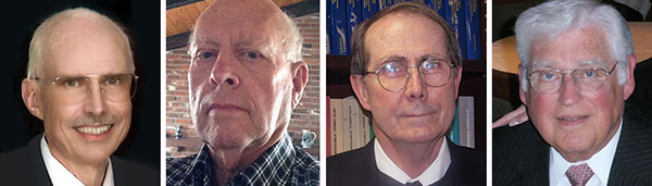
    By Dennis McCarthy, Wayne Hanson, Ronald Beard and William Klepczynski

    Once again we are going to adjust the world’s clocks by one second. This time it will happen on June 30, when we insert another leap second in Coordinated Universal Time (UTC), the standard international time scale. In theory, all UTC clocks should insert a second labeled 23h 59m 60s (the leap second) following one labeled 23h 59m 59s UTC. This is equivalent to having all of the clocks in the world stop for one second at that time.

    Are you ready for it?

    The last leap second occurred two years ago on June 30, 2012, and the continuation of the process of making these one-second adjustments has stirred a growing controversy over the last few years.

    How did the leap second come about — and why do we continue making these sporadic adjustments?

    From Sun to Caesium

    Historically, it has been easy to make use of the apparently uniform repetition of various astronomical phenomena to measure the passage of time. We’re familiar with the Sun rising and setting, and this regularity provides us a convenient measure of time: the solar day. In recent times until 1960, the average solar day was used as the basis for timekeeping, and if we divide the day into 24 hours, each containing 60 minutes made up of 60 seconds, we can define the second as 1/86,400 of the mean solar day. This meant that the length of the second depended on the Earth’s rate of rotation because it is the rotating Earth that causes the Sun to appear to move across the sky.

    In the mid-1930s, astronomers concluded that the Earth did not rotate uniformly as measured by the most precise clocks then available. This causes the duration of a second to vary as the Earth’s rotation rate varies. We now know that a variety of physical phenomena affect the Earth’s rotational speed, and consequently this definition of a second became impractical for applications that require a truly uniform time scale. So, in 1960, the second was redefined in terms of the Earth’s yearly orbital motion around the Sun. The time scale provided by this astronomical phenomenon was called Ephemeris Time (ET), to call attention to the fact that its realization depended on the conventionally adopted positions and motions (that is, the ephemeris) of the Sun (or Moon) that was used in the analyses of the required astronomical observations. The second defined in this manner was called the Ephemeris second.

    Although Ephemeris Time does provide a more uniform measure of the duration of a second, it is inconvenient to make the necessary astronomical observations that would be required to maintain a practical time scale for applications that demand high precision. So, in 1967, the second was redefined again, this time in terms of the frequency of an energy level transition in the Caesium atom, which had already been calibrated with respect to Ephemeris Time by using astronomical observations of the Moon’s motion. Caesium frequency standards, by the early ’60s, had become known as reliable, uniform, accurate and precise clocks. The second defined in this way provided, and continues to provide, a uniform standard of time that can easily be measured in a laboratory with greater precision and accuracy than any astronomical phenomena.

    Lab Clocks Rule

    Although the second defined using the frequency of an atomic energy level transition does provide a unit of time duration that is precise and uniform, it does mean that the passage of time measured in this way is no longer connected to astronomical phenomena. Indeed, with the advent of more accurate observational techniques, astronomers could measure variations in the Earth’s rotation rate by measuring its changing orientation in space and comparing the rate of change with laboratory clocks. They established that among the various variations in the Earth’s rotation rate is the gradual slowing down with respect to a uniform atomic time scale. This deceleration is consistent with theoretical tidal effects and observed terrestrial deglaciation.It is also apparently consistent with ancient observations of solar eclipses, indicating that that this slowing has been going on for thousands of years

    As a result, if we were to observe a recurring astronomical event, we would see it happening earlier from day to day. To bring our clock back into agreement with the astronomical event, we would have to add some time to the face of our atomic clock. While astronomers can cope with this situation by applying the appropriate corrections derived from astronomical observations that measure the Earth’s rotation rate, navigators that relied on astronomical observations to determine their positions considered this situation problematic.

    When the definition of the second based on the Caesium atom was introduced, it was known that there would be a time varying discrepancy between a clock running at a uniform rate and a theoretical one using a second defined by the Earth’s rotation rate. Starting from 1961, the observed discrepancy was modeled by making small adjustments on the order of a few milliseconds (thousandths of a second) to our clocks at first, and later by making small adjustments to the frequency of the atomic clocks from time to time, usually on an annual basis. This meant that the duration of a second could vary depending on when it was measured.

    No More Changes

    In 1970 the International Radio Consultative Committee (CCIR and now known as the International Telecommunications Union Radiocommunications Sector, or ITU-R) in collaboration with other international agencies adopted a definition of UTC that did away with any periodic changes to the duration of the second. Instead it was decided that the discrepancy between UTC and the observed rotation angle of the Earth would be accounted for by making one-second adjustments when needed, so that the absolute difference between UTC and the Earth’s rotation angle measured in time units would always be less than 0.9 seconds. A finer correction would also be provided frequently so that the Earth’s rotation angle in time units designed as Universal Time 1 (UT1) could be derived to 0.1 second precision.

    It was specified that the one-second adjustments, either positive or negative, were to be made preferably at 23h 59m 59s on the last day of the months of December or June, but could also be made, if necessary, at 23h 59m 59s on the last day of the months of March and September, and further if required at 23h 59m 59s on the last day of any month. The implementation of this definition actually began in 1972, a year in which two leap seconds were introduced.

    These one-second adjustments came to be known as “leap” seconds by analogy with the “leap” day inserted in calendars. This definition then fixed the second in UTC to be uniformly established as the international standard atomic second defined by the resonance frequency of Caesium and known as the SI (Système International) second.

    Compromise Overcome by GNSS

    The introduction of the concept of the leap second was historically a compromise with practitioners of celestial navigation who needed to base their observations on astronomical time to determine their longitude. If UTC doesn’t differ from the observed rotation angle of the Earth by more than a second, navigators could use UTC directly as a substitute without introducing a systematic error greater than a quarter of a mile. However, the routine practice of using celestial navigation has been overcome by the success of Global Navigation Satellite Systems (GNSS), inertial navigation systems, and radar navigation.

    In fact, the U.S. Naval Academy stopped including celestial navigation in its curriculum in 1998. In the time span since the introduction of the idea of a leap second, computer networks, wireless telecommunication systems, satellite communications, telephone networks, air traffic control systems and even industrial processes have developed to the point where precise time is an essential component of their successful operation. Users and suppliers of these systems are concerned with the impact of sporadic, essentially unpredictable, one-second adjustments.

    Most of these modern systems derive their time using GPS timing receivers. Although the navigational solutions make use of GPS System Time, these receivers provide UTC by means of a broadcast correction that provides the time-varying difference between GPS System Time and UTC. This correction normally provides the varying difference between the two times to less than a microsecond but must also keep track of when a leap second is introduced. As the leap second changes occur sporadically, there may be worries that problems could arise because hardware or software may never have been tested thoroughly for a leap second occurrence. As a result of these concerns, as well as the cost of stopping all of the clocks in the world for one second, the ITU-R has been discussing a possible revision of the definition of UTC by dropping the future use of leap seconds.

    Leap or Not Leap?

    The question of the future of UTC was raised in 2000 with the suggestion of modifying it to be a continuous timescale without leap seconds. Consideration of this question is still ongoing. The 2012 World Radiocommunication Conference (WRC-12) identified this issue as urgent, requiring further examination by the 2015 World Radiocommunication Conference (WRC-15) “to consider the feasibility of achieving a continuous reference time-scale, whether by the modification of Coordinated Universal Time (UTC) or some other method, and take appropriate action…”.

    With the aim of providing adequate technical background for WRC-15 to make an informed decision on this issue, the International Bureau of Weights and Measures (BIPM) and the ITU agreed to organize jointly a workshop on the future of the international time scale. This workshop was held in Geneva, Switzerland, in September 2013. It provided a unique opportunity to present available information on current and possible future precise frequency and time standards, sources and their characteristics, time scales and dissemination systems and different views on the future of UTC.

    Contributions to the workshop were specifically invited to ensure that the breadth of the issue would be covered. Included were the relevant international organizations (the International Astronomical Union, the International Earth Rotation and Reference Systems Service, the International Union of Geodesy and Geophysics, the International Organization for Standardization, the International Maritime Organization, the International Civil Aviation Organization, the Union Radio-scientifique Internationale), the providers of GNSS services (GPS, GLONASS, Galileo and BeiDou), the national metrology institutes that realize and maintain local representations of UTC, the ITU member administrations, and the ITU-T and authorities responsible for electronic time services. Information on the workshop, agenda and presentations is available.

    Final Decision in November

    A special issue of ITU News magazine dedicated to the workshop has also been published; an online version is available. It did not provide a decision on the issues, but rather a forum for issues to be discussed, since there is some controversy over modifying the global reference time scale. The final decision is to be made at the WRC-15 in November when the method for satisfying the feasibility of achieving a continuous time scale will be determined as well as how it would be implemented.

    As preparations begin for the June leap second, hardware and software will undergo testing. This process is likely to be repeated for some time to come, even if the decision to eliminate the use of leap seconds in UTC is made. Legacy systems reliant on the use of leap seconds will require an adequate period of time to adapt to any change in the definition of UTC. If the suppression of leap seconds would be decided, it is recommended that a period of time no less than five years be allowed  before the Final Acts of the WRC-15 go into effect. So, leap seconds could be with us for some time yet.


    Editor’s Note: For an earlier discussion on the leap second by McCarthy and Klepczynski, download the Innovation article “GPS and Leap Seconds: Time to Change?” from the November 1999 issue of GPS World.


    Dennis McCarthy is retired, and serves as a contractor with the U. S. Naval Observatory, where he was science advisor, director of the Directorate of Time, and head of the Earth Orientation Department. Internationally, he has served as president of the Commissions on Time, Commission on Earth Orientation, and Division 1  (Fundamental Astronomy) of the International Astronomical Union (IAU). He was also secretary of Commission 5 of the International Association of Geodesy.

    Wayne Hanson has been a consultant and president of Time Signal Engineering since his retirement in 2001 as chief of the Time and Frequency Services Group in the Time and Frequency Division of the National Institute of Standards and Technology. He is the U.S. chairman of the International Telecommunication Union – Radiocommunication Sector, Working Party 7A concerned with Time Signal and Frequency Standard Emissions.

    Ron Beard is the head of the Advanced Space PNT Branch at the Naval Research Laboratory and International Chairman of ITU-R Working Party 7A, Precise Time and Frequency Broadcast Services. During the early development of GPS in the 1970s, he was the project scientist in the NRL GPS Program Office that developed Navigation Technology Satellites One and Two that operated the first atomic clocks in space.

    William Klepczynski is now retired. During his career, he was a consultant to the Institute for Defense Analyses and the head of the Time Service Department of the U.S. Naval Observatory, where he managed the USNO Master Clock, timing operations for GPS and time distribution systems that utilize communications and navigation systems.

  • CHC Offers LT500 Series Handheld for GIS

    The CHC LT500.
    The CHC LT500.

    CHC has launched the LT500 series of handheld GPS receivers. The LT500 series LT500N /LT500T/LT500H covers three accuracy ranges from sub-meter to centimeter accuracy and is a cost-effective full GNSS positioning solution for survey, construction and GIS professionals.

    Powered by the Windows Embedded Handheld 6.5 operating system, the LT500 is accurate, rugged and versatile, CHC said. User productivity is enhanced with the built-in gyroscope, an innovative laser plummet for positioning the accurate handheld receiver over a point, an E-compass for showing the direction and G-sensors for leveling.

    The LT500 series is competitively priced and comes with several bundled software programs, including SurvCE, DigiTerra, MapCloud and other third-party software.

    “CHC’s LT500 series is our brand-new GNSS handheld, which has amazing features and specifications. It meets more customers’ needs with more options and affordable prices,” said George Zhao, CEO of CHC. “The introduction of the LT500 demonstrates CHC’s commitment to provide the GIS community with a full spectrum of rugged, cost-effective professional GPS handhelds.”

    The LT500 series features these specifications:

    • 1-GHz high-speed CPU with 512-MB RAM and 16-GB flash memory built-in
    • Three tracking options:
      • LT500H 120 channel GPS L1/L2/L2C,GLONASS G1,G2,BeiDou B1, Galileo E1 Tracking
      • LT500T 220 channel L1,G1,B1
      • LT500N 12 channel L1
    • 13-hour battery: 11.1V, 2600mAh
    • Gyro, laser-plummet, E-compass, G-sensor

    The LT500 series is available immediately through CHC’s worldwide distribution channel.

  • GNSS Students Sought for ESA Summer School

    Students still have time to join the ESA International Summer School on Global Navigation Satellite Systems, which will take place in Barcelona, Spain, at the end of August.

    The 10-day course — lasting from the afternoon of Aug. 31 to the morning of Sept. 10 — will cover all aspects of satellite navigation, up to and including the creation of a satnav-based business.

    Hosted by the University of Barcelona at the four-star Hotel Alimara, the Summer School is open to graduate students, PhDs and postdoctoral researchers, as well as young engineers and academics working within industry or agencies, aged 35 or younger.

    Internationally renowned scientists and specialists will be giving lectures as well as overseeing practical exercises and lab work. Participants will receive a full-spectrum overview of satellite navigation, starting from the theoretical basis of the Global Navigation Satellite System (GNSS), its signals, the processing performed by signal receivers and how the position-navigation-time solution is worked out.

    Discussion will also be made of threats to satnav systems, such as spoofing or jamming, and the countermeasures available against them, along with back-up navigation solutions for a GNSS-denied environment.

    Practical exercises will include receiving the various satnav constellations now in orbit — including Europe’s eight-satellite Galileo, the foundation of the full system soon to come — to give course members direct, hands-on experience.

    In addition, lectures will cover business aspects, including patents and intellectual property rights.

    The main emphasis of the course will be the development of a group business project, building on an innovative idea to take in the planning of the product or service, its technical realization and finally its marketing to customers.

    Register before the end of May to benefit from an early registration discount. The number of participants is limited to 50, on a first-come, first-served basis.

    The ESA International Summer School is taking place in conjunction with the GNSS Summer School of the Joint Research Centre of the European Commission, and is organized by Universitat Politecnica de Catalunya (UPC) in cooperation with Stanford University in the US, the Institut Supérieur de l’Aeronautique et de l’Espace in France, Graz University of Technology in Austria and University FAF Munich in Germany.


  • Happy 20th Anniversary, GPS!

    The Global Positioning System marks its 20th year of operation on Monday, April 27. Below is a timeline showing important milestones in the 20 years since the constellation reached full operational capability (FOC) on April 27, 1995.

    FOC was formally announced on July 17, 1995.


    GPS Operational History Timeline


    Featured image: U.S. Air Force

  • Trimble Expands Geospatial Portfolio to Increase Productivity


    Trimble-S9-Total-Station-Application-W

    Trimble has expanded its portfolio of geospatial solutions for surveyors, engineers and mapping professionals. Highlights include new total stations, a new GNSS receiver and new field and office software features. The solutions save time, reduce costs, streamline workflows and produce high-quality geospatial deliverables across a wide range of industries, Trimble said.

    “Trimble’s portfolio expansion will enable our customers to work in a more efficient, seamless and collaborative manner,” said Chris Gibson, vice president of Trimble. “Trimble’s solutions are best known for quality, dependability and performance. Our vision is to equip customers with the most innovative tools, which includes a focus on offering new software applications that streamline and elevate the value of geospatial data to guide smart decision-making and transform the way organizations work.”

    The expanded portfolio of productivity solutions include:

    Total Station Solutions

    Trimble-totalstations-W

    A range of new and enhanced robotic total stations — the Trimble S5, S7 and S9 — improve project efficiencies, productivity and deliverables. Times saving enhancements include improved Trimble VISION technology, SureScan technology included in the S7 and optional in the S9 total station, and the DR Plus electronic distance measurement technology as a standard feature.

    Theft and loss risks are also minimized now with Locate2Protect technology embedded in each instrument, allowing users to remotely track the location of their equipment in real-time using Trimble InSphere Equipment Manager.

    In the office, Trimble Business Center software can be used to create high-dynamic-range (HDR) images using data captured with total stations. A new total station data editor enables fieldwork to be rapidly reviewed and allows surveyors to create deliverables with confidence, Trimble said.

    Scanning Solutions

    Trimble continues to blend powerful 3D laser scanning and imaging hardware with workflow-based software to drive new efficiencies for survey applications and construction planning and design.

    The Trimble TX8 3D laser scanner now offers greater accuracy (down to 1 mm) and streamlined onboard operation when measuring to longer ranges, decreasing the field time required for capturing reliable high-accuracy data.

    Enhanced tools in Trimble RealWorks software version 9.1 further reduce the time to produce high-quality deliverables from Trimble TX8 data. The new version of Trimble RealWorks software includes improved workflows for creating floor settlement plans and 3D pipeline models as well as complete storage tank inspection and reporting capabilities.

    GNSS Solutions

    The new Trimble R8s Integrated GNSS receiver and updated version of Trimble Access field software combine to offer configurable and scalable settings. Surveyors have the flexibility across their workflows by being able to tailor the Trimble R8s receiver with the updated field software for their specific application. The ability to customize provides flexibility for future business requirements and allows customers to maximize efficiencies across their workflows.

    cameraSightImage_S6-W

    Imaging Solutions

    Trimble enhancements to Trimble VISION workflows increase the value of highly accurate image data. Survey, engineering and civil infrastructure professionals can now generate dense point cloud deliverables in Trimble Business Center from images captured using the Trimble V10 Imaging Rover. Users can also quickly generate 2D CAD and 3D real-world models from images captured with Trimble total stations using the streamlined workflows created within Trimble Business Center and SketchUp software.

    Availability

    Trimble Access field software, Trimble Business Center version 3.50 office software, the Trimble R8s GNSS receiver, Trimble S5, S7 and S9 Total Stations and TX8 3D Scanner are available now through Trimble’s Geospatial Distribution Channel.

  • 60 Minutes Segment on AFSPC Set for Sunday

    60-minutes-O
    CBS’s 60 Minutes will air a special two-part segment on Air Force Space Command (AFSPC) this coming Sunday, April 26, reflecting a broad array of AFSPC missions — launch, satellite operations, missile warning, acquisition, and the Joint Space Operations Center.

    The GPS Directorate is a joint service effort directed by the United States Air Force and managed at the Space and Missile Systems Center (SMC), Air Force Space Command, Los Angeles Air Force Base, Calif.

    “The show seldom uses two-part segments, and the producers expressed that the visually interesting nature of the mission and intellectual heft of the interviews was the deciding factor in expanding the segment beyond the normal 12 minutes,” reads an email from the Retiree Activities Office of Los Angeles Air Force Base.

    Included in the segment is an interview with Brigadier General Bill Cooley, director of the GPS Directorate. Cooley was interviewed at the Boeing facility in front of a GPS IIF satellite, and will discuss the foundational nature of space to the military and economy, as well as emerging threats and how the Air Force is responding.

    60 Minutes airs on CBS at 7 p.m. ET/PT. Check local listings for specific times and channels.

  • International Symposium on GNSS Coming to Kyoto

    International Symposium on GNSS Coming to Kyoto

    Logo: International Symposium on GNSS

    The 2015 International Symposium on GNSS has been announced for Nov. 16–19 in Kyoto, Japan, and registration is now open, along with full information about the event.

    The GPS/GNSS International Symposium was first held in 2000 in Seoul and has been held annually ever since, rotating among Korea, China, Japan, Australia, Malaysia and Taiwan. The 2008 meeting in Tokyo attracted 428 attendees, including 179 foreign delegates, and 188 papers were presented. The 16th Symposium will be held in Kyoto, a beautiful historic city and the ancient capital of Japan.

    Important dates for paper submission:

    • June 30 : Abstract Submission for Scholarship application and Refereed Papers
    • July 31: Full paper Submission for Scholarship application and Refereed Papers
    • August 15: Abstract Submission for Regular Papers
    • September 15: Acceptance Notification
    • October 15: Full Paper Submission.

    Registration dates:

    • Early-bird registration: April 1 – August 18
    • Regular registration: August 19 – October 31

    Session tracks include:

    • Global Satellite Navigation Systems (GPS, GLONASS, Beidou, Galileo)
    • QZSS and Regional Systems
    • Augmentation Systems (SBAS, GBAS, etc.)
    • Next-Generation GNSS
    • Inertial Systems for Positioning & Orientation
    • Signal Processing in Navigation Systems and Systems Integration
    • Interference, Jamming and Spoofing
    • GNSS Receivers and Antenna Technologies
    • Autonomous Navigation (Car, Boat, UAV)
    • Agricultural and Construction Machines Control
    • Multi-sensor and Integrated Navigations
    • Aviation, Marine and Land Applications
    • Tsunami and Landslide Monitoring
    • Earthquake Prediction with GNSS Monitoring
    • Timing and Science Applications
    • Space Weather and Atmospheric Effects on GNSS
    • Geodesy, Surveying, Mapping and RTK Applications
    • Precise Positioning with QZSS Data Transmission
    • Space Applications and Remote Sensing
    • Algorithms and Methods
    • Novel Applications
    • Indoor Navigation / Indoor Mapping / Urban Navigation / Personal Navigation
    • Other Topics Related to PNT.
  • Galileo Update, Ionospheric Model Shared at ENC

    This year’s European Navigation Conference (April 7–10 in Bordeaux, France) got underway with “Good news from up there .…”

    Galileo’s seventh and eighth satellites launched successfully in late March, the European Space Agency (ESA) plans four more satellites to reach orbit in 2015, and space maneuvers for Galileo 5 and 6 have been completed, with a recovery plan currently under study. ESA also happily confirms that satellites 7 and 8 are in good position, under control, and behaving very well.

    Fiammetta Diani, deputy head of Market Development for the European GNSS Agency (GSA) followed her keynote opener with “ . . . some good news also from down here.”

    Photo: European GNSSThe GSA has just published a new document on the NeQuick Ionospheric Model, used to compensate ionospheric errors on Galileo and other GNSS signals. The document, titled “European GNSS (Galileo) Open Service Ionospheric Correction Algorithm for Galileo Single Frequency Users,” and downloadable, contains detailed description and results from years of intense research.

    Ionospheric Model

    The NeQuick model improves accuracy levels globally when using single-frequency services, even during hyperactive periods of the 11-year solar cycle, according to the GSA.

    (Last year, authors from the European Space Research and Technology Centre (ESTEC) at the European Space Agency (ESA) published an article in GPS World magazine, “Innovation: the European Way,” as the Innovation column edited by Richard Langley. From Langley’s introduction to the article: “The ionosphere is a dispersive medium for radio signals, so by making measurements simultaneously on two frequencies transmitted by a satellite, most of the effect of the ionosphere can be removed. However, single-frequency devices such as most vehicle navigation and handheld receivers don’t have the luxury of dual-frequency correction. These devices must rely on a single-frequency correction model. The coefficients for such a model are included in the navigation messages transmitted by all GPS satellites. Known as the Ionospheric Correction Algorithm or Klobuchar Algorithm, it removes at least 50 percent of the ionosphere’s effect.

    “The Galileo satellites also include the parameters of an ionospheric algorithm, called NeQuick G, in their navigation messages. In this month’s column, the Galileo system design team describes the novel European way for modeling the ionosphere for single-frequency users and compares its performance to the current GPS approach.”

    The online version of the Innovation column contains an extensive Further Reading list, including resources on the GPS (Klobuchar) ionospheric model.)

    Receivers operating in single-frequency mode may use a single-frequency ionospheric correction algorithm,which is given in the report in the form of two equations, to estimate the ionospheric delay on each satellite link. The Effective Ionisation Level, Az, is determined from three ionospheric coefficients (broadcast within the navigation message) and the Modified Dip Latitude (MODIP) at the location of the user receiver. MODIP is expressed in degrees and a table grid of MODIP values versus geographical location is provided together with NeQuick G model. The receiver then calculates the integrated Slant Total Electron Content along the path using NeQuick G and converts it to slant delay using a stated equation for ionosphere group delay (delay on the pseudo-range or signal code phase), neglecting higher order terms.

    A further section of the report describes practical guidelines for the implementation of the single-frequency ionospheric model within Galileo user receivers, with sub-sections detailing:

    • Zero-valued coefficients and default Effective Ionisation Level;
    • Applicability and coherence of broadcast coefficients;
    • Effective Ionisation Level boundaries;
    • Integration of NeQuick G into higher level software;
    • Computation rate of ionospheric corrections.

    In a document annex titled “Performance Results,” the performance of the model is compared with that of the GPS Ionospheric Correction Algorithm (ICA) algorithm, also known as the Klobuchar model.

    “As an example of the behavior of the two models as a function of the time of day, the delay computed using Klobuchar and NeQuick G are plotted as a function of the satellite elevation and of UTC in Figure 5. For this example, in order to have a direct comparison between the two models, the delays computed using Klobuchar and NeQuick are compared with respect to the delay estimated using Global Ionospheric Map (GIM). The plots have been computed for a station in latitude [deg] 40.8234, longitude [deg] 14.2161, altitude [m] 122.6590 m, using GPS satellite PRN 11 and for day 16 of year 2010 characterized by quiet geomagnetic activity.”

    GNSS-D&T-Figure-5

    Several further figures and tables within the document annex give more details on the performance results obtained.

    The NeQuick electron density model was developed by the Abdus Salam International Center of Theoretical Physics (ICTP) and the University of Graz. The adaptation of NeQuick for Galileo single-frequency ionospheric correction algorithm (NeQuick G) has been performed by the European Space Agency (ESA) involving the original authors and other European ionospheric scientists under various ESA contracts.

    GNSS Market

    In market forecasts, Diani related some high-level results from the GSA’s 2015 GNSS Market Report.  Among other insights, the GSA predicts that the installed base of GNSS devices will triple by 2023, with per capita rates of 2.5 in North America (currently 1.4), and 2.3 in Europe and Russia (now 1.1 and 0.8, respectively). Around the rest of the world, in eight years nearly every person, on average, will possess a GNSS device. Currently rates are 0.5 in South America, 0.2 in Africa, and 0.4 in the Middle East and non-Russian Asia.

    Galileo Services: Proposal for an Industry Policy

    Axelle Pomies of Galileo Services, an association of industry players active in GNSS applications, stressed the need for a comprehensive, assertive industry policy to support the development of EGNOS/Galileo downstream sector, leading to growth, job creation, and autonomy for Europe.

    As stated in her presentation, GNSS market trends do not currently favor Europe, as the continent aggregately currently holds a market share of less than 20%, whereas the usual European market share in other high-tech sectors is around 33%. European GNSS downstream industry suffers from a competitive disadvantage vis-à-vis industry from other regions, because dedicated national programs/strategy in the United States, Russia, China, and Japan support competitiveness of their respective industries and enhance GNSS market take up, including funding from R&D to manufacturing capabilities; regulation; and massive public procurement. Europe has none of these, or at least not to the same degree.

    Among the risks this entails for European Union autonomy are that Galileo may not be used as intended; there is little predicted interest for most user applications to track four constellations. Meanwhile GPS, GLONASS and BEIDOU are already in place.

    She cited a number of key GNSS application markets where European industry must position itself strongly and securely. In her view, the most promising markets in terms of growth potential and strategic placement include:

    • Road (intelligent transport systems, connected vehicles, and advanced driver asisstance systems, or ADAS)
    • agriculture
    • autonomous/unmanned vehicles
    • rail
    • timing
    • critical infrastructures
    • multimodal logistics
    • defence
    • Internet of Things.

    In that regard, Pomies posited the necessity of a comprehensive and assertive industry policy to support the development of EGNOS/Galileo downstream sector, with the goals of  fostering the use of European GNSS infrastructures; encouraging European Industry to develop EGNSS equip/apps; fostering the manufacturing of E-GNSS based solutions in Europe; and supporting the European industry competitiveness in the GNSS global market and fostering the emergence of European champions.

    Support from European and national institutions is necessary for the full success of the EGNOS programmes, she said, and she previewed the mid-May publication of a draft position paper from Galileo Services in this regard, for wide consultation within the European downstream sector.

    Follow www.galileo-services.org for its first appearance.

    Key Issues in Intelligent Transport and Location-Based Services

    Concluding the ENC plenary, Florence Ghiron of Topos Aquitaine, a regional council of satnav and intelligent transport companies in southwest France, focused on opportunities and risks for small-to-medium enterprises. One of her key points regarding the intelligent transport systems market: the long development paths of public and regulatory policy do not help SMEs grow.

    Today, several GNSS-based road schemes are already operational, but they tend to be limited to specific applications, to regional areas and/or to specific classes of vehicles, for example, trucks above a certain weight !

    Moreover, each country tends to work with their national champion. This has led to fragmentation of the targeted markets all over Europe. Thus, the need for interoperability between schemes is an increasingly important factor.

    Among her major recommendation for supporting application and business development:

    Support GNSS stakeholders at promoting their innovative GNSS applications towards the largest possible community. This encompasses:

    • Visibility of GNSS mature solutions/applications

    • Cost-benefit analyses for already developed GNSS-applications

    • Identification of the best ways/means to help SMEs  promote their offers towards public purchasers

    • Development of a Directory of European regional and national contact points

    She further proposed additional funding mechanisms for SMEs to bridge the gap between the R&D step and the industrialization/market development phase.

    Finally, help medium/small regions and cities to purchase or procure the innovative GNSS-ITS applications they need to answer their public transportation/mobility needs.

    Further information on the Topos project SUNRISE (Strengthening User Networks for Requirement Investigation and Supporting Entrepreneurship), a European project managed by the GSA, may be found at www.topos-aquitaine.org.

    Back to Bordeaux in October

    Both Diani and Ghiron closed their presentations with invitations to return to Bordeaux in October for the Intelligent Transport Systems World Congress, themed “Towards Intelligent Mobility: Better Use of Space.” GNSS looks to take a more central role than ever in this far-reaching economic segment.

  • NASA’s James L. Green to Headline ION GNSS+ 2015

    NASA’s James L. Green to Headline ION GNSS+ 2015

    James L. Green, director of Planetary Science for NASA.
    James L. Green, director of Planetary Science for NASA.

    James L. Green, director of Planetary Science for NASA, will take the audience on a journey navigating through the solar system at The Institute of Navigation’s ION GNSS+ 2015 Conference.

    Green’s keynote address will show new worlds and new discoveries through the eyes of NASA’s planetary spacecraft. The conference takes place Sept. 14-18 at the Tampa Convention Center in Tampa, Florida.

    At NASA, Green is responsible for solar system exploration including astrobiology research. Under his leadership, a number of recent planetary science mission events have been successfully completed, including the New Horizons space probe which is scheduled to reach Pluto on July 14, Messenger orbit insertion at Mercury, the launch of Juno to Jupiter, the launch of Grail A and B to the Moon and subsequent orbit insertion, Dawn’s encounter with Vesta, and the landing of the Mars Science Laboratory and Curiosity rover on Mars. He has published more than 100 scientific papers on the magnetosphere of Earth and Jupiter. He has also contributed more than 50 technical articles on various aspects of data systems and networks.

    Green received his Ph.D. in physics from the University of Iowa in 1979 and has worked at NASA’s Marshall Space Flight Center and Goddard Space Flight Center before becoming the director of the Planetary Science Division at NASA Headquarters in 2006. In 1988 he received the Arthur S. Flemming award given for outstanding individual performance in the federal government and was awarded Japan’s Kotani Prize in 1996 in recognition of his international science data management activities

    Sponsored by the ION’s Satellite Division, ION GNSS+ is the world’s largest international technical meeting and showcase of GNSS technology, products and services and brings together international leaders in GNSS and related positioning, navigation and timing fields to present advances, introduce new technologies, update current policy, demonstrate products and exchange ideas.

  • GPS IIF-9 Satellite Declared Operational

    GPS IIF-9, launched March 25, has been declared healthy and operational by the U.S. Air Force. The Air Force issued the following Notice to NAVSTAR Users (NANU).

    The next GPS satellite, GPS IIF-10, is scheduled for launch on June 16, with GPS IIF-11 following three months later, on September 16.


    NOTICE ADVISORY TO NAVSTAR USERS (NANU) 2015028

    SUBJ: SVN71 (PRN26) USABLE JDAY 110/2222

    1.     NANU TYPE: USABINIT

           NANU NUMBER: 2015028

           NANU DTG: 202222Z APR 2015

           REFERENCE NANU: N/A

           REF NANU DTG: N/A

           SVN: 71

           PRN: 26

           START JDAY: 110

           START TIME ZULU: 2222

           START CALENDAR DATE: 20 APR 2015

           STOP JDAY: N/A

           STOP TIME ZULU: N/A

           STOP CALENDAR DATE: N/A

    2.  CONDITION: GPS SATELLITE SVN71 (PRN26) WAS USABLE AS OF JDAY 110

        (20 APR 2015) BEGINNING 2222 ZULU.

    3.  POC: CIVILIAN – NAVCEN AT 703-313-5900, HTTP://WWW.NAVCEN.USCG.GOV

        MILITARY – GPS OPERATIONS CENTER at HTTPS://GPS.AFSPC.AF.MIL/GPSOC, DSN 560-2541,

        COMM 719-567-2541, [email protected], HTTPS://GPS.AFSPC.AF.MIL

        MILITARY ALTERNATE – JOINT SPACE OPERATIONS CENTER, DSN 276-3514,

        COMM 805-606-3514, [email protected]

  • GPS Glitch Two Years Older than First Stated

    On Wednesday, the GPS Directorate said further data analysis shows that a technical error affecting some Boeing GPS IIF satellites first appeared in 2011, two years earlier than originally stated, according to a Reuters report.

    The error first appeared one year after the GPS IIF satellites became operational. The error affects the way the ground control system builds and uploads messages transmitted by the satellites, but does not affect the accuracy of GPS signals. It involves the ground-based software used to index messages.

    Lockheed Martin runs the GPS ground control segment, which enables Air Force officials to operate all GPS satellites, including the IIF satellites built by Boeing.

  • Air Force to Award Additional GPS III Satellite Contracts

    The U.S. Air Force plans to award multiple contracts for companies to demonstrate their ability to build GPS III satellites, according to a report by Mike Gruss of Space News.

    The Air Force expects to award the contracts — worth up to $6 million — during this calendar year. Lockheed Martin Space Systems of Denver is the current GPS III satellite contractor, building the first eight GPS III satellites. The first satellite is expected to launch in 2017.

    The GPS III program is nearly two years behind schedule.