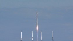
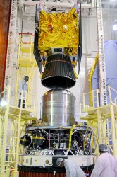
The next GLONASS launch — the GLONASS-K1 satellite from Plesetsk scheduled for November 20 — is being insured for 2.17 billion rubles ($50 million US). The insurance is costing Russia 242 million roubles ($5.6 million US).
Russia has faced numerous technical difficulties in its launches. On May 15, a Proton-M satellite crashed. In 2013, Russia lost three GLONASS satellites when their launch aboard a Proton-M rocket went awry, sending the satellites crashing into the Baikonur Cosmodrome in Kazakhstan instead of aloft into space. In 2010, three other GLONASS satellites ended up in the Pacific Ocean aboard a Proton-M rocket.
The insurance covers the launch and flight tests of the carrier rocket Soyuz-2.1b, with the satellite GLONASS-K. Flight tests, according to the tender documentation, will last for three months.
Matters sit not well with Galileo, the European GNSS. Only one of six currently orbiting satellites can be said to be truly and fully operational. With these troubles augmented by persistent uncertainties regarding the fitness of Soyuz rockets, despite a recent inquiry panel that identified a root cause of the August launch failure, the European Commission has nixed an upcoming December launch. The European Space Agency will have to wait until February 2015 to see if the skies clear by then for the next opportunity to place two new satellites into orbit.
Hard-charging veteran investigative reporter Richard Langley has learned from his eastern listening post in New Brunswick that “E11 and E12 [launched three years ago] exhibit ongoing problems with the onboard clocks. E20 [launched two years ago] has experienced power-supply problems and, following a brief outage, is now broadcasting on E1 only and with a reduced power. The latest two satellites [rose August 22 of this year] are in irregular orbits and will likely not form part of the final constellation. This leaves E19 [born October 12, 2012] as the only fully operational satellite operating within specifications.
“So, strictly speaking, only one of the currently orbiting satellites is fully operational. However, for most (E1/L1-only, single-point) users, four of the six satellites are currently quite useable. Moreover, preliminary studies suggest that, once on line, the latest two satellites will be perfectly usable, despite the irregular orbits. And, as we have heard, there will be attempts to make the orbits somewhat more circular.”
Langley cites “knowledgeable researchers” as his sources.
The initial quartet of in-orbit validation (IOV) satellites — E11, E12, E19, and E20 — constructed by Astrium GmbH and Thales Alenia Space have experienced a range of difficulties outlined above. The decision to cancel the next scheduled launch in December of the newest duo of full operational capability (FOC) satellites, manufactured by a consortium led by OHB AG, comes on the heels of a completed inquiry that blamed a “design ambiguity” of the Soyuz rocket’s Fregat stage for the too-low orbits of Satellites 5 and 6, but left several lingering doubts about other Soyuz issues that were uncovered and must be corrected.
The situation is complicated by further unresolved issues aboard the two FOC satellites themselves. They each failed to deploy one of their two solar arrays on the first try. After several days of effort and re-orientation of the satellites by ground controllers, the arrays were successfully unfolded, but the cause of the initial failure remains unknown. “There is no conclusion on a root cause,” stated one official. “Was it a consequence of the bad orbit, or is there an issue with the solar array deployment mechanism? We cannot yet say for sure.”
As for their incorrect orbit, getting them into their originally planned paths around the Earth is impossible. They simply do not have enough fuel onboard. ESA does, however, plan to raise the perigees of the satellites to get them out of the Van Allen radiation belt, which could severely damage the satellites. The agency also envisions reducing the maximum Doppler frequency shift from 9.6 kHz to at least 6.8 kHz to allow receivers to easily acquire and track the satellites but leave enough hydrazine for future station-keeping. Spokespersons hold out hope that the satellites may yet be usable somehow, someday, after some adjustment measures are taken: a rephasing, a special almanac, perhaps other adjustments.
Overall, a disheartening picture, with some pessimists concluding that “2013 and 2014 have been lost.” The recent slip of full operational capability declaration from 2018 to 2020 may have to be revised yet again. However, lessons learned, etcetera. Galileo has had its ups and down. Advocates may draw comfort from the wisdom imparted by 19th-century German philosopher Friedrich Wilhelm Nietzsche, “Was mich nicht umbringt, macht mich stärker.” That which does not destroy me, makes me stronger.
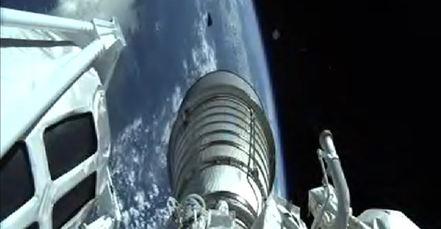
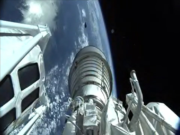
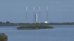
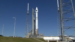
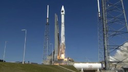
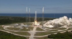
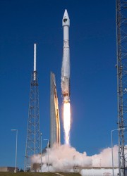
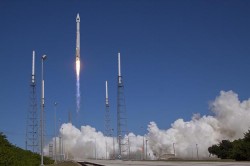
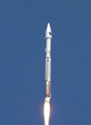
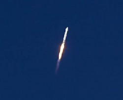
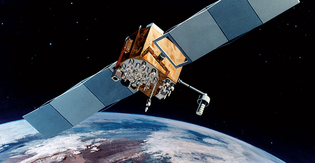
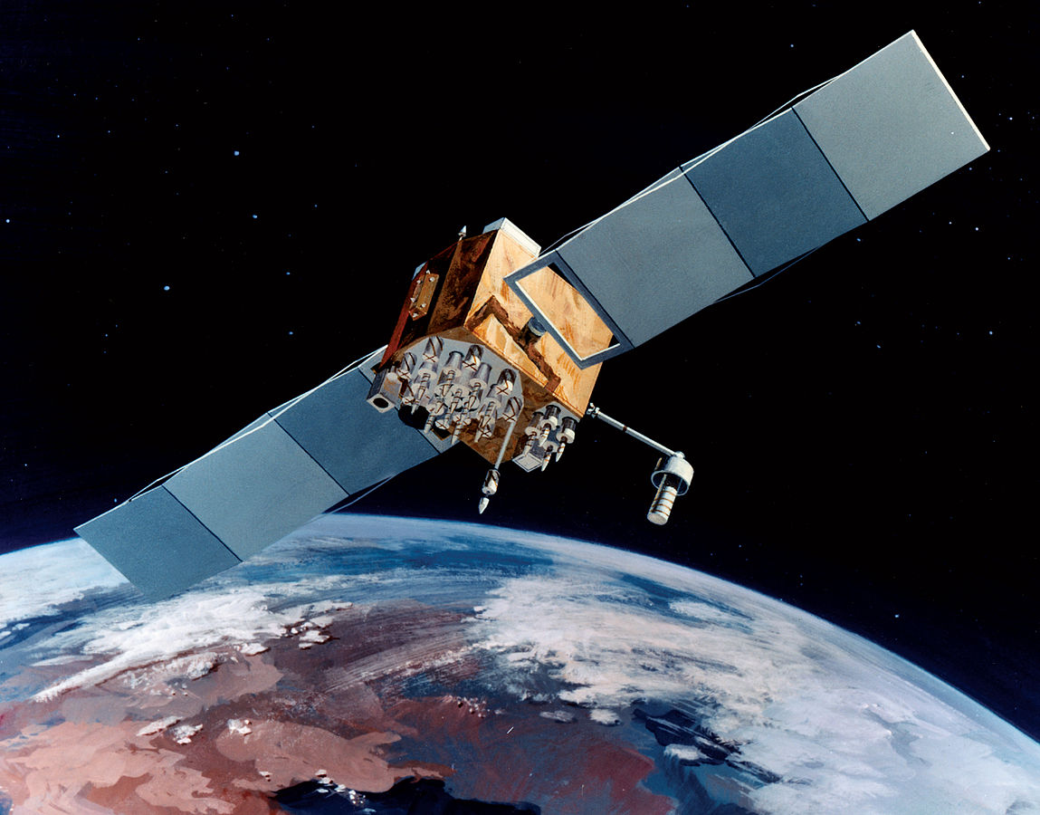
The U.S. Air Force launched the eighth GPS IIF satellite from Cape Canaveral Air Force Station in Florida today at 1:21 Eastern Time, as scheduled. An Atlas V 401 carried the GPS satellite aloft.
GPS IIF-8 is one of the next-generation GPS satellites, incorporating various improvements to provide greater accuracy, increased signals, and enhanced performance for users. With this eighth satellite now launched, only four more Block IIF satellites remain to be placed into orbit. Three are in storage awaiting launch, and one is in production.
“I’m delighted with the outcome of today’s launch. Thanks to the men and women of SMC, the 45th, 50th and 310th Space Wings; Boeing; ULA; the Aerospace Corporation; and the GPS IIF and Atlas V launch teams ceaseless efforts, commitment, dedication, and focus on mission success, we successfully launched the fourth GPS IIF space vehicle this year,” said Col. Bill Cooley, director of Space and Missile Systems Center’s Global Positioning Systems Directorate. “Today’s launch demonstrates our commitment to users around the globe that GPS is the gold standard for position navigation and timing and will continue to deliver capabilities for the foreseeable future,” he said.
After launch, the mission entered a coast phase that lasts about three hours. Following a short second burn of the RL10 engine, the Centaur second stage will deliver the Boeing-built GPS IIF-8 satellite to semi-synchronous orbit over the southern ocean north of Antarctica. Separation takes place about 3 hours, 24 minutes after liftoff.
GPS IIF-8 is the United Launch Alliance‘s fourth GPS launch this year. The mission marks ULA’s 89th mission launched since the company was founded in 2006.
GPS IIF-8 (SVN-69/PRN-03) will replace SVN-51 in the E plane slot 1. SVN-51 will be re-phased from E1 to an auxiliary node at E7 somewhere around SVN-54 currently on station at E4, according to the Air Force Second Space Operations Squadron (2 SOPS). SVN-38/PRN-08 will be taken out of the operational constellation prior to SVN-69 payload initialization and sent to Launch, Anomaly Resolution and Disposal Operations (LADO). PRN-08 will be assigned initially to SVN-49 and set to test.
SVN-38 was launched on November 5, 1997, successfully serving nearly 17 years, 9.5 years beyond its designed service life, due to the diligent efforts of the men and women of the U.S. Air Force. SVN-51 will remain in an auxiliary node once it completes its re-phase journey. The SVN-51 re-phase will take about six months after the initial burn occurs.
Russian companies looking to develop GLONASS products and services can soon tap into an 8-billion-ruble fund. Russian state development bank Vnesheconombank (VEB) plans to offer financial support for projects using GLONASS, pending government approval, according to the Russian news agency Ria Novosti.
VEB’s sister fund, VEB Innovations, will set up the GLONASS Fund in the fourth quarter of this year, with funds made available by next February-March. The fund will include 5 billion rubles ($122 million) from VEB and 3 billion rubles ($73.1 million) from private investors.
The project is designed to expand GLONASS market share, both to acquire advanced technology and attract new customers. It aims to support small companies with new, innovative ideas. Its goals will include the creation of an investment model that will ensure that the most promising and viable projects reach market, from conception to production.
Assistance will be sought from specific European, North American and Asian technology companies, including Norway’s Q-free, Switzerland’s Saphyrion, Slovakia’s Sygic, the Netherlands’ AND, France’s Benomad, and the Germany companies Peiker, Init and IVU. Each of these companies is involved in navigation, with hardware, software, GIS and mapping software, telematics or dispatching. The GLONASS Fund concept says that by using these technologies for the development of new domestic products and services, GLONASS can achieve technical superiority in all the major segments of the global navigation and information market.
The fund’s support will include contacts with Russian trade representatives abroad to promote the Russian products in markets such as India, Latin America and the Middle East.
The Air Force is set to launch the eighth GPS IIF satellite from Cape Canaveral Air Force Station in Florida on October 29. The 18-minute launch window opens at 1:21 p.m. EDT.
An Atlas V 401 will launch the GPS IIF-8 mission for the U.S. Air Force.
As described by the Air Force, GPS IIF-8 is one of the next-generation GPS satellites, incorporating various improvements to provide greater accuracy, increased signals, and enhanced performance for users.
GPS IIF-8 will be United Launch Alliance’s fourth GPS launch of 2014 and the 12th of the year. The mission will mark ULA’s 89th mission launched since the company was founded in 2006.
To keep up to speed with updates to the launch countdown, dial the ULA launch hotline at 1-877-852-4321 or join the conversation at www.facebook.com/ulalaunch and twitter.com/ulalaunch; look for the #GPSIIF8 hashtag.
The Air Force Second Space Operations Squadron (2 SOPS) indicates that IIF-8, SVN-69/PRN-03, will replace SVN-51 in the E plane slot 1. SVN-51 will be re-phased from E1 to an auxiliary node at E7 somewhere around SVN-54 currently on station at E4. SVN-38/PRN-08 will be taken out of the operational constellation prior to SVN-69 payload initialization and sent to Launch, Anomaly Resolution and Disposal Operations (LADO). PRN-08 will be assigned initially to SVN-49 and set to test.
SVN-38 was launched on November 5, 1997, successfully serving nearly 17 years, 9.5 years beyond its designed service life, due to the diligent efforts of the men and women of the U.S. Air Force. SVN-51 will remain in an auxiliary node once it completes its re-phase journey. The SVN-51 re-phase will take about six months after the initial burn occurs.
Hyman Huang of South Surveying & Mapping Instrument Co. talks with GPS World about the company’s new dual-frequency GNSS Receiver and its tablet counterpart while at InterGeo 2014, held October 7-9 in Berlin.
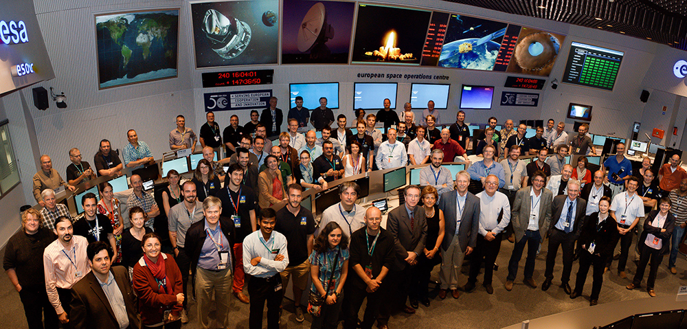
Flight Operations Director Hervé Côme celebrating success finding the satellites. Photo: Galileo Control Centre
On September 27, the first two Galileo Full Operational Capability (FOC) satellites were handed over from the European Space Agency’s Space Operations Centre (ESOC) in Darmstadt, Germany, to the Galileo Control Centre, Oberpfaffenhofen, which will care for them pending a final decision on their use.
The satellites, launched on August 22, are in excellent health and working normally. However, a launcher problem left the pair in the wrong orbit, with higher apogee, lower perigee and an incorrect inclination compared to the planned circular orbit.
According to a release by the European Space Agency, the orbit presented a sudden and unexpected — though not untrained for — challenge to the team at ESOC responsible for the launch and early orbit phase. For months before each Galileo launch, a joint team of mission operations experts from ESA and France’s CNES space agency train intensively for this critical period, which typically lasts about eight days, from separation until handover to Oberpfaffenhofen.
“After launch, we quickly discovered that one of each satellite’s pair of solar wings had not deployed correctly,” said Liviu Stefanov, Spacecraft Operations manager. “At the same time, difficulties in receiving radio signals — indicated by unusually low power and instability — alerted us to the fact that the orbits could be incorrect. Basically, the ground stations were pointing to where we expected the satellites to be, and they weren’t there, so we weren’t getting good signals.”
The joint ESA–CNES Galileo operations team in the Main Control Room at ESA’s Space Operations Center, August 28. (Photo credit: R. Solaz).
Engineers determined within four hours the approximate actual orbit and then generated new commands to point the ground antennas to establish robust radio links. Working around the clock, and with assistance from the Galileo project engineers and the satellite builder, the teams then started to look at how to free the solar arrays. “Each undeployed wing had to be treated as a separate problem,” said Flight Operations Director Hervé Côme.
“Each satellite had to be maneuvered separately into an orientation where the undeployed panel was facing the Sun because we realized that one cause was linked to the low temperature of the release mechanism. It all required developing, validating and rehearsing new flight operation procedures on the fly.”
It took three days to release the trapped solar wing of the first satellite, and then two days later the second Galileo’s stuck array was also freed. The satellites have since been brought into full operation, as the teams in Darmstadt were tasked to retain control for five weeks — four weeks longer than planned.
“This was very demanding on the ESA and CNES personnel, and on the ESOC operations team in particular, but the strong bonds developed through months of joint training enabled them to perform very well,” Liviu said.
Possible uses of the two satellites are now being studied, and a future mission scenario will be decided at a later date.
While the process of handing over the satellites to the Galileo Control Centre (where they are operated by teams from a private company, spaceopal GmbH), had been practiced in the past, this was the first time it was done with FOC satellites in orbit. The delicate process involves transferring responsibility for commands and telemetry, and beginning the satellites’ secure mode of operation by the teams at Oberpfaffenhofen. The handover ran very smoothly over the last weekend in September.
“By the end of the Saturday, the first satellite was fully handed over, while the second handover took place on Sunday,” said Richard Lumb, ESA’s Galileo Mission director.
“I am extremely proud of the entire Mission Control Team and the way they handled a dramatic and very critical situation resulting from multiple, independent anomalies,” said Paolo Ferri, ESA’s head of Mission Operations. “After launch, the joint team managed to maintain control of the satellites under extremely difficult conditions, rapidly stabilized them, and determined the actual orbit. The accuracy and professionalism of the subsequent handover activities also showed that the joint team at ESOC and the spaceopal team at the Galileo Control Centre are very well tuned for this procedure, which will become increasingly frequent with future launches.”
As European satellites offer a possibility to improve the efficiency of train control systems, GNSS technology is starting to gain momentum in the rail sector. To promote the role of GNSS in this important sector, the European GNSS Agency (GSA) recently exhibited at Innotrans — a leading rail transport tradeshow.
EGNOS can and, in the future, Galileo will provide continuous and highly reliable positioning service — helping increase the competitiveness of rail among other modes of transportation. Currently, GNSS in European rail is primarily used within non-safety-of-life applications, including asset management and passenger information services. However, the latest technological developments show that augmented GNSS, together with specific sensors, can help satisfy the stringent CENELEC Safety and Integrity Level requirements.
As a result, the rail sector has an increasing demand for cost-effective and innovative GNSS applications for both safety critical and non-safety critical purpose. For example, in the safety-critical domain, GNSS-based applications can provide signaling and autonomous train control. In the non-safety critical domain, GNSS is helping improve the performance of asset management and passenger information systems.
Showcasing the E-GNSS Advantage
With rail becoming an important market segment for GNSS technology, and to put emphasis on the many benefits E-GNSS can bring the rail sector, for the first time the GSA exhibited at a rail tradeshow. At Innotrans, one of the leading international tradeshows for the sector held September 23-26 in Berlin, the GSA showcased the EGNOS advantage for rail.
Joining a panel discussion hosted by the European Railways Agency (ERA) entitled “How Heaven Could Support European Train Control System (ETCS),” GSA Head of Market Development Gian-Gherardo Calini explained how European GNSS can serve as a solution to some of the problems the sector currently faces.
“Although rail will become a major market for E-GNSS, it is already providing benefits, such as helping to improve safety,” he said. “Our role at the GSA is to serve the end user by making sure the technology delivers the necessary solutions.”
Calini acknowledged there are challenges to the sector’s full adoption of GNSS, but stated that other sectors have overcome challenges and are benefiting from E-GNSS: “It is a successful reality in other transport sectors, especially aviation, and we must focus on building from these experiences,” he said.
The ERTMS/ETCS is a major industrial project that aims to replace Europe’s different national train control and command systems. The deployment of ERTMS will enable the creation of a seamless European railway system with aligned signalling — essential to increasing the competitiveness of European railways.
Europe’s GNSS systems — Galileo and EGNOS — are actively contributing to the needed evolution of the ERTMS. One example of this long-term perspective is the Shift2Rail Joint Undertaking, whose objective is also to support the adoption of GNSS in the rail sector. Within this undertaking, it is foreseen that both Galileo and EGNOS will be brought into ERTMS standards and foster European GNSS adoption in the area of Low Density Lines.
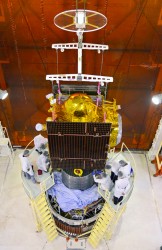
The third IRNSS satellite heads into orbit. Photo: ISRO
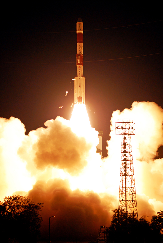
India has successfully launched IRNSS-1C, the third satellite in the Indian Regional Navigation Satellite System (IRNSS), early on October 16. The satellite was launched aboard the Polar Satellite Launch Vehicle (PSLV) C26 at 2002 GMT (4:02 p.m. EDT) from Satish Dhawan Space Centre, Sriharikota.
After the lift-off of PSLV-C26 with the ignition of the first stage, the important flight events — namely, stage and strap-on ignitions, heat-shield separation, stage and strap-on separations and satellite injection — took place as planned, according to the Indian Space Research Organization (ISRO). After a flight of about 20 minutes, 18 seconds, the IRNSS-1C satellite, weighing 1425 kg, was injected to an elliptical orbit of 282.56 km x 20,670 km, which is very close to the intended orbit.
After injection, the solar panels of IRNSS-1C were deployed automatically. ISRO’s Master Control Facility (at Hassan, Karnataka) assumed the control of the satellite. In the coming days, four orbit maneuvers will be conducted from the Master Control Facility to position the satellite in the geostationary orbit at 83 degrees East longitude.
IRNSS-1C is the third of the seven satellites constituting the space segment of the Indian Regional Navigation Satellite System. IRNSS-1A and IRNSS-1B, the first two satellites of the constellation, were successfully launched by PSLV on July 02, 2013, and April 04, 2014, respectively. Both IRNSS-1A and 1B are functioning satisfactorily from their designated geosynchronous orbital positions.
IRNSS is an independent regional navigation satellite system designed to provide position information in the Indian region and 1,500 kilometers around the Indian mainland. IRNSS will provide two types of services, namely, Standard Positioning Services (SPS) — provided to all users — and Restricted Services (RS), provided to authorized users.
A number of ground stations responsible for the generation and transmission of navigation parameters, satellite control, satellite ranging and monitoring, etc., have been established in as many as 15 locations across the country.
This is the 27th consecutively successful mission of the PSLV, which used the XL configuration of PSLV for the seventh time. Honorable Minister of State (Space) Jitendra Singh, witnessed the launch from the Mission Control Centre at SDSC, Sriharikota.
The next satellite of this constellation, IRNSS-1D, is scheduled to be launched by PSLV in the coming months. The entire IRNSS constellation of seven satellites is planned to be completed by 2015.
Below is a slideshow with images from the launch preparations and launch.
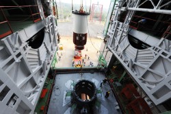
Nozzle end segment of PSLV-C26 being hoisted for assembly. Photo: ISRO
Nozzle end segment of PSLV-C26 being hoisted for assembly with launch pedestal. Photo: ISRO
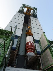
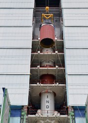
IRNSS-1C being assembled with PSLV-C26 in the mobile service tower. Photo: ISRO
PSLV-C26 inside the mobile service tower prior to satellite integration. Photo: ISRO
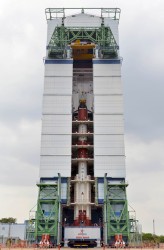
IRNSS-1C being assembled with PSLV-C26. Photo: ISRO
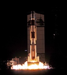
The PSLV-C26, carrying IRNSS-1C, lifts off. Photo: ISRO
Assembly of PSLV-C26, third and fourth Stages. Photo: ISRO
The third IRNSS satellite heads into orbit. Photo: ISRO
To submit an abstract and view the full call for papers, visit this link.
In this first event in a brand-new series of world-class conferences, the conference will highlight the state of the art in fields like GNSS and Galileo, indoor positioning, autonomous transport, security and resilience of navigation in the world of cyber attacks, and new quantum technologies. The conference will be of special interest to the maritime, aviation, PNT, transport, research and development and security communities.
Confirmed keynote speakers and topics:
Privacy in Tracking (smartphones & indoor navigation) — Chandu Thota, Google
Security and Resilience — Dana Goward, president and executive director, U.S. Resilient Navigation and Timing Foundation; Professor Todd Humhreys, University of Texas at Austin, USA
Multi-Constellation GNSS — Gian Gherado Calini, GSA
Multi-Sensor Integration — Professor Dorota Grejner-Brzezinska, Ohio State University
Quantum Technologies — Sir Peter Knight, Professor of Quantum Optics and Senior Research Investigator, Imperial College London
Emerging Trends and Current Challenges — Colin Beatty FRIN, CBiL
Autonomy in Transport — BAE – ASTREA
Legal Aspects of Navigation — Professor Frans von der Dunk, Institute of Space Law, Leiden University.
Visit the website for full conference details, including the exhibition and sponsorship brochure.
After the death of Mao Zedong, who had himself changed the “cultural” face of China, Deng Xiaoping led China from 1978 until his death in February 1997. During that period, China advanced economically further than it did in the previous 200 years, and rose from a financial backwater into one of the world’s largest economies. From 1978 to 1998, GNP increased 500%, average annual income rose from a few hundred dollars to $1,800, savings increased 14,000%, and exports went from $10 billion a year to $153 billion. In a Chinese 1998 survey, Deng was named the number-one hero in China.
Deng Xiaoping.
To achieve all this, there had to be a strategy — a vision of how to bring about such significant change. The approach chosen was to lead and support through government-sponsored initiatives — and the group who was in the best position to be able to convince people and demonstrate by example was China’s well-educated military.
So now we get to GNSS, and of course one of these initiatives was to emulate what the U.S. had done and to create its own satnav system. So we have the BeiDou/Compass space and ground control infrastructure. And having built all this, indeed they did come and a Chinese GNSS industry began to emerge. But it nearly didn’t happen.
In 1994 as part of Deng Xiaoping’s efforts, a state company was formed to pursue economic reform. Ruxin Zhou was one of those military guys who was there, and he recognized that the planned military BeiDou satnav system could be an avenue towards a huge commercial opportunity for China. But the Chinese military was already launched on a course to build BeiDou for their own purposes, and maybe they didn’t want to get caught up in these economic changes going on with the civilian population. As a member of the government advisory group, Colonel Zhou worked long and hard to promote his concept with several levels of government and to persuade military leaders and those involved with BeiDou that they should participate in Xiaoping’s reforms. Ultimately he was successful, and BeiDou eventually emerged as a joint military civilian system.
The next step was to somehow create a commercial business out of all this. To do that, in 2000 Mr. Zhou formed Beijing BDStar Navigation Company Ltd. with only himself and another original founder — Mr. Jianhui Li. Based in Beijing, BDStar was ideally located close to the government, close to military management, and close to the BeiDou operations and control centers. Coincidentally, around the same time, NovAtel in Calgary was beginning to be active in the region and was looking for dealers to market its OEM receivers into China. After a trial phase with a couple of dealers, it was finally agreed that BDStar would represent NovAtel exclusively in China.
That’s when I first met Ruxin Zhou — with U.S. WAAS development well underway, it turned out that China was also interested in creating its own Satellite Navigation Augmentation System (SNAS), and was considering NovAtel’s WAAS GI reference receivers for the ground infrastructure. Mr. Zhou became the contact point between NovAtel and BDStar, and what followed was what appeared to us to be a lengthy, frustrating negotiation which rolled out in both China and in Canada. Now we know that not only was the SNAS program making sure it understood the technology inside the NovAtel WAAS receiver, but Mr. Zhou was also learning English, the ways of doing Western commercial business, and, most of all, he was getting to know and be comfortable with us.
NovAtel went on to win three contracts to supply 85 WAAS receivers to the SNAS system over three years, and the relationship with BDStar and Mr. Zhou became one which both sides wished to grow and prosper. NovAtel OEM receivers were also supplied in quantity into a number of applications that BDStar developed in China over many years. BeiDou was also an important catalyst to initially help BDStar gain traction — the company equipped 40,000 fishing boats with BeiDou messaging receivers over several years, used for basic communication across the fleet and for location reporting to monitor authorized fishing areas.
Fast forward to today. Almost 15 years have gone by. Mr. Zhou is now chairman of the board of the BDStar Navigation group of companies, and Mr. Li is president, running day-to-day ongoing business at BDStar. I sat down with my old friend in Tampa at the Institute of Navigation (ION) GNSS + Conference to catch up with the growth and expansion of this business and listen to the many achievements that have now turned BDStar into the largest (¥780 million RMB = $127 million US) GNSS-based public company in China. BDStar had a difficult beginning between 2000 and 2007, like many start-ups, but has now emerged as a profitable leading enterprise within the Chinese BeiDou industry.
Ruxin Zhou, Chairman of the Board, BDStar Navigation.
Ruxin Zhou was born in March 1963, and he has been involved in China’s GNSS industry since 1994. He lives in Beijing, and is the father of two sons. He is also vice chairman of the Association of GNSS of China. He earned his BSc degree in 1983 followed by his master’s in 1989, both at University of NanKai in Tianjin. His MBA was awarded by the University of Beijing in 2003.
Ruxin Zhou considers BeiDou an important part of the GNSS industry, and he is looking forward to cooperating with other GNSS related companies inside and outside China to add more value to users.
Mr. Zhou chairs the BDStar board of directors — one of whom is the president of the company. There is also a group chief technology officer (CTO), a board secretary who is responsible for investment, three outside directors from industry, and an advisor who is familiar with government financial policy. Along with the parent company BDStar Navigation Products Division and its internal GNSS Applications Division, there are nine subsidiary companies, each of which is governed by a small management board.
BDStar Information Service Co. — Largest BeiDou operations service provider.
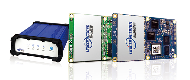
Unicore Communications, Inc. — Consumer and precision chipset and board-level receivers.
BDStar Hong-Kong — Import/export company for the group.
Shenzhen XG Electronics Co. — Vehicle electronics and installations.
BeijingSinsTek Technology — MEMS inertial technologies for defense.
Beijing Hanvic Photoelectricity Co. — Navigation using IR/photo–electric technologies.
BeiDou Information Equipment Co. — National Defense equipment and services.
Recently, the BeiDou Equipment Division within BDStar has become a separate company known as BeiDou Information Equipment Co., and another company — Harxon, which manufactures antennas — is in the process of being added to the group.
The number of people working within the BDStar group has grown from an initial staff of 20 when Mr. Zhou and Mr. Li began operating the company, to around 1,500 people today in 2014.
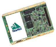
BDStar Navigation is where this all began as a value-added reseller for NovAtel OEM receivers — integrating them into a number of applications, such as vehicle, marine and military navigation installations. BDStar was also instrumental in the establishment of the ground infrastructure for SNAS and took part in the construction of the system. As this business increased, installations became focused within a separate group, along with building the equipment using integrated NovAtel GPS and inertial OEM equipment — the GNSS Applications Division.
With an increasing number of satellite launches, and a growing ground infrastructure, BeiDou began to become a more important part of China’s GNSS/navigation infrastructure. BDStar began to play a larger role in the emerging BeiDou program (BeiDou System or BDS), and it became clear that BeiDou technology would have to be developed by BDStar in China. And so the spin-off and company start-up phase of BDStar’s growth got underway.
BDStar Information Service Co., Ltd.
BDStar Information Services Limited is a wholly owned subsidiary of BDStar Navigation, providing location-based system solutions and information services, based on the BeiDou Navigation Satellite System, for the fishery, agriculture, forestry, water conservancy, and meteorology industries. By integrating Internet and mobile communication networks with geographic information, BDStar Information Service has now become the largest BDS information service provider in China with more than 40,000 BeiDou end-users, hundreds of government users and more than 100,000 mobile phone users. The service is 24/7/365 and includes real-time positioning, and short message communication for typhoon warnings, emergency alarms and other related services. The system has capacity for over 100 million navigation positioning and communications messages per year.
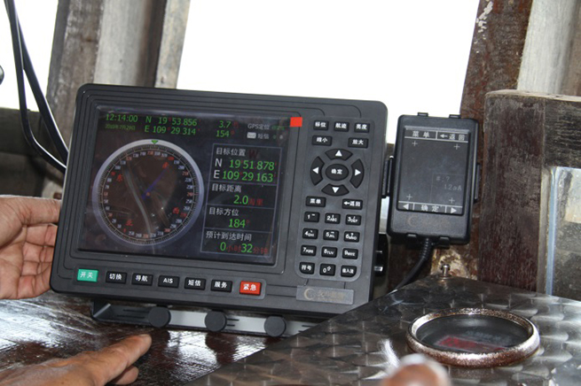
Ship terminal. Photo: BeiDouBeidou Operational Service Center. Photo: BeiDou
Unicore Communications Inc. (Beijing)
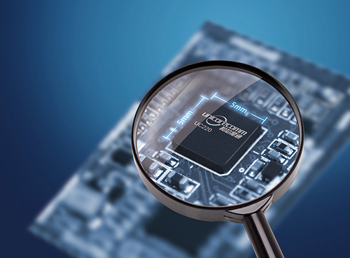
Unicore Communications Inc. is a share-holding subsidiary of BDStar Navigation — a high-tech company dedicated to highly integrated system-on-a-chip (SoC) IC design and GNSS algorithm development. Unicore is focused on the commercialization of BeiDou through advanced GNSS professional applications and innovative technology breakthroughs — one of the leading Chinese companies involved in the “industrialization” of BeiDou systems.
Unicore provides turn-key location-based services (LBS) in both the GNSS professional and consumer navigation segments. An innovative core chip has been independently developed, providing high-performance GNSS as well as low-cost, low-power, high-quality products with positioning accuracy ranging from millimeter all the way up to meter levels. Not only have high-precision requirements for surveying, mapping and CORS reference stations been satisfied, these components have also been used in less onerous applications such as vehicle monitoring and personal navigation.
By the second quarter of 2014, Unicore has sold more than one million BeiDou SoC chips and won multiple breakthroughs in BeiDou multi-GNSS applications such as in-dash automotive navigation, automatic driving test system, Ground-Based Augmentation System (GBAS), and the International GNSS Monitoring and Assessment Service for Open Service (iGMAS).
Beijing Hanvic Photoelectricity is a share-holding subsidiary of BDStar Navigation targeted at the infrared thermal imager market. The company has used in-house infrared optics, imaging circuitry, image processing, artificial intelligence, mechanical structures and system engineering to develop a number of products using planar and linear arrays. Short-medium-long-wave infrared cooling thermal imagers can provide users with a visual context under varying weather conditions from up to tens of kilometers from a target object. These products are widely used in scientific research, electrical distribution, forest-fire prevention, surveillance, public security, firefighting, and anti-smuggling.
Beijing SinsTek Technology Co., Ltd.
Beijing SinsTek Technology is a shareholding subsidiary of BDStar Navigation specializing in the original development of inertial navigation, inertial measurement, and measurement and control systems and devices- for which SinsTek owns all related intellectual property rights. SinsTek has independently developed products such as high-precision quartz accelerometers and gyros, mixed inertial navigation systems, missile-borne computers, a missile overload switch and a ground control system. Products and systems have been widely used within China in various fields of national defense and also commercially.
Shenzhen XuGang Electronics Co., Ltd.
Shenzhen XuGang Electronics was founded as a shareholding subsidiary of BDStar Navigation in 2001. The company undertakes product development, design, manufacture and sales of medium- to high-end consumer-level vehicle audio-video navigation products and services. The company has more than two decades of experience in automobile accessories, and has good cooperative relationships with China’s major automobile manufacturers. With a marketing network that extends across China, the company is one of the most important automotive electronics and navigation products providers in China. Automotive products are also exported to the U.S., Russia, Brazil, Israel and to other countries.
The scope of this business includes:
CAR navigation/CAR audio original design manufacturer (ODM) — High volume/high-quality production of auto accessories, auto electronics and GNSS products.
Marine radio ODM — Waterproof hi-fi player/radios have won wide recognition in Europe and the U.S. This is the only Chinese company whose SIRIUS satellite radio technology has been certified in the U.S.
Telematics auto network solutions — BDStar auto navigation system and BDStar Black Box have been independently developed, fusing sensors, network communications, processing and controlling technologies to provide telematics products and services for auto makers and commercial consumers.
BeiDou online telematics. Photo: BeiDou
Navigation Products Division
The Navigation Products Division has successfully collaborated for more than 10 years with NovAtel as its value-added reseller (VAR) of GNSS and GNSS-inertial products in China. Focused on satellite positioning and inertial navigation applications, BDStar has promoted domestic Chinese navigation and positioning applications development, and has established close cooperative relationships with domestic inertial and integrated mapping companies, research institutes, and other sectors. Application fields include railways, electricity, telecommunications, meteorology, and seismology. Quite naturally, independently developed BeiDou products have also followed this route to market in China.
NovAtel OEM6 receiver. Photo: BeiDou
GNSS Application Division
The GNSS Application Division is the business division of BDStar Navigation, which is mainly engaged in the development, production, sales, and service of the products based on high-precision GNSS technology applications. With the objective of becoming expert in high-precision GNSS solutions used in the developing industry using the “Internet Of Things (IOT),” the company provides a series of GNSS terminal products and solutions for the civilian market. Applications have included agriculture, container ports, and deformation monitoring. Meanwhile, the successful port IOT that this division has provided for Tianjin Port has now been implemented at more than 20 domestic and foreign ports including Shanghai, Ningbo, Shenzhen, and in India.
BeiDou Internet of ships Photo: BeiDou
BeiDou Information Equipment Co.
BeiDou Information Equipment, a wholly owned subsidiary of BDStar Navigation, is focused on supplying products for national defense and government agencies, and provides complete solutions and products for dispatch management of hazardous materials and special cargo handling. Several successful projects have been undertaken, including special hazardous vehicle command and monitoring, public security, anti-terrorism, forest-fire prevention, emergency management, personnel command and monitoring of disaster relief, public security, and border defense. The division relies on its experience in system engineering, command and control software, radio system design, and military satellite navigation to provide users with terminal products such as navigation, timing and heading, and location-based military information service systems. Specific products developed include terminal equipment, vehicle-mounted navigators, vehicle traveling data recorders, police positioning and telecommunication terminals, and an emergency communication system.
Following this phase of significant growth, what does the future hold for BDStar? We know that China’s huge annual rate of GDP growth may have slowed a little, but Mr. Zhou still has pretty big aspirations for his group of companies. His target for 2020 is to have BDStar reach annual sales of 10 billion RMB ($1.63B US). To get there, his intermediate step is to reach 2 billion RMB ($326m US) by the end of next year. Overall, this represents a ten-fold growth in revenue over six years — by Chinese industrial standards, this might even be termed “modest” growth.
But where will all this growth come from? The strategy appears to be textbook:
Through significant organic (internal) growth, or by doing the same things better and to a greater extent.
Through strategic partnerships with targeted leading companies in key growth areas.
Through further acquisition of companies that would improve the bottom line and also benefit from the synergies of the existing corporate group.
While the anticipated course would be to add companies at the corporate level, it’s possible that some companies within the organization may also get to the point where they see adding an organization below or alongside may become a profitable avenue for their own growth. Of course, other suitable companies in China would be on Mr. Zhou’s strategic acquisition list, but he’s also looking for expansion elsewhere around the world. The U.S. market is significant for the type of products and technologies available in the BDStar group, so it would be natural to anticipate that a North American acquisition could help improve product distribution and development. As BeiDou becomes an integral part of global GNSS, and industry partners seek more than Open Service capability and better Chinese access, its also conceivable that partnerships with North American players could come about.
So, at least with BDStar and some other similar Chinese companies, it would seem that those earlier 1990s aspirations of the Chinese government to create a commercial economic sector within the Chinese economy have at least begun to show a measure of success in the GNSS market segment.
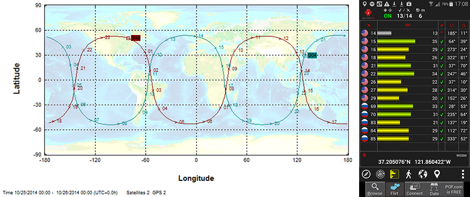
In this course assignment, the map predicts the satellite paths, and the app is what students use to observe them.
Final results are not yet in, but early indicators presage that Monday’s inaugural webinar with two Stanford professors will be the largest GNSS public event ever staged. Enrollment surpassed 20,000 some time ago, and the free subscription rolls are still open. It’s massive!
Per Enge, professor of engineering at Stanford University, where he directs the Stanford Center for Position Navigation and Time, and Frank van Diggelen, vice president of technology at Broadcom Corporation and a consulting professor at Stanford University, are teaching the massively open online course (MOOC) on GPS this fall. The six-week course began October 13 and lasts through November 24, but it’s not too late to enroll.
The course focuses on GPS basics with the use of smartphones.“This is the first ever MOOC on GPS/GNSS,” said van Diggelen. “It will be carried by Coursera.”
GPS: An Introduction to Satellite Navigation, with an interactive Worldwide Laboratory using Smartphones
Explore the fundamentals of the Global Positioning System (GPS) and how it works by conducting “backyard” laboratory experiments on your own mobile device. Learn the basics of satellite navigation and witness the power of a network with planet-wide coverage. Gain a deeper understanding of GPS and its role in our lives, while interacting with a worldwide community of learners and backyard scientists.
“Online learning, especially with MOOCs, is about to revolutionize teaching, and Stanford is in the vanguard,” van Diggelen added. “We’ve been teaching this course for several years at Stanford, and so this seems a very natural extension. We’re both excited by the possibility of reaching students all over the world, and by being part of the revolution.”
He provided some sample questions from set of short quiz exercises that will form part of the course.
What is the repeat period of the apparent orbit from a fixed point on earth, of a GLONASS satellite with orbit period 8/17 of a sidereal day?
What is 27 W in dBm?
Why is the bandwidth of the GPS C/A code signal one million cycles/second when it only sends data at 50 bits/second?
How precise are the GPS pseudo-range measurements?
Why is the fundamental GPS measurement called a pseudo-range?
There are even lab sessions. Participants will use their own smartphones or tablets.
A sample lab assignment: Predict which of the two GPS satellites, PRN 20 and PRN 32 will pass closest overhead at your location. Go outside at that time and verify that the GPS in your smartphone can acquire and track this satellite. Post the results on the course site, and watch who saw the satellite before you, and who sees it next.
“The class as a whole will follow these satellites around the world, as they tie us together in a global laboratory,” van Diggelen concluded, “using online apps that make the worldwide labs work.”
Frank van Diggelen
Frank van Diggelen is vice president of technology at Broadcom Corporation, a consulting professor at Stanford University, and inventor of coarse-time GNSS navigation, co-inventor of Long Term Orbits for A-GNSS, and author of A-GPS: Assisted GPS, GNSS, and SBAS. He is also a frequent contributor to GPS World.
Per Enge
Per Enge designs navigation systems that are safe and secure. He has worked on such systems for maritime and air applications. Two of these navigation systems have been deployed worldwide. He received his B.S.E.E. from the University of Massachusetts, and his M.S.E.E. and Ph.D. from the University of Illinois. Today, he is the Vance and Arlene Coffman Professor of Engineering at Stanford University, where he directs the Stanford Center for Position Navigation and Time. He was awarded the GPS World 2013 Leadership Award in the Signals category.