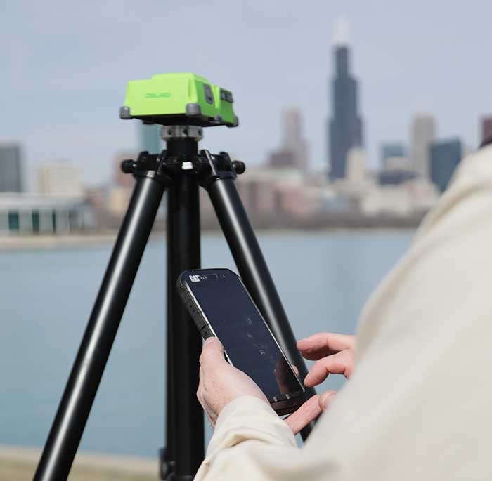
Miguel Amor, chief marketing officer, Hexagon’s Autonomy & Positioning Division
GPS World celebrates its 30th anniversary, and together we’ve seen huge leaps of innovation over the years. Reflecting on these developments, I wanted to share some of the contributions Hexagon | NovAtel made to support the evolution of the GNSS industry.
We began in 1978 in Alberta, Canada, in the telecommunications industry. In the 1990s, we shifted our focus to satellite receivers, choosing to forge ahead in GPS/GNSS technology. This decision would see NovAtel become one of the world’s leading manufacturers of high-precision GNSS components and systems developing multiple new patents and innovative solutions.
Our engineers have seen first-hand the growth of GPS and other satellite positioning systems worldwide, GNSS adoption across industries from aerospace to agriculture, and the present-day developments of precise positioning in autonomous applications. A rising tide raises all boats, and we helped foster the evolution of the industry through our goals of assured autonomy and positioning.
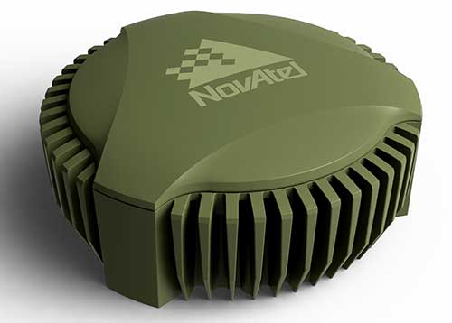
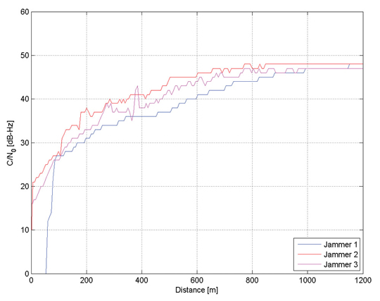
GAJT-710ML anti-jam antenna. (Photo: Hexagon)
Assured positioning means a reliable and robust solution you can trust. Technologies we’ve contributed to the broader industry include our GPS Anti-Jam Technology (GAJT) protecting users’ positioning, time and navigation, and SPAN technology, which expertly combines GNSS and inertial navigation systems (INS) measurements for seamless motion observations and a robust positioning solution. The capabilities of these technologies have been major contributors to the evolution of the GNSS industry.
Hexagon acquired NovAtel in 2007, and we’ve continued to grow and develop exciting new opportunities around the world where GNSS can grow, strengthen and improve applications in agriculture, automotive, defense, marine and many other industries. Our mission of assured autonomy and positioning encourages us to continue providing assured positioning in the most demanding environments and begin bringing autonomy to these markets.
GPS World has been a key player in covering these technological advancements for the past three decades. Together as an industry, we’ll continue innovating positioning and autonomy, and I’m excited to see how the industry will evolve over the next 30 years.
News from the British government appears to be a part of the United Kingdom’s diversification away from primary reliance on GNSS for positioning, navigation and timing (PNT) services, and toward a more diverse set of sources.
The nation has previously undertaken establishment of a National Timing Centre for distribution of time from suites of atomic clocks and has long transmitted an eLoran timing signal from a government facility in Anthorn.
Thursday’s press release, titled “Government to explore new ways of delivering ‘sat nav’ for the U.K.,” reinforces the government’s commitment to space-based PNT, but not necessarily from GNSS.
OneWeb satellites
The announcement follows significant criticism in Parliament of the nation’s purchase of a 45% share of the bankrupt communications satellite company OneWeb, with the India’s Bharti Holdings having the majority stake. OneWeb had 74 of its planned 648 satellites in orbit when it declared insolvency. With new ownership and financing in place, it plans to resume operations and launch another 36 satellites in December.
Prime Minister Boris Johnson’s motivation for making the investment was to offset Britain’s post-Brexit exclusion from Europe’s Galileo system. The idea was that OneWeb assets in low earth orbit (LEO) could provide a global British PNT capability.
This concept faced political and technical opposition from the start. Many technologists in the U.K. and elsewhere doubted that the constellation could be easily adapted to provide sufficiently accurate PNT services. The doubts were so serious that the senior career civil servant responsible for signing the agreement to invest in OneWeb took the very unusual step of refusing to do so without written direction from the political appointee she worked for.
Before the OneWeb investment, the U.K. government had been studying establish of its own GNSS like America’s GPS and Europe’s Galileo. Sources say the required investment was much higher than the nation wanted to make and would provide little added capability beyond that available from extant systems.
According to Thursday’s press release, the UK GNSS effort was exploratory and will end this month. It will be “reset” as the Space-Based Positioning Navigation and Timing Programme (SBPP). This project “will explore new and alternative ways that could be used to deliver vital satellite navigation services to the United Kingdom which are critical for the functioning of transport systems, energy networks, mobile communications and national security and defence, whilst boosting the British space industry and developing the U.K.’s own capabilities in these services.”
While the press release is short on detail, it does mention satellites at low earth orbit and that “a wider range of options” will be examined. This could suggest redoubling efforts on getting PNT from OneWeb, and/or investing in regional PNT satellites.
Galileo again?
The press release also says SBPP will “consider collaboration with international allies to share satellite navigation services, costs and technology.” This may signal reengagement with Europe on involvement with Galileo.
Some observers have said that Brexit did not have to automatically mean that the U.K. was excluded from the Galileo project. European Union membership is not required for participation in the European Space Agency which is responsible for Galileo. Switzerland and Norway, for example, are not EU members, but are members of ESA and sit on its governing board.
The U.K. government has been very concerned with PNT and GNSS vulnerability since at last 2012 when large solar flares became part of its National Risk Register. In 2017 a London Economics Report found that a five-day GNSS disruption would cost the nation more than $1.3B per day.
This most recent announcement indicates that Britain is still intent on going its own way and diversifying PNT sources, while still acknowledging the ongoing importance of GNSS and keeping its options open with allies.
Dana Goward is president of the Resilient Navigation and Timing Foundation. He is the proprietor at Maritime Governance LLC. In August 2013, he retired from the federal Senior Executive Service, having served as the maritime navigation authority for the United States. As director of Marine Transportation Systems for the U.S. Coast Guard, he led 12 different navigation-related business lines budgeted at more than $1.3 billion per year. He has represented the U.S. at IMO, IALA, the UN anti-piracy working group and other international forums. A licensed helicopter and fixed-wing pilot, he has also served as a navigator at sea and is a retired Coast Guard Captain.
Terry Moore, professor emeritus, University of Nottingham
The end of July was quite a momentous occasion for me as I accepted the offer of voluntary redundancy from the University of Nottingham after almost 35 years of employment. If I then add the six years I spent at Nottingham as an undergraduate and then as a postgraduate student, that totals almost 41 years of my life spent at the university.
I guess it is not surprising that recently I have spent some time reflecting on those years and the changes that have occurred in positioning and navigation throughout that long period. My first degree was in civil engineering, although I did specialize in land surveying in the final year.
Professor Ashkenazi. My first contact with satellite navigation was early in 1981, when Professor Vidal Ashkenazi, later my mentor and good friend, brought a JMR-1 Transit Doppler NAVSAT receiver into our second-year surveying lectures. That gentle repetitive beep as the receiver tracked the Transit satellites had me hooked for life. I don’t think I realized then that navigation and positioning would be the focus of my working life, but I was fascinated by the technology and prospects, and it really was one of those life-changing moments.
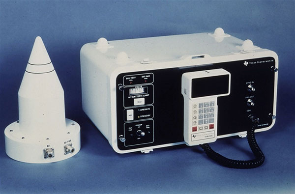
1984: Texas Instruments TI-4100. (Photo: NOAA National Geodetic Survey)
My Ph.D. continued in surveying and geodesy, and the focus was on the precise orbit determination of the LAGEOS geodetic satellite using Satellite Laser Ranging measurements. The goal was to investigate the determination of Earth Rotation Parameters (the Polar Motion and diurnal spin of the Earth) as part of an international collaboration known as Project MERIT.
Using Transit. I remember taking a Magnavox MX 1502 Transit receiver down to a conference at Herstmonceux Castle, and over the weekend I set up the instrument in my parent’s back garden in Sheffield, much to their amazement.
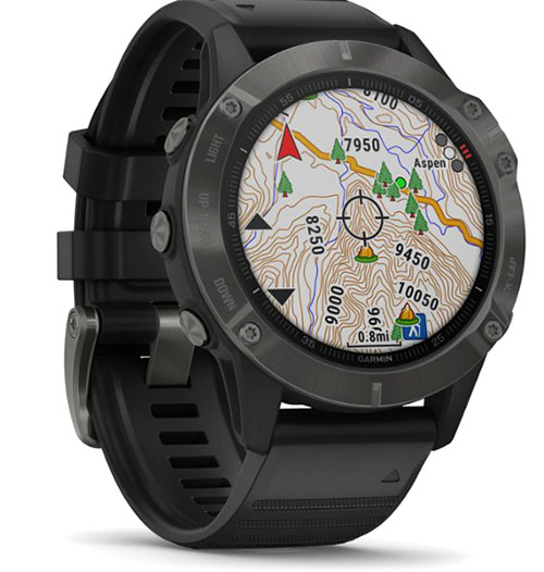
2020: Garmin Fenix6 smartwatch. (Photo: Garmin)
I did not start working on GPS until 1985, through my post-doc research position, sponsored by British Petroleum. This was investigating the first uses of GPS within the oil-and-gas sector for precise offshore positioning on platforms and survey vessels. The early GPS receivers we used were the Texas Instruments TI-4100 receivers, of which we borrowed five for the first long survey campaign to measure precise heights down the East Coast of England and Scotland. What a “pleasure” they were to use. I remember manually typing in the elements of the almanac for the receiver to acquire one satellite at a time.
Soon after we bought our first two Wild-Magnavox WM-101 receivers, which looked to be masquerading as Samsonite luggage. And now here I sit typing this article with GNSS receivers in the Garmin watch on my wrist and the Samsung phone beside me on the desk.
Last weekend, I was walking in the Lake District of England with my wife and daughter, and I did a quick count of our GNSS receivers. We had eight GNSS receivers (in watches, phones and handheld receivers) between the three of us, and of course there were others in our cars and the cycling GNSS receivers all nearby. How things have changed and how could we have imagined such as staggering growth in the ubiquity of GPS, and now GNSS, over those past 35 years.
GPS technology is doing far more than helping us navigate or receive accurate time. It is now being used to fight the spread of the global COVID-19 pandemic.
Global navigation satellite systems are being used to collect big data on travel and contact, but they are also being used in more unconventional ways: for example, quarantine enforcement and sanitation technology.
Read on to learn about a few recent developments in the world of GNSS/GPS that are bolstering the battle against the novel coronavirus.
Electronic monitoring enforces quarantine
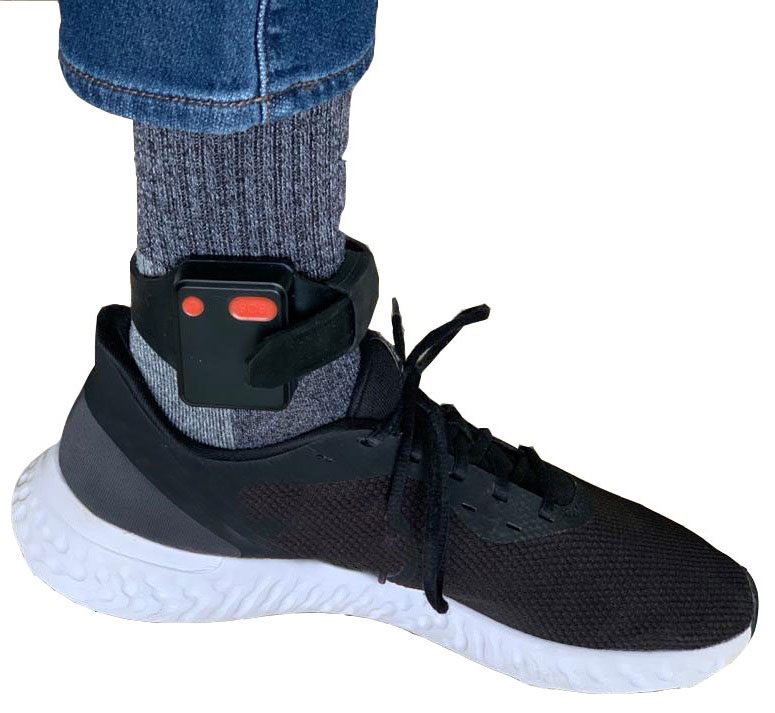
There is a surge of applying ankle monitors to track sick individuals and deter them from spreading the virus further. According to BloombergBusinessweek, one business is thriving because of it: providers of electronic ankle monitors.
Kentucky courts are requiring GPS ankle monitors for people who test positive for COVID-19 and refuse to self-quarantine. Kentucky couple Elizabeth and Isaiah Linscott were two of a growing number of people placed under house arrest after Elizabeth tested positive for COVID-19 and denied signing the Self-isolation and Controlled Movement Agreed Order, a health department document promising she would stay home.
Photo: Regulus Cyber
Elizabeth told Louisville television station WAVE 3 News that she did not sign because she disagreed with the wording of the document. She said that she was concerned about having to contact the health department before traveling, even in the case of an emergency.
“My part was if I have to go to the ER, if I have to go to the hospital, I’m not going to wait to get the approval to go,” she said.
A few days after Elizabeth refused to sign the paperwork, her husband opened their door to an entourage of law enforcement officers serving them with a Health Department order to wear ankle monitors.
“I open up the door, and there’s like eight different people, five different cars, and I’m like ‘what the heck’s going on?’ This guy’s in a suit with a mask. It’s the Health Department guy, and they have three papers for us. For me, her and my daughter,” Isaiah said.
The Linville family is now confined to a 200-foot radius. If they leave their designated quarantine area, their ankle monitors will alert law enforcement.
Alternative to prison
The number of people on house arrest in the United States and across the world has surged as corrections departments struggle to slow the spread of the coronavirus within prisons. An estimated 25 to 30 percent more people are wearing ankle monitors in comparison with a few months ago, according to Bloomberg Businessweek. The U.S. Federal Bureau of Prisons reported a 160 percent increase in home confinement from late March to July. European corrections departments have similarly put thousands of inmates on house arrest in the last few months.
“Demand has spiked everywhere,” BI Inc. monitoring equipment executive Robert Murnock said to Bloomberg. “We’re getting calls from different jurisdictions and other countries we’ve never worked with.”
Efforts to reduce crowding in prisons mean that the electronic monitoring industry is one of very few industries benefiting financially from the coronavirus pandemic.
“Coronavirus gives electronic monitoring companies an opportunity like they’ve never had before to expand,” parole reform expert James Kilgore said.
On Aug. 3, Singapore announced the rollout of electronic tracking devices to enforce quarantine. Travelers will be required to wear GPS and Bluetooth-powered tracking devices that notify authorities if quarantine is broken or the device is tampered with. The rule went into effect on Aug. 11 and applies to all incoming travelers — resident or nonresident — over the age of 12.
On Aug. 20, the premier of Western Australia, Mark McGowan , said his government could soon force people in hotel quarantine to wear electronic monitoring equipment if they are deemed a risk. “If we identify people who are potential flight risks or who might have a criminal history, we are looking at applying monitoring bracelets to them,” he said.
An estimated 25 percent to 30 percent more prisoners are wearing bracelets now compared to the pre-outbreak period. In the U.S., the Federal Bureau of Prisons has placed about 4,600 inmates in home confinement, a 160 percent increase since the end of March.
“Demand has spiked everywhere,” said Robert Murnock, vice president for partnership development at BI Inc., a provider of EM technology.
The emergency shift to electronic monitoring spurred by COVID-19 may foretell a long-term shift toward use as an alternative to prison time, reducing clutter and the risk of the virus spreading among inmates.
Photo: LeoPatrizi/E+/Getty Images
Contact tracing via mobile phones
Israel is using covert mobile phone data to track the spread of COVID-19. On July 1, the Knesset approved a bill temporarily reauthorizing mass surveillance of coronavirus-infected citizens by the Shin Bet, Israel’s internal security service. The original program lasted from mid-March to June 9.
The contact-tracing program works like this. When a patient is diagnosed with COVID-19, the Israeli Health Ministry provides their personal information — including their mobile number — to the Shin Bet. The Shin Bet then consults a classified database of every person who uses Israeli telecom services to determine who came into contact with the infected individual for more than 15 minutes at a time. After the Shin Bet sends information back to the Health Ministry, the Health Ministry notifies those people via text and tells them to self-quarantine.
The Shin Bet’s newfound role in public health enforcement is quite different from its usual focus. Former Shin Bet agents say the COVID-19 mobile phone tracking technology was originally developed as a counterterrorism measure, and the tracking system being used on Israeli civilians is almost identical to that used for suspected terrorists.
“It’s the same system, the same methods,” retired Shin Bet agent Arik Brabbing said to BBC. “We know that someone was here in the park. We can get from the [mobile phone] company all the details about the hour, the place, exactly the place… and we can understand who else was around.”
Supporters of the mass surveillance program, including Prime Minister Benjamin Netanyahu, argue that reduced privacy is necessary to curb the spread of the virus. However, the Israeli government has come under fire by opponents who claim that the program is intrusive and undemocratic.
Israel’s contact tracing procedures are more secretive than those of South Korea and Taiwan, other countries that mandate central mass surveillance. South Korea and Taiwan both enforce quarantines with mobile-phone tracking, and both have built publicly available COVID-19 data platforms.
The South Korean government has disseminated detailed — but anonymized — information about COVID-19 carriers, including their travel routes and treatment facilities. Citizens broadly support these measures — a testament to collectivism in Korean culture.
Civic engagement and enthusiasm for fighting the pandemic is also remarkable in Taiwan, where the public has been collaborating with the government on a town hall-style website called vTaiwan. Citizen-led initiatives, like a GPS-powered tool for tracking face mask supplies, have been applied nationwide.
Meanwhile in Europe, eight major telecom companies, including Vodafone and Orange, have been supplying anonymized metadata to the European Commission to model and predict the spread of the virus. In the United States, the Centers for Disease Control and Prevention is soliciting GPS data from mobile advertising companies rather than carriers themselves.
The two tech giants, Apple and Google, made it easier for health agencies to join its coronavirus exposure notification system, creating a new built-in app within iOS and Android. The app provides real-time notification to users when they are exposed to a sick person.
Virus-killing robots may roam the streets
GPS-based robots, drones and autonomous cars are being deployed to sanitize outdoor spaces, transport medical equipment, and announce safety information to the public.
Robots began rolling around the streets of Wuhan, the original epicenter of the coronavirus outbreak, as early as January. China was the first to deploy robots of this type, but India, Spain, France and other countries have followed in their footsteps. In addition to the chemical-spray approach, some companies are pioneering mobile disinfection robots armed with large ultraviolet-C germicidal lights.
Apollo, the autonomous vehicle company of multinational internet giant Baidu, has partnered with Chinese self-driving startup Neolix to transport food and supplies to Beijing Haidian Hospital. Every morning at 10:30 a.m, an unmanned car delivers meals to about 100 frontline workers. The process eliminates direct contact, protecting the safety of food service workers, hospital staff, and patients.
Zhangjiang Artificial Intelligence Island
A fleet of Apollo and Neolix’s unmanned cars is also responsible for disinfecting all roads on Zhangjiang Artificial Intelligence Island, an 100,000-square-meter industrial complex in Shanghai. The vehicles are loaded with up to 160 liters of spray disinfectant and can cover the island’s entire road system in about half an hour.
The vehicles at Zhangjiang AI double as nighttime surveillance bots. They patrol the island and make sure that guests are adhering to coronavirus protocols, alerting security personnel if they note suspicious activity.
In addition to using drones to spray disinfectant, South Korea’s government has leveraged the technology for public announcements. On July 4, 300 drones lit the sky above Seoul in a show of appreciation for frontline workers. The drones executed a 10-minute synchronized show that included images of face masks, hand washing, and social distancing.
Summary
As COVID-19 continues to ravage the globe, governments rely on GPS to track the virus, contain it, and fight against it. The battle against coronavirus is still being waged on a global scale, utilizing GPS as a weapon along with many other existing technologies.
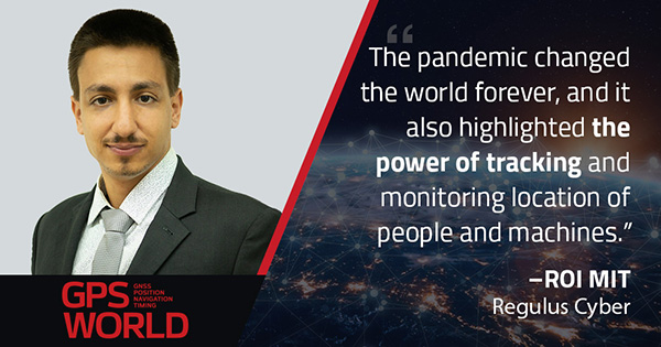
The pandemic changed the world forever, and it also highlighted the power of tracking and monitoring location of people and machines. It is another testament to the immense reliance on GPS technology in our modern world.
The increased deployment of these technologies necessitates increased security measures, especially when public health is on the line. Regulus Cyber offers GPS Cybersecurity software. To read more about it, visit www.regulus.com.
John Fischer, vice president, advanced R&D, Orolia
In 1990, I had just left the military electronics industry (radars, electronic warfare) and entered the growing wireless telecom industry. Recall, this was at the end of the Cold War with shrinking U.S. defense budgets. Alas, after eagerly waiting for the full operational performance of GPS throughout the 1980s, I unfortunately missed its early successes.
I spent the 1990s in startups, working to provide wireless alternatives to dial-up and leased lines. We founded Clearwire, which eventually became WiMax — the broadband wireless on-ramp to this new “information superhighway” we now call the internet.
However, within a few years, we started to look for a way to synchronize our adjacent basestations to avoid interference at overlapping regions. Those of us who came from the military navigation sector turned to GPS. We began to use a GPS receiver to give us a 1PPS sync.
This worked well, although we had to train our installers not to put the GPS antenna high up on the tower with all the others, but low, away from the transmission beams. It was hard for them to believe we got better reception on the ground than up high!
The Trimble Accutime 2000. (Photo: Trimble)
By the late 1990s, Trimble had introduced its Accutime 2000, which made our lives easier. (Everything futurist in those days was called Something-2000 — the new millennium was approaching). Today, it is the standard for time sync, but back then, it was novel.
When I think of the progress in terms of Moore’s Law (semiconductor performance doubles every 18 months), we have been through 20 doublings since 1990. That is an improvement factor of a million!
However, technological advancement alone does not account for GPS’ huge success. The fact that the U.S. military opened its system for use by everyone in the world, and the continued cooperation of all nations in making all GNSS systems interoperable, is mind blowing.
We are living in the world that John Lennon only “Imagine(d)”: all the people sharing. In 2020, we are now focused on GNSS vulnerabilities and protecting the integrity of GNSS signals, which are such an integral part of our daily lives. GPS is truly a modern miracle.
Stuart Riley, vice president of GNSS technology, Trimble
Over the past 30 years, GPS World has been at the forefront of the transition of GPS from obscure technology to ubiquitous utility. The magazine was first published before the satellite constellation achieved Initial Operational Capability (IOC). In fact, it preceded Operation Desert Storm, which created unprecedented publicity and demand for GPS equipment; and has documented a period of unprecedented increase in the rate of change in the technical disciplines.
Thirty years after the Wright brothers’ initial flight, commercial air travel remained expensive, uncomfortable, and available to relatively few people. Compare that to GPS and GNSS — in 30 years the technology has moved from 50-pound receivers powered by car batteries to residing in the pockets and on the wrists of billions of people.
In 1978, the year the first GPS Block-I satellite was launched, Trimble was founded. Trimble’s first product was a Loran receiver in 1980, followed by the world’s first commercial GPS product in 1984. The year the magazine was launched, Trimble became the first publicly traded GPS company in 1990. Positioning technology is in Trimble’s DNA and the foundation for helping transform industries such as construction, agriculture, transportation, geospatial and more.
Two factors drove GPS from obsurity to ubiquity: Rapid technological advances (electronics, software, communications, and increasing numbers of satellites) combined with innovations using positioning to benefit large numbers of users across disparate applications. Think of it as “Moore’s Law meets market demand.”
A Malaysian tribe and the Trimble 4000SLD, the first kinematic “backpack” GPS receiver. Weighing 44 lbs. without batteries, the receiver was introduced in 1988. (Photo: Trimble)
The key to GNSS’s growth is its adaptability. By serving a broad range of industries, GNSS manufacturers addressed widely differing needs for precision, form factors, interfacing, and availability of positions. The markets drove the development of more-capable and cost-efficient solutions and injected varying requirements for performance and functionality.
Recent advances illustrate the ability of GNSS technology to react to market needs. Satellite-delivered PPP corrections enable users to achieve real-time centimeter accuracy with fast convergence time almost anywhere on Earth. Low-cost, high-performance inertial sensors boost performance in challenging environments. Software-defined high-precision GNSS receivers, coupled with augmented reality on consumer devices (phones and tablets), open the door to innovation in as-yet-undiscovered directions.
GNSS is playing a key role in a broad range of applications. For example, compact, high-precision receivers are transforming work by delivering higher levels of productivity, reliability, safety and flexibility in industries including automobile and trucking, precision farming, and earthworks and construction. Future applications are expected to increasingly integrate GNSS with other sensors to drive productivity and safety for autonomous applications.
It took less than 30 years to move from static post-processed positioning to holding centimeter precision in your hand. For those of us who experienced the early days, GNSS has changed the world in ways we never imagined. The next three decades will see GNSS embedded into applications unimaginable today.
And to GPS World: Congratulations and thank you for 30 great years of pioneering the education, awareness, and promotion of the GNSS industry.
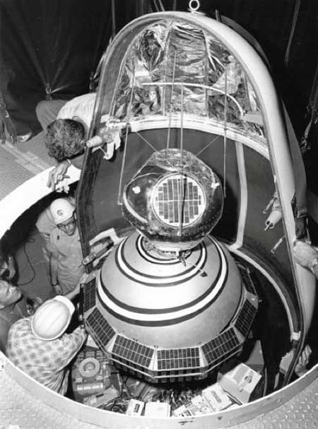
1960: ARPA launched Transit, the first satellite in what would become the world’s first GPS. (Photo: U.S. Army/DARPA)
Sixty-three years ago, on Friday, Oct. 4, 1957, the Space Age began — most everyone alive today is a progeny. The Soviet Union sent a shiny, metal, beach-ball-sized sphere into orbit. Sputnik beeped every second for 21 days before going silent. Its beeps were heard ’round the world. Using the Doppler effect, a listener could tell whether the tiny satellite was moving toward or away from them. Scientists pinpointed the satellite’s exact location by observing it in a single pass, and realized the reverse could also be true. A terrestrial observer’s unknown location could be derived from the known orbit of a single satellite. That idea turned into the first satellite navigation system.
In 1964, the Navy Navigation Satellite System (NNSS) became operational. The highly classified system called Transit was built to support the Polaris ballistic missile submarine fleet. It operated on a small constellation of less than five polar orbiting satellites. With so few satellites in orbit, it could take more than an hour to get a positional fix. Twenty-meter accuracy could be attained by using specially encrypted signals, but these were restricted to submarines. All other users of Transit could only achieve accuracy within 200 meters.
Accuracy was a challenge. The problem was solved the same way John Harrison’s chronometer solved it 300 years earlier, threading together the past and present. More accurate location required more precisely measuring time (see geospatial-solutions.com/from-the-great-pyramids-to-gis-gps/). The problem was solved by two Timation satellites launched in 1967 and 1969 to broadcast a time reference signal. Essentially, the Timation satellites were space-based chronometers.
Timation improved location accuracy, even though it took hours to achieve sub-meter precision. It proved a success, and as a result, in 1967, Transit became available for non-military users, such as surveyors. In fact, everyone today who has ever worked with a reference system is familiar with WGS 84, which was originally based on “Doppler surveying receivers” called georeceivers, referring to measurements from the Transit system. Transit was also known as NavSat as it became more broadly adopted for civilian purposes such as commercial shipping.
In 1973 the Department of Defense sought to combine the success of Transit (NNSS) and Timation into one satellite system, which evolved into the NavStar-Global Positioning System. The first launches began in 1978 and reached a full constellation of 24 GPS satellites in 1993. Since that time, Russia, Europe, China, India and Japan have all created their own constellations. All of those systems combined with GPS make up the global navigation satellite system (GNSS), which totals more than 120 satellites.
Recognizing GPS’s sustained success and positive global impact, in February 2019 the Queen Elizabeth Award for Engineering went to four of the primary developers of the GPS program for their contribution to the world. These four gentlemen are Engineering Stars. On Feb. 12 of this year, President Trump signed an Executive Order further acknowledging the value of position, navigation and timing (PNT) as the invisible infrastructure of modern society. And, on July 1, Capt. “Sully” Sullenberger addressed the Space-Based PNT Advisory Board, stating how GPS has become a universal part of every facet of our lives including financial transactions, transportation, agriculture, rescue operations, surveying and construction.
The GPS satellites are our own constellation and each of them should be named in honor of a scientist or engineer who helped conceive and develop the Transit, Timation and GPS programs; even though the earlier systems no longer exist, their legacy should long be remembered.
From those Cold War origins of a chirping beach ball traveling through space 63 years ago, now more than 2,600 satellites enhance our terrestrial lives providing better communication, location and understanding. We are all children of the stars, albeit stars of our own making.
A new offshore service opportunity for an already proven mini-helicopter UAV, a possible alternative to flying cars, and bulking up UAVs to carry cargo – just a few of this month’s new developments in unmanned aircraft.
Oil Services UAV?
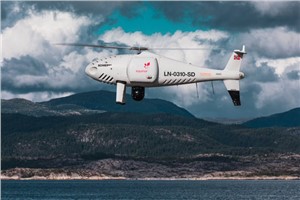
S-100 Camcopter. (Photo: Schiebel)
If you’ve ever gotten close to the Schiebel Camcopter S-100, such as at a trade show, or if you’ve worked with one, you’ve probably noticed that it’s a rugged, weather-hardened vertical take-off UAV.
It would seem that both military and maritime operations would be natural applications — so it’s not surprising that the United Arab Emirates (UAE) Army and German Navy have both bought S-100s.
The U.S. Air Force Research Laboratory (AFRL) also investigated use of the S-100 for detection of improvised explosive devices (IED).
The S-100 is a vertical take-off and landing, unmanned mini-helicopter with a top speed of around 138 mph, a range of just over 100 miles, with two payload bays, an electronics bay, and the ability to carry underslung loads — the all-up payload is 110 pounds. Sensors include an electro-optical/infrared (EO/IR) camera, an electronic support measures (ESM) system for detection and identification of electronic signatures, and synthetic-aperture radar (SAR).
So it’s no surprise that a recent trial demonstrated the S-100’s long-range, high-speed capabilities to deliver parts to a Norwegian offshore oil rig.
Nordic Unmanned and Schiebel flew a demonstration S-100 for rapid delivery of a 3D-printed replacement part from Mongstad out 55 miles to the gas production platform Troll A in the North Sea. This is said to be the first full-scale offshore UAV delivery from shore to an active oil and gas installation.
The demonstration simulated an urgent requirement for a nozzle holder for injecting diesel fuel into the platform’s lifeboat engine. Maintaining safety regulations and production flow from these offshore platforms is essential, but both ship and helicopter emergency trips out to platforms can be risky and downright dangerous in bad North Sea stormy weather — so the UAV option may save lives, time and cost.
Before flying back to base on the mainland, the S-100 also demonstrated its ability to closely inspect the operational platform, and even carried out a simulated search and rescue, locating a dummy in the water and providing live video and location data from its L3 Harris EO/IR camera and an Automatic Identification System (AIS).
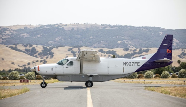
Do we really need flying cars?
Where are we with people-carrying drone taxis and cars? To get them in the air for demonstration flights is tricky — there are a lot of i’s to dot and T’s to cross before agencies like the U.S. Federal Aviation Administration (FAA) allow them to fly. There are also plenty of restrictions on where they can fly — certainly not over populated areas. It will undoubtedly happen eventually, but time is money, and regulations will likely outlast the financial supply for most start-ups.
Because of this, one outfit with significant credentials has taken another tack — automating aircraft that have already earned their certified wings.
The original Cessna 172 Skyhawk test flights and certifications successfully culminated in June 1955. The Cessna 208 Caravan gained FAA approval in October 1984. Both General Aviation aircraft have flown since then with established safety and reliability records. The FAA knows what makes a safe airframe, power plant and aircraft flight controls — what’s needed to qualify a remotely piloted, automated flight control system is surely a lot less than the complete aircraft and its existing systems.
Ex-SpaceX software systems director Robert Rose decided that getting his autoflight system past FAA scrutiny would actually be an easier job. He started Reliable Robotics to get drone aircraft flying sooner.
The company has now developed an autonomous platform that can be retrofitted into virtually any fixed-wing aircraft. The system comprises avionics, flight control software, a mechanical hook-up, and a communications system which enables remote command and control, along with a reversionary backup system.
The autonomous system was integrated into a four-passenger Cessna 172 Skyhawk, and was used in an automated, unmanned gate-to-gate demonstration flight. The system underwent a full system safety analysis and test and the unmanned test flight included automatic taxiing, takeoff and landing.
The Skyhawk was flown without a pilot on board over a populated area, which was an essential part of qualifying the Reliable Robotics platform for safe civil use on an already certified passenger aircraft.
For the next test flight of a larger 14-passenger Cessna 208 Caravan, the integrated system again demonstrated full automatic remote landing of the aircraft. Reliable Robotics hopes that continuing certification efforts with the FAA will soon enable them to sell their automation system for certified unmanned passenger aircraft operations.
Cargo UAV
The majority of unmanned aircraft have been small. There’s even a category called small unmanned aircraft systems (sUAS) — so hanging a pizza on one for delivery by suppertime is about the most cargo you might imagine these things could carry.
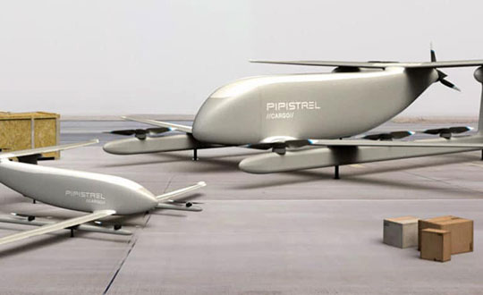
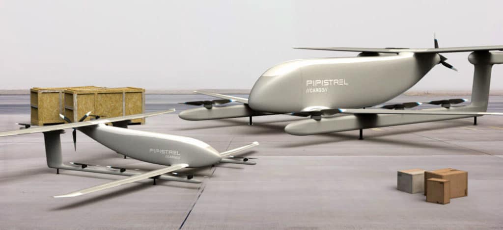
V20 and V300 cargo UAVs. (Artist’s concept: Pipistrel)
One way to overcome this limitation — as we just saw — is to hook up a sophisticated auto-flight system to a passenger aircraft. Another way could be to build a large cargo-carrying UAV — like the Pipistrel (Slovinia) Nuuva V300, which is claimed to be able to carry up to 1000-pounds of cargo over impressive distances.
The vehicle has eight identical electric motors for vertical take-off and landing, and a gas engine powers a pusher propeller for cruise. The vertical lift electric motor has apparently been certified for airborne use by the European Aviation Safety Agency (EASA).
If the V300 cargo is reduced to 110lb, it looks feasible for it to fly over 1500 miles at up to 8,000ft. Pipistrel claims this operational cargo envelope to be 10 times more efficient than for an equivalent helicopter. Pipistrel has also launched a smaller V20 cargo version with the same offset wing set up and smaller electric lift and cruise propulsion — aimed at last-mile deliveries.
Seems the V20 is available fairly soon, but the V300 still has work to do — presumably certification effort – and won’t be available till 2023.
Until next time
So potential oil-platform service deliveries for the S-100 Camcopter, turning already certified aircraft into passenger carrying unmanned vehicles, and UAVs coming for cargo carrying — all are new, promising and different UAV exploits. Let’s hope they all become commonplace in the coming years.
Auto Mining: A driverless Cat 793F CMD truck leaves an iron ore pit. (Photo: Caterpillar)
Individuals who use GNSS today may not know the significant advancements that have been accomplished over the past 30 years to obtain accurate GNSS-derived coordinates, especially GNSS-derived orthometric heights.
Thirty years ago, there were two limiting factors for estimating GNSS-derived heights — estimation of accurate ellipsoid heights in a timely manner and the availability of an accurate geoid model. The geoid model was only good to the decimeter level, between two stations relatively close together. A significant improvement of the measurement of the Earth’s gravity field (such as from the GRACE mission) and digital elevation data (from the Space Shuttle Radar Topography Mission) facilitated the creation of more accurate geoid models. Geoid models went from decimeter values to centimeter, and then sub-centimeter values between closely spaced marks.
A new national network
During the past three decades, the U.S. National Geodetic Survey (NGS) has developed a national network of Continuously Operating Reference Stations (CORS). These CORS, along with the states’ real-time networks (RTNs), have provided the ability to compute accurate GNSS-derived coordinates in an efficient and effective manner. The modeling of antenna phase patterns was a critical development for combining different types of antennas.
Today’s GNSS processing software is basically a “hands-off black-box” system. But 30 years ago, the analyst had to identify cycle slips and ensure that all unknown cycle ambiguities of the carrier-phase data (integers) were determined correctly. It was a time-consuming task, and analysts needed to understand the data. So many things can go wrong when someone relies on an answer from a black box. That said, federal agencies such as NGS and GNSS software companies have produced hands-off software that provides statistics and warning messages, as well as guidelines for ensuring results are consistent and accurate.
The advancements in estimating GNSS-derived coordinates (including orthometric heights) have changed the way many industries do business. Farmers use it to drive their tractors and combines, mining companies control driverless vehicles, construction companies use automated machine guidance to build roads, and, of course, it has improved how individuals navigate from one location to the next.
Hands-off farming and mining
Thirty years ago, few farmers thought they would be able to sit in their cab and let their combine harvester drive itself. Geodesist, surveyors, and engineers had a vision of using GNSS to automate the use of farming and construction equipment, which became a reality.
What will it be like in another 30 years? Will it be routine for individuals to program their car for a destination, and then sit back and read a book?
Positioning with GNSS will be critical for the safety factor of driverless vehicles and the use of drones for delivery. Geodesists, surveyors and engineers, once again, need to lead the way to meet the positioning requirements of the future.
Depending on your age, 30 years represents a varying opinion of time. For some, it may seem like forever; for others, it may be a blink of an eye. In respect to technology, it can represent a complete change in the way we do things.
When we turned the calendar page to January 1990, our world had yet to experience the internet, the Hubble telescope had not been deployed to share its fantastic views, and The Simpsons television series was preparing to become the cartoon juggernaut it remains today.
Yes, lots has changed since 1990, and surveying is no exception.
Most professions look back through their history and see various periods where discoveries and inventions revolutionized how the work was completed.
For surveyors, the past 30 years have contained more advancements than all other years combined, with the greatest achievement being the global navigation satellite system (GNSS). With the United States leading the way with its Global Positioning System and the civilian ability to use this measuring system, modern surveying was forever changed.
Solar and lunar observations replaced
Before the implementation of a satellite navigation system, true global navigation was only computed using solar and lunar readings under specific conditions. GPS provided a new frontier for surveyors to establish positions without having to perform traversing from known points or collecting solar/lunar observations.
As the constellation grew, it became easier to use GPS to gain initialization for accurate and redundant position determination. As processor speeds and data storage capability increased, real-time kinematic (RTK) observations became the norm for surveyors everywhere.
The Russian satellite constellation, GLONASS, began operating fully in the late 1990s, and is now included to create today’s GNSS. More satellites provide more coverage, which in turn means more data collection potential.
Many nations and regions are building their own constellations to augment the current GNSS lineup, and also to safeguard the ability to obtain geographic locations when other systems are not available.
Bathymetric surveys made easy
GNSS capability and integration revolutionized several aspects of surveying, including a new and more reliable way of performing bathymetric surveys over large bodies of water. Computerized depth sounders were programmed to coincide readings with GNSS data collection to provide a more accurate and precise method of hydrographic surveying.
The past decade has continued the reliance on GNSS technology with many more devices and applications — not just for the surveyor, but for the public as well. While surveyors are using GNSS receivers on unmanned vehicles such as UAVs and boats, satellite navigation has infiltrated into many of our everyday routines. Cellphones, fitness trackers and our automobiles use this technology to guide us to our destinations.
Surveyors have used the GNSS revolution to create a digital world for better data collection, asset management and increased efficiency. Much has changed in 30 years for the surveyor and the world around us, so we should not be surprised about what technology will bring us next.
As technology evolves, the Civil Air Patrol will continue to be a platform for implementing new technologies to secure the country in times of crisis.
The strength of this country isn’t in buildings of brick and steel. It’s in the hearts of those who have sworn to fight for its freedom! —Captain America
Eyes of the Home Skies, World War II-era poster of Civil Air Patrol. (Image: CAP)
If you are someone who likes aviation, GIS and emerging technologies like artificial intelligence and computer vision, and you want to fulfill a greater sense of purpose, the perfect time is now.
The Flying Minute Men, so called by Robert Neprud in the 1948 Story of the Civil Air Patrol (CAP), serve on the frontlines of national threats and disasters. They are the air wing for first responders.
CAP works with many government organizations including the Federal Emergency Management Administration (FEMA), The National Geospatial-Intelligence Agency (NGA), the National Oceanic Atmospheric Administration (NOAA), the Army Corps of Engineers, the National Guard, and many others.
CAP works with non-government organizations too, such as the United States Geospatial Intelligence Foundation (USGIF), the GIS Corps, the National Alliance for Public Safety GIS (NAPSG), and the Red Cross.
CAP also works with youth teaching valuable skills in leadership, community service, STEM and aviation. It has a proud heritage originating in World War II.
In the final days of 1941, the world was in flames. Dark shadows lurked in the waters off American shores. German U-boats attacked ships along the coast. The newly established Office of Civilian Defense understood the importance of aviation for stopping the U-boat threat but lacked the military resources. On Monday, December 1, 1941, six days before the attack on Pearl Harbor, Administrative Order 9 was signed creating the Civil Air Patrol, but there would be no celebration. The threat was all too real. The Battle of the Atlantic had begun. Within a few months Germany sank over 230 ships in U.S. waters. American shores were on fire.
A list of known shipwrecks and their locations in U.S. waters can be downloaded from NOAA’s Coastal Survey website. It is not a complete or a clean dataset so some wrangling will be required. A shortcut is using the shipwreck layer in Google Earth. Along the Atlantic Coast, Gulf of Mexico, and Caribbean Sea there are multiple sunken German U-boats. Most notably are U-85, the first U-Boat sunk by the U.S. Navy in WWII, less than 20 miles off of Nag’s Head, North Carolina (35.885, -75.2829); and U-853, the last one to be sunk in WWII 10 miles off the coast of Rhode Island less than 24 hours before Germany’s surrender (41.2268, -71.4187).
The American tanker SS Harry F. Sinclair burns south of Cape Lookout North Carolina, torpedoed by U-203 on April 11, 1942. (Photo: U.S. Naval History and Heritage Command)
During the War, the Civil Air Patrol flew 5,684 aerial escorts for shipping convoys keeping the sea lanes safe and enabling supplies to get to Europe and North Africa. Shortly after the war, on July 1, 1946, President Truman recognized the valuable contribution made by the Civil Air Patrol making them permanent, but once again there was no celebration. On the same day, responding to overwhelming public attention, TIME published “COSMOCLAST EINSTEIN: All matter is speed and flame.” Radios around the world tuned-in as the clock counted down to zero hour. The first post-war atomic bomb was detonated at 22:00 Greenwich Mean Time (5:00 PM Eastern) in Bikini Lagoon (11°36’00” N 165°29’00” E) over a ghost fleet of ninety-five ships in the middle of the Pacific. History’s long shadow fell over the moment. The applause of a grateful nation for the Flying Minute Men was silence.
It is the mark of real heroes, duty is the highest honor, the rewards are personal having the courage to stand in the face of danger and clasp the hand of Victory. It is valor not fame that makes heroes of normal men and women. The Civil Air Patrol rarely makes the front page, but it supports many of the nation’s most significant events.
Photo of Ground Zero taken on September 12, 2001 by Civil Air Patrol. (Photo: CAP)
The first photographs of Ground Zero released to the public the day after September 11, 2001, were taken by the Civil Air Patrol. With the creation of the Department of Homeland Security in 2002 the Civil Air Patrol took on a much larger role in homeland security. CAP serves a unique purpose flying a multitude of missions because aircraft can fly for extended periods at optimum altitudes to get the best resolution. CAP imagery is often the most currently available and of the highest quality after an event. The Civil Air Patrol aircraft can carry interchangeable sensor arrays, such as thermal cameras, synthetic aperture radars, lidar, communications equipment, and more. Imagery collected by the Civil Air Patrol is publicly available on the CAP GIS Portal.
In 2017, FEMA hosted a Disaster Crowdsourcing Exchange laying a foundation for working with the Civil Air Patrol to push the imagery out to various crowdsourcing channels. The Red Cross Humanitarian OpenStreetMaps Team (HOT) used it to map road networks. Crowdsourced imagery analysts used it for feature extraction and damage assessments. In 2018, this effort was developed further using Hurricane Michael imagery of Panama City, Florida, for creating artificial intelligence algorithms to identify and extract features.
The Civil Air Patrol captures imagery with the WaldoAir XCAM Ultra 50 by flying in overlapping circles as the aircraft sweeps over a disaster area. The overlapping images allow the system to create high-resolution 3D point clouds. The spatial intelligence algorithms employed with post flight processing conducted by Skyline and GeoX can automate feature extraction of buildings, vehicles, bridges, roads, cell towers, and other structures, and identify structures as destroyed, damaged, or undamaged. The system can begin damage assessments almost immediately. The process used to take several weeks with an enormous cadre of specialists and resources and now it can finish in a few days or less with a handful of specialized staff.
I had the privilege of speaking with the Director of Operations for the Civil Air Patrol, Mr. John Desmarais, or Moose as his friends know him. He is a 33-year veteran of CAP, has a pilot’s license, a master’s degree from Embry-Riddle Aeronautical University and is married with two children. Moose shared how September 11th, 2001 changed his commitment and understanding of C.A.P.’s role working with and supporting homeland security missions. He shared with me some of the stories above and gave me an in-depth look into CAP’s future.
Screenshot: Civil Air Patrol
Today, the Civil Air Patrol supports important missions. For FEMA CAP does post-event damage assessments after hurricanes, floods, tornadoes, fires, earthquakes, dam bursts, and more. This will be able to get people the assistance they need much faster ultimately saving lives. This year alone, the Civil Air Patrol has saved 91 lives according to the Air Force Rescue Coordination Center. Other examples are providing search & rescue, border protection, homeland security, emergency flight services, remote sensing, humanitarian support, education and training, and Air Force training support to name a few. These initial successes led Christopher Vaughan, the Geographic Information Officer of FEMA, to request the Civil Air Patrol provide GIS support for natural disaster operations. CAP remains very active fulfilling that commitment. Mr. Desmarais said that CAP took close to half a million pictures for the 2018 hurricane season. FEMA hosts all of CAP’s publicly available imagery as part of its GEOPlatform.
Civil Air Patrol Cessna. (Photo: CAP)
GIS has always been a huge part of what the Civil Air Patrol does when looking at it from a basic level of identifying locations, features, and information. Now, GIS is becoming central to the operations of the Civil Air Patrol because it is a force multiplier as in the example above, using spatial intelligence for completing disaster estimates in days instead of weeks with a fraction of the staff. This is powerful and driving the future of CAP towards a more geocentric operation. CAP’s GIS future is in modeling, remote sensing, crowdsourcing, artificial spatial intelligence, and data sharing.
In 2019, the Civil Air Patrol proposed its path forward creating opportunities for its members to gain valuable GIS skills and creating a qualification in GIS Operations. The Civil Air Patrol has recently begun fielding courses with support from its partners to provide training qualifications. Members of CAP can receive the following training courses: GIS for Emergency Managers, GIS Applications for Emergency Management, GIS Specialist and training in HAZUS, a GIS-based hazard analysis tool. This requirement for operations to become geocentric is so great that a call went out for people who are doing GIS work to reach out to the Civil Air Patrol Wing in their local area and consider joining. To find out more get in touch with your local Wing, visit www.GoCivilAirPatrol.com and enter your zip code to find a CAP squadron near you or you can reach out to the CAP National GIS team at [email protected] for more information. The Civil Air Patrol is using GIS more every day for search and rescue operations where CAP members are locating aircraft crash sites using ADS-B and radar data, and locating missing persons using cell phone forensics, and creating situational awareness maps for tracking resources and planning purposes for CAP senior leaders.
The Civil Air Patrol is investing into autonomous aircraft technologies. It has the largest inventory of small unmanned aerial systems (sUAS) for civilian/ public safety use in the nation. The great advantages to CAP for sUAS are their low costs to deploy and their ability to collect close-up, high-resolutions imagery with minimal risk to people. In disaster areas flying low level flights are extremely hazardous to piloted aircraft because wires and cables and other smaller objects that have shifted. The use of sUAS will fly alongside emergency responders and CAP expects to have sUAS available for each of its 150 incident command posts across the country by the end of 2020 with over 1,000 trained operators nationwide.
In the future, the high-resolution 3D imagery point clouds will enable the Civil Air Patrol to provide real-time virtual environments and augmented reality enhanced awareness for humanitarian assistance and disaster relief operations, especially when that imagery is infused with powerful geographic information systems and artificial spatial intelligence algorithms.
In the near term, the Civil Air Patrol will be expanding the number of aircraft it has equipped with FLIR and other high-end sensors and will continue growing its sUAS operations. It will continue its outreach efforts to build working relationships with new partners and bring onboard volunteers interested in supporting GIS and imagery analysis.
As technology evolves, the Civil Air Patrol will continue to be a platform for implementing new technologies to secure the country in times of crisis. The words spoken by Colonel Scott at the First Report to Congress in May 1948 continue to ring true.
“I predict that the Civil Air Patrol will grow immeasurably stronger — it will continue to contribute to the strength and the security of this nation.” —Colonel Scott, First Report to Congress, May 1948
GPS had been around for about five years before first launch in February 1978 and Full Operational Capability (FOC) was eventually declared in April 1995. It takes time to develop, field and prove something as complex as the world’s first satellite navigation system. But we’re now well into a third generation of the venerable GPS, with GLONASS, Galileo, BeiDou and IRNSS/NavIC and QZSS around the world and in geographic locales. So, putting aside Transit or anything else, this would make GPS about 47 years old — heading into middle age.
Therefore, it would seem that Glen Gibbons waited until “this GPS thingy” looked like it might actually work — circa 1990 — to launch GPS World, since the magazine is now 30 years old and is also into its third-generation of editor-custodians! Alan Cameron bravely carried the flag after Glen and nurtured the magazine for a good number of years and brought me into the fold as a contributor. We shared ION GNSS conventions and GPS World Leadership dinners and he was able to cajole monthly articles out of me for many years. Now Marty Whitford has his hand firmly on the tiller as publisher, with Tracy Cozzens as senior editor.
So what went down during these decades of technological advancement and for many of the people in the satnav industry? It would be impossible to answer within my word-limit, so I’ll take on an extremely small subset and recount a few things I can still remember.
µGPS. I got into GPS around 1990 in an OEM board-level product spin-off program from a certified GPS airborne receiver at CMC in Montreal — we initally called that L1 receiver µGPS because then it was a small GPS board. Later it became known as the AllStar receiver. We found pretty neat applications for the early ’90s — golf-course systems, vehicle tracking, airport vehicle tracking, the start of vehicle nav systems and such.
At NovAtel in Calgary in the early ’90s, we watched things develop through L1/L2 dual frequency, began RTK market applications in survey, geographic information systems (GIS), agriculture, mining and all multitudes of attempts to get new companies off the ground.
WAAS. Eventually the U.S. Wide-Area Augmentation System (WAAS) program came and swallowed us up through three different prime contractors. Once that Federal Aviation Administration program was running well, we were into programs in Europe, Japan, India and China, and that led into Galileo ground reference receivers. The software qualification work we did on Galileo positioned us to take on mil-spec receiver work, and even anti-jam products.
Then CMC bought NovAtel, and we also joined with CMC to develop a certified airborne receiver. In 2003, NovAtel bought the AllStar OEM product line from CMC — funny how things work out! The joint certified receiver program eventually resulted in a new generation of high-accuracy airborne sensors. We again changed hands in 2007 when Hexagon bought us, and then NovAtel began working closely with Hexagon subsidiary Leica on survey applications. Many new and interesting developments are still going on there.
Nowadays, my interests lie with assisted GNSS and with Rx Networks in Vancouver, which I support and advise. Assisted GNSS comes in many forms, has many avenues in the marketplace, and presents its own unique challenges.
As GPS has evolved into GNSS and into so many, many applications, companies have come and gone but the core of people who drive the industry has grown and acquired new and specialized skills, developing ever more capable technology and products. Even after 47 years of the industry and 30 years of GPS World, we aren’t anywhere close to done.