Category: Opinions

  • GPS aboard the world’s highest, fastest manned gliders

    Featuring an exclusive interview with Astronaut Scott Kelly from aboard the International Space Station

    This month, we discuss sailplanes of all sorts and conduct a brief on-orbit interview with Astronaut Scott Kelly concerning his time piloting the space shuttle — actually a supersonic glider. We touch on the role GPS played in making it a safer rocket glider. Kelly also gives us an update on his time aboard the International Space Station (ISS), nine months and counting.

    You can jump straight to U.S. space shuttles: The world’s highest flying and fastest manned gliders for the interview. For some background on gliders, read on.

    Combat Gliders versus Sailplanes

    When you think of gliders — or more accurately sailplanes — you probably think of long flexible wings, slow flight, bubble canopies, pristine white aircraft gleaming in the sunlight and tow requirements. For most aviators, the holiday picture of the beautiful Schleicher Model 32 sailplane below typically comes to mind.

    AS (Schleicher) Model 32. (Courtesy of AS GMBH)
    AS (Schleicher) Model 32. (Courtesy of AS GMBH)

    However, there are certainly some World War II combat glider pilots living today, heroes all, although unfortunately fewer and fewer everyday, that think of gliders in a very different way. They think of and remember huge green, tan and camouflaged wooden and cloth flying machines that carried 10 or more troops, who — if they lived through the experience — were able to wear glider rather than paratroop badges.

    Army General William C. Westmoreland said of the heroic combat glider aviators, “Every landing was a genuine do-or-die situation . . . it was their awesome responsibility to repeatedly risk their lives by landing in unfamiliar fields deep within enemy-held territory, often in total darkness. They were the only aviators during World War II who had no motors, no parachutes, and no second chances.”

    The venerable wooden and cloth combat gliders of World War II were about as far removed from soaring sailplanes as a glider can be. Once released, they glided or, more accurately, careened to Earth. They were versatile and rugged enough to carry combat vehicles behind enemy lines and land in rugged terrain. but they most certainly did not soar.

    The courageous flight crews did not have the luxury of GPS. Navigating for the short time after the tow vehicle — typically a transport, cargo (C-24) or bomber aircraft (like the B-24) — dropped them off at altitude, almost always below 10,000 feet, was a very hit or miss affair. There were only four very basic flight instruments on the glider’s rudimentary control panel, which most of the pilots completely mistrusted and ignored.

    Glider flying in World War II was strictly VFR, or visual flight rules. Veteran glider pilots tell me that finding your landing zone (notice I did not say runway) was frequently haphazard. Often they had to make do with any decent-sized farmer’s field as a landing zone. Frequently, these landing were made in broad daylight, behind enemy lines, amid a hail of bullets, so they were fraught with danger in many ways, including not knowing their exact location when they finally landed. Glider infantrymen and glider pilot casualties reached 40 percent for some missions. What would they have given for a GPS?

    The venerable WACO gliders were the most common versions. By war’s end, more than 13,900 CG-4A gliders had rolled off the production lines of several companies mass producing the same design for approximately $15,000 per copy — although one company charged as much as $50,000 per unit. It is estimated that less than one tenth of 1 percent of the gliders survived to fly after conflict ceased in 1945.

    According to the Silver Wings National World War II Glider Pilots Association, “Over 6,000 individuals were trained as combat glider pilots and earned their silver wings with MOS (military operational specialty) 1026. Approximately 150 glider pilots and Troop Carrier Veterans still participate in the group’s activities, although their numbers are declining with ages in the 89- to 96-year group.

    Author Michael MacRae, writing on the ASME (American Society of Mechanical Engineers) webpage in an article titled “The Flying Coffins of WWII,” describes the WACO CG-4A as America’s first stealth aircraft, but also as an aircraft expendable by design: “The CG-4A fuselage was 48 feet long and constructed of steel tubing and canvas skin. Its honeycombed plywood floor could support more than 4,000 pounds, approximately the glider’s own empty weight. It could carry two pilots and up to 13 troops, or a combination of heavy equipment and small crews to operate it. The nose section could swing up to create a 5 x 6-foot cargo door for Jeeps, 75-mm howitzers, or similarly sized vehicle. With a wingspan of 83.5 feet, the Waco maxed out at 150 mph when connected to its tow plane. Once the 300-foot length of 1-inch nylon rope was cut, typical gliding speed was 72 mph.”

    Gliders first appeared in U.S. combat operations in the 1943 invasion of Sicily. They flew on D-Day into Normandy, June 6, 1944, and in other important airborne operations in Europe such as Operation Market Garden, the Battle of the Bulge, and crossing the Rhine, as well as in the China-Burma-India Theater.

    After World War II, the gliders participated in U.S. military exercises in 1949, but glider operations were deleted from the U.S. Army’s capabilities on Jan. 1, 1953. Today, only special forces use gliders for silent, small-scale insertion.

    Sailplanes

    In contrast, a modern-day open competition glider built by the world-famous Alexander Schleicher (AS) company, for example, can soar to more than 50,000 feet with a supplemental oxygen supply, cruise at 280 kph or 170+ mph with a glide ratio of up to 80:1, with flight durations lasting more than 50 hours. Most modern sailplanes today fully incorporate GPS into their avionics suite that rivals any powered aircraft cockpit.

    Contrast this with the World War II combat gliders that careened Earthward with somewhere between a 16 to 30:1 glide ratio at 70+ mph on a trajectory that typically lasted 10-15 minutes max. Sad to say, most of the operational versus training flights during World War II were one-time affairs and one-way trips, but they delivered the goods, including some very expensive firewood once the gliders were abandoned. Certainly, the WACO CG-4A glider was the last of its genre. Mothballed at war’s end, fewer than a dozen restored gliders exist today.

    Rocket Gliders

    Now to the heart of the matter. Gliders have evolved in ways that are difficult to imagine. Many of the aircraft that have broken world altitude and speed records are actually gliders, although we don’t typically think of them as being among that genre.

    Messerschmitt Me 163B at the National Museum of the United States Air Force. (U.S. Air Force photo)
    Messerschmitt Me 163B at the National Museum of the United States Air Force. (U.S. Air Force photo)

    Typically a rocket-powered glider consumes fuel at a rapid rate, so most glide in for a landing. Examples include the German Messerschmitt Me 163 rocket-powered interceptor seen above, as well as the American series of research aircraft starting with the Bell X-1, which first flew and glided in for an unpowered landing in 1946. Examples of the type include the North American X-15, which spent much more time flying unpowered than under power.
    In the 1960s, research and development or test vehicles now known as unpowered lifting bodies such as the X-20 Dyna-Soar space project vehicle were all the rage, and even though the X20 was eventually cancelled, the R&D led directly to the development of the U.S. space shuttle.

    U.S. space shuttles: The world’s highest flying and fastest manned gliders

    NASA’s now-famous and retired space shuttle first flew on April 12, 1981. The shuttle, which was a powered rocket during liftoff and cruise, re-entered as the fastest glider known to man at Mach 25 at the end of each spaceflight, landing entirely as an unpowered glider that, ironically, created its own sonic boom when it re-entered the atmosphere.

    The U.S. space shuttle and its Soviet equivalent, the seldom-seen Buran shuttle, were by far the fastest aircraft ever to fly and, by a wide margin, the fastest gliders ever to fly in space and in the atmosphere.

    NASA astronaut Scott Kelly floats aboard the International Space Station after the hatch opening of the Soyuz spacecraft Mar. 28, 2015. (Photo: NASA)
    NASA astronaut Scott Kelly floats aboard the International Space Station after the hatch opening of the Soyuz spacecraft Mar. 28, 2015. (Photo: NASA)

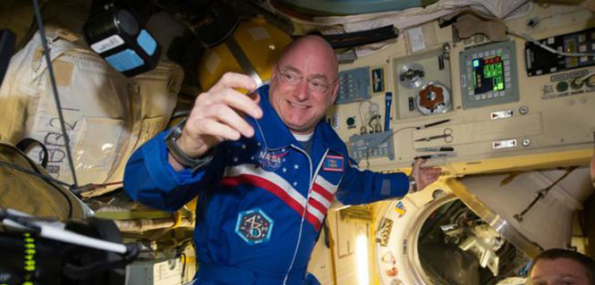
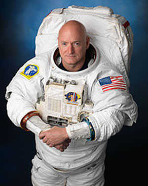
    One of the more well known space shuttle command pilots is Commander Scott Kelly, who as I write this is well into his ninth month aboard the International Space Station (ISS). He has three more long months to go before he returns home to a hero’s welcome and a battery of medical tests to determine how longevity in space affects the human body by comparing him to his astronaut twin who remained Earth-side during the same 12-month period. You know Einstein’s general theory of relativity, divided by telomere length and all sorts of quantum mechanics and medical technology. Talk about being poked and prodded.

    Scott Joseph Kelly (born February 21, 1964) is an American astronaut, engineer and a retired U.S. Navy Captain. A veteran of three previous missions, Kelly was selected in November 2012 for a special year-long mission to the International Space Station, which began in March 2015.
    Scott Joseph Kelly (born Feb. 21, 1964) is an American astronaut, engineer and a retired U.S. Navy Captain. A veteran of three previous missions, Kelly was selected in November 2012 for a special year-long mission to the International Space Station, which began in March 2015.

    Scott Kelly is interesting for one more record he created during his time as a shuttle commander and shuttle command pilot. He flew the first-ever space shuttle GPS approach on Aug. 21, 2007, on STS-118. When I first heard about this feat, I thought it would be interesting to talk with Scott about it, and I made plans to do so upon his return from the ISS in March 2016.

    However, through the marvels of instant messaging and the good graces of my friend Joe Rolli at Harris Corporation (nee Exelis, nee ITT) I was put in touch with Scott Kelly.

    We conducted our brief interview electronically with nary a glitch even though Scott is hurtling around the Earth in low Earth orbit at a speed of approximately 17,150 miles per hour (about 5 miles per second). This means that as Scott orbits the Earth, he experiences a sunrise once every 92 minutes for a total of 5,634 sunrise events during his year on orbit.

    Relatively, however, compared with the speed of electrons or light, which travel at 670,616,629.4 mph in the vacuum of space, Scott and I — who are traveling at a differential of 17 orders of magnitude compared to electrons — are essentially standing still. So the seemingly huge speed differentials makes little or no difference. Again Einstein, Newton, Schroedinger and probably his cat, if alive, would beg to differ on a technicality, but for our intents and purposes, I stick by my statement.

    Here’s how that interview went. I want to publicly thank Scott for taking the time out of an incredibly busy schedule to talk with us about the importance of GPS and the space shuttle. Scott currently serves as Commander of the ISS on the one-year mission. In October 2015, he set the record for the total amount of days spent in space by an American astronaut — 382. As this article goes to press, Scott has spent more than 445 days in space.

    NASA astronaut Scott Kelly has been aboard the International Space Station since March as part of an endurance mission to test the effects of long-term exposure to space.
    NASA astronaut Scott Kelly has been aboard the International Space Station since March as part of an endurance mission to test the effects of long-term exposure to space. In this July 12, 2015, photo he poses for a selfie in the “Cupola” of the ISS. (Photo: NASA)

    (Don: Don Jewell, GPS World Defense Editor; Scott: Astronaut Scott Kelly)

    Don: Scott, thanks for taking the time out of your busy schedule for our questions concerning GPS and the first space shuttle approach made using that technology, which you flew several years ago now.

    Scott: This was eight years ago and I don’t have notes here, so this is my best quick effort.

    Don: Why did NASA decide to approve GPS approaches for the space shuttle, and why were you chosen to fly the first one? I would assume that your experience, safety, approach options and flexibility would play a part here.

    Kelly-patchScott: TACAN was going away. I wasn’t assigned to STS-118 because of this. This was a secondary DTO or Developmental Test Objective.

    Don: Was a GPS approach after that first landing always an option?

    Scott: GPS approach is kind of a misnomer. We incorporated GPS into the navigation state [for the space shuttle] from about Mach 5 [five times the speed of sound] until we transitioned to a microwave landing system on final.

    Don: Were the certified and validated GPS approaches unique, or did they mimic current approaches such as ILS or VOR/DME?

    Scott: Actually, Don, they have little to do with the GPS approaches aircraft fly.

    Don: Were there both precision and non-precision GPS approaches? Do you remember the approach speeds and critical points in the approach? Can you discuss them? Since some of the alternates around the globe are in fairly primitive locations, did GPS make them more accessible and actually provide more alternates?

    Scott: Again, GPS was used to update our navigation state. On an approach to a runway without an MLS (Microwave Landing System), GPS would have been our primary navigation source to the ground, but its not like we would be looking at an approach plate.

    Don: What were the minimums for a GPS approach, before you could start a descent profile for a GPS (aided) approach and landing?

    Scott: Actually, Don, our weather minimums were pretty restricted before we could start the de-orbit burn [while still in orbit]. Ceilings of 5,000 feet I think.

    Don: At what point in your descent profile were you or NASA required to make a decision about your landing location and alternates? And, related to that, was there a typical point during the descent profile where you were committed to a landing location and could not choose an alternate? How far was that from your landing site nominally?

    Scott: Legally you could re-designate after the de-orbit burn to an alternate [landing] site, but this would be in a very critical situation and was never done. Basically, when we did the de-orbit burn, we were essentially committed to landing at the chosen airfield.

    Don: In an emergency, were you able or authorized to land at an alternate that did not have an advance NASA team in place, and were you able to fly the space shuttle totally manually or were computers always involved for stability?

    Scott: Yes, and computers were always involved.

    Don: Many modern fighters are inherently unstable. When the last computer fails, ejection is the only option. How did this apply to the space shuttle?

    Scott: We were [essentially] fly by wire…the shuttle can’t fly without at least the backup flight control system (FCS) computer. Nominally, we have four FCS computers online.

    Don: Since aerodynamically you were essentially flying the world’s fastest and highest flying glider, at what point were you committed to a landing site? What discretion as the Pilot in Command did you have, or was it all up to NASA headquarters?

    Scott: When you did the de-orbit burn, you were committed to a landing attempt somewhere. If you had communications with the Mission Control Center (MCC), they decided where you would land. [With] no communications, it is up to the commander in an emergency.

    Don: The space shuttle exceeded the speed of sound by a factor of 25 in the Earth’s atmosphere (Mach 25) on approach. What were the handling characteristics when this occurred? While there was obviously a sonic boom, where there any handling anomalies that required manual inputs from the pilot in command?

    Scott: There was a little buffeting — sort of like running off the road in a pickup truck.

    Don: Speaking of alternates, if your landing gear failed to deploy, or you had an indication that there was a gear malfunction, where you able to land on alternate surfaces such as grass or sand? Most importantly, in your opinion, would the shuttle and crew have survived a water (ocean or lake) landing? And were these alternate landing sites planned for or simulated to any high degree of fidelity?

    Scott: The simple answer is you would try and bailout, but of course crash, if you had no choice.

    Don: Finally, your comments. What was it like to pilot the space shuttle, and what did having a GPS approach available mean to you?

    Scott: It was a privilege. GPS allowed us to continue to fly the space shuttle as legacy systems like TACAN were retired.

    Don: Thank you so much for your time. If you have some comments concerning your current one-year experiment aboard the ISS, that would be great.

    Scott: Sure, Don. I am currently a little over 270 days into my one-year flight aboard the ISS and going strong. Plus, to bring this all back to GPS, I can definitely say that GPS is working well on the International Space Station. We also have a Garmin GPS in the Soyuz, which we would break out in an emergency situation, and use a handheld satellite phone if we had an off-nominal landing, to tell people where we were.

    The International Space Station. (Photo: NASA)
    The International Space Station. (Photo: NASA)

    Space Station and GPS

    It is a good thing the GPS receivers on the ISS are working as well as they are. Since 2002, they have been the primary means for determining attitude, position, speed and universal coordinated time reference on the ISS. The GPS position of the ISS, which moves at five miles per second, is accurate to within 10 meters and is updated continuously.

    Previously, according to NASA, the station’s position was determined using ground tracking and other techniques. That information was considered to be adequate if not overly accurate, as it was updated just once a day. Just before an update, the actual and propagated position of the station, the ephemeris, could differ by as much as 10,000 meters.

    Specifically, the ISS uses the GPS position and velocity solution as the ISS navigation state. The ISS’s attitude determination filter combines the GPS receiver attitude information with ring laser gyro data available from the ISS rate gyro assembly (RGA) to produce the ISS attitude solution.

    Today, continuous accurate knowledge of the space station’s location also keeps it safely out of the path of wayward space debris.

    So now you know something about sailplanes, combat gliders, the U.S. space shuttle, the ISS, Astronaut Scott Kelly and how they are all affected by GPS. Even more importantly, I hope this column reinforces for you the ubiquity of the Global Positioning System.

    GPS is the world’s time keeper and primary global time distribution system. GPS time synchronizes networks, computers, communications and any number of other devices, from Apple iWatches to undersea navigation, to systems used by private pilots, airlines, spacecraft and astronauts in deep space. You name it: If it uses time, chances are GPS time is the provider, with an incredible stability of 1E-14.

    Indeed, you should think of GPS as an enabler. It enables so much of our technology today that it would be difficult to imagine living without it. Contrary to popular belief, even in the U.S. government, GPS is robust and reliable and becoming more so every day. Just think about it: GPS tells us when and where we are, how to get where we are going, and whether or not we are late. An amazing system, brought to you free of charge by the United States Air Force.

    Until next time, happy navigating.


    Featured photo: NASA

  • Taking Position: Women in PNT extend a hand

    A first-time gathering at ION GNSS+ gives mentors in the GNSS field an opportunity to help newcomers.

    By Tracy Cozzens
    Managing Editor

    I had the privilege of attending a unique and special gathering at ION GNSS+ this past September. The meet-and-greet event was Women in PNT, sponsored by the Institute of Navigation (ION), Spirent Federal Systems and NovAtel.

    “The idea to organize it cropped up last Janu­ary in discussions with sev­eral ION colleagues, men and women, who recognize that both academia and industry in the navigation-related fields may not be considered as an attractive career path for young female professionals, due to insufficient mentorship and too few role models,” explained organizer Dorota Grejner-Brzezinska, who is ION president, a professor at The Ohio State University and contributor to GPS World. “The main goal of this, and future gatherings, is to show the younger women in PNT that balancing engineering or academic career with family life is quite possible, and that there are many of us out there who can mentor, advise and help.”

    The guests were treated to a variety of delicious hors d’oeuvres shared with champagne, and plenty of time to get acquainted and network. But the highlight of the event was the stories and perspectives shared by the eight designated mentors, who discussed the tricky business of balancing home life and work life, including motherhood, despite building a career in a challenging male-dominated field.

    More than 60 women attended the event. “I didn’t even realize we had that many ladies in the PNT community,” said Grace Gao, assistant professor, University of Illinois at Urbana-Champaign.

    “I hope that the younger women were able to network and take away some of the advice and wisdom provided,” said Francine Vannicola, mathematician, U.S. Naval Research Laboratory.

    A poll conducted after the event showed that all attendees are likely to attend another such gathering, and everyone found it not only satisfactory, but valuable. One attendee commented, “I was trying to make a time sensitive career decision, and it was extremely helpful to discuss it with people who fully understand the field but have absolutely no involvement in the outcome. Their feedback was valuable and unbiased.”

    The mentors also found the networking opportunity invaluable. “I got to talk to several fellow PNT women whom I would probably not have met in, say, the exhibition hall,” said Anna Jensen, professor, KTH Royal Institute of Technology. “Also, it was encouraging and motivating to hear the stories from the other panelists.”

    “As I entered into engineering school, I felt a great deal of competition between the men and women,” said Ellen Hall, president, Spirent Federal Systems. “I felt it in the workplace, also. But at the women’s PNT event, it seemed like a support group where all guard could be let down, and everyone genuinely wanted to help one another.”

    “As a young woman I often discounted specific women in science or engineering events because I didn’t think they were necessary and that I already knew how to run with the boys,” said Sandy Kennedy, director and chief engineer, NovAtel. “Now that I am older, I see the value in them because we do have specific challenges to face. And as a hiring manager, I also value these events to meet students and new grads.”

    “I think this is a great event that brings women together not to be judged by their papers and presentations,” said Jade Morton, professor, Colorado State University. “Instead, we were all in the same room to support each other, and to share our own struggles and triumph. That was wonderful!”

  • Out in Front: Resilient navigation and timing

    Space maps of some of 13,986 satellites, below, and some navigation satellites, above (courtesy Esri).
    Space maps of some of 13,986 satellites, below, and some navigation satellites, above (courtesy Esri).
    Alan Cameron
    Alan Cameron

    Advocacy in the U.S. capital urges augmentation of GPS/GNSS with eLoran and other “complementary terrestrial PNT services to increase resilience.” See the Resilient Navigation and Timing Foundation’s website, rntfnd.org. This is assuredly a good thing, a worthy cause.

    I’ve come to believe, however, that true resilience goes beyond what we normally think of as position and timing sensors. Stimulus comes from a keynote lecture by Dawn Wright, Esri chief scientist, at the 2015 American Geophysical Union Fall Meeting. I hope Esri or the AGU will publish the lecture or post the video. For now, bear with my limited rendition.

    In “Toward a Digital Resilience, with a Dash of Location Enlightenment,” Wright describes the new science of big data: the flood of info from satellites, sensors and other measuring systems; the issues inherent in large data sets; and the insight discovered through their manipulation and exploration. She talks to geographic information systems professionals, software makers and users, but her remarks resonate beyond that associated industry sector and well into that of PNT hardware, where we live.

    Integrate, integrate, integrate! Interoperability and crosswalking with other systems and data sets. To make it reproducible, make it virtual — as in virtual, living journals. These are three of the eight ideas toward digital resilience that she espouses, making communities more resilient with tools and data.

    I’ll return to this in a later editorial; there’s much around which still to wrap my head. But here’s the moral: resilient PNT will ultimately mean more than complementary sensors. It will entail a seamless mesh of hardware and software, of pre-existing and new data, much of it from sources we don’t currently consider PNT-relevant, of input from amateur app makers and users and more.

    It’s a big universe out there.

  • OpenSensorHub: Tackling a modern geospatial ‘Tower of Babel’

    Last summer at the Space and Missile Defense Symposium, GEO Huntsville held its annual GEOINT workshop including a keynote by NGA (National Geospatial-intelligence Agency) Deputy Director Sue Gordon. One of the sessions, presented by Mike Botts, focused on the OpenSensorHub and related information published on GitHub.

    His topic: clearing the path for use of geospatial-capable devices via the Internet, thus preventing a geospatial Tower of Babel.

    In the mid-80s, I purchased my first personal computer from Sharper Image, a 286 with a monochrome monitor. The PC was not bad for its time, and I learned a lot about personal computing, but hooking up a dot-matrix printer at the time was a nightmare. There were numerous types of printer cables — 25-pin parallel, 36-pin Centronics, 15-pin, etc. Additionally, some printers needed changes to the pin configurations, so nothing about the process was easy.

    Then, after the mechanical connections were made, proper drivers had to be loaded, not to mention operating system and software configuration. Today, you simply plug in a USB cable or go wireless and are off and running thanks to “plug and play.” However, plug and play is only common in popular mass-market devices such as printers, scanners and cameras. Most other devices, even commercial consumer devices, can still present maddening connection challenges.

    One example: About five months ago, I tested more than a dozen different Internet video security cameras for a special project. All the cameras I tested touted quick and easy connection. Some were quite nice, while others were installation torture — I returned those after a few days.

    One well-known consumer brand was especially bad. I spent more than three hours with hard-to-understand tech support in India, and after countless different IP configurations and tests, I gave up. I decided that my remaining life is too short to waste that much time on a poorly designed camera system.

    (By the way, the FLIR FX and Netgear Arlo were my top choices. Both connected fast and easy, both have especially nice cloud applications and both are wireless, including power. The FLIR is rechargeable, but the battery life of the Arlo seems remarkable, although some reviewers differ, especially outdoors and in freezing weather. In my test, after three months of flawless operation indoors, the Arlo is still on the original set of batteries at 60 percent, so it gets my top nod.)

    OpenSensorHub

    What is OpenSensorHub, and what are they doing to help achieve universal plug and play? By their own definition:

    “OpenSensorHub is a license free, open source software platform for geospatial (FOSS4G) sensors that allows you to easily, rapidly and affordably network sensors into a seamless SensorWeb of real-time, location-aware, interoperable, web accessible services. With OpenSensorHub, these OGC compliant SensorWebs can be enabled across all manner of space-based, airborne, mobile, in situ and terrestrial remote sensors — including your basic mobile device. OpenSensorHub finally makes it possible to integrate location-aware sensors into the geospatial mainstream.”

    (FOSS4G — Free and Open Source Software for Geospatial — is an annual recurring global event hosted by OSGeo growing out of the GRASS and MapServer communities. OSGeo — Open Source Geospatial Foundation — promotes open source software and resources. OGC — Open Geospatial Consortium — promotes open geospatial standards for both open source and proprietary software.)

    The OpenSensorHub evolved from the early work of Mike Botts of Botts Innovative Research and Alex Robin of Sensia Software for NASA. They very laboriously designed and developed systems and software to connect sensors and actuators into an interoperable and integrated environment. They also realized that this connectivity and integration process had to become streamlined and not a custom programming effort every time for every device. Thus was born the idea of Sensor Model Language (SensorML) and, thanks to NASA funding in 1999, it became a reality.

    Over the years, many scientists and engineers worked to develop connectivity for devices that could be queried and controlled through the Internet, called the Internet of Things (IoT). However, a key missing element of IoT was location awareness, so in 2000, SensorML was brought to the Open Geospatial Consortium (OGC) and served as a catalyst for the creation of a suite of open standards to support location-enabled discovery, access and tasking of sensors through web services and XML encodings. They named it the OGC Sensor Web Enablement (SWE) standards, or SWE for short.

    The SWE standards, now in version 2.0, have been adopted worldwide supporting scientists, emergency responders and the military. Although SWE opened the door to geospatial integration, much work still remains to achieve true plug-and-play connectivity of thousands of devices. In my mind, SWE is standardizing communication protocols between sensor and actuator devices, much like USB standardized interactions between disparate devices.

    However, what really enables us to plug in a USB cable and have instant and effortless communication between various devices, is the software and hardware that implement the USB standard protocols. This, in essence, is the focus of the OpenSensorHub community, to provide open software and hardware that fully implement the SWE vision and enable us to have effortless interaction between IoT devices.

    This is also where the OpenSensorHub community needs your help. In addition to helping improve the significant capabilities of the OpenSensorHub Core, the OpenSensorHub community is looking for those interested in deploying sensors and in developing adaptors and adaptor technologies for adding new sensors, actuators, and processes.

    If you’d like to learn more about the technology and ways that you can contribute, check out the OpenSensorHub website or contact the team at [email protected].

    Other useful links include demo videos and source code.

  • Data is the crop: GNSS used by surveyors and farmers

    Data is the crop: GNSS used by surveyors and farmers

    As technology continues to march forward, and storage and data evaluation use grows, the surveyor and the farmer will begin to use each other’s skillsets to increase their own productivity. So how do we get there? First, we must establish how each side uses their prospective GPS tools.

    As a child, I spent several summer vacations at my relatives’ farms in central Illinois. My early impression of working on a farm was one of long hours and hard work. Work and chores completed by my family members was very physical with no set hours to look forward to. My uncles didn’t get to set the schedules for rain and sun and had no say in whether or not a piece of equipment would break down.

    What I encountered as a child taught me that there was no technology in farming; it was nothing but hard work. The thought of using something as high-tech as GPS would have made most old-time farmers laugh you right out of the coffee shop.

    My career as a land surveyor has had its share of hard work at times, but it has been the technology that has always fascinated me. When I began as a rodman, the electronic distance meter allowed surveyors to measure distances more than a mile instead of hand taping the entire way, and with much more accuracy. Along the way, I’ve watched computer technology grow, with total stations that incorporate cameras and video and GPS receivers that provide accurate locations instantaneously.

    That brings us to our modern-day crossroads. As surveyors, we are constantly trying to find ways to incorporate our skills into other occupations to increase productivity. We also see the modern farmer moving away from small family operations with only several hundred acres, morphing into farm management corporations with tens of thousands of acres as well as millions of dollars of equipment.

    Efficiency is what they are after, and they are spending significant amounts of money on technology to make it happen. My own curiosity and research has opened my eyes to how far the farming profession has grown, and in many ways surpassed the land surveyor with technology. But I think there is still common ground that needs to be explored, so let’s start at the root of each profession.

    The Farmer and the Surveyor

    As different as the two professions may seem, farming and surveying have one large common link: data. More specifically, the tools, methods and procedures they operate to acquire the data used in their everyday jobs and projects.

    The implementation of GPS equipment and the ability to collect location data has greatly improved the productivity of both professions, but for drastically different reasons. However, as technology continues to march forward, and storage and data evaluation use grows, the surveyor and the farmer will begin to use each other’s skillsets to increase their own usefulness.

    So, how do we get there? First, we must establish how each side uses their respective GPS tools.

    The Land Surveyor

    The land surveyor and his or her staff use GPS daily, with varying degrees of accuracy. Here are a few examples:

    Mapping-Grade GPS Device (>= 3 meters)

    This handheld unit is primarily used for mapping utilities and improvements that don’t require high accuracy. The data and attributes acquired by this unit will be inserted into geographic information system (GIS) databases for inventory, and maintenance logs for future review and upgrade needs. Surveyors use these units for mapping items that require additional attributes and information necessary to improve the overall usefulness of a GIS database.

    Differential GPS (<= 1 meter)

    Differential GPS provides live positional solutions for applications that require more accuracy than mapping-grade GPS, at a reasonable equipment and operational price. These systems are used by aeronautical companies for mapping assistance, logistics companies for asset tracking, and emergency operations for 911 systems. These systems are also used by hydrographic surveyors for use in mapping lake and river bottoms as well as surveyors working in open pit mines, producing existing condition maps and volumetric surveys.

    Survey-Grade GPS

    Surveyors began implementing GPS equipment into their measuring repertoire in the mid 1980s with the introduction of data collection by static methods. This technique allowed for long-distance measurements with good accuracy and precision, but it came at an incredibly expensive cost.

    By the mid 1990s, real-time kinematic (RTK) equipment was introduced, and gave the land surveyor a new gateway into long-distance measurement with shorter occupation time and less cost. Additional enhancements to RTK systems included on-the-fly initialization, increased data-collector capability, and cellular/long-distance radio networks.

    These improvements allowed increased data-collection productivity, including mobile collection on all-terrain and survey vehicles. A topographic survey of a 40-acre parcel that would take several days of walking now is completed in less than 6 hours on an ATV. Boundary retracements of large parcels that used to take weeks of traversing the perimeter can now be done in a few days.

    Many credit GPS technology and functionality for greatly improving land surveying production as well as increasing accuracy and precision of the work.

    The Farmer

    Photo credit: ViaMoi via Foter.com / CC BY-NC-ND
    Photo credit: ViaMoi via Foter.com / CC BY-NC-ND

    Farming has been passed down from generation to generation for hundreds of years. History tells us this has been a hard life for many of these families as manual labor was at the root of the occupation. Livestock and family members were used to pull the necessary implements for planting each year’s crop, with most harvesting being done by hand.

    The Industrial Revolution brought the tractor and planting and harvesting equipment. After World War II, equipment manufacturers retooled their factories to increase the size and capacity of tractors. Even with the reduced manual labor that a farm tractor allowed, it was still a physical burden on the farmer planting crops and driving the miles of rows necessary to plant fields.

    Also, many agricultural areas became more organized, with local farm bureaus and associations being formed to help the farmer. These organizations provided information on how to increase yields in their crops; this data became the basic form of a GIS database for soils and drainage mapping well before digital mapping. These databases provided the initiative for the farmer to analyze planting methods and rates; herbicide, pesticide and fertilizer applications; and to review crop yields for notable increases and deficiencies.

    In the 1980s, yield monitoring equipment became a new tool for the forward-thinking farmer to invest in, analyzing how well his crops were producing. The only negative was the inability to accurately map the location of the various yield rates that would occur in the harvest. The farmer was forced to spend more time reading the yield analyzations in smaller parts of his fields in order to identify where adjustments were needed for increasing the output. Many farmers didn’t see the return on investment for this system, and those who did purchase such a system soon gave up.

    In the early 1990s, Rockwell International debuted the Vision System, a GPS unit using a U.S. Coast Guard correction system paired with a yield monitoring unit to map the location of yield rates during field operations. Trimble, John Deere and others were soon developing their own systems. All of these systems were expensive, delicate and too complex for most farmers to justify installing in their tractors.

    However, new discoveries in GPS technology during the late 1990s brought sweeping changes to this new tool for the farmer. While the term “precision agriculture” had floated around for a while, it wasn’t until the introduction of high-accuracy GPS that the statement reflected correctly on the industry.

    Differential GPS (<= 1 meter)

    John Deere began its pursuit of GPS technology in the early 1990s along with many others, but the company’s decision to continue pursuing this competitive edge is what led to several advancements for the farming industry. Deere’s work with Stanford University and NASA led to the revision of differential corrections for GPS locations to gain additional accuracy for a guidance system for Deere equipment.

    By 1998, John Deere presented a differential GPS system that provided 1-2 meter accuracy to assist farmers with smaller tolerances of precision field planting and harvesting. Innovations such as this led to many more advancements in the farming industry.

    Real-Time Kinematic (<= 2.5 centimeters)

    Today’s precision farming is more accurate than ever, with RTK networks providing a bulk of the coverage necessary to supply the farmer with corrections. In places where a local correction provider is not available, the farmer has choices of setting up his own base for correction or subscribing to other real-time networks via cellphone coverage. These systems allow for highly accurate mapping and guidance systems so the farmer has more control and information on his field and crops than ever before. Farmers now using GPS control in precise methods have more tools for increasing yields and production, including crop planning, soil sampling, pesticide/herbicide/fertilizer application and harvest analyzation.

    Crop planning used to be strictly in the hands of the farmer who drove his tractor in his field in an effort to follow the lay of the land. Today’s farmer uses topographic maps, aerial photography and mapping software to create planting patterns that make farming more efficient. By maximizing the planting configuration, this is also an opportunity to minimize fuel consumption. Soil sampling and weed mapping are now staples of many farmers’ activities.

    The farmer uses these methods to reduce the number of contaminants within the crop. He can also analyze the field’s health in order to apply the appropriate amount of necessary chemicals. These procedures are now computer controlled to vary the rate of application depending on the location within the field.

    Harvest analyzation has become the biggest source of data collected. Yield monitoring equipment was the first tool introduced into the electronic farming age. Now, coupled with GPS mapping of yield rates and volumes, farmers can accurately predict spot, regional and overall crop production from their fields. This data, along with soil mapping, is reviewed after the harvest and is used to determine a strategic plan for the next year’s planting.

    The biggest improvement, in most farmers’ opinions, is the implementation of steering-guidance systems. Initially produced to be strictly a guide to the driver, systems are now automated into the steering system to follow a predetermined path within a 1-inch tolerance. This frees the driver to monitor planting, spray application and harvesting operations.

    By turning the driving over to an automated system, field row overlap is reduced by up to 30 percent. This decreases double coverage of seed and spray application and it minimizes fuel consumption. This system also allows for less driver fatigue with the ability to work around the clock as needed or conditions dictate. Coupling this steering system with variable rate planters and sprayers, the farmer has a system that allows him to be more effective in managing and monitoring operations.

    Bringing the Two Occupations Together

    Both of these noble professions are using a highly accurate form of measurement and data recording, but we must review further how they can help each other. To do that, we must analyze what each is doing with the technology.

    Surveyors and GPS Use

    Roles of the surveyor are to measure land, provide his professional knowledge regarding parcel boundaries, and collect data for engineering and drainage purposes. A majority of this data is now collected by GPS methods and is in NAD83 state plane coordinates with NAVD88 elevations. This information can be supplemented by county and state GIS data as well. Surveyors also have knowledge of existing monuments by local, state and federal authorities tied to these coordinate systems/datums so all future surveys can be related to each other geographically.

    Farmers and GPS Use

    Farmers who have embraced GPS technology now have the power not only to map and collect data, but to also utilize previous data for crop efficiency. This ability to run a more efficient farming system is happening now for many farmers. The farmer is educated in regard to seed germination, weed and bug prevention, and maximizing crop yields so collecting this data has become a necessary task.

    The Farmer and the Surveyor — Harvesting Data

    The farmer and the surveyor can use their knowledge in many ways for the mutual benefit of increasing crop yields, efficiently working the land, and maximizing production.

    The surveyor’s knowledge of topography and drainage can assist the farmer with shaping of land to minimize water runoff and loss of key nutrients in the soil. This loss is estimated to be an average of two to three tons of soil per acre per year. Installation of drainage tile in addition to grading can be a critical part of minimizing soil loss, and the surveyor can help with this analysis.

    Accurate boundaries allow the farmer to know the limits of his property. The surveyor can provide this information so the farmer can maximize his planting configuration, yet not encroach on the adjacent property. The surveyor can also help with the creation of land-management systems to help farmland owners plan for financial decisions and tax strategies.

    The biggest opportunity for the surveyor is to offer assistance to the farmer who has little or no knowledge of data collection. This geospatial data can be confusing to those not familiar with this information. Farmers who become educated in analyzing and reading crop data can increase production and yields.

    Surveyors have the math skills and background to assist with the management of the data from a location standpoint. This effort will help the farmer know soil conditions, germination, spray application and harvesting to maximize the cost effectiveness of his investment in the land.

    Together, the farmer and the surveyor can create a successful partnership that can increase crop production worldwide. Data is the crop that brings them together, and planted with the right amount of care and nurturing, this data can become more valuable than ever.

  • German automakers complete HERE acquisition

    Kevin Dennehy
    Kevin Dennehy

    In what was 2015’s largest location-industry deal, three German luxury auto manufacturers completed the purchase of HERE. But that wasn’t the only recent acquisition as location-based services provider TeleCommunication Systems, or TCS, was bought by Comtech Telecommunication Corp. Both deals indicate the growing, and continued growth, of location services going forward into 2016.

    Three German automakers are now in the location business following the finalization of a $2.8 billion deal to buy Nokia’s HERE digital mapping company last week. Audi, BMW and Daimler are now equal owners of HERE following quick regulatory approval.

    While some say there was much Nokia-driven hype about who was bidding on HERE, including Uber and Baidu, ultimately others breathed a sigh of relief that automotive companies, not Google, bought the digital mapping pioneer.

    The deal, which was originally announced in early August, shows the continued value of accurate maps to the automotive industry as it transitions for connected to autonomous vehicles. In addition, the number of big suitors interested in HERE shows the rise in the potential and real market for location-based services in both smartphones and connected vehicles.

    Many of the early suitors balked at HERE’s early price tag, estimated to be more than $4 billion. Uber, which some felt would be a good match for HERE because of their autonomous vehicle intentions, decided to go in another direction, buying mapping company deCarta.

    While it’s too early to analyze the consequences of the deal, some analysts say it will be interesting to see if the new owners keep the mapping giant neutral to not alienate future clients.

    It remains to be seen whether its competitor, TomTom, which also has been talked about as an acquisition target, should stay as an independent company or form its own consortium.

    Nokia purchased HERE, the former Navteq, for $8 billion in 2007. The sale of HERE is part of Nokia’s transformation as it completes its $16.6 billion acquisition of Alcatel-Lucent, which is expected to close early next year.

    In another big deal since our last column, Annapolis, Md.-based TeleCommunication Systems was acquired by Comtech Telecommunication Corp. for $430.8 million deal. The deal is expected to close in March 2016.

    TCS was one of the first companies to do it all in the consumer location space, buying entities in automotive navigation and also making inroads in the fleet management and indoor positioning/9-1-1 space. The company most recently was developing location technology for mobile, or m-health markets.

    Cyber Security Big Connected Vehicle Concern in 2015

    As we review the past year, one of the biggest connected vehicle trends in 2015 was when cyber security became real for the automakers, said Jon Allen, Booz Allen Commercial Solutions principal.

    “Just as automakers are increasingly demonstrating the power of automation, their momentum is challenged by researchers showing they really can hack into vehicles. While there are engineering challenges ahead to realize the full potential of autonomy, the priority in automotive is to protect the trust of customers and regulators as autonomous capabilities are further developed,” he said. “That puts cyber at the top of the agenda.”

    2016, OEMs will need to further embrace a security mindset, Allen said. “These [cyber risk] issues are solved by designing, engineering and testing your vehicle to meet defined standards. But cyber risk has an outside variable you can’t control: cyber threat actors. This means you’re not just engineering a solution — you’re fighting an adversary,” he said.

    Allen said that automakers need to identify a single leader to champion vehicle cyber security, supporting them up with an integrated, cross-functional team. “That includes experts from safety, privacy, IT, legal, engineering, manufacturing, customer service and supply chain,” he said.

    Autonomous vehicles tout a safety record that far surpasses today’s cars, but a cyber incident has potential to reverse that claim, Allen said. The “doomsday” scenario is attacking multiple vehicles over the air to “brick” multiple platforms, but this may be an unlikely near-term scenario, he said.

    “The near-term attacks will be motivated by money. That’s why many of the largest hacks were designed to exploit personal and financial information,” Allen said.

    At a Colorado Space Roundup meeting in Denver last week, Thad Allen, former Coast Guard commandant and now executive vice president at Booz Allen Hamilton, said that there won’t be a “cyber Pearl Harbor” as the government and civilian entities should have had plenty of warning it was coming. Allen, who was in Denver working on the GPS Operational Control System, or OCX, also said that it would be catastrophic if the GPS infrastructure was compromised.

    “If someone does something to disrupt GPS, it will affect everyone,” said Allen, who oversaw the Hurricane Katrina and Deepwater Horizon oil spill operations.

    Indoor Positioning’s Big Story in 2015: Consumer Appliances?

    While there were several significant tests and infrastructure rollouts, at least one analyst says the rise of indoor positioning in consumer appliances was huge. Bruce Krulwich, Grizzly Analytics founder, said that such companies as Move ‘n See are putting location chips into electronic devices.

    Move ‘n See also has a camera robot, called Pixio, which follows a person moving around a sports field or other indoor site. “What’s huge about this is not the product itself — it’s hard to tell whether it will appeal to the masses or only a niche market–but I believe that it’s the first in a new trend of electronic products that enhance their capabilities by incorporating indoor location technology,” he said.

    In other location news:

    • CalAmp Corp. said it made a $113 million offer for LoJack Corp., which is a pioneer in car theft-recovery using location technology. According to published reports, CalAmp has made three cash offers for Lojack in the past 14 months. LoJack’s car recovery systems use location technology, which seems to be a great fit for CalAmp, which offers fleet tracking software.

    It’s been a good run. After eight-and-a-half years, this is my last Wireless LBS Insider column. Many thanks to Alan Cameron and Tracy Cozzens, both seasoned journalists, who steered me on the right course over the years. I will be at CES in a freelance role next month and will continue to operate my autonomous vehicle conference, Driverless.

  • What to expect from the Consumer Electronics Show

    What to expect from the Consumer Electronics Show

    A scene from the hectic and high-tech show floor of CES 2015.
    A scene from the hectic and high-tech show floor of CES 2015. (Photo: CES)

    It won’t be long until the January Consumer Electronics Show (CES) overwhelms us, so I want to ensure that we don’t overlook innovation occurring now, both in mapping and in automated vehicle technology. And if you are attending the show or following its news, I will provide you with a heads-up that will help orient you.

    what3words. GPS has revolutionized mapping and burst open a host of technologies. We have lived through a transformative age, but today, new features are mostly iterative, just a bit better than last year. A UK startup, what3words, is providing an intriguing perspective on geolocation, mapping the world by words instead of long number strings of location coordinates.

    what3words has divided the world into 57 trillion nine-meter square tiles, each randomly assigned a unique string of three words and, yes, that’s a big vocabulary. For instance, Strawberry-Cart-Walk might be the name for a patch of soil in Africa, and Flower-Hay-Pen might designate a square on the sidewalk in Manhattan. The words have no context, but provide the advantage of being easier to remember, communicate (particularly vocally) and may be less prone to error.

    The advantage of worded geolocations is more apparent in places that are mapped poorly, and have inadequate addressing or limited technology. This describes most of the world, where water wells in remote places can’t be found and aid has trouble reaching people that lack a way to communicate their location. Even in well-mapped areas, worded geo-location can be helpful by identifying specific locations at a traditional address, such as goods and vehicle entrances as well as front doors. How many times are we told by a nav system that we have arrived at our destination when the entrance or driveway isn’t in sight? what3words has recently signed a deal with Esri and has received a Series A investment round.

    Google’s Latest Patents. The race to owning the connected car has been a marathon, and the smartest companies have focused on developing intellectual property that can be patented. Google is in the lead, and most recently the company was granted a patent regarding the interaction between a vehicle and a pedestrian. Self-driving vehicles by necessity are overly cautious or may overreact to road “obstacles.” They are disadvantaged by not being able to interact like a human driver, who might nod or frown or gesture to a pedestrian to indicate intent. Google was recently granted a patent for automated vehicles to communicate intent with a pedestrian, via a physical signaling device, an electronic sign or lights, or a speaker for providing audible notifications. Signage on the vehicle might illuminate to indicate that the vehicle will stop at a crosswalk and that it is safe for the walker to proceed.

    Innovations Unveiled. The CES Innovation Awards are given prior to the show. Bosch is a 2016 winner for a new in-vehicle touch screen that provides haptic control. The screen recognizes the pressure applied by fingers and activates functions accordingly. Having recently announced that it is entering the auto component market, expect different offerings from Samsung. Anticipation is growing that Faraday Future, a new automaker planning to go head-to-head with Tesla, will unveil a concept car.

    Innovation will abound at the Consumer Electronic Show in Las Vegas. Look for the most exciting technology announcements in automotive and virtual reality technology. CES in expanding automotive exhibit space by 25 percent to fit 100 automotive technology companies and nine automakers. Virtual reality and robotics will both have a much stronger presence this year. In addition, the evolution of smart homes, wearables, drones and mobile health technology will be interesting to watch. And if you want see the next trendsetters, check out the curated area of 500 startups. That is the real barometer of the future.

    If you are interested in the connected vehicle, attend the conference Driverless, the Business of Autonomous Vehicles, which will be held March 22-23, 2016, near the San Francisco Airport.

    This is the last issue of Wireless LBS Insider. For six years I have been the editor of GPS World’s newsletters Wireless Pulse and then Wireless LBS Insider, to provide perspective on location-based trends. My coverage started with the beginnings of E-911, telematics and location-based services (LBS) and expanded into connected vehicles, location-based advertising, and M2M.

    As an industry insider, I have a consulting practice devoted to helping companies shape new offerings, research new markets, take the temperature of customers, develop new business and communicate the value of their offerings. Let’s keep in touch. Email me at [email protected]. And if you happen to be at CES, we can meet and talk technology.

  • Directions 2016: Galileo — strategic tool for European autonomy

    Directions 2016: Galileo — strategic tool for European autonomy

    Jeremie Godet, Galileo Implementation Head of Sector, European Commission (left); Fiammetta Diani, deputy head of Market Development, European GNSS Agency.
    Jeremie Godet, Galileo Implementation Head of Sector, European Commission (left); Fiammetta Diani, deputy head of Market Development, European GNSS Agency.

    By Jérémie Godet and Fiammetta Diani

    The Galileo programme is currently in its deployment phase, which is due for completion in 2020. Following declaration of initial services in 2016, an exploitation phase will start and aim at delivering a fully operational system by the end of 2020. The deployment and the exploitation are entirely financed through the budget of the European Union, while two non-EU members, Norway and Switzerland, contribute through international agreements.

    The aim of the Galileo programme is to establish and operate the first global satellite navigation system under the control of the European Union, thus contributing, amongst other things, to the strategic autonomy of the Union. This is the first time that the EU has developed, owned and been responsible for such a large-scale infrastructure.

    While independence is the main political objective, ensuring compatibility and interoperability with other existing and future systems is also critical. Indeed, frequency compatibility has been achieved with GPS, IRNSS, QZSS and COMPASS with a range of coordinations achieved in the last two years under the framework of the International Telecommunication Union (ITU). A wider international agreement was previously reached in 2004 between the U.S and the EU, achieving the compatibility and interoperability of their respective systems and resulting in a common modulation for both systems’ state-of-the-art open signals. A positive outcome of this for all GNSS users is that similar signals have been adopted by other global or regional systems, in particular the MBOC modulation jointly defined by the U.S. and the EU (Galileo, GPS, COMPASS, QZSS), the ALTBOC modulation adopted by COMPASS and a common signal in E6 adopted by QZSS.

    The Galileo programme will provide unique services, functionalities and performance levels that have never, or not yet, been provided by other satellites navigation providers.

    What Will Users Get, and When?

    These services, defined in consultation with user communities and EU Member States, will be offered by the system:

    • An Open Service (OS): With positioning accurate to around 1 meter using up to three different frequencies (E5a, E5b and L1), free of charge to the user and providing positioning and synchronization information intended mainly for high-volume satellite navigation applications;
    • A Public Regulated Service (PRS): Restricted to government-authorized users, for sensitive applications which require a high level of service continuity. It will use strong encrypted signals. This service is intended for security-related use for the EU Member States, the European Council, the European Commission, the European External Action Service and duly authorized Union agencies. It may be accessed by non-EU states and international organizations subject to bilateral agreements.
    • A contribution to the Search and Rescue Service (SAR) of the COSPAS-SARSAT system: Galileo’s worldwide search-and-rescue service will help to forward distress signals to a rescue coordination center by detecting emergency signals from beacons and relaying messages to them in near real time.
    • A contribution to integrity monitoring services by means of Galileo OS signals, in cooperation with other satellite navigation systems, aimed at users of safety-of-life applications in compliance with international standards;
    • A Commercial Service (CS): Encrypted for authentication purposes and offering very high accuracy to the sub-decimeter level, it will target applications for professional or commercial use owing to improved performance and data with greater added value than that obtained through the open service.

    As of 2016, Galileo will progressively offer initial services for the open service, search-and-rescue service and the public regulated service. Those initial services will be gradually improved, and the other two services will be gradually implemented, with the aim of reaching full operational capability by end 2020.

    The performance improvements of the services expected between 2016 and 2020 are linked to completion of the constellation deployment. In 2018, this will reach 24 satellites, the number required to achieve Galileo’s positioning performance targets, and the completed constellation with up to 30 satellites will be in place by the end of 2020 to provide the necessary spares to ensure performance commitments.

    On top of this, a number of additional capabilities are planned to be added to the core services, including:

    • An improvement of the OS nav message with full backward compatibility to enhance both the time-to-first-fix and the ability to perform signal acquisition and tracking for users in lower visibility conditions (INAV improvement);
    • An authentication of the OS navigation message allowing users to verify that a certain number of broadcast parameters are the actual Galileo data — aimed at applications requiring trusted position and timing information for commercial purposes;
    • An improvement of the PRS;
    • A new functionality within SAR that provides, via the navigation message, a Return Link Message to distress beacons acknowledging that a rescue center has received their distress signal.
    • Constellation Status

    The current Galileo constellation is composed of two different families of satellites: the In-Orbit-Validation (IOV) satellites procured before 2010 and the Full-Operational-Capability (FOC) satellites procured after 2010. Since the last Galileo launch on Sept. 10, there are four IOV satellites and six FOC satellites in orbit. The FOC satellites have improved capabilities regarding signal transmission compared to the IOV satellites, despite a similar mass and size. The FOC satellites carry a SAR payload; two IOV satellites have this capability. While this initial deployment faced a number of difficulties, these are now well behind us.
    Sixteen more FOC satellites are being built. The next launch of two FOC satellites is scheduled for Dec. 17, and four more launches (three Ariane 5 and one Soyuz) are foreseen from 2016 to mid-2018. This implies four to six satellites launched per year, and this is judged perfectly realistic as demonstrated already in 2015.

    An additional series of satellites will be procured in 2016 for deployment starting in late 2019/early 2020.

    Preparing to Use and Benefit

    The ultimate objective of the Galileo program is for its signals to be translated into valuable and reliable services for users across the globe. Europe aims to generate the return on investments in terms of public benefits for citizens and businesses, and for this reason the users are at center of the program.

    This is the focus of the European GNSS Agency (GSA), which is in constant dialog with user communities via a wide range of activities.

    For example, cooperation with chipset and receiver manufacturers aims to ensure that all products are Galileo-ready. This process involved a successful testing campaign done in cooperation with ESA and the EC’s Joint Research Centre (JRC). Equally important is to work closely with large user communities, such as road, maritime and rail, to support them in updating their systems so that they are ready to use Galileo. This is accomplished by dedicated market and technical support, via cost-benefit analyses, testing campaigns, initiation of standards and certification processes, user satisfaction surveys and more. These actions are part of tailored adoption roadmaps built with each user community. Periodic user fora are also organised to get feedback on current services and collect ideas for the evolution of the European GNSS systems.

    EU R&D programmes, such as Horizon 2020 for the development of Galileo applications as well as the recently launched Fundamental Elements program that focuses on funding European GNSS chipset and receiver technologies, are essential tools for preparing users and supporting EU competitiveness in the downstream sector.

    The GSA leverages these EU R&D programmes as a tool for adoption with large user communities and receiver manufacturers fully involved. The projects are managed by experienced staff specialised in different markets and application areas. In the case of PRS, the core user equipment technology is being designed and tested. This work is already paying off; today, a growing number of receivers available on the global market are Galileo-enabled, while almost 70 percent of the models have EGNOS.

    Among others, Europe’s ST Microelectronics in the automotive sector, and the U.S.’s Broadcom and the Taiwanese Mediatek in smartphones, have already announced their Galileo-ready chipsets. Many other chipset manufacturers are ready and tested for Galileo. It is expected that, with recent successful launches and the deployment schedule, most of them will bring their Galileo products to market in 2016.

    Galileo on the Horizon

    Despite its particularly challenging complexity, involving extensive technical and security requirements, Galileo deployment is now progressing well and services will be provided starting in 2016, to reach their full operational capability in 2020. One early benefit of interoperability with GPS is that even before the Galileo constellation is completed, the number of L5/E5a signals in space will allow meaningful use of that frequency for the first time. Galileo will deliver real advances in precision, availability, coverage and additional features unprecedented in any other satellite navigation systems to date: while GPS is today’s de facto standard, Galileo is aiming to be the world’s second GNSS reference system by 2020.


    Governance Set-up

    The European Commission (EC) has overall programme supervision and budget responsibilities. The EC delegates system design and infrastructure procurement to the European Space Agency (ESA) and service preparation, delivery and operations to the European GNSS Agency (GSA). ESA is one of founders of the Galileo system and has been responsible for the development phase, co-financed by the Member States of ESA and the EU. ESA is the procurement agent of core infrastructure and in charge of the overall system integration since 2007.

    The GSA’s role will grow considerably in the exploitation phase as it becomes the day-to-day interface with ESA in several areas, including infrastructure roll-out and maintenance. The GSA will procure main operations of the system from 2017 and will operate key services facilities such as the Galileo Security Monitoring Centre in France and the UK, the European GNSS Service Centre in Spain, and the Galileo Reference Centre in the Netherlands. The GSA also supports the enabling of receivers and chipsets for Galileo use and the development of applications in downstream segments, in close cooperation with the major user communities.


  • Boxes and Boxes of Professional-Grade Tools

    Geospatial data is everywhere. Many times I’ve shown the following photo I shot at the Esri User Conference several years ago. At the Field Technology Conference in November, I talked about this. Actually, I believe I’ve talked about the topic at nearly every Field Technology Conference since the inaugural event in 2010. Geospatial data long ago left the user domain of thousands and is rapidly headed toward billions.

    GeospatialConsciousness

    One of the many developments driving that growth was the appearance of Google Earth in 2004, sprung from Google’s acquisition of Keyhole. Suddenly there was easy-to-use software to visualize geospatial data. At about the same time, Navteq (now HERE) and TeleAtlas (now TomTom) — two of the premiere geospatial data companies at the time — were gaining tremendous momentum in the exploding GPS car navigation market because they were, and still are, the two companies that provide the vast majority of the map data to the Garmins and TomToms (and others) of the world.

    Professional Mapping

    Today, Google Earth and Google Maps are still the defacto standard for “desktop mapping” by the general consumer. Google Earth Pro, the company’s offering to the high-end mapping market, formerly available on a subscription basis, will soon be free, as of January 2016. Previously the user received the following, and one supposes the same will continue to hold true:

    • Advanced measurements: Polygon area measurement. Determine affected radius.
    • High-resolution printing: Print images up to 4800 x 3200 pixels.
    • Pro data layers: Demographics, parcels, traffic count.
    • Import spreadsheet data: Import up to 2,500 addresses at a time.
    • Import Esri and MapInfo-formatted data: Import .shp and .tab files.
    • Make HD movies: Make Windows Media and QuickTime HD movies.

    To download Google Earth Pro, register for a license key and download for Windows or Mac.

    Creating 3D Visualizations

    Trimble offers another cool geospatial tool that was once part of the Google portfolio.  SketchUp is a powerful software for creating 3D visualizations (think 3D structures and objects).

    Sketchup
    Building that was modeled in SketchUp and overlaid in Google Earth

    Both free SketchUp and fee-based SketchUp Pro versions are available. If your work includes generating renderings for clients, the latter can be valuable. You can download a free trial version here.

    SketchUp pro is designed for architects, engineers, and design and construction professionals, as well as members of the global maker community.  Its capabilities include:

    • Professional Drafting: Using a 2D drawing and documentation tool, users can manage drawings and display data from their information models, applying object classifications and accessing that info with an annotation tool.
    • Modeling Tools: With a 3-point arc tool, users can draw arced edges four different ways. A rotated rectangle tool allows for drawing precise rectangles unbound by default axes.
    • 3D Warehouse: Models of popular brand-name building products are among a broad free content offering, more than 2.5 million models.

    Integrating with Other Geospatial Tools

    In coordination with Google, Esri has prepared a transition offer to ArcGIS for Google Earth Enterprise and Google Maps Engine customers and partners. ArcGIS provides 2D and 3D mapping and analysis in desktop, server and hosted environments. The system provides an infrastructure for making maps and geographic information available throughout an organization, across a community and openly on the Web.

    Among its features:

    • Geoprocessing: a 3D analyst incorporating a LAS dataset toolset and visibility toolset; and conversion, data management, multi-dimension and spatial analyst toolboxes.
    • Geodata: connections to read-only databases or geodatabases in Oracle.
    • Extensions: 3d analayst and spatial analyst extensions.

    Esri will provide no-cost software to replace Google Earth Enterprise or Google Maps Engine technology, and will include no-cost training in ArcGIS.

    Realizing the value and momentum of Google Earth to reach the consumer users of geospatial technology, Esri has also announced ArcGIS Earth, and its website says it is accepting beta testers.

    At Play in the Fields of Google Earth Pro

    For just a quick-and-dirty exercise, I imported some unsmoothed, 1-foot contour lines generated from a UAV flight and overlaid them in Google Earth Pro.

    Planimetric-W
    Planimetric view

    Then, in true Google Earth fashion, I zoomed in to have an oblique ground view (with Mt. Hood in the background, some 74 kilometers in the distance).

    UAV-GE-GroundView1-W
    Zoomed in oblique ground view

    Finally, following is the UAV imagery overlaid in Google Earth Pro.

    UAV-GE1-W
    Screenshot of the UAV imagery overlaid in Google Earth Pro

    Actually, the Google Earth Pro imagery looks pretty good, but you start to see the differences as you zoom in. It’s hard to beat UAV orthophoto resolution.

    UAV-GE-CloseUP1_Track
    Google Earth imagery
    UAV-CloseUP1_Track
    UAV imagery shot with a 12-megapixel camera at 200 feet AGL (above ground level.)

    Last month, I wrote that I’d post the presentations from the Field Technology Conference. Well, they aren’t quite ready, so we’ll have them for next month. There’s a great mix of presentations on GPS/GNSS, mobile devices, UAVs for mapping, laser rangefinders, various sensors and GIS software.

    Happy Holidays and cheers to a prosperous New Year!

    See you next month.

    Follow me on Twitter at @GPSGIS_Eric.

  • Directions 2016: A new stage for the development of BeiDou

    Directions 2016: A new stage for the development of BeiDou

    Shuren Guo, deputy director of China Satellite Navigation Project Center.
    Shuren Guo, deputy director of China Satellite Navigation Project Center.

    By Shuren Guo

    In line with its three-step development plan, the BeiDou Navigation Satellite System (BDS) will constitute a complete space constellation by around 2020, when it will be comprised of five geosynchronous orbit (GEO) satellites and 30 non-GEO satellites, providing services for global users. The year 2015 is of particular significance for the BDS establishment, which has witnessed stable operation of regional services and formal deployment of new-generation satellites. These satellites possess higher performance and better compatibility and interoperability with other navigation satellite systems.

    In March 2015, the first new-generation BDS satellite, or 17th BDS satellite overall, was launched at the Xichang Satellite Launch Center, and kicked off the deployment of the BDS global constellation. Launched and directly inserted into an inclined geo-synchronous orbit (IGSO) by a Long March launch vehicle with a newly designed upper stage, the satellite is equipped with a new bus system, as well as a payload system carrying inter-satellite links and new navigation signals.

    In July 2015, two mid-Earth orbit (MEO) BDS satellites, the 18th and 19th overall, were launched into their scheduled orbits precisely with one single launch vehicle. More new types of payloads are on board, and the satellite performance is dramatically improved. After the in-orbit-delivery, these two satellites are able to interconnect with other existing BDS satellites, and jointly carry out the experiment and verification of the global network deployment process.

    In September 2015, another BDS satellite was successfully launched into IGSO, and became the 20th of the BDS space constellation. Different from pervious launches, this satellite reached its designed orbit by using its built-in autonomous orbit maneuver mechanism. For the first time, the satellite also carries a Chinese-made hydrogen atomic clock, which provides enhanced time and frequency reference capacities.

    Currently, these last four launched satellites are in normal working mode. The ongoing in-orbit tests show that these satellites satisfy the desired requirements. At present, tests and validations for the new navigation signal system, inter-satellite links, and the new atomic clock are being conducted. Once the tests and validations are completed, these satellites will be included in the network, and start to provide services for global users.

    In 2016, BDS will keep improving its service performance. Three BDS satellites will be launched to boost up the deployment of global constellation. The construction of the BDS augmentation systems will be accelerated. Meanwhile, international cooperation activities will be further promoted, and the application development process will be attached with much importance, to broaden the fields and domains of BDS/GNSS applications.

    “To serve the world and benefit Mankind” is not only the purpose of BDS, but also its commitment to the world. On the basis of maintaining stable services, BDS will make all efforts to enhance the performance, to speed up the deployment of global constellation, and to provide better services for global users.


    Shuren Guo is the deputy director of China Satellite Navigation Project Center. He received his bachelor’s degree in electromagnetic theory and microwave engineering from Xi’an Jiaotong University, and his master’s in electronics and communication engineering from Beihang University. As a researcher, he has long been engaged in the design, research and development of the BeiDou Navigation Satellite System.

  • Directions 2016: GPS — dedicated to excellence

    Directions 2016: GPS — dedicated to excellence

    Col. Steve Whitney, director, Space and Missile Systems Center’s Global Positioning Systems Directorate.
    Col. Steve Whitney, director, Space and Missile Systems Center’s Global Positioning Systems Directorate.

    By Col. Steve Whitney

    The year 2015 was an exciting one to assume leadership of the Global Positioning Systems Directorate. I’ve witnessed the men and women of our team accomplish some amazing things, across all of our efforts to modernize the constellation, and would like to take a moment to share our progress over the past year and set the vision for 2016 as we remain dedicated to excellence.

    The past year has been another outstanding one in terms of delivering capability on-orbit. We’ve continued the pace from last year, placing another three new satellites into space, most recently including the launch of our 11th GPS IIF satellite, built by Boeing. This launch marks the 18th satellite to broadcast the Military Code (M-code) and second civil signals (L2C). Each time the dedicated professionals from government and industry, representing many, many organizations, have come together to show the world the gold standard.

    GPS III. In the development of our next generation of satellites, the GPS team continues to make progress. In September, we completed flight qualification of the navigation payload and its software — many of you recall that this area has been a challenge for us over the years, and I wanted to share this success. Additionally, the first GPS III satellite entered into thermal vacuum testing at prime contractor Lockheed Martin’s facility in Waterton, Colorado, in October.

    Thermal vacuum testing, or TVAC, is one of the last major events in the assembly and integration flow of the satellite and will prove out the hard work of the team. This first GPS III satellite is scheduled to be available for launch by the end of 2016. Lastly, we aren’t losing focus on the rest of the development units, as the second GPS III space vehicle is over 95 percent delivered and integrated at the GPS III processing facility.

    OCX. Over in the development of the ground segment, it’s no secret we’ve had very significant cost and schedule challenges in the development of the GPS next-generation system, OCX. Right now, we are engaging with both our industry partner, Raytheon, and the Department of Defense leadership to plot a way forward to deliver these much-needed capabilities. This effort is intended to improve both Positioning, Navigation, and Timing (PNT) capabilities and cyber-security posture in increasingly contested, congested and competitive space and cyber domains.

    User Equipment. The third area of our modernization efforts is our work on user equipment. Our military user equipment division continued to make acquisition history by pursuing a commercially driven strategy with all three contractors: L-3 Interstate Electronics Corporation, Rockwell Collins and Raytheon Space and Airborne Systems. They started the year by taking prototype cards to field exercises such as RED FLAG and are currently in full developmental testing of the functioning receiver cards. 2015 was an exciting year, and I’m proud to say 2016 will be no different.

    As we enter 2016, I’d like to reemphasize a challenge my predecessor Brig. Gen. Bill Cooley laid out in his 2015 Directions article, “What It Takes to Make a Gold Standard.” A challenge that GPS manufacturers worldwide innovate and build products that utilize modernized civil signals and the improved PNT capabilities brought by the Civil Navigation message. After all, in February 2016 we will launch the 19th satellite to broadcast M-code and L2C signals as well as the 12th satellite to broadcast the third civil signal, L5. With 19 satellites providing global coverage of L2C, it’s now up to industry to take advantage of these capabilities and pave the way towards modernized civil navigation.

    New Capabilities. For the first time in history, civil users will have access to what has been available to military users since the inception of GPS, full use of dual-signal frequency accuracy. This, combined with other advances, translates into increased PNT accuracy and resiliency for users worldwide. It’s time for the civil community to develop receivers that take advantage of these capabilities and usher in an era of more robust civil navigation.

    The February 2016 launch also marks the end of an era. It is the 12th and final GPS IIF satellite to launch, presenting a finale to one of the most aggressive launch campaigns in recent history: seven GPS IIF satellites in 21 months! This satellite is the last GPS satellite considered “second generation,” a generation that began operations in 1989.

    In total, Generation II GPS launches will have spanned over 28 years comprised of 61 space vehicles amongst five different blocks: II, IIA, IIR, IIR-M and IIF. Over these years, characteristics such as User Range Error (URE) have continuously improved, hallmarking the success of the GPS developers and operators past and present. In fact, from 2001 to 2014, URE was nearly cut in half, going from an annual average of 1.6 meters to just 0.7 meters for the civil user. These improvements will continue as we launch the next-generation GPS III satellites.

    In preparation for continued success into the future, 2016 will also be the year the GPS Directorate begins acquisition of GPS III space vehicles 11+. On July 3, 2015, the Office of the Secretary of Defense for Acquisition, Technology and Logistics approved the acquisition strategy for the GPS III space vehicles 11+ Production Readiness Feasibility Assessment to verify if capable GPS III production designs exist beyond the current GPS III contractor. The results of the GPS III Production Readiness Feasibility Assessment will shape and inform a GPS III space vehicles 11+ follow-on production acquisition strategy in the FY17 timeframe.

    Service. Also in 2016, the GPS Directorate will reaffirm our commitment to excellence and providing unparalleled service and capability. Challenges remain ahead, but the GPS Directorate is dedicated to delivering a ground system necessary for command and control of both today and tomorrow’s GPS enterprise. This includes the GPS Directorate’s pursuit of aggressive and innovative strategies to meet interim and future needs such as increasing the resiliency of the current ground system and investigating means for launching GPS III satellites as soon as possible so they are ready for operation at full capability with the completion of a modernized ground segment.

    Just this past year, we successfully accomplished several “hardening” efforts of the current ground system, adding to its robustness against the threats of today and tomorrow. Another endeavor we are working on is providing options to higher headquarters for the early use of M-code.

    The modernized GPS user equipment (MGUE) program will continue to pursue an innovative and aggressive acquisition strategy in 2016. Next year will kick off integrating receiver cards into service nominated lead platforms, which include the Defense Advanced GPS Receiver Distributed Device or D3, Joint Light Tactical Vehicle, Arleigh Burke-class Destroyer’s navigation system, and the B-2 Spirit. These efforts culminate with operational testing and eventually allow services to procure receiver cards directly. Over the next 12 months, the GPS Directorate also plans to begin work on a modernized GPS handheld, ensuring airmen, marines, soldiers and sailors have access to portable, accurate, and resilient position, navigation and timing powered by M-code. As MGUE is integrated into a myriad of DoD systems over the coming years, our users will continue to have the assured PNT needed to win today and tomorrow’s fight.

    Team. Finally, you can count on the professionals of GPS Directorate’s team to continue to exhibit acquisition excellence. It’s been six months since I assumed leadership of the GPS Directorate, and I am amazed every day with the passion and accomplishments of our people — which includes military, civilian, support contractors, federally funded research and development center partners and our industry partners. I feel privileged to work with each and every one of them on daily basis and look forward to what 2016 has in store for us all.

    A final thanks to you, the GPS user. With over 4 billion users and an ever growing-economic impact, you motivate us to continue to improve and assure this vital mission.

  • Directions 2016: GLONASS priorities — improved accuracy and reliability

    Directions 2016: GLONASS priorities — improved accuracy and reliability

    Sergey Karutin, GLONASS designer general (left); Nikolay Testoyedov, director general, SC Information Satellite Systems (center); and Andrey Tyulin, director general, SC Russian Space Systems.
    Sergey Karutin, GLONASS designer general (left); Nikolay Testoyedov, director general, SC Information Satellite Systems (center); and Andrey Tyulin, director general, SC Russian Space Systems.

    By Sergey Karutin, Nikolay Testoyedov and Andrey Tyulin

    Currently, Global Navigation Satellite Systems (GNSS) are widely used in transportation, power systems, agriculture, communication, banking and the service sector. Humankind has very rapidly realized the benefits of GNSS use and therefore its dependence on the “artificial navigation field” is constantly growing. That is why at the present stage of GLONASS development, the major research and development foci include not only activities aimed at enhanced accuracy, availability and integrity of navigation, but also theoretical and practical efforts focused at ensuring resilience of navigation (interference mitigation).

    These activities logically evolve from the changes GLONASS has experienced over the last decade, establishing the essential groundwork to boost the demand in its services. In 2011, the fully operational constellation of 24 GLONASS-M satellites was deployed. For the first time, civil users got the benefit of navigation signals in two frequency bands (L1 and L2) for positioning.

    The GLONASS-K satellite launched the same year transmits a new navigation signal in the L3 frequency band. Its onboard atomic clocks include two Cesium and two Rubidium frequency standards. Implementation of these onboard frequency standards with long-term relative stability less than 5×10-14 provides better accuracy without reliance on ground control. The program of onboard atomic frequency standards development also includes design of a hydrogen maser with relative daily stability of 5×10-15 and its in-orbit validation onboard GLONASS-K satellites in 2017–2018.

    Simultanesously, the high reliability of GLONASS-M satellites operating beyond their design lifetime, 1.5 times longer in some cases, led to a change in the constellation replenishment strategy. In 2012, the launch-on-demand approach was adopted for future satellites. Currently, nine GLONASS-M satellites are in ground stock, scheduled for launch in 2015–2017 timeframe.

    These factors caused a three-year delay in constellation modernization and launch of new GLONASS-K satellites.
    Nevertheless, in 2014 GLONASS-K No. 12 was put into orbit with the single phased antenna array for the L1/L2/L3 signals. GLONASS-M satellites No. 55–61 also have the enhanced functional capabilities due to additional L3 navigation payload. The string structure of navigation message digital information provides for a higher rate of data update in case of necessity.

    We contribute to the user navigation equipment interference mitigation capabilities by developing GLONASS signals at the frequency bands different from the common frequencies accepted for GPS, Galileo and BeiDou. It is common knowledge that, in some cases, low-end personal jammers made to jam the L1 band with the center frequency of 1575.42 MHz and installed in vehicles may cause severe problems to critical infrastructure. In similar situations, use of 1600.992 MHz and 1248.02 MHz center frequencies (new GLONASS CDMA signals) allows improving the reliability of navigation.

    Efforts on the global network of the radio and laser-ranging stations for precise orbit determination and time synchronization (ODTS) are also of note. Six GLONASS measuring stations have been established abroad so far. Further expansion of the network is scheduled for 2015–2016 to ensure ODTS accuracy of up to 0.1 meter in real time during the next few years.

    Global use of GLONASS is impossible without international cooperation, and we pay special attention to the recommendations of the UN International Committee on GNSS. In particular, we are finalizing the GLONASS Open Services Positioning Performance Standard and developing the national GNSS Performance Monitoring and Assessment System to be used to continuously monitor quality of the GLONASS services and its compliance with the standard.