Category: Opinions

  • Fleet Remains Strong Worldwide Location Market

    Photo by born1945 is licensed under CC BY 2.0
    Photo by born1945 is licensed under CC BY 2.0.

    Because of nonstop government regulation, which can help and hinder the trucking industry, the mobile resource management market will continue to be one of the strongest location segments. In other news this month, while it doesn’t get much bigger a deal in the location industry than a $2.5 billion purchase, as in the case of Qualcomm buying CSR, one smaller deal that should not be overlooked is ST Telecom’s acquisition of Shopkick, a growing indoor location provider.

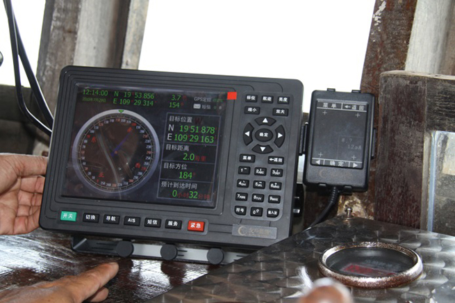
    SAN DIEGO — The global trucking market for fleet management products has always been strong — and one of the first location segments to have prospered over the last 15 years. This market growth will continue because of new technology and government requirements, say attendees at the American Trucking Association annual management conference here.

    An American Transport Research Institute report offered at ATA, “Critical Issues in the Trucking Industry – 2014,” outlines 10 issues, mainly driven by government regulation, that concern fleet owners.

    One of the big issues is hours of service (HOS). Rules adopted by the feds require 11 hours of driving — and a 34-hour break before restart. This includes a 30-minute break before driving again after eight hours. ATRI believes these rules cost carriers $1.6 billion to $3.9 billion annually in driver pay impacts.

    An electronic device (ELD) mandate requires all drivers to keep records of duty status via a logging device. A mandate could come in 2016 that outlines hardware specs.

    Another big issue is truck parking — and could be an opportunity for mapping and location companies. Because HOS regulations require drivers to take many breaks, shortage of parking is a big and dangerous concern because drivers are operating beyond allowable rules to find areas to park. ATRI wants closed public rest areas to reopen. They want real-time truck parking information availability and trucking parking reservation systems.

    Driver distraction in the form of texting and driving is a growing concern. ATRI wants the feds to ban hand-held cell-phone use/texting for all motorists, encourage harsher penalties and more aggressive enforcement, and to continue to research to understand the size of the distracted-driving problem.

    Other issues include driver shortage, health and retention; compliance, safety, Accountability (CSA); and congestion funding.

    “My takeaway from [ATA’s] luncheon panel was that the trucking sector is in pretty good shape overall, except for the driver shortage. In regard to mobile resource management (MRM), I would estimate overall growth in in-cab and trailer monitoring at less than 10 percent per year,” said Clem Driscoll, president, CJ Driscoll Associates. “The Truckload sector is heavily penetrated with in-cab solutions. Most large carriers have a system. CSA is motivating some sales to mid-size fleets, but many small fleets are waiting for the ELD regulations. So, the delays with ELD regulations have probably been slowing market growth.”

    Such companies as AT&T are trying to address the growing trucking requirements with new and existing products. For example, Saia LTL Freight, a trucking and logistics company, is managing its fleet of trucks with several AT&T products. Saia drivers are using handheld computers to connect with dispatch managers and monitor fuel consumption, safety, and location using AT&T’s wireless network.

    “[SAIA] is a trucking company that is using all our capabilities. We partnered with them from an early stage, starting with the [Electronic Device Mandate] requirements,” said John Moscatelli, AT&T advance resource management solutions director. “Then we helped them with rugged handhelds and voice where necessary.”

    Overall, Moscatelli sees a few fleet trends emerging. “There have been a lot of mergers and acquisitions in this industry. I also see that trucking companies are very aware of forced hours of service regulations for every company [mandated by the government],” he said. “It will not necessarily be the first adopter of technology that will be needing units. We have looked at the demographics, and even small and medium fleets are going to need affordable connected systems. The other trend is the growth of government sales — local, state and federal — very strong.”

    Targeting a large worldwide market, Trimble has acquired several companies in the fleet space in recent years. One of them is Minneapolis-based PeopleNet, which is gearing up for the ELD mandate with an “Internet of Transportation Things” strategy that includes multiple devices talking to each other, said Randy Boyles, company senior vice president, tailored solutions.

    The company rolled out its Wi-Fi-enabled in-cab scanning feature at ATA that allows drivers to scan and transmit transportation documents.

    PeopleNet, along with ALK, GEOTrac, Vusion and TMW Sysems, are part of Trimble’s Transportation and Logistics division. Trimble has allowed their purchased companies to operate autonomously.

    “About 95 percent of our management team is still intact. TMW still works with Omnitracs and others, but you will see a convergence with [other Trimble companies],” said Boyles, who believes that oil and gas pipeline monitoring/mapping is a growing niche.

    The fleet and enterprise market is a growing space for Magellan, said Mark Perini, company associate vice president. The company has been offering its Magellan RoadMate 9496T-LMB Android unit for the fleet market.

    “The unit enables bulk updates using our smart GPS technology. The Android operating system has been a growing technology for fleets,” Perini said. “The HOS regulations require reporting of how many hours truckers are off duty. With our management system, operators can implement a full set of protocols [to achieve HOS compliance]. It’s on a server, so the driver can’t change anything.”

    Telogis Partners with Ford

    Telogis has grown from a small company to a major player in the fleet market. The company recently announced it will be the “technology provider” for the Ford Crew Chief in North America, which is an expansion of its European partnership with the automaker.

    In Europe, Ford’s telematics products will be offered to customers as a dealer-installed option and will feature vehicle location, diagnostics and performance.

    The company has also been a major player in the U.S. market, integrating into Volvo Link, said Kevin Moore, Telogis vice president of OEM sales at ATA.

    “While the trucking business is huge, the aftermarket is also growing,” he said. “While location information is central to what we do, we are constantly growing the platform. We are looking to be the only product that provides crowdsourcing for the commercial market.”

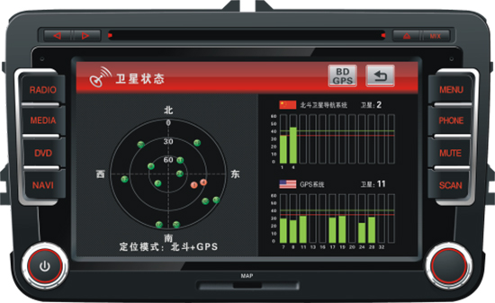
    Even though the U.S. fleet market is growing, other world markets are growing by double digits each year. Driscoll, in his China Commercial Telematics Market Study, says the Chinese markets are growing at 20 percent, or more, each year. “China is manufacturing over 600,000 commercial trucks per year for internal use, so the addressable market is growing at a very fast rate,” he said. “China has a very inefficient logistics system and spends far more on logistics than the U.S. or Europe as a percentage of GDP. The government is very aware of the problem and is mandating the use of satellite tracking solutions in a number of sectors. Systems being sold in China today typically support both GPS and BeiDou (Compass).”

    In other ATA news:

    • Orbcomm rolled out its GT 1100 chassis tracking solution to allow trucking companies to monitor where their rigs are located. It also allows operators to see if a trailer is mounted.
    • 10-4 Systems is offering real-time data products NonStop, NonStop Mobile and NonStop premium. The company has a track/trace asset management capability for operators.

    Qualcomm to Buy CSR for $2.5 Billion

    The recent announcement by Qualcomm saying it would buy United Kingdom-based CSR for $2.5 billion signals continued inroads into the connected car and Internet of Things markets for the San Diego company.

    In 2009, CSR, which stands for Cambridge Silicon Radio, purchased SiRF Technology, a GPS pioneer that was making huge strides in indoor location technologies. CSR, mainly known for its wireless Bluetooth technology, has chips in such products as audio speakers and Apple-owned Beats headphones.

    The connected car market will be a big one for Qualcomm in the future. The connect car market, a dominant topic at most wireless trade shows, is expected to grow to $20 billion by 2018, according to Juniper Research. Another research company, SBD, has even higher expectations for the technology, saying the connected car market will grow to $54 billion by 2018.

    Macy's plans to add Shopkick indoor location beacons in preparation for holiday shopping. (Photo by Nicholas Eckhart is licensed under CC BY 2.0.)
    Macy’s plans to add Shopkick indoor location beacons in preparation for holiday shopping. (Photo by Nicholas Eckhart is licensed under CC BY 2.0.)

    Shopkicking It at Macy’s

    In another big industry acquisition, SK Planet, part of South Korean mobile carrier SK Telecom, bought indoor location provider Shopkick for $200 million. The sale indicates how valuable the worldwide indoor location market is becoming.

    Macy’s announced it was installing 4,000 Shopkick beacons prior to the holiday shopping season, according to published reports. The company has nearly 8 million active users and relationships with 20 retailers

    In other location news:

    • General Motors OnStar is arguing for less restrictive open Internet rules for wireless carriers, according to published reports. OnStar argues that future connected services (Wi-Fi hotspots, wireless collision avoidance systems, streaming video and audio) that are going into cars make the net neutrality issue vital for the auto industry. The auto giant, which works with such carriers as AT&T Mobility, is siding with the wireless carriers in their battle with the FCC over net neutrality.
    • A number of location companies, and companies using the technology, are seeing major investments. Most notably, INRIX received a $55 million investment from Porsche. XAd, which develops mobile advertising products, received $50 million in funding from a number of partners. Geofeedia, an LBS social media monitoring company, raised $3.5 million. The company gathers social data from such sources as Twitter, Instagram, YouTube, Flickr, Facebook and others.
    • Nokia’s HERE mapping platform is now available on Samsung’s Galaxy smartphones. The HERE app, available in Samsung’s Galaxy App Store, will run on devices operating Android 4.1. Currently, Google Maps is the default mapping service on Android phones. However, the HERE platform gives consumers another Android option.
    • TomTom said it has “extended [its] location-based services product portfolio with an online turn-by-turn navigation service” with support from deCarta. While TomTom has many customers, including Apple, it has never offered an off-board, server-based navigation service. Industry sources say that this announcement will allow TomTom to better compete in the Internet of Things/connected car market.
  • Danger, Will Robinson! Beware the IMES of Japan

    Danger, Will Robinson! Beware the IMES of Japan

    IMES-1-B
    The IMES navigation concept. Credit: IMES

    In May 2011, Dinesh Manandhar and Hideyuki Torimoto of GNSS Technologies, Inc., Japan, penned a very interesting article in GPS World titledOpening Up Indoors: Japan’s Indoor Messaging System, IMES. The opening paragraph of their lengthy article seemingly describes the Holy Grail for the indoor positioning lobby:

    “An indoor messaging system (IMES) has been developed to meet the challenges of indoor and deep indoor positioning, as a system that can be implemented in any device that has a GPS/GNSS receiver without hardware modification. IMES can provide reliable 3D position data with a single transmitter device without performing range calculation[s].”

    They go on to describe the IMES concept thusly:

    “The main concept of IMES is to transmit position and floor ID of the transmitter with the same RF signal as GPS. IMES transmits latitude, longitude, height, and floor ID by replacing the ephemeris and clock data in the navigation message of GPS. A single unit of IMES is enough to get the position data, since the position itself is directly transmitted.”

    Now, you don’t have to be a rocket scientist to start thinking about interference and spoofing issues or risks, especially when you read that the navigation message ephemeris and clock data are being replaced by data broadcast by IMES. To be fair, the authors address these issues briefly:

    “Since IMES shares the same frequency as [the] GPS L1 band (1575.42 MHz), there is an interference level that IMES may have on GPS signals. This interference has been studied in detail by conducting experiments and simulations. Based on these studies and analysis, various methods have been considered to avoid harmful interference to GPS signal. To avoid such interference, IMES center frequency is shifted by +/– 8.2 KHz from GPS L1 band. This will have the least impact on the GPS L1 band signal. For example, if the IMES signal is –110 dBm (very strong) and the GPS signal is –142 dBm (very weak), the loss of GPS signal (C/N0) due to IMES is less than 2 db. If the IMES signal is –120 dBm and the GPS signal is –142 dBm, there is no loss of GPS signal (C/N0). Based on this analysis, the IMES transmitter power must be controlled such that the maximum power to the receiver does not exceed –110 dBm at a distance of 3 meters from the transmitter. [There are] guideline[s] specified in the QZSS IS document for setting the transmitter effective isotropic radiated power (EIRP) based on location.”

    Let’s put these concerns in perspective. I thoroughly enjoyed the article and firmly believe that we desperately need to solve the indoor positioning and navigation problems, especially for our warfighters and first responders. While many of today’s excellent commercial receivers work well indoors near windows and doors, they are absolutely abysmal underground and deep inside large buildings with lots of metal, or in the middle of dense urban canyons such as Tokyo, Japan. Without a doubt, there is a dire need for a system like IMES — or maybe exactly like IMES — but there must be some caveats and stipulations as to how the IMES system is implemented.

    Not Alone

    Fortunately, I am far from being a lone wolf in voicing my concerns and my position, for once again the conspiracy theorists as well as renowned scientist and policy makers are concerned about IMES and the operating systems they supposedly desire to replace or augment. Chief among them is the Father of GPS, Dr. Bradford Parkinson, who has frequently described improperly operated in-band pseudolites as “…just another name for a legal jammer or spoofer.” Having known Brad for almost 40 years, I am convinced few GPS experts in the world today have as much experience with pseudolites as Dr. Parkinson. Consequently, the very reason that an indoor navigation system such as IMES is needed may well be a portent for why it may well fail, unless it is implemented properly.

    It would be easy but extremely tedious to write about the numerous issues facing IMES in a complicated and technical manner. Certainly previous articles have become bogged down in minutia, and I want to avoid that. It is actually very simple. The issues are fairly straightforward and should be faced head on and not hidden in the midst of tech-speak lingo, legal jargon, policy minutia or politics. So lets dive straight in, shall w,e and make sure these issues see the light of day?

    Interference

    There can be no doubt that IMES has the potential to significantly interfere with GPS and QZSS signals. The authors of the IMES article are quite clear concerning the potential for interference, and in their own way attempt to mitigate it with signal power restrictions. Their example of a small three- to four-story building with IMES transmitters may indeed be adequate for signal power mitigations, but what happens in Tokyo where tall buildings — skyscrapers if you will — abound? When the Tokyo Skytree skyscraper opened to the public in 2012, it was then listed as the world’s tallest tower and Japan’s biggest new landmark. At over 2,080 feet tall, this is definitely the type of building where one would need an IMES system. With an average of 20 IMES transmitters per floor and weighing in with over 200 floors, we can quickly see that there would be over 4,000 IMES transmitters in this one building alone, all broadcasting simultaneously on or near the center frequency for GPS. Absent stringent regulations and infinite care (the IMES article authors propose that the pseudolite network operator will have the responsibility to continuously monitor each pseudolite and the pseudolite network to prevent interference), and perhaps even with those caveats in place, the GPS L-band noise floor would be such that GPS signals would be incapable of being received.

    Now, put 20 such buildings in a ten-block area and the noise floor would be almost incalculable and certainly not predictable. Dr. Parkinson’s fears are realized; your legalized IMES system becomes a distributed network of jammers and/or spoofers. However, technically IMES is currently far from being a legal jammer or spoofer as currently IMES transmitters are not legal to operate in the GPS band at 1559-1610 MHz under the International Telecommunications Union (ITU) Treaty per the International Table of Frequency Allocations of the ITU Radio Regulations. The ITU further states that IMES currently operates on an interfering basis with the co-primary allocations (ARNS/RNSS) in this band, and therefore are in violation of the ITU Treaty. However, Japan’s frequency regulatory agency can develop and implement regulations that allow IMES operations. When this occurs, if not operated within stringent guidelines, IMES could then be considered a legalized jammer or spoofer.

    Even the Joint Research Centre of the European Commission, the JRC, states in its Executive Summary on pseudolites that in-band pseudolites pose a significant jamming risk to GNSS receivers. Specifically they state:

    Pseudolites or pseudo-satellites are an emerging technology with the potential of enabling satellite navigation indoors. This technology found several applications that are not limited to indoor navigation. Precise landing, emergency services in difficult environments and precise positioning and machine control are few examples where pseudolite technology can be employed.

    Despite the great potential of this technology, severe interference problems with existing GNSS services can arise. The problem can be particularly severe when considering non-participating receivers — legacy devices not designed for pseudolite signals. The design of pseudolite signals is thus a complex problem that has to account for market requirements (modifications of existing receivers for enabling the use of pseudolite signals, measurement accuracy, target application), regulatory aspects (frequency bands to be allocated for pseudolite services) and interference problems.

    JRC investigates the main aspects to be considered for the design of a pseudolite signal standard minimizing the interference problem without compromising the location capabilities of the system. The focus is on the signal characteristics and topics relevant for the signal design.

    Pseudolite or Communications System

    The second technical portion of the interference issue revolves around how exactly you define IMES, for when you are dealing with radio regulation agencies semantics matter. Think back to the first paragraph of this article where the IMES authors defined IMES as a messaging system. That certainly sounds like a communications system to me, and others agree. Consequently, the question has been raised and rightfully so: Is IMES a navigation and positioning system, a pseudolite or a communications system? Honestly, to me it sounds like a bit of all three, but if you define it as a communications system, then Japan is seeking to authorize the integration of a communications system with known significant interference issues with GPS signals right in the middle — indeed, potentially on the center frequency of the protected navigation band using terrestrial PRN codes assigned by the U.S. government. If IMES is deemed an indoor pseudolite, then the interference issues are still there. But it is defined as a bonafide PNT system using authorized terrestrial PRN codes. Talk about a bucket of worms!

    The issues here are numerous, and they need to be fully addressed to ensure that all those who are potentially affected clearly understand what is being proposed and the risk for the public at large, including who owns responsibility if something goes wrong. I could go on for several pages on this issue alone, but suffice it to say, we do not want to authorize a communications system that is a known and acknowledged GPS interferer right in the middle of the band — or anywhere in the band for that matter. Remember all the issues GPS had in the past several years with a communications system in adjacent bands. So, do we really want a known communications system — or communications system masquerading as a pseudolite, for that matter — with known GPS signal interference issues in the restricted GPS frequency spectrum? The blaringly obvious answer is absolutely not! Yet this is exactly what the IMES authors are proposing not only for Japan, but eventually, if they receive authorization, for other countries around the globe as well. Japan has twice petitioned the U.S. government to make the assigned IMES terrestrial PRN code allocations global in nature. Fortunately, to date those request have been denied.

    Dichotomy

    Certainly, other countries and companies have noticed this apparent frequency authorization dichotomy and are following suit. For instance the Conference of European Postal and Telecommunications agencies, or CEPT, which is Europe’s regional representative to the World Radiocommunication Conference (WRC), has proposed adding several troubling IMES-related agenda items for the quadrennial WRCs coming up in 2015 and 2019. Even more importantly, these critical issues could be aired in the next three weeks, as the agenda for the 2015 WRC will be largely set at a plenipotentiary conference happening October 20 through November 8 in Busan, South Korea.

    There are what I consider to be dangerous proposals under consideration by the ITU (International Telecommunication Union), which should concern GNSS users worldwide. The ITU is the United Nations’ specialized agency for information and communication technologies — ICTs. This is the ITU, where every member state (currently 193) gets one vote, whether they fully understand the technical issues or not and regardless of whether they are a space-faring nation or have a dog in the fight, so to speak. This means that the vote of tiny Saint Lucia counts the same as the United States or Canada or Australia. The ITU charter is to “…allocate global radio spectrum and satellite orbits, develop the technical standards that ensure networks and technologies seamlessly interconnect, and strive to improve access to ICTs to underserved communities worldwide.” Fortunately, the ITU regulations, unlike the CEPT or IMES proposals, wisely require new transmitters proposing to operate in the radio navigation spectrum to operate without causing interference to primary users. Meanwhile, there are member states, countries and companies that want to capitalize on this seeming dichotomy within the global safety-of-life, historically protected, radio bands. Those nefarious efforts, for the future of GPS and GNSS worldwide, need to be stopped in their tracks.

    Spectrum is a limited and valuable resource, to say the least, and here fortunately the ITU regulations have it right and do not risk human life, by intruding and potentially interfering with the frequencies used globally by airliners to control, route and land aircraft. I am convinced there are solutions available to us through cooperative efforts with the ITU and other national organizations that will produce pseudolites without causing interference in the protected safety-of-life frequency bands.

    When Is a PRN Code Not a PRN Code?

    Some of you who are a bit more savvy or have been following this fiasco for some time may now be thinking, what’s the problem, the IMES authors are merely using and proposing further use of U.S. government-authorized terrestrial PRN codes for IMES. This indeed touches on the third thorny issue, which is not only technical but political as well — the use of and authorization to use PRN codes for what is ostensibly a communications system, if you believe the authors of the IMES article, who go to great lengths to differentiate IMES from pseudolites. They continually make the argument that IMES is not a pseudolite, but as we shall soon see, when the U.S. government authorized these specific PRN codes (173-182) for Japan, they were to be used solely for a low-power terrestrial pseudolite program, not an in-band communications system.

    Technically, these specific PRN codes assigned to the Japanese for IMES expire in 2017. The authorization of these PRN codes come with numerous restrictions that legally make the codes useful only for the Japanese landmass. This is where the technical, political and operational issues come to a head. We are in for some tough sledding here. However, I will endeavor to make it as simple as possible.

    History

    In 2007, ten PRN codes were specifically assigned to the Japan Aerospace Exploration Agency or JAXA “for the Indoor Messaging System (IMES) terrestrial pseudolites of the Quasi-Zenith Satellite System (QZSS).” The Memorandum of Agreement from the GPS Wing at SMC (Space and Missile Systems Center) in Los Angeles at Los Angeles Air Force Base (LAAFB) clearly states that the codes are valid for ten years and expire on 19 November 2017, unless a renewal application is filed and approved. Hence, PRN codes 173-182 for IMES were assigned with several crucial caveats and restrictions by the U.S. government that are definitely pertinent to our discussion:

    1. The codes are designated for low-power terrestrial regional applications limited to Japan only.
    2. Although the GPS Wing conducts an initial check on PRN number requests with respect to potential interference issues, the issuance of a PRN number does not convey authority to radiate in the [GPS] band. In order to radiate in the GPS L1 band, the applicant [Japan] shall obtain a frequency assignment from the [Japanese] national authority.
    3. The GPS Wing assumes no responsibility for ensuring systems using these spreading codes follow domestic radio frequency regulations or other applicable laws or regulations, or for ensuring that systems using GPS PRN codes do not cause radio frequency interference.
    4. GPS PRN codes were developed for signals transmitted from satellites, and are not necessarily optimized for use by terrestrial transmitters.
    5. The maximum effective isotropic power for each terrestrial transmitter will be less than -94 dBW.
    6. The QZSS [organization] is responsible for the redistribution of these spreading codes throughout Japan and will limit their use to Japan only.

    With all these restrictions, it is difficult to see how the IMES authors could legally use, distribute or promote authorization of IMES and the use of the PRN codes outside of Japan and at the power levels related in the GPS World IMES article. Regardless of the IMES author’s interpretation of the PRN code assignment, the GPS Wing 2007 Memorandum restrictions and caveats are clear, and it cannot be disputed that the codes expire in 2017 unless renewed by the USAF. The PRN codes are restricted to the landmass of Japan even if they are renewed, and if IMES wishes to broadcast anywhere in the GPS band, they need to have permission from their national frequency allocation authority (the Ministry of Internal Affairs and Communications, which is equivalent to the U.S. FCC –Federal Communications Commission) to do so.

    The Way Ahead

    This is the easy part from my perspective. See if you don’t agree. If the U.S. government is concerned about IMES and what Japan is planning to do with the assigned PRN codes for terrestrial use, the U.S. government through the USAF has the options to:

    1. Rescind the PRN codes immediately.
    2. Insure the Japanese adhere to the caveats and restrictions in the original Memorandum.
    3. Simply refuse to renew or recertify the codes for future use and/or recommend for IMES frequencies that are outside the protected GPS band.
    4. Update and clarify the footnote on the GPS Wing PRN Codes website pertaining to the Japanese IMES PRN Codes with all the restrictions listed in the GPS Wing Memorandum so other countries will realize this is not a global IMES PRN assignment.

    Japan is a valuable ally and we need to work together cooperatively, but frankly, the plans laid out for IMES by the authors in the GPS World article must be troubling to those whose job it is protect the GPS spectrum and enforce mutual agreements with our allies. If we were just concerned about a Japanese IMES system, this whole discussion might be moot. However, other countries and commercial companies around the world are watching closely and laying the groundwork for similar IMES and pseudolite incursions into the GPS L-band spectrum — if the Japanese are allowed to proceed and the limited use of PRN codes for IMES is not clarified for all. No one, and I include the Japanese, wants to see this happen if it means interference with GPS, and QZSS for that matter.

    Fortunately, where European countries are concerned, there are the ITU regulations. Specifically for GPS and pseudolites, the CEPT regulation has a license condition that requires the pseudolite network operator to submit to the European country regulator confirmation of the terrestrial PRN codes from the GNSS operator before operating pseudolites in the GPS band. So again, the U.S. government wields the hammer here.

    Therefore, the U.S. government must act immediately and decisively to put an end to the threats against the protected GPS spectrum caused by the proposed in-band IMES system. At the same time, the Japanese government has an obligation and responsibility to adhere to the letter of the law where the original GPS Wing 2007 IMES Memorandum is concerned.

    Finally, the U.S. government must urgently engage cooperatively with the European Union administration and Japan to prevent the authorization and proliferation of interfering devices in the GNSS frequency bands, and to work together to ensure the positive benefits to GNSS from commercializing pseudolite uses outside the GNSS radio frequency bands. GNSS manufacturers worldwide are successfully marketing commercial pseudolites that do not cause interference. In my opinion, this is the way to go both in terms of regulations and governance.

    Until next time, happy navigating, and remember GPS is brought to you free of charge by the United States Air Force.

  • Which Industry Will Be the Largest Consumer of RTK Technology?

    Which Industry Will Be the Largest Consumer of RTK Technology?

    In September, I attended the Institute of Navigation (ION) GNSS+ conference in Tampa, Florida.

    Downtown Tampa, FL Location of the 2014 ION GNSS+ Photo: GPS World
    Downtown Tampa, location of the 2014 ION GNSS+. Photo: GPS World

    The ION GNSS+ conference is a gathering where many of the GNSS scientists from around the world come to share their successes, trials and tribulations. It gives one a view into the future of where GNSS positioning might go. Granted, most of the ideas and concepts presented won’t ever be introduced in a commercial product, but it’s great to see that engineers are pushing the technology envelope to see how much they can squeeze from receivers.

    As I was perusing the ION GNSS+ conference agenda, I was looking for presentations and other subject matter relevant to RTK GNSS technology. (Yes, I’ve been obsessed with low-cost RTK receivers this past year, if you haven’t been following).

    I’d like to tell you about two presentations I attended. The first was sort of unexpected, and the second was every bit of what I hoped it would be.

    The first was a presentation by SubCarrier Systems Corp (SCSC), a small consultancy focused on ITS (Intelligent Transportation Systems) technology. It just so happens, according to David Kelley of SCSC, that RTK receivers and RTK networks will play a critical role in the future of ITS and, as a result, help drive down the cost of RTK technology.

    How is RTK relevant to ITS?

    In ITS, I’ve been told there are three levels of accuracy that drive particular ITS applications. The accuracy terms are expressed in transportation terms:

    • Which Road?, Which Lane? and Where in the Lane?

    Translated into GPS accuracy terms:

    • Which Road? = Autonomous GPS — 5-meter accuracy
    • Which Lane? = WAAS (or SBAS)-corrected GPS — 1-meter accuracy
    • Where in the Lane? = RTK — 2-cm accuracy

    "Safety Applications are Enabled by increased accuracy in the rovers"

    Mr. Kelley further presented that transportation applications of RTK technology will drive mass-market adoption (commoditization) of RTK technology and into the millions of units sold.

    The Automotive Sector: Extending State Networks to Support Vehic

    Lastly, he discussed the strain that such massive deployment of RTK technology in transportation might place on existing RTK networks run by state agencies.

    The Automotive Sector: Extending State Networks to Support Vehic

    To view the entire presentation from Mr. Kelley, you can click here.


    The second RTK-centric presentation I attended at the conference was a moderated discussion panel entitled “High-Precision GNSS — What Will It Look Like in 2020?”

    If you’ve followed my articles over the past couple of years, you have to know I was looking forward to attending this discussion panel with great anticipation.

    Discussion Panel Members: High Precision GNSS - What will it Look Like in 2020?  Photo: GPS World
    Discussion Panel Members:
    High Precision GNSS – What will it Look Like in 2020? Photo: GPS World

    The discussion panel members were (from right to left):

    • Gian Gherardo Calini – European GNSS Agency
    • Ivan Di Federico, Chief Strategy Office and EVP, Topcon Positioning
    • Bernhard Richter, GNSS Business Director,  Leica Geosystems, Switzerland
    • Elmar H. Lenz, General Manager – Geospatial GNSS, Geospatial Division, Trimble Navigation Ltd.
    • Jan Van Hees, Director of Business Development, Altus Positioning Systems
    • Shaowei Han, Co-founder and CEO/President, Wuhan Navigation and LBS, Inc., China

    The discussion began with a short presentation by Gavin Schrock, who, among other things, administers the Washington State Reference Network, a state-wide RTK network, to frame the discussion.

    Next, each panel member commented on the presentation and provided some of their own thoughts. The thoughts by the mainstream manufacturers were largely what you’d expect, since they do not look forward to the day that RTK technology becomes a commodity.

    I’ll cut to the chase and just say that the gentleman from China, Dr. Han, stunned the audience with his claim that RTK GNSS chips will eventually be sold for $20 each. OK, to be fair, he also said RTK GNSS modules (an RTK GNSS chip on a circuit board with supporting components) will sell for $100. At first, these numbers seemed somewhat shocking to the audience, and one might dismiss it as being a speculative pipe-dream to disrupt the current RTK receiver competitive landscape. But then, when questioned, he dropped the reality bomb with a sort of puzzling look at the audience, being a little surprised why they didn’t understand. He said, and I’m paraphrasing, that $100 for an RTK module in 2020 doesn’t seem to be a stretch at all if you consider that RTK GNSS modules in China are selling for only $400 today. BOOM! He dropped the hammer. I admit, the $400 number even surprised me a bit. I thought it was more like $800.

    The reason for the low price is the number of RTK GNSS receivers sold in China is more than 100,000 per year now, and growing. That’s more than the rest of the world combined. What’s driving the demand for RTK GNSS receivers? You guessed it — transportation. While the mainstream RTK GNSS manufacturers are still talking about RTK GNSS technology for niche markets like surveying, engineering, GIS, construction, and agriculture, Dr. Han was talking about RTK GNSS technology being used by everyday consumers for everyday activities. He’s talking about the commoditization of RTK GNSS, and he’s right. The only question that remains is how soon it will arrive.

    Thanks, and see you next month.

    Following me on Twitter at https://twitter.com/GPSGIS_Eric


  • Out in Front: Curing Cancer

    Out in Front: Curing Cancer

    source:  global.
    Source: Cancer Research UK.

    As in, “It’s not like you’re curing cancer,” a refrain I hear sometimes when I get a bit over-inflated on GPS/GNSS and the wonders they can do in many fields of human endeavor. The intent of that remark is to remind me that on the one hand, there is technology. On the other hand, there is life, and there is death. Despite the leaps and bounds and the many alterations to life and its circumstances that technological advances have created, life — and death — still have the upper hand. And they will for the forseeable future. What’s that bumper-sticker saying? “Nature bats last.”

    At the crux of the mystery of life and its endings is the nature of cancer, one of the leading causes of the end of life. Cancer is so deadly because cancer cells are immortal. They multiply endlessly, unlike normal cells that have a limit of about 30 times multiplying-and-dividing. Cancer cells take over the host body until they have crowded out enough normal cells to kill it. The cause of death in this case is . . . immortal life.

    Some believe that the key to immortality, if not to perpetual youth, lies hidden inside the coding of cancer cells, and that in unlocking one mystery, we may succeed in unlocking two. But I’m treading on thin metaphysical ice here, so I’ll withdraw to the solid shore of what we do know, of what we know we know.

    One of these known facts is that, yes, GNSS will not cure cancer. But it can be useful in the fight. See our special coverage, which appears in the October issue.

    The first successful forays have come in the field of geographic information systems (GIS); as yet, the insights furnished by GIS are not down to the level of accuracy furnished by GPS/GNSS, but they will surely get there. And GPS itself has been employed to study the recovery rates and health issues of cancer patients, indicating further usefulness.

    It’s all part of the fabric. The solutions lie at the heart of the mystery.

  • Summer — and the Living Ain’t Easy

    Summer 2014 will be one that the €6.3 billion (US$8.2 billion) Galileo GNSS programme will need to chalk down to experience and hope to move on from. At the time of my last EAGER column, we were starting to get a hint that one of the four in-orbit Galileo IOV satellites was not functioning. We now know that it has suffered a catastrophic power failure.

    And in August, celebrations for a successful launch of the first two Galileo FOC satellites, named Doresa and Milena, quickly went sour when it became clear that they had suffered an anomaly during launch. And a very big anomaly at that.

    We are still awaiting the preliminary results from the inquiry set up by the European Space Agency (ESA), the European Commission, and the rocket’s operator Arianespace. It is hoped that the results of the inquiry board will be available at the end of September.

    ESA spokesperson Franco Bonacina informs me that on the satellite side, ESA’s teams at the ESOC control centre are investigating the possibility of partially raising or modifying the orbit of the two satellites, which are fully under control and in good health. They are also considering performing some software adaptations on board the spacecraft and at ground station level to try and make them “be seen” as operational satellites and able to provide operational services within the Galileo system. All this is still “work in progress” and it will take a few more weeks to be fully evaluated and put into practice.

    So, what went wrong?

    In the absence of firm conclusions from the inquiry, the rumour mill has been running at full throttle with the wide range of theories from cock-up to conspiracy.

    What we do know is that the Galileo craft were supposed to be launched by a Soyuz-Fregat rocket into a circular orbit 23,222 kilometres above the Earth and angled at 56 degrees to the planet’s equator. The initial launch from Kourou, French Guiana, on August 22 seemed to be smooth and nominal, but something went wrong in the final stages of the flight, and the two satellites were placed in an elliptical orbit varying from more than 2,000 kilometres too high to nearly 10,000 kilometres too low and also tilted by about 5 degrees from the intended plane.

    The most plausible explanation for the anomaly is that the Soyuz – Fregat upper stage suffered a control malfunction at some point before its final orbital injection burn. So although the rocket engine seems to have fired correctly, the craft wasn’t pointing in the right direction.

    In fact, I am told that a likely mechanical root cause for the anomaly in the Fregat stage has been identified by the inquiry committee; however, more information is being gathered and further technical analysis is required to verify this.

    Can anything be done?

    Doresa and Milena do not have enough fuel on board to achieve the correct orbit for full Galileo operations.

    Some interesting solutions have been proposed to launch a rescue mission to drag the errant satellites into their correct orbit, but that could be a slow, risky and expensive exercise. So could the satellites be useful in situ?

    For most GNSS uses, the answer is probably no. Despite the fact that the satellites themselves are apparently working perfectly, in a safe state, correctly pointing towards the Sun, properly powered and fully under control of the ESA team, their elliptical orbit does not conform with Galileo’s standardized data format. For example, the value that represents the shape of the satellites’ orbit is too big to be expressed within the allotted bit limit for that parameter.

    Marco Falcone, ESA’s Galileo system manager, says his team have been working intensely to determine if the satellites can be at least partially recovered. Among the considerations are the flight dynamics of moving the two spacecraft and the impact of the radiation they are experiencing in their current location, which can shorten the satellite’s lifetime. “It’s very dangerous for the satellite,” admits Falcone.

    Another unknown is the timing performance of the satellites’ rubidium frequency and hydrogen maser given the relativistic effects of their orbit. Signal issues, such as the navigation message almanac, also must be considered before the FOC satellites can be introduced into operation, Falcone said.

    Good for geoscience?

    But according to fellow GPS World contributor Richard Langley of the University of New Brunswick, the situation is more hopeful for scientists wanting to use Galileo-derived data in their research. Quoted in an article in leading science journal Nature, Richard says that researchers tracking GNSS satellites via the IGS global network of ground stations combine that information with the timing data transmitted by the satellites themselves and could use it to measure changes in the position of points on the ground much smaller than the one-metre margin of error for standard navigation-system receivers. This level of precision is good enough to detect millimetres of movement in tectonic plates, for example.

    This reminded me of a presentation by a team of Italian scientists I saw recently. The VADASE (Variometric Approach for Displacements Analysis Stand-alone Engine) project uses a novel strategy consisting of an algorithm able to perform real-time retrieval and estimation of displacement and waveforms based on high-frequency (1 Hz or more) carrier phase observations collected by a stand-alone GNSS receiver. The algorithm works with broadcast data (satellite clocks and orbits), requires very simple hardware, and has demonstrated potential application in real-world situations such as earthquake risk assessment (and related early-warning systems for tsunamis) and structural monitoring (see citations below). VADASE had already achieved a Galileo-only displacement solution using the four IOV satellites in orbit.

    I contacted Gabriele Colosimo at Rome’s “Sapienza” University, and he confirmed that, although the satellites could not be used for direct gravimetric studies that require a very low orbit (below 1,000 km), the data from Doresa and Milena could be used to estimate displacements of GNSS receivers. He and the VADASE team think that a slight adjustment in their algorithm might be needed depending on the exact orbit parameters of the satellites, but the data would be useable without any significant change in orbit being required.

    Gabriele also thinks that the data could be used to usefully contribute to studies in fields such as troposphere studies and GNSS reflectometry, as well as for geodynamic and seismic monitoring using GNSS.

    Munich Masters

    Hopefully the mystery of Doresa and Milena’s anomaly will have been resolved by October 23, when the 2014 European Satellite Navigation Competition (ESNC) awards ceremony takes place in Berlin in conjunction with the two-day Satellite Masters Conference.

    Gabriele and the VADASE team are in the running for a prize — so we wish them well.

    But the real prize for the European GNSS community would be a full explanation of the recent Galileo issues, and how they are being resolved, and a clear statement and timeline on the future deployment and implementation of this flagship programme.

    A bientôt – as they say in these parts


    Citations

    G.Colosimo, M. Crespi and A.Mazzoni, “Real-time GPS Seismology with a stand-alone receiver: A preliminary feasibility demonstration,” Journal of Geophysical Research, vol 116, doi: 10.1029/2010JB007941

    M. Branzanti, G.Colosimo, M.Crespi and A.Mazzoni, “GPS near-real-time coseismic displacements for the great Tohoku-oki earthquake,” IEEE Geoscience and Remote Sensing Letters, vol 99, doi: 10.1109/LGRS.2012.2207704

  • InterGeo: The Worldwide GIS Showcase

    Did you know the largest GIS conference in the world is held in Germany every year? Last October, more than 16,000 geospatial geeks traveled to Germany to attend the InterGeo Conference. In just a few short weeks, Geospatial Solutions’ staff will travel to Berlin and mix it up with the world’s leading geogeeks. If you want to see the latest and greatest GIS technology, both hardware and software, it is the best show in the world, bar none.

    The second largest GIS conference in the world is the Esri International User Conference. It’s a great conference, with one major caveat; it’s a user conference for Esri users. Competitors and perceived competitors are not invited.

    InterGeo is open to any company that can afford an exhibit booth. That’s one major difference. The other major difference is that there are very few technical sessions. That means all 16,000+ attendees are wandering around the exhibits. The exhibit aisles are packed with people, all the time for all three days, and the energy is fantastic.

    The InterGeo conference is an eye-opener for North Americans who attend for the first time. This is because they will see a much wider variety of brands than they are exposed to in North America and, in many cases, they will see products with lower price points. It’s all about marketing. The African, Asian and European markets won’t pay as much for products as North Americans will, and seeing how 83% of the InterGeo attendees are from Europe, you can imagine how the products are marketed. Only 2.4% of the 2013 attendees were from North America. Following is a map illustrating where last year’s attendees traveled from:

    INTERGEO 2013 Attendance
    InterGeo 2013 attendance.

    Not only are there commercial exhibits, but also technology displays such as this mapping machine from the 19th century that was displayed during the 2012 InterGeo Conference.

    MappingMachine-W

    At this year’s show, we expect to see a lot of UAVs. Last year, there were 25 exhibits showing UAVs. This year, I expect that number to double as new UAVs are being introduced almost weekly and, unlike in the U.S., UAVs are legal to fly in many countries of the world.

    I also expect to see a wider variety of RTK GNSS receivers, at more competitive prices than last year.

    Stay tuned to Geospatial Solutions and GPS World magazine staff as we descend into Berlin in a couple of weeks. Expect lots of photos, video recordings and write-ups of the event. Remember to follow me on Twitter for real-time news and photos.

  • Galileo’s Two Giant Steps Back

    Galileo’s first two full-operational capability (FOC) satellites have been in a safe state since August 28, under control from the European Space Agency’s (ESA’s) center in Darmstadt, Germany, despite having been released on August 22 into lower and elliptical orbits instead of the expected circular orbits.

    ESA continues investigating the possible exploitation of the out-of-position satellites to maximum advantage, despite their unplanned injection orbits and within the limited propulsion capabilities. ESA specialists, supported by industry and France’s CNES space agency, are analyzing different scenarios that would yield maximum value for the program, and safeguard — as much as possible — the original mission objectives.

    Galileo orbits viewed from above: Orbits of the fifth and sixth satellites in red, compared to their intended position in dashed green, and the position of the four satellites launched in 2011 and 2012 in solid green. This view looks down over the South Pole to illustrate how the inclination relative to the equator is less than intended. The satellites are in an elliptical rather than circular orbit, with a maximum altitude of about 25,900 km and a minimum altitude of about 13,700 km, compared to a planned circular orbit of 23,222 km altitude.
    Galileo orbits viewed from above: Orbits of the fifth and sixth satellites in red, compared to their intended position in dashed green, and the position of the four satellites launched in 2011 and 2012 in solid green. This view looks down over the South Pole to illustrate how the inclination relative to the equator is less than intended. The satellites are in an elliptical rather than circular orbit, with a maximum altitude of about 25,900 km and a minimum altitude of about 13,700 km, compared to a planned circular orbit of 23,222 km altitude.

    Experts representing the Galileo Program provided a frank and open update at the ION GNSS+ conference in Tampa on September 10, as reported by Richard Langley:

    • An inquiry board is looking into problem to find the root cause of the anomaly. The board has already met several times.
    • An intermediate report is due shortly; a final report and recommendations will come next month.
    • ESA is considering what can be done with the two satellites; ESA hopes to be able to use them operationally as much as possible.
    • ESA is also looking at the impact on the commercial Galileo service and the search-and-rescue service.
    • ESA is narrowing down the possible causes of the anomaly.
    • ESA is waiting for the enquiry board to report before deciding on when and how the next two satellites will be launched.
    • The payloads of the errant satellites are currently off.
    • ESA wants to try to raise the perigees of the satellites to get them out of the van Allan radiation belt as soon as possible to prevent damage to the satellites. Raising the perigrees will also to reduce the maximum Doppler frequency shift from 9.6 kHz to at least 6.8 kHz to allow receivers to easily acquire and track the satellites, but leave enough hydrazine for future station keeping.
    • ESA is looking at the almanac problem and whether unused bits in the Galileo navigation message might be able to support a special almanac for the satellites.
    • ESA is also looking at possible rephasing of the satellites to optimize their use with the other satellites in the constellation.
    Galileo orbits viewed side-on: The fifth and sixth Galileo satellites in red, compared to their intended position in dashed green, and the position of the four satellites launched in 2011 and 2012, in solid green. This view looks side on to the two satellites’ orbital plane, which is off-center relative to Earth. The targeted orbit was circular, inclined at 55º to the equator at an altitude of 23,222 km.They are in a safe state, correctly pointing towards the Sun, properly powered and fully under control of an ESA–CNES team.
    Galileo orbits viewed side-on: The fifth and sixth Galileo satellites in red, compared to their intended position in dashed green, and the position of the four satellites launched in 2011 and 2012, in solid green. This view looks side on to the two satellites’ orbital plane, which is off-center relative to Earth. The targeted orbit was circular, inclined at 55º to the equator at an altitude of 23,222 km.They are in a safe state, correctly pointing towards the Sun, properly powered and fully under control of an ESA–CNES team.

    Soyuz at Fault? On August 28, the Russian newspaper Izvestia reported that “The failure of the European Union’s Galileo satellites to reach their intended orbital position was likely caused by software errors in the Fregat-MT rocket’s upper stage.”

    “The nonstandard operation of the integrated management system was likely caused by an error in the embedded software. As a result, the upper stage received an incorrect flight assignment, and, operating in full accordance with the embedded software, it has delivered the units to the wrong destination,” an unnamed source from Russian space Agency Roscosmos was quoted as saying by the newspaper.

    An independent inquiry panel has been set up by Ariane and headed by former ESA Inspector General Peter Dubock. It started work on August 28. The panel includes a couple of academics and a majority of ESA and EC figures.

    The new EC commissioner in this area, Ferdinando Nelli Feroci, invited ESA and Arianespace to his study during the first week of September to present the initial results of the inquiry.

    The commissioner commented, “The problem with the launch of the two Galileo satellites is very unfortunate. The European Commission will participate in an inquiry with ESA to understand the causes of the incident and to verify the extent to which the two satellites could be used for the Galileo programme. I remain convinced of the strategic importance of Galileo, and I am confident that the deployment of the constellation of satellites will continue as planned.”

    The commissioner expects that the Galileo constellation will be fully deployed by the end of this decade. This may qualify as optimism because system planners had envisioned for six spares ­— and three are already blown.

    Ariane and ESA did not insure the satellites.

    According to back-of-the-envelope calculations, system operators are now one short of the minimum 24 needed for full 24/7 global coverage, as they have four in orbit validation satellites up (one broken) and 22 FOCs on order (two launched and now in what could be called a junk orbit), which makes a potential maximum 23 satellites that have actually been ordered ­­— one short of the target.

    The Satellites Are Alright. Satellite manufacturer OHB Systems of Bremen, Germany, issued a release stating that “Controllers at ESA’s ESOC control centre in Darmstadt, Germany, confirm the good health and the nominal behavior of both satellites. They are in a safe configuration, are thermally stable, have stable pointing to the sun and sufficient power production. All platform subsystems have been checked and they work properly. Also, the procedures to deploy the solar arrays are successfully performed and all solar arrays are properly unfolded.”

    Further, “The orbit anomaly has no impact on the production and delivery of the in total further 20 satellites. Two FOC satellites are currently at ESTEC test facilities in Noordwijk, the remaining are in various status of integration. ”

    Blogs Alive; BBQ Mode. The chairman of the Executive Board of the German Aerospace Center, Johann-Dietrich ‘Jan’ Wörner, writes an interesting blog. A recent installment opened with a quote from Elon Musk: “Rockets are tricky.”

    Wörner went on to say, “The Soyuz launcher lifted off from the European Spaceport in French Guiana. Initially, all of the measurements suggested a perfect mission; the launcher took off at the scheduled time, followed the prescribed trajectory, and the stage separation was carried out correctly. However, the first problem became apparent when the two satellites proved unable to deploy their solar arrays as intended. A more detailed analysis then revealed that the eccentricity, the altitude and the inclination of the satellites’ orbits with respect to Earth’s equator did not meet the specifications. The upper stage had also evidently failed to induce the planned rotation around the longitudinal axis of the spacecraft (known as ‘barbeque’ mode, designed to maintain favourable thermal conditions during exposure to the Sun).”

    Further discussion of the possible causes of the anomaly can be found on a Russian site, which focuses on the Fregat stage thrusters and indicates that the Russians think the barbeque maneuver was completed, and thus not the problem.

    The other big issue is how the telemetry didn’t pick up the issue straight away.

  • CTIA SMW Features Large Connected Car Presence

    CTIA’s Super Mobility Week featured machine-to-machine technology, connected vehicle vendors, and a few location-based services companies. While combining its spring and fall conferences, which drew a big crowd, CTIA also tried to be everything to everyone in wireless. Meeting planners also placed the conference with conflicting dates — as the Institute of Navigation, Berlin IFA and ITS World Congress were held in the same week. One of my goals as a reporter was to make sense of a big trade show — and to limit the times an interviewee said “Internet of Things.”

    LAS VEGAS — Outside of the announcement by GM and AT&T to expand OnStar to Europe, the CTIA Super Mobility Week here featured several connected car panels, but limited location news. The action seemed to be in company backroom meetings with existing clients — or trying to find additional niche opportunities for location products.

    One company, Annapolis, Maryland-based TeleCommunication Systems, said it is proving its navigation product for the Atlanta-based AT&T Drive Studio. The company is involved in most location markets, now ranked No. 2 in terms of units deployed (second to Ericsson, according to one source), said Jay Whitehurst, TCS president, commercial software group.

    TCS’ Location ToolKit, which will be used in the 5,000-square foot AT&T Drive Studio, offers navigation, with automatic map updates, traffic, real-time gas prices, weather, movies and showtimes.

    Whitehurst said a market that is growing is e-health and mobile payments, which are both big topics at CTIA SMW and at the Barcelona Mobile World Congress. “We are developing a new product in conjunction with physicians to allow first responders to be able to reach patients who are not responsive. We are working the system into clinical workflows to provide diagnosis,” he said.

    Standards, particularly for connected vehicles and handsets that control functions, will be important as new systems and vehicles offer this technology, said Alan Ewing, Car Connectivity Consortium president and executive director.

    “Having a proprietary service is okay until someone says, ‘Hey, we don’t want to do this anymore,’ then there is a button in a car that does nothing,” he said. “We want to ensure that button is meaningful. While a lot of cars have MirrorLink built in, what happens when it disappears and consumers don’t know where to buy a compatible phone? [Consumers] don’t want three different phones for their vehicles.”

    Ewing said that despite proponents’ arguments that autonomous vehicles are here to stay, he believes it is a generational issue. “I don’t want to give up control of a vehicle. But it is a surprise to hear younger people are not even getting driver’s licenses.”

    Ford, which is not a MirrorLink member, had its inaugural developer’s conference at CTIA SMW. The developer’s conference was a big hit, with more than 200 application developers, said Douglas VanDagens, Ford global director, connected services solutions organization.


    u-blox Rolls Out New Module, Outlines Marketing Strategy

    Several companies at CTIA SMW are attempting to find niche opportunities in the crowded machine-to-machine market — and Switzerland-based u-blox is no exception. The company is focusing on the mobile, industrial and consumer-location markets, said Thomas Seiler, u-blox CEO.

    While Seiler says there is no one dominant market for u-blox, the fleet market has been very good for the company. In addition, asset tracking has been a good market, he said.

    “We are also seeing consumer markets such as e-bikes, golf carts, commercial helicopters and drones growing,” Seiler said.

    While many location companies are fretting about government regulation, u-blox is taking the position that most agency requirements have actually helped build the market. “Regulatory requirements have been driving business for us. The [National Highway Traffic Safety Administration] proposes that vehicles report location, speed and direction,” said Nikolaos Papadopoulos, u-blox America president. “The collision avoidance regulations have helped to create an ecosystem that drives business.”

    The company recently rolled out its ODIN-W160 multi-radio module for automotive, industrial, medical and security applications.

    Nick Papadopoulos, president of u-blox America, tells CTIA Super Mobility Week show-goers what they should see at the u-blox booth.

    Numerex Exec Talks Omnilink Purchase

    The recent $37.5 million purchase of offender-monitoring company Omnilink allowed Numerex to boost its presence in the tracking of prisoners, Alzheimer’s patients and children, said Kelly Gay, Numerex president, security solutions.

    “Our strategic focus is on M2M solutions — the Omnilink purchase is a perfect fit. Both companies are based in Atlanta and we have a lot of products we are working on together,” she said. “It’s been a great four months [since the acquisition].”

    Gay said Numerex is focusing on four markets, or “battlefields” for growth: solutions as a service; asset identification and tracking; supply chain delivery; and remote monitoring, which includes oil and gas, tank monitoring, water systems and tracking weather.

    LBS Companies Few and Far at CTIA…

    While there were only a handful of LBS companies at CTIA SMW, one company, Mexia Interactive, mapped the exhibit hall in the Sands Convention Center. The Winnipeg, Canada-based company is offering indoor location beacons — and has installations in four airports, with six more under contract.

    “We set up 80 sensors in this area to capture data from mobile devices, every 10 seconds, to place the information on a heat map. With this heat map, retailers can see how many people are in a registration area, patterns of who is going to booths — and who is not,” said Glenn Tinley, Mexia president and CEO.

    While Tinley says his company, which was founded in 2010, can work with both Apple and Android systems, he believes Apple is pushing Android out of the indoor market.

    At airports, both security and airlines can see how long lines are with the technology to open up new lines and distribute personnel to meet the need, Tinley said. “We can instantly send a text alert to have a new check-in line established. Retailers can do the same thing at check out,” he said. “At retailers, [long lines] represent potentially billions in losses each year.”

    Iridium Expanding M2M Market Demand

    Iridium recently reduced the price of its short-burst data receivers by 50 percent to allow its OEMs and value-added resellers to offer a product that works worldwide in areas with no cellular coverage.

    “The machine-to-machine market is one of our fastest growing [segments]. We see a combination of new services being developed,” said David Wigglesworth, Iridium vice president and general manager. “By the end of the year, we should have a push-to-talk service like the old Nextel phone.”

    Big changes are coming to Iridium and its satellite constellation. The Iridium NEXT satellite network will consist of 66 in-orbit satellites and several in-orbit spares. The constellation is expected to begin launching in 2015 and will offer greater bandwidth and data speeds when fully operational in 2017.

    “We are replacing the whole Iridium system. Space X is our launch partner — and they have been great,” Wigglesworth said. “The new constellation will allow new services. We see aviation as being a big market. The satellite industry has many niche markets.”

    In other CTIA SMW news:

    • One of a handful of antenna companies exhibiting at SMW was Ireland-based Taoglas, which says there is growth in distributed antenna systems, said Dermot O’Shea, Taoglas president. “We are seeing a huge movement to LTE,” he said. One of Taoglas’ customers is Omnilink, which uses a custom GPS antenna in its offender-monitoring product.
    • Stockholm-based Birdstep is getting into the connected car market, based on its defense experience, with future data plans that turn off when a car is stationary. “Why should consumers pay for a data plan when a car is parked 90 percent of the time?” asked Lonnie Schilling, Birdstep CEO.
    • Spirent Communications launched its Elevate Test Framework for M2M devices and services. Because of the surge in smartphone and M2M devices, the new testing device allows evaluation and performance tests to enable faster development cycles, the company said.
    • Fleet Freedom rolled out a new mobile resource-management product that works with Android, iOS and Magellan’s RoadMate fleet units at SMW. “This unit is the fourth generation. It features dispatch integrated, while most of our competitors view this as a separate product,” said Andrew Singer, Fleet Freedom general manager.
  • What Mattered at CTIA

    What Mattered at CTIA

    The morning sunlight steams into the Sands Expo Center.
    The morning sunlight steams into the Sands Expo Center.

    To those attending CTIA’s Super Mobility Week in Las Vegas September 9-11, it was clear that we’ve entered a period of divergence. Sensors, multiple platforms, all sorts of devices, computing in clouds, processing in clouds, car companies, connected houses, smart watches and indoor location positioning are being touted as part of the “Internet of Things” that will work together seamlessly. Some day. The connected car was a highlight of the show and Ford held (purportedly) the automotive industry’s first developers’ conference. The exhibit floor was jammed with machine-to-machine (M2M) solutions, some positioned for the Internet of Things, most for traditional telematics. In the past, wearable devices were in the show’s fringe, but new smart watches have mainstreamed wearables.

    Telematics solutions were plentiful at CTIA, but these companies are all looking for new markets. The second-largest telematics market in the world is China, but it has been a bit of a mystery. C.J. Driscoll and Associates’ report on the Chinese commercial telematics market was just released. “There are five million fleet vehicles in China that use a tracking system,” says Clem Driscoll. “Regulations are part of the impetus for telematics, but the cost of transporting goods in China is very high, so economics play a role in the adoption.” Almost all telematics devices sold in the U.S. market are being manufactured in China.

    Jeff Lawson, CEO of Twilio, comparing "hardware people" and "software people," says Tesla's Model S interior forgoes extra buttons for useful, adaptable software.
    Jeff Lawson, CEO of Twilio, comparing “hardware people” and “software people,” says Tesla’s Model S interior forgoes extra buttons for useful, adaptable software.

    Ford, a newbie at CTIA, entered the conference with a bang, hosting what it claimed to be the first developers’ conference for the automobile. Developers from 17 countries participated and received access to simulated vehicle data, including speed, fuel economy and GPS, based on data from Los Angeles. As the night wore on, I expect the floor was littered with spent energy drinks, coffee and pizza in the all-night coding session. Currently, there are 60 apps developed for Ford; the company forbids apps with games, videos and complicated demands on the driver. Ford had been at the forefront of the connected vehicle and already has connected collision avoidance, adaptive cruise control, smartphone integration, and parallel parking assistance.

    GM is furthest ahead in bringing cars to market with embedded connectivity and, unlike Ford, has plans for an app store. Embedding connectivity into the car greatly deepens the functionality of car apps and also allows for over-the-air updates of firmware and software (FOTA and SOTA). Maintenance issues can be caught quickly. “Software and firmware updates save OEMs the $400-$500 that it costs each time a vehicle is serviced at the dealer for a recall,” said Egil Juliussen of market research firm IHS. “Currently, 70 percent of recalls come into the dealers, but with over-the air-updates, I expect about 95 percent of car owners will obtain updates.” Juliussen expects to see self-driving vehicles on highway lanes in 2017, followed by automated lane switching and local road driving in 2025. His assessment is consistent with other automotive experts.

    CTIA President Meredith Atwell Baker laughs as The Daily Show's Larry Wilmore provides news updates between opening keynotes.
    CTIA President Meredith Atwell Baker laughs as The Daily Show’s Larry Wilmore provides news updates between opening keynotes.

    Besides pleading to the FCC for more spectrum, most keynote speakers talked about technologies or products that require LTE (often called 4G) for fast connectivity. GM, in partnership with AT&T, leads U.S. car makers in LTE deployment. The 2015 Chevrolet Malibu is the first 4G LTE-equipped GM vehicle, to be followed by more than 30 more GM models by the end of the year. In 2016, GM plans to roll out “Super Cruise” for hands-free highway driving, at both highway and stop-and-go speeds, as well as lane following, speed control and braking that will be available in an undisclosed Cadillac model in 2017.

    To spur usage, a three-month free data trial is being offered by GM, and 90 percent of owners with cars equipped with LTE are participating. Billing for in-car connectivity is complicated. Few OEMs have a mechanism for collecting ongoing fees, such as for data services. With the GM offering, current customers of AT&T can add a car (similar to adding another phone) onto a phone plan for $10 per month. Otherwise, data can be purchased in increments, the same way some pre-paid phone plans work.

    CTIA fielded a panel of experts moderated by CNBC's Julia Boorstin to respond to Apple's Live Event.
    CTIA fielded a panel of experts moderated by CNBC’s Julia Boorstin to respond to Apple’s Live Event.

    Google and Apple each want to get a proprietary connected platform into vehicles as a way to control the integration of apps with vehicles, as well as to “own” the ecosystem. The traditional automotive players, including the OEMs, have banded together to create MirrorLink, a collaborative, standards-based non-proprietary platform, an effort facilitated by the Car Connectivity Consortium. MirrorLink is being created by collaborators from 105 countries who grapple with standardization issues. “The biggest concern we have right now, is how to get the platform distributed throughout the world,” remarked Alan Ewing of Car Connectivity Consortium. “In three years we will be talking about the ecosystem of apps, and you will see 100 more times than what we see today.” Who prevails with this platform — MirrorLink, Apple or Google — will have a huge advantage.

    The location services that deliver content to vehicles and devices have been in the foreground, but there is a quieter category of location services. Companies like LocationSmart and Locate are automatically identifying the location of customers (with permission) for enterprises that include asset management, mobile gaming, financial security services, and customer management services. Initially, the services were based on identifying the location of callers to customer service centers, who could then route callers accordingly. A broader set of use cases is now seen. “We’ve moved far beyond traditional location determination,” says Mario Proietti of LocationSmart. “For instance, LocationSmart is providing financial service companies with the location of a customer’s phone, which is matched with the location of financial transactions.” If a credit card is being used at a store in Chicago while the customer’s cell phone is in Miami, fraud may be involved.

    An engaging heat map of all attendees in the exhibit hall demonstrated the power of indoor positioning. On the hall’s ceiling, Mexia Interactive installed Wi-Fi/Bluetooth sensors to receive attendees’ cellular signals. The sensors were spaced at about every 10,000 square feet. Mexia has the distinction of being the only exhibitor mentioning a bathroom use case. A customer is using the sensors to keep 90 bathrooms clean. After the sensor receives signals from a set number of phones, the cleaning staff receives an alert to service the bathroom.

    The show floor heat map, by Mexia, uses sensors throughout Sands Expo to show where people are connecting to Wi-Fi.
    The show floor heat map, by Mexia, uses sensors throughout Sands Expo to show where people are connecting to Wi-Fi.

    Things people said:

    • “Wearable smart watches are not quite enough to get everyone to buy one.”  — Steve Mollenkopf, CEO, Qualcomm
    • “Wearables are highly unregulated. Experiential apps will always have a privacy component.  The most privacy-sensitive areas are fitness, health and children.” — Rudy Zefo, Vice President, Intel.
    • “Of consumers looking to buy a car within the next two years, 50 percent are willing to switch brands to get connected services.” — Ralph de la Vega, President and CEO, AT&T Mobile and Business Solutions.

    What will we be talking about at CTIA 2015? I’m betting that we will still be focused on the connected car and the Internet of Things.  I expect to see more automotive and indoor location companies, and of course, smart watches. And yes, there will be more pleas for added spectrum.

  • Galileo Conspiracy Theory

    Galileo Conspiracy Theory

    PLUS: Flying for GPS Book Review

    Do you know any conspiracy theorists? You know, those folks who I am sure are well meaning, but see a conspiracy behind every event? Think Mel Gibson in the great 1997 movie with the very imaginative title Conspiracy Theory. Well, the conspiracy theorists have been coming out of the woods following the Galileo launch fiasco, and they are blaming both the Russians and European Space Agency for allowing the Russians the capability to effectively render useless what should have been the first two operational Galileo PNT satellites.

    Think about it. The European Union spends more than 17 years gearing up for a launch of the first two operational Galileo satellites, and they leave the final orbit determination to equipment from a country (Russia) that their countries, and the United States, are collectively (European Union) currently sanctioning for numerous treaty and humanitarian violations.

    Who knows? Maybe this was all just a big mistake, and there were no overt actions taken by Russia to place the two Galileo satellites in the wrong orbit. Frankly, I have no idea if the final stage was sabotaged or not, but it makes for an interesting theory and gedankenexperiment. It also should serve as a warning to the U.S. government, especially the USAF when it comes to utilizing the remaining Russian rocket engines we have in stock.

    I have been to the location where the handover of the Russian rocket motors takes place. The motors are delivered by the Russians and accepted by USAF and United Launch Alliance officials. Then, I have been assured, that the engines are gone over with a fine-tooth comb. Hopefully, there is no opportunity for a motor that has been tampered with passing our inspections, validations and launch certifications. Still, there is always that niggling worry in the back of your mind that won’t go away. So, even if the conspiracy theorists are all wet, and I hope they are, the whole Galileo launch fiasco should still serve as a warning to our National Military Space (NMS) acquisition and launch certification officials. A little extra scrutiny of Russian-manufactured space equipment might be in order.

    Of course, there does not have to be a conspiracy. It could be just bad luck or poor workmanship. It is public knowledge that the Russians have had numerous launch and space-equipment failures in recent months, while the U.S. has had more than 115 consecutive NMS launches without a single failure. Indeed, there has not been a single NMS launch failure since the Broad Area Review (BAR) in the late ’90s.

    There have been two additional follow-on BARs since and they all recommended greater situational awareness and attention to detail. So maybe the Russians just need a good BAR — pun intended. At any rate we should know in the next few months as there are no fewer than three separate European investigations being conducted as I write this. Let’s hope the conspiracy theorists are all just crying wolf.

    Flying for GPS Book Review

    Flying-for-GPS-JacobsonThis is the title of a new book by an old friend and colleague, Len Jacobson. This is Len’s second full-length book, as he writes copious articles (many for GPS World) and chapters of books for other writers. In my opinion, this is the better of his two books, although the first book was much more technical in nature. It sits on my GPS bookshelf and I refer to it frequently. So maybe this one is just a better read.

    When Len’s autographed book arrived, I dove into it and immediately discovered it is as much about Len and his life before and since GPS (BCEGPS and ADGPS if you will) as it is about the Global Positioning System per se. This is certainly not a criticism, merely an observation, since the personal touch makes this book come alive.

    Seriously, this book is an unabashed personal history, a travelogue and a history of the GPS program all rolled into one, and although Len cautions readers to only read Part Two if they only want to know about GPS, I maintain that you will miss a great read if you go that route.

    Len Jacobson
    Len Jacobson

    As I said, I have know Len since about 1975 ,and even though we have known each other for 39 years I had no idea of all the qualifications Len brought to GPS and how his life, after 1975, has revolved around this singular military weapons system.

    The book is a tour de force for GPS, but also is about an engineer coming of age in the 1960s during the Vietnam War. Len describes the technology and communications capabilities and programs that made GPS possible. But more than that, he also goes into the personalities, and this may be the highlight of the book for many. He names names when possible, and obscures them when circumstances, personal preferences and legal precedents demand it. Still, most of the time ,if you were around in the halcyon days of Parkinson and Getting, then you know exactly who Len is describing. And even if you don’t know, it is fun to guess.

    Len gives some painful insights to the birth pains that GPS experienced — to include the early rejections by both the military and the Federal Aviation Administration (FAA). And his description of the whole Selective Availability saga sheds new light for me on just what took place, and I was there.

    Throughout the book, Len describes his life and key roles in self-deprecating terms, and yet acknowledges he was known far and wide. I can personally attest to this, as a GPS proselytizer. There is another word I could use, but since this is a family magazine I will forego the opportunity. Let’s just say that if Len was in the room, you knew you were going to hear about or talk about the latest in GPS technology.

    Some of you might describe parts of the book as esoteric trivia concerning GPS, and while that may be true, Len presents it in such a way that you want to file that bit of trivia away for a rainy day and then spring it on your PNT colleagues when they least expect it. For instance, I found it very compelling when Len describes on page 95 the history of the Chinese BeiDou program. I think you will be surprised. I was.

    And in the end, many of the companies that Len worked for over the years no longer exist today, such as Figgie, but fortunately many of the people are still around. And Len doesn’t pull any punches. He relates stories of business intrigue, intransigence and even bigotry. He even manages to include the Lacy Peterson murder investigation.

    I hope I have piqued your interest, because this is a unique book that everyone who is evenly remotely interested in the history of GPS and PNT in general should read. Highly recommended. Read a quick excerpt from this unique GPS tome on the GPS World website if you have the time.

    Happy navigating!

    Don Jewell


    Until next time happy navigating and remember GPS is brought to you free of charge by the United States Air Force. Aim High!