I’m attending ION GNSS+ 2014 in Tampa, Florida, this week. Although this is a GPS conference, there are topics that will be of interest to us geospatial people. The opening plenary session Tuesday night included a series of short “Ignite” presentations that were moderated by Alan Cameron of GPS World.
I am completely sold on the concept of short “ignite” presentations, which are a preview of full sessions to come later in the conference. It was quick, kept my interest, and drew my attention to sessions that I may not have attended.
All conferences should start with this kind of quick preview of things to come.
Experts representing the Galileo Program provided a frank and open update on how it is addressing the problem of the first two full operational capability (FOC) satellites being delivered to the wrong orbit. The presentation was part of the panel discussion “Status of GPS, GLONASS, Galileo, BeiDou, and QZSS” at ION GNSS+ Wednesday morning.
No one from Rocosmos attended to present information on the status of GLONASS. A Russian spokesperson had hoped to come but could not obtain a visa, for unknown reasons. There appear to be no Russians at the conference apart from one CEO of a Russian receiver manufacturing firm.
A new article in Nature magazine provides additional background on the Galileo FOC anomaly. Also, the CANSPACE listserv has been engaged in discussing the issue.
An inquiry board is looking into problem to find the root cause of the anomaly. The board has already met several times.
An intermediate report is due shortly; a final report and recommendations will come next month.
The European Space Agency (ESA) is considering what can be done with the two satellites; ESA hopes to be able to use them operationally as much as possible.
ESA is also looking at the impact on the commercial Galileo service and the search-and-rescue service.
ESA is already narrowing down the possible causes of the anomaly.
ESA is waiting for the enquiry board to report before deciding on when and how the next two satellites will be launched.
The payloads of the errant satellites are currently off.
ESA wants to try to raise the perigees of the satellites to get them out of the van Allan radiation belt as soon as possible to prevent damage to the satellites. Raising the perigrees will also to reduce the maximum Doppler frequency shift from 9.6 kHz to at least 6.8 kHz to allow receivers to easily acquire and track the satellites, but leave enough hydrazine for future station keeping.
ESA is looking at the almanac problem and whether unused bits in the Galileo navigation message might be able to support a special almanac for the satellites.
ESA is also looking at possible rephasing of the satellites to optimize their use with the other satellites in the constellation.
Several weeks ago, I attended a National Geospatial-Intelligence Agency (NGA) Workshop conducted in Huntsville, Alabama. Of the numerous presentations, I found two especially interesting.
The first was a session by Sandra Broadnax, the director of the Small Business Programs Office for NGA. She gave a refreshingly energetic presentation about NGA’s efforts to build opportunities for small businesses in the geospatial community. The reason is twofold — NGA needs to meet federal guidelines to provide opportunities for small business, but even more important, NGA knows that there is a wealth of creative talent in the small-business sector that can address its requirements. So, if your firm is a small business, there may be some wonderful opportunities listed by NGA. And, very important, The agency is willing to help you get started. Go to www1.nga.mil, and click “Partners” and “Small Business Interaction” to get started. NGA also lists scholarships, internships and many unfilled full time positions.
Colonel Grimes
A second session, conducted by retired Army Colonel John Grimes, J.D. of the University of Alabama in Birmingham (UAB), caught me by surprise since it was so broad in scope and stretched everyone’s concept of how geospatial science fits into our increasingly complex and treacherous cyber world. Col. Grimes, a seasoned Army Intelligence Officer who oversaw a staff of 180 intelligence analysts in Afghanistan, is now part of a broad interdisciplinary team started at UAB in 2011 addressing the growing field of cyber crime and intelligence. This center of excellence is simply called “The Center,” and it brings together a wide collection of professors, students and professional partners across many disciplines. Their focus is simple: “Making the world a safer place for citizens of the 21st century.”
This broad effort is supported by experts in cyber, geospatial, human factors, data systems, forensics, psychology, medicine, chemistry and many others with financial support from Google, Facebook, Microsoft, eBay, UPS and even the FBI. You have to have a “dizzying intellect” just to wrap your head around their collective work, which is too complex to explain in this short article. But I’ll give you a brief summary of their organization, which is divided into divisions called Pillars:
INFORMATION ASSURANCE/SECURITY — The division deals with the basic design of information/data systems. Are the systems designed with security in place? Does the system provide access to authorized users while excluding those who are not? Do the systems protect the confidentiality, integrity, and availability of information and systems that process, store, and/or transmit data. This is the underpinning of secure data systems and unfortunately most are less than perfect and continually under attack. When attacked, the action becomes a cyber crime.
CYBER CRIME – This division is the pillar that addresses attacks on information systems. As you know, these attacks are becoming more frequent, more creative, significantly more disruptive and potentially very dangerous. I was surprised to learn that more than 85% of the world’s email is spam, and more than 20,000 phishing websites are created every month. So this really is the core of the work at The Center.
“The Center” at UAB.
INTELLIGENCE ANALYTICS – This is the division headed up by Col. Grimes. As a lawyer and intelligence expert, he completed numerous cyber-security projects for major banks and businesses, and this hands-on real-world experience prepared him to build The Center team that analyzes cyber crimes using a variety of tools, including human behavioral patterns and anomalies, electronic intelligence, imagery and unique digital signatures. This team determines the nature and scope of cyber-attacks. They work not only to identify the “content” of attacks and criminals, but to understand the more complicated, interwoven and far reaching “context” of the action in the big picture cyber world.
FORENSIC SCIENCE — This division has been doing traditional crime scene forensics for many years using lab forensics that many of us have seen on television. With the growth of cyber crime, the division has evolved and expanded its tradecraft into the digital domain, requiring the development of completely new tools and techniques that combine unique biological and electronic “signatures” and patterns of cyber criminals.
HEALTH INFORMATICS is a newly developed division that will deal with cyber crime issues related to healthcare and associated professions. This could be significant, since pundits have voiced concerns that the Affordable Care Act seems to have weak web security in place.
DATA SCIENCE is another new division focusing primarily on “Big Data” ranging from social-media data mining to video and persistent surveillance analysis and crowd sourcing.
Dr. Parcak at The Center.
GEOSPATIAL SCIENCE is the division that I and most of you will find especially interesting. The division is headed up by Dr. Sarah Parcak, FSA who is also associate professor in the Department of Anthropology and CEO of SpectralGlobe technologies, a company that specializes in the use of remote-sensing technologies. Dr. Parcak brings an impressive resume to the division, including extensive experience using remote sensing to identify archeological site looting, a major terrorist revenue source. A graduate of Yale University, she went on to earn her Ph.D. at Cambridge University, is a 2012 TED fellow, and has appeared on the Discovery Channel, BBC and CNN. She also a National Geographic Society Fellow.
The Geospatial Science team uses a combination of high-resolution aerial/satellite imagery coupled with traditional GIS vector data to map and analyze the Earth’s surface. Operating in the cyber realm, team members also map and analyze data that was not even on our GIS radar a decade ago — data such as cyber networks, nodes and servers, social media footprints and temporal changes using traditional imagery, and persistent surveillance imagery and video.
The team also leverages its key industry partnerships to use the most cutting-edge software and approaches to analyze layers of image data to detect subtle patterns that otherwise may be overlooked.
WORKFORCE DEVELOPMENT is an ultimate goal of The Center. Dealing with 21st-century criminals will require a workforce with skills and collections of skills that didn’t even exist 20 years ago. The students learn necessary technology and cyber skills to prepare them for entry-level and advanced positions in public and private organizations.
Opportunity
Talking with colleagues and staff at USGIF, there are other geospatial programs that have interdisciplinary collaborations with geospatial technology. However, UAB seems to have wrapped its arms around a powerful collection of talent and expertise to fill an urgent need while training cyber talent that is in great demand.
This column is a much-abbreviated description of The Center, so I strongly encourage you to visit the website, which contains a rich collection of information, papers and videoclips that describe the work and organization in detail. For more information contact Col Grimes at [email protected] or Dr. Parcak.
If you are a geospatial professional looking for a growing segment of our community, this looks like a very promising and most interesting career path.
The year 2014 is most certainly the Year of Galileo.
After rising up from near elimination in 2008 due to much confusion about how to fund it, the European Union, that same year, decided to allocate 3.4 billion euros to fund the ground infrastructure and the initial satellites. Unlike the U.S. GPS and Russian GLONASS systems, Galileo is civilian-funded as opposed to being funded primarily from defense budgets, which makes it politically much more difficult to gain funding. But, they did it.
That was six years ago.
Since then, ground infrastructure has been designed and built. Six test satellites have been designed, built and successfully launched into orbit. In early 2013, the first position fix using only Galileo satellites was achieved. With all the necessary test satellites launched and systems tested, the anticipation of FOC (Full Operational Capability) satellite launches has been high, because it would signal the rapid deployment of the Galileo navigation system that would so complement GPS and so benefit the high-precision GNSS user community.
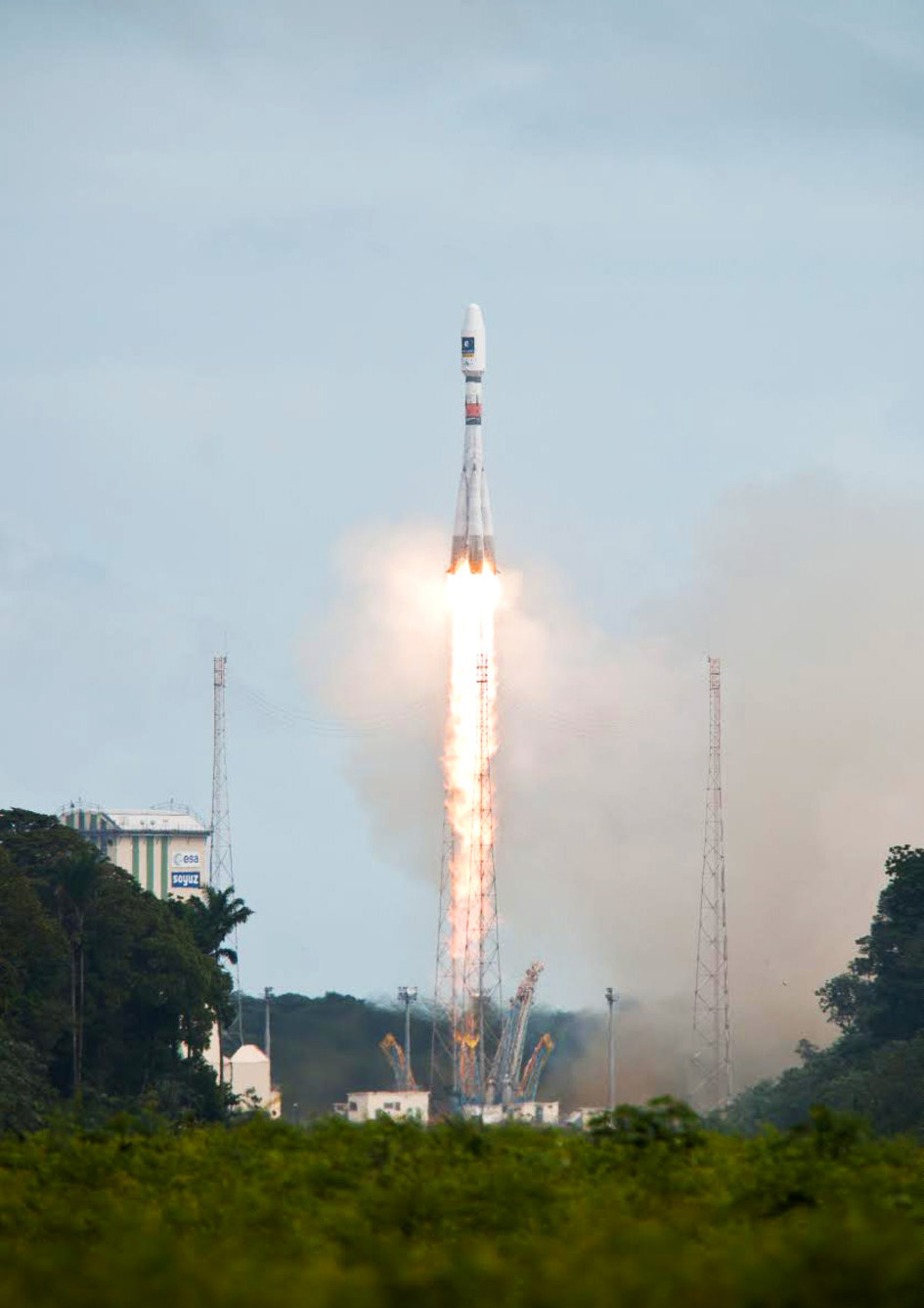
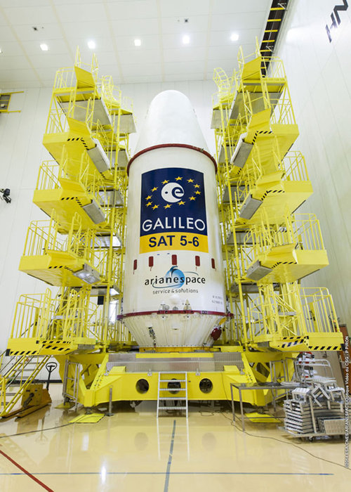
Soyuz Flight VS09, carrying Europe’s fifth and sixth Galileo satellites, lifts off from Europe’s Spaceport in Kourou, French Guiana.
That moment arrived last month, on August 22, with the launch of the first two Galileo FOC satellites. The significance of the first FOC launch is that it would trigger an aggressive launch schedule comprised of one launch every three months, at two satellites per launch — equaling eight satellites launched per year. With four test satellites already in orbit being converted to operational satellites, one can envision 16 Galileo satellites in orbit by the end of next year. While not a complete constellation at that point, it would offer plenty of upside — worldwide I might add, as I’ve written about in the past — by adding more satellites in view and accelerating the adoption of the new L5 signal, which is also supported by GPS.
Between Europe deploying Galileo and China deploying its BDS (BeiDou) system, the world of high-precision GNSS is going to change a lot in the next couple of years. There will be more receiver choices at much lower prices for RTK receivers.
But, the satellite navigation business is not a forgiving one. The devil is in the details, and the number of details has got to be overwhelming. Consequently, there have been many casualties.
The Russians have taken their lumps, losing a total of seven GLONASS satellites to faulty rocket launches in just the past four years.
In 2009, the U.S. placed into orbit a GPS satellite, SVN-49, that never has been set healthy, rendering it a “$100M test satellite.”
Now, the Europeans have joined the club.
The “pucker factor” during the satellite launches is always high, so on August 22, when two Galileo satellites mounted on a Russian Soyuz rocket at the Arianespace launch pad in French Guiana were pushed up into space, there must have been a sigh of relief that the launch seemed to go smoothly. Even I was excited, Tweeting “#Galileo Launch Successful, Satellites Deployed. Booyah!”, shortly after the launch.
However, looks can be deceiving.
It turns out that somehow, some way, the two Galileo satellites, after years of planning, were inserted into the wrong orbits.
The liftoff and first part of the mission proceeded nominally, reports Arianespace, leading to release of the satellites according to the planned timetable, and reception of signals from the satellites. However, the targeted orbit was circular, inclined at 55 degrees with a semi major axis of 29,900 kilometers. The satellites are now in an elliptical orbit, with excentricity of 0.23, a semi major axis of 26,200 km and inclined at 49.8 degrees.
With navigation satellites, we’ve seen disastrous launch failures and defective satellites placed in orbit, but I can’t recall ever hearing about navigation satellites being inserted into the wrong orbits. It’s difficult not wonder how such a seemingly simple error could occur, yet sympathize with the Galileo program managers given the complexity of the task, but also appreciate the consistency and reliability of GPS satellite deployments.
Galileo satellites fastened to upper stage.
The Russians quickly commented on the satellite deployment anomaly since it was a Russian Soyuz rocket launcher, speculating that it was a software bug. The Russian newspaper Izvestia quoted an unnamed source from the Russian Space Agency Roscosmos that “the failure of the European Union’s Galileo satellites to reach their intended orbital position was likely caused by software errors in the Fregat-MT rocket’s upper stage.”
It’s too early to say if the Galileo satellites will ever become serviceable. The Monday following the launch, an independent inquiry commission was formed to “establish the circumstances of the anomaly, to identify the root causes and associated aggravating factors, and make recommendations to correct the identified defect and to allow for a safe return to flight for all Soyuz launches from the Guiana Space Center (CSG).”
This subject will certainly be a hot topic at the Institute of Navigation (ION) GNSS conference being held next week in Tampa, Florida. A full staff of GPS World editors and administration folks will be attending, including yours truly. It’s the premiere GNSS technical event of the year, so I’m sure there will be plenty of scientists and program managers commenting and speculating on the future of these two satellites.
If you’d like the latest news on this and other GNSS-related subjects during the conference next week, follow me on Twitter at https://twitter.com/GPSGIS_Eric. There are lots of interesting subjects at the ION GNSS+ conference. Take a look at the conference agenda here. I’ll be attending many of the presentations related to high-precision GNSS and report to you in next month’s newsletter. To give you a flavor, following are some of the presentations that I’m going to try to attend.
The Triple-frequency Multi-system RTK Engine for Challenging Environments
Mobile Mapping Using Smartphone
Analysis of Using Smartphones for Indoor Mobile Mapping
GPS Program update
Galileo Program Update
Glonass Program update
BDS Program update
GLONASS Only and BeiDou Only RTK Positioning
Comparing Multi-constellation and Multi-frequency Based on GPS/Beidou RTK Positioning
Combined GPS+BDS+Galileo+QZSS for long single-baseline RTK positioning
Real-time PPP with Galileo, Paving the Way to European High Accuracy Positioning
High-Precision GNSS — What will it Look Like in 2020?
Col. William Cooley, Director, U.S.A.F. Global Positioning Systems Directorate.
Colonel William “Wild Bill” Cooley, director of the GPS Directorate at Space and Missile Systems Center, discusses CNAV signals, GPS IIF launches, and the OCX with Defense Editor Don Jewell.
There is probably no busier United States Air Force officer than Colonel William “Wild Bill” Cooley, Ph.D., the director of the GPS Directorate at Space and Missile Systems Center (SMC), Air Force Space Command (AFSPC), Los Angeles AFB, California. He is the driving force for all things dealing with acquisition and development for GPS. Currently, he is juggling so many objects, it is amazing that he is not totally overwhelmed. Consider the issues with the Next-Generation Operational Control System (OCX), GPS IIF, GPS III, and military government user equipment (MGUE), plus a plethora of classified endeavors we can’t even discuss here. He is one busy man, but even with all that, he found time to sit down and answer a few questions in an effort to bring us all up to speed on GPS and PNT.
Don Jewell (DJ): One of the hot topics at all the symposia lately, here and abroad, has been the broadcasting of additional civilian navigation signals and messages. The U.S. Department of Transportation (DOT) originally objected and sent a strongly worded and probably unadvisable letter to General Shelton (AFSPC/CC) on the matter, but sanity prevailed, and the GPS navigation signals on L2C- and L5C-capable satellites began broadcasting with full navigation messages on April 28. However, we understand DOT still insists some restrictions be put in place for the L5C signal. Can you provide us with an update and a status on that program? Plus, what can users expect in the way of improved accuracy and signal availability?
Colonel “Wild Bill” William Cooley (WBC): As of April 28, the civil navigation message (CNAV) broadcast was implemented on all operational GPS satellites capable of transmitting the L2C and L5 signals. Currently, seven GPS IIR-M satellites broadcast L2C, and six GPS IIF satellites broadcast L2C and L5. On average, users may expect at least one L2C-broadcasting satellite to be in view at all times.
The CNAV message content now includes the minimum message set needed to support the positioning, navigation, and timing mission, namely Broadcast Message Types (MT) 10, 11, 30, and 33, which contain information about the satellites’ position, clock, health, and corrections, in lieu of the previously transmitted MT-0 placeholder or default message.
The Air Force intends to broadcast L2C messages with the health bit set healthy and L5 messages with the health bits set unhealthy until sufficient monitoring capabilities are available for the L5 signal. We expect the accuracy to be slightly less than the Legacy Navigation Message (LNAV) because we are only updating the satellites two times each week. The accuracy should improve to be slightly better than LNAV beginning this December, when we begin updating the CNAV message on each satellite daily.
DJ: The M-code (military code) and MNAV (military navigation) signals are also being broadcast on M-code-capable satellites. So, the same questions apply: what can our warfighters and government users expect as far as M-code availability and accuracy? What can you say about the multiple messaging capabilities both on the civilian and military (CNAV and MNAV) signals?
WBC: Like the civil CNAV message, the modernized military-data message MNAV will enable military users to take advantage of all of the performance improvements offered by a modernized military signal. We can expect continued accuracy improvements as newer satellites replace aging satellites.
MNAV broadcast testing will continue occasionally in support of developmental test events for the next-generation military GPS receiver cards.
DJ: I know we can get in sensitive territory here in a hurry, but since we are discussing the military signals, can you give us an update on the long-running MGUE and M-code program? When can government users expect to see an actual signal and a receiver with M-code chips and/or modules that utilize the military only signals? Plus — and here’s where we have to be careful — what can you say about the security, availability, and accuracy of the military signal?
WBC: The M-code-capable military receiver (MGUE) modules in development have successfully acquired and tracked M-code during live-sky tests, and we have many more tests scheduled. MGUE is expected to begin fielding by 2017, at which point at least 18 M-code-capable GPS satellites are expected to be on orbit, providing global four-in-view coverage of full M-code capabilities.
In the meantime, the most recent GPS IIF satellite launches have raised the total number of M-code-capable modernized GPS spacecraft to 14 (seven GPS IIR-M and seven GPS IIF). This provides four or more M-code satellites in view globally at least 50 percent of the time, and at least one M-code satellite in view continuously. This increasing M-code satellite signal coverage will enable effective, realistic, developmental and operational testing of MGUE receivers.
The new GPS III block of satellites will provide an M-code signal with greater security, and higher power, comparable availability, and accuracy when compared with the GPS IIF satellites, allowing users to operate closer to jammers and under trees, as well as with greater resistance to jamming and spoofing. Also OCX will offer significantly improved crypto protection and cyber security.
DJ: Recently, the U.S. Air Force successfully launched the fifth, sixth, and seventh SVs in the GPS IIF family of satellites in less than seven months. Quite a feat! Congratulations are in order for that milestone. However, in the past, the checkout times averaged approximately 30 days. In fact, speed in initializing the IIF SVs and declaring them operational seemed to be an unofficial goal. On GPS IIF-5, however, the rapid checkout timelines have been extended considerably. Can you enlighten us concerning the checkout program and what the government hopes to achieve?
WBC: There are three key dates with regard to checkout timelines: completion of on-orbit checkout, the transfer of Satellite Control Authority (SCA), and the Operational Acceptance of the vehicle. Measured from launch, the nominal on-orbit checkout timeline is 21 days. The nominal checkout for SCA transfer is 28 days. For the IIF-5 mission, the on-orbit checkout occurred in six days and the SCA in 11 days, a record for the IIF program!
The operational acceptance was completed 60 days later, following an on-orbit observation validating a requirement to see if the vehicle works as expected without receiving any commands from the ground segment in that time period.
This may explain the perceived extended checkout, which is in reality a delayed operational acceptance.
The average time to SCA transfer for the first four vehicles is 42 days. The average is inflated due to a long checkout of the first GPS IIF space vehicle, which took 88 days. From IIF-2 to the present, the average SCA transfer time has been 21 days.
Using SCA transfer time makes the most sense, because that is the time it took the SPO to go through the entire process (to include meetings and documentation) to hand over the vehicle.
DJ: Can you give us a status update on the entire GPS IIF family of satellites? How are the SVs faring in orbit, and are the clocks proving to be as stable and accurate as forecast?
WBC: The first seven of 12 GPS IIF satellites are currently on-orbit and meeting all mission requirements. Of the remaining satellites, one is being prepared for launch in October 2014, one is being prepared for shipment to Cape Canaveral AFS, two are in storage, and one is completing production. The oldest satellite is now four years old. The legacy GPS satellites have remained operational well past their design lives, demonstrating the high-quality engineering and mission-assurance practices used on this program. The clocks are improving the overall accuracy of the constellation with the best-ever day (measured in Signal-in-Space User Range Error) in June 2013 of 46.6 centimeters and the best week in April 2014 of 64.6 centimeters.
DJ: What exactly do the IIFs mean to the GPS modernization program, for the average user and for the GPS constellation and program as a whole?
WBC: The 12 Boeing-built GPS IIF satellites will provide improved signals that will enhance the precise global positioning, navigation, and timing (PNT) services supporting both the warfighter and the growing civilian needs of our global economy. The next-generation satellites will provide improved accuracy through advanced atomic clocks, a longer design life than previous GPS satellites, and a new operational third civil signal (L5) that benefits commercial aviation and safety-of-life applications. It will also continue to deploy the modernized capabilities that began with the modernized GPS IIR satellites, including a more robust military signal.
The anomalies that we have seen on orbit have been resolved either through rework at the factory or through modifications in flight software.
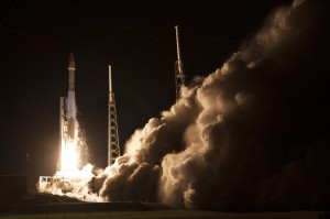
GPS IIF Launch. The seventh of the follow-on generation, rising August 1.
DJ: Bill, that’s comforting, but what about the clocks on the IIF SVs? There were serious problems with the Cesium clocks on the first couple of launches. Are the operators now able to utilize or activate either the Rubidium or the Cesium atomic reference systems?
WBC: Don, the answer is yes. The system has triple redundancy with two Rubidium frequency standard clocks and one Cesium frequency standard.
DJ: What about signal strength and stability on the IIF birds?
WBC: In addition to an increased number of signals, GPS IIF provides more than the legacy power levels, and all signals on GPS IIF meet stability requirements. For reference, the GPS IIR-M series introduced one new L1 and two new L2 signals, while GPS IIF introduced the new L5 signal. All of these signals are part of the GPS IIF navigation payload and provide information including GPS date and time, satellite health, satellite ephemeris (for individual satellite positioning), and almanac information (for information on other satellites in the constellation).
The L1 frequency carries the L1 C/A code for civil users, and the L1 P (Y) code and L1 M-code for military users. The L2 frequency carries the first modernized civil signal, L2C, and the L2 P (Y) code and L2 M-code for military users. Finally, the L5 frequency carries the newest modernized civil signal.
Modernized GPS civil signals provide dual-frequency signals to all GPS users, enabling ionospheric corrections that greatly improve the accuracy. The new L5 signal will be used for safety-of-life applications, including aviation. In addition to an increased number of signals, GPS IIF provides more than the legacy power levels, and all signals on GPS IIF meet stability requirements.
DJ: Let’s move to the ground segment. OCX, the next-generation GPS Command and Control (C2) system, has literally moved to the right on the schedule timeline for every month it has been in existence since it was awarded in 2010. The end date just keeps getting farther and farther away. OCX is also currently exceeding the original contract budget by a large margin.
What’s the problem? Is OCX more difficult or complicated than originally planned? Is there any good news to report to users on OCX? What can users expect in the future?
Just so our readers know, just what is it that OCX brings to the GPS arena that cannot be provided by the current Architecture Evolution Plan (AEP) C2 system? Why do we need OCX? And in your opinion is it still a viable option? Are there contingency plans?
My apologies — that is about eight questions in one, but hopefully you can bring us up to speed on OCX.
WBC: Actually, the primary drivers of schedule delays for OCX are related to:
issues with the integration and testing of Block 0 on the cyber-hardened infrastructure; and
the concurrent systems engineering approach for Block 1 and Block 2, which drove a high rate of rework and inefficient staffing.
The OCX program is a pathfinder for many of the U.S. Air Force’s and Department of Defense’s most rigorous Information Assurance (IA) and Cyber Security requirements, which have turned out to be more complex to implement than anticipated.
OCX is a challenged program, but there is progress to report. Raytheon completed a hardware compatibility and integration test with the non-flight test bed of the Lockheed Martin GPS III space vehicle. This test validated the network infrastructure’s ability to communicate between the Lockheed Martin Launch and Checkout Capability and the Raytheon Launch and Checkout System, sending commands to the full-sized, functional satellite prototype test bed.
In addition, Raytheon and Lockheed Martin completed the third of five planned launch and early orbit exercises to demonstrate launch readiness. This exercise used new installments of the Raytheon OCX software and network infrastructure to demonstrate space-ground communications for initial acquisition, orbit-raising maneuver planning and execution, and basic anomaly detection and resolution.
Another recent accomplishment was the merging of the Cyber Security hardware and software baseline with the Block 0, Launch and Checkout System, mission applications. The completion of this merge allowed the program to enter formal integration and test activities, which are ongoing.
The full capabilities of OCX provide more than a dozen new capabilities for the GPS mission. OCX enables the full capabilities of the modernized navigation signals: adding L2C and L5 for civil users, M-code secure signal for military users, an internationally compatible L1C, as well as worldwide monitoring of these modern signals for quality and integrity.
OCX enables operation of the new GPS III satellites. As we discussed previously, OCX will provide the USAF’s most rigorous cyber-security capabilities, built in from the OCX foundation.
Raytheon just completed implementation of a program re-plan, which implemented lessons learned to date to correct many of the development challenges encountered, and created a lower risk schedule for delivery. With these changes, the program remains a viable and important component of the modernized GPS enterprise.
DJ: With that in mind, when do you currently plan on having the first GPS III OCX-controlled launch? Original schedules called for a late 2014 date, then it was 2015, and now we are hearing 2016 or as late as 2018 for OCX. Are there viable alternatives, and if so, can you tell us what they are and if they are being pursued?
WBC: OCX and GPS III are synchronized to support launch of the first vehicle in the second half of 2016, conditioned upon launch manifest availability. Contingency plans are being developed, but will only be implemented if warranted by the risk.
DJ: Now, Bill, I am not asking you to blow your own horn here, but frankly we have heard nothing but good reports from SMC and the GPS Directorate since you arrived about 14 months ago. That is a short period of time, but evidently you have made your presence felt and have had a major impact on the GPS program overall. What have you done differently that seems to work so well? To what do you ascribe your success so far?
WBC: Thank you, Don. I’m very happy to hear the reports are positive, but the credit goes to the men and women of the GPS Directorate, our federally funded Research and Development Center personnel, and our contractors. My job is to continually assess the challenges and barriers that slow modernization. I help resolve the challenges or get additional resources if needed to enable the team to accomplish their important mission.
I am incredibly fortunate in that the GPS team is passionate about our mission to maintain the Gold Standard for position, navigation, and timing (PNT) for the world. The entire directorate understands the critical role we play for civilian and military users worldwide, and that knowledge motivates and energizes us every day!
I’m the luckiest colonel in the Air Force because I get to work alongside this terrific team of government and contractor professionals on one of the most important missions in the U.S. Air Force.
DJ: Obviously you are proud of your team, and you know what it means to be a great leader. In closing, do you have any final comments?
WBC: Don, just that the GPS Directorate and our contractor team, along with our partners at the 2nd Space Operations Squadron (2SOPS) who fly the GPS constellation 24/7, take our job seriously and understand the important mission we have: to provide reliable and precise position, navigation, and timing services for America’s warfighters, our allies, and civilian users around the globe. GPS is the Gold Standard for space-based PNT today, and we are modernizing to ensure GPS is the Gold Standard for the future.
When I was a young man, the moment seemed like all there was, all there needed to be. Why plan? Why reflect? The days were just packed.
Once I turned 25 — or somewhere around there — intimations dawning of my own mortality, I began to look both forward and back. It seemed like a good idea, perhaps even an important one, to draw from my own history, good and bad, and use that perspective to start building a more informed, more mapped-out future.
That’s what the Special Section accompanying this issue is all about. So much goes on at all times — the days are just packed — and we are so busy formulating solutions to the challenge of the moment, whether that be spoofing or indoor positioning or adjacent-band use, that we have little opportunity to reflect on how far we have come. To take the long view on just where we want to go in the next 25 years.
In that vein, we are proud to present Brad Parkinson’s vision of the future. He brought you GPS in the past. He has his sights firmly fixed on “PTA” for the future: Protect, Toughen, and Augment GNSS to assure continuous delivery of solutions.
Brad is uniquely qualified to lay out these prescriptions for our collective future. Having been deep in the political and technical trenches, fighting to build a revolutionary new system decades ago, and in continuous engagement ever since, he knows both the vulnerabilities and the possibilities.
No mention of the 25-year history of this magazine would be complete, or even remotely accurate, without giving prominence to two individuals who shaped it from the beginning. Glen Gibbons was the founding editor and held down this chair for 16 years. He literally invented GNSS journalism. His confrère from those early days is still with us: Richard Langley logged his 200th Innovation column a couple of years ago, and it remains a cornerstone of every issue. Except August and December, when he helps us compile the GNSS Constellation Almanac.
So, back to the young man, 25 years of age, who had a head full of impressions but not much, perhaps, in the way of concrete ideas. He has turned twice that number since then, and I hesitate to state how many more. The impressions, of course, have only continued to accumulate. The ideas have started to come. Plans have formed, been left by the wayside, new plans derived, and some of them even followed. Life, it has been said, is what happens while you are busy making plans.
Take some time to wander through the back pages of GNSS industry history in the Special Section volume that accompanies this one. Read what the GPS Directorate is doing now to make things even better. Absorb the necessary strength and vision — Dr. Parkinson’s PTA prescription — we’ll need for the future.
“Following the failure on Friday August 22nd to inject Galileo satellites 5 and 6 into the correct orbit, the European Commission has requested Arianespace and the European Space Agency (ESA) to provide full details of the incident, together with a schedule and an action plan to rectify the problem.”
This is the only official face showing, but extremely high levels of activity take place behind the curtain, studying what might have caused several million Euros of hardware to end up much lower above the Earth than desired. Meanwhile, active speculation in the satnav blogosphere provides glimpses of possible outcomes from the latest satellite disaster — not exclusive to Galileo, by any means — created in all likelihood by a malfunction aboard its Soyuz launcher and/or the Fregat upper stage thereof.
The full official EC announcement is available here.
The satellites are under the control of the European Space Operations Centre (ESOC), ESA’s main mission control center in Darmstadt, Germany. But they are far out off position — more than 3,500 kilometers of space away, so far as to make their eventual use as part of the Galileo constellation very unlikely. Discussions continue with ESA and Arianespace regarding whether or not the satellites are likely to be of use, but odds are against it.
Their onboard fuel is not enough to compensate for the launch shortfall to reach higher orbits under their own power. ESA scientists are studying how they might still possibly be used, far from their optimum position,s within the Galileo constellation.
According to an Arianespace press release on August 23, the target orbit was circular, inclined at 55 degrees with a semi-major axis of 29,900 kilometers, but what they got was an elliptical orbit, eccentricity of 0.23, semi-major axis of 26,200 kilometers and inclined at 49.8 degrees.
On August 28, the Russian newspaper Izvestia reported that “The failure of the European Union’s Galileo satellites to reach their intended orbital position was likely caused by software errors in the Fregat-MT rocket’s upper-stage.”
“The nonstandard operation of the integrated management system was likely caused by an error in the embedded software. As a result, the upper stage received an incorrect flight assignment, and, operating in full accordance with the embedded software, it has delivered the units to the wrong destination,” an unnamed source from Russian space Agency Roscosmos was quoted as saying by the newspaper.
An independent inquiry panel has been set up by Ariane. It is headed by former ESA Inspector General Peter Dubock. It starts work on August 28. The panel includes a couple of academics and a majority of ESA and EC figures.
Ferdinando Nelli Feroci, the new EC Commissioner for Industry and Entrepreneurship.
The new EC commissioner in this area, Ferdinando Nelli Feroci has invited ESA and Arianespace to his study during the first week of September to present the initial results of the inquiry.
The commissioner commented, “The problem with the launch of the two Galileo satellites is very unfortunate. The European Commission will participate in an inquiry with ESA to understand the causes of the incident and to verify the extent to which the two satellites could be used for the Galileo programme. I remain convinced of the strategic importance of Galileo and I am confident that the deployment of the constellation of satellites will continue as planned.”
The commissioner expects that the Galileo constellation will be fully deployed by the end of this decade. This may qualify as optimism because system planners had envisioned for six spares – and three are already blown.
Ariane and ESA did not insure the satellites.
According to back-of-the-envelope calculations, system operators are now one short of the minimum 24 needed for full 24/7 global coverage, as they have 4 IOVs up (1 broken) and 22 FOCs on order (2 launched and now in what could be called a junk orbit) which makes a potential maximum 23 sats that have actually been ordered – one short of the target.
The Satellites Are Alright
Satellite manufacturer OHB Systems of Bremen, Germany, issued a release stating that “Controllers at ESA’s ESOC control centre in Darmstadt, Germany, confirm the good health and the nominal behaviour of both satellites. They are in a safe configuration, are thermally stable, have stable pointing to the sun and sufficient power production. All platform subsystems have been checked and they work properly. Also the procedures to deploy the solar arrays are successfully performed and all solar arrays are properly unfolded.”
Further, “The orbit anomaly has no impact on the production and delivery of the in total further 20 satellites. Two FOC*-satellites are currently at ESTEC test facilities in Noordwijk, the remaining are in various status of integration. ”
Blogging the Boondoggle
The chairman of the Executive Board of the German Aerospace Center, Johann-Dietrich ‘Jan’ Wörner, writes an interesting blog. The current installment opens with a quote from Elon Musk: “Rockets are tricky.”
Wörner goes on to say, “The Soyuz launcher lifted off from the European Spaceport in French Guiana. Initially, all of the measurements suggested a perfect mission; the launcher took off at the scheduled time, followed the prescribed trajectory, and the stage separation was carried out correctly. However, the first problem became apparent when the two satellites proved unable to deploy their solar arrays as intended. A more detailed analysis then revealed that the eccentricity, the altitude and the inclination of the satellites’ orbits with respect to Earth’s equator did not meet the specifications. The upper stage had also evidently failed to induce the planned rotation around the longitudinal axis of the spacecraft (known as ‘barbeque’ mode, designed to maintain favourable thermal conditions during exposure to the Sun).”
Further discussion of the possible causes of the anomaly can be found on a Russian site, which focuses on the Fregat stage thrusters and indicates that the Russians think the barbeque maneuver was completed, and thus not the problem.
The other big issue is how the telemetry didn’t pick up the issue straight away.
There is avid speculation and a number of interesting theories being aired on the Canadian Space Geodesy Forum. For subscriptions to this vital listserv, visit here.
A number of factors are holding the proximity marketing/indoor positioning markets back: standardization issues, consumer acceptance/privacy, retailer awareness and the technology itself. However, as one location executive put it, it may be the one way that retailers with brick and mortar stores can compete with Amazon and other online giants.
Indoor location and proximity marketing may be the way large and small brick and mortar stores can compete with online retailers in the future, said panelists at the New York Place conference, held July 22. But all of this indoor location market talk doesn’t mean much if consumers don’t find a need for it.
“I am in an aisle at a grocery store and you sent me a coupon for cat food, and I don’t have a cat, I am not going to be interested. The retailer gets to own the data by providing a great experience to the consumer, not the spontaneous ‘you are in a store — here’s some information,’” said John Dempsey, Datalogix head of mobile and video.
While having a broad picture of a consumer’s “mobile moment” is important, there is something to be said about bombarding a consumer with too many location-based applications, said Doug Kilponen, Wanderful Media chief operating officer. “There are a limited number of apps consumers are willing to have, but not 200 different ones. It’s one thing to have an app for say, Target, but trying to find out what is broadly available during shopping makes shopping too much work,” he said. “Trying to find out what’s available becomes too much work as there are too many options [for the consumer].”
From a retailer’s perspective, they want consumer’s data, and will share it with partners, but they also want control, said Catherine Lindner, Shelfbucks chief marketing and merchant officer, who was an executive at Walgreens. “If you think about your own shopping behavior, there is only a few places you actually go to and spend money — a grocer, drug store. That retailer wants your data, and it makes sense,” she said. “How do we spend the money to grow the business? The idea that there is one bucket of money to transfer is not going to happen.”
One company says that consumers don’t want to be “advertazed” by retailers. “Their job is to show you Calvin Klein, but sometimes there is not enough information or context. They hijack moments, rather than create them,” said Scott Townsend, Urban Airstrip director of agency programs.
Still, retailers are increasingly using indoor location as part of their mobile strategies. Jewelry chain Alex and Ani has three beacons in their Boston and New York stores, said Ryan Bonifacino, Alex and Ani vice president, digital strategy. “We really want to prove that this [indoor location] can really work. We really want to get in front of people who wouldn’t have discovered us,” he said.
Indoor Location Standardization? What Standardization?
Like any new technology and market, industry standardization will have growing pains, and a lot of the problem may be with the retailers, said panel members. “There are issues with standardization. If Walmart puts a [indoor positioning] in to its store — they don’t care if it works anywhere else,” said Don Dodge, Google developer advocate.
Indoor location is the classic chicken-before-the-egg situation, said Chris Goodall, Trusted Positioning founder and CEO. “There currently are no standards for indoor [positioning], maybe we need it. Databases are not standardized,” he said.
A lot of the reason that standardization has not be resolved is that no big application, the old killer app, has appeared. “Indoor is something that has not emerged yet, it’s a long tail story,” said Dan Ryan, ByteLight co-founder and CEO. “Every location company is trying to build a network — and naturally attract developers.”
Making Proximity and Indoor Location Relevant to Retailers
Some retail chains like Walgreens have used indoor positioning technology for years and are considered some of the major early adopters. However, making consumer-purchasing behavior data relevant to retailers is the only way for indoor marketing to take off.
The concept of geofencing each store has been tested in several locations. One company envisions an image of a celebrity greeting consumers in a store with an offer. “Walgreens focused on not invading people’s privacy. But they basically asked users, what’s important to them when they walk into a store,” said aisle411 founder and CEO Nathan Pettyjohn. “[Bluetooth Low Energy] beacons can do this very elegantly. When a consumer walks through a store, perhaps they see a celebrity popping out to greet them.”
In many successful mobile marketing campaigns, all have a common theme — proximity components always enhance sales, said James Smith, Verve chief revenue officer. “Every one of our studies says it drives sales. Sometimes we hear that geofences don’t work — my answer to that is they are in the wrong places,” he said. “A person can go into a place 15 days later and a beacon locks on them — the retailer is happy because it works. Consumers are more empowered because they have a research device in their hand to go where they want to go.”
Case Study: Walkbase
A Finland-based company is delivering market research to retailers that examines consumers’ in-store shopping behavior and loyalty patterns. Walkbase, which signed a deal with Helsinki airport operator Finavia, started in 2007 when it spun off from an indoor location company.
“It’s a retail tool that analyzes indoor performance of marketing campaigns and [sales] conversion. It measures when consumers come into a store — do they bounce out or are they engaged?” said Juha Mattsson, Walkbase vice president, sales and marketing. “A retailer can launch a campaign that is affected by a consumer’s indoor journey. Whether that is through coupons, or not, as some retailers don’t want that.”
Mattsson says that the company is operating primarily in Europe — and is waiting for what indoor technologies will win. “It is just a matter of time before the market takes off. Retailers are very interested in these types of consumer spending analytics,” he said. “We will be launching a U.S. white paper on in-store optimization as it’s all about education. We also are rolling out a version 2.0 of our product in the third quarter.”
In other LBS news:
According to published reports, Michael Halbherr, CEO of Nokia’s HERE mapping unit, will be stepping down. Halbherr, who is based in Berlin, steps down after eight years at the company. As recently as 2012, HERE, then called Navteq, had been losing money but had stabilized recently. Cliff Fox, HERE senior vice president, will be acting CEO until a replacement is found.
I will be covering CTIA’s Super Mobility Week in Las Vegas, Sept. 8-11. To arrange an interview with me for Wireless LBS Insider, or to submit press releases, contact me at [email protected].
On the tail of the Esri International User Conference (UC) and the first-ever live event webinar we’ve ever conducted, I’d like to revisit a subject I’ve pounded hard for the past couple of years. It’s a subject that still, after my 25 years in the geospatial industry, is still the most common problem that geospatial users ask me about.
First, however, the live event webinar at the Esri UC. What a blast it was to broadcast live from San Diego with people walking by and the buzz of 14,000+ conference attendees in the air! I’ll definitely be looking for more opportunities to broadcast live from events like this. The webinar was great. It touched primarily on high-precision GNSS on mobile devices. If you weren’t able to attend and would like to listen to it, register here and you’ll be sent a web link. Then, just last week I conducted a follow-up webinar that dug further into the details of how to use RTK (real-time 1-2 cm accuracy) on almost any mobile device. If you missed it and would like to listen to it, register here and you’ll be sent a web link.
So, what is the #1 question I was asked 20 years ago and is still the #1 question I’m asked about today?
“Why doesn’t my GPS data line up?”
Part of the reason that the question has been a consistent perennial favorite is that low- to medium-cost GPS (now more commonly referred to as GNSS) receivers have become more accurate, so our expectations for better accuracy have increased. It used to be that 2-5 meters (after post-process differential correction) was about what you could expect from a $10,000 GPS receiver. Today, you can buy a real-time, submeter receiver for under $2,000 and an RTK receiver capable of 1-2 cm accuracy for two to three times that.
So, “why doesn’t my GPS data line up?”
I wrote two articles that attempted to summarize the problem. The two-part series was entitled “Nightmare on GIS Street.”
Horizontal datums, and changing horizontal datums, are the root of the problem. Lack of user knowledge and GIS software vendors’ improper implementation of horizontal datum transformations exacerbate the problem.
There are a few common horizontal datums used, at least in the U.S.. Outside of the U.S., there a myriad of datums with associated transformation algorithms. A few common ones are:
ITRF08 – International Terrestrial Reference Frame of 2008. ITRF08 is world-wide datum with no epoch (time stamp) associated with it.
WGS-84 (G1674) – World Geodetic System of 1984. WGS-84 has changed substantially over the years. G1674 is the latest revision (actually, I think G1762 is out but I’ll leave that for now). At epoch 2005.0 (January 1, 2005), WGS-84 (G1674) and ITRF08 are within a centimeter of each other.
NAD83/2011 – North American Datum of 1983. As with WGS-84 and ITRF, NAD83 has undergone significant changes over time. The current version is NAD83/2011 with an epoch date of 2010.0 (January 1, 2010).
Now, it would be great if all of our geospatial data was referenced to the same datum. In that case, all of our geospatial data would line up perfectly. But, it’s not that easy. In fact, not only is data published in all three of the above datums (and more), but also a lot of legacy geospatial data is published in earlier versions of the datums above, which can significantly differ from the current revision of the same datum.
For example, if you received geospatial data that is reported to be referenced to NAD83? What does that mean? Is it the original version of NAD83 or is it the latest revision of NAD83 (2011) or somewhere in between?
Let’s take a practical and very common example.
Assume you’ve got a high-precision handheld GNSS receiver. Unless you’re connected to a RTK network or post-processing, you’re likely using WAAS as a source of GPS corrections, which is a very common setup.
Let’s say that your GIS database is referenced to NAD83/2011, another very common setup.
WAAS is referenced to ITRF08 current year epoch.
ITRF08 differs from NAD83/2011 from 2 to 4.5 feet in the U.S. depending on the geographic region you work in. So, if you don’t adjust your incoming data to match NAD83/2011, the data you add to your GIS database will be offset by 2 to 4.5 feet. Following is a graphic from Michael Dennis of the National Geodetic Survey that illustrates the difference between NAD83/2011 and WGS-84/G1672.
Source: National Geodetic Survey
What’s really important to note about the slide above is the epoch date. I write about the time variable of datums in Part2 Nightmare on GIS Street: Accuracy, Datums, and Geospatial Data. The bottom line is that the ground we walk on moves. It’s only very slightly, unless there’s an event like an earthquake, but it’s constantly moving, and generally in the same direction and rate. In the midwestern U.S., for example, the ground may only be moving a few millimeters per year. In some places in California, the ground moves 4 cm per year. If you’re using RTK to achieve 1-2 cm precision, 4 cm is a big number and can’t be ignored. If you located a point five years ago with RTK to the 1-2 cm level and revisited it today, the difference would be 20 cm, well over a half foot.
What methods are available to adjust for the difference between the two datums?
There are at least three ways I can think of. Of course, the easiest one is if the data-collection software you use is smart enough to deal with this. Unfortunately, this is not likely. Surprisingly, even mainstream GIS data collection software sold today doesn’t address this problem.
Some data collection software (ArcPad, SurvCE, FieldCE) have the functionality to define the GPS datum and apply a datum transformation in real time (in the field) so it’s transformed to NAD83/2011 before it’s stored in the GIS database. Note, however, that even fewer are able to deal with crustal movement. For example, take a coordinate time-stamped 2008 and “move” it to 2014.
Apply the datum transformation after the data is collected.
If your GIS software doesn’t have the correct datum transformation functionality built in, use a tool such as HTDP (Horizontal Time Dependent Positioning) to determine a precise offset distance and direction in and apply the offset to all of the data collected in that geographic region. Since WAAS precision is 50 cm at best, this type of offset correction is perfectly suitable.
As I mentioned in no. 1 above, several software packages can transform between datums, but very few can take into account the time component of datum transformations. In other words, they don’t take into account the fact that the ground we stand on is moving.
Some people are beginning to take note that addressing the time component of datum transformations is just a matter of time, which it is. For example, Geomobile Innovations just introduced a plug-in for ArcPad that adds extensive datum transformation functionality to ArcPad, including accounting for the ground movement. It turns ArcPad into a true high-precision data-collection tool.
More good news is that the big dog is starting to wake up. At the Esri UC last month, I heard from a reliable source that Esri has made dealing with this issue an active project, and is working on the logic and user interface to implement a time-dependent datum transformation model (commonly known as a 14-parameter transformation). As someone who used to design GIS data-collection logic and user interfaces, I can appreciate the challenge of implementing this model. What happens when a road/pipeline/transmission line crosses from one tectonic plate to another when the two plates are not moving the same direction and velocity? How does one make accounting for that easy to use yet technically correct?
I was born in the UK, so I still have a soft spot for people and things going on there. I really enjoy those PBS Mystery dramas, and, of course, Downton Abbey. Where’s this going? you might ask. It’s basically to preface an overview of a GNSS outfit I know quite well, which operates out of Lancaster in northwest England.
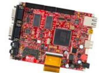
Forsberg Services Ltd. (FSL) has been around as a consulting company since 1987, when Charles Forsberg began the company, developing marine engineering solutions and, beginning in 1999, also representing NovAtel OEM GPS in the UK and the Middle East.
In 2002 the company was reconfigured as a navigation systems engineering company. With a number of successful programs underway in both the UK and Germany, FSL went on to open an office in Würzburg Germany, in 2002. At the same time, FSL won its first major naval contract with the CPUpak — an interconnect enclosure containing both SAASM and commercial CA-code receivers, which distributes GPS data to multiple systems. The CPUpak is now on several countries’ mine-countermeasure vessels (MCMV). It was also developed as an inertial navigation system as a key part of naval vessels’ air operations certification systems.
CPUpak is on a number of MCMVs.
FSL is still privately owned, has 26 employees, and considers itself a “design house” for vehicle manufacturers, the marine industry, defense contractors, cellular operators, and television networks. It is an ISO9001-certified R&D partner to several blue-chip companies for navigation systems.
Today, its primary activities include:
selling and supporting off-the-shelf FSL and NovAtel GNSS products and providing associated customer service,
custom engineering solutions developed over very tight timescales,
research into new and emerging markets and development to create new opportunities,
managing production of FSL products and also for key customers.
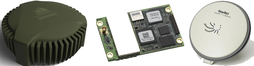
As NovAtel’s dealer in UK and Germany, FSL markets and services the full range of NovAtel OEM products, including the latest OEM6 GNSS receivers, Waypoint inertial and post-processing software, Antcom antennas, and Raven Starlink RF components.
NovAtel GAJT anti-jam system, OEM6, and Pinwheel antenna.FS-D6 processor module.
FSL has developed a number of key building blocks to enable further integration and production of various GNSS enclosures based on common hardware and software designs. This has allowed FSL to develop multiple systems in parallel and to expand the level of support provided through its dedicated team of engineers. The FSL-developed FS-D6 processor module and EDGE-WARE firmware it runs, along with the earlier FS-M4 microcontroller and FS-D5 DSP module, have become key building blocks that have enabled the creation of other products.
ReACT integrated GNSS/antenna.
The ReACT smart antenna was first produced in 2011, and has been qualified to appropriate mil-spec standards for use on military vehicles, with RS232/422, USB, and CAN interfaces providing data outputs. The unit has a sturdy, waterproof enclosure for operating in harsh environments, with up to 5 serial, 3 USB and 2 CAN interface channels to hook up other sensors. Applications have included INS and dual-antenna heading reference for military vehicles; agriculture; reference navigation for optical navigation; and photogrammetry.
MICROpod.
The MICROpod unit houses up to two GNSS receivers, and comes with a heading/attitude determination option. A MICROpod telecoms application involved supplying GNSS data to each radio network controller (RNC) to provide AGPS (assisted-GPS) data over the cellular network — the objective was to improve the start-up time for supporting emergency services. A less-expensive solution than installing separate GNSS receivers with each RNC, but certification to CE/FCC and IP67 was essential. The solution was the MICROpod eight serial ports along with firmware that made each RNC think it was connected to an independent receiver. Within the processor, the inbound commands and outbound data were managed to ensure that the system was serviced as expected. The whole project had extremely tight timescales — from contract award in August 2008, to first delivery on-site in the U.S. in November. The system was designed, developed, certified and passed test, all within three months! Around 400 systems are now installed across sites in the U.S. and around the world.
The unit has a sturdy IP65 enclosure, with up to 10 serial, 3 USB and 2 CAN interface channels to hook up other sensors. Other applications for MICROpod have included sub-10 nanosecond time synchronization of LIDAR, Earth observation/IR cameras, third-party INS, networked military vehicle/vessel navigation and data communications, pulse-train generation for coded equipment operations, and precision velocity measurement. Another variant has been customized and qualified for Train Control Network (TCN) applications.
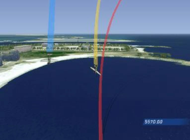
FSL has also dabbled in a couple of “glamorous” undertakings along the way, such as providing inertial/GPS dynamics measurement for the Red Bull World Series air races in Abu Dhabi, and also race-car inertial/GPS tracking and camera slaving for TV. A byproduct of the race-car project was a patent for a computer game using race data for vehicles that took part or could actually be played live during a Grand Prix on a particular circuit from a participating car.
Abu Dhabi air race aircraft.Air race graphics.GTR evolution game patent.
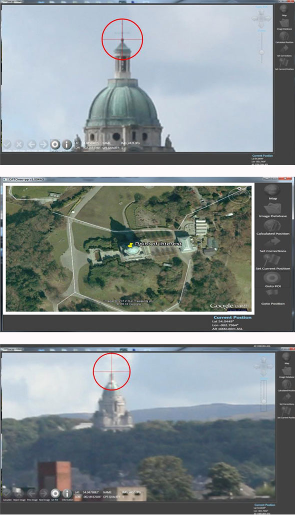
An interesting oblique photography application involved aircraft fitted with DSLR and video camera as well as other EO/IR sensors, their position and orientation measured by inertial navigation all feeding into FSL’s OPTOnav. A recent enhancement has been release of an in-flight bore-sight calibration. This is essential when navigation and camera choice may only be applicable for a single flight, and rapidly rendered results are necessary. The system works with a choice of cameras. For one project, an advanced GSS C516 compact five-axis gyro-stabilized platform and INS have been configured with Canon 1DC, Corona and Red Dragon cameras. The resultant ground positions are comfortably accurate to better than 1 meter at 500-meter range in real-time. This is despite GPS antenna often being fitted in less than ideal locations such as inside the cockpit of some aircraft.
The FSL OPTOnav product originated in 2006 as a piece of software installed on a rubber-tired gantry crane in a container port. The customer was experiencing problems of crane drivers being unable to see that they were drifting off course and moving outside of track, creating a safety risk. The crane is shaped like a staple, where the driver sits on one leg with the container in between the legs. As a result, the other leg cannot be seen clearly. This system is currently being enhanced so that it may utilize the latest technologies.
The software takes feeds from a GNSS receiver and from cameras. Using these inputs, a pattern and line-matching algorithm was developed to provide drivers with a centimeter-level indication of whether they were to the right or left of a safety line, along with the heading of the crane’s cameras to better than a 20th of a degree. This data was used to augment the GNSS in challenging areas, and unlike INS, simply doesn’t drift. During the development, a number of obstacles including shadows, reflections and obstructions were overcome.
This work leads to an RT version, which augments RTK GPS in obstructed sky locations, and a PP version, which supports precise point positioning aided GPS for applications such as photogrammetry. The system may be used to measure precise ranges to targets, and position is determined by triangulation. Simple, accurate and effective!
Measure the same point in multiple shots at different angles and distances: OPTOnav provides a 3D position.
So, let’s recap. That’s project management of contracted hardware, software and production to very short timescales; sales and support of GNSS; inertial and optical navigation; and OEM products from NovAtel, Waypoint and Antcom. That’s lots of options — along with access to markets in UK, Germany and elsewhere, and specialist applications in photogrammetry, machine control, survey, telecommunications and systems integration. So, although Forsberg Services Ltd. may be one of many outfits around the world in the value-added reseller (VAR) game, it certainly has enough irons in the fire. And it has demonstrated the quick turn-around of a small, flexible organization with a track record of success — so Forsberg Services should anticipate a bright, growing and interesting future.
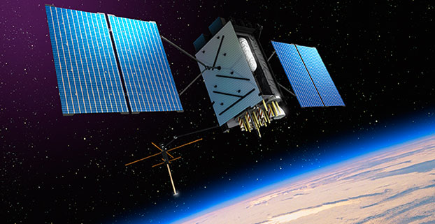
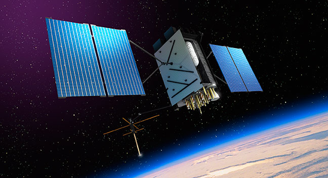
Artist’s rendering of GPS III satellite (courtesy of Lockheed Martin).
So, there I was, sipping a cold green tea in the shade on my back deck in the beautiful foothills of the Rocky Mountains in early June, when the phone began to ring off the hook. Upon answering, I was hit with a barrage of questions. Have you seen the GPS III Sources Sought? What should we do? Do you have any advice? Should we respond? But by far the question I thought expressed most everyone’s initial reaction of incredulity was “Are these guys serious?” For frankly this Sources Sought does contain a bit of a giggle factor.
The questions continued and the phone rang all week. Officially the Sources Sought being referenced is the GPS III Space Vehicles Production Readiness Solicitation Number: FA8807-14-R-0008. Prepared or not prepared by, take your pick, the space acquisition folks at SMC (USAF, Space and Missile Systems Center), and it has caused quite a stir in the PNT (position, navigation and timing) industry.
Before we get ahead of ourselves, I should explain exactly what a Sources Sought means in terms of what the U.S. government is looking for and how to respond — in my humble opinion of course.
First a Sources Sought, as defined by the business folks at Georgia Tech (GTPAC) who have researched the matter thoroughly and who I absolutely agree with, is not an actual bid or proposal solicitation; instead, it’s a solicitation of interest. You should think of a Sources Sought as market research being conducted by a government agency or service to determine the capabilities and interests of the marketplace in a specific area, product or capability. This specific Sources Sought should be of interest to companies having an interest and capability to produce products relating to GPS III specifically.
So, that’s the boring official definition, but what is a Sources Sought really? Certainly, the official definition works, but more often than not in my experience, the Sources Sought has also been used to:
Determine what companies, new and established, are players and who is still in the game.
Determine what partnerships might be formed and how companies might work together to provide a required and often difficult capability. Often government acquisition officials will discover a new capability from a trusted supplier, or discover new teaming arrangements that provide a synergy otherwise unavailable.
Determine who is paying attention.
See which companies answer the announcement. Acquisition officials say it is often just as interesting and enlightening to see which companies do not submit a response as it is reading the proposals of the responders, especially if the Sources Sought is being used as justification for a Sole Source award.
Determine if the project has any hope of succeeding, and if so, how do various companies approach the problems involved?
Provide an official and public catalyst for lethargic or too-comfortable contractors that are not getting the job done on a current contract. Fear can be a great motivator.
Enact the old marketing axiom, “Let’s run it up the flag pole and see who salutes.”
Regardless of what you feel the real reason or reasons for the GPS III Sources Sought might be, or even if you have doubts about the seriousness of the release, the one hard and fast rule among marketers is that if you have any capability that even vaguely matches the Sources Sought announcement, then by all means respond.
The official GTPAC advice — and again, I totally agree — is to always respond to a Sources Sought if it appears to be of any interest to you. Just as I have always said to company marketing reps, when asked about the company’s capabilities, the answer, a la Marketing 101, is always “Yes” until it is emphatically “No.” As in:
“Can you build that MDU?”
“Absolutely!” (Stage whisper) “What’s an MDU?”
“Dude, it’s a Mission Data unit.”
“Oh yeah, that MDU. Of course we can build it!”
It may be hard to believe, in this technological day and age, but contracting officials frequently complain about the limited responses they routinely receive to Sources Sought. Responding is usually quick and painless, and can be the first step to place your company in the running for a lucrative government contract. It distinguishes you from your competitors, who did not take the time or effort to respond. The bottom line is it may very well lead to an inside track on an eventual government contract. Just like poker — you can’t win if you are not in the game.
Of course, the reverse is also true, as almost every Sources Sought states. There are no guarantees, and a Sources Sought announcement may — or may not — be followed up by the agency or service with the issuance of an actual bid or RFP (Request for Proposal). The GPS III Sources Sought legalese reads this way: “This notice does not constitute a Request for Proposal. There has been no decision to develop an RFP for the effort in this sources sought notice.”
You take your chances, but nominally it is time well spent, as most Sources Sought require very little in the way of scripted paperwork and government forms. Sometimes the response may be in the form of a simple response on company letterhead laying out your qualifications and stating clearly that you and your company are interested.
However, the government being the government, more often than not the reverse is true, and there may be very specific instructions in a Sources Sought for responding. GTPAC recommends, as do I, that your company follow these instructions to the letter. Give the government no more or less than requested — in other words, give the federal agency or service which posted the Sources Sought notice exactly what it asks for in exactly the form it asks for it.
Now that we are all on the same sheet of music and fully understand exactly what a Sources Sought announcement means, why did this particular GPS III Sources Sought generate so much interest?
Caught off Guard
First I think, well actually I know, this announcement caught almost everyone off guard. It was a surprise, even to those of us who heard rumors about it for some time, not only because of the timing, but also the scope. It far exceeded what most everyone expected —we will get to that shortly. My sources inform me the exact wording and timing were even a surprise to Lockheed Martin Space Systems Company (LMSSC) and Exelis, who are, of course, as incumbents officially excluded from responding.
In retrospect, however, perhaps it should not have been that big of a surprise. General William (Willie) Shelton (USAF), who when this column is first released will have only 48 hours remaining as the commander of Air Force Space Command, had been telegraphing for some time, in sometimes strident language, that he was not happy and something was in the works. He has been uncharacteristically publicly critical of both LMSSC and Exelis for schedule slips and overruns pertaining to GPS III.
Without a doubt, Lt. General Ellen Pawlikowski (USAF), the most recent former commander at SMC (Space and Missile System Center) where the GPS Directorate is located in Los Angeles, California, at LA AFB, let her misgivings concerning a single provider for the GPS III payload be known for some time. Earlier this year, referring to LMSSC, General Pawlikowski was quoted as saying “They know we are not happy — that we are disappointed at the delays we have seen, the technical issues that their subcontractor [Exelis] has had, and probably they are considering whether an alternative source could provide them a better opportunity…I think that Lockheed is doing the right things to figure out how do they best deliver the GPS III in the timelines that they’re expected to.”
In LMSSC’s defense, it was always aware of a possible schedule slip, as was the USAF — for more than two years a bevy of LMSSC engineers and senior managers have been putting in overtime at the Exelis facility in Clifton, New Jersey, to try and wrestle the wayward Mission Data Unit back on track. Many of them are still there, plugging away, including the indefatigable and always optimistic former LMSSC GPS III Program Manager and VP for Space Keoki Jackson.
The MDU is the beating heart of the payload for the GPS III SVs, and it has been in trouble for some time. So, although LMSSC and Exelis are late to need for the three LMSSC GPS III payloads awaiting a heartbeat in the City of Oz or the new LMSSC manufacturing facility in Deer Creek Canyon in Littleton, Colorado, it is not from want of extraordinary efforts to deliver the payloads on time, and those efforts continue today.
Lockheed Martin spokesman Chip Eschenfelder dropped me an email recently that stated: “All GPS III SV01 (Space or Satellite Vehicle Number One) Navigation payload components — including the Mission Data Unit — have successfully completed unit acceptance testing; these components have been integrated onto the payload panel; and the panel is now undergoing panel-level testing [at Exelis]. The SV01 Navigation Payload forecast delivery to Lockheed Martin is Fall 2014.”
As I write this, I have just received an email from Kristin Jones, the senior communicator for Geospatial Systems at Exelis. She states: “Delivery of the GPS III navigation payload to Lockheed Martin continues to progress following recent Mission Data Unit build and successful test activities. The GPS III navigation payload is an original, highly advanced system that brings new capabilities to the GPS constellation, including improved user accuracy and a more robust signal for contested environments. The new flexible design is also optimized to accommodate additional capabilities in the future. This system has now successfully completed testing and has been added to the payload panel. The integrated payload panel is now going into ambient testing. Also, all six of the navigation payload transmitters have successfully completed their ATP testing. To date, significant testing with flight-like engineering units and the SV01 flight hardware indicates that signal crosstalk variances have been addressed, and GPS III will meet all mission and quality requirements. Exelis is on track for a fall delivery to Lockheed Martin.”
The Farmers Almanac states: “In 2014, the autumnal equinox brings the fall season to the Northern Hemisphere on September 22 at 10:29 P.M. EDT. Let’s see, that is only a biblical 40 days and 40 nights from now, and according to both LMSSC and Exelis the MDU problems have been resolved, to the best of their knowledge to date. The MDU for GPS III SV01 is in the final portion of panel testing, and will undergo more rigorous testing, including thermal vacuum testing at the LMCO (Lockheed Martin Company) facility in Deer Creek this Fall. That is very positive news, and it sounds as though the MDU is back on track.
LMSSC has been involved with GPS for decades, and Exelis, formerly ITT, has been involved in producing all or some portion of almost every GPS payload for four decades, since the GPS program began. So why were there technological problems at this late date? I can only say that providing the Gold Standard for space-based PNT is a complicated business, and as the Europeans are learning the hard way with Galileo, slips are just part of the environment in spaceborne PNT platforms.
How Would It Work?
A subset of the official wording of the GPS III Sources Sought, which you can view in its entirety at Fed Biz Ops.gov goes like this:
SMC/GP is conducting market research to review the industrial base and determine whether viable alternate sources exist to the continued GPS III SV production on the current baseline by LMSSC. For every block of GPS satellites over the past 40 years, the primary risk has been the navigation payload. This market research seeks to determine if alternate sources can attain a production-ready configuration for a GPS III SV with an alternate navigation payload in time to allow the Production Ready Alternate Source to compete with LMSSC for up to 22 satellites.
For many, the key phrases are “product ready” and “compete.” This is not only, as many first thought, a Sources Sought searching for an alternate source for a GPS III MDU. It is that and much more. It is a Sources Sought for new competition. SMC is also looking for a full up GPS III production capability that is able to compete with LMSSC for up to 22 more GPS III SVs, and they want it at a FFP (firm fixed price). At this stage, some pundits might say it is a solution looking for a problem.
The bottom line is SMC is asking for companies to step up and produce a full-blown and fully compliant GPS III space vehicle, with NDS and all the associated payloads. This includes a validated, certified and integrated launch capability to compete with LMSSC for the next 22 GPS III SVs, and even though it is not specifically mentioned, competitors could find themselves competing against the United Launch Alliance with launch services from SpaceX, who bill themselves as the world’s fastest-growing launch provider. Who are the competitors? Can you say Boeing, Northrop Grumman, Raytheon and General Dynamics? Because these are the usual suspects, and all conspiracy theories aside, it appears the government does not want LMSSC to have a monopoly on GPS, and the Exelis MDU worries have given them…well, let’s just say, have justifiably fed that fear. The GPS III Sources Sought is just one result.
Results
So, just what were the results of the GPS III Sources Sought? I could easily say your guess is as good as mine, but I do have my sources, and they tell me on the one hand SMC heard from the usual suspects, and now you know who they are, about what they expected to hear, but then again they also heard from a couple of surprise (only to SMC) companies. Both have significant space capabilities, but have in one case not played in the GPS arena in some time (several decades), and in another case, a well known company may be looking for a way to increase their GPS role.
I also heard that few of the submittals were compliant or met all of the required criteria, and that should definitely not have come as a surprise to SMC. Consider they are asking companies with space capabilities to commit to designing an MDU from scratch — and indeed it may need to be an advanced MDU for new capabilities that will work with the current GPS III LMSSC interface. Those specifications are not exactly common knowledge, certainly not for a Sources Sought. SMC is asking for a full-up compliant system, and only gave companies two weeks to think about it.
Going back to my original premise: How should these companies have responded? Again, Marketing 101 — hopefully they said, “Sure, we can do that,” submitted the required paperwork, and then started scrambling to put a team together and figure out how they can produce and compete. And competing against the incumbents, especially when they are LMSSC and Exelis, is no easy task. Hopefully past performance still matters.
The 2014 Lamborghini Gallardo (Wikimedia Commons).
Still the disconcerting, curious and, according to some space companies, the giggle factor, concerns the scope of this would-be proposal. LMSSC has three almost-complete (missing only one crucial part) GPS III space vehicles waiting for a fully tested and certified MDU. Every other aspect of the GPS III program is on track and has been tested.
This is analagous to Sant’Agata Bolognese, a small comune in the province of Bologna, which just happens to be the home of Lamborghini, complaining that it has three brand-new Lamborghinis waiting to be delivered, if only Audi would ship the engines. One of the reasons I like this analogy is that it happened, it works, and I love exotic sports cars. The other reason is that it is easy to see the problem is the engine, not the Lamborghini, which remains as exotic and flamboyant as it has always been. Lamborghini is only going to fix the actual problem, a tardy engine delivery. They are certainly not going to scrap everything and fund competitors to build a new Lamborghini from the ground up.
Or closer to home, consider the F-35 engine issue. The USAF did not ask for companies to design a new F-35 just because it needed an alternate engine. It just contracted for another engine supplier — a simple solution to a complex problem. Viola! Bob’s you uncle!
The F-35C Lightning II test aircraft CF-1 performs a flight test (photo by Andy Wolfe, courtesy of the U.S. Navy).
The U.S. government, DoD, USAF, Air Force Space Command, and SMC is putting forward the proposition that it will pay for another company or companies to compete with a proven system that works, and works well. LMSSC GPS IIRs and IIRMs are on orbit today and preforming well past their programmed life. LMSSC knows how to build the best GPS satellites in the world today. Like Lamborghini and the USAF, LMSSC is just waiting on a subcontractor to supply the GPS III engine or MDU.
So regardless of the purpose or multiple purposes of the GPS III Sources Sought, and whether you think it is an overreaction or not, in the end it opens the door to numerous potential players in the GPS space arena. To paraphrase that paragon of wisdom, Martha Stewart, “Competition is a good thing,” even if you have to pay for it.
Until next time, happy navigating, and remember GPS is brought to you free of charge by the United States Air Force.
As you may know from previous columns, I’m a big proponent of oblique imagery and 3D models for non-GIS users such as first responders or the general public. The primary reason is that most non-geospatially-trained people have a hard time getting oriented when viewing only abstract maps or ortho imagery. Oblique views are the way we navigate our natural 3D world, so anything less is not ideal.
Many products and services provide oblique imagery and 3D models. Pictometry, Bing (Pictometry imagery), and Google provide oblique views. Numerous companies build 3D models such as AEgis Technologies, Esri with City Engine, Cyber City 3D, and PLW Modelworks, which builds probably the most photorealistic and photo-accurate models.
Each company builds its 3D models or views with slightly different technology and methods. This year at GEOINT, Raytheon caught my attention with a 3D-model creation process that uses only 2D imagery, even satellite imagery of locations that are not accessible by ground or air. The system, called Intersect Dimension, doesn’t use LiDAR, but leverages passive 2D and other remote-sensing imagery sources to automatically create high-accuracy 3D models very quickly and for a fraction of the expense of current multi-dimensional modeling solutions. Dimension uses a Raytheon-patented technology to automate optimal image selection and geometric registration to build models with high positional accuracy and optimal resolution.
Unlike LiDAR-generated 3D data, Dimension’s passive 3D point clouds offer several advantages, including
global coverage in airborne-denied geographies or in areas with outdated flyover information
extensive coverage from multiple data sources
compatibility with a broader selection of data sources, including archived (historic) images
faster turn-around times with fully-automated renderings requiring no human intervention
compatibility with existing investments in people, training and enterprise visualization/exploitation tools and systems.
Dimension performs extraction of vertical feature points to build true-to-life models with walls that are perpendicular and details like tall, thin buildings, light poles and antennas accurately represented without tilting or a “melted chocolate” look. Additionally, all extracted 3D features are geo-referenced with horizontal and vertical accuracy touted by Raytheon to be better than the original image sources. The image collections are processed using algorithms in a proprietary, patented photogrammetric bundle adjustment that increases the accuracy of XYZ locations.
Multiple images are used to create the models. In fact, the more images the better for a final product. Metadata is maintained so users can understand the source and dates of the imagery used to build the models. The resultant models permit accurate measurements in three directions, XYZ, and angular measurements from one high point to another, such as towers or rooftops. Since the model is fully georeferenced, GIS vector data can be accurately overlaid on the model, and data layers such as flood planes can be displayed while showing where the plane intersects buildings.
The Dimension process is extremely fast. In a typical operational environment, Dimension can automatically produce a large-area photorealistic and photo-accurate model in minutes or hours, a process that typically could take weeks or even months using older technology.
The Intersect family of solutions enhances Dimension with data fusion, processing, analysis, visualization and automation capabilities using almost any data source or system, including full-motion video (FMV), activity-based intelligence (ABI), social-media tracking and multi-source data integration. Dimension allows for the addition of new analytics, rich content and augmented-reality data while enabling the fusion of data from public and private/proprietary data sources.
Each point on the 3D model can be colorized with electro-optical data from source imagery, or points can be colored manually using external sources. Imagery can be used from any time of year or any time of day, is not constrained by collection angles, and is not limited to stereo pair collection.
Dimension models are compatible with existing enterprise investments in people, training, and visualization and exploitation tools. The models can be viewed, and interactively rotated, zoomed, measured and navigated, using many legacy 3D viewers such as Google, Skyline, and Autodesk. Occlusions or “no data” areas are left blank, but similar data can be cloned to fill in gaps if the customer desires the cloning. Trees are modeled similar to other types of reflective surface models. Since these are standard format digital models, a user can create wireframes or bare-earth models if desired.
You can contact the people at Raytheon for samples of even higher resolution models and additional information at [email protected]. They also have video clips that demonstrate the system in operation so you can get a feeling of the system speed and operation in a more visually compelling way. The engineers at Raytheon have built quite a strong addition to our geospatial toolbox and they deserve your serious consideration.