Category: Opinions

  • Live Event Webinar Follow-up: Answering Your Questions from the 2014 Esri Conference

    Live Event Webinar Follow-up: Answering Your Questions from the 2014 Esri Conference

    Booth2

    A few weeks ago at the Esri 2014 International User conference in San Diego, California, we conducted our first live event webinar from a Plexiglas booth sitting among many of the 14,000+ attendees buzzing around inside the San Diego Convention Center.

    The webinar focused on high-precision GNSS on mobile devices (iOS/Android/Windows), unmanned aerial systems (UAS), and real-time GIS transactions. These are hot topics in the geospatial world, and that was confirmed when I received about 100 pre-webinar questions and more than 100 post-webinar questions.

    In my article this month, I’ll do my best to provide answers to the questions asked. If I don’t get to your question, or if you have another, please email me at [email protected].

    First of all, if you didn’t attend the webinar and would like to view the recording, you can register here and you’ll be provided a link to view it. It’s a great, interactive discussion. I grabbed Sharad Garg, iOS consultant, from the Esri show floor to talk about the intricacies and complexities of using GNSS receivers on iPads and iPhones. 

    Without further delay, following are some of the more popular pre- and post-webinar questions I received.

    Mobile Devices

    First, I’ll start with the questions about mobile devices and high-precision GNSS.

    1. Will Android be the dominant mobile tablet platform in the Enterprise?

    It’s hard to say. I recently met with a group of enterprise IT professionals and we were discussing this issue. Basically, the group was equally divided into thirds. One third were using Android. one third were using iOS, and one third were using Windows.

    Android advantages: Lots of mobile devices available that run Android.
    Android disadvantages: Open source = non-standard implementations, so app software may not run on every device; security concerns.

    iOS advantages: Consistent user interface, consistent software development environment, popularity of iPad and iPhone.
    iOS disadvantages: Closed ecosystem (very limited number of tablets); doesn’t interface to devices (such as GNSS) that haven’t been through the Apple certification process; security concerns.

    Windows advantages: Security; lots of legacy apps and utilities written for Windows.
    Windows disadvantages: Limited number of tablets being deployed based on Windows.

    For enterprise organizations, data security is a huge concern. Since Android is open source and gaining the most market share (at least in the consumer market), it’s got a target on its back for hackers. That’s the biggest concern I hear from corporate IT professionals. How will Android device developers address that, or will they? The consumer market for Android devices is exploding regardless of security. Do they even care about the enterprise market? Apparently Apple does as it recently signed an agreement with IBM to address the enterprise market, with IBM committing to deploying more than 100 enterprise solutions for iOS.

    Booth1
    Site of the webinar broadcast from the Esri UC.

    2. Which mobile platform is the most universal/easy to integrate with GNSS receivers?

    Out of the box, Windows and Windows Mobile devices are still the easiest to interface to external GNSS receivers for the average consumer. Using Bluetooth, serial or USB, NMEA (or proprietary binary) data flows easily via the device com port or virtual com port. If you’re using a Bluetooth interface, there is some inconsistency among mobile devices due to the different versions of Bluetooth management software used on mobile devices, but it’s workable, and worst case you can buy an inexpensive third-party Bluetooth software manager like BlueSoleil.

    With the use of an app such as Bluetooth GPS that allows you to select an external GNSS receiver, connecting your Android device to an external Bluetooth GNSS receiver is relatively painless.

    Apple products are the toughest to integrate with external GNSS receivers via Bluetooth. Each GNSS receiver has to be specifically designed with an Apple Bluetooth authentication chip and be subjected to the Apple certification process, which can be lengthy and costly. This is the reason why you see very few Bluetooth GNSS receivers available for Apple products. The good news is that once the GNSS receiver is approved, the Bluetooth connection happens automatically when the GNSS receiver is in range of the Apple device. No com port config, no baud rate to worry about, etc.

    3. What is available on Android that will make my smartphone a practical and useable tool that can assist in collecting professional data?

    First of all, you need to find a high-precision Bluetooth receiver to connect to your Android device. Then, establish the Bluetooth partnership between the Android and GNSS receiver (scan for Bluetooth devices, enter passcode, etc). Once you have that, download the Bluetooth GPS utility I mentioned above and it will allow you to select which GNSS device to use (external vs. internal). Once you’ve selected the external GNSS receiver and connected to it via Bluetooth, every location app on your Android device will use the high-precision GNSS receiver for location.

    This applies to an Android tablet or Samsung Galaxy phone. Take a look at this article to see how I ran RTK on a Samsung Galaxy using a Bluetooth RTK receiver.

    Today’s challenge is finding “professional” GIS data collection apps that run in the Android environment. There are a few, but the selection is limited. Esri has its Collector for ArcGIS app that runs on Android, but it requires an ArcGIS server backend or ArcGIS Online account. Other data collection apps like Fulcrum and Amigocloud run on Android as cloud-based services.

    4. Is there an actual GPS receiver within smartphones, or are they triangulating off of cell towers?

    There’s a GNSS receiver in virtually every smartphone manufactured. The GNSS chips are so cheap (a few dollars) compared to the functionality gained that it wouldn’t make sense not to design a GNSS receiver in a smartphone. Now, just because there’s a GNSS chip in each smartphone doesn’t mean it’s the only technology used for location. For example, Apple iOS uses multiple data sources to determine the location at any given time. It will use a combination of cellular triangulation, Wi-Fi IP address, and internal GNSS receiver and external GNSS.

    5. Which applications do you see requiring RTK accuracy within the mass-market applications?

    A couple of years ago at the GPS World Leadership Dinner at the ION GNSS conference in Nashville, Dr. Todd Humphreys of the University of Texas at Austin predicted that you’ll have RTK (real-time centimeter accuracy) capability on your smartphone by the year 2020. I agree with his prediction, and I think we’ll see inexpensive Bluetooth RTK “pucks” well before 2020, as I’ve written before.

    Often, I get the question raised above. Who needs RTK on a mobile phone?

    I can’t tell you any more than that in the early 1970s when GPS was first being conceived, not one could tell you what GPS would be used for today. I love the following quote from Steve Jobs: “People don’t know what they want until you show it to them.”

    6. Since many devices are complete systems with GNSS inside, do you see the direction of the industry moving towards remote “add-ons” like Bluetooth receivers?

    Bluetooth receivers are certainly trending, and it’s primarily driven by the explosion of powerful yet inexpensive tablets and smartphones in the past five years, starting with the iPad/iPhone, and now with Android devices and smartphones in general. People want to use their consumer devices in a professional capacity and some need high-precision GNSS receivers, so that’s driving the demand for “add-ons” like Bluetooth GNSS receivers, laser rangefinders, and more.

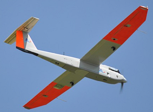
    Unmanned Aerial Systems

    Ok, let’s transition to some questions on UAS (such as UAV, drones).

    1. Do you see the FAA allowing simple operations for very low altitude UAV-sensors?

    It’s difficult to speculate what the FAA will implement, but I have to think, based on its past behavior, that the initial rules will be super-conservative with minimum requirements being that a licensed pilot will be required to operate the UAS in addition to strict equipment requirements.

    What’s going to be interesting to observe is what the FAA will do about the hundreds (maybe thousands) of UAS operators who will attempt (or are attempting) to “fly under the radar” and skirt the FAA rules. We’ve seen the FAA attempt (sometimes successfully and sometimes not) to crack down on some UAS operators whom it believes are violating the rules, but there have only been a handful of those cases.

    2. When do you think the FAA will release rules for commercial UAV users?

    The U.S. Congress-mandated deadline is September 2015. Some sources are doubting the FAA can meet that deadline.  The FAA UAS Integration Manager says they will.

    I wouldn’t be surprised if the FAA issued some guidelines in September 2015, but I seriously doubt they will publish the full set of rules by then.

    By the way, I attended an interesting UAS presentation at the AEC Summit prior to the Esri UC. You can see my write-up of it here.


    That’s it for now. I’ve got many more questions from the audience that I’ll address in upcoming newsletters. Stay tuned and feel free to email me directly at [email protected].

    Thanks and see you next time.

    Follow me on Twitter at https://twitter.com/GPSGIS_Eric


  • Out in Front: The State of Our Union

    Out in Front: The State of Our Union

    JEFF FEHLBERG, winner of the drawing for a Trimble Juno T41, grand prize in the 2013 State of the Industry Survey. You, too, can be this lucky!
    JEFF FEHLBERG, winner of the drawing for a Trimble Juno T41, grand prize in the 2013 State of the Industry Survey. You, too, can be this lucky!

    Like Olympic athletes, doctors without borders, and magicians, members of the GNSS community constitute an informal international group that gathers periodically, in different centers around the world, to share knowledge and advance their craft. It is due and fitting, perhaps even necessary, that we also try to summarize or collect our views about ourselves, our field, and our future. The State of the Industry Survey is an effort to do just that.

    Last year’s Survey drew 893 responses from I lost count of how many countries; the results were published in the September issue. The questions for the 2014 Survey appear on the pages immediately following, and the online interactive Survey is now live, through the end of August. You can win cool stuff simply by answering 20 questions.

    Displayed here are last year’s top prize winners. Jeff Fehlberg, a mobile business analyst from Tritech Software Systems in Little Rock, Arkansas, garnered the rugged handheld Trimble.  

    John Zittere of Engility Corporation in Hollywood, Maryland, sent along a selfie with giftie, and a few comments: “I really do enjoy reading GPS World and I also suggest it to our new-hire engineers. Here are a few pics from our Automated Aerial Refueling tests in Niagara, New York (see below).”

    JOHN ZITTERE with his dinner ticket, the second raffle prize from the 2013 survey.
    JOHN ZITTERE with his dinner ticket, the second raffle prize from the 2013 survey.

    Also receiving gift cards for completing the 2013 Survey: Jinghui Wu of  Kensington, New South Wales, Australia; Dr. S.M.A. Rizvi from Aligarh, Uttar Pradesh, India; and Rui Barradas Pereira of GMV in Lisbon, Portugal.

    CALSPAN Lear Jet with the probe (non-functional but flight ready).
    CALSPAN Lear Jet with the probe (non-functional but flight ready).
    AAR016, view of the tanker drogue from the Lear Jet.
    AAR016, view of the tanker drogue from the Lear Jet.
  • A Long Look at Advanced Multisensor Navigation and Positioning

    A modern-day fable related by Steven Covey tells of a civil engineer leading a crew engaged in building a road through a dense jungle. Each day the engineer’s adept management, the crew’s motivation and energy, and the high-tech equipment at their disposal pushed the new road well beyond scheduled targets. Midway through the allotted month, the engineer decided to climb to the top of a tree to see if he could get a distant glimpse of the destination. After a few minutes, he called down to his crew, “Wrong jungle!”

    This comes to mind as we consider the well-known fact that the next generation of navigation and positioning systems must provide greater accuracy and reliability in a range of challenging environments, to meet the needs of a variety of mission-critical applications. It’s no secret that not a single navigation technology, among scores available to us, is robust enough to meet these requirements by itself. A multisensor solution is required.

    Although many new navigation and positioning methods have been developed in recent years, little has been done with all-encompassing vision to bring them together into a robust, reliable, and cost-effective integrated system. Almost all the solutions proposed — and I have conveyed many of them in the pages of GPS World, thanks to the expert engineers who designed and tested them — spring from the requirements of a particular situation, application, or industry sector. Their parameters are suitably specialized.

    What’s been lacking so far is an over-architecture for the entire field. Paul Groves of University College London has outlined such a structure in an article that will appear in the September issue of the magazine: “Four Key Challenges to Multisensor PNT.” This material was first presented at the IEEE/ION Position Location and Navigation Symposium (PLANS) in Monterey, California in May of this year.

    The magazine article will describe each challenge in turn. In each case, Groves explains the problem, proposes one or more solutions, and identifies the issues that must be resolved in order to implement those solutions. He also presents the results of some preliminary context-detection experiments and illustrates some of the problems using results from several UCL research projects. The discussion is illustrated with results from research into urban GNSS positioning, GNSS shadow matching, environmental feature matching, and context detection

    The four challenges: complexity, context, ambiguity, and environmental data handling.

    • Complexity – How to find the necessary expertise to integrate a diverse range of technologies, how to combine technologies from different organizations that wish to protect their intellectual property, how to incorporate new technologies and methods without having to redesign the whole system and how to share development effort over a range of different applications.
    • Context – How to ensure that the navigation system configuration is optimized for the operating environment and host vehicle (or pedestrian) behavior when both are subject to change.
    • Ambiguity – How to handle multiple hypotheses, including measurements of non-unique environmental features, pattern-matching fixes where the measurements match the database at multiple locations, and uncertain signal properties, such as whether reception is direct or non-line-of-sight (NLOS).
    • Environmental Data Handling – How to gather, distribute, and store the information needed to identify signals and environmental features and define their points of origin or spatial variation.

    As Groves relates in his article, many new positioning techniques have been investigated over the past fifteen years.

    • Wi-Fi positioning
    • Ultra-wideband (UWB) positioning
    • Positioning using phone signals
    • Positioning using television signals and other signals of opportunity (SOOP)
    • Bluetooth low energy positioning
    • Laser-based position fixing and dead
    • Pedestrian dead reckoning (PDR) using step detection
    • Pedestrian map matching Error! Reference source not found.
    • Magnetic anomaly matching
    • Activity-based map matching
    • GNSS shadow matching

    There have also been improvements to existing technologies.

    • Hardware required for visual navigation
    • Micro-electro-mechanical systems (MEMS) technology
    • Cold-atom technology and nuclear magnetic resonance (NMR) gyros offering aviation-grade performance with compact sensors
    • Legacy radio navigation systems, such as Distance Measuring Equipment (DME) and Loran (in Europe and South Korea) are being modernized
    • Doppler positioning is being reintroduced using Iridium communication satellites

    Finally, GNSS itself has been enhanced through multiple constellations in a continual state of upgrade and renewal, high-sensitivity receivers and network assistance, and augmentation by commercial pseudolite systems.

    Maybe it’s time for a high-level perspective on all these adjoining jungles, if we want to find our way out of them.

    Potential components of a car navigation system using commonly available equipment and other low-cost sensors.
    Potential components of a car navigation system using commonly available equipment and other low-cost sensors.
  • Who Will Win at Indoor Location?

    Janice Partyka
    Janice Partyka

    Where are bets on new technology being placed? Prominent venture capital (VC) firms are investing in companies with indoor location solutions. But with more than 50 companies to choose from and at least ten unique technologies, it is hard to judge who will make it into the winner’s circle. There is no early leader to put money on, and unlike other location-based markets like mapping, I expect this market to support many competitors and not be dominated by a few. The vertical markets that are ripe for indoor location have different needs for accuracy, cost and speed. Promising applications include retail, advertising, manufacturing, asset tracking, gaming, intelligence and public safety, but who knows what other applications will emerge. GPS has infiltrated everyday life in ways unimagined at its start.

    With no obvious front-runner technology, many companies hedge their bets and offer multiple technology solutions. With infrastructure already installed throughout the great indoors, the easiest solution may appear to be Wi-Fi triangulation. While the cost may be attractive, the accuracy is not precise enough for many apps. Other solutions include Wi-Fi fingerprinting, Bluetooth, sensors and beacons.

    Some companies are offering technologies outside of the mainstream. ByteLight provides a solution based on LED lights mounted in the ceiling that generate fast pulses that can’t be seen by people. A smartphone can detect the pulses and triangulate position by identifying different lights by pulse pattern. Indoor Atlas and Indoo.rs use sensors to detect Earth’s natural magnetic fields for positioning. Camera technology is being used by WhereLab and Omiimii. Object recognition software determines location.

    The accuracy requirements of applications will drive the choice of technologies. Low accuracy is more than 11 meters, and medium accuracy is six to ten meters. High accuracy is one to five meters. High-accuracy solutions are generally more expensive and require more infrastructure.

    Apple iBeacon Changes to Opt-Out

    Anything that Apple does garners attention, including iBeacon for indoor location, which uses low-energy Bluetooth to communicate to phones and computers. Apple has some showcases, including a few Eagle and Safeway grocery stores using the iBeacon to send marketing messages to customers. The Peeble smartwatch added iBeacon support and reportedly can zero in on a lost phone. iBeacon technology at some of the Virgin Atlantic gates can trigger an app to automatically display a boarding pass as a traveler approaches. BeHere automates classroom attendance.

    I often write about privacy issues, and so I wonder, where are the techno-privacy advocates challenging Apple on iBeacon? You would think that there would be a tangle of permissions required of users, including turning on the beacon and giving an app permission to locate the user and for receiving notifications. Apparently, Apple thought the permissions were unwieldy. Apple users had to opt-in to turn on iBeacon, but in March with the new iOS release, the default changed to opt-out.

    Apple users may be unaware that an app using iBeacon doesn’t need to be open to interact with the phone. If the Safeway app is installed, the user will receive messages from the store, even when the app isn’t running and phone screen is locked. Even though iBeacons don’t track users or collect data from them, I find this functionality to be unsettling.


    Advertising in Minority Report was very personal.
    Advertising in Minority Report was very personal.


    Stores are having trouble competing with online shopping and are looking for ways to interact with shoppers when they come through the door. That interaction might be loyalty points, greetings or personalized special offers. Only three percent of retailers currently have the ability to identify customers coming through their doors, according to a survey of top retailers by Boston Retail Partners. ABI Research predicts beacons will be installed at 30,000 locations worldwide by year’s end. If beacons alone can generate such widespread usage so quickly, it is easy to see why indoor positioning technology companies have been a magnet for VCs.

    Do you remember the scene in the movie Minority Report when Tom Cruise enters a clothing store? As Cruise passes by advertisements, they address him by name. Indoor location can get creepy.

  • Indoor Positioning Gaining Retail, Advertising Agency Notice

    Kevin Dennehy
    Kevin Dennehy

    Proximity and indoor positioning will grow as technology gets better — and consumers value its benefits. Attendees at the recent Place conference in New York had the opportunity to hear from companies who advocated Bluetooth, Wi-Fi and even magnetic positioning technology. In addition, several advertising agencies and retailers attended, showing that the nascent proximity/indoor location niche could be a major market in the next few years.

    NEW YORK — The potential for indoor positioning and proximity marketing is huge if even a fraction of overall retail sales are attributed to the information the technology gives to retailers, said panel members at the July 22 Place conference here.

    The indoor opportunity is huge as studies have shown that 70 percent to 89 percent of consumers use smartphones in stores to compare prices and shop for coupons, said Greg Sterling, Opus Research senior analyst. “About $20 to $50 billion of purchases were influenced at point-of-sale in stores. $500 billion of retail sales came without any premeditated product selections,” he said. “Even if a small fraction shifts to mobile devices, that’s an enormous amount of money.”

    Sterling said that despite consumers’ ambivalence to privacy issues, if they are guaranteed some sort of benefits to being tracked, they will opt-in. “72 percent said they don’t want tracking [without benefits]. That number goes up to 66.4 percent who say ‘yes’ if there are specific benefits — rewards and discounts,” he said. “It is about educating consumers [as to benefits of location-based advertising].”

    Technology improvements and retailer awareness in the last two years have made such mobile advertising agencies as Joule interesting in location as a data point beyond geofencing, said Michael Lieberman, company co-president.

    “I am biased as we are mobile agency, so for us, most of our clients are using location to identify buyers. Ideally, we see a device in multiple locations, we understand consumers’ behavior,” Lieberman said. “If I see you every morning at a Starbucks, you are a coffee drinker and I should target you that way. However, if you are trying to use location as a national campaign you will only get a percentage of accuracy — you are missing out on other information.”

    Right now, retailers have little idea how and why a consumer makes a purchase, Lieberman said. “The [important] point is in [indoor location’s] measurement — what happens in the store environment. You walk in store, make a purchase, right now we have no idea what they did to buy a product,” he said. “We are losing that piece — and it is a big gap in thinking. Everything about consumer path in that store determines a purchase. What’s valuable is the in-store data that gives you the most actionable information.”

    Location today is used for targeting, but not for the total consumer measurement that Facebook requires, said Doug Stotland, Facebook product marketing director. “IKEA recently ran a campaign in a local radius, they wanted to see who showed up in their parking lot,” Stotland said. “It’s really compelling when you look at the methodology — you want to see if people actually showed up at the store. The home run is how to tie it to what they actually buy.”

    Stotland said Facebook uses location information for targeting, but basically users tell the company where they live and that’s it. “We can do better than that — there is definitely a big opportunity there. The great thing about Facebook is that I am always logged in — there is no value for targeting if I am not.”

    In a case study session at Place, Korean telecom provider SK Telecom has been making inroads in indoor positioning markets for several years, said John Kim, SK Telecom senior business development manager. “While we are the number one mobile operator in Korea, like other companies, we were hitting saturation levels,” Kim said. “We found that location-based services for telecos are a key service, basing this on earlier tracking, navigation and security markets.”

    SK Telecom ran indoor positioning tests at Seoul National University Hospital, which has 1,360 beds, making it hard to find patients. Kim said younger indoor positioning users liked the service and found it easy to use. “We also found that it was difficult for active marketing — what does a hospital use to promote it? Two-for-one x-rays?” Kim said. “The service was also difficult for remote maintenance and support.

    Kim said that SK Telecom is installing the product as a test in a Seoul sports stadium and at the L’Oreal Madrid flagship store. “We are also partnering with [Herndon, Va.-based] APX to work in their Google Glass product to provide location information.”

    Overall, the upside of indoor location is huge, said Don Dodge, Google developer advocate. “Imagine if you can look at phone to know exactly what stores your family members are in at the mall. At CES, you have no idea where 15 to 20 of your friends are,” he said. “If my wife gives me a list of groceries, I can find them in certain areas and know what price they are. First responders, fire departments, can find their way around in a burning building — and find a safe way out.”

    Privacy: The Attack on Opt-In

    In a privacy panel, members put a dark cloud over the ubiquitous answer by many companies that consumer opt-in alleviates all concerns for the location industry.

    Amanda Koulousias, a Federal Trade Commission attorney, said Section Five of the FTC Act, which has been expanded to cover tracking users over a certain time, prohibits deceptive practices that are likely to mislead people acting reasonably.

    Privacy seems to be a hot topic for reporters. Kate Kaye, a panel member who is a reporter with Advertising Age, said that security issues around beacons and leakages is a story. She also said that the Associated Press recently ran a story critical of the new Verizon rewards program. “The story typifies the balance a lot of marketers are trying to straddle — how much information can we gather, and how do we not [anger] consumers. Verizon Wireless prompts you to join their loyalty rewards program, but you have to opt-in to their location data program,” she said.

    Privacy panel moderator Jules Polonetsky, Future of Privacy Forum executive director, said a way some companies get consumers to opt in to being tracked is just to say “download this app.”

    The location industry’s privacy issues are not going away — and the path for resolution isn’t clear, said Greg Turetsky, principal engineer in Intel’s wireless communications group. “The privacy issue is so complex legally, economically and socially, that I expect it will not be resolved any time soon,” he said.

    In other Place conference news:

    • Opus Research, the organizer of the conference, published a report on magnetic positioning, which has a unique footprint. The company contends that magnetic positioning, which can be complimented by other technologies, offers six-foot accuracy with 90 percent precision. In comparison, Bluetooth offers proximity, but not the blue dot solution magnetic positioning currently has. In addition, Opus believes that Wi-Fi positioning, which has 40-foot accuracy, needs too much support and is expensive.


  • Report from the 2014 Esri International User Conference

    Live from Esri in San Diego: The Hottest Mapping Trends

    If you’d like to experience an industry first, I think, I’ll be participating in a live webinar being held during the Esri conference at the San Diego Convention Center on Thursday, July 17, at 10:00 a.m. U.S. Pacific time. I’ll have some planned guests, and perhaps drop-in guests, discussing the complexities of integrating mobile devices with disparate operating systems (Android, iOS, Windows, Windows Mobile, Windows Phone) into your GIS workflow. If you’re at the conference and would like to see us in action, stop by the podcast booth near Room 27 of the convention center. If you’d like to tune in live via the Internet, please sign up by clicking here.


    This week is the mecca of GIS, at least in the U.S.; the Esri International User Conference (UC) in San Diego, California, and I’m swimming in GIS up to my ears.

    There’s always a myriad of Esri-centric meetings and events during the weekend prior to the UC, and this year was no exception. During the weekend prior, I attended the AEC Summit, formerly named the Survey Summit. The AEC Summit bills itself as the “Forum for High-Accuracy” GIS.

    The dominant technology discussed at the AEC Summit was UAS (aka UAVs, Drones). There was lots of discussion about the forthcoming Federal Aviation Administration rules (due September 30, 2015) and “potential” UAS applications. However, one presentation gave the audience a practical look at the value of a UAS. Burns & McDonnell, in association with the University of Connecticut, reported their company worked nine months to gain approval (Certificate of Authorization) from the Federal Aviation Administration (FAA) to conduct a transmission line inspection using a rotary-wing aircraft.

    Steven Santovasi, GISP at Burns & McDonnell, gave a summary presentation of their experience with UAS technology. He started with this slide that frames the UAS device market, divided into three device segments: fixed-wing, rotary craft, and a hybrid version with the hover features of a rotary UAS but the speed and stability performance of a fixed-wing UAS.

    Types of UAS used for Mapping
    Types of UAS used for Mapping

    Santovasi reported that using the rotary UAS allowed his company to perform an inspection that he thought couldn’t be performed by a manned aircraft. He said that the UAS was able to get within five feet of the structure and take detailed, high-resolution photos. In fact, he said his team was able to identify a failing bolt that may have caused a significant power outage. He reported that a representative of the transmission line owner said that the discovery of the failing bolt “paid for the project.” The transmission line is strung on a 250-foot-tall tower.

    Following is a photo of the bolt (and accompanying structure) taken by the rotary craft UAS. There’s actually a much higher-resolution an close-up photo of the bolt I’ll try to obtain and update in this article.

    Failing Bolt Identified by High-Resolution Photo Captured from a UAS
    Failing Bolt Identified by High-Resolution Photo Captured from a UAS at Close Range

    There was some discussion in the audience that the FAA may not make the September 30, 2015, deadline, or that it will issue a partial set of rules. Last month, a Washington Post article reported the same. If that happens, it’s going to be really interesting. It seems like with each day that goes by, the heat gets turned up a little more for the FAA to act. More frequently, perhaps fueled by the FAA vs. Pirker case where the FAA was slapped by a NTSB judge for not having enforceable rules to punish “violators,” there are media reports that individuals and companies are using UASs for commercial purposes regardless of the FAA’s position. For example,

    However, the FAA is not giving up in its attempt to assert its rules despite the ruling by the NTSB judge. On June 23, the FAA issued a press release offering “guidance to Model Aircraft Operators” in an attempt to squelch commercial UAS operators from believing they can fly under modeler rules.

    User Conference Plenary

    Every year, I look forward to Esri President Jack Dangermond’s keynote at the plenary. I love that Esri is still a privately held corporation, having only to answer to themselves. They don’t have to worry about Wall Street quarterly reports as publicly-traded companies do, so they can choose to change strategy or take on projects that may not appeal to public shareholders. Given that, you really never know what Mr. Dangermond might decide to do, or say, so it’s always interesting to listen to his thoughts on Monday morning.

    Of course, there were tons of ideas shared, some new products introduced, and some impressive fourth-graders speaking to a crowd the size that 99.5% of us will never have the opportunity to address. But, after listening to the plenary, watching Twitter, reading blogs and news releases, etc., I can boil it down to one word where this technology is headed…real-time (or is that two words hyphenated? :-) ). I want current information, and I want information as events occur. That is the definition of real-time. I was struck by the City of Rancho Cucamonga’s  presentation, which won Esri’s President’s Award. The city has deployed a GIS that allows it to “see” events as they happen, whether it be a traffic accident, fire or other public emergency. Of course, you can easily extrapolate that to include public works nuisances like potholes, traffic signal outages, and street closures, then further extrapolate to society where you have something like Waze, a mobile phone app that allows millions of drivers to share real-time information about traffic conditions.

    City of Rancho Cucamonga Executive Dashboard for Monitoring Municipal Gov't Activity
    City of Rancho Cucamonga Executive Dashboard for Monitoring Municipal Gov’t Activity

    In geographic regions where there is solid wireless connectivity, there’s no reason we can’t or shouldn’t have access to real-time information on a broad scale, in a very accessible manner. And of course, geographic location is a super-important part of that real-time information. Accurate, real-time information allows us to make accurate, real-time decisions.

    The real-time theme bubbles and oozes from GIS, and GIS is begging to be a real-time technology. This is largely driven by mobile devices and sensors. It’s not like the real-time “transaction,” as Mr. Dangermond has coined in past Esri UC conferences, is a new concept. That concept hasn’t changed. What has changed is the proliferation of mobile devices and sensors that enable us to carry the power of GIS in our pockets. They are the technology enablers of real-time GIS, and the trend is crystal clear. It is what people want, and they will get it because GIS, mobile devices and sensor technologies are converging, and to a price point that is very affordable. This year, Mr. Dangermond mentioned the Internet of Things during the general plenary. This is exactly what I’m referring to. Devices and sensors will each have an IP address, or some method of making themselves known on a network. Some people call this Big Data. Regardless, we’re seeing this transformation beginning.

    I saw a great example of the transition from labor-intensive transactions to real-time transactions at a Esri UC presentation this week. It’s a utility company that was using a data check-in/check-out workflow to collect high-precision GPS data for its infrastructure (e.g., valves, meters, etc.). The company was spending a significant amount of time dealing with the data check-in/check-out procedure and  data post-processing. Some downsides of the data check-in/check-out workflow listed were:

    • many opportunities for human or technical error
    • clunky and arduous QA/QC process
    • slow and expensive workflow that is difficult to scale
    • software maintenance cost and overhead

    In the past six months, the company transitioned to a real-time data collection process that posts high-precision GPS transactions in real-time within SDE in ArcMap. Some of the benefits listed were:

    • GPS points update in real-time within SDE
    • laterals and fittings draw and populate automatically
    • support for a wider variety of software data collection tools like ArcGIS Mobile, ArcPad (either SDE or ArcGIS Online) or Collector
    • simple design for tablet use (either online or offline)
    • software cost reduction (unlimited seats of ArcGIS Mobile w/Server, Collector free through ArcGIS Online)

    Perhaps the words that best describe the company’s transition to a real-time GIS transaction workflow were contained in the summary page of the presentation.

    Time: Our Most Precious Resource

    ‘ Nuf said.

    Plenary Opening Keynote by Mr. Dangermond

    If you want to take a look Mr. Dangermond’s opening keynote, including the presentation by the City of Rancho Cucamonga, following is a 22-minute video that’s worth a look.

    Thanks, and see you next time.

    Following me on Twitter at https://twitter.com/GPSGIS_Eric

  • Year of the Generals

    Several pleasant surprises popped up at this year’s Institute of Navigation’s Joint Navigation Conference (ION JNC) in Orlando, Florida, and the best by far centered on the presenters and the attendees. In a change from recent years due to budget restrictions, better known as sequescastration, this year two senior Air Force generals attended and actively participated in several events.

    General (S) John Hyten – Vice Commander AFSPC - Courtesy of the USAF
    General (S) John Hyten – Vice Commander AFSPC – Courtesy of the USAF

    General (S) John E. Hyten (USAF), currently the Vice and soon to be the Commander of USAF Space Command (AFSPC), participated in two days of ION JNC and was featured as the keynote speaker on the second day of the plenary session. As a senior steward of the Global Positioning System, indeed for all USAF Space Systems, General Hyten has a special place in his heart for GPS, having served as the Commander, 50th Space Wing, Schriever AFB in Colorado, the home of GPS.

     The 2nd Space Operations Squadron is a component of the 50th Operations Group, 50th Space Wing, Schriever AFB, CO. The squadron was activated Jan. 30, 1992.
    The 2nd Space Operations Squadron is a component of the
    50th Operations Group, 50th Space Wing, Schriever AFB, CO.
    The squadron was activated Jan. 30, 1992.

    Conference attendees were pleasantly surprised with the access they had to General Hyten as he toured exhibits and joined fellow attendees for lunch, presentations, and discussions in the hallways. General Hyten made it clear that he was there to interact with ION JNC attendees and welcomed everyone to engage him in conversation. A rare invitation from a very busy general officer with huge responsibilities — and an invitation that many attendees clearly took to heart, as General Hyten was continually engaged in discussions during his two-day stay.

    In his plenary presentation, General Hyten addressed GPS and the general lack of knowledge in the public today concerning the origins of the system. Hint — the answer is the United States Air Force. More on that later.

    Major General (USAF) Robert Wheeler
    Major General (USAF) Robert Wheeler

    Major General Robert Wheeler (call sign Wheels) also attended ION JNC this year to speak during the classified day on June 19 and to participate as an ad hoc member of the always-popular War Fighter Crosstalk Panel. General Wheeler  currently serves on the staff of the Secretary of Defense (SECDEF) as  Deputy Chief Information Officer for Command, Control, Communications and Computers (C4) and Information Infrastructure Capabilities (DCIO for C4IIC). General Wheeler is a command pilot with more than 5,000 hours in multiple aircraft, including the B-2 bomber in which he saw combat time over theater.

    It was obvious from his initial comments in the classified sessions that General Wheeler is a warrior and staunch supporter of GPS and all things PNT-related. As much as I would like to relate some of his more pithy remarks, they were made in a classified environment, so sharing them is impossible in this venue. However, suffice it to say the General’s comments were well received by the war fighters who attended as well as the classified session attendees, which included many of our closest international allies.

    The comment was made several times in my hearing that “We sure hope General Hyten and General Wheeler are invited back again next year.”

    If all goes according to plan, General Hyten will be a four star and a MAJCOM Commander in just a few weeks. If he thought he was busy before . . .

    Now let’s utilize that sage observation as a segue to General Hyten’s Plenary remarks at this years ION JNC. Having known John Hyten for over 20 years it has always been my experience that he does things just a bit differently – he hears a slightly different drumbeat and this year’s plenary speech was certainly no exception. Right from the start this speech was a bit different. General Hyten warned his audience he was going to praise them for their hard work and then gently admonish them but in a good way. With that opening statement he certainly had everyone’s attention. General Hyten asked for a show of hands from those attendees who knew that GPS originated with the USAF, the 50th Space Wing at Schriever AFB and particularly the 2SOPS (2nd Space Operations Squadron).

    2SOPS operators on the GPS Operations Floor at Schriever AFB, CO
    2SOPS operators on the GPS Operations Floor at Schriever AFB, CO

    In the GPS/PNT-savvy audience Gen Hyten was addressing, literally every hand went up, and that was evidently what he hoped to see. The response was not a surprise to anyone, however the general went on to make the point that if he went out into the general population in the Renaissance Hotel at SeaWorld he would be lucky to find one in ten who even knew what GPS stood for, and that it came from space, and almost none would know that it was, is, and will for the foreseeable future always be provided free of charge to global users courtesy of the USAF.

    GPS has been provided by the USAF free of charge for global users ever since President Ronald Reagan declared it so via a Presidential Decision Directive issued in 1988 shortly after the Soviet military shot down a Korean Air airliner (Flight 007) that had strayed off course and into Soviet Airspace due to a navigation error.

    Ironically, General Hyten made the point that if the U.S. Government charged for use of the GPS signals, even at a nickel (5 cents) per user per device per year, it would pay for itself, and everyone would know that the USAF provided the service on behalf of the U.S. Government.

    However, since it is free, ubiquitous, and considered almost a utility today, everyone around the world just assumes it will always be there and they don’t think about how or why the signals are provided. GPS is just always there.

    GPS Orbitology 101- Courtesy of the USAF
    GPS Orbitology 101- Courtesy of the USAF


    General Hyten went on to make several cogent points concerning current and future use of GPS and other PNT assets. At the same time he warned us that there are those in the Pentagon  [Obviously shortsighted, my comment, not the general’s.— DJ]  who erroneously question why we still need GPS today. They myopically see it as an antiquated, compromised system. When in fact GPS and multi-GNSS PNT systems are on the cutting edge of technology.

    The general made the comparison with WWII bombers that were being shot down at an alarming rate until the War Department (circa 1943) started the practice ofusing fighter escorts to help them fight through and return home safely. The analogy applies to GPS, which even today is being purposefully and at times maliciously attacked by spoofers and jammers.

    Augmentations

    Fortunately there are numerous actions that can and are being taken to secure GPS as a critical global service — fighter escorts if you will — that will not only help GPS maintain its preeminent Gold Standard position in the world of global PNT, but allow the system to grow and mature, even flourish, with additional high tech capabilities such as CNAV and MNAV (new civilian and military navigation messages).

    Indeed the general stated that we have just begun to explore all the transformational capabilities being added to our GPS/PNT and multi-GNSS arsenal with the addition of L1-L2 M-Code (military code) and L2-L5 CNAV signals.

    Of additional interest are space-based augmentations (SBAS) such as WAAS (Wide Area Augmentation System) and EGNOS (European Geostationary Navigation Overlay Service) as well as independent regional terrestrial augmentations and backups such as E- and D-LORAN (long range navigation), which today have demonstrated a time stability of 1×10(-12) and a position accuracy of 5-10 meters,  an order of magnitude better than LORAN C’s 50-1,000 meters.

    General Hyten went on to warn the commercial PNT vendors and government program managers in the 400+ audience that they must cease placing commercial GPS receivers in critical government systems that support the war fighters, government users, and our critical national infrastructure. Indeed he said this is why we have SAASM (Selective Availability Anti-Spoofing Module) and M-Code: to help secure these critical systems against interference, jamming and spoofing, intentional or otherwise. He also pleaded with industry manufacturers and vendors of PNT devices to please build their devices in strict adherence to the U.S. government;s ICD process. While the general declined to mention specific cases or companies, most in the room were aware of the ramifications of ICD non-compliance, from usefulness, mission and financial perspectives.

    The general cited several known cases where, due to noncompliance, several systems just never did work well or consistently in a war zone. He said he knew of cases where “…the PNT systems worked fine in Yuma, Arizona but failed to work in Afghanistan. Please do not put commercial systems in critical military equipment.”

    Pseudolites

    Pseudolites are another area where the general has concerns. This is of course a hotly debated spectrum issue. Whereas we in the United States have been fighting highly-publicized spectrum battles, attempting to preserve the sanctity of the GPS spectrum globally, the Europeans are on the verge of approving pseudolite implementations all over the European continent that could seriously degrade GPS/PNT/Galileo signal reception and make PNT systems unusable or at least undependable in some critical areas, especially around the approaches to airports. Although on the surface pseudolites may seem like a good solution, I always remember what Dr. Bradford Parkinson is fond of saying: “An improperly implemented pseudolite is just another name for a potential GPS or PNT jammer.”

    The Unofficial Test

    After General Hyten’s comments, I decided to put his theory to the test. Just how many people know GPS is provided free to the world courtesy of the United States Air Force?

    As someone who has been working GPS issues since 1975, I find it hard to believe that the American public is so uninformed about a system that is so critical to their everyday existence, because as most of you know, GPS is pervasive in almost all of our critical and not-so-critical national infrastructure. Indeed stealth GPS chips and receivers are embedded in so many devices today that it would be easier to name the devices that don’t use GPS. So I took the General at his word and set out to conduct my own mini-survey.

    However, before I even had a chance to think much about what I would ask, I stepped into an elevator at the Sea World Renaissance Hotel where the ION JNC was taking place and found myself face to face with an elevator full of attendees from a major medical convention in the same hotel. They saw the ION JNC patch on my black golf shirt and asked me about it.

    I told them and then asked what they knew about GPS. As in, did they know where the GPS signals came from and who provided them? Lots of answers were given and none of them remotely correct.

    Frankly I was appalled, and before they exited the elevator I made sure they knew that GPS signals came from space and were provided totally free by the USAF. Mission accomplished. But not so fast; unfortunately the rest of my day and ad hoc surveys went about the same way. Some actually knew that GPS signals were free, some knew or thought they were provided by the government but had not a clue what agency or service.

    Most thought they were radio signals from ground transmitters and were provided by the GPS equipment manufacturers. After asking more than 100 people where GPS signals originated and who provided them, I received exactly two correct answers, from wives whose husbands had recently served in the military in theater.

    In my informal survey, 2% (two percent) of the respondents knew the right answers — and they had a military background. None of the true civilians had a clue. It was appalling and discouraging! Apparently General Hyten has done his homework and his point is well taken.

    We need to get the word out that GPS is totally free, provided to the world by the United States Air Force. A simple but important message. Simple yes, and certainly discouraging at this specific venue, as this is a major part of the mission of ION and JNC — educating the world about the capabilities of GPS. Now I guess we need to emphasize the basics, just as GPS acquisition has reverted to a “back to a basics” approach. I agree with General Hyten that we (all those of us who care about GPS and all that it enables) need to do the same: get out the basic message every chance we get. Join me, won’t you, in getting that simple message across?
    The next ION symposium, ION GNSS+ 2014 will take place September 8-12, 2014 at the Tampa Convention Center in Tampa, Florida. I hope to see you there.

    Thanks

    In closing I tip my hat to Lisa Beaty, the Executive Director of ION, and her entire team especially the new Military Division headed by my good friend and Institute for Defense Analyses (IDA) colleague Jim Doherty. Jim arranged  the classified Cross Talk Military Panel this year, which was the hit of the show, as it has been under Jim’s leadership for the past several years. Jim stepped down this year as the Military Division Chair during the ION JNC symposium, and he will be sorely missed, although I suspect he will still be involved in some fashion.

    The bottom line is that the ION symposia just keep getting better every year. The venues and the host hotels are first class, the food is excellent, and most of all the speakers and papers presented are scrubbed to the point that you really only get the cream of the crop. Unfortunately, you can’t say that about every GPS/PNT symposium today.

    This year the exhibitors were in a large area that allowed everyone more room, and it made for a much more relaxed atmosphere in the exhibit area. I found that I spent a great deal more time with the exhibitors this year than in years past, and what I discovered there will be the subject of several future columns.

    Until next time, happy navigating and remember, GPS comes to you courtesy of the United States Air Force.

    Aim High!

    What’s Don Reading?

    Beyond Horizons – A Half Century of Air Force Space Leadership

    David N. Spires, PhD – Professor Emeritus University of Colorado, Boulder, CO.

    Reading good history volumes is one of my favorite pass times and when it comes to an early history of Air Force Space there is none better than Beyond Horizons.

    Dr. Spires does an excellent job of setting the stage and explaining exactly how Air Force Space Command came into existence and why it was so sorely needed. The current volume covers the US Air Force and Air Force Space from its very beginnings at the end of WWII; think Dr. Theodore von Karman (Toward New Horizons) and General of the Army (Five-star) H.H. Arnold.

    General Arnold actually flew a Wright Flyer back in 1911 and would have retired as a 5-star Army General but on May 7, 1949, Public Law 58-81 changed the designation of Arnold’s final rank and grade to that of General of the Air Force, and he remains the only person to have held the rank. He is also the only person to hold five-star rank in two U.S. military services. General Arnold was instrumental in funding and authorizing research conducted by von Karman, and von Karman was instrumental in research that eventually led to an Air Force and an Air Force Space Command. It is all here in this fascinating book which is edited by longtime friends and colleagues George W. Bradley III (PhD) and Rick W. Sturdevant (PhD), who serve today as the Chief and Deputy Historians respectively at Air Force Space Command.

    I highly recommend this wonderful historical masterpiece, which is now in its third printing, and I predict will see many more versions and updates. In fact you can read it online at: http://www.afhso.af.mil/shared/media/document/AFD-110125-038.pdf

    The only pastime better than reading, this book is talking about it with the author personally, who was also a career Air Force Officer, which I have had the pleasure of doing briefly, on several occasions, and the conversations were fascinating. David is just full of interesting facts and stories concerning Air Force Space. I am convinced that if he were to commit them all to paper, there would be several volumes. I hope you enjoy this fascinating Air Force Space history.


  • FAA Issues First Commercial UAS Authorization over Land

    FAA Issues First Commercial UAS Authorization over Land

    Like it or not, as a person who works with geospatial data, UAS (unmanned aerial systems such as drones and UAVs) are in your future. The upside of said technology for “quick and dirty” mapping is undeniable.

    GNSS plays a key role with UAS, just like it plays a key role in classical photogrammetry. In fact, UAS may even push GNSS technology into areas where it hasn’t gone. For example, L1 RTK. I wrote about L1 RTK technology several years ago, and while several products attempted to exploit it, L1 RTK never was adopted in any significant numbers, primarily due to the short baseline, clear sky, and longer initialization requirements. However, UAS may change that because, by their nature, they work with short baselines, clear sky environments and require some setup time, at least enough for L1 RTK initialization.

    However, before we get ahead of ourselves, the regulatory machine (the Federal Aviation Administration) must publish regulations that provide guidelines on the use of UAS for commercial operations. In June, amidst its recent enforcement actions, the FAA issued its first commercial authorization for mapping UAS over land in the U.S. The FAA issued a Certificate of Waiver or Authorization (CoA) to BP to conduct aerial surveys in Prudhoe Bay, Alaska. According to the FAA, the first flights took place on June 8 and used a AeroEnvironment 13.5 lb. Puma AE fixed-wing UAS with a nine-foot wingspan.

    AeroEnvironment Puma AE UAS. 9.2' Wingspan. 13.5 lbs.
    AeroEnvironment Puma AE UAS. 9.2′ Wingspan. 13.5 lbs.

    According to a Wall Street Journal article, AeroEnvironment spokesman Steve Gitlin said it took about a year and considerable financial investment to win FAA approval for the BP project. Curt Smith, a director in BP’s technology office, said that manned aircraft are sometimes less expensive per flight than the AeroVironment devices, but that the drones will gather far more data, enabling BP to operate “more effectively, more safely, and at a lower cost.”

    The FAA announced that last summer that it issued restricted category type certificates to the Puma and Insitu’s Scan Eagle, another small UAS. The certificates were limited to aerial surveillance only over Arctic waters. The FAA recently modified the data sheet of the Puma’s restricted category type certificate to allow operations over land after AeroVironment showed that the Puma could perform such flights safely.

    Texas A&M University Becomes Fourth Operational UAS Test Site

    In further UAS news, the FAA announced on June 20 that Texas A&M University – Corpus Christi became the fourth of six UAS test sites to become operational. The FAA issued a CoA for the university to use an 85 lb AAAI RS-16 UAS with a ~13-foot wingspan. The other five UAS test sites are Griffiss (NY) International Airport, North Dakota Department of Commerce, State of Nevada, University of Alaska, and Virginia Polytechnic Institute and State University.

    American Aerospace RS-16 UAS. 12'11" Wingspan. 85 lbs.
    American Aerospace RS-16 UAS. 12’11” Wingspan. 85 lbs.

    The FAA UAS Legal Stuff

    Despite its setback when an NTSB administrative law judge ruled against the FAA in March 2013, the FAA sternly maintains its position that commercial operations of UAS in the U.S. are strictly prohibited without a CoA. In fact, just this week (June 23), the FAA issued a press release about a Federal Register Notice the FAA published of its interpretation of UAS rules for model aircraft in the FAA Modernization and Reform Act of 2012. In the Act, the Sec. 336 Special Rule for Model Aircraft reads:

    SEC. 336. SPECIAL RULE FOR MODEL AIRCRAFT

    (a) IN GENERAL.—Notwithstanding any other provision of law relating to the incorporation of unmanned aircraft systems into Federal Aviation Administration plans and policies, including this subtitle, the Administrator of the Federal Aviation Administration may not promulgate any rule or regulation regarding a model aircraft, or an aircraft being developed as a model aircraft, if—

    (1) the aircraft is flown strictly for hobby or recreational use;

    (2) the aircraft is operated in accordance with a community-based set of safety guidelines and within the programming of a nationwide community-based organization;

    (3) the aircraft is limited to not more than 55 pounds unless otherwise certified through a design,  construction, inspection, flight test, and operational safety program administered by a community-based organization;

    (4) the aircraft is operated in a manner that does not interfere with and gives way to any manned aircraft; and

    (5) when flown within 5 miles of an airport, the operator of the aircraft provides the airport operator and the airport air traffic control tower (when an air traffic facility is located at the airport) with prior notice of the operation (model aircraft operators flying from a permanent location within 5 miles of an airport should establish a mutually-agreed upon operating procedure with the airport operator and the airport air traffic control tower (when an air traffic facility is located at the airport)).

    (b) STATUTORY CONSTRUCTION.—Nothing in this section shall be construed to limit the authority of the Administrator to pursue enforcement action against persons operating model aircraft who endanger the safety of the national airspace system.

    (c) MODEL AIRCRAFT DEFINED.—In this section, the term ‘‘model aircraft’’ means an unmanned aircraft that is—

    (1)    capable of sustained flight in the atmosphere;

    (2)    flown within visual line of sight of the person operating

    (3)    the aircraft; and

    (4)    flown for hobby or recreational purposes.

    You can read more (lots more) about the FAA’s interpretation of the Act here. You can submit a comment on the FAA’s interpretation of the Act here. The comment period ends July 25.

    More FAA UAS Legal Stuff

    On June 25, the FAA issued a press release announcing that seven aerial photo and video production companies requested regulatory exemptions from the FAA to operate UAS before the FAA UAS rule-making is finalized. According to the FAA, “the Motion Picture Association of America facilitated the exemption requests on behalf of their membership. The firms that filed the petitions are all independent aerial cinematography professionals who collectively developed the exemption requests as a requirement to satisfy the safety and public interest concerns of the FAA, MPAA, and the public at large.”

    From the FAA press release, “The FAA published a brief summary of the petition from Astraeus Aerial in the Federal Register. The agency opted to ask for comments only on the Astraeus petition because that company’s request came in first, and the petitions from the other six companies ask for identical exemptions.”

    Interestingly enough, the FAA is soliciting public comment before it makes a ruling on the MPAA request, clearly highlighting the tremendous pressure the FAA is under to integrate commercial use of UAS in the U.S.

    More Commercial Use of UAS Despite what the FAA Says

    Back in February, I wrote an article entitled FAA Says Commercial Drone Operations Are Illegal… Public Says So What? discussing the expanding use of UAS in the commercial sector before the FAA rule-making on UAS was completed. To compound the FAA’s challenge, in March an NTSB Administrative Law Judge ruled against the FAA in an enforcement action the FAA attempted to impose on Rafael Pirker: a fine of $10,000 for commercial use of UAS and other violations.

    The NTSB ruling against the FAA fueled the commercial UAS fire and certainly gave commercial UAS operators, operating illegally according to the FAA, more confidence that the FAA may not pursue them. That might be the case in an incident publicized last week in Seattle, Washington, where a woman called police after she saw a UAS buzzing around outside of her apartment building, believing it was spying on her 26th-floor apartment. The Portland, Oregon-based UAS operator, Skyris Imaging, was interviewed by Portland’s KATU news.

    “It was not our intent to view anything other than the views from a 20-story office building that will be built across the street,” said Skyris’s Joe Vaughn. Vaughn told KATU that a Seattle-based developer hired Vaughn’s company to use one of his drones equipped with cameras to take photos of the view for a new 20-story building.

    Vaughn told KATU that his company has a fleet of six drones he says he responsibly flies. He told KATU that his company has strict guidelines to never fly for a third party, over crowds, above 400 feet, or beyond visual range. Click below to view the KATU interview.

    Live Webinar at the Esri International User Conference

    In a GPS World first, we’ll be producing a live webinar from the Esri International User Conference on Thursday, July 17, @ 10 a.m. Pacific Time in the exhibit hall at the San Diego Convention Center. Of course, the webinar will be focused on one of the hottest topics: high-precision mobile GIS. It will cover high-precision GNSS on mobile devices, from iPads to Android tablets to smartphones.

    Tune in or join us live from the exhibit hall floor! Register here.

    Thanks, and see you next month.

    Follow me on Twitter at https://twitter.com/GPSGIS_Eric

  • Expert Advice: Tigers, Tycoons on View at China SatNav

    Expert Advice: Tigers, Tycoons on View at China SatNav


    CSNC-2

    Turetsky-calloutI attended the China Satellite Navigation Conference in Nanjing in May, the fifth year of CSNC and my third time attending. Tremendous progress was evident this year in terms of BeiDou (BDS) deployment and China’s general openness and willingness to collaborate over those years. I have also seen a slowly growing international presence at the show and expect that to continue to increase as well. You may recall my column last year about Little Tigers. Well, they aren’t so little any more. As for the tycoons, you will have to read to the end.

    The conference opened with the usual provider updates. Chenqi Ran, who runs the China Satellite Navigation Office, the lead government agency for BDS, started off. It’s always good to hear his update delivered in China, where the is a little more freedom to provide information beyond the standard pitch. China continues on pace to its plan for the third step of BDS with five geosynchronous-orbit, three inclined geosynchronous-orbit, and 27 mid-Earth orbit satellites for a worldwide system by 2020. They are meeting their stated goal of 10-meter accuracy regionally today, and as good as 5-meter near the Equator. Ran also provided interesting numbers for the fast-growing Chinese domestic market:

    • More than 2 million BDS chips sold in China in Q1
    • More than 300,000 vehicles equipped with BDS
    • 20 domestic brands offering car navigation systems
    • First consumer tablet (Samsung Galaxy Note 3) with BDS.
    • First consumer smartphone (Huawei B199) with BDS

    The updates from other providers (GPS, GLONASS, and Galileo) were relatively standard and did not contain much new information. I had hoped that maybe the Russian presentation would provide more information about the April outages, but nothing was forthcoming and I was not overly surprised.

    CSNC-4The conference itself is very well organized and runs nine parallel technical tracks over two full days, with additional special-interest sessions. All of the presentations are in Chinese, however the conference provides headsets for simultaneous translation, and many presenters have dual slide sets in Chinese and English, so it is easy to attend anything that seems interesting.

    I came as an invited speaker on the Institute of Navigation (ION) panel organized by Professor Jade Morton from Miami University, Ohio, and Professor Lu of the National Timing Service Center near Xian. The ION panel was well attended and included a short panel discussion at the end.

    One of the most interesting outcomes was that both Broadcom and Trimble showed approximately 25 percent accuracy improvement by adding Beidou to their existing GPS/GLONASS solutions. It was interesting not just because they reached the same number, but because Broadcomm was talking in meters about urban-canyon performance and Trimble was talking in centimeters about precise positioning.

    It became clear that everyone sees BDS as an important part of their roadmap at L1, regardless of how many frequencies they currently support. I must also note that both Professor Morton and Professor Lu were outstanding hosts and showed us some of the wonderful local sites.

    Exhibit Hall

    The biggest change from last year was in the exhibit hall. I would estimate the overall floor space grew by 50 percent, with 106 companies in specially designed booths (up from 56 last year) and another 44 in standard booths.

    The content change was even more dramatic. Last year there were a lot of small booths with pretty basic displays, mostly of prototypes and slideshows. This year, there were many more extremely large booths that were very professionally created. They had evolved into displaying very polished-looking finished products with nicely edited videos. It was clear that this was all targeted at domestic buyers, as it was difficult to find anyone on the show floor who spoke English (except in the Spirent booth). These are no longer little tigers. These are now real companies, out hunting for new business.

    CSNC-3

    Policy and Intellectual Property

    My other favorite topic to listen to at this conference is on policy and intellectual property (IP). That is where I spent most of my time and was not disappointed. There was in fact an entire session dedicated to intellectual property, and several presentations on the global state of affairs of patents in GNSS.

    Interestingly, most of the speakers were either lawyers or from government, but there were some corporate ones as well. Several speakers highlighted the recent disagreement and settlement of the patent dispute between the United States and the United Kingdom over complex modulation patents. There was a large element of underlying concern that although the U.S. had been able to settle the dispute, it might be very hard for China if either the U.S. or the UK came after them. They had several charts showing how far behind they were in GNSS patents, in an effort to encourage local companies to create more IP and patent it. They also showed they have made significant progress in recent years in domestic Chinese patents, though they still have a long way to go in international patents.

    They were also very concerned about the largest holders of GNSS patents in China — Qualcomm and Broadcom — as a threat to domestic industry. They cited the GlobalLocate/Broadcom versus SiRF/CSR lawsuit as a cautionary tale. Several presenters showed the dominance of Broadcomm and Qualcomm in terms of domestic Chinese patent holdings and referred to them as the “Tycoons.” I envisioned Rich Uncle Moneybags, the guy from the Monopoly game wearing the top hat, walking around with patents instead of dollar bills hanging out of his hat.

    CSNC-1Conclusion

    The little tigers have definitely grown up. They are much bigger, have real teeth, and are definitely trying to stake out territory in the fast-growing domestic market. But the Tycoons still have the upper hand in the mass-market battle for consumer devices. For the moment, anyway.

    The Tycoons are going to have to start spending some of their bounty in China if they want to maintain that market share against rapidly evolving domestic competition. I won’t be surprised if next year we see the Tycoons exhibiting at CSNC, and soon after that, the tigers looking to expand their hunting ground into nearby markets in Korea, India, and Japan.


    Greg Turetzky is a principal engineer at Intel responsible for strategic business development in Intel’s Wireless Communication Group focusing on location. He has more than 25 years of experience in the GNSS industry at JHU-APL, Stanford Telecom, Trimble, SiRF, and CSR. He is a member of GPS World’s Editorial Advisory Board.

    The statements, views, and opinions presented in this article are those of the author and are not endorsed by, nor do they necessarily reflect, the opinions of the author’s present and/or former employers or any other organization the author may be associated with.

  • Out in Front: Epic Fail

    Sometimes the patient has to get sick in order to get better. The eruption of a malady leads to identification of an underlying condition; appropriate treatment can then be devised to cure the body of its ills. Sound like House, M.D.?

    As a variant on this plot line, the patient can know full well what is wrong deep down inside, but refuses to acknowledge or deal with it. As in, “I’ll stop smoking when I start coughing,” or “My drinking hasn’t gotten to the problem stage . . . yet.”

    Let us examine the patient GNSS. The April signal outage, system-wide on the GLONASS constellation, lasted less than 12 hours. That was long enough to cause consternation for end users around the world, and for several voices to renew their calls for multi-constellation GNSS and alternative PNT. The interruption was also short enough that it has now vanished from most rear-view mirrors. Everything is back to normal and everyone can go about their business.

    But the patient is still unhealthy, and vulnerable.

    It is easy enough to fault the system operators, who after all are only human, and to say, “That can’t happen here. We have enough safeguards in place. And our guys and gals are just that good.” In other words, we take enough antibiotics and are generally, you know, well, healthy. As healthy as anyone else.

    We have yet to see a full-scale jamming or spoofing attack on the order of cyber-security breaches in other targeted areas that have made off with millions or billions of dollars.

    We have yet to experience a truly major-league Sun event, when global circumstances would be in dire need of PNT help just when GNSS was least helpful.

    We have yet to encounter some other unknown, unexpected event or environment that will reveal in painful detail the vulnerabilities of GNSS.

    Which are well known to us at this writing.

    This month’s cover story on a new enhanced differential Loran technique represents one arm of geospatial-medical research. Notably, it evinces little concern for GLONASS, the area where the latest malady erupted. No, the Dutch harbor pilots are concerned about over-reliance on GPS, the Gold Standard. The Gold Standard! What could possibly be wrong with the Gold Standard? After all, it’s golden.

    GPS III Misses Delivery Date. The U.S. Air Force is shopping for alternative companies to make future GPS III satellites after the first eight birds come through. Current contractor Lockheed Martin Space Systems missed a 2014 delivery date because, although it has three satellites in the production barn and a satellite test-bed vehicle that has successfully passed system tests, it has received no payload from subcontractor Exelis to put aboard same.

    Delivery of the first GPS III satellite is now expected to slip from fiscal 2014 as far as fiscal 2016. Then there’s launch to consider, which brings to mind the launch budget and schedule, annually trimmed back by Congress. Then there’s OCX, needed to operate GPS III, also struggling to stand up.

    Even once established, GPS III will share the same vulnerabilities of current GNSS.

    The doctor looks worried.

  • Europe Weighs Mandate of Galileo Chips in Mobile Phones

    The European Commission is considering a requirement for mobile phones, and perhaps other portable devices such as tablets, to be equipped with Galileo receivers that would automatically send location data as part of any emergency call to 112.

    E112 is a location-enhanced version of the 112 universal European emergency services number via telephone, equivalent to 911 in the United States, in which the telecoms operator receiving the call for help transmits location information to the emergency dispatch center, which has further connection to police, firefighters, medical, and other emergency services.

    A European Union Directive on E112 requires all mobile phone networks to provide emergency services with available information on the location of the caller. Currently this data is the cell id, which is of limited use in localising a call as, for example, in rural areas where the mobile cell may have a radius of two to twenty kilometres — not very helpful for police or medical emergency crews in finding someone in distress.

    Whether the Commission (EC) should mandate Galileo, or take a different option, is currently the subject of consultation.  The EC convoked a public hearing  in Brussels in May to chew over the pros and cons.

    Legal Obligation

    The Commission has a legal obligation to look at potential activities that can maximise the societal benefits of Europe’s huge investment in satellite navigation technologies such as Galileo and EGNOS. It is also tasked to assess how these technologies could reinforce Europe’s economic infrastructure. To me, the E112 mandate is a low-hanging fruit ready to be picked, and the majority of stakeholders who voiced an opinion at the hearing evinced great enthusiasm for the proposal.

    Interestingly, the regulatory route to achieve a mandated use of Galileo for E112 would be via a delegated act; the relevant radio equipment and telecommunication directives are already effectively in place. This means that if the Commission decides to mandate, it can do so without the need for further regulation.

    Mandating a specific GNSS system for a regional service of this type is not a new idea. Russia and China have both done so. As Richard Catmur of Spirent Communications put it: “We are not seeing Galileo being pushed like GLONASS and Beidou in the market. We need input from this forum.”

    Justyna Redelkiewicz of the European GNSS Agency (GSA) outlined some technical reasons for mandating Galileo. Over and above (yet to be fully proved) improved accuracy, availability. and a faster time to first fix, the likely inclusion of signal authentification in the Galileo open service would reduce any impact of spoofing — a very useful characteristic in what is essentially a safety-critical system.

    Johannes Vallesverd, who chairs the group within the European Conference of Postal and Telecommunications Administrations, Electronic Communications Committee tasked with delivering harmonisation of the 112 number across Europe, was also very positive: “We need to talk about how we could be saving lives Europe.” He advocated a proactive and rapid decision.

    This was reinforced by Gary Machado, CEO of the European Emergency Number Association (EENA). He estimated the annual economic cost of the delays induced by inaccurate location data at more than €4 billion across Europe. In contrast, the cost of implementing a system to relay GNSS location from equipped smart phones was of the order of €250 million. Economically, it is a no-brainer.

    Bruno Gagnou from Thales Alenia also thought that GNSS — and specifically Galileo — gives the right answer for E112 positioning. “The technology is reliable and accurate,” he said, “with obvious benefits for society. Lives will be saved, the security of citizens enhanced due to quicker intervention, and European industry will be supported.” He noted that this was also the experience in the United States when the enhanced 911 regulation was introduced.

    Gagnou thought that Galileo should be mandated in order to ensure a harmonised approach across Europe and avoid an anarchic, non-compliant deployment of technologies for E112. “EU emergency services should rely on EU technology,” he concluded. “EU citizens deserve the best E112 emergency service.” Galileo should be favoured, all mobile devices should be addressed, but this will require mandating. It seems to me that the Commission will agree with him.

    Quantum Navigation: Ultra-Cold Alternative to GNSS?

    Some potential future tech! The Quantum Timing, Navigation and Sensing Showcase at the UK’s National Physical Laboratory (NPL) in mid-May highlighted the possible use of quantum technology for highly accurate timekeeping and advanced, GNSS-independent, navigation. This so-called second quantum revolution’\ could make a big impact on the field of Timing, Navigation and Sensing (TNS) through technology based on ultra-cold, laser-cooled atoms.

    The meeting was organised by the UK’s Defence Science and Technology Laboratory (DSTL). It presented a number of research projects including a table-top quantum accelerometer designed to provide ultra-precise, highly reliable positional data for submerged submarines.

    As we know, GNSS does not work well underwater, so submarines navigate using accelerometers to register every twist and turn of the submerged vessel relative to its last surface GNSS fix.

    “Today, if a submarine goes a day without a GPS fix, we’ll have a navigation drift of the order of a kilometre when it surfaces,” said Neil Stansfield of DSTL. “A quantum accelerometer will reduce that to just one metre.”

    Once chilled to an ultra-cold state, the rubidium atoms in the accelerometer achieve a quantum state that is easily perturbed by an outside force. Another laser can then be used to track these perturbations and calculate the size of the outside force, and therefore the relative position.

    At present, such devices are only found in the laboratory, but research is pushing past classical physical limits towards optimal performance, as scientists investigate miniaturisation and the potential use of new materials to reduce costs and increase the practicality of the devices. Following land trials in late 2015, it is anticipated that a sea-going version will be demonstrated in a British sub during 2016.

    ”The defence industry often acts as a pioneer in the development of new technologies. The potential benefits of a future in which we can navigate by inner space rather than outer space will impact both the military and civilian world,” commented Neil Stansfield.

    Bob Cockshott from NPL said: “Whilst the most immediate applications are in the defence field, future quantum navigation technologies could also have significant civilian applications across a wide variety of activities, covering high frequency trading, network synchronisation, robust and ubiquitous navigation, geo-surveying, and mineral prospecting. With the first applications potentially ready for market in five years, now is the critical moment time to consider the opportunities provided by quantum.”

    Cockshott points out that chip-scale atomic clocks using similar principles are here now from Microsemi in the United States —  indeed, they have been integrated with GPS in some U.S. military applications — and can provide low-power, low-cost hold-over for timing applications. He expects to see European designs on the market within five years and a steady improvement in capability thereafter.

    “Cold atom accelerometers may also appear in high-value (probably military) applications within five years. These could form the basis of a quantum compass,” he predicts .

    GPS-like progression. He envisages something like the progression seen in GPS receivers from expensive military equipment to high-value professional users and then mass-market. DSTL and the UK’s Technology Strategy Board are working hard to get industrial suppliers of support equipment and of quantum devices working as quickly as possible to get these technologies to market, and consumer devices are certainly the ultimate aim.

    “I would see these technologies as complements to GNSS, at least in the short and medium term, providing hold-over in poor GNSS environments (such as urban canyons etc) and capability where GNSS will never work — in tunnels, for example,” comments Cockshott.

    Of course companies like Google would like to guide city dwellers through urban underground metro systems, switching seamlessly to GNSS when they step out into the open air. “The quantum compass will not of course provide position fixes, only information about positional changes from a known starting point,” he points out.

    However, in the long term, such gravity sensors combined with detailed maps of the Earth’s gravitational field may be able to provide GNSS-free positioning and navigation. Militaries are interested in this option because there is no known physics that could jam or spoof such sensors. “But it’s hard to see them matching the precision available from GNSS,” he concludes.

    Galileo First Fixers

    The European Space Agency (ESA)  handed out certificates to the first 50 global citizens to determine their position using only the Galileo system. They got responses from around the world.

    While half the applications for certificates came from Galileo’s home continent, Europe, others first-fixers came from Australia to Canada, Egypt to Vietnam.

    The first positioning fix using only Europe’s civil-owned navigation system took place at ESA’s Navigation Laboratory in Noordwijk, the Netherlands, on March 12,2013.

    The Galileo team knew of fixes being performed on an informal basis, so to mark the anniversary of the first positioning fix they decided to issue commemorative certificates to groups who had picked up the signals to perform their own fixes. Teams were asked to include details of the receiver they used, the start and finish of the fixes in Universal Time Coordinated (UTC), and a plot of their latitude/longitude positioning overlaid on a map.

    Italy turned out to be the single best represented country in Europe, with six separate fixes, followed closely by Germany and the UK with five  each. Several groups had achieved fixes on the same day as ESA in 2013.

    Most of the employed receivers were software-based radio systems, with signal processing performed by software on a computer linked to a radio-frequency front end. Professional receivers were also customised for the job.

    “Most of the applications were obtained with static receivers and simple position fixes with Galileo’s Open Service signals,” explains Galileo engineer Gaetano Galluzzo.

    Belgium’s Royal Military Academy performed Galileo’s first position fix at sea, aboard Belgian frigate Leopold-I, while sailing along the Norwegian coast.

    A German telecom company made use of the satellite signals for timing and network synchronisation – one of the most important applications of Galileo will be as a nanosecond-scale time source, enabling the effective synching of financial, power and data networks around the globe.

    Finally

    Talking of fixes – has anyone heard anything from Galileo GSAT0104 recently? According to the European GNSS Service Centre, the fourth IOV satellite is “unavailable until further notice.” The setting of unavailability may be due to in-orbit validation testing, as the website implies may be the case, but no further official statement has appeared, nor active user notifications (NAGUs) at http://www.gsc-europa.eu/system-status/user-notifications.

    There have been a number of NAGUs over the past couple of months concerning outages and, at different times, one or more of the Galileo satellites have been off line while this extended period of testing takes place.

    A bientôt, as they say in these parts.