Earth observing satellites are generating big data sets — Really Big!
I’m stepping in just for this month as a self-invited guest columnist, giving a brief look at the trailblazing work of the International Centre for Earth Simulation.
Look for both Eric Gakstatter and me at the ESRI User Conference in July, where Eric will also host a webinar on the hottest trends in mapping. We hope to accommodate a live audience at the webinar. If you’re not attending ESRI, attend the webinar anyway! For a top-level look at conference doings, register free.
In easily the most mind-blowing presentation of the Geospatial World Forum held recently in Geneva, Bob Bishop of the International Centre for Earth Simulation spun a vision of Big Data Earth Science, using the world’s largest computing resources (talk of exoflops and exobytes and “the human mind cannot comprehend these large volumes of data” supplied by many orbiting imagery satellites and other sensor inputs) to model the Whole Earth: surface, subsurface, ocean, atmosphere, and social economics.
The Centre’s mission is “Helping guide the successful transformation of human society in an era of rapid climate change and frequent natural disasters.”
In its prospectus, Bishop writes “The key to solving problems in weather, climate and environmental science is high-performance computing. Nature can only be accurately described and computed from equations that take account of complex, non-linear interactions between multiple natural systems, i.e. rivers, lakes, oceans, mountains, forests, dust, pollution, cloud cover, snow cover, ice, polar regions, etc. Such equations of motion are so interconnected and intertwined that they can only be managed when all aspects are held in big memory and computed simultaneously. Only then can we begin to address the systemic risks associated with natural disasters and planetary change.”
The ICES Foundation supports Open Science, which incorporates a combination of open data files, open source code, and open access publications. Much of the data supplied by the following organizations, upon whose resources ICES draws, is either directly produced by or referenced to GPS/GNSS data: Global Observing Systems Information Center and the U.S. National Oceanic and Atmospheric Adminisration; the European Space Agency and Centre for Space Records; the U.S. Geological Survey; the U.S. National Aeronautics and Space Administration; the European Union’s Joint Research Center; the U.S. National Center for Atmospheric Research; the U.S. Naval Research Laboratory; the European Commission’s Infrastructure for Spatial Information in the European Community (INSPIRE); and many more.
Slides from Bishop’s Geneva presentation are available here. These, however, of necessity lack some of the video and Flash Player simulations that he showed at the conference, revealing truly a dynamic planet in all aspects.
Bishop warned of both sequential and synchronous collapse of natural systems, leading to cascading crises. His language and message bear some resemblance to Al Gore’s An Inconvenient Truth, but Bishop, whose previous 40-year professional career had him responsible for building and operating the international aspects of Silicon Graphics Inc., Apollo Computer Inc., and Digital Equipment Corporation, has assembled some actual practical tools to apply to the many problems.
The immediate goal is modeling, simulation, visualization, and ultimately understanding of the whole, leading to new forms of civic engagement and insights as to risk, safety, food, water, and energy.
The highest court in the European Union has granted the right to be forgotten by a search engine. Will location privacy be next on the docket? We are seeing the beginnings of the in-car smartphone-type apps market and are watching for approaching hockey-stick style growth that is a year or two away. Google has added rich, engaging features to maps. And we take a look at results from indoor location advertising. Read more.
The European Court (EU) of Justice, made a curious and powerful ruling on privacy. The court stated that upon request, Google is obliged to remove reputation-hurting information that is generated by searching a person’s name. Like Mr. González, who brought this case to court, many of us have things in our distant past that we don’t want to be aired each time we are Googled. Perhaps it is an old bankruptcy or a youthful prank gone bad. The continuous re-airing of this information can make it hard for people to move forward in their lives. But while the court rule serves a purpose, it is poorly conceived and vague. The administrative complexity for search engines to comply is staggeringly onerous. And the information that it seeks to shield will still reside in websites.
How does this relate to location privacy? The EU Court of Justice is in the mood for privacy restrictions, and the use and handling of location data may be in their scopes. Also, sensitive location information can turn up in Google searches. A person in the EU will be able to request to have it shielded. Location information can be revealing. There may be records of check-ins from the café outside a rehab center or other treatment center, for instance.
Market, Fast Approaching. Companies are falling over each other for a piece of a new market about to burst open — software apps within vehicles. Analysts at IHS Automotive expect there will be 370 million smartphone apps for cars in use by 2020, a hefty growth from the 6.9 million units projected by the end of this year. Aha Radio is in Honda cars. General Motors is embedding Pandora, the music streaming app. 4G Internet connectivity will be in some GM and Audi models next year. BMW is opening app stores, this year in Europe and next year in the U.S.
The Players. Google and Apple (Google Projected Mode and Apple CarPlay) are poised to together dominate the market for auto apps integration, but other companies are in pursuit as well, including MirrorLink, Aha by Harman, and Ford Sync AppLink. North America is ahead of the global rush. Let’s hope some money flows into Detroit.
Google v. Apple. Information about Googles’ Projected Mode is scarce. Daimler posted an ad for a software engineer to help implement Google’s new in-car system, referred to as “Google Projected Mode.” The employment ad described Project Mode as a way to “seamlessly integrate” Android smartphones into a dashboard’s head unit. There is no mystery about Apple’s CarPlay, an extension of IOS. CarPlay simplifies the in-car experience by offering the same look and feel as an iPhone.
GM Pulls Ahead. Ford was the early automotive leader to offer smartphone-type apps with its Sync system, but more recent versions of the offering have had issues. They weren’t alone. Other car makers have had confusing interfaces that often contained annoying bugs. IHS now predicts that vehicle OEM adoption and integration will be led by General Motors. “Apps for autos are growing rapidly and will have a profound impact on auto infotainment and connectivity in the next decade,” said Egil Juliussen of IHS Automotive. “Auto apps will influence the competitive landscape among auto manufacturers and will even change the brand market share between them. OEMs will have to keep up to remain competitive.”
Better Google Maps. Google’s navigation system will now offer less congested or otherwise quicker routes during navigation, a byproduct of Google’s purchase of Waze. In addition, the navigation system will now advise on the best traffic lane, replacing less precise directions such as “keep left at the fork.” Google has partnered with cab provider Uber to show how long it would take to get home via cab when searching for public transit or walking directions. Google maps also now enable users to save entire cities for offline use.
Indoor Location Pays? In order for retailers to adopt indoor location technology, there needs to be clear returns. “A body of information is now gathering that verifies the effectiveness of these technologies,” reports Dominque Bonte of ABI Research. “We can see how limited trials are showing increases of advertising local search click-through rates from 0.1 to 3.5 percent, indoor location applications increasing basket sizes 10 percent, and how smartphones are significantly changing the cross channel shopping habits of users.”
Not everyone is talking up the accuracy of indoor positioning. Arlington, Virginia-based Telecommunications Industry Association says the technology, which is seen as the one way location-based services providers will be able to capture consumer interest, is not ready. In other LBS news, AT&T has come out with data pricing for its connected vehicle initiatives.
In a recent FCC filing, the Telecommunications Industry Association said that indoor positioning technology is not sufficiently developed to support ongoing wireless E-911 location accuracy requirements.
While TIA supports the FCC’s goal to improve location accuracy, “Imposing location accuracy mandates at this time would be premature, given the nascent stage of the technology that will be needed to accomplish the Commission’s objectives, and should neither favor nor disfavor specific technologies,” said the association in its filing.
The NPRM proposes a requirement to achieve “rough” indoor location information, TIA said. It proposes to require providers to provide horizontal information for wireless 911 calls that originate indoors, specifically a caller’s location within 50 meters.
TIA also disagrees with an FCC proposal to require mobile operators to provide z-axis, which is vertical location within 3 meters of a caller’s location, for 67 percent and 80 percent of indoor wireless 911 calls — ranging from three to five years after adoption. Again, TIA says that the technology is not fully developed.
TIA quoted AT&T’s filing: “[The] time [is] right to begin discussing Indoor Location Accuracy for E-911” but the “FCC should be careful to ensure that any proposed rules on location accuracy are aligned with proven capabilities of the current state of technology and they should set realistic accuracy benchmarks that the industry and public safety can embrace.”
The location industry has been counting on indoor positioning, with its beacons and Wi-Fi enhancements, to jump-start a location-based services market that always seems to have tremendous potential, but the numbers don’t back it up. Some big-time analysts have said that while the promise of indoor positioning is huge, it just isn’t there technically yet.
In fact, one analyst said that the biggest technological breakthrough last year was indoor mapping. Such major retailers as Home Depot and Lowes launched indoor maps with product search locators. These same analysts say that indoor Wi-Fi positioning is not accurate enough for macro location.
The big deal coming up is how FCC positioning accuracy regulations will affect beacons or Bluetooth low energy for micro location and proximity services.
TIA said it supports initial FCC location accuracy requirements back to 2007. However, don’t ask TIA for more location regulation. “To date, the development of 911 and E911 location accuracy technologies and applications has been fostered by a voluntary and consensus-based standards process. This process has proven quite successful to date, and the Commission should refrain from imposing regulations that could slow additional development,” the association said.
AT&T Announces Connected Car Pricing
AT&T Mobility said standalone pricing for new LTE-enabled OnStar service will be $5 or $10 per month, depending on whether the driver is an OnStar subscriber. The company said it will allow customers, with a GM LTE-capable vehicle, to add the car as another device for $10 — which is the same price as a tablet.
OnStar subscribers will get coverage ranging from $5 for 200 MB of data per month to $50 for 5 GB. GM is also allowing customers to buy one-time data packages.
At this year’s CES, General Motors announced its first LTE-enabled vehicles — in which AT&T Mobility is powering the LTE network for GM’s OnStar service. The first LTE-enabled vehicles, which will be available this summer, are Impala, Spark, Volt, Orlando, Spark RV, Silverado, Silverado HD, Malibu, Equinox and Corvette Stingray. GM plans to have 30 Chevrolet, Buick, GMC and Cadillac vehicles LTE-equipped by the end of the year.
AT&T also made recent deals to provide connectivity for Ericsson Connected Vehicle Cloud which connects to the AT&T Drive platform for automakers.
CEA Hosts CES on the Hill
Members of Congress and their staff had the opportunity to observe location technology during the Consumer Electronics Association’s recent CES on the Hill event in Washington. Exhibiting companies include Origo Safe, distracted driving; AT&T Drive; DashIt; Qualcomm, which showed off a geofencing product around schools; and RideScout.
Washington-based Ridescout is a cool, and free, mobile app that allows a user to find the nearest subway, bus, taxi, bikeshare, sedan service, carshare, pedi-cab or carpool. A user can choose from a list of options by proximity, cost or arrival time.
“We launched in November in Washington, D.C. We are in Austin, San Francisco, Boston, Chicago and planning several new markets,” said Steve Carroll, Ridescout vice president of operations.
The app, which is on the iOS and Android platforms, generates revenue by sharing with the ride providers, large organizations and universities and the public transport network, Carroll said.
Some of Ridescout’s partners include Mozio, RidePost, Metro of Washington, Bandwagon, Sidecar, Car2Go, Arlington Transit, Capital Bikeshare, Yellow Cab, DC Circulator and Dash.
RideScout, founded by two Army veterans, was hatched when founder and CEO Joseph Kopser wanted an application to show him the best way to get to work in the Washington area. He could not find one and started the company with Craig Cummings. The company initially launched an alpha product at South by Southwest in 2013.
Though it was the first to combine all modes of transportation in a single application, the company has some competition. Of course this competition is from the 800-pound location gorilla, Google.
Google, with its Google Maps platform, shows the directions to the nearest transportation mode. Now it is incorporating Uber, which is an on-demand transportation provider.
This is not the first time Google has launched a product in an effort to dominate a market place or niche. When it launched Google Maps in 2009, it put the hurt on many companies in the location industry, which underwent a three-year period of consolidation, company closings and layoffs.
“Use any opportunity to create friendship and peace,” urged Javad Ashjaee, president and CEO of JAVAD GNSS, in a May 23 conversation with journalists. He decried the recent controversy about monitoring stations on both U.S. and Russian soil, saying it was based in misinformation and misinterpretations, inflated by a political crisis in a completely different area. “This [GNSS] is a good thing, that for 25 years kept us together. And if you see, there are lots of high-level meetings between U.S. and Russian officials, they are all very friendly meetings.”
A transcription of his remarks appears here, below the following main points and clarifications that he wished to make:
• Earlier this year, Russia sought GLONASS monitoring stations in the United States, not for uploading any data, but for monitoring GLONASS satellites to provide more accurate orbit and clock information, for the free and open benefit of all users.
• The Russian general who threatened to close down monitoring stations on Russian soil that contribute data to the International GNSS Service was immediately and roundly criticized by Russian scientists and surveyors. The general subsequently retracted his remarks.
• The 11-hour GLONASS outage on April 1 was not due to a wait for all satellites to pass over ground control stations on Russian soil to receive a fresh upload of data. GLONASS has the capability (as does GPS) to make such updates via inter-satellite communication. The delay was caused by the time it took to find the bug in the erroneous software that had been uploaded, and to correct it.
• Ashjaee also noted that “No military activity requires millimeter accuracy. It is only scientific applications for humanitarian tasks that require millimeter accuracy. Needing more monitoring stations, such as the IGS stations, is only for that purpose.”
The Background
Javad Ashjaee, founder and CEO of JAVAD GNSS, contacted GPS World on May 20 with a message: “I had a discussion today with the head of the GLONASS program in RosKosmos regarding the tracking sites that they wanted to establish in the United States, and the subsequent events. What has been published in most U.S. media is far from the truth. It is time that we contribute to defusing problems rather than putting more fuel on the fire. The world has enough problems already.”
The Full Statement
This is the story of GPS/GLONASS. It also gives some insight as to how things get out of control, and much, much bigger issues like war and things like Ukraine get created. It is just a tiny, simple example.
When I first heard the issue of GLONASS about 25 years ago and was invited by RosKosmos to Moscow, I didn’t think of Communism or anything political, I thought “30 satellites free, that they’re willing to give to the world, free of charge.” That’s how I got excited. Recently, GPS World published a wonderful history of the growing development of GLONASS and GPS.
What bothers me now is some negative reactions that I see towards GLONASS. It seems that when they see something negative about GLONASS, they enjoy it. In the reports, read between the lines. When there is a problem with GLONASS, you sense some sort of happiness. There is something of “them versus us.”
There was the question, “Why do they need things in our country? Don’t they have them in their country?”
When people don’t know each other, they fear and they create fear.
One thing we should look at: GLONASS is good for all of us. As President Reagan offered GPS free of charge to the world, and everybody applauded him — the Russians have done the same thing. In Oklahoma, California, everywhere, farmers and surveyors are using GLONASS free of charge, the same as GPS. And GLONASS has been better, and I emphasize, it has been better because they didn’t encrypt their code so that we had to go behind and decipher and decrypt and all the trouble that we went to during the past 20 years, because GPS didn’t think that we need carrier phase.
GLONASS is good for America, for the world, as is GPS. If there is a problem with GLONASS, we must be unhappy, as we are unhappy when there is a problem with GPS. And if we can help GLONASS, we must help GLONASS. There is nothing to fear about war, nobody needs [millimeter-level] accuracy of GPS or GLONASS if there is a war between super-powers.
We should all want GLONASS to give precise information. We care about centimeter-level accuracy, the military doesn’t. Five-meter accuracy is good enough for them. To improve the precise-orbit information of GLONASS is the concern of surveyors and those that need precision GPS.
Now, what’s the issue? GLONASS needs 50 reference stations all around the world to monitor the orbits of its satellites, to make the precise-orbit information [furnished to users] better. Not to upload information to the satellites. For this, one station is enough, for both GPS and GLONASS, because both have inter-satellite connections that can do this.
There was speculation in early April that it took GLONASS 11 hours to correct a software bug because it took that long for all the satellites to pass over a control station on Russian soil. This was not the case, I have learned from conversations with their engineers and with the head person responsible for all of this. One engineer made a mistake and uploaded the wrong software. Until they could find it and debug it — and it took them 11 hours to do so — they could not upload correct software to the satellites.
What they are asking for from the United States is not an upload station. They need as many [globally-distributed] monitoring stations as possible; 50 is good.
The International GNSS Service (IGS) has 300. To have a good orbit determination for scientific work, to get to the depth of centimeter- or millimeter-level accuracy, the objectives of IGS reports is to have 200 or 300 monitoring stations. For military work, three or four is enough.
Russia already has more than 50 monitoring stations. They use IGS stations. They didn’t need to ask for anything. Even [data from] the units we have in our San Jose office is available to everybody.
So I asked the GLONASS people, “Why did you ask? You have [access to more than] 200 monitoring stations!”
This was the issue: it was only political. When RosKosmos made internal presentations in Russia to their [government and military] decision-makers, they were asked, “OK, these stations are controlled by who?” By the IGS, they answered. They were told “You must have stations under Russian control.”
I explained to them that IGS stations, for them, are more convenient and more secure. If President Obama told the IGS, told Stanford University and 200 other universities, to turn off their IGS stations, there would be a lot of disagreement! President Obama could turn off Russian stations on U.S. soil. I told them, IGS stations are more convenient and more secure for you than your own stations, and they understood. They are not pushing for it, they said those officials on the top, they know nothing. They were asking that we must have five stations under our control.
If you understand this: that the issue was [Russian internal] political, that they don’t need anything. They already get the precise orbit data from IGS stations.
Now, the second part or episode of this problem: when a Russian general heard that the United States said “No” to the request for Russian-controlled monitoring stations on U.S. soil, he said “Oh, now they don’t let us do this? We will turn off their stations in Russia.” All surveyors and all scientists in Russia jumped at that general, and he retracted what he had said.
But people who didn’t understand this [that IGS-participating stations in Russia have nothing to do with controlling GPS satellites or supplying GPS data to users], they put their own statements in the press, they added fuel to the fire.
The Q&A
When asked how surveyors in Oklahoma could help GLONASS, as he had urged, Ashjaee replied “They can write to their senators and ask, why didn’t you let monitoring stations be in the heart of Oklahoma too?”
Afterthought
Once the first version of this online story was posted, Javad Ashjaee sent in this further comment:
“Part of my admiration for the GLONASS team is that they managed to pull this project off amidst their worst economical, social, and political times. Compare their situation with GPS that had a huge budget (and still ran way over budget) and with Galileo that took several rich countries to put the budgets and technology together. GLONASS also offered this free and unrestricted service to the world without making any political gestures. No encryption of codes and no selective availability either.
“There is an abundance of opportunities to create hostility, and there are enough people to promote it. Situations like this are rare that we can grasp the opportunity to promote friendship.”
There has been a lot of GNSS-related news in the past month, so I thought I’d do a quick review of the importance (and possibly unimportance), of news you may have heard about.
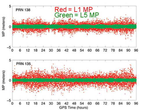
Just because some GPS satellites weren’t broadcasting CNAV on L2C and L5 doesn’t mean your receiver isn’t using L2C or L5. On the contrary, if your receiver was designed to handle L2C and L5, it’s likely already been using them. The CNAV is just the message being transmitted on the L2C and L5 carrier along with the code. If your receiver tracks L2C and L5, it’s likely already using the carrier (phase) observations. However, even then there are only a limited number of satellites broadcasting L2C and L5 carriers. Specifically, there are 11 satellites broadcasting L2C and four broadcasting L5, meaning that your receiver is roughly tracking one L5 satellite at any one time during the day and several satellites broadcasting L2C.
The C/A code (NAV) message on L1 that your receiver already uses today is good enough. Your receiver doesn’t need the CNAV message on L2C or L5 to utilize the L2C or L5 carrier observations. That’s not to say there’s no benefit to CNAV on L2C and L5, but for RTK or post-processing, the value is largely in the carrier observations. In the future, when L2C and L5 are fully deployed (or near fully deployed), the L5 CNAV does have some distinct advantages, but that’s a few years down the road. To give you an idea of the benefit of L5 when there are enough GPS satellites broadcasting L5 , take a look at the following illustration published by Dr. Richard Langley from the University of New Brunswick comparing the reduction of code multipath on L1 and L5 of two WAAS GEO satellites.
Reduction of code multipath using L1 and L5 on WAAS GEO Richard B. Langley, Hyunho Rho
For the full text of the Langley/Rho article on L5 and WAAS that appeared in the May 2009 issue of GPS World magazine, click here.
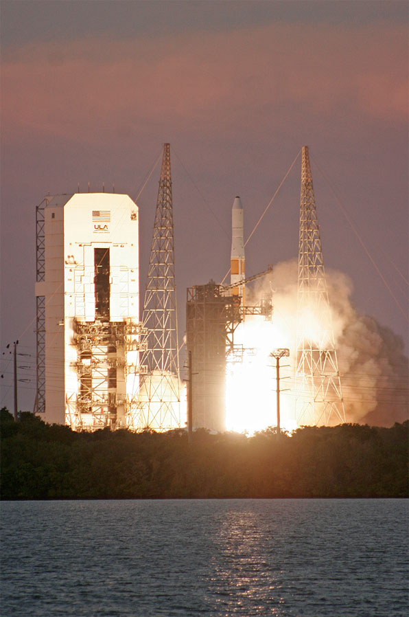
Second GPS IIF Satellite of 2014 Launched May 16
On May 16, the second GPS satellite of 2014 was launched successfully from Cape Canaveral in Florida. It was the sixth model IIF GPS satellite, of which 12 are being built, before transitioning to the next-generation model GPS satellite named GPS III. It began transmitting on May 21, 2014, but is not yet set healthy.
Photo credit: Spaceflight Now.
The GPS model IIF satellite broadcasts the legacy GPS signals as well as the new civilian L2C and L5 signals.
Normally, a launched GPS satellite is set healthy (and automatically begin being used by your GPS receiver) within 30 days of launch, sometimes much sooner. However, the IIF GPS satellite launched in February of this year still hasn’t been set healthy, the reason reportedly being an extended navigation test reported here.
A third GPS IIF satellite is scheduled for launch this year on July 31.
During the post-launch interview last Friday, the Air Force stated that the remaining GPS IIF satellites (six) will be launched by the end of 2016. From previous conversations I’ve had with Air Force officials, they’ve stated that there could be an overlap between IIF and III satellite launches. In other words, the first GPS III satellite could be launched before all IIFs have been launched.
“Since March 15, 2014, the Air Force has been conducting functional checkout on a GPS satellite, designated Space Vehicle Number (SVN) 64. SVN-64 broadcasts a data message that clearly indicates SVN-64 is unusable for navigation. Nevertheless, the U.S. government has confirmed that certain GPS receivers are using data from SVN-64, in violation of GPS interface specifications, resulting in outages or corrupted, inaccurate position calculations.”
CGSIC reports that the GPS continues to operate and is fully functional.
In Australia, faulty GPS receivers on roughly 1,000 fleet vehicles caused an apparent GPS “outage” about a month ago.
The U.S. Air Force GPS Operations Center reported that in mid-May tests, “PRN 30 [was] broadcasting almanac datasets that do not reflect constellation changes that occurred since it was last uploaded with navigation message data. [. . . ] The utilization of these almanacs in a manner that regards the time of week, but neglects or mishandles the week number (effectively executing as if the current week number is the week number associated with these almanac parameters), will result in an increasing error in visibility determination and other almanac based estimations (elevation/azimuth, Doppler shift, SV clock offset from GPS time, etc) as the dataset’s actual week offset from the current week increases.”
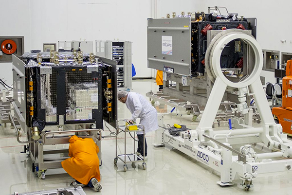
First Two FOC Galileo Satellites Arrive in French Guiana for Launch Preparation
The first two Fully Operational Capability (FOC) Galileo satellites arrived in the French Guiana in preparation for launch this summer. When launched into orbit, they will join four IOV (In-Orbit Validation) Galileo satellites launched in 2011 and 2012.
The first FOC satellite launch may signal the beginning of Galileo “production” launches of one pair per quarter. Giuliano Gatti, Head of ESA’s Galileo Space Segment Procurement Office, stated that “A steady stream of satellites is foreseen, coming from OHB to ESTEC for acceptance testing and then on to French Guiana. Thanks to the preparatory work done with these pioneer satellites, future Galileos will be processed more rapidly.”
OHB is the prime contractor for a total of 22 FOC Galileo satellites. Those are in addition to the four IOV Galileo satellites.
The two Galileo satellites in the clean room.
Massive GLONASS System Failure
On April 1, the entire GLONASS system was inoperable for about 11 hours. A second, partial failure involving eight GLONASS satellites occurred on April 14 and lasted for about 30 minutes. There were many reports of RTK receivers not operating properly, and some manufacturers instructed their users to “turn off” GLONASS tracking capability on their receivers.
Subsequently, mathematical mistakes were blamed for the failures. The head of the Russian Space Agency, Oleg Ostapenko, stated that the problem would be fully resolved by mid-May and that there is almost no chance of a similar failure happening again.
Some news media are reporting that such an action by Russia would have an effect on GPS.
It would not.
What they’re talking about is discontinuing operations of some or all IGS (International GNSS Service) GPS stations in Russia. Those stations have nothing to do with the operation of GPS. They are simply CORS (Continually Operating Reference Stations). If anything, it will hurt Russian scientists (and scientists from other countries) more than anyone else.
Russian Rocket Launch Failure
Last week, Russia suffered its fifth rocket launch crash in the past four years. Fortunately for the GNSS user community, the rocket was not carrying any GLONASS satellites.
However, it raises serious concerns about the reliability of Russian rockets and launch procedures. Europe’s Galileo satellites are launched using Russian Soyuz rockets at Europe’s space port in French Guiana.
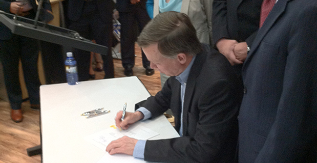
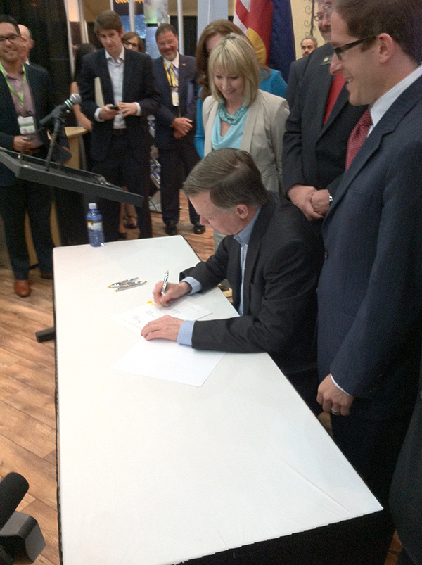
Colorado Governor John Hickenlooper signs a space-friendly bill at the 30th Space Symposium in Colorado Springs.
Colorado Ranks Third in Space-Friendly States
Governor John Hickenlooper (D) of Colorado made the trek from the statehouse in Denver yesterday to sign key space-friendly Colorado legislation at the 30th Space Symposium in Colorado Springs. The world’s largest annual space symposium takes place at the famed Broadmoor Resort in Colorado Springs and nominally draws a crowd of space aficionados and professionals, government and civilian alike, approximately 9,000 strong. Colorado House Bill #1178 is titled the “Sales And Use Tax Exemption for Qualified Property Used in Space Flight,” and it is hoped this legislation will help expand aerospace industry growth in Colorado. Spokesmen from the governor’s office and Tom Clark from the Colorado Space Coalition stressed that Colorado currently has the nation’s third-largest aerospace economy, and the new tax-exemption bill is part of Colorado’s strategic initiatives to support and grow one of its strongest industries. Indeed, Colorado Springs is known in government circles as the Home of Military Space. Several key space industry experts (both government and civil) present at the bill signing stated that the new tax exemption will add an important boost to keep Colorado ahead of the competition and further stimulate the state’s massive aerospace economy. Colorado is known as a national hub for geospatial technologies, remote sensing and satellite-based services. The space services and technology providers comprise the largest category of the state’s space economic activity, bringing in $6.3 billion in annual revenue. Currently, the Colorado space-based revenue is growing at a steady 8 percent annual rate. In conversation with Tom Clark, he admitted that in years past, Colorado has actually occupied the number-two raking for a state’s space-based economy, but was recently surpassed by Florida, which has similar tax-friendly legislation on the books. Clark was confident that with the new legislation Colorado would, like Avis, soon be number two again.
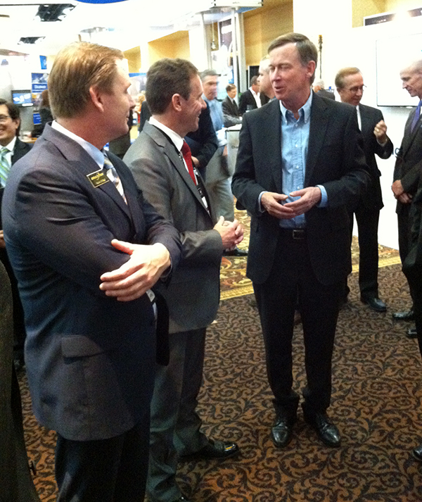
Colorado Gov. John Hickenlooper discusses space matters at the 30th Annual Space Symposium with Braxton Chairman of the Board Kevin O’Neil and Braxton CEO Frank Backes.
Report from the 30th Annual Space Symposium, May 19-22, Broadmoor Resort, Colorado Springs, Colorado
For the past five years, the first day of the National Space Symposium — now known simply as the Space Symposium, the largest symposium of its kind in the world — has started with an entire day dedicated to discussions of the cyber domain as it pertains to the DoD and civilian industry. The annual event highlights presentations from the major civilian cyber players and the senior cyber commander for the DoD, military services and government agencies. Several of the now-senior military officers worked for or with me as junior officers at some point in the past, and while that is an age-related humbling experience, it also makes me proud of them at the same time.
One major talking point, among many, is crystal clear: the U.S. government and civilian enterprises alike understand that cyber security is a critical mission and that cyber warfare, especially from a nation-state point of view, is a credible and viable threat to every government and civilian program and and to everyone today.
Major General Kevin McLaughlin, currently the commander of 24th Air Force and AFCYBER, the major command that takes cyber warfare to heart as a major mission, is one of those young officers in my past that make me proud today. Kevin was the luncheon speaker, and he put the Air Force role for cyber warfare in perspective as well as explaining how the Air Force role is integral to the overall Defense Cyber Enterprise. This integration role may seem like a small matter, but General McLaughlin’s explanation of Air Force and DoD cyber and IA (Information Assurance) synergy is critical to the success of his organization and mission.
This is critical because throughout my Air Force career and even today I constantly encounter commanders that are quick — too quick in my book — to explain, usually with great passion, why their particular mission(s) are critically important and “unique” to the Air Force writ large enterprise. Unfortunately, history shows us that “unique” organizations within services do not always fare well in budget scenarios, especially seques-castration budgets.
In my humble but experienced opinion, the senior officers commanding these “unique” organizations, be they cyber or otherwise, would fare far better if they conformed to Air Force budget requirements and still conducted their day-to-day unique missions just like a fighter pilot and fighter sortie. By that I mean you never know what you will encounter on a fighter sortie. You never know what the enemy will throw at you but you can rest assured that any plan, no matter how well conceived, will not survive initial contact with the enemy. The plan always changes and will hopefully be successful, but only because of flexibility, which has been described as the key to air power, and certainly not because of the “plan.”
So, I was assured when Gen. McLaughlin described “A Day in the Life of a Cyber Warrior” just as I would a fighter sortie. Prepare for the known threat and expect the unexpected. Be innovative and flexible, and you may win the battle and live to fight another day, because make no mistake about it, cyber warfare is a life-and-death struggle.
Fortunately, there do seem to be solutions that work, and a key point that was made numerous times by various speakers is that the small, small, usually local cyber warrior company is often times much more successful than the security behemoths that tend to get bogged down in their own administrative minutia. One of the companies mentioned was NDP, a small cyber and IA company in Boulder, Colorado, known for its work slaying the cyber dragons attacking the well-known SBIRS (Space Based Infrared System) program. The story goes that NDP, with only 50 employees, took on major global SBIRS cyber and IA issues and made it look simple. It is always the real experts that make it look simple. The chairman of one of panels really put it in perspective when he opined, “Would you really want Raytheon or Boeing providing anti-virus software for your home computer? Probably not! No slight to the mega companies intended, but I would go with the local, flexible and responsive small company, like NDP, every time.”
Thankfully, a lot of what I heard this year, as opposed to years past, conforms to the scenario I just described. Bad cyber actors (villains), local or nation state, are anticipated, and while the white-hat cyber warriors win more times than they lose, it is clear there is currently no panacea for cyber and IA threats — just hard work, diligence and flexibility to hopefully win the conflict.
AUVSI Unmanned System 2014 provided a showcase for new UAV/UAS products, and a dialogue on the rapidly growing industry.
Report from the Association of Unmanned Vehicle Systems International (AUVSI) Orlando, Florida, May 12-15, 2014
Just before the start of the huge AUVSI show, the FAA once again cautioned Unmanned Aerial Systems proponents that still more care is needed with UAS airspace access. The majority of UAS operators and manufacturers are making efforts to become compliant with reasonable FAA rules. Also, AUVSI had some good information on the economic benefits of UAS commercial applications to the U.S.
The annual AUVSI conference came down to the Sunshine State this year, and the sun did shine, with temperatures in the high 80s most days. The Orlando Convention Center is a huge place and AUVSI took up the majority of the South Exhibit hall along with a bunch of rooms where most of the technical presentations were run. With close to 600 exhibitors and more than 6500 attendees, this is still one of the bigger trade shows.
FAA Rules
However, just before the start of this huge show, the Federal Aviation Administration (FAA) once again cautioned Unmanned Aerial Systems (UAS) proponents that still more care is needed with UAS airspace access. It’s probably more than a coincidence that FAA released news of a March 22 close call at 2,300 feet between a US Airways airliner on approach to Tallahassee, Florida, and a model F4 Phantom Jet — UAS owner and operator unknown. And CNN also picked it up and animated it pretty quickly. As the industry as a whole strains to seek more airspace access, it’s difficult to understand how incidents like this happen. And, in the process, they push back all the good efforts that are being made by the large majority of UAS operators and manufacturers to demonstrate their ability and desire to become compliant with reasonable FAA rules.
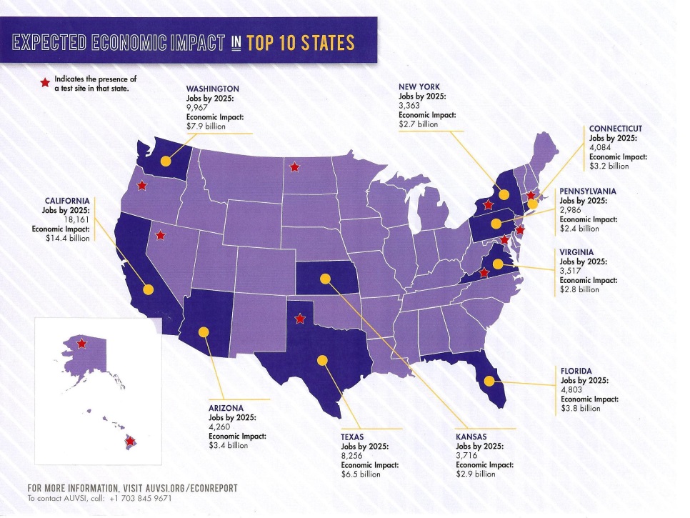
Nevertheless, AUVSI had some good promotional material available at the conference showing the economic benefit to the U.S. for UAS commercial applications — a $82 billion market and around 104,000 jobs over the next ten year, $50 billion in the top ten states alone.
Wildfire mapping, agriculture monitoring, disaster management, power-line surveys, telecomms, weather monitoring, aerial imaging/mapping, TV news and sports coverage, movie making, environmental monitoring and oil and gas exploration — these are just some of the commercial areas where AUVSI anticipates that UAS will generate significant revenue.
Presentations and Sessions
The conference presentations began on Monday afternoon, and one paper that caught my eye was by Sierra Nevada (SNC) on its Fusion Filter, which is designed to take multiple sensor inputs and develop navigation and guidance for en-route, terminal approach and landing. This particle filter maintains thousands of weighted position estimates and refines them to provide a composite position and guidance output. Sensor inputs that SNC has used include 3D radar, lidar, FLIR IR camera, daytime camera, GPS/INS, and digital terrain elevation data (DTED). For landing applications, ~50 algorithms run to determine runway location with or without GPS/INS inputs. SNC has flown development flight tests on both fixed wing and rotor craft.
Tuesday began with a General Session headlined by Rep. John Mica (R-Fla.), House of Representatives; Lt. Gen. Kevin Mangum, deputy commanding general/chief of staff, U.S. Army Training and Doctrine Command; and Rep. Frank Lobiondo (R-N.J.), House of Representatives. In introducing these speakers, Ralf Alderson of AUVSI talked about the change from an industry basically serving the U.S. Department of Defense to a coming UAS commercial marketplace: “Time to start learning about the rest of the world,” he commented.
John Mica chaired the House Transportation Committee until 2012, and was one of the movers behind the government’s legislation that gave the FAA its 2015 deadline to integrate UAS into the National Airspace System (NAS). Mica’s disappointing advice was for us to now think in terms of 10-15 years before there would be complete UAS integration in the NAS, largely due delays in the name of safety by the FAA.
Lt. Gen. Kevin Mangum (Army three-star) began by telling us that the Army’s first UAV may have been the SD1 Drone used in Germany in 1960/61. He indicated that everything the Army does with UAS is basically focused on providing the soldier in the field with the tools he needs to be successful. He indicated how UAS are available at the various command levels, and gave us insight into progress with manned and unmanned teaming.
Frank Lobiondo is chairman of the House Aviation Subcommittee, which oversees the majority of programs of the FAA. He acknowledged that “The rest of the country is not tuned in” to the benefits of UAS, and “sensationalized media coverage only highlights (UAS) in a very negative way.” Nevertheless, Congress is desperate to see the potential economic impact of UAS unleashed, and will urge FAA to speed up the process.
Later on at the conference, almost as if in response to Lobiondo’s comments, FAA Manager of UAS Integration Jim Williams made a welcome announcement. Four companies have approached FAA for expedited UAS approvals, and the FAA is now working with them to expedite limited commercial operations before UAS rules are finalized. Limited commercial operations for filmmaking, power-line inspection, precision agriculture and flare-stack inspection are therefore expected to be soon authorized by FAA.
The next General Session featured presentations by Alaska Lt. Gov. Louis Mean Treadwell and futurist Mike Walsh. While Walsh’s presentation was entertaining and thought-provoking. Challenging almost all status quos for how to conduct business, Treadwell had more to say that was directly relevant for today’s UAS industry. “Do consumers get it, do they want it, do they fear it?” These were the messages Treadwell gave to his AUVSI audience. As a past technology and business start-up innovator, he had a lot to say about the suitability of Alaska for UAS testing and innovation. With 47,000 people working in aerospace in Alaska, and the recently FAA-awarded Alaska-Hawaii based Pan-Pacific Test Range; Treadwell encouraged the UAS industry to come and try Alaska.
Exhibit Floor Highlights UAS Opportunities
Meanwhile, the GNSS and navigation systems suppliers to the UAS industry were going about the business of the trade show — exhibiting and demonstrating their capabilities. Wandering purposefully around the huge show floor, I set about uncovering what was new and how people felt about UAS opportunities:
Septentrio:
Septentrio introduced a new RTK engine this year, which is better in occluded situations — such as under tree canopies or around downtown buildings. It has better scintillation detection and provides clearer warning indicators to users. The bottom line is that its RTK is more robust and works better.
Septentrio has also had some significant success with major dredging operators around the world. It has reduced convergence times for PPP, say when starting with an initial RTK position, and position accuracy degrades gracefully over 15-30 minutes.
Accord:
Accord is quite excited by the prospect of a new FAA TSO C-199, which when approved will establish equipment requirements for gliders, balloons and aircraft such as micro-lights, all without electrical systems. The TSO creates a new class of equipment, which is now referred to as Light Aircraft Surveillance Equipment (LASE). The aircraft targeted for equipage are currently exempt from the rule that mandates other aircraft should carry ADS-B — which broadcasts position and velocity, allowing others in the airspace to track and avoid your aircraft. So to improve safety, a simpler, less expensive ADS-B device is being called for that uses an off-the-shelf (non-certified) GNSS receiver as the position source. The point is if this GNSS is good enough for this special class of aircraft, why wouldn’t it be good enough for UAVs, which are so similar to these targeted aircraft?
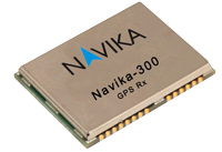
Accord has a Micro-i GPS SBAS receiver for this application using a chip-level receiver called the Navika-300, which comes from its Indian technology partners. Accord claims that the Navika is comparable to other chip-level receivers in the market from CSR (Sirf) and u-blox.
Topcon:
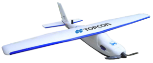
Topcon has partnered with MAVinci from Germany to market the Sirius Basic and Pro aerial positioning system in Europe, and presumably this system will find its way into everywhere that Topcon does business.
Achieving 5-cm GNSS-RTK accuracy without traditional Ground Control Points (GCP) increases productivity. Removing the need for placement of GCPs can potentially reduce time for a survey project by up to 50 percent. This precise positioning technology allows image locations developed by Sirius Pro to be used as the equivalent of GCPs.
Trimble:
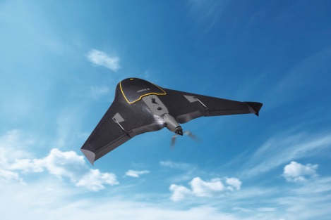
The Trimble UX-5 Aerial Imaging Rover was probably first on the market as a GNSS/UAS system for precision surveying. Following the acquisition of Gatewing, Trimble has been working hard to bring a fully capable UAS surveying solution to market.
The Trimble UX5 aerial image data is processed into deliverables by the new Trimble Business Center (TBC) photogrammetry module. Specialized computer-vision algorithms produce accurate results automatically, with minimal manual interaction. The UX-5 provides a stable and reliable photogrammetric system delivering excellent results without requiring specialized photogrammetry knowledge or experience.
Trimble also unveiled a new high-performance integrated UHF receiver at the chipset level ( 60 x 55 x 15 millimeters), designed for OEM integrations, UAS among them. The BD930-UHF supports both triple frequency from the GPS and GLONASS constellations plus dual frequency from BeiDou and Galileo, making it ready to take advantage of additional signals as GNSS grows and grows. The BD930-UHF delivers quick RTK initializations for 1–2 centimeter positioning. It also has an advanced kalman filter PVT engine positioning in urban canyons and the like, for applications not requiring centimeter-level accuracy. The receiver also supports fault detection and exclusion (FDE) and receiver autonomous integrity monitoring (RAIM) for safety-critical applications — sure to become increasingly important in the FAA-ruled airspace and coming regulations.
The Trimble BD930-UHF high-performance integrated UHF receiver.
NovAtel:
NovAtel announced the release of the new OEM617D receiver at AUVSI’s Unmanned Systems 2014. The OEM617D is a compact, dual-antenna, dual-frequency, single-card receiver offering NovAtel’s ALIGN heading functionality and RT-2 Real Time Kinematic (RTK) GNSS positioning technology, in both dynamic and static environments. The OEM617D provides dual-frequency operation with GPS, GLONASS and BeiDou signals and also tracks Galileo, SBAS and QZSS, maximizing GNSS availability globally. Fixed and rotary-wing aircraft/UAS, marine, and autonomous ground vehicles will benefit by integrating the OEM617D as well as other applications requiring precise position and heading accuracy.
Gladiator:
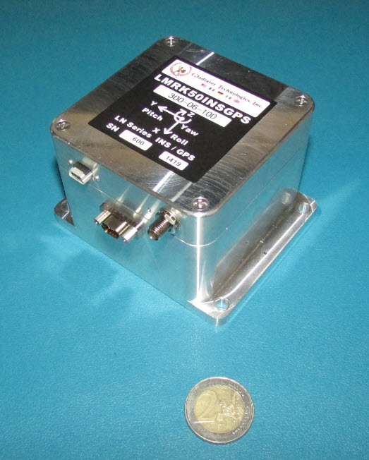
The Landmark 50 is a high-performance GPS/inertial product which comes in at the top of the Gladiator MEMS inertial product line. The LandMark 50 INS/GPS represents inertial performance on par with small ring laser and fiber-optic gyros. This performance leap with low-cost MEMS technology offers substantial improvement in performance utilizing the newest high-performance MEMS gyros and accelerometers combined with a 72-channel, 10-Hz update rate u-blox GPS, GLONASS, BeiDou, QZSS and SBAS receiver.
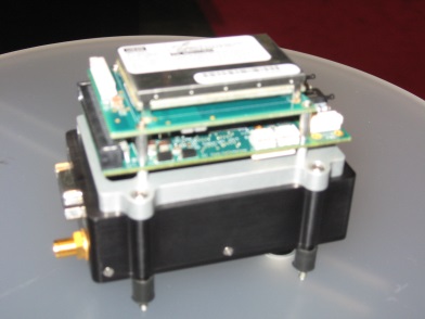
Geodetics:
Geodetics showed off a couple of new GPS/inertial products. The Geo-ReiNAV comes in both a commercial and a mil-spec (SAASM) version. As the team was at lengths to explain, Geodetics is GPS “agnostic” — which in today’s terminology means Geodetics uses a variety of OEM receivers in their products — the smarts are in the filter and processing. The other key component is a Seiko/EPSON G352/362 MEMS Quartz IMU, which apparently has less noise and lower drift (or more accurately “in-run bias stability”) than other silicon MEMS inertials.
Incidentally, we sat and discussed this material at the Geodetics booth, which seemed more spacious than in previous years — it was larger, as it spilled over into the next vacant booth which Hemisphere was supposed to have occupied — but having apparently reserved and paid, didn’t show up for the exhibition.
Sparton:
Sparton released news of the GAINS-10 Multi-GNSS assisted inertial navigation system at AUVSI this year. The unit excels in challenging environments. It provides accurate inertial navigation in the presence of mechanical shock, transient platform vibrations and extreme magnetic interference. The 10DOF IMU features high speed, synchronous sampling of all inertial systems combined with high rate coning and sculling compensation and is fully calibrated over temperature.
Vectornav:
The VN-300 is a miniature dual antenna GPS-aided INS system. The dual GPS adds heading determination, and the inertial aiding helps through potential GPS outages. A pressure sensor is also included for altitude determination. The VN-300 can be used in a wide variety of industrial and military applications and is well suited for size, weight, power and cost-constrained applications such as unmanned vehicle systems; antenna, camera and platform stabilization; heavy machinery monitoring; robotics; and primary or secondary flight navigation.
Oxford Scientific (OxTS):
Last year at AUVSI, Oxford introduced a miniature datalogging GPS/MEMS INS — this year it returned with the xNAV500, which is now real time. With dual GPS and antenna inputs, this unit also provides heading determination in a small form factor that is apparently very affordable.
MicroPilot:
One of the leading providers of autopilot systems for a large number of the UAS at the show, MicroPilot has not stood still during the last 12 months. The latest product addition is the MP2128³× triplex redundant autopilot using three high-performance 2128ɡ autopilot boards on one pcb. The advantage is that this autopilot is fault resistant, providing two additional back-up channels to resist critical function failure. A board-level option is available for integrators who want to combine functions in fewer on-board boxes.
UTC/Cloud Cap:
Cloud Cap is also one of the principle autopilot suppliers to the UAS industry. Cloud Cap appears to pack additional functions into its range of autopilots — including a core autopilot, flight sensors, navigation, wireless communications and interfaces providing data to the payload system. The Piccolo Nano is its smallest device, and has been mounted in a board stack on top of a Cloud Cap enclosure containing a NovAtel OEM615 used as the Nano GPS navigation source.
Overall on par with last year’s AUVSI conference in Washington, D.C., the Orlando venue probably encouraged more industry participation, but there seemed to be a lot fewer military people around. This probably accounts for what looks like reduced attendance over last year.
The GNSS/navigation exhibitors, however, were just as innovative as last year, and were present in good numbers. There was generally good traffic at most of these booths, so there are probably new customers coming directly from the show. What was the most notable new thing at the conference? For me, it was discovering the potential for a reduced scope of equipment certification — provided UAS could find a way to be included within the same class of aviation as balloons, micro-lights and gliders. This would really help bring more UAS with high-performance navigation into usable airspace — even unleashing the commercial potential that Congress and the industry need so badly.
At the ENC-GNSS Conference in Rotterdam, we delved into actions necessary to officially use EGNOS (giving me déjà vu from WAAS’s early days), heard sage words from Brad Parkinson, the father of GPS, and, on the last day, saw amazing proof of a claim many of us initially thought was outrageous — that differential (DLoran) with modern monitoring can result in consistent horizontal accuracies approaching five meters on a moving platform.
When I was asked if I could cover the European Navigation Conference 2014 (ENC-GNSS) in Rotterdam, The Netherlands, it took me about two seconds to answer in the affirmative. Let’s see… Travel to Europe in the spring, visit The Netherlands — my old stomping grounds where my daughter was born — see miles and miles of beautiful Tulips in bloom, and visit with some old friends. Gee, what a tough decision. Oh, and of course, cover the ENC. Almost forgot that
Seriously, my primary purpose, of course, was to cover the ENC and associated events such as the Resilient PNT Forum and a meeting of the European Maritime Radionavigation Forum (EMRF), but literally miles and miles of brilliant red, white, and yellow tulips interspersed with ancient windmills are hard to ignore. But I digress.
In past years the ENC, with approximately 400 attendees, has been naturally dedicated to European PNT matters, and in reality it concentrated almost exclusively on Galileo with a slight mention of EGNOS. That was about it. This year, the venue was the same, but the program was more open, with presentations on PNT augmentations such as EGNOS and DLoran, and maritime navigation to include radar and inertial systems.
For those of us that have been in the PNT (positioning, navigation and timing) or merely the navigation business, say, for the past 40+ years or so, in some respects it was more than slightly reminiscent of times past. As the great American octogenarian baseball philosopher and malapropism aficionado extraordinaire, Yogi Berra, once said, “It was déjà vu all over again.”
European Maritime Radionavigation Forum
The Port of Rotterdam today (2014).
The EMRF was the first official function to kick off in Rotterdam. When you consider that Rotterdam is one of the busiest ports in Europe and had been around since 1340, you would naturally expect one of the main conversations at the EMRF to concern the port of Rotterdam and navigating in less-than-perfect conditions. The Netherlands is known as the Low Country, and that is as an apt description since most of the country is below sea level — hence the persistent fog, dikes, sea walls, and windmills that pump water and grind grain and all those good things. Today, the modern versions of those windmills are huge — twenty stories tall — and generate electricity. Many of them are close to shore so precise navigation in foggy conditions is even more critical than in times past.
The main topic of conversation at the EMRF revolved around the actions necessary to officially use EGNOS (the European Geostationary Navigation Overlay Service) as a precision and official safety-of-life augmentation for GPS (similar to WAAS, Wide Area Augmentation System) and Galileo.
During those discussions, I swear when I closed my eyes, except for the accented English, I was propelled backward almost 20 years to discussions of WAAS as a safety-of-life system, not for maritime but for aviation purposes. Still, the dialogue and heated discussions echoed down through the years almost verbatim. The main difference, of course, being that in the U.S. it was 20 years earlier, we were embarking on virgin territory, and we had only ourselves, one nation, to debate. Whereas the Europeans are fighting the same battles two decades later, with a system that is purposefully almost an identical copy of WAAS technically, and they are working for maritime and aviation certifications simultaneously. And not with just one nation but the entire European Union. A truly daunting task.
The EMRF website is sponsored by Trinity House in London, which is responsible for the safety of [English and European] shipping and the well being of seafarers, which have been their prime concerns ever since Trinity House was granted a Royal Charter by Henry VIII in 1514. I planned to list the EMRF website for your further edification, but since the latest news on the site concerns the upcoming January 2011 EMRF meeting in Paris, I thought it was best left to molder in obscurity. The website, not the EMRF.
The bottom line for the EMRF is that while it fills an important role where EGNOS and maritime navigation are concerned, it still has a lot to learn and could benefit greatly by lessons learned from WAAS. However, I personally see no indication that will happen, so we wish them luck. Many of us are standing by to assist if asked. Even if it is only, “Been there, tried that, and here is why it did or did not work.” Quod homo non sit Island.
Resilient PNT Forum
I was happy to see Dana Goward (USCG Ret), the head honcho at the Resilient Navigation and Timing Foundation, which conducted the Resilient PNT Forum at ENC 2014. Dana’s forum, which took place just before the official ENC 2014 kickoff, concentrated on the need for and strategies to achieve resilient position, navigation and timing (PNT) services. The event was well attended, and was jointly hosted by the European Group of Institutes of Navigation, the International Association of Institutes of Navigation, and the International Association of Marine Aids to Navigation and Lighthouse Authorities. There was no charge to attend the event, and the collaboration proved interesting, especially since Dana really wanted to talk eLORAN and GPS/Galileo augmentations.
Dana is retired U.S. Coast Guard and worked many years supporting LORAN-C and the USCG Navigation Center. Dana showed a brief video of his recent testimony before the U.S. Congress, where he lobbied for a cessation of the destruction of LORAN-C towers and their associated infrastructure. If recent congressional actions are any indication, he has been somewhat successful in that regard. Now all that is left is to help the U.S. Congress, services, and agencies realize how badly the United States needs LORAN as a backup, enhancement, and augmentation to GPS and other space-based PNT services on a global basis. No small task, but it is a task that Dana Goward and the Resilient Navigation and Timing Foundation have strapped on, and we wish them the best. Plus, as you will see later, a surprise presentation at ENC-GNSS may have given Dana and his cause just the boost they need. Keep reading.
As it turns out, many others thought these non-Galileo presentations were timely topics as well, and the discussions were enlightening, especially the Resilient PNT Forum keynote address by Professor David Last. Among many other titles he holds, Last is a consultant engineer and expert witness specializing in radio navigation and communications systems. He is a professor emeritus at the University of Bangor, Wales, and past president of the Royal Institute of Navigation. He acts as a consultant on radio-navigation and communications to companies and to governmental and international organizations and is active as an expert witness, especially in forensic matters concerning GPS.David and I are old friends, and it is always enlightening and entertaining to hear him speak. On this occasion, Professor Last spoke eloquently and authoritatively concerning the ubiquity of GPS/PNT and the resultant and inherent vulnerabilities of space-based systems. David made the essential point that while GPS remains the sine qua non of PNT, it is still vulnerable and subject to failures as are all space-based PNT systems, the recent GLONASS debacles being prime examples. More on these unfortunate Russian examples of PNT vulnerability at a later date.
David pressed the issue, as he has many times, that we desperately need a ground system or many different ground-based augmentations, backups, and enhancements to ensure that the user is never without navigation and timing data at a critical juncture, such as navigating through an insanely busy commercial port in thick fog.
This theme was carried forward in the ENC-GNSS very adroitly by none other than Dr. Bradford Parkinson, the Father of GPS. Dr. Parkinson spoke at length on the need to “Protect, Toughen, and Augment GNSS” against all enemies, be they manmade or natural. Brad made the point, with all due credit to Will Rogers, that “Rumors of GPS’ death are greatly exaggerated.” Indeed, the GPS constellation has never had more satellites on orbit, in residual status, and spares in the barn than we do today. The SIS or Signal In Space has never been more accurate, and the GPS atomic reference systems have never been more stable than today, and yet GPS remains incredibly vulnerable. But take heart, as Dr. Parkinson is convinced “There are actions such as PTA that can be taken to safeguard PNT for all users.” We will cover Dr. Parkinson’s 60+-slide presentation in depth at a later date.
Surprise! Loran Is the Answer
The big surprise came on the last official day of the conference during a group of alternate PNT presentations co-chaired by Dr. David Last. The rather startling enhanced differention LORAN (eDLoran) presentation was given by Professor Durk van Willigen, representing his colleagues René Kellenbach and Cees Dekker of the Dutch consulting firm Reelektronika, and Wim van Buuren of the Dutch Pilots’ [ed. maritime] Corporation, who helped with the DLoran research and authoring of the paper for the ENC presentation.
Professor van Willigen made what many of us initially thought was an outrageous claim, and then amazingly went on to prove that enhanced differential Loran with modern monitoring produced consistent horizontal accuracies approaching five meters on a moving platform. Needless to say, Professor van Willigen, who teaches at the Delft University of Technology in The Netherlands, was mobbed at the end of his presentation, but I did manage to catch him for a few minutes afterwards. Since then, GPS World Editor-in-Chief Alan Cameron has spoken with Professor van Willigen at length, and the result is the first of what I am sure will prove to be numerous articles on eDLoran in GPS World.
Shipboard DLoran receiver installation (orange boxes on rails).
One would hope that with this rather startling improvement in differential Loran accuracy and the decision by the U.S. Congress to halt the destruction of Loran-C infrastructure in North America, that there might once again be a future for Loran, especially eLoran and/or DLoran in North America, and hopefully globally as well.
As Professor David Last in his best imitation of John Cleese might say, “It is the answer to a maiden.s prayer.”
Until next time, happy navigating. I hope to see you all at the 30th Space Symposium May 19-22 in Colorado Springs at the Broadmoor Resort. More than 10,000 attendees are expected, and I hope you will be one of them. Stop by the GPS World booth and say hello.
In the mid ’80s I set up the Navy’s first Geographic Information System (GIS) to accomplish the 1987 base closure study, now called the BRAC (Base Realignment Commission). That first experience with GIS convinced me to pursue GIS as my second career after retiring from the Navy. Fortunately, I was able to land an ideal final tour of duty as the Commanding Officer of the Naval and Marine Corps Reserve Center in Charlotte, N.C. I worked to get this position since at the time the University of North Carolina at Charlotte was one of the few universities starting a GIS master’s program, and taking some evening classes helped with my transition. Jack Dangermond, who I hadn’t heard of at the time, was the keynote speaker for program kick off.
That was a nice assignment after years of sea duty and other demanding assignments over an 18-year career, but one aspect would make this assignment hauntingly unforgettable. As the only active-duty Naval Officer within 50 miles of Charlotte, one of my collateral duties was to act as the Navy’s Casualty Assistance Calls Officer (CACO). A CACO is the official representative of the Secretary of the Navy who notifies immediate family members in the event of a service member’s death or severe injury. Unlike some depictions in movies, military branches take special care to notify immediate family members in person not by phone. I did several of these notifications and learned to take a chaplain and corpsman with me in case there was traumatic reaction by the family members to the news.
It was an especially clear spring day when I received a message to notify a family of the death of their only son. He was a young man living his dream as a Navy diving officer. He worked hard to get there by earning an engineering degree from Duke University while also participating in the NROTC program. He was serving as the diving officer on a submarine rescue ship in the Mediterranean when he was killed in the line of duty. My job was to notify the family.
The chaplain, corpsman and I arrived at the home just as the mother and father returned from grocery shopping. As I knocked on the screen door the mother looked up and with a surprised smile on her face seeing the three of us in uniform she happily said, “Oh, you’re in the Navy!” and within a half second her voice dropped to a low painful tremble, “Oh no….my son is in the Navy.” She knew. She knew. In a half second she knew the Navy doesn’t send three uniformed people to deliver good news. The only thing I remember as she and her husband collapsed to the floor holding each other was her repeating “Oh no” “Oh no” and mention of her daughter-in-law, who was expecting.
I could only imagine how she felt after receiving the most horrific news a mother of an only child could receive. I felt like I had just plunged a long jagged dagger into her heart and each piece of additional information just twisted that dagger around further. I pictured her life as a mother racing before her — childbirth, his first steps, school, graduation, his wedding, pending fatherhood. Soon neighbors, friends and their local minister arrived to comfort the family.
Over the next several days, while the flag draped coffin made its way to North Carolina, I worked with the funeral home and family preparing for the graveside ceremony. I rehearsed our Navy team in preparation — six pall bearers, a firing squad, bugler, chaplain and myself. The day of the ceremony I inspected our sailors and as expected each man was inspection perfect. We loaded up the bus and headed out. The ride to the site was quiet, we all knew that this funeral was different from the numerous retiree funerals we had done. This young man was one of us, gone in the prime of his life serving his country.
The ceremony went perfectly. The six sailors in their dress uniforms carried the flag-draped coffin to the burial site and stood at attention next to the coffin. Seven members of the firing squad positioned themselves several hundred feet away. We all stood at attention as the chaplain spoke. When he finished I nodded to the six pall bearers; they slowly grabbed the flag, lifted it, and stretched it out over the coffin. That was the signal for the seven-member firing squad to fire three volleys immediately followed by the playing of taps.
I know of no military member who doesn’t get choked up at the crack of the rifles followed by the melancholy playing of taps. As taps was playing, the pall bearers were folding the flag with precision. The goal is to fold the flag into a perfect tight triangle with only white stars and dark blue showing by the time taps is complete. They did a perfect job, and the lead petty officer then handed the flag to me. It was my task to walk over to the family and present the flag. “On behalf of grateful nation and proud Navy, I present this flag to you for the honorable service of your son and husband.” And that was it, the final capstone to a short and honorable life, or so I thought.
The funeral director then announced that all were invited to the fellowship hall for a potluck luncheon. I dismissed the funeral team and we all headed over to the fellowship hall. The mood was less somber as family members and friends recalled the good times. It was nice to relax a bit and hear some fond memories of our departed shipmate. Soon it was time for us to go. While my team headed to the bus, I went to pay my last respects to the wife and parents. I shook hands with the wife, the father, and then as I offered my hand to the mother, she held it with both hands and said something that has haunted me to the core ever since.
Holding my hand ever so tightly she said, “I just wanted to let you know… how bad I felt for you having to deliver the news to me.” Her comment floored me. Three days before I had delivered the most painful news a mother could ever receive. I plunged a dagger into her heart that would never heal….and she felt bad for me? Speechless, I nodded and squeezed her hand back. I left shaking my head in disbelief. I had never met someone so selfless.
That was over 25 years ago, and the memory of her is just as fresh today. I don’t think that a week goes by without me thinking about her, and every time I do, I still shake my head in disbelief. She definitely left a mark on me. I’ve tried my best to honor her memory in my small way by doing the same thing many of you in the geospatial community do, working hard to provide the tools that may help minimize future flag-draped coffins. I’ve seen our geospatial tradecraft save lives — GIS, imagery, human geography, and now social media and cyber. So whether it’s the intelligence specialist in a Special Operations team, a cyber-analyst in D.C., a geospatial contractor in Huntsville, or the countless GIS personnel supporting first responders in local governments around the country, you all can feel great pride in your life-saving work.
Over the years I’ve come to realize that there are many people just like her who live quite decent lives doing their best and leaving indelible marks on the hearts and souls of those they meet. Mothers like her may not bask in limelight, but they have provided us with some remarkable citizens and military service members, and I understand the pain that each mother feels when we lose one of our shipmates. I was blessed to meet her and will never forget her.
Unmanned aerial vehicles (UAVs), or as most civil aviation authorities now call them, unmanned aircraft systems (UASs), are attracting a lot of attention lately from geospatial professionals. Common questions in their minds are:
What applications can I use it in?
What benefits can it provide to my organization or my clients (or data users)?
How do I implement such a system in my organization?
This article will cover the first two questions, while addressing some of the third as well.
High-Level System
Unmanned aircraft are either a fixed-wing (plane) or a multi-rotor (helicopter) design. Typical fixed-wing UAS available today are equipped with wide-angle cameras that fly about 100 meters, more or less, above the ground. Multi-rotors, with their ability to hover, move vertically — and even fly in reverse — may sometimes be operated at lower heights above ground. A greater diversity of sensors are being developed and offered specifically for small UAS platforms. Some of these include near-infrared cameras, miniaturized laser imaging detection and ranging (LiDAR) scanners, and even sensors that enable hyper-spectral or multi-spectral capabilities. The typical system runs on electrical power, and flights last between 30 and 60 minutes, often less for multi-rotors because of the greater amount of energy needed to achieve a mission. Depending on the endurance and speed of fixed-wing aircraft, typical coverage is around 1 to 1.5 square kilometers (100–150 hectares). For multi-rotors the area covered is much less; it could be as little as 10 percent to as much as 30 percent of what can be achieved with a fixed-wing UAS.
UAS image-processing is usually done using close-range photogrammetric techniques adapted to exposures taken in flight. This allows accurate construction of photogrammetric models that approach the quality achievable with much more sophisticated manned aerial systems flying at much higher altitudes.
With these technologies, photomosaic, orthophotographs, digital terrain models (DTMs), digital surface models (DSMs), and point clouds can be output. Without ground control, the models have decimeter-level internal consistency in X, Y, and Z. With much sparser ground control than is typically required for conventional photogrammetry, good-quality models with centimeter-level accuracy registered to the ground control can be rapidly generated at much lower costs than most other methods of achieving similar results. That, however, doesn’t make today’s UASs a solution for all aerial surveying and mapping situations; but where their application is appropriate, they bring benefits that are sometimes unique.
Some of the more common applications of UAS-based mapping appear in the two-part table here, with a limited set of users and data consumers for each type, and special benefits that may be unique to UAS aerial imaging.
Superior Adaptability. UAS aerial imaging can provide flexibility unsurpassed by other technologies. Portable equipment that can function in a wider variety of adverse weather means that mapping can be done closer to the time of need. Because mobilization and flight cycles are short, flights can be done hourly or more frequently in urgent situations such as floodwater or fire tracking. Cloud cover is rarely a problem as unmanned aircraft typically fly below the clouds.
In fact, in some parts of the world it is being considered as the only mapping tool for aerial mapping as the weather, availability of aircraft, other equipment and trained personnel rarely coincide to allow opportunities for conventional aerial mapping. When focused areas need to be mapped with timely generation of data products under conditions — weather, hazard limitations, or closely spaced visitations — that test the capabilities of other tools, the selection and successful use of UAS in such situations is only limited by the solution-provider’s creativity.
Regulatory Framework. Operational issues and working within a nation’s civil aviation regulatory framework must be examined in detail before an organization decides to acquire and fly UAS for geospatial applications. UAS flying is highly process-oriented. It involves much more planning and preparation than the typical use of ground-based technologies involves. Training of flight crews and data processing teams is more than just an up-front investment. It is necessary for flight crews to maintain current skill levels through non-revenue flights if the revenue flight schedule is widely spaced in time.
The state of regulations vary from country to country, but fliers in any locality must also be aware of the restrictions on flying in the national airspace that may have been imposed by the civil aviation authority that covers sub-sections of the airspace or that restrict how or where an UAS may be flown. This includes restrictions on flights near airports and aircraft routes, flights over populated or urban areas and maximum and minimum flying heights over ground level. A common limitation is to restrict flights to areas that are within visible line-of-sight of the UAS pilot.
UAS are not a panacea for all mapping problems. Satellites, high-altitude photogrammetry, fixed-ground, mobile terrestrial and manned aircraft LiDAR, and ground-based techniques all have their place, especially when large areas are to be mapped at widely spaced time intervals. But geospatial data managers will be surprised to see how nagging problems — as well as some they didn’t recognize as problems — can be solved with UAS-based mapping.
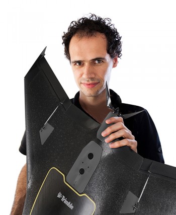
Peter Cosyn is site manager and director of research and development of Gatewing, a Trimble company. He is a co-founder of Gatewing, which was launched in 2008. Cosyn earned a Ph.D. in electromechanical engineering from Ghent University. He has more than 10 years of experience in unmanned aircraft system design.
Interview with Graham Purves, Executive Vice President, NovAtel
Graham Purves, NovAtel
GPS World (GPSW): In the regulatory picture for unmanned autonomous vehicles (UAVs), what are the concerns for the GNSS research, design, and manufacturing community regarding air-space regulation?
Graham Purves (GP): The main concern is the scope and impact of certification requirements for UAV navigation systems in the National Air Space. Certification places constraints on software complexity, so it is difficult to define solutions if the certification framework is unclear.
In the context of current avionics for civil aviation, design standards and certification requirements are well defined. In the case of pilot-less aircraft, the navigation systems may make use of additional features and technologies that are not part of the current certification paradigm. Examples are tightly coupled inertial navigation systems (INS) for flight control and redundancy, and real-time kinematic (RTK) and differential GPS for landing and capture. Certification requirements and design assurance levels for these features will have a major impact on the definition and design process, and may even prevent some effective technical solutions from being used, due to the software complexity. Of course, communications and communication standards will also present a significant hurdle.
GPSW: What are the concerns for the GNSS research, design, and manufacturing community regarding vehicle/road regulation for UGVs?
GP: Similar answer. The software used in positioning and navigation systems is significantly more complex than the safety-critical software in current automotive systems. Regulation for UGVs may result in restrictive certification requirements that affect or prohibit the use of more complex software. Until we have a clear understanding of the certification framework, it is difficult to define technical solutions.
GPSW: In looking forward to the Federal Aviation Administration tests at six sites for integrating unmanned aerial vehicles into the commercial airspace safely, what are some of the technical challenges that you (and presumably NovAtel’s partners) are facing?
GP: We have proven some excellent technical solutions in the non-civil applications and believe the main barrier is not a technical but a regulatory challenge.
GPSW: What other pieces/technologies do you have to pull into the UAV/UGV integration to make it work? Inertial, certainly. What else?
GP: The UAV/UGV application is a very interesting arena for other positioning technologies that either augment or complement GNSS. Apart from navigation and auto-pilot functions, we believe the sense-and-avoid functions will require other sensing technologies, like scanning lasers. When you include the mission-related functions that require precise steering, pointing and measuring systems, the UAV/UGV is a very exciting category for companies like NovAtel.
GPSW: Is UAV/UGV a game-changer for the GNSS industry? Similar to the cellphone/smartphone implementation of GNSS chips, which created a whole new sector?
GP: It does have two elements that might be considered game-changers:
The movement of GNSS and other positioning technologies into a safety-critical role. It seems inevitable that someday we will live in a world where autonomous vehicles are the norm, and the idea of having a human behind the wheel is both complex and unsafe.
The UAV/UGV is an enabling technology and a platform for innovation. Similar to the wireless revolution, the killer applications may well be things we haven’t yet conceived of.
Graham Purves has been active in the GNSS industry since 1990, starting in ASIC development and continuing with various technical and business positions within NovAtel over the last 26 years.