Category: Receivers

  • Eagle Mapping Expands into Large-Area Projects with Airborne LiDAR

    The Riegl LMS-Q1560 airborne laser scanner.
    The Riegl LMS-Q1560 airborne laser scanner.

    Eagle Mapping Ltd., a North American digital airborne mapping company, is now using the new Riegl LMS-Q1560 airborne laser scanner system. Designed to capture ultra-wide swaths and complex environments, the high-performance Riegl LiDAR will enable Eagle Mapping to expand into new markets including large-area, forestry and urban mapping applications for governments and first-nation organizations.

    “The Riegl LMS-Q1560 is a powerful laser scanner developed to acquire data over large geographic areas at high altitudes,” said James Hume, Eagle Mapping President. “This will allow us to map expansive cities, counties and tribal lands quickly and cost effectively.”

    Riegl designed the powerful dual-channel LMS-Q1560 laser scanner with integrated medium-format camera for a variety of airborne mapping projects with an emphasis on wide-swath coverage. With a 58-degree field of view, the laser can be operated at a maximum pulse repetition rate of 800 kHz capable of measuring 530,000 points per second on the ground from an altitude up to 15,500 feet AGL.

    “The Riegl LMS-Q1560 is the most cost-competitive airborne laser scanner on the market today,” said Hume. “We can fly at a higher altitude and collect a denser spacing of elevation data than any other LiDAR system out there.”

    In addition, the Riegl LMS-Q1560 has a forward-and-look capability which, when combined with its wide field of view, enables the device to capture data from multiple angles effectively and accurately at an extremely high point density. The sensor also utilizes Multiple-Time-Around processing, echo digitization and waveform analysis to simultaneously track more than 10 pulses in the air.

    This means the LiDAR can collect tightly spaced elevation points even in complex environments. Examples are built-up city centers with a variety of buildings and vertical structures, as well as extremely rugged mountain terrain where elevations change dramatically and abruptly.

    “Whether working in the mountains of British Columbia or over a densely developed urban center, we will capture accurate elevation points between soaring peaks as efficiently as we do between high-rise office buildings,” added Hume. “And regardless of the terrain, we’ll collect more data in a day and finish jobs faster than we could before.”

    Over nearly three decades, Eagle Mapping has built its reputation on finding more accurate and affordable mapping technologies. Focusing primarily on the global mining industry, the Vancouver firm was among the first to deploy airborne LiDAR technology for mapping. More recently, the Canadian firm configured a high-density, narrow-swath Riegl VQ-580 LiDAR with a DiMAC medium-format camera on a single aircraft to simultaneously collect elevation and image data for efficient mapping of pipeline and transmission line corridors.

    “As we expand into urban and large-area projects for government clients, we will continue to support our extensive client base in the international mining and corridor mapping markets,” said Rodney Cope, vice president of sales and marketing.

    Eagle Mapping operates a Cessna 206 and Piper Navajo aircraft based in British Columbia. The Navajo carries the new Riegl LMSQ1560, and the Cessna is equipped with the Riegl VQ-580 LiDAR and DiMAC digital camera. The firm maintains field offices in Bellingham, Washington, USA, and Medellin, Colombia, in South America.

  • Arrow RF & Power Reaches Agreement with Maxtena

    Arrow Electronics, Inc., has announced that its RF & Power business will globally distribute products from Maxtena, Inc., a developer and producer for wireless solutions, including GNSS, Iridium, Inmarsat and Thuraya satellites, and terrestrial M2M, MSS and LTE applications.

    Arrow RF & Power will distribute Maxtena’s line of rugged and compact helix antennas, microstrip antennas, and combo antennas, and will also support customers with custom wireless solutions ranging from smart metering to 4G LTE. Maxtena’s products are designed for portable wireless applications including satellite phones, communications gear, handheld navigation, asset tracking, UAVs, recreational devices, and industrial equipment.

    “Maxtena’s proprietary Helicore technology provides high-performing yet miniaturized antenna solutions,” said Mark Vitellaro, director, strategic marketing, Arrow RF & Power. “Maxtena’s technical and competitive advantages combined with our technical and customer support will enable design engineers to utilize the optimum antenna solution for their needs.”

    “Maxtena is very excited to have Arrow RF & Power on board as an authorized distribution partner,” stated Vanja Maric, director of sales and marketing, Maxtena. “Their product and technology knowledge and expertise, along with their ability to form strong and lasting customer relationships make Arrow RF & Power a perfect fit for Maxtena and our unique products.”

    More information is available at www.arrow.com/rfpower.

  • Ethertronics Unveils GPS Helix Antenna for Mission-Critical Applications

    Ethertronics Unveils GPS Helix Antenna for Mission-Critical Applications

    EtherHelix GPS antenna.
    EtherHelix GPS antenna.

    Ethertronics has unveiled EtherHelix GPS, a small, stand-alone, Right Hand Circularly Polarized (RHCP) external GPS antenna. Measuring 35 mm in length, the EtherHelix GPS is 27 percent shorter than other antennas on the market with no performance trade-offs, the company said. It is designed for high-performance, mission-critical devices such as walkie-talkies, tough books, tough tablets, first responders, public safety, military applications and more.

    EtherHelix can be tuned for various satcom frequencies and various polarizations (RHCP or LHCP). EtherHelix GPS is designed using Ethertronics’ patented Isolated Magnetic Dipole (IMD) technology providing high performance and efficiency in a small form factor.

    EtherHelix GPS has a high tolerance to frequency shifts given the technology’s high RF isolation, which is designed to resist antenna detuning that can otherwise impair reception. EtherHelix GPS provides exceptional coverage inside buildings, vehicles or other areas where weak signals and signal reflection occur, the company said.

    “GPS capabilities are critical for first responders and military applications. It is imperative that the antennas used in these devices are high-performance, small and rugged,” said Olivier Robin, general manager Americas and Europe at Ethertronics. “EtherHelix GPS is the most recent example of Ethertronics’ leadership in developing industry-first RF solutions to provide manufacturers with a way to differentiate their products and stand out in a competitive market. Already we have seen interest in our new EtherHelix GPS antenna given its best-in-class performance coupled with its smallest occupied volume.”

    Given its reduced weight and size — 11.8 g and 35 mm long by 15 mm in diameter — manufacturers benefit from simpler integration for an array of GPS devices, Ethertronics said. In addition, the new GPS antenna’s capabilities include high selectivity, which minimizes the need for additional filters. EtherHelix GPS’s ruggedized design includes IP-68 protection from dust and water, as well as a standard SMA male connector for easy integration. The RoHS Compliant antenna is designed and manufactured in the United States.

    EtherHelix GPS is commercially available now and is the first in a series of antennas for mission-critical applications.

  • VectorNav Launches Dual-Antenna GPS-Aided Inertial Nav System

    VectorNav Launches Dual-Antenna GPS-Aided Inertial Nav System

    The VectorNav VN-300
    The VectorNav VN-300

    VectorNav Technologies has introduced its VN-300 dual-antenna GPS-aided inertial navigation system (GPS/INS). A follow-on product to the VN-100 IMU/AHRS and VN-200 GPS/INS, the miniature, high-performance VN-300 enables a wider range of applications through the incorporation of GPS compassing techniques.

    The VN-300 can be used in a wide variety of industrial and military applications, and is well suited for size, weight, power, and cost (SWAP-C)-constrained applications such as unmanned vehicle systems; antenna, camera and platform stabilization; heavy machinery monitoring; robotics; and primary or secondary flight navigation, among others. The VN-300 will be on display and available for review at VectorNav’s booth #330 at AUVSI in Orlando May 13-15.

    Incorporating the latest MEMS sensor technology, the VN-300 combines 3-axis accelerometers, 3-axis gyros, 3-axis magnetometers, a barometric pressure sensor, two GPS receivers, and a low-power microprocessor into a rugged aluminum enclosure about the size of a matchbox. When in motion, the VN-300 couples the position and velocity measurements from the onboard GPS receivers with measurements from the onboard inertial sensors to provide position, velocity, and attitude estimates of higher accuracies and with better dynamic performance than a standalone GPS receiver or Attitude Heading Reference System (AHRS).

    The dual GPS receivers incorporated into the VN-300 provide the added benefit of accurate True North heading measurements when the sensor is stationary through the use of GPS compassing techniques, the company said. The VN-300 is designed for applications that require a highly accurate inertial navigation solution under both static and dynamic operating conditions, especially in environments with unreliable magnetic heading and good GPS visibility.

    VN-300 Differentiating Features:

    • The VN-300 has small size, low weight, and low power requirements.
    • With Development Kits priced around $5k USD, the VN-300 is a fraction of the cost of similarly performing dual-antenna GPS/INS systems and is competitively priced with other MEMS-based GPS/INS systems that do not provide the dual-antenna moving baseline RTK features.
    • The GPS compass feature coupled with the GPS/INS capabilities on the VN-300 enables applications that require high-accuracy position, velocity, and attitude measurements under both static and dynamic operating conditions.
    • The algorithms on board the VN-300 enable applications to seamlessly transition between static and dynamic operations without having to collect extended stationary measurements or perform specific dynamic maneuvers in flight for attitude alignment.
    • The VN-300 incorporates a “True INS Filter” that does not force any requirements on alignment of the sensor to the velocity direction of a platform or specify the orientation of the sensor for initial alignment.

    “The VN-300 is unique in that it provides a complete, high performance GPS-aided navigation solution under both stationary and moving conditions, all in a miniature and cost-effective package,” said VectorNav President, John Brashear. “By addressing some of the most difficult issues users face when trying to integrate an inertial navigation system — high cost; large size, weight and power; unreliable magnetic environments; and restrictive operating requirements — the VN-300 will enable an unprecedented number of applications.”


  • Tallysman Offers Low Current Multi-Constellation Compact GPS Antennas

    Tallysman Offers Low Current Multi-Constellation Compact GPS Antennas

    Tallysman TW4327 and TW4329 antennas.
    Tallysman TW4327 and TW4329 antennas.

    Tallysman Wireless, Inc., is offering a family of very low power, compact, high-performance GNSS antennas for precision, commercial, and military applications.

    Based in Ottawa, Canada, Tallysman Wireless,  is a designer and manufacturer of high-performance GNSS, Iridium, and Globalstar antennas and associated components.

    The TW4327 and TW4329 are low-power GPS L1 + GLONASS G1 antennas that feature current consumption of 1.75 mA typically and parametrically invariant performance over a supply range from 2.5V to 12V.

    The TW4327 offers a 21-dB gain minimum, and the TW4329 includes a narrow pre-filter to prevent front end saturation by near out-of-band interfering signals.

    Both antennas are more tolerant to detuning effects caused by the operational environment, thanks to a 40% thicker patch element that provides wider bandwidth than conventional antennas. These antennas are also very compact (38mm x 38mm x 14.4mm), making them ideal for use in a wide range of locations.

    The TW4027 and TW4029 are equivalent antennas for reception of GPS L1 signals.

    “These products are ideal for any battery operated applications where low power is a pre-requisite,” said Gyles
    Panther CEO of Tallysman Wireless, “and the wider patch element bandwidth will minimize detuning in non-ideal
    environments, such as in covert applications.”

    Tallysman Wireless has recently added an authorized distributor of its products for Russia (Aurora Mobile Technologies), and another distributor for Asia (Advanced Information Technology, Inc.), for the countries of Vietnam, Hong Kong, Singapore, China, Indonesia, and India.

  • Applied EM Offers Anti-Jam Antenna

    Applied EM’s anti-jam GPS antenna, AJGPS045, has achieved a four-channel Controlled Radiation Pattern Antenna (CRPA) in a very small size, weight and power (SWAP) particularly suitable for airborne platforms. Its footprint is the same as a standard GPS Fixed Radiation Pattern Antenna (FRPA), the FRPA-3.

    This is a key enabler to bringing greatly improved anti-jam performance to smaller platforms and to GPS-equipped platforms that have inadequate anti-jam capability.

    When integrated with appropriate four-channel antenna electronics and a military GPS receiver, the AJGPS045 enables L1 and L2 anti-jam performance of typically >80 dB. This is achieved with a passive compact antenna (.7” x 4.6” x 4.6”) that weighs 9 oz.

  • Septentrio, Imec Co-Design Antenna for High-Precision GNSS

    Septentrio, Imec Co-Design Antenna for High-Precision GNSS

    antenne copy-W
    photo: Imec and Septentrio

    Imec and Septentrio have collaborated to design multi-frequency GNSS antenna that simultaneously receives all GPS, GLONASS, BeiDou, and Galileo bands. Developed under the European Community’s Seventh Framework Programme project Handheld, the compact antenna can be integrated in multi-frequency handheld GNSS devices for high-precision location applications up to 1 centimeter.

    The announcement came at the Mobile World Congress being held this week in Barcelona, Spain.

    The compact antenna integrates Imec’s GNSS antenna and Septentrio’s GNSS RF front-end. Imec’s antenna design satisfies the requirements for the high-accuracy GNSS market while remaining small enough to fit in a handheld surveyor device, the companies said. The antenna has desired uniform gain and phase coverage over the complete upper hemisphere, with strong suppression of unwanted reflected signals below or in the vicinity of the GNSS receiver.

    The GNSS RF front-end, based on established front-end technology developed by Septentrio, is characterized by a superb out-of-band interference rejection to avoid notably device self-interference with other radiation sources such as Bluetooth and WLAN radios, as well as other ambient intentional and non-intentional interference. The compact multi-frequency antenna is a perfect companion of Septentrio’s compact and low-power AsteRx-m receiver, a credit card-sized dual frequency GNSS receiver that provides centimeter accuracy at less than 500-mW power consumption, by far the lowest power consumption in the professional GNSS market.

    The research leading to these results has received funding from the European Union Framework Programme (FP7/2007-2013) under grant agreement n°287183.

  • Trimble Launches New Airborne LiDAR Systems

    Trimble's AX60i aerial imaging system.
    Trimble’s AX60i aerial imaging system.

    Trimble is adding to its airborne LiDAR portfolio with the Trimble AX60i and AX80. Both are highly capable, versatile systems that meet the demands of aerial survey operators for corridor and wide area mapping projects, Trimble said.

    The new airborne systems, together with flight planning and analysis software tools, have been designed to provide rapid and efficient point cloud capture as well as high-resolution images and proven workflows with high productivity. The systems can be installed on either fixed wing or rotary aircraft.

    Designed for low-altitude corridor mapping applications, the Trimble AX60i is an entry-level LiDAR system built on the same versatile platform as the high-altitude AX60 system, Trimble said. The platform allows AX60i users to upgrade to an AX60 in the future. The AX60i can be operated up to 5,000 feet above ground level (AGL) while offering a 400-kHz laser pulse repetition rate (PRR) with a single-channel, downward-looking laser.

    The Trimble AX80 is a dual-channel LiDAR system that can be operated up to 15,500 feet AGL and is designed for the most demanding survey applications from high-altitude wide area mapping to detailed low-altitude corridor mapping. The AX80 offers an 800-kHz PRR with revolutionary forward- and backward-looking capability to enhance point density on the ground and improve image resolution. This two-dimensional oblique view offers unparalleled scanning of vertical facades of structures.

    Trimble's AX80 aerial imaging system.
    Trimble’s AX80 aerial imaging system.

    An optional, fully-calibrated 80-Megapixel camera with forward motion compensation can be added to the AX60i and AX80 systems. The camera is integrated into the sensor head package and harmonized with the laser sub-system so that it does not need re-calibration each time the system is fitted to an aircraft.

    These systems are optimized for precision applications, providing a uniform distribution of laser points across the entire field-of-view to widen the usable swath width. Operators can reduce track overlap or duplication, or fly at higher altitudes to achieve a given resolution. Together with a high-precision positioning system, integral power supplies and an in-flight monitoring tool, the Trimble AX60i and AX80 can allow operators to lower the complexity of airborne LIDAR surveys while increasing the quality of the output.

    “The Trimble AX60i and AX80 systems extend our portfolio of aerial imaging solutions to meet a variety of mapping applications,” said Phil Sawarynski, business area director of Imaging Solutions for Trimble’s Geospatial Division. “They have been designed as true end-to-end solutions and are delivered with Trimble flight planning software and Trimble Inpho analysis software. Because everything is supplied by Trimble, operators can have confidence that the complete solution works together properly, and that the flight planning and post-mission analysis suites will enable them to provide a high-quality service to their customers.”

  • Canadian Army to Test NovAtel’s GAJT GPS Anti-Jam Antenna

    Canadian Army to Test NovAtel’s GAJT GPS Anti-Jam Antenna

    NovAtel-GAJT_antenna
    NovAtel’s GAJT-700ML anti-jamming antenna.

    Public Works and Government Services Canada (PWGSC) has selected NovAtel’s GAJT-700ML antenna for testing on Canadian Army armored vehicles. The GAJT-700ML, developed in Calgary at NovAtel’s global headquarters, is a single-unit GPS anti-jam antenna system for land vehicles.

    The testing is being conducted through PWGSC’s Build in Canada Innovation Program (BCIP).

    NovAtel was selected to participate under the BCIP’s “safety and security” priority area. PWGSC will procure a number of GAJT-700MLs on behalf of the Department of National Defense (DND). The Directorate of Land Requirements (DLR) — with the assistance of the Quality Engineering Test Establishment (QETE) and the Land Force Trials and Evaluation Unit (LFTEU) — will oversee all testing on DND’s behalf.

    Field testing, centered on battlefield days, is expected to take place in early March of 2014 at 4th Canadian Division Support Garrison Petawawa. The battlefield days will analyze the performance of GAJT on the Artillery Observation Post Variants (OPV) of the Light Armored Vehicle III (LAV III) in operational conditions to confirm the suitability and robustness of GAJT-700ML for this role. The process is expected to be completed by the end of March.

    “NovAtel has worked closely with Canadian and Allied defence agencies to test the resilience of the GAJT-700ML in challenging jamming environments,” said Jason Hamilton, vice president, Marketing and Product Management. “The BCIP program provides an opportunity to expand this testing to incorporate end user soldier feedback on the installation and operational effectiveness of GAJT during battlefield usage of the LAV OPV. This invaluable feedback will be used by NovAtel to further drive product innovation in support of Canada and its Allied partners.”

    “The Canadian Army requires accurate, secure and reliable access to Global Positioning Systems to conduct operations throughout the full spectrum of conflict in all potential theatres of operation,” said Colonel Andrew Jayne, Director Land Requirements. “With the ever-increasing demands on the electromagnetic spectrum and threat of harmful interference, technologies which contribute to the assurance of position and timing information are a critical enabler of Army and Canadian Armed Forces operations in today and tomorrow’s operating environment.”

    GAJT is a null-forming technology that negates jammers, ensuring the satellite signals necessary to compute position and time are always available. Three categories of GAJT are manufactured by NovAtel:

    • GAJT-700ML: for use with military land vehicles, networks and timing infrastructure
    • GAJT-700MS: for marine vessels, from small boats to capital ships
    • GAJT-AE: for use with an external antenna in size and weight constrained applications

    The BCIP was created by the Government of Canada to strengthen Canadian innovation. The program offers procurement and testing of pre-commercialized products and services, at a late stage of development. The BCIP:

    • Bridges the “pre-commercialization gap”
    • Supports Canadian suppliers by connecting innovators and government users and by testing innovations
    • Provides real-world evaluation of pre-commercial goods and services
    • Improves the efficiency and effectiveness of government operations
  • Saelig Introduces Low-Cost SMD Antennas

    Saelig Introduces Low-Cost SMD Antennas

    Saelig-proant-W

    Saelig Company, Inc., announces the availability of the Proant OnBoard SMD 2400 (2.4GHz band) and SMD GPS (GPS and GLONASS) miniature surface-mount (SMD) antennas for mobile wireless products. The OnBoard series moves embedded antenna integration one step ahead by combining high performance and low cost in this new OnBoard SMD family, the company said.

    Traditionally, small low-cost antennas for printed circuit board assembly have been manufactured with a dielectric substrate as the base for the radiating structure. With this approach, the antenna is normally a rectangular block, which means that the PCB area below the antenna is unavailable for mounting other components. Another drawback is that the substrate itself introduces dielectric losses to the antenna, reducing its total efficiency.

    Proant has taken the concept of small SMD antennas one step ahead by increasing both the antenna performance and design flexibility, and combining this with low cost and manufacturability. The result is the new OnBoard SMD antenna family, which builds on previous OnBoard antennas, but in a surface mounted sheet-metal solution, packaged in tape-on-reel and suitable for high volume manufacturing. One of OnBoard’s key features, which eliminates the need of the dielectric substrate used in other SMD antennas, is the patent-pending capacitively-loaded footprint of the antenna’s supporting pins, which significantly reduces losses and increases the performance.

    The first two products to be launched in this 50 ohm RoHS-compliant family are OnBoard SMD 2400 (2.4GHz band) and SMD GPS (GPS and GLONASS). Future variants will include WLAN dual-band, 868/915 MHz, and GSM versions.

    “We wanted to simplify antenna integration for our customers,” said Tomas Rutfors, CEO of Proant. “The solution was to make a simple product that satisfies both engineering and sourcing needs. With the OnBoard SMD family, we have defined a new product segment, which didn’t exist before.”

    Made in Sweden by Proant AB, a widely respected specialist antenna company in the M2M and wireless market, providing a wide range of embedded and external antennas, OnBoard SMD 2400 (2.4GHz band) and SMD GPS (GPS and Glonass) are available now at under $1 (1000 pcs) from Saelig Company, Inc., the USA technical distributor. A demonstration board is also available at $35.

  • GEOINT 2013: The Conference that Almost Was

    Tampa ConvCenter

    As you would guess, it takes a lot of planning and preparation to put on a technical conference of the scope of GEOINT. So imagine the hand wringing the USGIF staff went through deciding to postpone a conference of about 4,000 attendees and 300 exhibitors because of the untimely government shutdown. There really was no choice, with the majority of federal attendees canceling due to travel restrictions. Without their participation, holding the conference would have been futile. Since the city of Tampa was so accommodating and easy to work with, USGIF rescheduled the conference at the same Tampa venue, April 14-17. They tried their best to minimize scheduling conflicts with other geospatial and USGIF conferences such as the NGA Tech Showcase West (also scheduled for April) and USGIF’s GEOINT Community Week, including Tech Days.

    Prior to a major conference, manufacturers send out press releases and invitations to see new products being shown on the exhibit floor. So, although GEOINT 2013 was postponed, I’m still doing my column as a “virtual conference” report. This is a very broad sample of new developments that I received from vendors who planned to be at the October conference, now rescheduled for April.

    Thermopylae

    Thermopylae Sciences & Technology

    Thermopylae focuses on commercially-based knowledge-fusion capabilities in the geospatial, cloud, and mobile arenas. It has three solutions: iSpatal, a web-based collaborative framework that leverages Google Earth and Maps in a flexible, task-based approach to solve complex problems; iHarvest, a standards-based enterprise analytic service that organizes, analyzes, and reports activities to enable critical decisions; and Ubiquity, a proprietary platform for creating dynamic, customized, and geocentric native mobile applications. Thermopylae is also bringing back the popular Liquid Galaxy immersive virtual-reality display showcasing Google Glass and Leap integration, showing a unified demonstration of all of its products in the Liquid Galaxy display.

    KEYW Corporation

    KEYW’s geospatial capability exploits cyberspace as a domain for collecting, processing, and supporting actionable imagery intelligence to the warfighter and for civilian and commercial uses. The company matches aircraft to mission requirements and modify the aircraft with integrated airborne sensor systems for onboard, geospatially referenced digital imagery collection and processing. KEYW planned to showcase its intelligence, surveillance, and reconnaissance (ISR) imaging and mapping; and its Precision Geo-location via handheld, backpack and mobile solutions, along with several other innovations.

    brocadeBrocade Communications Systems, Inc.

    Brocade provides networking solutions for government agencies and has expanded its product line with a new compact, fanless switch that simplifies network operations. It’s a secure, enterprise-quality network that is responsive to the complex needs of warfighter and civilian missions. The ICX 6450-C switch is deployable outside the wiring closet, without interfering with other critical activities. Using power over Ethernet, the switch can operate in remote locations, where access to an external power source is limited or not available.

    touchshare

    TouchShare, Inc. 

    TouchShare has extended its multi-touch solutions for immersive geospatial collaboration to anyone, regardless of location or device, through the TouchShare Mobile Access. The new TouchShare Mobile Access significantly improves teamwide productivity as it gives all collaborators the ability to simultaneously view and contribute to what other team members are seeing in real-time and interact with visual geospatial information (live data, 2D imagery, video, etc.) via any device. This allows all participants to easily and quickly see the big picture for making better decisions faster.

    Surrey Satellite Technology US LLC

    Surrey Satellite Technology provides small satellite solutions, applications, and services for Earth observation, science, technology demonstration, and communications. Since 1981, Surrey has launched 41 satellites as well as provided training and development programs, consultancy services, and mission studies for NASA, the United States Air Force, Los Alamos National Laboratory, and other institutional and commercial customers.

    GameSim

    GameSim planned to show off its latest version of Conform, a software product for geospatial visualization. Conform imports, fuses and renders LiDAR content in near real time, while offering a variety of unique abilities, including an instantaneous 3D view of raw source data. Users are able to easily import large amounts of data (such as Shape Files, DTED, GeoTIFFs, LIDAR) and immediately view them in both 2D and 3D displays.

    headwall
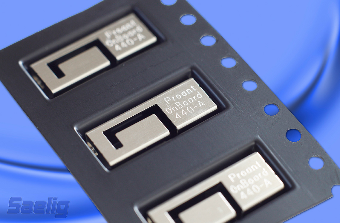
Headwall Photonics, Inc. 

    Hyperspectral sensing offers advantages over traditional multispectral imaging with respect to the number of spectral bands being covered. Use enhances target recognition, material identification, and elimination of false positive alarms. Hyperspectral imaging yields much more spectral data than multispectral by producing a continuous spectrum of data representing the chemical composition of objects or spectral “signatures” of everything within the sensor’s field of view. Headwall’s Micro-Hyperspec have been miniaturized and optimized for deployment aboard small, tactical UAVs, including small hand-launched versions.

    orbit-all

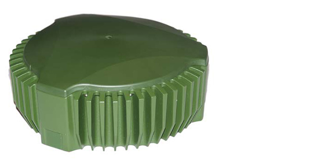
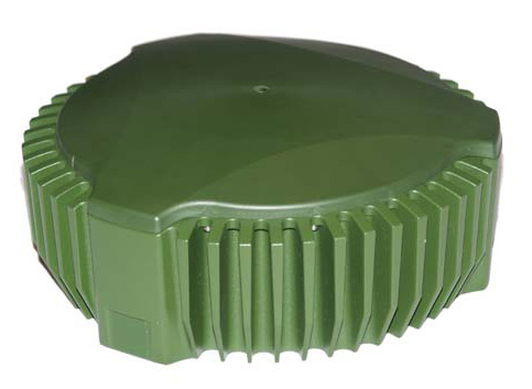
    Orbit Communication Systems, Inc. 

    Orbit Communication Systems provides ground-station solutions for Earth observation and remote-sensing applications. It has a new product family known as the Gaia series that supports a range of antenna sizes. These ground stations offer an ideal combination of high performance in a compact footprint. “With our new Gaia family, Orbit addresses a void in the market, and opens the door to new Earth observation markets that could not afford to purchase legacy ground stations due to their size and cost,” said Ofer Greenberger, Orbit CEO.

    The antennas are designed to withstand extreme weather conditions and to handle a broad range of applications, operated anywhere on Earth. The series comprises three different sized antennas: 2.4 meters (7.9 feet); 3.7 meters (12.1 feet); and 4.5 meters (14.7 feet). Each antenna supports X-band or S-Band (both transmit and receive) feeds, as well as a dual-band (S&X) feed.

    astrium STRM 90

    astrium WorldDEM

    Astrium Services

    Astrium’s Street Factory, an advanced 3D urban mapping solution, was awarded “most valuable product in the geo-information field 2012” at the World Geospatial Developers Conference. Building on that success, Astrium planned to demonstrate WorldDEM, a high-resolution elevation data set that covers the Earth’s entire land surface, pole to pole. The accuracy of the German high-resolution radar satellites TerraSAR-X produces data intended to replace SRTM data. It has excellent ground-position accuracy with vertical accuracy of 2m (relative) / 10m (absolute) in a 12m x 12m raster GSD. WorldDEM will be available in 2014 with data less than 2.5 years old. Shown above is a comparison of STRM 90 elevation data compared to WorldDEM.

    epson 2

    Epson Plotters

    Ever since my experience supporting Katrina recovery efforts, I’ve be a strong advocate for simple low-tech hard-copy imagery plots overlaid with vector data to support emergency responders. Many times this low-tech embodiment of our high-tech capability suits the needs of first responders better than computer displays. However, paper plots ideally need to be laminated on foam core to be useful in wet and windy environments. Epson has one solution, a plotter that prints on ridged media. Epson engineers developed the SureColor T-Series printers with an all-new design that prints directly on ridged substrates that have a thickness of 1.5 mm. This is especially important to agencies that have a need for fast print output on thick media eliminating the hassle of laminating or marrying to thicker carriers for immediate use. The SureColor T-series also features Epson UltraChrome XD pigment-based ink technology for smudge and water-resistant prints.

    This is just a sample of the nearly 300 exhibitors that will be at GEOINT in April. I’ll bet you thought that GEOINT was just imagery and big data. Quite the contrary — it takes a lot diverse players and pieces to build a strong GEOINT capability.

    epson

  • Tuck Mapping Integrates Leica RCD30 Camera with Applanix POSTrack

    Bell-LongRanger-O

    Leica Geosystems Inc. today announced that Tuck Mapping Solutions Inc. has completed the first integration of a Leica RCD30 airborne camera with the Applanix POSTrack system. With technical support from Leica Geosystems and Applanix, Tuck Mapping contracted Lead’Air Inc. of Kissimmee, Florida, to perform most of the software upgrades and new cabling required to integrate the Leica digital camera with the POSTrack all-in-one GNSS-aided inertial direct georeferencing and flight management system.

    The Leica RCD30 is a true metric camera built for mapping. Introduced by Leica Geosystems as a digital follow-on to its RC30 film cameras, the RCD30 is a medium-format digital imaging system developed for a variety of photogrammetric and remote sensing applications. The 60 MP single-camera-head design delivers co-registered, multispectral imagery in the Red, Green, Blue and Near IR portions of the spectrum. The sleek modular design allows the camera to fit easily in aircraft previously outfitted with film cameras, and the RCD30 integrates with many LiDAR sensors, including the Leica ALS series.

    For the many current owners of the POSTrack system, the availability of integration by Lead’Air makes the Leica RCD30 a more affordable and attractive choice among medium-format digital cameras. When buying a new Leica RCD30, POSTrack owners do not have to purchase the Leica flight management system, train flight crews in the use of multiple interfaces, and install redundant equipment in their aircraft.

    “The integrated systems enable our flight crews to operate the Leica RCD30 and a third-party LiDAR sensor with a single flight management interface,” said Tuck Mapping President, Bobby Tuck. “In addition, POSTrack collects the GNSS location and Inertial Measurement Unit (IMU) attitude data needed to georeference the imagery and LiDAR data sets.”

    Based in Big Stone Gap, Virginia, Tuck Mapping is a photogrammetric services and aerial mapping firm with a reputation for engineering innovative solutions related to geospatial data collection. Tuck was among the first aerial mappers to use a helicopter for LiDAR scanning operations, and more than a decade ago the firm took the lead in successfully integrating an airborne camera and LiDAR sensor for simultaneous collection. Tuck Mapping owns four POSTrack systems, three helicopters, two fixed-wing airplanes, and state-of-the-art airborne cameras and laser scanners.

    “Bobby Tuck deserves credit for driving the integration of the Leica RCD30 with the POSTrack system,” said Jean Gardiner, General Manager of Leica Geospatial Solutions. “From a business perspective, Leica believes that supporting the compatibility of our products with other manufacturers’ products is an integral part of providing solutions to our clients.”

    “This joint integration project exemplifies the maturity of Leica and Applanix,” said Joe Hutton, Applanix Director of Inertial Technology and Airborne Products. “It’s a natural progression of good customer support.”

    Jointly developed by Applanix and Track’Air, the POSTrack product integrates the Applanix POS AV direct georeferencing technology, utilizing GNSS and IMU components, with the XTRACK Flight Management System software from Track’Air into a single, compact package. POSTrack provides direct georeferencing for airborne mapping sensors, mission planning, real-time sensor control and pilot guidance.

    Lead’Air, a subsidiary of Track’Air, specializes in integrating the Track’Air flight management systems with any airborne camera or LiDAR sensor. Now that the first Leica RCD30/POSTrack integration has been completed for Tuck Mapping, Lead’Air offers this integration as a commercially available service.