Category: Receivers

  • Authentication added to GNSS timing receivers

    Authentication added to GNSS timing receivers

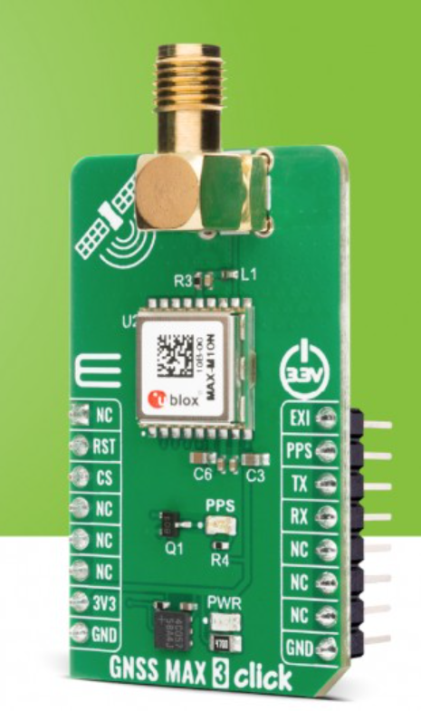
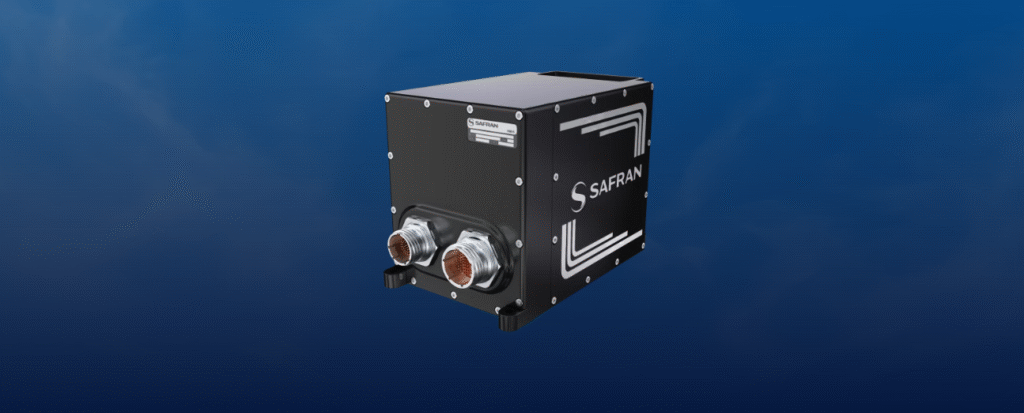
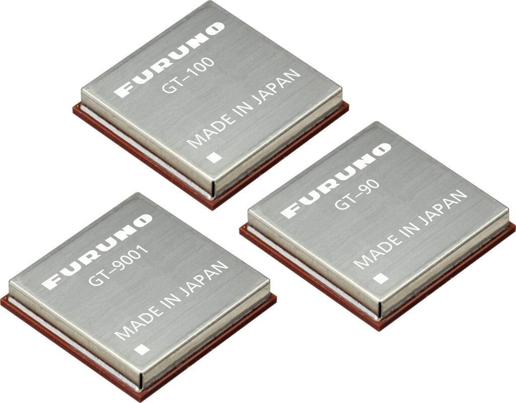
    Furuno will begin providing new firmware for its GNSS receivers for time synchronization, including models GT-100, GT-90 and GT-9001, which adds authentication features (OSNMA/QZNMA) and significantly strengthens anti-jamming and anti-spoofing measures.

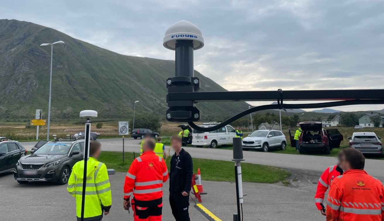
    In fields that support critical infrastructure such as telecommunications, finance and power, GNSS vulnerabilities have become a major issue. The Furuno team participated in Jammertest 2025, the world’s largest GNSS resilience testing event. Jammertest 2025 took place in Norway, and verified robustness and reliability under real attack conditions to meet the requirements of critical infrastructure.

    Features of the new firmware

    The GT-100, GT-9001 and GT-90 modules. (Photo: Furuno)
    The GT-100, GT-9001 and GT-90 modules. (Photo: Furuno)
    • Addition of authentication functions (OSNMA/QZNMA): Authentication messages from Galileo (European GNSS) and QZSS (Japan’s Quasi-Zenith Satellite System) confirm the authenticity of navigation messages, strengthening resistance to spoofing attacks.
    • Enhanced anti-jamming and anti-spoofing measures: Detect and eliminate various interference signals with high precision, ensuring stable time synchronization.
    • Removal of altitude restrictions, enabling use in the stratosphere and similar environments
    • Addition of TAI (International Atomic Time) output function
    • Support for multiple data formats (RTCM10403.3, RINEX4.1, binary)

    Availability
    For existing users: Provided as a firmware update.

    For new shipments: GT-100, GT-90 and GT-9001 with the new firmware are scheduled to ship beginning in March 2026.

    Related product information
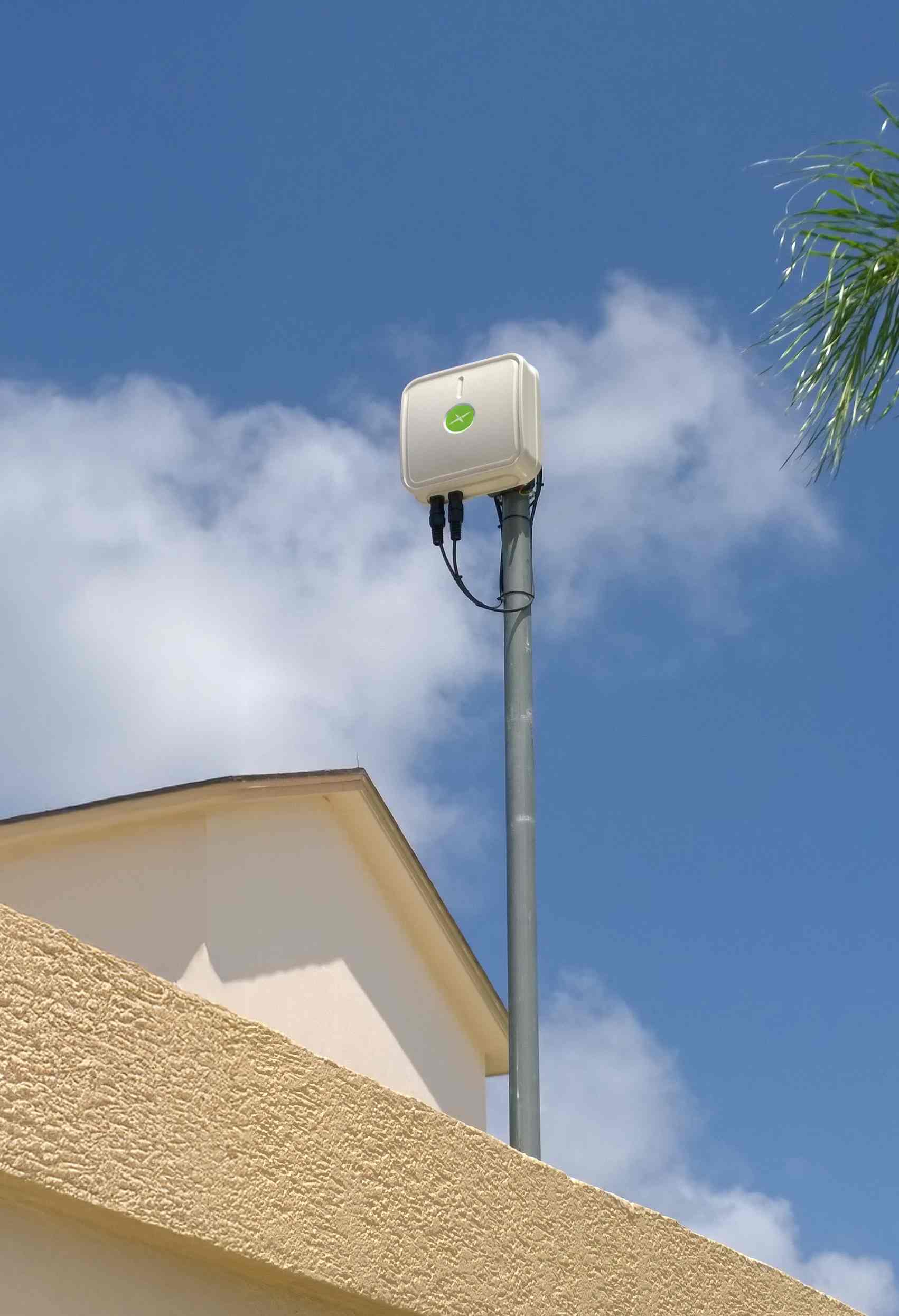
    Furuno has also launched the GNSS Surge Protector, TVA-05V for GNSS antennas.
    This product protects GNSS receivers from surges caused by lightning, further enhancing the stable operation of critical infrastructure.

    In Jammertest 2024, challenges were identified using GT-100; in Jammertest 2025, improvements were validated with the upgraded version, confirming the effectiveness of the resilience algorithms under operational conditions.

  • GNSS MAX 3 Click designed as a professional-grade receiver

    GNSS MAX 3 Click designed as a professional-grade receiver

    A new GNSS board is available from Mikroe. The GNSS MAX 3 Click is a compact add-on board designed for low-power satellite positioning for embedded applications. It is based on the MAX-M10N-10B, a professional-grade standard-precision GNSS receiver from u-blox, built on the ultra-low-power u-blox M10 platform.

    Key Features

    • Multi-Constellation GNSS. Offers exceptional tracking capability across GPS, Galileo, BeiDou, and QZSS/SBAS systems for reliable global coverage
    • Ultra-low power. Uses the u-blox M10 platform and the LEAP (Low Energy Acquisition and Processing) energy-saving mode for extended battery life
    • Enhanced RF immunity. Features an additional SAW (Surface Acoustic Wave) filter for excellent performance in the presence of strong RF interference
    • Interference detection. Includes integrated jamming and spoofing detection for robust security and reliable operation
    • Fast acquisition. Supports AssistNow Predictive and Live Orbits for faster satellite acquisition (time-to-first-fix)
    • Standard precision. Provides consistent L1 GNSS performance at a standard precision level.

    Applications

    • Asset tracking devices and logistics solutions requiring long battery life and accurate location data
    • Portable devices and wearables where power efficiency is critical
    • Industrial monitoring and sensor applications requiring reliable, interference-resilient positioning
    • Any application demanding interference-resilient GNSS positioning.

    EmbeddedWiki

    Hundreds of ready-to-use embedded projects featuring this Click board are available on EmbeddedWiki.

  • Safran Federal Systems selected by Moog for Hercules Avionics Suite

    Safran Federal Systems selected by Moog for Hercules Avionics Suite


    Safran Federal Systems, a provider of assured position, navigation and timing (APNT) solutions, has been selected by Moog Inc. to provide its Skynaute navigation solution as part of Moog’s Genesys Avionics Suite for the Lockheed Hercules platform (L-Series and C-130).

    Skynaute is a hybrid inertial/GNSS navigation system based on HRG Crystal technology. It will serve as a critical component of the Hercules avionics suite designed and integrated by Moog.

    The Skynaute navigation unit by Safran. (Photo: Safran Federal Systems)
    The Skynaute navigation unit by Safran. (Photo: Safran Federal Systems)

    Under this agreement, Safran Federal Systems will supply Skynaute units to support enhanced navigation performance in demanding operational environments.

    “Being selected by Moog underscores the reliability, innovation, and mission readiness of our Skynaute solution,” said Tony Full, senior director of Business Development, Navigation Systems, Safran Federal Systems. “This collaboration continues our tradition of delivering precise, resilient navigation technologies to meet the evolving needs of military aviation.”

    Skynaute is engineered to meet the needs of both legacy and next-generation military aircraft, providing superior accuracy and robustness with minimal size, weight, and power consumption. The system is suited for retrofit and modernization programs, particularly for platforms like the Hercules that remain integral to global air mobility and tactical transport operations.

    Safran Federal Systems supports Safran Defense & Space Inc. (Safran DSI) by providing APNT technologies across a range of defense and aerospace applications.

  • SatLab launches SL8 laser RTK receiver

    SatLab launches SL8 laser RTK receiver

    SatLab Geosolutions has launched a new GNSS receiver, the SL8. The SatLab SL8 Laser RTK combines dual cameras, GNSS, an inertial measurement unit (IMU) and visible laser technology to make surveying faster and easier.

    With non-contact measurement, image-assisted targeting, CAD live-view stakeout, and a built-in LoRa radio. It ensures smooth, reliable work even in complex or GNSS-limited environments, SatLab said.

    Photo: SatLab
    Photo: SatLab

    The SL8 achieves 2 cm accuracy within 10 meters and enables efficient data collection across bridges, tunnels, riverbanks, and other sites where traditional GNSS methods are restricted.

    It features image-assisted targeting through SatSurv software, displaying laser points directly on real-time images for quick and precise aiming. Its automotive-grade IMU requires no manual calibration or initialization and enhances measurement accuracy by up to 40% in GNSS-challenged areas.

    A built-in multi-protocol LoRa transceiver provides stable transmission beyond 15 km and compatibility with multiple RTK brands. The integrated CAD and visual stakeout functions combine live imagery with CAD data, allowing users to visualize target points on site and increase layout efficiency by up to 50%.

    Download a brochure.

  • U-blox launches SIG 2.00 GNSS firmware

    U-blox launches SIG 2.00 GNSS firmware

    Dedicated firmware delivers AFC-compliant geolocation and adheres to 6 GHz spectrum rules, accelerating deployment of location-enabled Wi-Fi infrastructure.

    U-blox has released Standard Infrastructure GNSS (SIG) 2.00, a dedicated GNSS firmware solution for Wi-Fi 6E/7/8 access points operating in the 6 GHz band.

    Designed to meet Automated Frequency Coordination (AFC) requirements in the U.S. and Canada, SIG 2.00 enables access points to determine their geolocation with 95% confidence-bound accuracy. It also delivers improved positioning accuracy under multipath environments, ensuring AFC systems receive reliable geolocation data.

    Compatible with the u-blox M10 and F10 platforms, the firmware simplifies compliance processes and speeds up integration, helping OEMs deploy high-performance, location-enabled Wi-Fi networks quickly and at scale.

    Turnkey geolocation for regulatory-ready 6 GHz deployments

    As Wi-Fi infrastructure expands into the 6 GHz band, compliance with regional spectrum regulations becomes essential for Standard Power operation. SIG 2.00 offers a ready-to-integrate GNSS solution that meets these requirements out-of-the-box, reducing design effort while ensuring operational reliability.

    Its precise location reporting enables Wi-Fi 6E/7/8 access points to coexist safely with incumbent users of the 6 GHz band, such as microwave and satellite services.

    Flexible design options on M10 and F10 platforms

    SIG 2.00 runs on two established u-blox GNSS platforms. On u-blox M10, it offers a cost-efficient single-band (L1) ultra-low-power solution for mainstream deployments. On u-blox F10, it provides a dual-band (L1/L5) GNSS with RAW data output, delivering enhanced robustness in multipath or dense environments.

    This flexibility allows OEMs to meet a wide range of performance and integration requirements while achieving 95% confidence-bound accuracy and maintaining regulatory compliance.

    By removing complexity from AFC compliance, SIG 2.00 supports rapid design-in for enterprise and industrial Wi-Fi deployments, from campuses and stadiums to city-wide infrastructure. With robust positioning accuracy and streamlined integration, it helps accelerate the adoption of high-performance, location-enabled wireless networks in the 6 GHz band.

  • Aurora Navigation introduces mobile visual RTK system

    Aurora Navigation introduces mobile visual RTK system

    The small, light RTK receiver integrates the Anypos App and LoRa radio for high-precision surveying, photo surveys and 3D modeling.

    Image: Aurora Navigation
    Image: Aurora Navigation

    Aurora Navigation has launched the Astra1 Mobile Visual RTK, a professional-grade GNSS receiver engineered to redefine high-precision mobile data acquisition.

    The Astra1 is an ultra-compact (60g) solution designed to deliver reliable, centimeter-level positioning and advanced 3D mapping capabilities through seamless integration with a smartphone and the proprietary Anypos App.

    The Astra1 Mobile Visual RTK is built to meet the demand for highly portable, yet exceptionally reliable, high-precision tools that simplify complex field operations.

    Full Field Functionality. Users can perform standard surveying tasks, stakeout and RAW data capture directly from their mobile device.

    Photo Survey. The system enables high-accuracy measurement of inaccessible or remote points, providing typical accuracy under 4 cm and significantly enhancing operator safety and efficiency.

    Georeferenced 3D Scanning. Astra1 allows users to capture photos with precise RTK coordinates, enabling the creation of accurate 3D models for detailed construction verification and digital twinning applications.

    Key Functional Features and Reliability:

    • Unmatched 60 grams and matchbox size
    • 1408 channels, multiple frequencies
    • 900MHz LoRa radio, compatible with Aurora Nav G1000 geodetic receiver
    • Accuracy: RTK 8mm+1PPM Horizontally, 15mm+1PPM Vertically, Photo survey <4 cm (2-15 m distance)
    • AI-enhanced reliability
    • IP67-rated
    • Mobile Visual Survey Workflow via the Anypos App, transforming a standard smartphone into a comprehensive high-precision data collector.
    Image: Aurora Navigation
    Image: Aurora Navigation

    Industry applications and vision

    Astra1 is a suitable and useful tool for professionals across multiple sectors:

    Surveying & Engineering. Streamlines field stakeout and topographic data collection with minimal equipment.

    UAV & Robotics. Serves as a lightweight PNT solution for GCP collection or base station for unmanned aerial vehicles (UAVs) and robotic platforms.

    BIM/Digital Twin. Provides the foundational high-accuracy data required for complex 3D modeling projects.

    “We designed Astra1 to address the fundamental need for portability, safety, speed, reliability and simplicity in professional geospatial data collection,” said Zhitao Lyu, founder and CEO, Aurora Navigation. “By focusing on superior performance in tough environments and integrating our Anypos App for a seamless visual workflow, we are delivering a tool that significantly boosts efficiency and safety, and provides survey-grade confidence to every user.”

    Headquartered in Calgary, Canada, Aurora Navigation is focused on developing and delivering innovative GNSS solutions. The company is committed to advancing the efficiency and reliability of geospatial data collection through its unique blend of compact hardware design and advanced positioning algorithms.

  • Voyant Photonics expands Carbon lidar platform with chip-scale sensing

    Voyant Photonics expands Carbon lidar platform with chip-scale sensing

    Voyant Photonics is offering new versions of its Carbon lidar platform, adding 32-line and 64-line variants designed to bring the power of frequency modulated continuous wave (FMCW) sensing to more compact, cost-sensitive, and compute-limited systems.

    The new models will be on display at the upcoming Consumer Electronics Show (CES 2026) in Las Vegas (LVCC West Hall, Booth #4875). Voyant will demonstrate live FMCW sensing capabilities and provide development kits for qualified partners.

    The models complement the existing 128-line configurations, enabling broader choices and customizations from the Voyant portfolio of low-cost, high-performance sensors, and optimized for industrial autonomy, robotics, drones and smart infrastructure applications.

    Building on the same efficient semiconductor foundation as Voyant’s flagship Carbon platform, the new versions offer lower data rates and simplified integration without sacrificing core FMCW advantages such as velocity measurement, interference immunity, and high dynamic range.

    The Carbon family represents Voyant’s most versatile and scalable lidar product line, designed using Voyant proprietary silicon-photonics architecture that integrates beam steering and coherent detection on a single photonic chip. This integrated technology will unlock mass-production economics, reduced calibration drift, and unmatched consistency from unit to unit, the company said.

    The new Carbon variants extend the core Carbon platform’s advantages:

    • High-precision depth sensing and real time velocity
    • Exceptional ambient light immunity, ensuring reliability from dim warehouses to direct sunlight
    • Compact design for demanding industrial and mobile environments

    With line resolutions now spanning 32, 64 and 128, OEMs and system integrators can tailor performance, bandwidth and compute load to their specific use cases, from agile robotics and compact AGVs to drones and embedded edge platforms.

  • U-blox launches firmware-upgradeable GNSS chips with low power consumption

    U-blox launches firmware-upgradeable GNSS chips with low power consumption

    U-blox has launched the UBX-M10150-KB chip and the MAX-M10N module, the first M10-platform GNSS hardware designed with firmware upgradeability. Both products run the new SPG 5.30 firmware, introducing Low Energy Accurate Positioning (LEAP) — a mode that reduces power consumption by up to 50 percent while maintaining superior positioning accuracy.

    Designed for battery-powered devices, the new chip offers ultra-low power consumption of just 8 mW in continuous tracking. The new products are suitable for vehicle, people and pet tracking, as well as livestock monitoring and wearable applications.

    The UBX-M10150-KB and MAX-M10N extend the capabilities of the M10 family beyond previous ROM-based products. With SPG 5.30, they offer a set of new technical features: LEAP replaces cyclic tracking mode to achieve significant energy savings including external LNA power cycling, and RTCM corrections input supports positioning accuracy down to the sub-meter level. In addition, the firmware adds data logging and geofencing functions, enabling more autonomous tracking and monitoring directly on the device.

    By combining these improvements with firmware upgradeability, the new hardware provides a future-proof solution. Customers can benefit from future firmware releases that deliver ongoing performance enhancements and new functionality throughout the product lifecycle, the company said.

    Both products include lifetime access to AssistNow Predictive Orbits and Live Orbits, which accelerate start-up times and improve positioning performance when using small antennas or operating in weak-signal environments. The EVK-M102 evaluation kit and u-center 2 software are available to simplify the design-in phase for developers.

    The UBX-M10150-KB and MAX-M10N, running SPG 5.30 firmware, are available as engineering samples now and will be fully available later in this month.

  • Korea testing gridded VRS for better GNSS accuracy

    Korea testing gridded VRS for better GNSS accuracy

    South Korea has launched a test operation of a new GPS-based positioning service, reports the Korea Herald. The Gridded Virtual Reference Station (G-VRS) works without an internet connection to provide real-time location data with centimeter-level accuracy.

    The G-VRS will complement the current VRS system for users in remote areas with unstable internet connections — islands, mountains or fast-moving vehicles.

    GNSS control points have been installed across the country, including four on Jeju Island and one in Gageodo, an island off the southwestern coast. The state plans to install additional points on four islands, including Ulleungdo, about 120 kilometers off Korea’s eastern coast, to operate 103 control points in total by the end of this year.

  • Taoglas launches antenna for connected vehicle fleets

    Taoglas launches antenna for connected vehicle fleets

    Taoglas has introduced the Patriot series, a compact, multi-function combination roof mount antenna designed for connected vehicle fleets in emergency services, utilities and commercial sectors. The Patriot integrates up to 18 antenna elements within a single low-profile enclosure, aiming to provide robust multi-network connectivity while reducing vehicle roof clutter and simplifying installation processes

    The antenna was originally developed for the Ford Interceptor, allowing for a direct replacement of the vehicle’s OEM antenna. This approach maintains the original antenna’s functionality and adds multi-radio connectivity, eliminating the need for additional holes to be drilled in the vehicle roof. The design is intended to streamline and reduce installation time and costs for upfitters, offering public departments potential savings on antenna-related expenses and removing the requirement to fill in roof holes when vehicles are resold.

    The Patriot supports 5G and 4G cellular networks across the 600–6000 MHz range, dual-band GNSS (L1 and L1/L5) with a secondary GNSS (L1), Wi-Fi at 2.4 GHz, 5.8 GHz and 7.1 GHz, SDARS at 2.3 GHz, and LMR/TETRA at 380 MHz to 400 MHz and 700 MHz to 900 MHz. This enables the antenna to deliver concurrent broadband, navigation, telemetry and voice services. A dedicated whip element with full P25 VHF/UHF/700-900 MHz support is available in multiple lengths to meet various frequency requirements.

    The platform is flexible and scalable, with the patent-pending design allowing for customization to specific application needs. Full 17- and 18-in-1 configurations are currently available, and additional variants with up to 18 integrated elements are planned based on customer requirements. This modular approach enables organizations to match antenna performance and connectivity with operational needs while maintaining a consistent mechanical design.

    The Patriot’s housing is rated IK08 and IP69K for impact and water resistance, measuring 205 mm in length by 180 mm in width, with a variable whip height between 60 mm and 164 mm. The enclosure is designed to fit between vehicle roof ribs and uses the existing OEM mounting hole. A custom-engineered foam gasket ensures a secure and interference-free installation on curved vehicle roofs. The aerodynamic design is intended to enhance vehicle aesthetics and reduce wind resistance, and the antenna is available in black, white and other colors to match vehicle exteriors.

    Signal performance is engineered for optimal gain, isolation and efficiency across all supported frequency bands. Cable types, lengths and connector options are customizable to suit specific installation requirements.

  • u-blox launches triple-band GNSS module for fast-scaling robotics

    u-blox launches triple-band GNSS module for fast-scaling robotics

    u-blox has expanded its ZED form-factor portfolio with the ZED-F20P, a L1/L2/L5 triple-band GNSS module designed for high precision applications in ground and air robotics.

    The ZED-F20P provides OEMs deploying fleets of ground robots, drone light shows, and other dynamic autonomous platforms with centimeter-level RTK and PPP-RTK positioning, fast convergence times, and integrated security features.

    Within the u-blox high precision receiver family, the ZED-F20P is a dedicated L1/L2/L5 triple-band specialist. It delivers deterministic, centimeter-level RTK and PPP-RTK accuracy tailored to the needs of lightweight and dynamic platforms. Its end-to-end silicon-to-firmware architecture supports 25 Hz update rates, robust security features, and low power consumption in a streamlined design.

    These capabilities combine to deliver industrial-grade reliability and enable smooth scaling from proof-of-concept to high-volume deployment without increasing system cost, power consumption, or integration complexity.

    Compatible with the established ZED footprint and UBX protocol, the ZED-F20P fits directly into existing layouts. The expanded ZED portfolio now covers dual-, triple- and all-band GNSS options, giving developers the flexibility to select the best fit while reusing the same board layout. This enables both flexible design choices and a straightforward upgrade from earlier products.

    The ZED-F20P pairs with the u-blox ANN-MB2 all-band high precision antenna to ensure optimal RF performance, offering a one-stop solution for streamlined evaluation and integration. This consistent design approach accelerates time to market while preserving hardware and software continuity.

    PointPerfect Flex and Live native support:

    When combined with u-blox PointPerfect Flex and Live GNSS correction services, the ZED-F20P becomes a complete, production-ready GNSS solution that delivers centimeter-level accuracy in seconds, without the need for a local base station. The triple-band L1/L2/L5 architecture ensures rapid convergence and resilience in challenging environments, while PointPerfect provides reliable corrections across key regions. This tight integration simplifies development and accelerates time-to-market for mass-market autonomous platforms. 

    “The ZED-F20P delivers the precision and reliability required for today’s ground and air robotics,” said Mårten Ström, director of product management at u-blox. “It strikes a rare balance between performance, integration simplicity, and application-specific focus, enabling engineering teams to move from prototype to fleet deployment with confidence. We’re already seeing strong interest from robotic lawnmower markets preparing for large-scale rollout.”

    Engineering samples of the ZED-F20P are available now. Developers can evaluate the module using the EVK-X20P evaluation kit, with a simple configuration.

  • Taoglas Thunder enclosures simplify router installations

    Taoglas Thunder enclosures simplify router installations

    Taoglas has launched its new Thunder Series — a high-performance outdoor antenna enclosure platform engineered to support direct integration and installation of industrial routers within the antenna package. Designed for demanding outdoor environments, the series helps engineers optimize installations, reduce signal loss, and significantly lower deployment costs.

    Purpose-built for widely deployed routers from Digi, Ericsson and Semtech, the Thunder Series combines Taoglas’ wideband antenna technology with a rugged enclosure that allows the router to be installed directly inside the housing. This significantly reduces the need for long RF cables – cutting tens of meters per deployment – while minimizing signal loss, installation time, and the material and labor costs typically associated with separate device installations.

    Thunder is being deployed in number plate recognition systems, powered directly from streetlight DC infrastructure – reducing cabling requirements and enabling discreet, efficient installation in urban environments.

    Operating across a broad 600–6000 MHz frequency range, the Thunder Series supports 5G/4G, Wi-Fi, GNSS and Bluetooth. This wide coverage enables support for low-band cellular, mid-band 5G, and Wi-Fi 6/6E frequencies. The solution provides quality communication by locating the router and the antenna in the same enclosure to minimize cable loss and reduce installation costs while simplifying implementation and deployment. This ensures long-range performance and reliable high- or low-speed data connectivity. The addition of the POE splitter makes powering the router less complicated.

    The Thunder Series is available in directional and omnidirectional versions, with IP67-rated ABS enclosures protecting against water ingress, dust and vibration. It is well-suited for harsh outdoor conditions and mission-critical deployments across transportation, mining, agriculture, smart cities and industrial automation. In one such application, Thunder is being deployed in number plate recognition systems, powered directly from streetlight DC infrastructure – reducing cabling requirements and enabling discreet, efficient installation in urban environments.

    To support flexible deployment, the Thunder Series can be powered in several ways depending on the router in use. These include dedicated power inputs or Power over Ethernet (PoE), with Taoglas providing detailed guidance to ensure safe, standards-compliant installation.

    The Thunder Series is available now via the Taoglas website and through the company’s authorized distribution network.