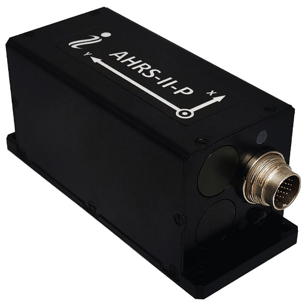
Inertial Labs has released its new attitude and heading reference system, the AHRS-II-P. This device is an enhanced, high-performance strapdown system that determines absolute orientation (heading, pitch and roll) for any mounted device. The AHRS-II-P can determine orientation for both motionless and dynamic applications.
The AHRS-II-P contains a tactical-grade inertial measurement unit (IMU) consisting of three high-precision MEMS accelerometers, three advanced MEMS gyroscopes and a high-precision, gyro-compensated, embedded fluxgate compass. It also uses 8 mm fluxgate magnetometers.
This device is suitable for a variety of devices such as UAVs, antennas, ships and robotic devices.
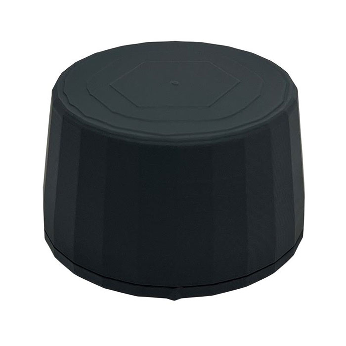
The HC990XF helical antenna is designed for precise positioning, covering the GPS/QZSS L1/L2/L5, QZSS L6, GLONASS G1/G2/G3, Galileo E1/E5a/E5b/E6, BeiDou B1/B2a/B2b/B3, and NavIC L5 frequency bands. This includes the satellite-based augmentation system (SBAS) available in the region of operation as well as L-band correction services.
The HC990XF has a base diameter of 64 mm, is 37 mm tall and weighs 45 g. Its precision-tuned helical element provides full GNSS band coverage, suitable gain and axial ratio, and a tight phase center. The antenna base has an SMA (male) connector, three screw holes for secure attachment and an O-ring to waterproof the antenna connector.
The HC990XF helical design does not require a ground plane, making it a suitable antenna for UAV applications.
The HC990XF antenna also supports Tallysman’s eXtended Filtering technology.
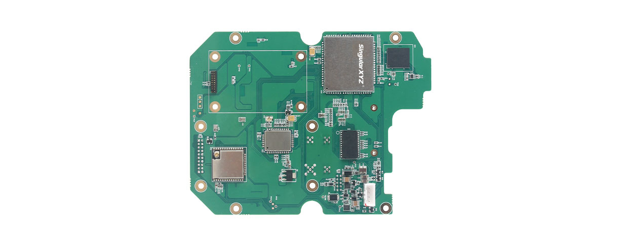
SingularXYZ, a manufacturer of GNSS technology, has launched its DK100 development kit. This multi-functional kit has selectable single-antenna and dual-antenna modules, full constellation tracking and centimeter-level positioning.
The DK100 development kit is a ready-to-use kit designed to simplify integration efforts and increase compatibility with a variety of applications. The kit reserves standard adapter board interfaces to connect different GNSS modules and radio modules for a variety of needs.
The development kit features a 4G module, Wi-Fi, Bluetooth, and Ethernet modules as well as status indicators on a single PCBA.
The DK100 development kit comes with its own web page for configuration. With Ethernet and Wi-Fi access, users can monitor device status and configure working mode and data transmission settings on the page.
The centimeter-level DK100 kit can be integrated in a range of horizontal and vertical applications, such as construction using CORS networks, precision agriculture, construction machinery, smart navigation, monitoring, robotics, unmanned systems and more.
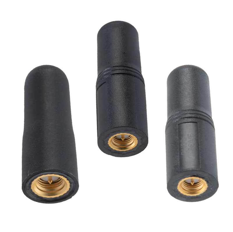
The MIL-STD-810G GPS/GNSS antennas include multi-standard GPS L1, Galileo E1 and GLONASS options and are designed for environmental performance according to the MIL-STD-810G standard.
The antennas are available in passive and active versions and provide coverage from 1,597 MHz to 1,607 MHz. The MIL-STD-810G GPS/GNSS antennas feature linear polarization for cross-polarized isolation, nominal gain options of -3 dBic and 10 dBic, and SMA mounts.
A roundup of recent products in the GNSS and inertial positioning industry from the March 2023 issue of GPS World magazine.
UAV
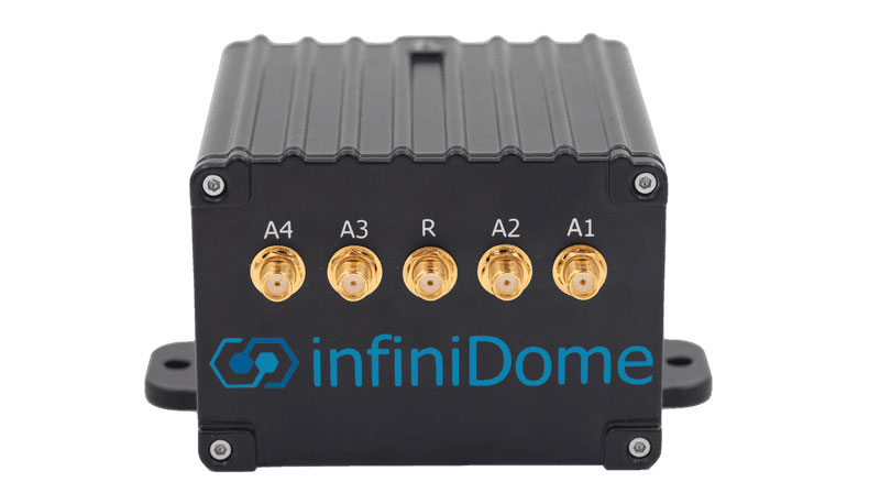
Image: InfiniDome
Anti-Jamming Device Provides protection from three directions of attack
The GPSdome 2 is tailored to defend small- to medium-sized tactical UAVs as well as manned and unmanned ground vehicles. With a small form factor (500 g, 87 mm x 91 mm x 61.55 mm) and minimal power consumption, GPSdome 2 is suitable for loitering munitions as well as UAVs. Fully retrofit and completely standalone, the system is compatible with almost any off-the-shelf GNSS receiver as well as standard active GNSS antennas, meaning that it can be integrated into existing GPS systems or into new product lines, manned or unmanned. With sophisticated algorithms and a proprietary RFIC, GPSdome 2 analyzes RF interference in the environment and combines multiple antenna patterns to create and dynamically steer three nulls in the direction of any hostile signal. GPSdome 2 provides simultaneous dual-frequency protection (GPS L1 + L2 or GPS L1 + GLONASS G1), creating up to three nulls, protecting from three jamming directions within each band in real time, making it suitable for PNT applications. The GPSdome 2 is a dual-use, non-ITAR device and comes with optional mil-spec compliance. InfiniDome, infinidome.com
Image: uAvionix
Command and Control Designed for easy integration
The SkyLine C2 management platform and muLTElink airborne radio systems (ARS) are designed to integrate, which enables a self-healing command-and-control network capable of both path and link diversity. This eliminates lost-link possibilities over broad terrain and altitude ranges. MuLTElink ARS consists of two models — muLTElink915 and muLTElink5060, the core of the uAvionix C2 system. The muLTElink915 model combines globally licensed aviation LTE, enhanced with frequency hopping 902 MHz – 928 MHz industrial, scientific and medical frequencies capability. The muLTElink5060 model combines global LTE with aviation-protected 5,030 MHz – 5,091 MHz C-band. Each muLTElink model allows up to one external CNPC radio to be optionally connected to allow simultaneous use of all three frequency ranges, higher power C-band operation or future radio integrations. uAvionix, uAvionix.com
Image: Atmos
VTOL UAV With Sony a7R mark III and IV camera
Atmos has integrated the Sony a7R mark III and IV cameras into its vertical take-off and landing (VTOL) fixed-wing UAV, the Marlyn Cobalt. This will increase coverage and accuracy achieved in a single flight for surveyors. Both cameras have an ISO of 32,000, which is expandable to 102,400, and camera sensors with high megapixel count — 42,4 MP for the a7R III and 61 MP for the a7R IV. When combined with Zeiss’ 35 mm and 21 mm lenses, it enables UAV surveyors to achieve ground sample distance levels below one 1 cm. The integration of the two cameras enables Marlyn Cobalt users to map an area of 210 ha with centimeter-level accuracy in a single flight. Atmos, atmosuav.com
UAV and Lidar Systems Suitable for geospatial professionals
TrueView 535 consists of updated lidar sensors, adding a third return, increasing mapping abilities below canopy. An additional third nadir camera offers another point of view and improves photogrammetry quality. It also includes a longer, usable lidar range to increase flexibility. TrueView 720 is a fourth-generation Riegl VUX-120 with three laser beam orientations. It provides high-point density corridor mapping. Using the Riegl VUX-120 with three laser beam orientations (nadir, +10 degrees forward and –10 degrees backward) and three oblique/nadir cameras enables data collection from more surfaces in one flight path. One application of TrueView 720 is scanning power lines. Users can capture the poles vertically, front and back. The extreme range of this system means it can be integrated with UAVs, airplanes or helicopters. In addition to the two sensor payloads, GeoCue has launched its LP360 software add-on for processing and visualization — the 3D Accuracy and the Accuracy Star hardware.
GeoCue, geocue.com
OEM
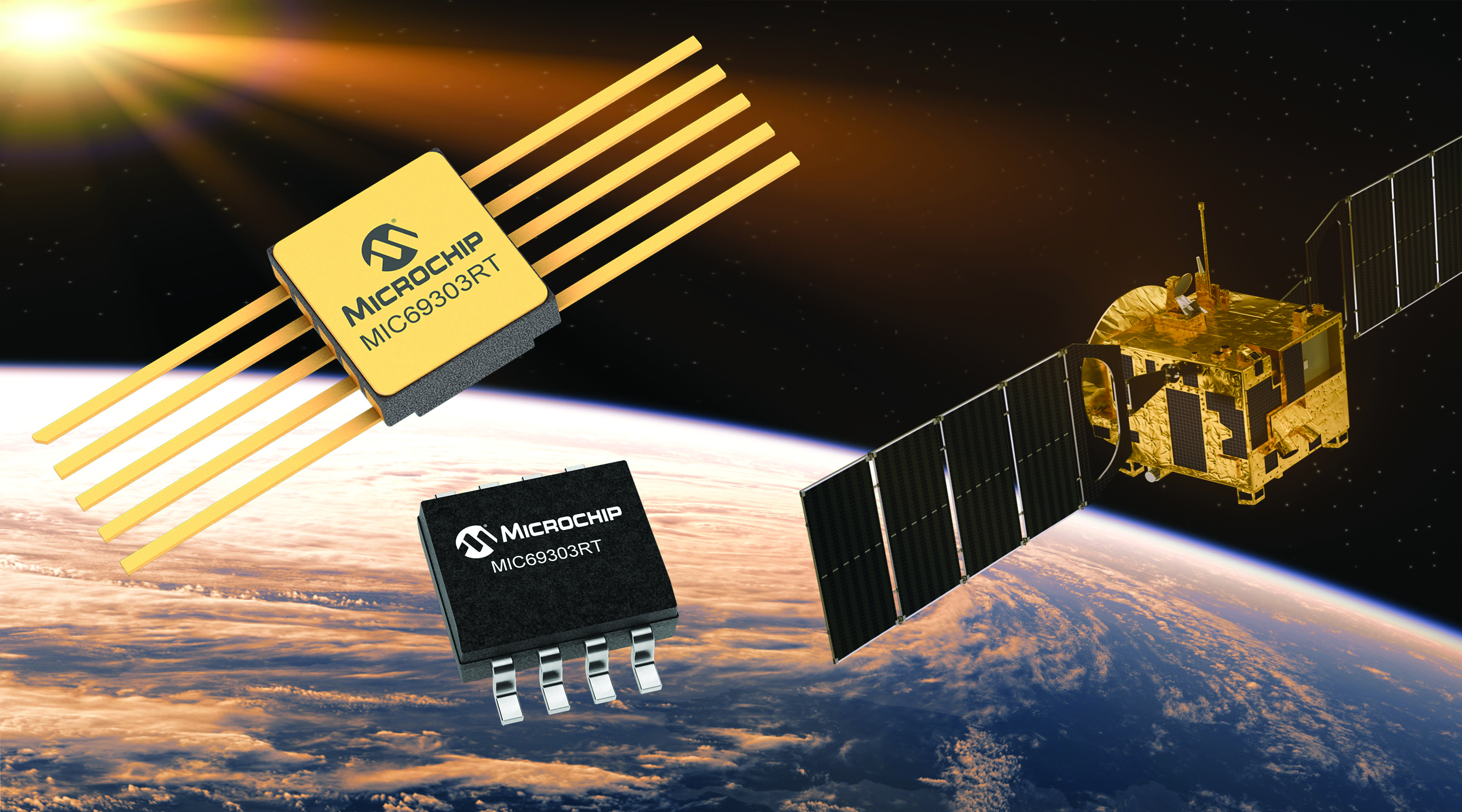
Image: Microchip
Voltage Regulator Device for LEO space application
The MIC69303RT is a radiation-tolerant power management device for space application developers. It is a high-current, low-voltage device targeting low-Earth orbit space applications. The MIC69303RT operates from a single low-voltage supply of 1.65 v to 5.5 v and can supply output voltages as low as 0.5 v at high currents. It offers high-precision and low dropout voltages of 500 mv under extreme conditions. The MIC69303RT is a companion power source solution for microcontrollers, such as the SAM71Q21RT and PolarFire field-programmable gate arrays. MIC69303RT is designed for harsh aerospace applications and remains operational in temperature ranges from -55 C to +125 C. Microchip Technology, microchip.com
Image: Spirent Communications
LEO Satellite Device Designed for GNSS/PNT lab testing
SimORBIT is a low-Earth-orbit (LEO) satellite solution software designed to aid developers in determining LEO orbits more accurately for GNSS/PNT lab testing. The software replicates LEO orbits so that simulations can provide the realistic environment of a LEO satellite, including gravitational and atmospheric impacts the satellite could encounter in space. Developers can create non-ICD signals via I/Q injection, or by the “Flex” feature, generating space-centered PNT signals to be developed in the lab as realistically as possible. Spirent Communications developed SimORBIT in partnership with SpacePNT. Spirent Communications, spirent.com
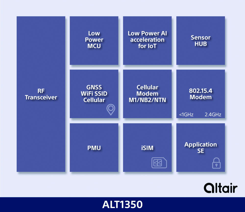
Image: Sony
5G Chipset Includes GNSS
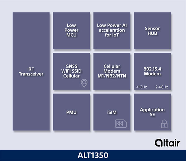
The ALT1350 implements GNSS, cellular and Wi-Fi-based location in a single chipset. The cellular LTE-M/NB-IoT chipset is designed to enable additional low-power, wide-area (LPWA) communication protocols; intermittent LTE and GNSS (GPS/GLONASS) navigation for low-cost applications; and concurrent LTE and L1/L5 GNSS for tracking applications. The ALT1350 incorporates a sensor hub to collect data from the sensors while maintaining ultra-low power consumption. It also provides cellular and Wi-Fi-based positioning and is tightly integrated to provide power-optimized concurrent LTE and GNSS to accommodate various tracking applications, which can be demanding with a single chip. The chip is designed to enable deployments for the internet of things (IoT), including location technologies. Sony, altair.sony-semicon.com
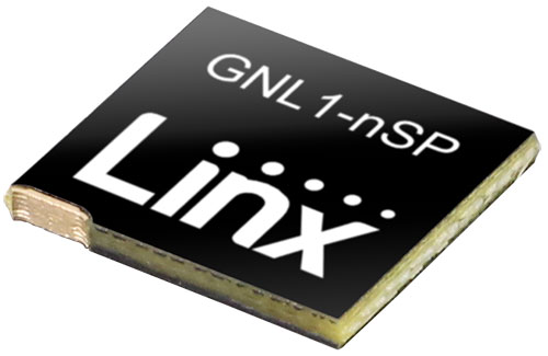
The ANT-GNL1-nSP is a surface-mount embedded GNSS antenna supporting GPS, Galileo, GLONASS, BeiDou and QZSS in the L1/E1/B1 bands. The ANT-GNL1-nSP antenna exhibits high performance in a compact size (10 mm x 8 mm x 1 mm) and features linear polarization and an omnidirectional radiation pattern. The antenna is available in tape and reel packaging and is designed for reflow-solder mounting directly to a printed circuit board for high-volume applications. Linx Technologies, linxtechnologies.com
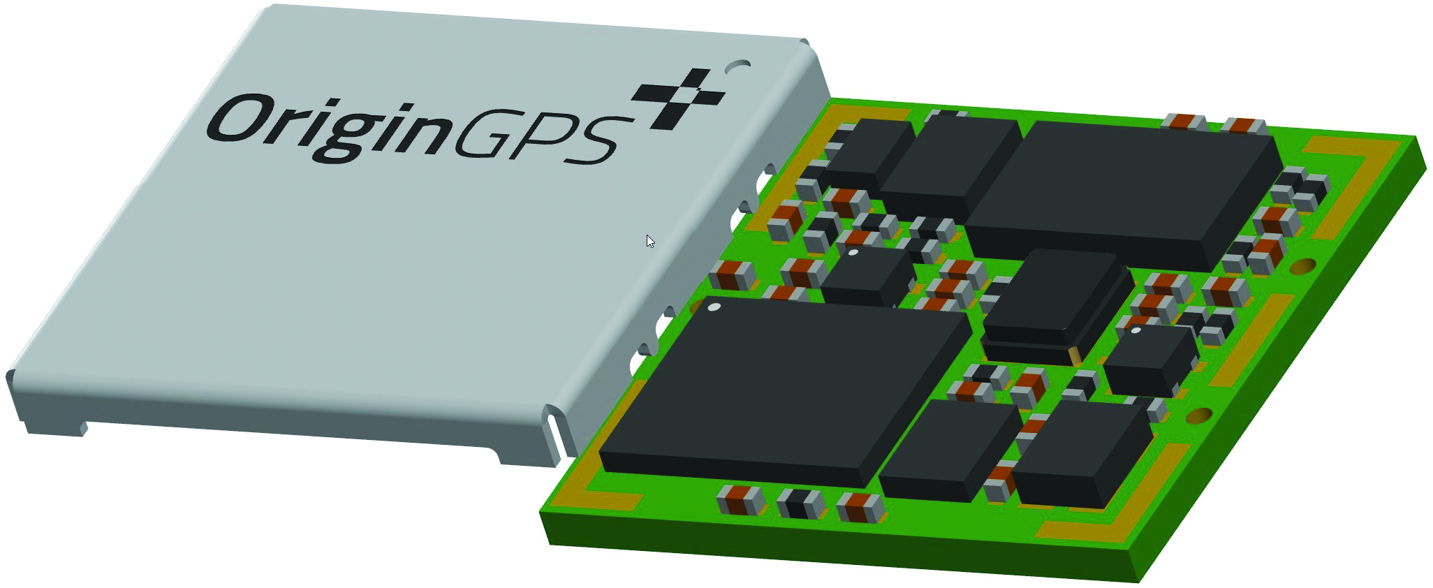
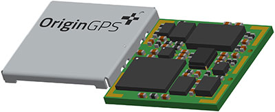
Image: OriginGPS
GNSS Module Based on a MediaTek chipset
The ORG4600-MK01 dual-frequency module provides higher precision than the company’s previous modules. It has sub-1 m precision at a cost lower than that of the company’s first L1+L5 module, the ORG4600-B01, which is based on Broadcom’s chipset. The 10 mm x 10 mm ORG4600-MK01 was designed for applications deployed in challenging environmental conditions. The solution also includes RTCM, a logger and accurate orbit prediction. OriginGPS, origingps.com
MAPPING
Image: Mapbox
Navigation Software Includes enhancements to existing software and more
Navigation software development kit version 2.9 provides pre-built applications compatible with Android and IOS. SDK v2.9 provides the primary navigation components across a workflow using lines of code instead of starting from square one. The drop-in user interface is customizable to reflect a developer’s brand, obviating the need to manually develop a full end-to-end application. Navigation SDK Copilot — a backend analytics tool for CX on navigation applications — collects trace files of navigation sessions and search analytics data from users. Developers can use this data to gather feedback and collective user data to create touch points with users and improve application experience based on their data-drawn conclusions. Matrix API has been updated to support scheduled departure times and provide optimal driving routes, creating a more accurate estimated time of arrival. Mapbox, mapbox.com
Image: Hexagon
Defense Platform For developing Android applications
LuciadCPillar is designed for the development of mobile applications for dismounted soldiers in the field. Developers can build applications with 2D and 3D views. It features military symbology and supports many geospatial data types including vector data, raster data, elevation data, point clouds and 3D meshes. It has the same capabilities found in desktops, in-vehicle and browser applications built with LuciadLightspeed, LuciadCPillar and LuciadRIA. The platform offers capabilities to match high-resolution screens, graphic processing units and multi-core processors including the ability to display 3D data in mobile applications. LuciadCPillar supports ARM processors and an application programming interface, which aligns with the Android developer experience. Impact, a French system integrator, partnered with Hexagon to test LuciadCPillar and will integrate it into its Delta Suite product, which is used by the French Special Operations Command. LuciadCPillar is part of Luciad 2022.1, which is available now globally. Hexagon, hexagon.com
Image: Golden Software
Surface Mapping Designed for 3D surface mapping
The Surfer package is designed for 3D surface mapping and provides robust subsurface visualization and modeling functionality by incorporating many true 3D gridding and visualization tools. With the enhanced functionality, users can now model an additional variable, a C variable, such as a contaminant or chemical concentration, along with the traditional X, Y, Z values. Surfer also includes the ability to create a 2D map of a slice-through 3D grid, which users can move up and down through the grid, illustrating how the C value changes with depth. Part of Surfer’s enhancements is isosurface creation, enabling visualization of the 3D grid in the 3D view as an isosurface, providing another way to see how C data varies with depth or elevation. The new 3D-rendered volume functionality also allows users to visualize the 3D grid in the 3D view as a solid body by assigning colors to different C values, highlighting variations in the data. Golden Software, goldensoftware.com
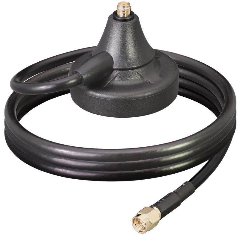
Linx Technologies has released the MAG Series SMA and RP-SMA magnetic antenna bases, which are suitable for GPS, Galileo and QZSS applications. The antennas are designed to combine a strong magnetic mount with typical connectors to create different mounting options for a variety of whip/blade-style connectorized antennas.
“This versatile mounting option provides the capability to extend the placement of the antenna to a remote location and allows the flexibility for the antenna to be used in a mobile application, making it especially well-suited for the growing internet of things (IoT) market,” said Tolga Latif, senior director of product management for IoT and micro-markets.
The MAG Series antenna bases are IP67 rated (connectors, base and coax) and are also suitable for LTE-M (Cat-M1), NB-IoT, 5G/4G LTE/3G/2G, LoRaWAN, Sigfox, Wi-Fi, HaLow (802.11 ah), Bluetooth and Zigbee, as well as GNSS applications.
The MAG Series antenna bases are available now via Linx Technologies’ distributor and manufacturer representative networks.
Innovative chip offers multiple ultra-low power connectivity options and low-power processing for internet of things (IoT) market
Sony Semiconductor Israel has launched the ALT1350 for the global market. The ALT1350 is a cellular LTE-M/NB-IoT chipset designed to enable additional low-power wide-area (LPWA) communication protocols, as well as GNSS, in a single chipset.
The ALT1350 incorporates a sensor hub to collect data from the sensors while maintaining ultra-low power consumption. It also provides cellular and Wi-Fi-based positioning and is tightly integrated to provide power-optimized concurrent LTE and GNSS to accommodate various tracking applications, which can be demanding with a single chip.
“The market demand for this multiprotocol, ultra-low power IoT chipset is intensifying, and Sony’s ALT1350 chipset meets that demand,” said Nohik Semel, CEO at Sony Semiconductor Israel. “This is the game changer we’ve been waiting for, which will enable IoT deployments, utilizing universal connectivity on edge processing and multiple location technologies.”
Diagram: Sony
The ALT1350 is an advanced cellular IoT solution, with architecture that resolves IoT service provider’s power-consumption concerns. Its optimized standby mode (eDRX) reduces power consumption by 80% when compared to the current generation and by 85% when using it to send short messages.
Overall improvements in the system’s power consumption will enable four times longer battery life for a typical device, enabling additional functionalities and use cases with smaller batteries.
The ALT1350’s sub-GHz and 2.4 GHz integrated transceiver enables hybrid connectivity for smart meters, smart cities, trackers and other devices. This enhances coverage, reduces costs and further decreases power consumption using IEEE 802.15.4-based protocols such as Wi-Sun, U-Bus Air and wM-Bus, in additional point-to-point and mesh technologies.
The chipset is designed to support the wide-ranging market needs of utilities, vehicle, tracking devices, smart cities, connected health and other verticals. Device manufacturers across all verticals can take advantage of its low power consumption, long-lasting battery life, mature Release 15 LTE-M/NB-IoT software stack, and future compatibility with 3GPP release 17.
All these guarantee longevity and ensure the ALT1350 will operate with 5G networks. It contains an additional LPWA radio transceiver with targeting operation in <1 GHz and 2.4 ISM bands for universal connectivity options.
The chipset provides advanced on-the-edge low power processing capabilities, ranging from data collection, low power AI/ML processing of the data, and MCU to enable IOT applications on the chip.
The device is now sampling to lead customers and will become commercially available in 2023. The ALT1350 also includes a secure element for application usage and integrated SIM designed for PP-0117 to meet GSMA requirements.
The IMU-FI-200C FOG IMUs are a fully integrated inertial measurement solution that combines the latest closed-loop FOG and MEMS sensors technologies
Inertial Labs has released the IMU-FI-200C high-performance fiber-optic gyroscope (FOG) inertial measurement unit (IMU), a compact, self-contained strapdown, advanced tactical-grade IMU that measures linear accelerations and angular rates with three-axis tactical-grade, closed-loop FOG and three-axis high-precision MEMS accelerometers in motionless and high-dynamic applications.
The IMU-FI-200C FOG IMUs are a fully integrated inertial measurement solution that combines the latest closed-loop FOG and MEMS sensors technologies. It is designed for a wide range of higher order integrated system applications, such as
antenna and line-of-sight stabilization systems
passenger train acceleration/deceleration and jerking systems
motion reference units
motion control sensors
gimbals
electro optical components/infrared
platform orientation and stabilization.
Fully calibrated, temperature-compensated and mathematically aligned to an orthogonal coordinate system, the IMU contains gyroscopes with an accuracy of up to 0.5 deg/hr and accelerometers with a bias repeatability of less than 2-mg over their operational range, very low noise and high reliability.
The IMU-FI-200C FOG IMUs have been thoroughly tested to perform in significant variations in temperature, high vibration and shock, and is designed to be used in air, marine and land environments.
“New technology creates new opportunities, and the new IMU-FI-200C represents the innovative approach we take every day at Inertial Labs,” said Jamie Marraccini, president & CEO of Inertial Labs. “The high performance and flexibility to integrate into different systems and applications is what we have striven to provide to our customers with this new release.”
Linx Technologies, now part of TE Connectivity, has expanded on its Splatch antenna series with the release of the ANT-GNL1-nSP, a surface-mount embedded GNSS antenna supporting GPS, Galileo, GLONASS, Beidou and QZSS in the L1/E1/B1 bands.
“The new linear GNSS antenna from Linx expands upon our already robust embedded PCB antenna portfolio of customer favorites like the uSP410, SP610 and the nSP250, by adding a GNSS solution,” said Rick Stuby, vice president of product management. “The antenna displays high performance in a compact surface-mount package, making it especially well-suited for small devices in the growing internet of things market.”
The ANT-GNL1-nSP antenna exhibits notable performance in a compact size (10 mm x 8 mm x 1 mm) and features linear polarization and an omnidirectional radiation pattern. The antenna is available in tape and reel packaging and is designed for reflow-solder mounting directly to a printed circuit board for high-volume applications.
The new GNSS antennas are available now via Linx Technologies’ distributor and manufacturer representative networks. For larger quotes, email Linx Technologies at [email protected].
OriginGPS is exhibiting a new GNSS module based on a MediaTek chipset at Electronica in Munich this week.
The company is also demonstrating how the OriginIoT system — equipped with a high-stability GNSS module from the company’s miniature range — can be speedily deployed to replace traditional control systems, providing a new way to remote-control devices that move.
Also on show is a weather board equipped with a range of sensors for multiple particulate matter, with data presented on a gauge-rich dashboard updated automatically.
ORG600-MK01, OriginGPS’ new sub-1m precision dual-frequency module, is built with MediaTek’s chipset. (Image: OriginGPS)
“We are excited to be launching our latest GNSS dual-frequency module, the ORG4600-MK01, at the Electronica trade fair this month,” said Haim Goldberger, OriginGPS’ Founder and CEO. “At GITEX 2022 in Dubai, we heard from visitors how demands for more precision and lower costs were on the rise. Thanks to the tenacity of our engineering team, the solution has sub-1m precision and is competitively priced. In fact, the cost of our new module — built with MediaTek’s dual-frequency chipset — is lower than that of our first L1+L5 module, the ORG4600-B01, which is based on Broadcom’s chipset and provides high stability with up to 10cms accuracy.”
The new 10 mm x 10 mm dual-frequency GNSS product is based on 12 nm technology and was designed for applications deployed in challenging environmental conditions. The solution also includes RTCM, a logger and accurate orbit prediction.
OriginGPS is showcasing its miniature GNSS modules and cellular IoT systems and devices in Booth B5-242 at Electronica, Munich, Nov. 15-18.
The D70 is the latest release in the Boreas digital FOG (DFOG) series, offering a new performance grade with superior accuracy, exceptional stability and reliability. The technology is suited to surveying, mapping and navigation across subsea, marine, land and air applications.
“We are thrilled to expand the Boreas series with the D70. It’s a system that will provide additional flexibility in the Boreas family, making ultra-high accuracy inertial navigation far more affordable than with previous FOG INS systems,” said Xavier Orr, CEO and co-founder of Advanced Navigation. “This patented technology opens the possibility for adopting FOG INS systems across a much broader range of vehicular applications, particularly autonomous vehicles and aircraft where weight and size are at a premium.”
Boreas D70 combines closed-loop DFOG and accelerometer technologies with a dual-antenna real-time kinematic (RTK) GNSS receiver. These are coupled with Advanced Navigation’s artificial-intelligence-based fusion algorithm to deliver accurate and precise navigation.
The system features ultra-fast gyrocompassing, acquiring and maintaining an accurate heading under demanding conditions. While the D70 does contain a GNSS receiver, it is not required for gyrocompass operation.
Based on the company’s DFOG technology, the D70 delivers a 40% reduction in size, weight, power and cost (SWaP-C) when compared to systems of similar performance.
0.01° roll and pitch
0.1° secant latitude heading (gyrocompass)
0.01°/hour bias instability
10 mm position accuracy
The Boreas Series
The Boreas DFOG series features ultra-fast gyrocompassing and can acquire heading, either stationary or dynamically, in less than two minutes. The gyrocompassing allows the system to determine a highly accurate heading without any reliance on magnetic heading or GNSS.
The technology stems from Advanced Navigation’s artificial intelligence sensor-fusion algorithm allowing the system to extract significantly more information from the data. It is designed for control applications, with a high level of health monitoring and instability prevention to ensure stable and reliable data.
Advanced Navigation designed Boreas from the ground up for reliability and availability. The hardware and software are designed and tested to international safety standards and have been environmentally tested to MIL-STD-810. The system achieves a mean time between failure (MTBF) of more than 70,000 hours.
Additional features of the Boreas D70 include Ethernet, CAN and NMEA protocols, as well as disciplined timing via a PTP server and 1 PPS. An embedded web interface provides full access to all of the device’s internal functions and data. Internal storage allows for up to 1 year of data logging.
About DFOG Technology
DFOG is patented technology, which has been developed over 25 years involving two research institutions. DFOG was created to meet the demand for smaller and more cost-effective FOGs, while increasing reliability and accuracy.
The first generation of FOG, made available in 1976, used analog signals and analog-signal processing. The second generation was developed in 1994 and is still used to this day. It improved upon the first generation with a hybrid approach using an analog signal in the coil with digital signal processing.
In 2021, FOG evolved into DFOG. This third generation of FOG sets itself apart by being completely digital, providing higher performance and reliability while enabling a 40% reduction in SWaP-C.
To achieve this, three different yet complementary technologies have been developed to improve the capabilities of FOG.
Digital Modulation Techniques. DFOG uses a specially developed digital modulation technique passing spread spectrum signals through the coil. The new digital modulation technique introduced in DFOG technology allows in-run variable errors in the coil to be measured and removed from the measurements. This makes DFOG significantly more stable and reliable than traditional FOGs. It also allows a smaller FOG with less coil length to achieve the accuracy of one with a longer coil.
Revolutionary Optical Chip. By integrating five sensitive components into a single chip and removing all the fiber splices, the size, weight and power are reduced considerably while significantly improving reliability and performance.
Specially Designed Optical Coil. DFOG employs a specially designed closed-loop optical coil, developed to take full advantage of the digital modulation techniques. The design allows for optimum sensing of in-run variable coil errors using the new digital modulation technique. It also provides a very high level of protection for the optical components from shock and vibration.
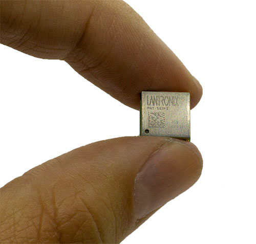
Lantronix Inc. has launched its new PNT Series GNSS receiver modules. The embedded modules provide an easy-to-use, cost-effective solution to enable the addition of GNSS functionality to products, Lantronix said, supporting the internet of things (IoT).
The new PNT Series modules are suitable for use in consumer solutions including people, pet and asset tracking devices, as well as agriculture asset monitoring and commercial solutions such as drones, toll-road charging, fleet management, maritime, rail, critical infrastructure and utilities.
“With the addition of the GNSS receiver modules, Lantronix is expanding its embedded IoT family to meet the growing demand for GNSS capabilities in a wide range of essential, often critical, consumer and commercial applications,” said Brian Jaroszewski, lead product line manager at Lantronix. “Adding positioning and tracking, navigation and timing capabilities supports essential processes in many industries, empowering our customers to propel our world forward with enhanced safety, security and the increased ability to more effectively and remotely manage people, places and things.”
According to the European Union Agency for the Space Program (EUSPA), by 2031 more than 10 billion GNSS devices will be in use across the world. Mass-market segments — consumer solutions, tourism and health — will contribute to 92 percent of all devices in use. The global GNSS downstream market revenues, covering both device sales and service-related revenues, is expected to grow at a CAGR of 9.2 percent over the next decade, reaching a total of USD $486 billion by 2031.
Available in Two Models
Lantronix PNT-SG3FS
Available now, the PNT-SG3FS flash-based module is designed for simultaneous tracking of multiple constellations. The PNT-SG3FS standalone module integrates a Teseo III receiver from STMicroelectronics.
The single-frequency receiver can track up to 32 satellite signals in view across GPS L1C/A, BeiDou B1, Galileo E1B/C, GLONASS L1OF, SBAS L1C/A (WAAS, EGNOS, MSAS, GAGAN) and QZSS L1C/A bands. The pin-compatible multi-frequency PNT-SG4FM adds support for GPS and QZSS L5C, BeiDou B2a and Galileo E5a bands.
PNT Series SG3FS evaluation board. (Photo: Lantronix)
The PNT-SG3FS module supports Differential GPS (DGPS) data according to RTCM 10402.3 for improving location accuracy. The module can output measurement data (carrier phase) supporting PPP-RTK host algorithms for precise positioning applications with a custom firmware and supports 1.8V or 3.3V power supply domains. Assisted GNSS algorithms support extended ephemeris data using local autonomous or server-assisted-based solutions for fast time to first fix (TTFF) operation.
The module provides a high stability pulse-per-second (PPS) output for time-synchronization for electricity transmission, telecom networks operation and timestamping of financial transactions as well as application uses in utility systems, scientific applications, IoT and in broadcast and datacom networks.
The PNT-SG3FS integrates 16MB flash memory that supports many capabilities, including data logging, geofencing, odometer, five-day autonomous assisted GNSS and firmware updates. Integrated is a temperature-compensated crystal oscillator (TXCO) for navigation performance and stability. Also included is a real-time clock (RTC) oscillator with a clock-trimming feature to compensate for the accuracy of the 32.768 kHz crystal in timing applications.
Lantronix PNT-SG4FM
Coming soon, the PNT-SG4FM is a pin-compatible flash-based module designed for multi-frequency GNSS deployments. The PNT-SG4FM is ready for IRNSS using a custom firmware build. The PNT-SG4FM relies solely on server-assisted-based assisted GNSS. In addition, the PNT-SG4FM has a built-in LNA and SAW filter and features short and open circuit detection functions for antenna status.