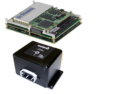
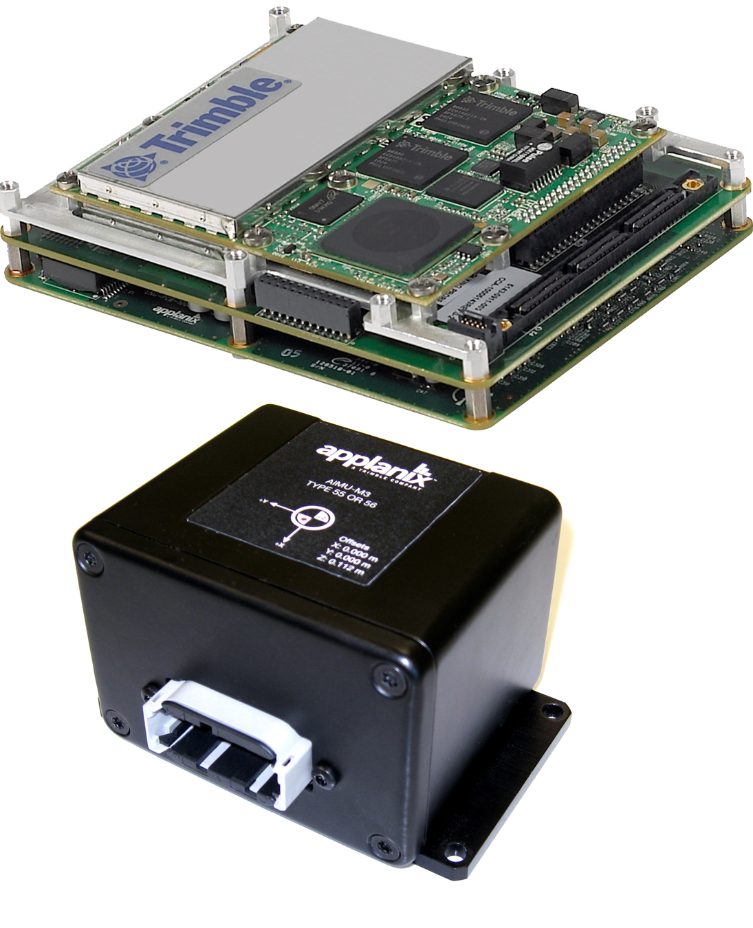
Trimble introduced today the Trimble AP15, the latest member of the AP series of OEM GNSS-Inertial board sets. The introduction was made at the AUVSI 2013 Conference and Exhibition, being held in Washington, D.C.
The AP15 uses a custom Micro Electromechanical Machined (MEMS) based Inertial Measurement Unit (IMU). It is the first product to take advantage of Applanix’ proprietary calibration process — Applanix SmartCal, a new software compensation technology that allows Trimble to achieve exceptional performance from IMUs manufactured specifically for mobile mapping applications.
The AP15 combines high-precision GNSS positioning with Applanix IN-Fusion GNSS-Inertial integration technology, all running on a powerful, dedicated Inertial Engine (IE) board. AP products provide the performance and functionality of Applanix’ POS systems in an embedded form-factor that is specifically designed for third-party manufacturers and systems integrators, Trimble said. The AP Series is designed for a variety of commercial mobile positioning and orientation applications including airborne, terrestrial and marine mapping and guidance for unmanned vehicles.
Combined with a wheel-mounted Distance Measurement Instrument (DMI), the AP15 provides a full 6-degrees-of-freedom navigation solution for land vehicles that is capable of providing robust position and orientation information regardless of obstructions to GNSS-only positioning such as multipath or complete signal loss. Applanix IN-Fusion technology produces uninterrupted position, roll, pitch and true heading measurements of moving platforms by combining IMU data with raw GNSS observables and DMI velocity.
GNSS functionality is provided by a Trimble GNSS module, a dual-antenna, 440 channel, multi-frequency survey-grade GNSS receiver that supports a wide range of satellite signals, including GPS L1/L2/L2C/L5 and GLONASS L1/L2 signals. The module also supports Satellite-Based Augmentation Service (SBAS) corrections, including the U.S. Wide Area Augmentation System (WAAS), European Geostationary Overlay Service (EGNOS), Japan’s Multi-functional Satellite Augmentation System (MSAS) and the OmniStar VBS, HP and XP/G2 corrections.
“Trimble is a leading provider of technology for positioning and orientation solutions and the introduction of the AP15 module continue this tradition,” said Kevin Andrews, product manager. “The AP15 has been designed as a more compact, lighter unit which can deliver excellent performance at lower cost.”
The Trimble AP15 is expected to be available in October of 2013 through Applanix’ sales channel.
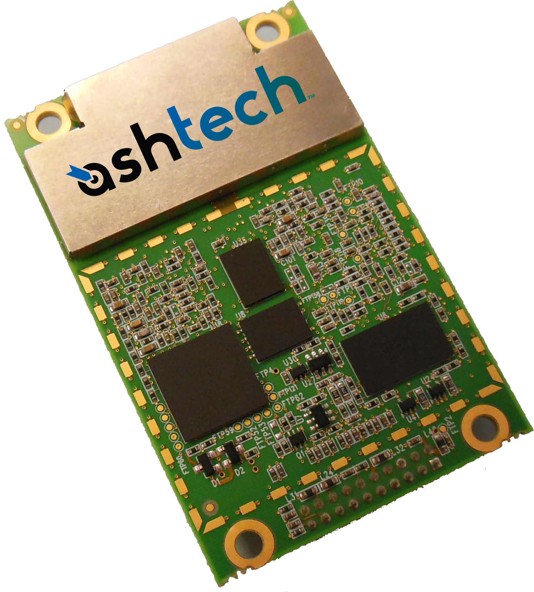
Trimble introduced today the Ashtech MB-One GNSS module. The MB-One delivers highly accurate GNSS-based heading plus pitch or roll in an advanced industry standard form-factor for system integrators.
The announcement was made today at the AUVSI 2013 Conference and Exhibition.
Its embedded Z-Blade GNSS technology uses all available GNSS signals equally, without any constellation preference, to deliver fast and stable solutions. The MB-One is designed to add precise positioning and heading in a wide variety of applications such as unmanned, agriculture, marine and military systems.
“System integrators demand high performance, reliability and support for their positioning solutions,” said Olivier Casabianca, business development manager for the Trimble’s GNSS OEM products. “The MB-One is designed for easy integration and rugged dependability. Users can leverage the module’s Ethernet capability and easy-to-use web browser interface to quickly and cost-effectively develop their products and solutions.”
The MB-One features an enhanced dual-core GNSS engine with 240 channels capable of tracking a large range of GNSS systems including GPS, GLONASS, Galileo and BeiDou. It uses over-the-air satellite corrections using L-Band hardware to achieve decimeter-level accuracy. The module is capable of receiving and decoding Precise Point Positioning (PPP) to output a highly accurate position solution that removes the need for a local base station.
The Ashtech MB-One module will be available through the Trimble GNSS OEM international network of representatives and authorized dealers. Evaluation units will be available in the fourth quarter of 2013 and production units are expected to be available in the first quarter of 2014.
TerraStar GNSS, a supplier of precision positioning services for land and near-shore applications, has established a base at Nottingham University’s GNSS Research and Applications Centre of Excellence (GRACE). GRACE operates operates under the auspices of its Institute of Engineering Surveying & Space Geodesy (IESSG).
TerraStar GNSS maintains and controls a worldwide network of more than 80 GPS and GLONASS DGNSS reference stations and associated control centers on behalf of a diverse range of users. Under the collaborative venture, TerraStar GNSS will contribute and have access to GRACE’s support facilities. These include customized incubation units, project offices, state-of-the-art test equipment, secure research and development laboratories, and dedicated training suites.
Expected projects include joint research and development of new GNSS-type solutions, in addition to provision of support for continued commercial exploitation of academic research endeavors. Also available will be mutual access to general geospatial expertise consistent with TerraStar GNSS’ present capability of providing year-round meter and decimeter-levels of precision for both land and aerial survey applications using software and a series of advanced purpose-designed integrated receivers.
Headed by General Manager Gary Wilcock, TerraStar GNSS’s new base facilities are at Office A03, The Nottingham Geospatial Building, University of Nottingham Innovation Park, Triumph Road, Nottingham NG7 2TU, UK.
Topcon Positioning Group announces new reference station network software — TopNET+ v10 — bringing new features and functionality to the TopNET+ reference station software suite.
Topcon’s TopNET+ software is a scalable solution supporting everything from a single CORS station to multiple CORS sites covering a large geographical area. Users of a TopNET+ reference network get GNSS RTK correction data generated using information from all reference stations in a network. This feature allows regional use of RTK while providing data that is specific for each local rover, Topcon said.
New features available in the latest TopNET+ v10 include:
Custom sub-networks based on a rover’s position within a larger regional network, which better supports the network RTK rover to local field conditions;
RINEX (Receiver Independent Exchange Format) shop with expanded data management functionality for conversion of data from Topcon and third party reference stations connected to the network;
Background maps and BING Maps allow multiple perspectives of the network orientation and regional surroundings;
“This upgrade of TopNET+ software provides increased capabilities and a more visual and detailed presentation of network status to the users of Topcon networks,” said Tom Morris, TPS senior product development manager. “Users will have a customized solution better adapted to local conditions and a better view into the hard processing and statistics being generated in TopNET+.”
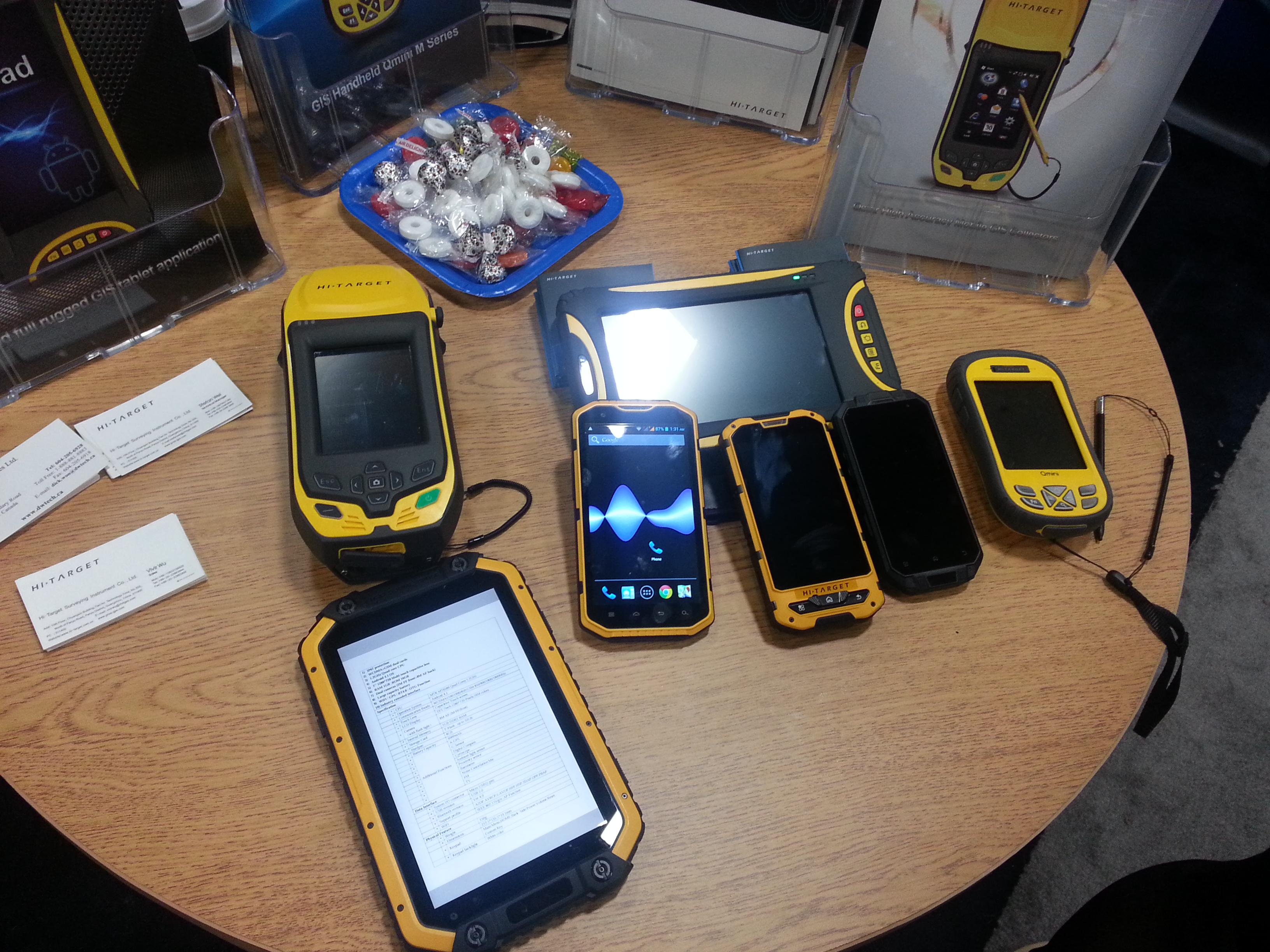
The Esri Survey Summit and Esri International User Conference (UC) were held in July in San Diego, California (they’re held San Diego every year). As always, these events are a whirlwind of spatial data technology, covering surveying software to handhelds/tablets, GNSS/GPS units, UAVs, handhelds/tablets, and plotters. There are only two conferences in the world where you will experience such a breadth and depth of hardware/software spatial technology: the Esri International User Conference (UC) and Intergeo.
The Esri UC, which is preceded by the Esri Survey Summit, is a vendor-specific conference, so you won’t see any Esri competitors there (such as Autodesk, Intergraph, MapInfo, Bentley, and Smallworld). Intergeo, set for October 8-10, is vendor-independent, so anyone can attend if you pay the fee, but it’s always located in Germany, which puts it out of reach for many North and South Americans. It’s also much more focused on business and a trade show than the UC. Finally, the Esri UC offers many more technical sessions than Intergeo. In my opinion, one of the greatest values of the Esri UC is the diverse, GIS-centric technical sessions available for about any vertical market you can imagine, from utility infrastructure to municipal engineering and wetland science. If you’re interested in browsing the technical sessions from last month’s Esri UC, you can do so here.
Survey Summit
The bulk of the Survey Summit was held the weekend before the Esri UC. This is an event where surveyors and GIS professionals (sometimes the same person) interact. The concept is solid, as surveying and GIS technologies are converging. However, this year’s Survey Summit suffered from a lack of attention from the organizers and, consequently, attendance took a hit. Only about 150 people attended, when the conference really should attract 750-1,000 people. Yes, tight travel budgets can be attributed to the decline in attendance, but there wasn’t buzz created leading up to the conference, and the content was marginal. For the first time since I can remember, there was no exhibition area for vendors. Note to Survey Summit organizers: I get that you’re busy on other projects, but if you want this to be a serious conference, you’ve got to put more energy into it.
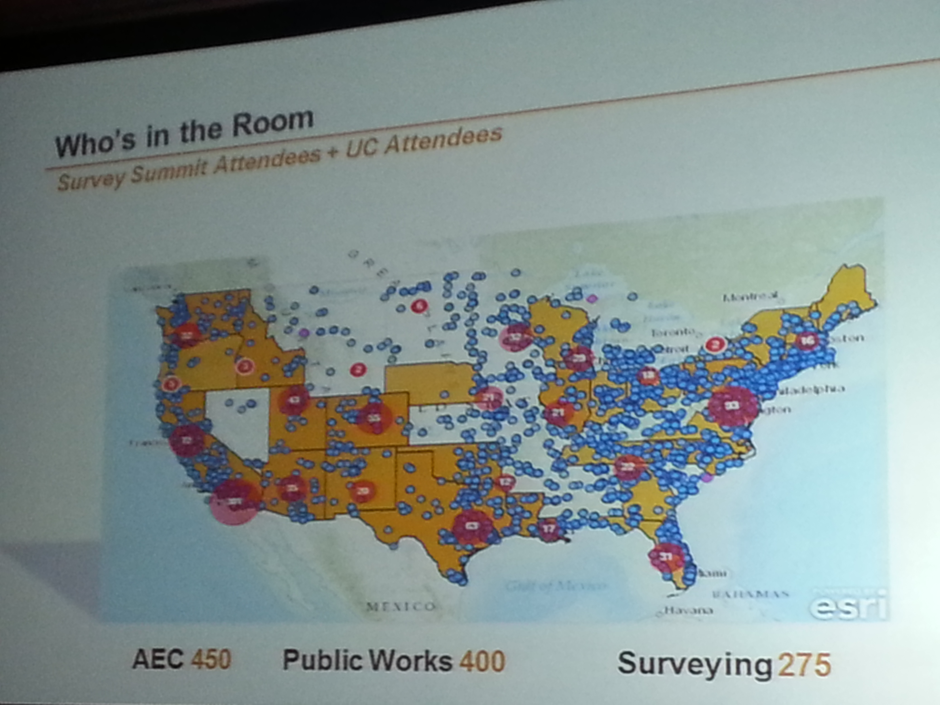
Who’s in the Room. Survey Summit + UC.
Who’s in the Room. Survey Summit + UC.
Most interesting take-aways from the Survey Summit:
• Esri programmers responsible for the geographic datum transformations in ArcGIS were at the Survey Summit and engaged. Esri needs to do a lot of work in this area to accommodate high-precision GIS and surveying, and it seems the company is taking it seriously, but it can’t come soon enough.
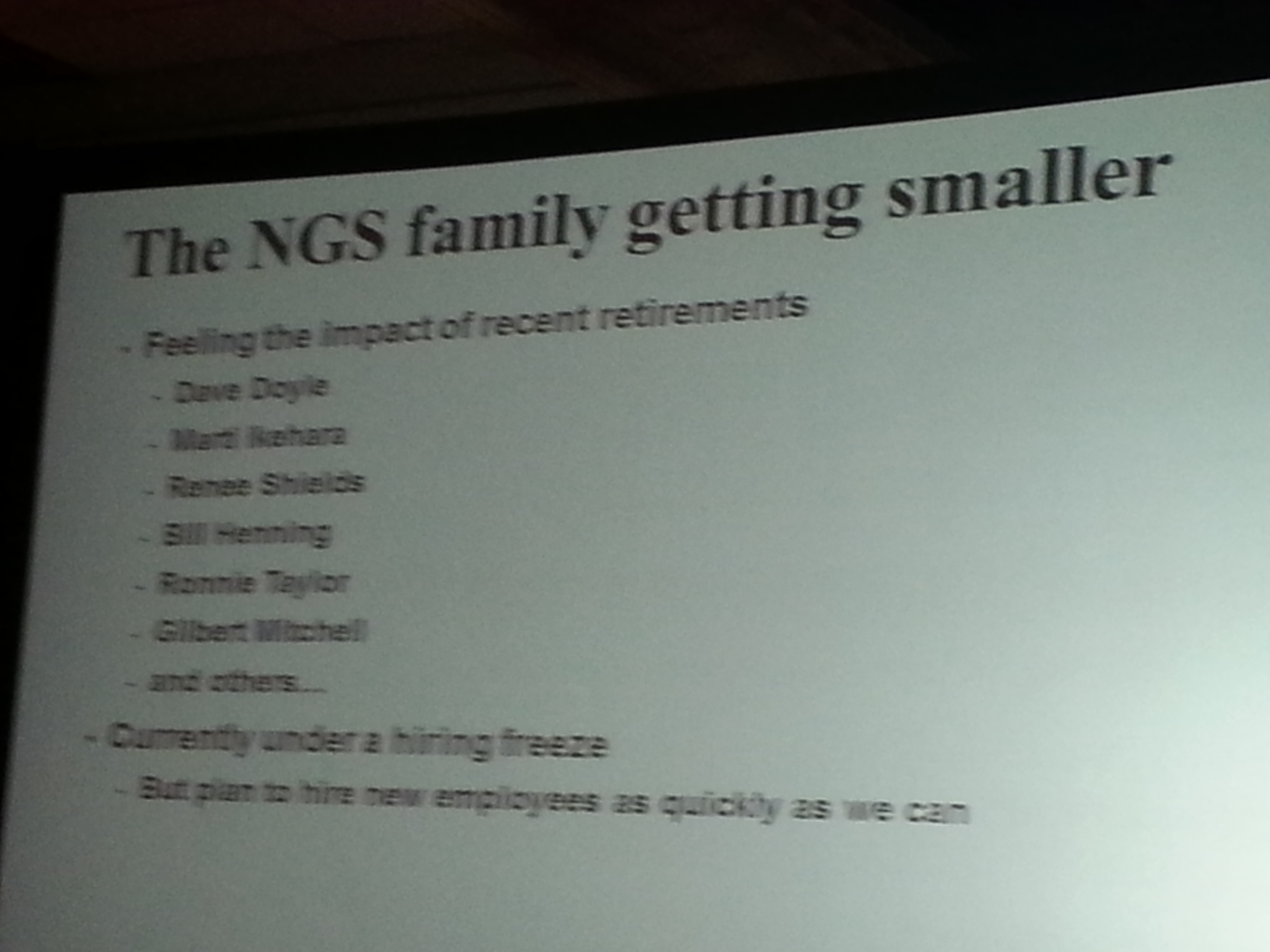
• National Geodetic Survey (NGS) usually sends a pack of people to the conference. This year, it all fell on Michael Dennis, who delivered a record number of presentations. The NGS is getting smaller. It employs about one third of the people it used to. People with a tremendous amount of knowledge and outreach throughout the years such as Dave Doyle and Bill Henning have retired recently, and there’s a hiring freeze at NGS. While geodesy for GIS is becoming more important, we are losing geodesy expertise at the federal level.
Most interesting quotes from the Survey Summit:
• “GIS isn’t an acronym for Get It Surveyed; it’s an acronym for Get Involved Seriously.” — Curt Sumner, National Society of Professional Surveyors
• “Think about what’s not going to change in the next 10 years, that’s the more important question.” — Brian Matsubara, Amazon Web Services
Esri International User Conference Keynote
The challenge is that Esri President Jack Dangermond sets the bar so high every year that there’s an expectation that he will “wow” us again. That didn’t happen this year. Mind you, I’m a huge fan of Mr. Dangermond. I love it that he’s kept Esri a privately held company (no public shareholders) and the way he dismisses investor community analysts. I love it that he has a vision, sticks to it, and yet doesn’t hesitate to make significant changes as he sees fit. He told Investor’s Business Daily, “We’ve never borrowed money,” conceding that this meant the company grew more slowly than it might have. “We had to be very, very, very conservative with money. …It drove careful decision making. We were never at the (beck) of outside shareholders or banks. What that means is we could focus on our users and employees.”
Think about a guy who, at 67 years of age, struck up a relationship with pop musician Will.I.Am, who ended up speaking in front of thousands of attendees at the Esri UC this year. You can view a video of Will.I.Am’s and other keynote conversations here. By the way, Will.I.Am says he’s going to attend the Massachusetts Institute of Technology (MIT) this fall, studying computer science. I’m impressed.
Esri International User Conference
Attendance at this year’s conference was probably down from last year, likely from reduced government travel budgets. On the conference opening day, Jack reported that 12,000 people were in attendance from 130 countries, making it the largest gathering of geospatial users in North America.
During the plenary session, four technologies were emphasized. None of them are new or earth-shattering, but each are pushing forward:
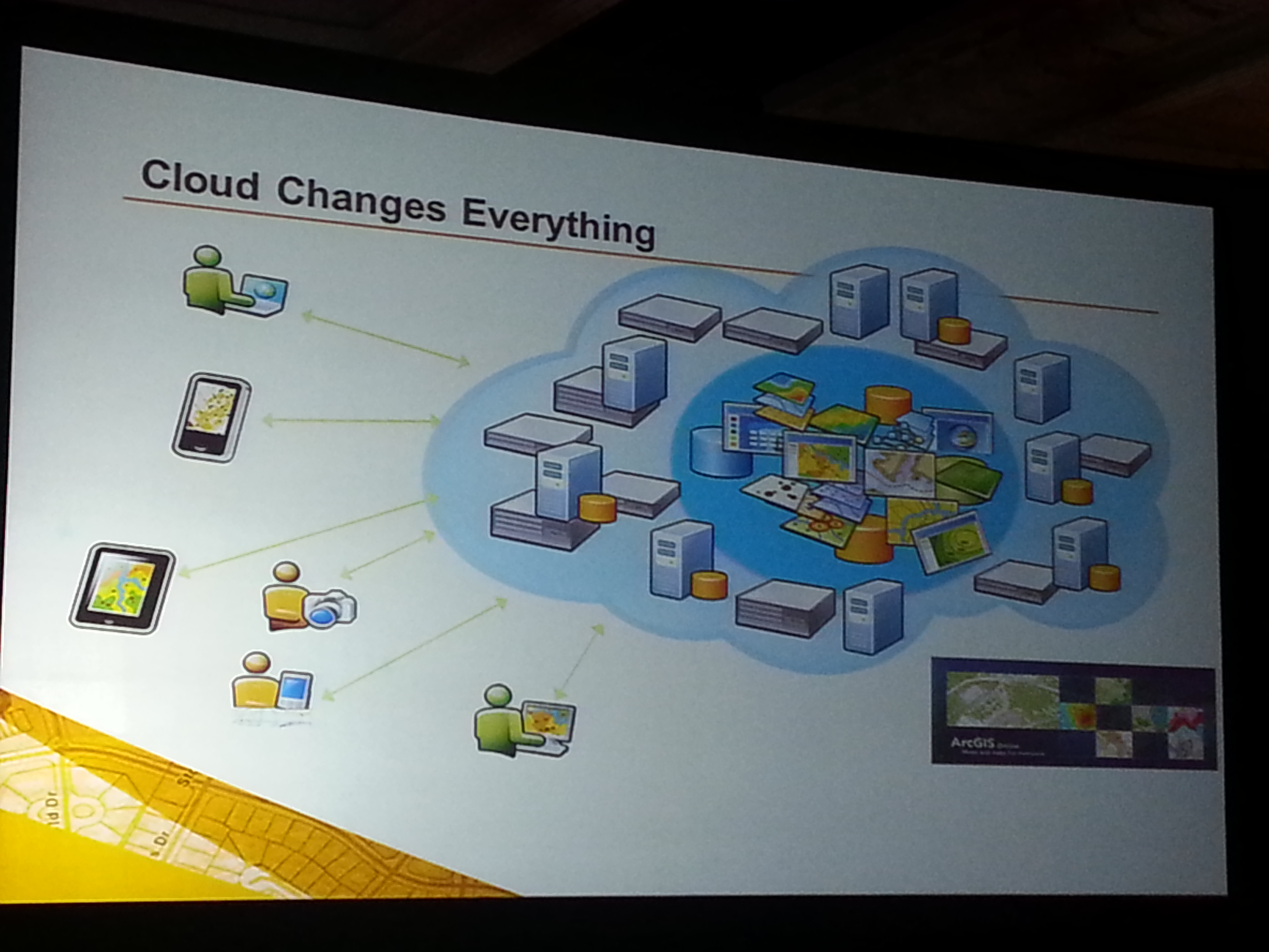
Cloud-based GIS: Esri is pushing cloud-based GIS hard. It’s a significant transformation, and there’s no turning back. During the plenary session, Jack announced that starting with ArcGIS 10.2, each license will also include a subscription to ArcGIS online. The cloud is a natural segue into Big Data.
More Data: If GIS software is the engine, then data is the fuel. More data usually translates into more apps. More granular data usually translates into better decision-making capability.
Esri reported that 100 million square miles of imagery was added or updated to ArcGIS online. DigitalGlobe announced that ArcGIS Online users will now have access to DigitalGlobe’s Global Basemap, FirstLook, and Multispectral Premium Services.
More Apps: Taking a lesson from Apple, Jack reported that “in a couple of months Esri will introduce an itunes-like appstore for GIS apps.” Seeing how GIS apps are largely customized, it will be interesting to see what this offers to the user community. It’s a super-smart idea from an Esri strategy perspective, allowing users to derive greater value from their Esri investments.
3D: Esri is spending time promoting 3D online. Jack said, “Once you get there, it’s hard to leave. 3D is a major footprint for us.” Ten years ago, I was involved with 3D visualization in landscape architecture and accident reconstruction. Generating 3D models was a painfully slow process. Jack is correct. If you can generate 3D visualizations relatively easily and inexpensively, why would you stay in 2D? This is the future. Check out Autodesks’s free Recap software for easily generating 3D visualizations from scan data and photos (even from your smartphone).
The most interesting take-aways from the Esri International User Conference:
Most interesting quotes from the Esri International User Conference:
• “One quarter of all Esri licenses are used by NGO’s or non-profits at little or no cost.” — Jack Dangermond, Esri
•”The poorest of the poor must obtain the best education possible. Information will be the fourth pillar of democracy in 21st century.” — Dawn Wright, Esri
• “In the past year, ArcGIS online has transformed from a web mapping tool to a true GIS.” — Jack Dangermond, Esri
• “Gangs are a business too, and they recruit (kids) earlier than companies do. To get a job, you have to graduate from college. What do you want these kids to be? If you’re not going to tell (them) what to do, (they’re) just going to go over here (to the gangs). Our system is broke.” — Will.I.Am
If you missed it, I along with Michael Dennis (Geodesist, NGS) were guests on the NSPS Radio Hour <ACSMJuly22_2013>. We talked about geodesy, LightSquared, and a few other subjects. It’s anMP3 file so you can download it onto your smartphone, i device or computer to listen at your convenience.
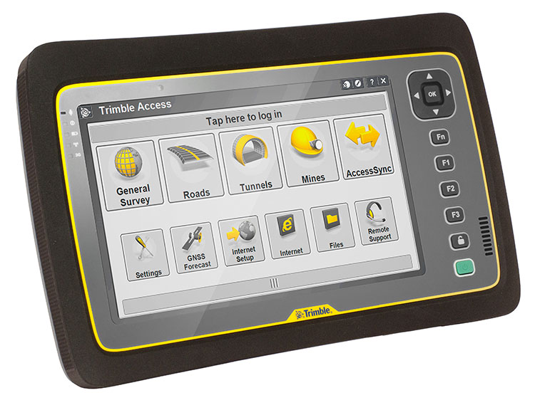
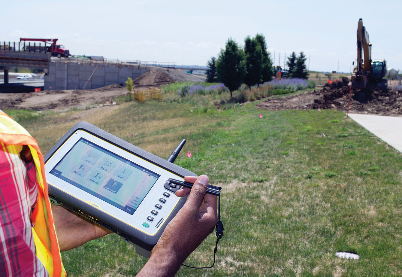
Trimble introduced today its next-generation Trimble Tablet PC for surveying. The Trimble Tablet is a lightweight, rugged and highly mobile field computer that can operate with Trimble’s suite of receivers and total stations to provide a complete surveying solution. With Trimble Access field software onboard, the Trimble Tablet streamlines the flow of information between the field and office while also allowing surveyors to run the applications they need to perform office work directly from the field.
The Trimble Tablet offers a 7-inch capacitive multi-touch screen in an easy-to-hold form factor that measures 6.3 inches x 9.6 inches and weighs three pounds. An extended battery set provides up to 16 hours of operation.
With the Microsoft Windows 7 Professional operating system, a 1.6 GHz Intel Atom dual-core processor, 4 GB RAM and 128 GB of flash-based storage onboard, the Trimble Tablet allows surveyors to run a variety of the applications they need to perform office work fast and reliably. Connectivity via Bluetooth, Wi-Fi and a built-in 3.75G GSM cellular data modem enables manageable and efficient workflows so surveyors can remain connected wherever networks are available. With the Trimble Tablet, surveyors can check their work and deliver it to clients without a trip back to the office.
Using the multi-touch capacitive touchscreen, surveyors can type, pan, and zoom with their fingers, a stylus or capacitive gloves. The large display features new technology created specifically to enhance sunlight readability. Viewing data, maps and applications is also easier so that surveyors can unlock the full potential of Trimble VISION instruments and applications dependent on highly visual data and graphic interfaces. Jobsite documentation is possible using the Trimble Tablet’s built-in 5MP camera with autofocus and built-in flash capabilities, while simultaneously providing geotag functionality using integrated GPS.
Ruggedized for extreme conditions, the Trimble Tablet holds an environmental rating of IP65 and can operate in temperatures of –30 °C to +60 °C (–22 °F to +140 °F), providing exceptional versatility, efficiency and portability. The full-color screen resides under a Gorilla Glass panel that is scratch and impact resistant.
“The ability to stay connected and complete office work from the field is becoming increasingly important to surveyors,” said Elmar Lenz, business area director of Trimble’s GNSS and survey handheld solutions. “With new features and functionality, the next generation Trimble Tablet rugged PC is an ideal solution that provides even more capability to surveyors—more memory, computing power, connectivity, data visualization, increased documentation and more.”
The Trimble Tablet rugged PC is available for ordering immediately through Trimble’s Survey distribution channel.
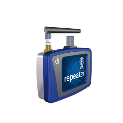
Settop Survey is offering the Settop Repeater, which allows network RTK rover use in areas of low- or non-GSM coverage by receiving differential corrections via radio. A new firmware update allows connection via any external radio to connect the repeater to precision agriculture systems or machine control. Repeater field application versatility is managed by intuitive software using a touchscreen.
Flowfinity Wireless, Inc., a provider of enterprise mobile applications, has announced a solution that enables businesses to quickly create and deploy mobile surveys for offline data collection and submission to a centralized database. Flowfinity’s survey customization and integration features help businesses improve productivity through better management of information collected in the field, the company said.
Survey data can be captured anywhere, even in locations without network coverage such as job sites, retail store stock rooms, or manufacturing plants. Feedback submitted in real time to a Flowfinity database provides actionable insights that allow businesses to improve efficiency and identify issues that require immediate attention, the company said. Information stored in the database such as survey results, locations, or customer data can also be easily retrieved on mobile devices.
Flowfinity mobile surveys configured using a point-and-click web-based editor can include dynamic fields such as checklists, drop-down menus, photos, signature capture, and GPS locations. Conditional field visibility allows users to be guided through the survey form based on previous answers. As soon as surveys are created, they can be immediately published to different user groups based on user permissions.
“Flowfinity helps businesses collect and access the information they need in the field, so that they can eliminate inefficient paper and spreadsheet processes,” says Larry Wilson, VP of Sales and Marketing, Flowfinity. “While many mobile survey solutions offer simple one-way data submission, Flowfinity provides two-way access to survey data from a centralized database, allowing feedback to be viewed or submitted anytime, anywhere.”
Flowfinity mobile survey software is available as a fully cloud-hosted or on-premise deployed solution.
Trimble is offering data integration capabilities between a variety of its planning, estimating and management software applications. The new capabilities are designed to boost the ease, accuracy and transparency of conceptual or detailed time- and cost-modeling estimates for general contractors and capital construction project owners.
At their core, the five new software versions within the Trimble Buildings’ Design-Build-Operate (DBO) portfolio provide a synchronized way to plan, track, and capture cost and work parameters before, during and after construction projects.
The new software versions include:
WinEst 15.0: database-driven software that uses a highly flexible spreadsheet for creating, adjusting and presenting cost estimates. Modelogix 3.2: software for collecting and analyzing past-project data and generating comprehensive cost models for future projects. Prolog 9.6.1: project-management and cost-control software for general contractors (GCs) and construction managers, streamlining project workflows and providing access to information from anywhere. Proliance 5.5: Office Application Pack – Microsoft Office extensions for Proliance software, combining capital planning and program and project management capabilities. Vico Office 4.2: virtual construction software, augmenting 3D models with constructability analysis and coordination, location-based quantity takeoff, 4D (time) scheduling and production control, and 5D (cost) estimating.
“With cost and productivity pressures facing the construction industry today, the ability to generate accurate estimates is vital — as is the need to integrate 3D models to time and cost,” said Mark Sawyer, general manager of Trimble Buildings’ General Contractor Division. “The updates to a variety of the core solutions in our DBO portfolio can help keep projects on track, on schedule, and within budget.”
At the earliest planning stage, when an owner proposes a new project and asks for a feasibility budget, the GC can use Modelogix to create a new project, and then push the cost model from Modelogix to WinEst to create a detailed estimate. Once the GC has been awarded the project, the WinEst estimate can be moved to Prolog as the official project budget for tracking and reconciliation of costs throughout the project lifecycle. At the project’s close, the reconciled budget can be sent back to Modelogix so that completed project data can be used to generate accurate parameter-driven cost models for future projects of similar scope. This “integrated cycle” can repeat with increasing accuracy over time and across projects as more types of estimates and budgets are created.
For building owners, the new Office Application Pack in Proliance software delivers similar benefits. Integration enables owners to develop detailed budget estimates directly from WinEst or conceptual budget estimates from Modelogix. Proliance also provides a new contingency-analysis tool, which uses statistical methods for recommending contingency amounts, based on the project risk profile represented in the Modelogix cost model. This structure provides a powerful way for project and building owners to build a library of detailed and conceptual estimates across a broad project portfolio.
For GCs and construction management firms working on building information modeling (BIM) projects, new integration between Vico Office 4.2 and Tekla Structures BIM software also improves project accuracy, with Vico Office 4.2 able to address the unique requirements of models generated in Tekla Structures.
With an increasing number of GCs using their own labor force to work with concrete or steel, the new Tekla model activation options in Vico Office 4.2 offer precisely tuned, location-based quantity takeoffs to improve the accuracy of scheduling and estimating created from today’s increasingly large and complex models. Tekla Structures users can also take advantage of Tekla’s Model Organizer to label model content so it is seamlessly registered as an element type (e.g., walls, slabs, beam profiles, rectangular columns, stairs, etc.) within Vico Office. These element types have specific quantity-calculation parameters, which help drive more precise quantity takeoffs.
“Tekla Structures provides enormous benefits as a modeling platform for GCs and Engineers. Our goal with the new publisher in Vico Office is to harness modeling specificity for construction-caliber quantity takeoffs, which in turn power estimates and schedules,” said Jon Fingland, business unit director of Trimble Buildings’ General Contractor Division. “This improved workflow from Trimble Buildings is yet one more way we are delivering critical project data when and where our customers need it.”
The new versions of WinEst, Modelogix, Prolog, Proliance and Vico Office are available now. Additional information on WinEst, Modelogix, Prolog, Proliance are available at www.meridiansystems.com. Information on Vico Office can be found at www.vicosoftware.com.
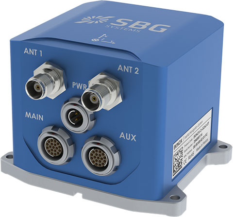
SBG Systems has added a new inertial system to its Ekinox Series. With integrated Dual Antenna GPS + GLONASS receiver, the Ekinox-D is a ready-to-use survey-grade inertial navigation system that provides consistent true heading (0.05°), SBG Systems said.
The Ekinox-D is a high-performance inertial navigation system that embeds a dual-antenna L1/L2 GNSS receiver to deliver more robust heading and position, while increasing satellite reception availability. Ekinox-D is an integrated system: GNSS data and inertial information are fused by an Extended Kalman Filter (EKF) to improve data integrity. This computation allows the system to achieve 0.05° roll, pitch, and true heading; 5-cm heave; and 2-cm RTK GNSS position.
The Ekinox-D is an all-in-one Solution for demanding applications. Instead of mounting separate GNSS receiver and inertial systems on a boat, car, or plane, the Ekinox-D can be installed and connect it to a camera, SONAR, or LiDAR system. With its 8-GB datalogger and its high output rate (200 Hz), Ekinox-D joins simplicity and performance for applications where robust heading is required such as surveying and hydrographic applications, unmanned system navigation, and auto testing.
The IP68 Ekinox Series brings robust, maintenance free, and cost-effective MEMS to the next level thanks to a drastic selection of high-end MEMS sensors, an advanced calibration procedure, and powerful algorithm design, SBG Systems said, adding that compromise is no longer required between high accuracy and cost.
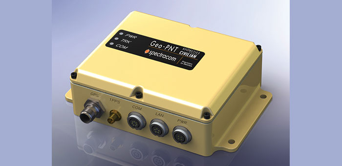
Spectracom announced today a strategic partnership with Geodetics Incorporated of San Diego, California. The partnership includes a variety of initiatives to enhance each company’s customer reach, channels, products and technology.
The partnership includes a distribution agreement for Geodetics’ Geo-iNAV inertial navigation products. Spectracom will offer Geo-iNAV alongside its portfolio of precision timing, test and simulation equipment. Geo-iNAV is a fully integrated GPS-aided inertial navigation system that provides real-time, high-precision positioning and navigation solutions for manned and unmanned air, sea and ground vehicles. It combines GPS and sensor fusion to achieve centimeter-level real-time positioning and navigation for dynamic platforms.
“In line with our long heritage in delivering robust precision time and frequency products and services, we understand the challenges our customers face to adopt and adapt new and often disparate GPS and GNSS technologies,” said Spectracom President and CEO, Lisa Withers. “We believe our partnership with Geodetics will help to simplify the integration of complex positioning, navigation and timing technologies and provide our customers with a broad range of GPS and inertial navigation platforms readily suited for today’s dynamic and mobile environments.”
Geodetics President and CEO Lydia Bock added, “Spectracom’s global reach immediately widens the playing field for our inertial navigation products and technology. They have a keen sense of customer’s needs for the convergence of PNT in both military and commercial applications.”
As the GNSS eco-system expands to support mission critical applications, so must the prevalence of interoperability and signal fidelity, and ultimately PNT applications must be able to withstand the temporary loss of GPS due to factors such as signal obscuration, Spectracom said. As such, contemporary GNSS signal management solutions must be resilient to various GPS impairments as required of the application. Geo-iNAV delivers this capability through six configurations. It is available in commercial as well as SAASM GPS configurations as well as a choice of IMU depending on accuracy requirements. It offers a low SWaP (size, weight and power) profile for autonomous vehicles and payloads on manned vehicles to meet a wide range of applications.
As a part of Spectracom’s broader initiative to provide a comprehensive portfolio of GNSS signal management products, systems and services, the Geo-iNAV is the first in a series of compact and rugged solutions specific to PNT applications. In addition to simplifying complexity for its customers with contemporary, modular platforms, Spectracom’s market reach, together with the technical strengths of their partners such as Geodetics will accelerate time to market and aggregate the resources necessary to support unique and changing needs for precision references, simulation and signal test and analysis.
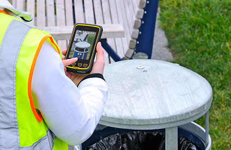
Trimble introduced today new functionality and configuration options for its Juno T41 rugged handheld computer. In addition to a handheld computer and smartphone configuration, the series now includes enhanced, real-time 1-2 meter GPS accuracy and high-speed 1D/2D barcode imaging technology.
The new configurations are in addition to the capabilities already available in Trimble’s Juno T41 handheld computer. All models are built to meet military-grade standards of ruggedness for drops, temperature, altitude, humidity extremes, vibration, chemical exposure and shock with either an IP65 or IP68 rating for water and dust.
“The Juno T41 is truly a workhorse,” said Jim Sheldon, general manager of Trimble’s Mobile Computing Solutions Division. “We designed it for today’s worker who needs a functional field computer that is tougher than any consumer-grade device, while providing easy-to-use features and convenience that people have come to expect.”
All Juno T41 handheld computers feature a 1 GHz processor and 512-MB RAM with either Android 4.1 or Microsoft WEHH 6.5 operating systems. Other standard features include an 8-MP integrated camera, multi-touch capacitive 4.3” sunlight-readable display and 9 PIN Serial and USB ports, all-day battery life and 2-4 meter GPS accuracy capability.
The Juno T41 X configuration is designed to replace Bring Your Own Device (BYOD) smartphones with SMS text and 3.75 cellular data transfer capabilities on GSM networks worldwide.
To increase real-time positional accuracy, the Juno T41 G configuration provides enhanced, 1-2 meter GPS acquisition capability and it can be combined with other Juno T41 configurations, including the smartphone or the 1D/2D Imager.
The Juno T41 G supports the GPS L1 band and offers reliable performance in reduced signal environments. Workers who have to move from place to place to collect remote assets won’t have to waste time waiting for a system warm-up: the Juno T41 G tests at an average cold start of less than 38 seconds, and a warm start of less than 6 seconds. The G configuration handheld collects data in real-time at 1-2 meter accuracy, while also capturing Raw Data Output for post-processing applications. The Juno T41 G is designed to work with Satellite Based Augmentation Systems (SBAS), third-party Real-Time Networks (RTN), and corrections services from Trimble.
Trimble Scan technology in the Juno T41 S reads a variety of traditional 1D barcodes as well as 2D matrix codes, and captures signatures and images. These features are customizable using the Trimble “Scan Agent” application. Enterprises can also use the Software Development Kit (SDK) to optimize applications to meet specific customer needs. Omni-directional reading capabilities along with high-motion tolerance allow for rapid, accurate scanning from virtually any angle or orientation from the handheld to the barcodes.
With these additions, the Juno T41 rugged handheld series has a configuration that can meet a wide variety of business needs in a single rugged device, Trimble said. Users can mix and match the capabilities to create the Juno T41 that is right for their specific business needs: combine the X smartphone with barcode imaging in the Juno T41 XS; add enhanced GPS for the XG. Combine barcode imaging with enhanced GPS and smartphone capabilities in the XGS.
 Trimble introduced today the Trimble AP15, the latest member of the AP series of OEM GNSS-Inertial board sets. The introduction was made at the AUVSI 2013 Conference and Exhibition, being held in Washington, D.C.