Category: Transportation

  • Research roundup: Autonomous applications in transportation

    Research roundup: Autonomous applications in transportation

    Image: gorodenkoff/iStock/Getty Images Plus/Getty Images
    Image: gorodenkoff/iStock/Getty Images Plus/Getty Images

    GNSS researchers presented hundreds of papers at the 2022 Institute of Navigation (ION) GNSS+ conference, which took place Sept. 19–23, 2022 in Denver, Colorado, and virtually. The following four papers focused on autonomous applications in transportation. The papers are available here.

    Addressing integrity monitoring of autonomous navigation

    There are critical issues for the integrity monitoring of autonomous navigation applications, which include an adequate uncertainty budget in the observation domain, redundancy for the determination of the navigational states, and the capability of fault detection and exclusion.

    Several aspects are addressed in the paper, including how to: determine interval bounds to handle GNSS multipath effects in urban environments, realize fault detection and exclusion based on constraint satisfaction and set membership, and improve the detector using weighting models.

    The authors of the paper aim to contribute to the alternative integrity approach based on interval and set representations for bounding and propagating system uncertainty. Simulated and real-world experiments are carried out to demonstrate the feasibility of the authors’ proposed methods.

    The authors note that statistical evaluation of integrity will not always suffice due to the presence of remaining systematic uncertainty, but state the alternative integrity approach will contribute to future autonomous navigation applications.

    Su, Jingyao; Schön, Steffen; “Advances in Deterministic Approaches for Bounding Uncertainty and Integrity Monitoring of Autonomous Navigation.”

    Estimation and reference systems in automation

    For a high level of automation, estimation is crucial, and to achieve a full and reliable navigation evaluation, a trustable reference system needs to be developed.

    Although the presence of a reference system and of an inertial measurement unit with GNSS through the multi-sensor fusion scheme was integrated, in GNSS-denied or challenging environment the navigation solution could not be accurately estimated and still needs to be fixed.

    The authors of the paper propose new strategies to better estimate the lidar-based position uncertainty and to update the reference system.

    The first strategy proposed involves determining the appropriate position error covariance matrix, based on the Hessian matrix and the scale of covariance obtained from a normal distribution transform (NDT) scan matching technique and the geometric dilution of precision computed from the distribution of point cloud segments in each scan.

    In the second strategy proposed in the paper, the updated reference system was post-processed according to the loosely coupled INS/GNSS/NDT integration scheme with a forward and backward smoothing process.
    The results of the proposed strategies indicated that the updated reference system provides more reliable navigation estimation compared to an existing reference system from commercial software and can be used for accurate evaluation of positioning, navigation and timing with automated vehicle applications.

    Srinara, Surachet; Chiu, Yu-Ting; “Adaptive Covariance Estimation of Lidar-Based Positioning Error for Multi-Sensor Fusion Scheme with Autonomous Vehicular Navigation System.”

    Evaluating TerraStar-X

    GNSS performance using typical, low-cost GNSS devices in vehicles is not enough to achieve the positioning and availability needed for lane-level accuracy on autonomous vehicles. The antenna and receiver hardware available in standard vehicles limits the position accuracy and convergence performance. These limitations make the positioning more susceptible to error sources such as receiver multipath, noise, carrier tracking and stability.

    GNSS correction services with additional design considerations and sophisticated algorithms are needed to work within the constraints of automotive-grade GNSS devices to achieve the performance required for lane-level positioning.

    TerraStar X technology from NovAtel enables these applications. It includes an orbit and clock determination system (OCDS), which produces a set of corrections, precise satellite orbits and clocks, and satellite-specific biases for individual signals augmented by the computation of additional regional corrections.

    The authors of the paper outline the design and performance of the combined OCDS and regional correction system. They demonstrate the performance of the TerraStar X technology across a variety of applications.
    The addition of regional corrections enables automotive and mass-market applications to achieve in-lane positioning in seconds, using any dual-frequency, dual-constellation GNSS hardware. The result is software that provides a continuous stream of multi-constellation, multi-frequency GNSS corrections — enabling a correction service that makes the affordable GNSS device ecosystem possible.

    Regional corrections also improve the performance of survey-grade GNSS receivers.

    Mervart, Leos; Lukes, Zdenek; Alves, Paul; “TerraStar X Technology: Design of GNSS Corrections for Instantaneous Lane-Level Accuracy on Large Scale Connected Vehicles and Devices.”

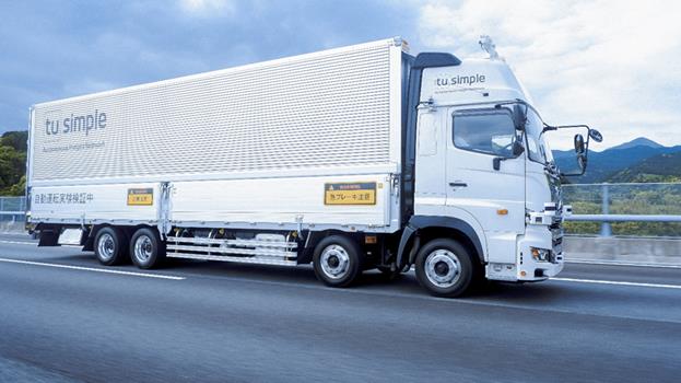
    Solving the localization problem in autonomous driving

    The localization problem in autonomous driving imposes two criteria on the navigation solution: accuracy and reliability or integrity. According to the authors of this paper, solving the localization problem is a key requirement to enabling the development of autonomous platforms.

    This paper presents AUTO, a real-time integrated navigation system that tightly integrates INS, GNSS-RTK, odometer, and multiple radars sensors with high-definition maps to achieve a high-rate, accurate, continuous, and reliable navigation solution. It also shows how AUTO leverages a tight integration of imaging radars with other traditional sensors to provide a robust navigation solution with corresponding estimates of the uncertainty.

    The AUTO solution was tested in a variety of environments and locations, including a range of conditions such as winter weather, to assure the robustness and reliability required by autonomous applications.

    The results demonstrate the lane level accuracy of the solution in a variety of challenging urban and downtown environments. Additionally, the tight integration enables the determination of protection levels to describe upper bounds on the uncertainty.

    The results in the paper are illustrated using a Stanford Diagram, along with a user-defined alert limit to describe the solution integrity and availability. The proposed algorithm uses a map matching technique between the imaging radar data and a globally referenced high-definition map to better estimate the solution uncertainty and protection levels.

    AUTO’s tightly integrated approach to integrity monitoring means uncertainties and protection levels can be determined even in areas where the system may experience extended periods of GNSS unavailability.

    Krupity, Dylan; Chan, Billy; Ali, Abdelrahman; Salib, Abanob; Georgy, Jacques; Goodall, Christopher; “Integrity Monitoring and Uncertainty Estimation with AUTO’s Non-linear Integration of Multiple Imaging Radars and INS/GNSS for Autonomous Vehicles and Robots.”

  • Autonomous trucks begin testing on Japanese expressway

    Autonomous trucks begin testing on Japanese expressway

    Image: TuSimple Holdings
    Image: TuSimple Holdings

    TuSimple Holdings, a global autonomous driving technology company, has started Level 4 autonomous test runs on the freight corridor that connects the major cities of Tokyo, Nagoya and Osaka.

    In 2021, TuSimple Japan, a subsidiary of TuSimple, completed a series of safety validation and testing work of its autonomous driving system with a truck provided by a Japanese OEM. In January, TuSimple Japan commenced regular testing on the Tomei Expressway.

    It has been reported that the Japanese government is planning to launch a self-driving lane on some sections of the new Tomei Expressway by 2024 and will allow commercial operation of SAE Level 4 fully autonomous trucks in 2026.

    TuSimple is developing a commercial-ready, fully autonomous (SAE Level 4) driving solution for long-haul, heavy-duty trucks. As of March 2023, TuSimple trucks have recorded more than 10 million cumulative miles through testing, research, and freight delivery.

  • UAVOS, Bayanat partner to supply autonomous helicopters

    UAVOS, Bayanat partner to supply autonomous helicopters

    Photo:
    Image: UAVOS

    UAVOS has been selected by Bayanat, a provider of artificial intelligence-powered geospatial solutions, to deliver its unmanned aircraft system (UAS) for a variety of applications, including aerial photography and perimeter control. The UAS consists of two UVH 25EL unmanned autonomous helicopters powered by electric motors, a ground control station, and various sensor payloads — including a multispectral camera, lidar, and digital and thermal cameras.

    The autonomous helicopter’s advanced capabilities of long endurance — up to 1.5-hours — along with its camera capabilities, enable the UVH 25EL to carry out accurate mapping within a radius of 67 km.

    The UVH 25EL has a practical load weight of 5 kg. These capabilities enable high performance as well as maximum operational flexibility for applications such as coastal security, search and rescue, and advanced aerial photography missions.

    UAVOS also provides full operational support, including training, and a fundamental review of the UAS’s possible uses.

  • Hexagon, Hitachi Zosen partner to provide TerraStar-X Enterprise corrections in Japan

    Hexagon, Hitachi Zosen partner to provide TerraStar-X Enterprise corrections in Japan

    Photo:
    Image: gremlin/E+/Getty Images

    Hexagon’s Autonomy and Positioning division and the Hitachi Zosen Corporation have signed an agreement to bring the TerraStar-X Enterprise correction service to Japan.

    Hitachi Zosen manages a network of 1,300 reference stations operated by the Geospatial Information Authority of Japan. Nippon GPS Data Service, a subsidiary of Hitachi Zosen, will provide Hexagon with GNSS data from this network.

    With access to this data, Hexagon will provide the TerraStar-X Enterprise GNSS correction service, which is suitable for automotive applications. The service is now available for testing in the Tokyo area and will be expanded across Japan.

    Hexagon has operational testbeds for TerraStar-X Enterprise in several locations in North America, Europe and China that provide reliable, lane-level accuracy in under a minute. With the addition of a testbed in Japan, vehicle manufacturers and technology providers can use the same design for all their correction service requirements.

    By utilizing data created from GSI network observations, Hexagon’s TerraStar-X Enterprise will ensure fast convergence to lane-level accuracy and is available to support large-scale programs with functional safety requirements in Japan.

  • KP Performance Antennas releases line of IoT antennas

    KP Performance Antennas releases line of IoT antennas

    Photo:
    Image: KP Performance Antennas

    KP Performance Antennas, an Infinite Electronics brand and a manufacturer of wireless network antennas, has released internet of things (IoT) multiband combination antennas. The antennas are designed to enhance connectivity for vehicle fleets and base stations.

    The IoT multiband combination antennas have dedicated ports for cellular, Wi-Fi and GPS bands. They are also indoor and outdoor IP69K rated and can withstand harsh environmental conditions, such as extreme temperatures, water and dust.

    The antennas are suitable for transportation emergency response and agriculture applications.

    KP Performance Antennas’ IoT multiband combination antennas are in-stock and available now.

  • Mapbox collaborates with Toyota and Lexus on in-vehicle navigation tech

    Mapbox collaborates with Toyota and Lexus on in-vehicle navigation tech

    Image: Mapbox
    Image: Mapbox

    Toyota and Lexus are now utilizing Mapbox‘s technology to deliver navigation features. Mapbox’s maps software development kit incorporates a map design that complements Toyota’s multimedia system, making turn-by-turn navigation intuitive for drivers.

    With Mapbox’s navigation technology, Toyota can push updates to the design to vehicles in real time, so that the driver’s experience continues to be up to date. As more vehicles hit the road with the next-generation multimedia system, drivers of those vehicles will benefit from utilizing more engaging and robust navigation software that can be updated in a manner similar to updates on their smartphone.

    Toyota’s designers are also able to modify the look and feel of the navigation experience via Mapbox Studio, enabling map design updates to be rolled out to all vehicles instantaneously.

  • Start your engines: How F1 drivers use GPS

    Start your engines: How F1 drivers use GPS

    Credit: vvectors/iStock/Getty Images Plus/Getty Images
    Credit: vvectors/iStock/Getty Images Plus/Getty Images

    GPS plays a quiet, but integral role in Formula 1 (F1) racing. In a sport where split-second reactions are vital, GPS helps drivers and their teams to improve race to race and navigate tracks safely.

    GPS is used to determine the speed of the car, which is beneficial for such things as straight line aerodynamic testing. It also provides data as to how fast F1 cars accelerate, enabling drivers and their teams to predict how much power their competitors are producing on the track.

    The streaming of location data can be converted to telemetry, such as what track maps viewers see on F1 broadcasts, that can determine which driver in a head-to-head scenario was faster on each sector of the track. This data is then used to work out strengths and weaknesses of cars relative to each other.

    In addition, GPS plays a large role in creating a safe racing space.

    If a driver is slowing down to recharge a battery, make space for a hot lap, or cool down tires between runs, and another car is entering the track at full racing speed, this creates safety concerns. GPS receivers on the cars and radio links to transmit their positions are used to show where cars are on the track at any moment. Teams use this information to manage traffic during sessions such as qualifying races to improve overall track safety.

    The impact of losing live location data was seen at the 2023 Australian Grand Prix FP1 in late March. At the opening practice session, a red flag was flown due to loss of location data triggered by a glitch in the distribution of live tire information. This caused several near-misses on the track because drivers no longer received traffic advisory calls from their team, reported AutoSport.

    For more on using GPS in F1, check out the video below by WTF1.

  • Leica Geosystems advances autonomous mobile mapping

    Leica Geosystems advances autonomous mobile mapping


    Image: Leica Geosystems
    Image: Leica Geosystems

    Leica Geosystems, part of Hexagon, has released an addition to its Leica Pegasus TRK portfolio of mobile mapping solutions, the Leica Pegasus TRK100. The mobile mapping system is a geospatial solution built for large-scale infrastructure measurement and digital twin creation.

    The Pegasus TRK100 is small and light, making it easy to mount on any vehicle. The mobile mapping system features the same modular hardware approach that enables users to add more cameras to expand the range of use cases.

    Image: Leica Geosystems
    Image: Leica Geosystems

    With its advanced mapping capabilities, the Pegasus TRK100 enables GIS professionals to visualize and understand the location of assets to help make the right decisions, improve asset management, and support infrastructure building and maintenance. The Pegasus TRK100 combines artificial intelligence and a learning algorithm to enhance and optimize the clarity of points in post-processing for improved accuracy.

    The versatility of the Pegasus TRK100 suits a variety of applications in diverse industries, including telecommunications, utilities and road maintenance.

    “The Leica Pegasus TRK100 advances autonomy and artificial intelligence in mobile mapping, removing manual process steps and providing actionable insights for informed decision,” Christian Schäfer, business director mobile mapping at Leica Geosystems, said. “It empowers GIS professionals to create the maps they need, collect the information they require, and visualize the data in a way that immediately aids understanding.”

  • SBG Systems now compatible with Marinestar corrections

    SBG Systems now compatible with Marinestar corrections

    Credit: SBG Systems
    Credit: SBG Systems

    The latest versions of Ekinox, Apogee, and Navsight from SBG Systems are now fully compatible with the Fugro Marinestar G4+ precise point positioning (PPP) solution.

    Fugro Marinestar G4+ is a solution that uses satellite-based augmentation to deliver centimetric positioning accuracy without depending on a local base station. This product is suitable for maritime operations where precise positioning is important.

    With this compatibility, users can now use Marinestar correction with SBG products both via L-Band or NTRIP distribution.

    The combination of high-performance correction with inertial measurements from SBG Systems enables users to achieve accuracy in attitude and position for maritime applications. This is suitable for applications such as marine construction, dredging, hydrography and more.

  • ESA and One Sea Association partner on autonomous shipping

    ESA and One Sea Association partner on autonomous shipping

    Credit: bfk92/iStock/Getty Images Plus/Getty Images
    Credit: bfk92/iStock/Getty Images Plus/Getty Images

    The European Space Agency (ESA) and the One Sea Association — a non-profit global alliance of commercial manufacturers, integrators and operators of maritime technology, digital solutions, and automated and autonomous systems — are partnering to promote the development of space-enabled services that aim to support the maritime sector’s transition to autonomous shipping.

    Autonomous shipping enables safe, commercially viable and environmentally sustainable maritime operations.

    This partnership will combine expertise in the maritime sector and in autonomous shipping from One Sea with technical competence and mandate through the Business Applications and Space Solutions program from ESA to support the development and demonstration of space solutions in addressing user needs.

  • STMicroelectronics introduces automotive inertial module

    STMicroelectronics introduces automotive inertial module


    Credit: STMicroelectronics
    Credit: STMicroelectronics

    STMicroelectronics has released the ASM330LHB automotive-qualified MEMS inertial-sensing module, which provides accurate measurements for a wide variety of vehicle functions. With the dedicated software provided, ASM330LHB also addresses functional-safety applications up to ASIL B1.

    ASM330LHB contains a 3-axis digital accelerometer and 3-axis digital gyroscope that provide a six-channel synchronized output. The module’s high-accuracy inertial measurements are used to improve the precise positioning of a vehicle.

    The accelerometer and gyroscope maintain high stability over time and temperature and have very low noise for an overall bias instability of 3°/hour. Specified over the extended temperature range, -40°C to 105°C, the ASM330LHB has multiple operating modes that let designers optimize the data-update rate and power consumption.

    ASM330LHB can support advanced driver assistance systems or vehicle-to-everything communication, as well as help stabilize sensing systems such as radar, lidar and cameras, and assist semi-automated driving applications up to L2+. Additionally, ASM330LHB can be used to enable a variety of functionalities in the body of a vehicle.

    ASM330LHB was developed with the automotive functional-safety standard ISO 26262 — the ASIL B compatible software library has been certified independently by TÜV SÜD. By implementing dedicated safety mechanisms, including data integrity and accuracy, the library ensures compliance with ASIL B automotive systems.

    With the companion software engine, the ASM330LHB supports the growing adoption of automotive systems that require safety integrity up to level B. The combination of two ASM330LHB sensor modules for fail-safe redundancy delivers resilient contextual data for driver-assistance applications such as lane centering, emergency braking, cruise assistance and semi-automated driving.

    ASM330LHB is AEC-Q100 qualified and in production now in a 2.5 mm x 3.0 mm 14-lead VFLGA package.

  • Qualcomm and Xiaomi demonstrate mobile meter-level positioning capabilities

    Qualcomm and Xiaomi demonstrate mobile meter-level positioning capabilities

    Qualcomm Technologies and Xiaomi have verified meter-level positioning in the Xiaomi 12T Pro powered by the Snapdragon 8+ Gen 1 mobile platform, in Germany.

    Accuracy verification tests, including driving tests, were conducted by Qualcomm Technologies, Xiaomi, and Trimble in various scenarios such as open-sky rural roads and urban highways. The companies’ solutions demonstrated meter-level positioning variance at a 95% confidence level.

    This level of accuracy in a commercial smartphone is enabled through Qualcomm meter-level positioning for mobile in combination with Trimble RTX correction services. When integrated with Snapdragon mobile platforms, Trimble RTX enhances the phone’s positioning capabilities.

    Meter-level positioning accuracy can improve smartphone user experience in several scenarios, including mapping, driving, and other mobile applications. It enables greater accuracy when using ridesharing applications to identify pick-up locations for both driver and rider, fitness applications to track users’ movements, and in-vehicle real-time navigation applications for increased lane-level accuracy with greater map details and more accurate directions.