Category: Uncategorized

  • CSR Webinar Registration

    Indoor Location with SiRFusion from CSR


    PrintDate: December 4, 2014

    Time: 10 a.m. PST / 1 p.m. EST

    Duration: 1 hour (plus extra time for Q&A)

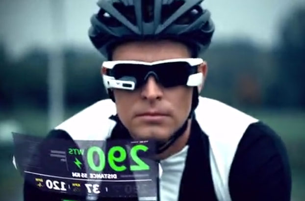
    Indoor location has become a hot topic, carrying the promise of ubiquitous location and user context. Set to take social networking, analytics, content targeting and enterprise efficiency applications to a new level, the technology hails from a high pedestal.

    SiRFusion TM from CSR is a new, innovative and technically disruptive solution, combining multiple sources of information to create high quality and accurate indoor positioning, without the need for new infrastructure or site surveys. Join CSR’s experts in Indoor Location, Dave Huntingford and the CSR SiRFusion team, to learn how this innovative indoor location technology can create new revenue streams for you through accurate understanding of your customers’ location indoors. Webinar topics:

    • Commercial applications for indoor location
    • SiRFusion – solving the indoor challenge via fusion of multiple technologies, including WiFi, BT Smart, GNSS & MEMS
    • Challenges and solutions for Pedestrian Dead Reckoning & BT Smart beaconing
    • SiRFusion performance results in real world situations

    Register now to learn how SiRFusion will enable new services, applications and social media for you.

    Featured Speakers:

    Dave_huntingford_120Dave Huntingford, Director of Product Management for Location, CSR

    Dave Huntingford, Director of Product Management for Location, joined CSR in June 2009 via the acquisition of SiRF Technology, Inc. In his current position he is responsible for the indoor location product portfolio which includes managing the SiRFusion portfolio and the expansion of CSR location technology from GPS to GNSS, Hybrid and Sensor Fusion. Prior to joining CSR, Dave was Director of GPS Product Management at SiRF. Previous to that he was Global Product and Marketing Manager for Motorola GPS products where he introduced the world’s first single-die commercial GPS receiver.

    Dimitri Rubin, Sr. Director of Emerging Technologies, CSR

    Nicolas_Graube_120Nicolas Graube, Fellow, Advanced Algorithms, CSR

    Nicolas Graube is leading the advanced algorithms group in Technology Platform Engineering (TPE) at CSR. Directly reporting to the Chief Innovation Officer, this group is tasked to cover many aspects of algorithmic development, in particular, in-doors location technologies, present and future, contribution to the field of voice and music applied to the Automotive Market and IoT and their applications within the context of Smart Buildings. Expertise in the domain of system design and location specifically has been gained over a period of more than twenty years, starting at Cambridge EuroPARC in the early 90’s, using Olivetti’s Active Badges, then more recently providing Location Solutions in the Cellular domains (GSM,UMTS), and presently addressing in-doors challenges using both WiFi, Ble and Dead-Reckoning. Nicolas Graube has a Doctorate from Pierre et Marie Curie (Paris VI) University in Computer Sciences.

    register-orange

  • Bentley Systems Acquires SITEOPS for Site Engineering

    Panther_Center_3_SITEOPS-W

    Bentley Systems, Inc., a company dedicated to providing comprehensive software solutions for sustaining infrastructure, has acquired Blueridge Analytics, provider of SITEOPS – a site design optimization “software at your service.” SITEOPS uses cloud-based computing techniques to empower site development professionals to move beyond engineering to “optioneering,” which enables the exploration of engineering alternatives and their costs. This substantially improves the choices considered for any site development, including commercial, industrial, institutional, campus, and residential projects.

    Blueridge Analytics is based in Charlotte, North Carolina.

    SITEOPS enables civil engineering professionals, real estate developers, and land planners to:

    • perform site configuration simulations that fully assess millions of layout, parking, grading, and drainage options for a site within hours instead of spending months evaluating a handful of options,
    • produce preliminary cost estimates and conceptual designs faster,
    • optimize site designs through advanced optioneering, and
    • minimize overall costs while ensuring engineering quality.

    Users of SITEOPS include Stantec, Horrocks Engineers, Langan Engineering and Environmental Services, Timmons Group, and WSP.

    “During the past few years we’ve been tracking SITEOPS technology and its performance in order to authoritatively validate its breakthrough capabilities,” Bentley Systems CEO Greg Bentley said. “Feedback we’ve received from engineering teams and owners has substantiated SITEOPS’ tremendous potential in enabling site development teams to deliver new value to owners. Through the power of site optioneering, owners can be confident that their engineers have considered the best choices and arrived at the most cost-effective solutions for the constraints of their respective sites. Hence, I’ve become convinced that site engineering should no longer be done any other way.”

    “To date, the development of SITEOPS technology has focused on continuous improvement to conceptual designs,” said Mike Detwiler, formerly president and CEO of BLUERIDGE Analytics and now Bentley vice president of SITEOPS product development. “Now, within Bentley’s comprehensive portfolio, SITEOPS’ BIM advancement can contribute throughout project delivery. Accordingly, an initial priority will be to complete the end-to-end workflows that Bentley is uniquely able to offer — from site development through detailed design and construction modeling.”

  • Satlab Geosolutions Adds Americas Office, Appoints Phil Gabriel

    Satlab Geosolutions Adds Americas Office, Appoints Phil Gabriel

    Satlab products include (from left) the SL600 6G GNSS receiver, the SL300 6G GNSS receiver, and the SL55 controller. Photo: Satlab Geosolutions AB
    Satlab products include (from left) the SL600 6G GNSS receiver, the SL300 6G GNSS receiver, and the SL55 controller. Photo: Satlab Geosolutions AB

    Swedish-based survey and GIS equipment maker Satlab Geosolutions AB has expanded into the U.S. and Americas with the creation of a new sister company Satlab Geosolutions (USA), Inc., based in Scottsdale, Arizona. Phil Gabriel has been named managing director of the USA office.

    Setting up a formal base of operations in the U.S. will allow Satlab to better service their clients and expand their customer base in the U.S., Canada, Mexico and Latin America, a company release said. As past president of Hemisphere GNSS, Gabriel brings to the team his many years of experience in the survey, GIS, GNSS, machine control, marine and navigation industries, Satlab said.

    The U.S. location will sell, support and service the new product lineup being introduced at InterGeo in Berlin, Germany, on October 7.  Satlab is seeking dealers to expand its business throughout the Americas.

    “The addition of a U.S. office is an exciting next step for us, after successful expansion into Turkey and the Czech Republic in the last few years,” said Bjorn Agardh, CEO of Satlab Geosolutions AB.

    “Our products have been well received and continue to perform extremely well,” added Birol Gucluer, CTO and partner of Satlab.

    “I’m excited to join Bjorn and Birol, extending their success by ensuring their high standards in customer service are maintained here in the Americas,” Gabriel said.

    Satlab invites Survey and GIS dealers to meet the expanded team at InterGeo October 7-9 in Berlin, where they will be introducing several new models of their popular receivers and handhelds.

  • Interactive Esri Maps Explore U.S., Global Poverty

    Esri has created two maps that explain how poverty affects billions of people around the world.

    Poverty in America

    More than 50 million people in the United States live in poverty. Explore the Poverty in America maps to learn more about the levels of poverty in your state and city.

    USA_poverty

    Global Poverty Map

    Through the use of storytelling, videos, and interactive maps, Esri’s map provides a look at one method of measuring global poverty. This measure, called the Multidimensional Poverty Index (MPI), addresses poverty through an integrative approach.

    Global_poverty

  • IFEN Officially Launches SX3 Software Receiver

    IFEN Officially Launches SX3 Software Receiver

    IFEN-SX3_with_chart-W Photo: IFEN
    Photo: IFEN

    IFEN has launched the SX3 receiver. The company’s previous scientific software receiver, the SX‐NSR, was subject to major upgrades, while the respective hardware front-end was completely redesigned. Together, they build the new SX3 GNSS software receiver.

    IFEN’s most important innovation of the year was introduced at the ION GNSS+ Conference September 9-12 in Tampa, Florida.

    One of the SX3’s key features is four RF frequency bands, which can be split into a maximum of eight sub-bands per unit. This enhances the bandwidth to a full 55 MHz per RF band, offering additional signal power, especially in E5 band. The new USB 3.0 port empowers a unrivaled data transfer rate that makes a maximal bit-quantization of up to 8-bit possible — for every single stream.

    The additional power is compressed into a significantly smaller and lighter hardware chassis than before. Among other options, a dual antenna-input feature can be ordered as well as an OXCO clock. (Standard equipment of the SX3 GNSS software receiver is a precise temperature-controlled oscillator.)

    The proofed difference correlator notably ruggedizes acquisition and tracking of any navigation satellite signals. Polyfit tracking reduces measurement noise through averaging (such as code/carrier measurements). (See “Innovation: Software GNSS Receiver.”) Accordingly, vector tracking improves the tracking of weak signals in degraded environments and the reacquisition of “lost” satellites.

    Just like its predecessor, it is also able to act as a framework for a customer’s own signal processing algorithms. “Customers can fully concentrate on their applications instead of dealing with potentially obscure code when using open source,” said Product Manager Bernhard Riedl. “Our professional support is specifically dedicated to scientific work as well as SX3’s capability for additional customizations. SX3 is far more than just a COTS product. This makes IFEN’s new SX3 scientific software receiver a mighty powerful tool for research and development.”

  • Satellite-Synchronized Network Clock Released by SEL

    Satellite-Synchronized Network Clock Released by SEL

    The SEL-2488 satellite-synchronized network clock. Photo: SEL
    The SEL-2488 satellite-synchronized network clock. Photo: SEL

    SEL has released a new network clock designed for critical infrastructure and harsh environments. Model SEL-2488 receives GNSS time signals and distributes precise time via multiple output protocols, including IRIG-B and NTP.

    The SEL-2488 provides time-delay compensation for antenna cables and output cables on per-port basis to further optimize time distribution accuracy. For security, the clock features the Syslog Ethernet standard for event messaging, role-based accounts and LDAP for user authentication, and secure HTTPS web interface.

    The clock synchronizes with precise time accuracy to within ±40 nanoseconds to UTC for power protection applications. The standard TCXO holdover accuracy is 36 µs/day and the optional OCXO holdover accuracy is5 μs/day.

    Time can be distributed from eight time outputs configurable for IRIG-B or time pulse outputs. The SEL-2488 also includes four standard Ethernet ports, which provide NTPv4 and are available in copper as well as single- or multimode fiber.

    With Satellite Signal Verification, the SEL-2488 uses signals from a second satellite constellation to validate the GPS time signals, providing a layer of protection from GPS spoofing attacks. The SEL-2488 also provides an option for a second, redundant power supply and operates in a temperature range of –40° to +85°C (–40° to +185°F).

    The SEL-2488 supports DHCP with a captive portal, LDAP, an HTTPS device webpage, and acSELerator QuickSet SEL-5030 software for easy and secure configuration.

  • Rx Networks Enables Fast GNSS Positioning in Recon Jet Smart Glasses

    Rx Networks Enables Fast GNSS Positioning in Recon Jet Smart Glasses

    RxNetworks-Jet-smartglasses-W
    Photo: Rx Networks, Inc

    Rx Networks, Inc., has licensed its GPStream PGPS GNSS assistance technology to Recon Instruments, a Canadian technology company that brings heads-up display products to the consumer market. GPStream PGPS will tightly integrate with the GPS chip inside of Recon’s upcoming Jet smart glasses, an advanced wearable computer planned for the first quarter of 2015.

    Through its location and GNSS assistance software and services, Rx Networks empowers fast positioning in more than a billion mobile devices every day, the company said. Its GPStream PGPS solution, licensed and deployed in more than 100 million smartphones and personal navigation devices, accurately predicts the future orbits of satellites for up to two weeks in advance. It then stands by, ready to deliver this assistance data into a GNSS chipset when it powers up. This not only speeds up initial time to first fix (TTFF) from 45 seconds down to less than 3 seconds, it also improves the receiver sensitivity and reduces power consumption. From a user perspective, this translates into longer battery life and faster initialization of apps that depend on location, even in difficult environments.

    According to IDC, the wearable devices market is expected to grow from 19.2M units in 2014 to 111.9M units in 2018. Most form factors today rely on the presence of a smartphone as a hub for core functions like Internet access or location. “We are seeing an exciting new trend in the mobile location market,” said Guylain Roy-MacHabée, CEO of Rx Networks Inc. “From smartwatches to smart glasses, we are helping OEMs optimally implement satellite navigation and other means of positioning directly in this new class of smart wearables devices.”

  • Parsec Introduces PTA1.5M-9 Active GPS/GNSS Antenna

    Parsec Technologies, Inc., global provider of wireless positioning antennas and amplifier integrated circuits for the consumer, automotive and defense markets, introduced its GPS/GNSS L1 high-radiated efficiency active antenna at CTIA Super Mobility Week September 10.

    The PTA1.5M-9, sized 9 x 9.175 x 1.3 mm, integrates easily with GNSS/GPS 3D-SIPs and system-on-chip (SoC) receivers with only a single direct connection typically required, and is compatible with any GNSS receiver operating from 1560 to 1610 MHz.

    The Parsec PTA 1.5M-9 is a wideband antenna ideal for embedded LBS receivers requiring good user experience to operate within 5 to 7 mm of the human body, indoors in the presence of multi-path, and in applications with obstructed views of orbiting satellites.

    Key benefits include:

    • Micro miniature size: 9mm x 9.175mm x 1.3mm (L x W x H)
    • 50 MHz bandwidth: covers GNSS systems from 1560 – 1610 MHz
    • Highest rated efficiency in class: 50% at 1575.42 MHz
    • Antenna gain: Ga=0.8 dBi @ Fc = 1575.42 MHz, linear polarization
    • Ideal for M2M GPS/GNSS requirements

    Plano, Texas-based Parsec is displaying their products for M2M devices, showcasing their GPS and GNSS product line of active and passive antennas as well as introducing their new ultra-thin dual band cellular antenna at CTIA 2014 in Las Vegas, Nevada – Booth #6221 in the M2M Zone.

  • Unicore Announces BeiDou/GPS+MEMS GNSS Module, High-Precision Heading Board at ION GNSS+

    UM220-INS BDS/GPS+MEMS dual-system inertial navigation module.
    UM220-INS
    BDS/GPS+MEMS dual-system inertial navigation module. Photo: Unicore

    Unicore Communications, Inc., is showcasing two new products at ION GNSS+, being held September 10-12 in Tampa, Florida.

    The UM220-INS is a BeiDou/GPS+MEMS dual-system inertial navigation module for in-dash automotive navigation and high-end navigation. Besides dual-system (BeiDou+GPS) GNSS navigation, the UM220-INS features a built in six-axis MEMS and can output a GNSS+MEMS inertial positioning result, making it suitable for applications requiring high accuracy, high reliability, and high continuity positioning.

    The second product is the UB280, a BeiDou/GPS dual-system dual-antenna high-precision heading board for precise RTK position and heading. According to Unicore, UB280 is based on Unicore’s mature BeiDou compatible multi-system GNSS system-on-chip (SoC), features low-power design and dual-antenna input, can offer millimeter-level carrier phase observation value and centimeter-level RTK positioning accuracy, and supports multi-path mitigation. Its advanced technology of instant and long-distance RTK is designed for high-precision positioning, navigation, and heading applications in static and dynamic environments.

    Features of the UM220-INS include:

    • Built-in six-axis MEMS. UM220-INS has a built-in MEMS with a 3-axis gyroscope and a 3-axis accelerometer. The solution fusing GNSS and inertial MEMS enables car-navigation devices to provide a continuous and stable position under complicated environments such as basement parking and tunnels, regardless of satellite visibility.
    • High-Sensitivity Design. With Unicore’s Ultra-Sense high-sensitivity design, UM220-INS can provide excellent acquisition and tracking sensitivity under weak signal conditions, maintaining the position continuity and reliability of the receiver.
    • High-Integrated Design. Different from traditional GPS navigation products, built-in MEMS devices support the odometer / speed pulse, the reversing signal input, and more integrated, simplified overall unit manufacturers’ design.
    • DGNSS and AGNSS Supprt. UM220-INS has extended support for differential GNSS and assisted GNSS positioning functions, and supports RTCM2.3/3.0.
    • Backward Compatibility with UM220. The UM220-III N module is backward-compatible with the UM220 in size and interface, which makes upgrades easy.
    UB280 BDS/GPS dual-system dual-antenna high -precision heading board. Photo: Unicore
    UB280 BDS/GPS dual-system dual-antenna high -precision heading board. Photo: Unicore

    Features of the UB280 incude:

    • Design standard. This board is totally compatible with mainstream OEM boards in dimensions and electrical standards for the convenience of user’s further development. Apart from this, more hardware interfaces are available.
    • Rapid RTK Integer Ambiguity Resolution. With super strong RTK algorithms, it ensures more rapid initializing speed and can make a GNSS-RTK solution on multi-constellation, thus ensuring users take the lead in the interoperability era.
    • Web Interface. The UB280 supports an Ethernet interface, so users can configure the board through Ethernet, managing, upgrading, and restarting the device remotely.
    • Instant Heading Technology. With an innovative RTK algorithm, Unicore has developed the real-time dynamic heading technology on variable baseline length for a moving base station. High-quality carrier observation and perfect RTK algorithm can provide a 0.2° heading accuracy on a 1-meter baseline.
    • Graphical Interface. Based on the graphical Control and Display Tool (CDT), the state, SNR and elevating angle of the satellites of all the constellations could be displayed on the screen, which is convenient for application development.

    Unicore Communications is located in Booth 118 in the ION GNSS+ exhibit hall.

  • CoreLogic Identifies U.S. States at Risk of Property Loss from Natural Hazards

    Corelogic-hazard-9-9-2014

    CoreLogic, a global property information, analytics and data-enabled services provider, has released an analysis ranking Florida as the U.S. state with the highest level of comprehensive risk exposure to multiple natural hazards, with Michigan identified as the state with the lowest risk.

    The analysis was derived from the new CoreLogic Hazard Risk Score (HRS), an analytics tool launched today that gathers data on multiple natural hazard risks and combines them into a single easy-to-use score ranging from 0 to 100. The overall score indicates risk exposure at the individual property and location level.

    For every geocoded location across the U.S, the CoreLogic HRS is compiled using data representing nine natural hazards: flood, wildfire, tornado, storm surge, earthquake, straight-line wind, hurricane wind, hail and sinkhole. Locations with higher risk levels are exposed to multiple hazard risks and will, therefore, receive higher scores when the risk analysis is aggregated. Subsequently, locations with minimal risk levels have lower exposure and receive lower scores. Geocoded locations are generated at the property-address level using latitude and longitude coordinates and include both residential and commercial properties.

    “Florida’s high level of risk is driven by the potential for hurricane winds and storm surge damage along its extensive Atlantic and Gulf coastline, as well as the added potential for sinkholes, flooding and wildfires. Michigan alternatively ranks low for most natural hazard risks, other than flooding,” said Dr. Howard Botts, vice president and chief scientist for CoreLogic Spatial Solutions.

    The proprietary CoreLogic HRS is able to calculate risk based on a 10 x 10 meter grid, the lowest level of granularity available for the underlying hazard data. In calculating the overall score, both the probability of an event and the frequency of past events are significant contributing factors used to determine risk levels associated with individual hazards, as well as each distinct hazard’s risk contribution to total loss. The data is combined into an aggregated, consistent and normalized value that allows statistically valid combinations to be derived.

    “In the past, natural hazards have been difficult to compare and combine in a meaningful way,” said Dr. Botts. “Hazard Risk Score is a single solution that measures risk concentration consistently and pinpoints the riskiest places in the U.S. with timely and granular accuracy. This insight is critical in conducting comparative risk management nationwide and fully understanding exposure to potential natural hazard damage.”

    Insurers, risk managers and mortgage servicers can use CoreLogic Hazard Risk Score to improve decision-making and enhance a variety of business operations, including:

    • Business continuity and disaster recovery planning
    • Analyzing risk associated with a residential property or portfolios of properties
    • Measuring mitigation savings vs. total hazard potential damage
    • Evaluating and determining natural hazard risk levels of distribution and supplier networks
    • Recognizing which underinsured or uninsured properties may become at risk of default
    • Adverse selection avoidance and identification of “good risk” properties

    U.S. Natural Hazard Risk by State* (Ranked by CoreLogic Hazard Risk Score)

    Rank State HRS

    1FL94.51

    2RI79.67

    3LA79.23

    4CA75.56

    5MA72.12

    6KS69.51

    7CT69.04

    8OK66.82

    9SC66.38

    10DE65.38

    11OR64.89

    12NJ61.54

    13IA61.02

    14TX60.89

    15NC59.72

    16MO57.81

    17DC57.33

    18MS57.05

    19AR56.7

    20NH55.3

    21ID52.75

    22MD52.28

    23CO51.88

    24NE51.86

    25IL51.8

    26IN50.74

    27GA50.58

    28NV50.12

    29AL49.42

    30KY47.34

    31TN46.48

    32UT45.22

    33NM43.76

    34AZ42.81

    35VA42.35

    36WA42.3

    37WI38.52

    38SD38.24

    39MT37.91

    40MN36.42

    41OH34.61

    42ME31.64

    43WY30.24

    44PA28.79

    45VT28.31

    46ND27.5

    47NY24.97

    48WV20.67

    49MI20.22

    Source: CoreLogic 2014.

    * AK and HI were excluded in the ranking due to limited natural hazard risk data.

  • Live from ION GNSS+ 2014

    Live from ION GNSS+ 2014

    Tampa_Waterfront_O
    Photo: GPS World

    The GPS World staff reports live from ION GNSS+ in Tampa, Florida, September 9-12, providing news, photos, videos and more. Check back throughout the week for updated information from the event.

    BLOGS

    Galileo Provides Update on FOC Anomaly, GLONASS a No Show (9/10/14)
    By Richard Langley

    Air Force Shares GPS Status at CGSIC at ION GNSS+ (9/10/14)
    By Richard Langley

    ION GNSS+ Blog: Ignite Presentations Spark Interest (9/10/14)
    By Art Kalinksi

    NEWS

    IWG Report: China to Join Effort on Aircraft Satnav Standards (9/23/14)

    KVH Introduces Fiber-Optic Gyro IMUs for Demanding Applications (9/19/14)

    IFEN Showcases SX3 Software Receiver at ION GNSS+ (9/11/14)

    Topcon and MAVinci Announce Sirius Pro for Use with RTK Base Stations or NTRIP (9/11/14)

    Unicore Announces BeiDou/GPS+MEMS GNSS Module, High-Precision Heading Board at ION GNSS+ (9/11/14)

    Exelis GPS Threat Detection Offers Improved Capabilities (9/11/14)

    Enge, van Diggelen to Teach Massively Open Online Course on GPS (9/11/14)

    New Broadcom Chip Provides Always-On Location and Sensing for Mobile Applications (9/10/14)

    NovAtel’s Velocity Magazine Features PPP (9/10/14)

    Septentrio, Altus Showcase High-Performance RTK at ION GNSS+ (9/10/14)

    Loctronix Advances GNSS Integrity Monitoring with HGX Interference Detection System  (9/10/14)

    Apply Orbital Science and Win at GPS World’s ION GNSS+ Booth (9/5/14)

    Lockheed Martin-Built GPS Satellites Reach 200 Years of Operational Life (9/4/14)

    Rohde & Schwarz Demos Latest Simulator at ION GNSS+ (9/3/14)

    Sensonor Showcases STIM300 IMU at ION GNSS+ (9/4/14)

    ION GNSS+ Features Natural Navigation, Commercial Track (9/3/14)

    New at ION GNSS+: Live Indoor Demonstrations (9/3/14)

    Dual-Frequency Pinwheel Antenna Designed for Optimal Positioning (9/3/2014)

    PHOTOS

    VIDEOS

    Boeing

    Larry Davidoff, director of advanced navigation systems at The Boeing Company, highlights the company’s Position, Navigation and Timing (PNT) system solutions at ION GNSS+ September 9-12 in Tampa, Florida. Jeffrey Goldstein shares digital navigation technology, which includes a GPS-enabled Jeppesen aeronautical aviation chart.

    Antcom

    Robert Dumont, international sales manager at Antcom Corporation, discusses the rugged GNSS and communication antennas as well as the microwave accessories Antcom manufactures while at the 2014 ION GNSS+ Conference September 9-12 in Tampa, Florida.

    Loctronix

    Michael B. Mathews, Ph.D., CEO and founder of Loctronix, details the company’s Interference Detection System (IDS) at the ION GNSS+ September 9-12 at the Tampa Convention Center in Tampa, Florida.

    KVH Industries

    Jay Napoli, vice president of FOG/OEM sales for KVH Industries, Inc., chats with GPS World about fiber-optic gyros (FOGs) while at the ION GNSS+ Conference September 9-12 at the Tampa Bay Convention Center in Tampa, Florida.

    NavtechGPS

    Carolyn P. McDonald, president and CEO of NavtechGPS, catches up with GPS World at the ION GNSS+ Conference September 9-12, 2014, at the Tampa Convention Center in Tampa, Florida. Franck Boynton, vice president and CTO of NavtechGPS, also shares about simulators with software, the company’s OEM presence and more.

    Introduction to ION GNSS+


    GPS World Editor and Publisher Alan Cameron discusses the importance of the annual ION GNSS Conference, held this year in Tampa, Florida.

  • Averna Acquires Testing Company Cal-Bay Systems

    Averna, a developer of test solutions and services for communications and electronics device-makers worldwide, has acquired U.S.-based Cal-Bay Systems, a privately owned provider of test systems, test and measurement solutions, automated testing and vibration monitoring tools. This move is intended to strengthen Averna’s presence in the consumer electronics, medical device, and vibration monitoring markets, as well as providing the company with strategic positioning on the U.S. West Coast.

    Averna has acquired 100-percent share of Cal-Bay Systems for an undisclosed amount and will take on management of its U.S. and European offices. The current owners, Buck Smith and Patrick Kelly, will continue to participate in the day-to-day operations and expansion plans. Cal-Bay Systems, headquartered in San Rafael, California, brings to Averna 20 years of test expertise and customer relationships in comprehensive, automated test and measurement processes for mission-critical applications.

    “We are thrilled with the acquisition of Cal-Bay, as it is very synergistic with our portfolio of test engineering services and expertise, and constitutes another building block of our growth plan,” said Averna President and CEO André Gareau. “Cal-Bay’s customer base and strategic location on the U.S. West Coast are a great addition to our current operations. This is also a fantastic growth opportunity for Cal-Bay’s team and we welcome them into the Averna family.”

    Gareau continued, “These are exciting times for our company and shareholders. This acquisition brings a wealth of business opportunities for our company, and could not have been accomplished without the talented team that we have assembled.”