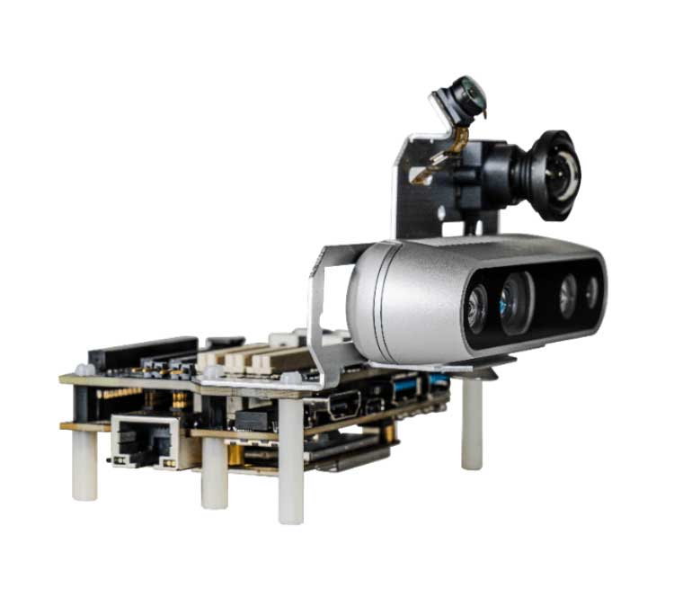
The Qualcomm Robotics RB5 Development Kit (Photo: Qualcomm Technologies)
Qualcomm Technologies released the Qualcomm Robotics RB5 platform. The RB5, comprised of hardware, software and development tools, is designed for the consumer, enterprise, defense, industrial and professional service sectors.
According to the company, the platform’s Qualcomm QRB5165 processor offers a heterogeneous computing architecture, coupled with the fifth-generation Qualcomm AI Engine that delivers 15 tera operations per second of artificial intelligence (AI) performance for running complex AI and deep learning workloads. The processor also offers incredible machine learning inferencing at the edge under restricted power budgets using the new Qualcomm Hexagon Tensor Accelerator.
Technical features of the RB5 include heterogeneous computing capabilities, 5th generation Qualcomm AI engine, advanced imaging capability, security support and connectivity. Qualcomm’s Spectra 480 Image Signal Processor (ISP) captures fast, professional-quality photos and videos, and can process two gigapixels per second, the company said.
In addition, seven concurrent cameras facilitate simultaneous localization and mapping (SLAM), object detection and classification, autonomous navigation and path planning to perform tasks in indoor and outdoor settings.
With the Qualcomm Robotics RB5 platform and the Qualcomm QRB5165 processor, Qualcomm enables various design offerings including off-the-shelf system-on-module solutions and flexible chip-on-board designs, the company said. The solution is available in multiple options, including commercial and industrial-grade temperature ranges and an option for extended lifecycle until 2029.
“With the Qualcomm Robotics RB5 platform, Qualcomm Technologies will help accelerate growth in a wide array of robotics segments such as autonomous mobile robots, delivery, inspection, inventory, industrial, collaborative robots and unmanned aerial vehicles, enabling Industry 4.0 robotics use cases, and laying the foundation for the UAV Traffic Management space,” said Dev Singh, senior director, business development and head of autonomous robotics, drones and intelligent machines at Qualcomm.
Qualcomm also has entered into a strategic collaboration with TDK to further enhance the capabilities of the Qualcomm Robotics RB5 platform. Through the partnership, TDK added its latest sensor technologies for enhanced robotics applications as part of the Qualcomm Robotics RB5 platform.
The Qualcomm Robotics RB5 Development Kit
In addition, Qualcomm Robotics RB5 Development Kit ensure developers have the customization and flexibility they need to make their visions a commercial reality.
According to Qualcomm, the kit allows developers to have flexible software capabilities, with the platform offering support for Linux, Ubuntu and Robot Operating System 2.0, as well as pre-integrated drivers for various cameras, sensors and 5G connectivity. It also provides support for OpenCL, OpenGLES and OpenCV.
It also includes support for the Intel RealSense Depth Camera D435i and Panasonic TOF Camera to provide depth-sensing capabilities. TDK’s six-axis ICM-42688-P IMU, ICP-10111 barometric pressure and T5818 Digital bottom port microphone are integrated into the kit, as well.
A link to the live event will be sent to you two hours before the event. Your personalized event URL will be automatically generated by the ON24 system. To ensure receipt of the email, please whitelist this email address by adding it to your contacts: [email protected].
This presentation will begin at 1 p.m. Eastern / 10 a.m. Pacific on Thursday, June 25th. A recording will also be sent to you the following day so you can watch it on-demand.
Audience members may arrive 15 minutes prior to live time. If you have any questions, please contact event producer Grace Rybak at [email protected]
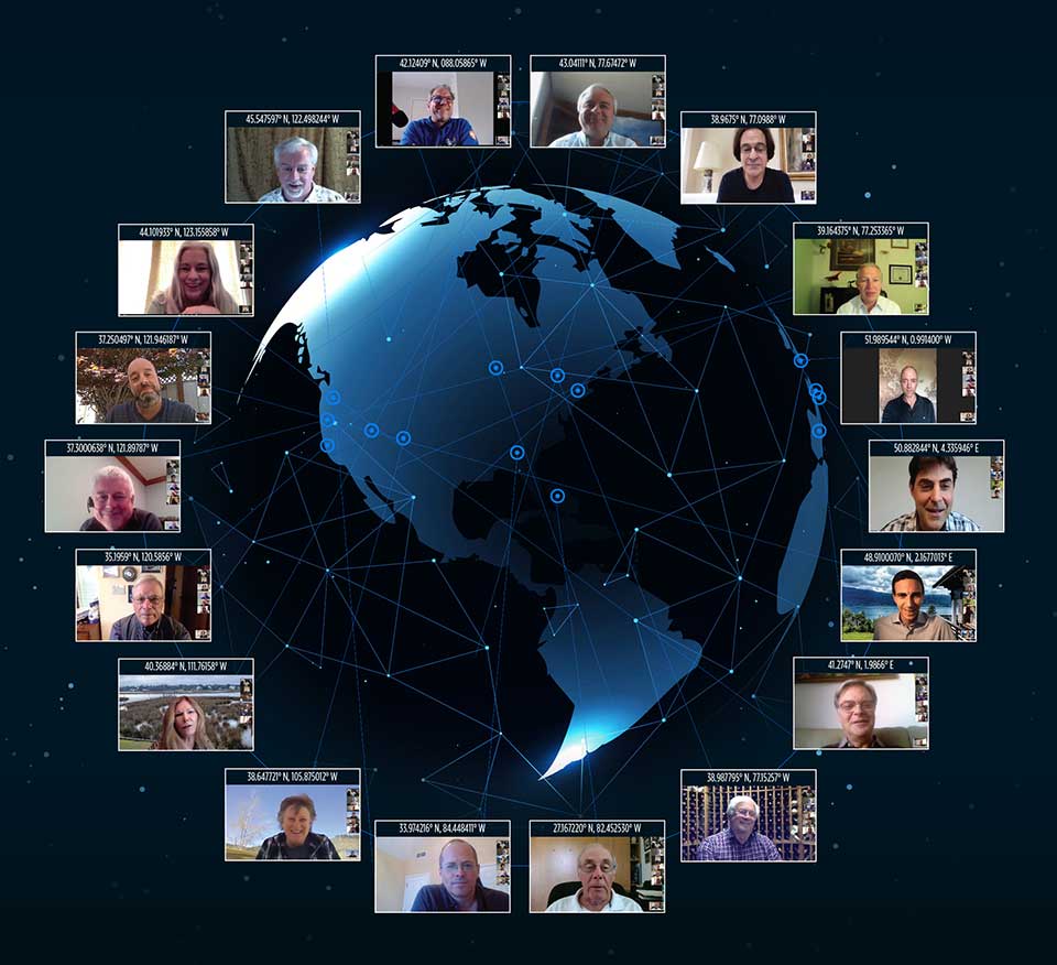
Reaching ’round the world: GPS World staff engage in a teleconference with Editorial Advisory Board members and contributors via teleconferencing. Clockwise from top: Tim Burch, John Fischer, Mitch Narins, William Tewelow, Julian Thomas, Jean-Marie Sleewaegen, Thibault Bonnevie, Ismael Colomina, Michael Swiek, Tony Murfin, Miguel Amor, Alison Brown, Ellen Hall, Brad Parkinson, Stuart Riley, Greg Turetzky, Tracy Cozzens and Matteo Luccio. (Photos: GPS World)
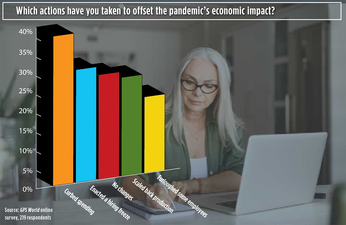
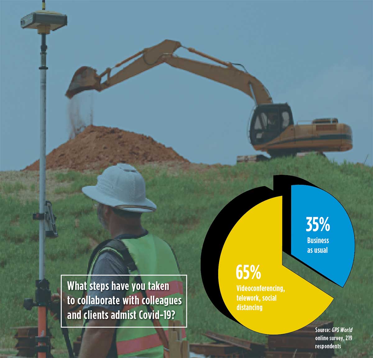
Our readers participated in an online survey on how they are being impacted by and responding to the COVID-19 pandemic. We summarize your responses here.
In April, GPS World asked its readers how the COVID-19 pandemic is affecting the GNSS/PNT industry and their day-to-day work.
About three quarters of respondents fell into two general areas of work: commercial (43%) and government/civilian (33%).
The three biggest market sectors primarily served by respondents’ companies are survey and construction (28%), defense and government (20%), and mapping and geographic information systems, or GIS (14%).
Because of the critical need for mapping during the pandemic, almost all mapping and GIS respondents said they have adapted to answer the needs of those seeking information about the coronavirus pandemic.
Supporting Solutions
About 14% of respondents reported their company has provided products or services for an application, project or customer directly tied to a COVID-19 response. These include support for police and government supervision, government and federal agencies’ emergency vehicles, air transportation, as well as medical supply transport.
Other efforts include ramping up the manufacturing of personal protective equipment such as face shields, with plants repurposed; others donated face masks, disinfectant and money. Also playing a supporting role are IT- and statistic-related services.
Tracking COVID-19. GNSS services provided by our readers to help track the virus include helping multiple agencies monitor traffic to and from critical locations, and building online dashboards for state data and surveillance.
“Our ability to provide GPS network services has enhanced the ability of public- and private-sector surveyors to continue working, to stay employed during these difficult economic times,” said one respondent.
Roadblocks. During the coronavirus pandemic, only 14% said they are significantly challenged to access parts and services, while 41% noticed a slowdown in deliveries. Comments included: “There have been issues getting supplies to set up for telework” and “Some international suppliers are having issues, so we are looking into alternative suppliers.”
Glass Half-Full
While there’s no question the COVID-19 outbreak has presented challenges, many respondents shared positive experiences while working in this current environment.
Working Remotely. For many of us, learning how to work remotely has been a positive experience, providing options that were overlooked or not considered before. Many readers were pleasantly surprised by how easy the transition has been and how well it has worked.
“It’s been a smooth transition to telework and production continues at normal rates,” said one respondent.
Others reflected on their successful adaptability with remote working, with comments such as “We have proven we can function with staff working remotely,” and “It brings people together in new ways!”
“As the team manager, I was fortunate that I had been transitioning my staff to be flexible in their work locations by replacing their desktop computers with notebook computers, enforcing the utilization of shared network resources for project data, and making sure IT systems were working for them — at work, in the field, and at home — prior to the pandemic. This has given me confidence in part-time telework for this group.”
Employees have become “more focused and more productive in necessary areas: documentation, contracts and gaining necessary certifications and contract information.”
Working from home also has improved productivity with fewer meetings and no commuting. “Traffic in any case was horrific.”
Rise of the Machines. Other respondents looked even further to the future. “COVID-19 has given companies and people a wake-up call. The new economy and new dynamics of workforce management will never be the same. This will help us tremendously as we approach AI (artificial intelligence) automation.”
No More Backlogs. While work has slowed in many areas, that cloud can have a silver lining. “It has allowed a backlog of work to be caught up, but we expect that will be temporary as business begins to bounce back.”
Finally, some respondents noted the human factor coming to the fore, including improved hygiene, seeing people help each other, and “more compassion for people in general.”
Photo: Photo: ftwitty / E+ / Getty Images
Where Do We Go from Here?
We asked our readers if coronavirus pandemic-related workflow changes and adaptations have brought about innovations they intend to keep going forward.
Many readers commented that increased reliance on working at home and new digital workflows will continue past the end of the pandemic. Online communication tools cited include email, WhatsApp, Skype, Teams and Zoom. “Knowledge and use of these tools are now ubiquitous,” wrote one respondent.
Others commented that traveling for meetings will be less frequent and reliance on videoconferencing will increase.
Staying Home. Companies plan to continue with at least some staff working from home to reduce their office-space spending. “I will probably have my staff telework two days per week once this pandemic passes. We will have more online training modules prepared. Digital signatures will be the norm.”
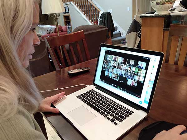
Senior Editor Tracy Cozzens Zooms from her home. (Photo: Steve Cozzens)
One respondent wrote, “We intend to keep using the digital workflow. Accepting and returning PDF plat reviews has worked very smoothly.”
“We are redesigning the logistics of how our business operates — decentralized versus centralized. In this new landscape, businesses cannot be tied to one central location,” another reader wrote.
Others are taking part of the new workflow back to the office: “Videoconferencing has taken on a new light. It works well, and will continue even after we move back to the office.”
Some had a steeper adaptation curve: “As a state government agency, we were not prepared to have the majority of staff working remotely, so we have had significant IT issues.”
Staying Healthy. “We will increase cleaning and sanitizing routines, and all employees and guests will have their temperatures taken before entering, and while on property,” commented one reader.
“The world has changed, and how these changes will affect our business has yet to be determined.”
A Look at Surveying
Surveying companies have adopted remote-office connection strategies and new ways to exchange digital and physical information with their field crews.
About two thirds of professional surveyors have taken steps such as working remotely and videoconferencing to collaborate with colleagues and clients. One respondent said, “We quickly pivoted to working from home by utilizing WebEx and Google Hangouts for collaboration.”
Out in the Field. Some firms are limiting one person per vehicle when traveling to work sites. “Drafting is done via work-from-home on laptops.” Field crews now typically are a single person using GPS and communicating via email.
Going Digital. “The paperless agenda that was difficult to institute is now in place and operational,” commented one surveyor. “It’s often difficult to change until we get that nudge.”
The 1,174 page set of reports are comprehensive and document the first phase of what is intended as a multi-phase effort.
Graphic: RIN and RNTF
The webinar will present how maritime positioning requirements were systematically developed; an assessment of current and future positioning systems to deliver the required performance and integrity; rigorous gap analysis, showing where performance falls short, as well as options to solve these issues; and a roadmap of steps needed to take — and by whom — toward maritime resilient positioning.
Webinar speakers will include Jonathan Turner of the MarRINav project team, Alan Grant of the Royal Institute of Navigation and Dana Goward of the Resilient Navigation and Timing Foundation.
Jackson Labs Technologies (JTL) has launched the PNT-6220 Assured Reference — a product combining low-Earth-orbit (LEO) signals, GNSS, terrestrial, wireline and atomic clock services in one small solution, specifically designed for critical infrastructure applications.
The PNT-6220 reference seamlessly combines concurrent L1, L2, L3 and L5 GNSS reception with a custom JLT-designed LEO-based Satellite Time and Location (STL) timing receiver. It also includes terrestrial receivers and PTP/IEEE-1588 edge grandmaster (EGM) and PTP/IEEE-1588-slave capability.
The PNT-6220 provides assured PNT for critical infrastructure applications such as those described in the directives of Presidential Executive Order 13905.
It can serve as a timing reference for 5G equipment, an ePRTC-capable reference, or a high-performance disciplined reference that supports PTP/IEEE-1588, STL, RF distribution and multi-frequency GNSS capability.
The PNT-6220 will be able to select the most optimal UTC reference input automatically and auto-switchover among its numerous reference inputs if one or more of them are jammed or spoofed, as well as average several references for additional stability and accuracy.
If all external references are jammed, the unit can provide UTC timing from its internal holdover oscillator with options that have less than 100-ns drift over 24 hours. The unit is also capable of outputting a GPS RF distribution signal driven by the internal flywheel oscillator, which allows glue-less retrofitting of any GPS-based legacy user equipment to the state-of-the-art reference sources the PNT-6220 can receive by simply plugging into the legacy equipment GPS antenna input.
Available Options
Numerous options are available for the half-width 19-inch-wide rack-mount box.
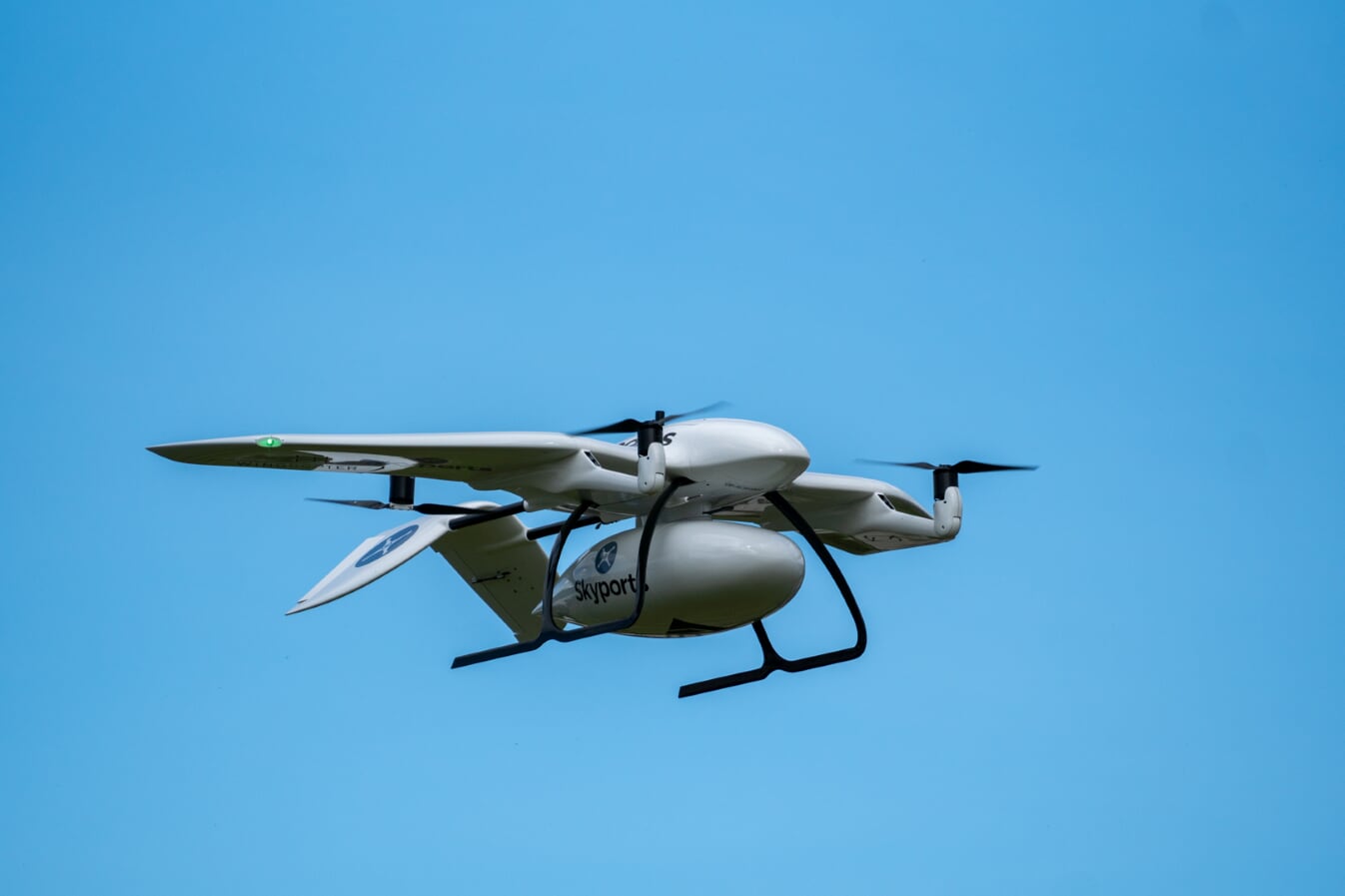
Skyports’ delivery drone, manufactured by Wingcopter, takes flight. (Photo: Wingcopter)
Skyports and Thales are partnering to conduct a drone delivery trial for the National Health Service (NHS) to support the United Kingdom’s COVID-19 response.
The trial, being conducted in Scotland, aims to prove the feasibility of delivering urgent medical cargo, such as COVID-19 test kits and Personal Protective Equipment (PPE), between remote medical facilities by delivery drone. The trial is backed by Argyll and Bute Health and Social Care Partnership (HSCP) — the integrated partnership of NHS Highland and Argyll and Bute Council directed by the local Integration Joint Board.
U.K. drone delivery provider Skyports will conduct the trial and operate the flights using delivery drones supplied by unmanned aircraft-maker Wingcopter, because of its proven capability through numerous delivery operations around the world. The trial flights will be planned through Thales’ drone operations management platform, SOARIZON, which offers digital tools to maintain compliant and safe drone flying operations.
Based at Lorn and Islands Hospital in Oban, the trial will consist of two-way flights between the hospital and Mull and Iona Community Hospital in Craignure 10 miles (16km) away on the Isle of Mull.
As COVID-19 testing rapidly gathers pace in the U.K., the proposed delivery service will help to ensure that isolated communities have access to tests, delivered in a fast and efficient way. Currently, the majority of medical supplies and specimens are transported between the laboratory at Lorn and Islands Hospital, surrounding general practitioners’ surgeries and other healthcare settings by sea and road, a long and complicated journey.
The service would cut delivery times from up to six hours one way by ground transport and ferry, to 15 minutes for on-demand delivery by drone. The speed would contribute to keeping front line medical and delivery personnel safe.
Answering the call from government and Argyll and Bute HSCP, in response to the COVID-19 crisis, the trial is the result of rapid mobilization from industry as well as the Civil Aviation Authority (CAA), local government, NHS Scotland and the U.K. Department for Transport (DFT). Argyll and Bute HSCP has been at the forefront of exploring with Skyports the use of unmanned aircraft technology, building on preliminary work with the Scottish government on the possibility of drone use by the public-sector emergency services in Scotland.
The two-week trial represents a crucial milestone for unmanned aviation in the U.K. Under current rules, drones must always be flown within visual line of sight of the remote pilot. To undertake these more extended flights (beyond visual line of sight, or BVLOS), the project team has been in close consultation with the CAA.
Through this trial, the alliance aims to prove the long-term, sustainable viability of such services; bringing together regulation, government and industry to unlock the transformational potential of drones for society when used in a safe, secure and controlled way.f this new service.”
Thales and Skyports are also working together within the CAA Regulatory Sandbox programme, exploring how regulatory approvals can be granted for more widespread BVLOS drone operations in the U.K.
Once the trial has been successfully completed, the team will continue to work closely with the CAA and the NHS to make services available in Scotland and across the U.K. to provide access to this innovative technology to a wide range of organisations, in particular a number of other NHS Boards and Trusts.
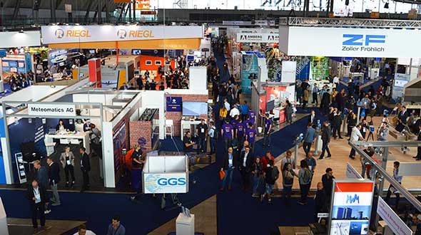
The 2020 Intergeo trade show will be hosted both in-person and virtually, said Intergeo organizer Christoph Hinte. The theme of the 2020 event will be “Geoinformation for a smarter world.”
“The hygiene and social distancing concept is currently being coordinated,” Hinte said. “In addition to the live event, this year is the first time we will also offer a virtual twin. Both the conference and the fair will be replicated. By hosting the fair in a virtual format, we expect to attract the same number of visitors as in previous years, if not more.”
Hinte made this announcement at the Intergeo Roundtable, an annual mid-year event for experts to discuss the latest industry trends.
During the roundtable, attendees discussed the latest industry trends. One trend mentioned in particular is the advancement of digitalization because of the COVID-19 pandemic. Trimble’s Janos Faust noticed that attitudes towards digitalization changed overnight after the breakout of the coronavirus pandemic, with people taking the digital transformation more seriously. Hexagon’s Michael Mudra also pointed out that anyone with round-the-clock access to automatically recorded, up-to-date and networked data that is evaluated using AI now has a clear advantage. Finally, Autodesk’s Ralf Mosler pointed out that companies are rapidly moving away from traditional work models and turning to technologies that completely reconnect BIM and GIS workflows.
Attendees also emphasized how the geo-IT industry can make a significant contribution to the climate crisis and current lack of resources. With regard to fleet management, up to 20% less fuel is being used and in Germany alone, precision farming methods are resulting in efficiency gains of 30%, Intergeo said in a press release. Whether it’s greater energy efficiency, enhanced energy utilization or even the simulation of different building methods, attendees agreed the industry is having a noticeable societal impact in both raw materials extraction and construction planning, Intergeo added.
Through the ION Online Job Board, ION corporate members can post job listings for free. For a limited time, non-ION corporate members can also post job listings for free. The job postings will expire automatically after 14, 30 or 60 days, depending on which expiration date the job poster chooses.
“To meet the burgeoning demand for a targeted talent pool specific to the PNT community, the new ION Online Job Board will help connect qualified job seekers with exciting and diverse employment opportunities for this niche audience, and in turn will help our corporate members continue to build talented teams to better ensure the success of their business,” said Lisa Beaty, executive director at ION.
The The Institute of Navigation is a not-for-profit professional organization dedicated to advancing the PNT industry.
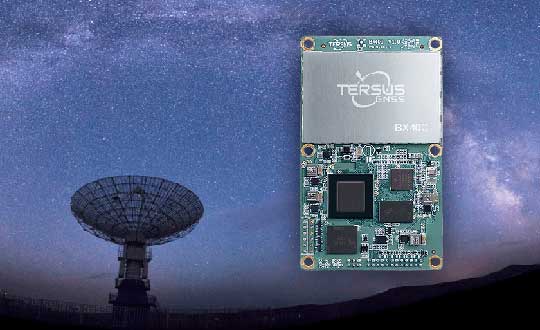
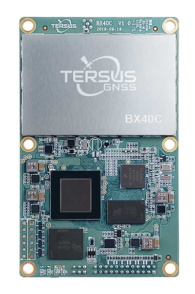
Tersus GNSS Inc. has released the BX40C RTK board to support its series of GNSS boards and provide highly accurate and fast positioning services.
Powered by the company’s new ExtremeRTK GNSS technology, the BX40C board can support multi-constellation and multi-frequency all-in-view satellite tracking.
The Tersus BX40C is a compact GNSS real-time kinematic (RTK) board with full constellation tracking for providing centimeter-level accuracy positioning. It can be integrated with autopilots and inertial navigation units to meet various developing requirements. It is suitable for high-precision positioning, navigation and mapping.
“Tersus has been proud of its BX-series RTK boards, and today we added a new member to the series by launching the new BX40C board,” said Xiaohua Wen, founder and CEO of Tersus GNSS. “The BX40C is with enhanced positioning accuracy and constellation tracking, even in harsh environments, the BX40C board can still control deviation within 3-centimeter in surveying and mapping applications. It supports 576 channels and can achieve centimeter-level position accuracy easily. We are excited to see how BX40C strengthens our product portfolio and technology competence to make a great effort in this industry.”
The BX40C board supports multiple constellations and frequencies to improve the continuity and reliability of the RTK solution — even in harsh environments. In-built 4GB memory makes data collection easy, the company said. It is compatible with other GNSS boards in the market via flexible interfaces, smart hardware design and commonly used log/command formats.
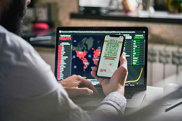
Contact tracing can help stem the spread of the COVID-19 pandemic. It involves tracking the movement and interactions of infected individuals to identify others at risk.
National and regional responses to the COVID-19 pandemic have included containment through quarantine and restriction of movement. When properly implemented, these solutions limit spread of the contagion to prevent it from overwhelming healthcare and emergency management systems.
According to the World Health Organization, the Centers for Disease Control and Prevention, and virtually all medical professionals, any effective strategy to return the world to normal requires three components: testing, contact tracing and isolation.
While testing to find the people who are infected is the absolute top priority, contact tracing is vital for stopping a disease from spreading out of control. It involves tracking the movement and interactions of infected individuals to identify others at risk. Any positive test without contact tracing is bad public health — it misses an opportunity to reduce the spread of the virus.
While the concept of contact tracing has just entered popular consciousness, it has been a standard public health tool for a century. For example, in the 1930s, Great Britain used it to contain the incidence of sexually transmitted infections. In the 1960s and 1970s, South American, African and Asian countries used it to eradicate smallpox. Additional diseases for which contact tracing is performed include tuberculosis, measles, HIV, Ebola, bloodborne infections, serious bacterial infections and novel infections.
What Is Contact Tracing?
The World Health Organization describes three basic steps:
Contact identification. Those who have been in contact with someone who has been confirmed to be infected are identified, by asking about their activities and those of the people around them.
Contact listing. All persons who have had contact with the infected person are informed of their status and told to receive early care if they develop symptoms.
Follow-up. Contacts are monitored for symptoms and tested for signs of infection.
In some cases, quarantine or isolation is required for high-risk contacts.
The enormous dimensions of the current pandemic, however, challenge traditional models of contact tracing, which are very resource intensive. In search of a technological assist, several Asian countries already have been taking advantage of the functionalities of smartphones to scale up contact tracing to match the pandemic’s rate of growth, such as the Trace Together app built by the Singapore government. Companies and organizations around the world are following suit, including Britain’s National Health Service, a pan-European initiative, and an unprecedented joint venture by Apple and Google.
Automating Contact Tracing
A study published on March 31 in Science concluded that “viral spread is too fast to be contained by manual contact tracing but could be controlled if this process [were] faster, more efficient and happened at scale.” A contact-tracing app that memorizes close contacts and immediately notifies users if they have had contact with infected individuals, prompting them to self-isolate, could control the pandemic without need for mass quarantines if enough people used it, the study argues.
Privacy versus Protection. A similar app has been deployed in China, where people are required to use it to be allowed to move beyond their neighborhood, enter public spaces, or use public transport. A central database collects data on each user’s movement and coronavirus diagnosis, artificial intelligence analyzes these data, then the app displays a red, amber or green code that determines the user’s freedom of movement. This app has been credited with significantly helping China suppress the pandemic, but has been criticized for its disregard for data protection and privacy.
Relying on fundamental epidemiological principles and common smartphone functionality, the Science study authors designed a simple algorithm to replace manual contact tracing. “Coronavirus diagnoses are communicated to the server, enabling recommendation of risk-stratified quarantine and physical distancing measures in those now known to be possible contacts, while preserving the anonymity of the infected individual.” Symptomatic individuals could use the app to request testing, and everyone could use it to access COVID-19-related health services, information and instructions, or even to request deliveries of food or medicine during self-isolation.
Public trust in the app and how the gathered data are used would be critical to its success. The study’s authors lay out a series of requirements for its ethical implementation, then point out that “the algorithmic approach we propose avoids the need for coercive surveillance, since the system can have very large impacts and achieve sustained epidemic suppression, even with partial uptake.”
The authors of a similar article in the journal JMIR mHealth and uHealth write that a contact-tracing system can limit any central coordination to notifying users who have been in contact with an infected person. Their core idea is that it does not matter where someone contacts an infected person, only that they were in close enough contact to risk infection. Particularly sensitive location data, such as GPS or phone cell data, “is actually neither necessary nor useful.” No one learns who the user is because the app is not linked to an identity, and it neither records nor stores location data.
The authors argue their proposed app is the most effective epidemiologically because it would determine which people were in close proximity, and it would receive user cooperation. “Only if people trust a system — because it does not spy on them — will the system find broad support in the population.”
GPS, Bluetooth or Both?
Technologically, the concepts of location and proximity are embodied in two standard smartphone components: GPS receivers and Bluetooth transceivers. GPS-derived location data makes it possible to map and analyze the movements of individuals and of large numbers of people; for example, it is how we know that many in this country have begun relaxing social distancing rules ahead of the lifting of legal mandates. Bluetooth’s use of low energy, generally a drawback, becomes an advantage here because it can tell us whether two or more people have been within 1.5 to 2 meters of an infected person for at least 10 to 15 minutes — when the risk of infection is highest. This knowledge can enable newly infected, pre-symptomatic people to self-isolate and not infect others.
Numerous companies are developing and proposing smartphone-based contact tracing apps.
Vesedia Mobile Technologies proposes that people who test positive to COVID-19 be asked to provide information about public places they visited in the preceding days and at what times, using their phone location history for verification. The information would be anonymized by healthcare officials, and entered into a database that would be publicly accessible via a website and mobile app.
Ramesh Raskar. (Photo: MIT/John Werner)
Intersections. The COVID Safe Paths phone app and the Safe Places browser tool for contact tracers were created by Ramesh Raskar and other researchers at the MIT Media Lab. If a user tests positive and consents, his or her data is uploaded, redacted by healthcare authorities to remove any personally identifiable information, and downloaded by the app.
The app then performs “intersections” — it identifies and notifies people with whom the infected person has crossed paths. By clicking on intersections, users can display their timeline for the past 14 days, in a calendar view, which tells them how many intersections have occurred each day.
The app also provides news reports from authorized local news channels, based on each user’s position or if they tap the URL for their local healthcare authority, said Abhishek Singh, the program’s tech lead, who is helping with the app’s development.
“We are also building an interoperable architecture,” Singh said. “Because there are many contact tracing apps already in the wild, we want to make sure that they have some common standards and guidelines that enable them to utilize data from other apps securely and through consent.” More than 1,200 people are voluntarily contributing to the project. “It is being led by the open-source community, and all our source code is out there and anybody can contribute,” Singh said.
Safe Places is helping health authorities by making the data and insights visible, enabling them to make the right decisions such as targeting resources to areas that need them most, helping them impose restrictions such as lockdowns, or reopen the economy. “The economy will not reopen in a single burst, but step by step.” Singh said. “A dashboard that allows them to monitor where the infection is spreading and where it has been contained helps them decide where to take which steps.”
The GPS Advantage. The uptake required for GPS-enabled contact tracing to be successful is generally lower than for Bluetooth-based contact tracing, Singh argues, citing an Oxford University simulation. “With GPS, you do not need people to have the app already downloaded for it to be effective,” he points out. A person who tests positive for the virus can use the Safe Place web tool to manually create a GPS trail and help healthy people. This is one of the biggest advantages of GPS compared to Bluetooth, because the latter requires exchanging information directly through the hardware, which cannot be done after the fact.
Because the app is open source, any government can deploy it using its own IT infrastructure. However, a government that wants to adopt Safe Paths must sign a letter that commits it to complying with privacy and ethical guidelines. Preventing authoritarian governments and nosy employers from requiring people to use this app and reveal their data requires stringent guidelines as to how it is deployed and who can access the data, Singh said.
Apple and Google Join Forces
Apple and Google have joined in an unprecedented alliance to develop a system for notifying people who have been near others who have tested positive for COVID-19. Eight out of 10 people in the United States own smartphones, and the two companies’ operating systems run more than 99% of them. Apps built directly into iOS and Android, especially if interoperable, could dramatically increase the reach of public health authorities (the only organizations that would receive the data). To avoid fragmentation and encourage wider adoption, Apple and Google will allow only one app per country to use their system, but will allow U.S. states to use it and support countries that opt for a state or regional approach.
The system will use Bluetooth signals from phones to detect encounters rather than GPS location data. It will not run ads, will require users to opt-in, be decentralized, and use randomized IDs not tied to a user’s actual identity to communicate potential contacts with individuals with a confirmed positive COVID-19 diagnosis.
With GPS, you do not need people to have the app already downloaded for it to be effective.
API Coming. On May 20, Apple and Google released an API to developers. Next, they will issue a system update to build in contact tracing at the OS level. Should a user’s phone notify them of a possible contact, they will be prompted to download and install a public health app from their local health authority to obtain trusted instructions.
Developers of coronavirus-related apps for several U.S. states have argued that GPS location data is vital to identify infection hotspots and track outbreaks. However, for various technical reasons, workarounds designed to bypass the decision by Apple and Google and collect GPS data in connection with their contact tracing system would work poorly.
Ethical and Equity Concerns
“The work that we are doing for COVID-19 is pretty similar to work that we do on a routine basis with other reportable communicable diseases,” said Lisa Ferguson, nursing supervisor for Communicable Disease Investigations and Case Management for Multnomah County, Oregon, which includes the city of Portland. Most commonly, her unit is notified of illnesses by the state database, which receives electronic lab reports. “We assign that as a case to somebody on our team, and they call the person, interview them, ask some questions about their illness, their symptoms and where they could have possibly been exposed,” Ferguson explained. “Then, they talk about who that person might have exposed and where they were from two days before they became sick up until the time of the interview or the time that their symptoms were resolved.”
The Multnomah County, Oregon, Disease Detection Team. (Photo: Multnomah County, Oregon)
How could technology — such as smartphone location data — best help Ferguson’s team conduct contact tracing for COVID-19? “In the public health world, we are not used to having access to technology in that way,” she said. “We need to have some ethical discussions before we are prepared to utilize something like a technology that can track people.” Also, unlike tracking measles, which requires knowing whether someone was in an airspace and who was there after them, “We do not automatically consider someone to have been exposed if they were in the same airspace as someone who tested positive.”
If the privacy concerns could be adequately addressed, receiving a list of all the people who were less than six feet away for at least 10 minutes from someone who had tested positive could help her team scale up, Ferguson said. Her team would then reach out to those people, using such language as “You may have been exposed,” and “Please watch yourself closely.”
Ferguson’s team always has “equity concerns,” fearing they might under-identify groups that do not have access to the technology. “It is a supplemental tool, but it certainly would not replace the work that we are doing,” she said.
Help Wanted
Safely reopening the United States will require a new workforce of at least 100,000 contact tracers, according to a report from the Johns Hopkins Center for Health Security and other experts. Any technological assist to contact tracing does not diminish this need. For example, smartphone alerts can help filter out those at low or no risk so that human tracers can focus on genuine cases, people at higher risk, or those who are harder to contact.
Two out of 10 people in the United States do not own a smartphone, and only 42% of those above the age of 65 — who suffer 80% of the deaths from COVID-19 — do, according to a 2017 Pew Research Center poll. Hardly any homeless people own a smartphone. Among those most vulnerable to the pandemic are immigrants who do not speak English and are fearful of efforts to collect their personal information, strengthening the need for this to be done in person by trusted community members.
Finally, even if Google and Apple’s automated service is widely adopted and works well, it will require many thousands of health workers to conduct tests and follow-ups.
A roundup of recent products in the GNSS and inertial positioning industry from the June 2020 issue of GPS World magazine.
OEM
GPS Tester
Compact antenna testing for mobile deployments
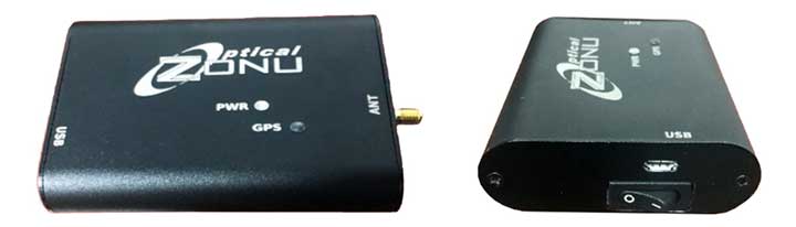
Photo: Zonu
The ZonuSkyShot is designed for quick testing during the critical installation phase of an antenna at a new site build or small-cell integration. The compact tester is designed for integrating a Zeno GPS solution, but works as a neutral testing device. SkyShot is a compact GPS receiver that detects the presence of a GPS signal, indicated on the top-panel LED. The receiver can be accessed via the USB port on the base unit, allowing the user to see the available satellites by using the app provided with the system and available at the Optical Zonu website. The receiver can simultaneously track up to 16 satellites while searching for new ones. Because of this, a problem can be found and mitigated when a GPS antenna is installed, rather than when hardware is being integrated further down the line. Close-out of projects can be indicated with screenshots of satellite visibility via the micro-USB port to a laptop.
Seamless installation on leading 2020 police sport utility vehicles
Photo: PCTEL
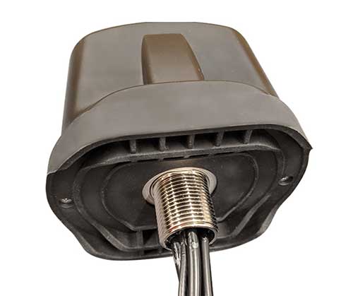
The Trooper TRP-20INT antenna platform supports the high-speed requirements of complex RF communication systems used for critical communications in FirstNet public safety and intelligent transportation systems. The antennas feature two 5G elements compatible with cellular routers supporting 600-MHz to 6-GHz frequencies. PCTEL’s proprietary high-rejection multi-GNSS technology is included for high-precision tracking and asset management.
The QR-100 L1/L2 GPS anti-jamming unit mitigates RF interference or jamming signals using a spatial domain of an antenna array reception pattern. Three passive antennas of the customer’s choice can be connected to the QR-100 unit using built-in SMA connectors. The unit default configuration (no jamming signal present) has a 120-degree phase gradient between antenna elements to maximize the reception of GPS right-hand circularly polarized (RHCP) signals. This feature allows the unit to be connected to either RHCP-type antennas or linearly polarized antennas. The default configuration of the unit is designed to connect to passive GPS antennas.
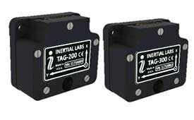
Inertial Labs’ TAG-200 two-axis and TAG-300 three-axis gyroscopes are developed for electro-optical systems, gimbals, line-of-sight, and pan-and-tilt platforms for stabilization and pointing applications. TAG-200 and TAG-300 use advanced-performance, tactical-grade MEMS sensitive elements to accomplish complex tasks requiring accurate stabilization of assorted platforms. The gyroscopes, designed for use in harsh environments, can withstand extreme shock and vibration in accordance with MIL-STD-810 ground mobile use. They are fully digitized, include built-in test functions and have no moving parts. The gyroscopes include low noise, low latency, wide bandwidth, high data rate, low bias drift, low VRE, high MTBF and are ITAR-free. They are factory calibrated over the operational temperature range and are quality assurance and quality compliance tested and supplied with individual calibration and acceptance test certificates.
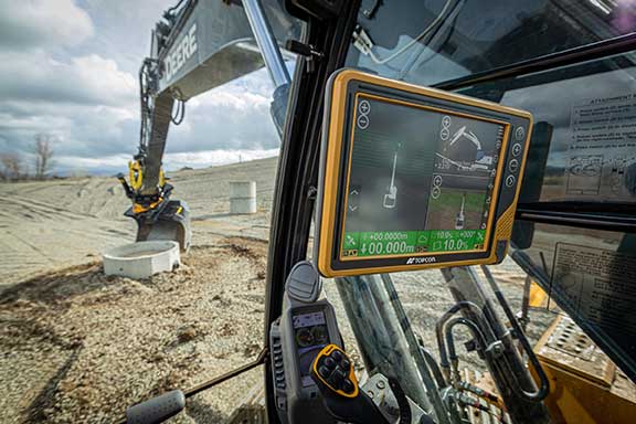
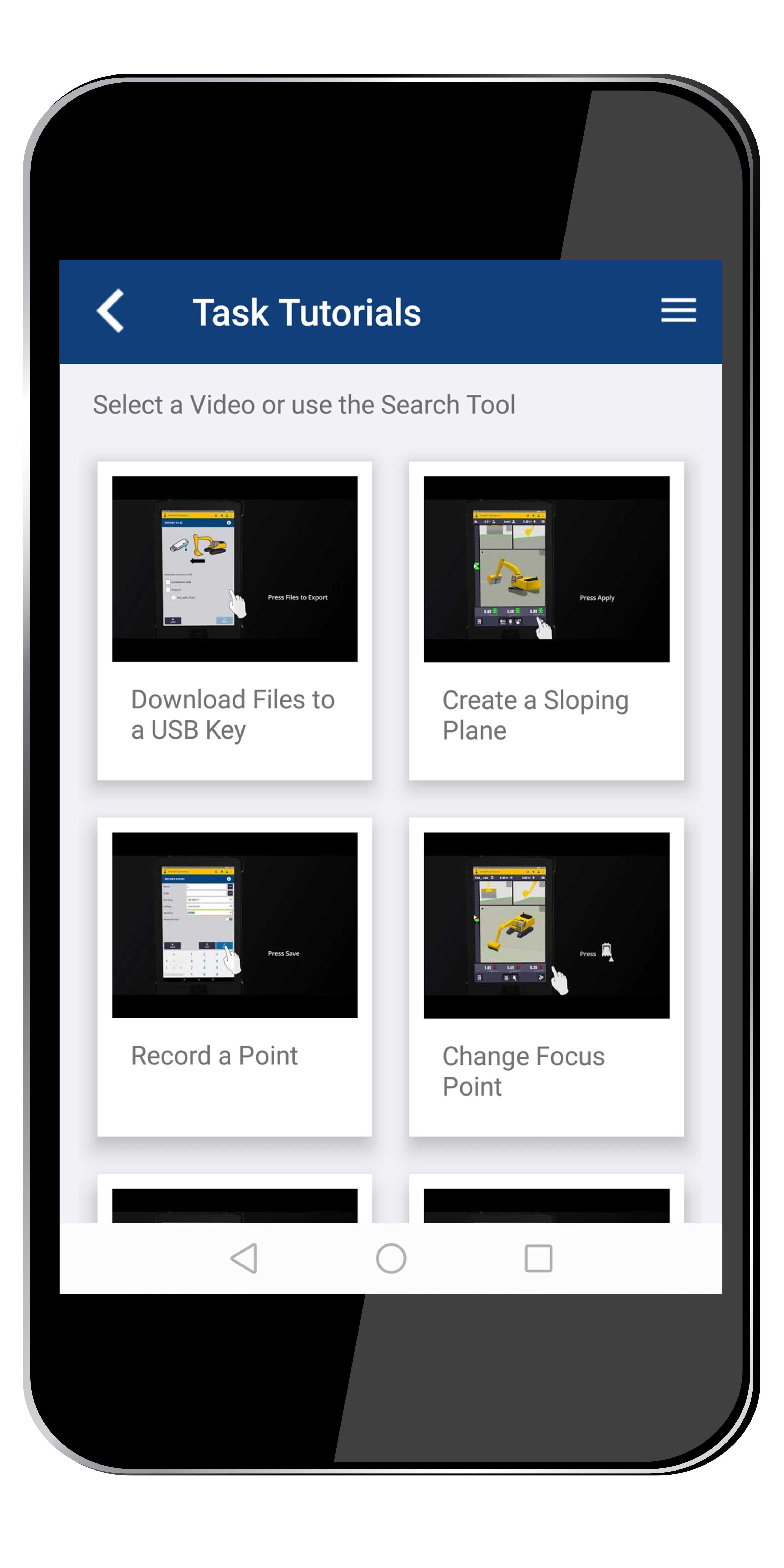
Earthworks Grade Control Platform version 2.0 features improvements to enable faster return on investment, increase productivity and decrease training time for operators. Horizontal Steering Control for dozers automatically controls the machine to follow any horizontal alignment such as a back of a curb, breakline, roadway centerline or bottom of slope, without operator assistance. Augmented reality for excavators enables users to understand 3D models, cut/fill information, slope data and other bench points and reference points on the in-cab display in context, without the need to interpret complex 2D plans or stakes. A new mastless motor grader configuration gives operators an improved range of blade motion, allowing for machine control in applications where it previously was not possible. Integrated Trimble Loadrite Payload Management displays grade control and accurate payload data on one screen, increasing mass haul productivity and efficiency by preventing underloading, and improving safety by avoiding overloading. Trimble Earthworks is also now available for compact grading attachments with dual GNSS, single GNSS and total station guidance options. The Earthworks Assistant App provides access to Earthworks learning material and documentation, allowing for a shorter learning curve and less downtime for operators.
The addition of advanced tilt and rotation functionality allows Automatic Excavator operators to easily swivel or tilt the bucket with automatic boom control for faster and more efficient excavation. If excavator operators are in situations such as at the top of the slope, grading a long incline and not totally perpendicularly lined up, the added feature makes it easier to position the cutting edge of the bucket to the surface. Operators can excavate more quickly, moving the excavator fewer times with less wear and tear on the chassis. It is also beneficial when navigating around manholes, trenches and tight spaces.
The Horizon is a high-performance lidar sensor built for Level 3 and Level 4 autonomous driving. It has a long-distance detection range of up to 260 meters, high-density point clouds, and is so small it can be embedded easily into vehicles. The Tele-15 has achieved a reliable detection range of up to 500 meters, offering improved safety for high-speed autonomous vehicles. Both the Horizon and Tele-15 high-performance lidar sensors feature a new scanning method that offers improved sensing performance at a low cost.
The IMU383ZA is a high-accuracy, triple-redundant inertial measurement unit (IMU) for guidance and navigation solutions in autonomous machines and vehicles. It integrates triple-redundant, 3-axis micro-electromechanical system (MEMS) accelerometer and gyroscope sensors. The IMU383ZA is pin-compatible with the IMU381ZA and offers high performance of 1.3 deg/hr, 0.08 deg/root-hr. The miniature module is factory-calibrated over the –40° C to +85° C industrial temperature range to provide consistent performance through extreme operating environments for a wide variety of applications.
According to organizers, the GEO Business show connects the data holders and processors with the people who benefit from the applications and insight which geospatial information provides.
“We appreciate how important GEO Business is for you, your business and the whole profession,” GEO Business said in a statement. “And we’re very sorry to disappoint you and the thousands of others who were planning on visiting this year. However, the safety of our visitors, speakers and exhibitors remains our priority.”
The 2021 event will now take place alongside Digital Construction Week, an event dedicated to digital construction, engineering, design, manufacturing and operation.
“Whilst both will remain separate shows, they will in effect create one much larger technology event for the sector,” GEO Business added.