Tag: autonomous vehicles

  • Autonomous Vehicles Face Privacy, Security and Liability Issues

    Chris Urmson, Google, speaks at ITS America on the future of the self-driving car.
    Chris Urmson, Google, speaks at ITS America on the future of the self-driving car.

    Plus: Resurgence in indoor location-based marketing, ITS America annual meeting report

    Autonomous vehicle technology has made industry-smart people pause and think what the consequences will be if cars and other platforms drive themselves. Will there be a huge increase in traffic when everyone decides to call their cars to grab a loaf of bread at a store? Many of these topics were discussed at the ITS America annual meeting held in Pittsburgh May 31-June 3. In other location news, there seems to be a resurgence in location-based marketing and indoor positioning conferences, leading one to believe that large retailers are finally taking notice.

    By Kevin Dennehy

    Kevin Dennehy
    Kevin Dennehy

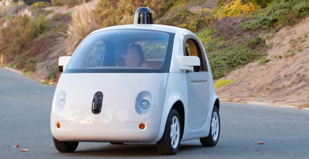
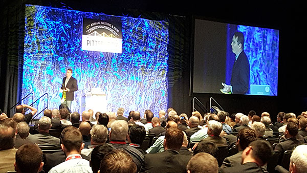
    PITTSBURGH — Chris Urmson, Google’s self-driving cars director, told autonomous vehicle proponents what they wanted to hear during his keynote presentation at the recent Intelligent Transportation Society of America’s annual meeting here. He told them that self-driving vehicles will cut down on the 33,000 U.S. traffic deaths each year (“the equivalent of a 737 falling out of the sky five days a week,” he said) and save time and productivity wasted.

    Urmson also said his goal, and his team’s goal, at Google was to ensure son doesn’t have to get a driver’s license, a trend that has become popular with urbanized youth.

    The message was upbeat and timely for the crowd of government and university transportation attendees. However, liability issues continue to surround autonomous vehicle development.

    “In the end, you are always going to have that guy with the ’57 Chevy in his garage. How do you make the autonomous vehicle work with it? It’s akin to the horse and car,” said Ken Leonard, U.S. Transportation Department ITS Joint Program Office director.

    Urmson said he has had “long conversations with insurance companies.” He said that insurance companies are trying to accurately assess risk, and while the model may change, money will still flow, just through a different path.

    One ITS America panel discussed security and privacy issues surrounding connected and autonomous vehicles. One panelist said that while privacy may be dead, security is the real big deal with recent reports indicating that cars’ electronics can be compromised.

    Others believe it’s going to take more time than Google’s assertion that autonomous vehicles will be on the road in five years. “Lessons from the past temper our optimism. While air bags were patented in 1953, and were introduced on luxury models in the 1970s, it wasn’t until the 1990s before there were big penetrations,” said James Anderson, Rand Corp. senior behavioral scientist. “Key takeaways are automaker opposition about the liability [of new technology] and lack of consumer support.”

    The ITS America show floor before the crowds arrive.
    The ITS America show floor before the crowds arrive.

    Anderson said that yes, the lives saved will be a big driver of autonomous vehicles, but congestion will increase, making way for super commuting. “Public transit will also go through big changes. An economic disruption will occur — do you know how much New York City makes from parking alone?” he said. “Safety doesn’t sell in the early stages, as many benefits don’t go directly to the user.”

    Steve Bayless, ITS America vice president of technology, said the solution is not to kill all the lawyers, as there will be continued liability surrounding new in-car technology. “Embedded devices were developed at a time when they were not connected, but the environment has shifted around systems,” he said. “The systems are usually vulnerable because there are poor requirements. Companies have no explicit security policy, or it is poorly specified, or specified too late after design and development.”

    Uber Gets Into Autonomous Game

    The ITS America’s closing keynote speaker was Uber’s head of global public policy, Corey Owens, who said that one of the best cases for autonomous vehicles was the lack of use by consumers of their cars. “In some areas, owning a car is non-negotiable. But how little these cars are used — as many as 95 percent stand idle,” he said.

    Uber announced that Google former head of mapping, Brian McClendon, is joining the company as it develops its own navigation, mapping and transportation systems.

    It’s no secret that Uber is targeting continued autonomous vehicle interest, as it created an Advanced Technologies Center in Pittsburgh. It was also rumored that it was a bidder, with Baidu, to buy Nokia’s HERE digital mapping company. (See more on Baidu in Janice Partyka’s June blog.)

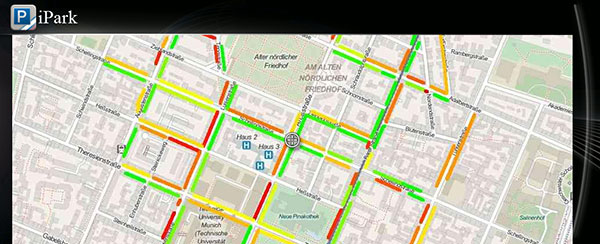
    One major company trying to find its way into connected vehicles, Xerox, exhibited at ITS America in the show’s Entrepreneurial Village. Xerox has installed its smart parking products in such systems as LA Express Park, ParkyIndy and others.

    Xerox has partnered with the University of Michigan Transportation Research Institute in Ann Arbor for testing connected and autonomous vehicles. The company is working with automotive OEMs on electronic tolls, parking, mobile payment and other projects, said David Cummins, Xerox senior vice president and managing director of parking and mobility solutions.

    The U.S. Department of Transportation booth at ITS America focused on the connected car.
    The U.S. Department of Transportation booth at ITS America focused on the connected car.

    Cummins moderated a panel where small companies talked about new technologies and applications like cities without bus stops where a bus is continually moving to the riders on demand.

    In terms of autonomous vehicle use, Cummins envisions an increase in ride-sharing over the next 5-10 years in urban areas. “Initially, there will be a spike in congestion [from autonomous vehicles]. But ultimately, there will be less car ownership,” he said.

    Thoughts on ITS America’s Annual Meeting

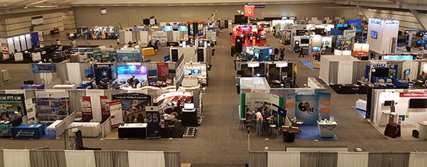
    ITS America celebrated its 25th annual meeting in Pittsburgh to an enthusiastic crowd of 2,000 attendees and 125 exhibitors. However, I am not sure if this conference has grown at all, despite claims it had the largest attendance last year (co-located with the larger, and more private-company-friendly, ITS World Congress in Detroit).

    Despite two decades of rhetoric that it is a private-public partnership, the meeting has the feel of a government and university gathering with a few private companies thrown in who want to do business with them. This is a sad thing, as ITS America has embraced the future of autonomous vehicles with excellent speakers.

    Having the meeting in the Bay Area next summer will be a good start to altering the perception that ITS America’s annual meeting is just a government show to “show-the-flag” for private companies.

    Mid-Year Report on Indoor Location

    Earlier this month, executives attended the Place Conference in New York to get an update on indoor location markets and technology for store chains, large department stores and malls. It was also a chance for technology vendors to show new capabilities that have recently reached the market, said Bruce Krulwich, Grizzly Analytics president, who has authored a report on 150 indoor positioning companies.

    Krulwich said, as the year reaches it’s the halfway point, new and more accurate systems are hitting the market. “This includes LED lighting-based systems from Acuity and GE Lighting, and proprietary radio technologies from companies like Quuppa, all of which deliver accuracy of around 10 centimeters with very fast response,” he said. “Some companies, including New York-based Spreo, are improving the quality using standard approaches, like beacons and motion sensing. They are achieving strong accuracy and responsiveness through software improvements. At the same time, hardware-based indoor location technologies, such as Ireland-based DecaWave’s chip and other UWB systems, are coming to market inside highly innovative consumer devices.”

    Going forward, the biggest challenge is moving from the lab to the real world, Krulwich said. “Deployments such as Game Stop stores and Taubman malls are great moves in this direction,” he said.

    In other location industry news:

    • Note to meeting organizers: Do your due diligence to ensure conference dates don’t overlap. Having two major transportation conferences on the same week was challenging to attend: ITS America Annual Meeting and Telematics-Detroit.
    • The brass at Nokia continue to court a consortium of German car makers to buy its HERE navigation business, according to Bloomberg. The consortium, which consists of Audi, BMW and Daimler, is hung up on the price tag of $4.5 billion — and the deadline for bidders has passed, according to the story.
  • Will China Win the Automated Vehicle Race?

    Janice Partyka
    Janice Partyka

    By Janice Partyka

    The race for the automated vehicle is on. This time, it’s not about whether automotive OEMs or tech will own the vehicle. It’s a battle between Baidu, China’s web giant, and Google, and it isn’t clear who will win. Baidu has announced it will launch an unmanned car in the second half of this year. Despite speculation that Baidu will be working with BMW, Baidu hasn’t announced its automotive partner. The Baidu vehicle will provide the flexibility of some conventional controls, such as pedals, coupled with automation, unlike Google’s approach of being completely autonomous, without pedals and steering wheel.

    One of the most practical uses of artificial intelligence is in the automated vehicle, as cars need to recognize and sort images they “see,” and make quick safety decisions. In a recent TED talk, Chris Urmson of Google revealed a few of the unusual things that Google cars have had to process while driving. The cars have successfully encountered a woman in an electric wheelchair chasing a duck on the road and a child driving a toy car in the road. I wouldn’t be surprised if there are some even weirder encounters that Google is shielding us from.

    Artificial intelligence is critical to the automated vehicle. This year Baidu won a prestigious international artificial intelligence competition at Stanford, but was just stripped of its title and barred from competing in 2016. Apparently, the Baidu team broke the rules on how many tests they could run. In the competition, computers had to recognize and sort images and classify objects into 1,000 different categories. The teams were allowed to run a limited number of tests to train their programs on identifying objects. The Baidu team exceeded the limits by submitting their program using different accounts. In an article in the New York Times, Jitendra Malik, an expert in computer vision, compared the actions of the Baidu team to drug use during a sports competition. “If you run a 9.5-second 100-meter sprint, but you are on steroids, then how can your result be trusted?” Malik said.

    Automated vehicles aren’t the only location market Baidu is aggressively pursuing. With technology from IndoorAtlas, Baidu has rolled out indoor location to 270 million active users of its map application. The solution uses mobile device technology to create geomagnetic maps of indoor places to enable indoor search and to power store and product search, as well as way-finding. A physical map of a building is uploaded into an app on a mobile device, like a smartphone. Using the app, a person walks all corridors in a building, thereby adding location positioning and creating a map.

    Let’s return to the topic of automated vehicles. Earlier this month, Uber suffered a blow when the California Labor Commissioner’s Office ruled that drivers are employees and not contractors, and therefore need to be so compensated. Taxi and limo services had been hurt by services like Uber, and they pressed for redress from what they felt was unfair competition.

    Like Uber, the automated vehicle market will likely hit intense push-back from a number of industries that will be disrupted. These include insurers, taxi and truck drivers, and personal injury and traffic litigation attorneys. These groups may try to build regulatory roadblocks for automated vehicles. And as their businesses may suffer, the automated vehicle industry needs to think now about how to mitigate the damage and create allies. With a completely different political process, Baidu may encounter no such resistance in China — quite an advantage. Perhaps Baidu will be first out of the gate, but may not be the long-term winner. Think Ford Sync.


  • Drone Delivery Test Event to Focus on Medical Service

    Drone experts will join with those from the medical field in a demonstration July 17 in Wise, Va. The event, “Let’s Fly Wisely,” aims to show how unmanned aerial systems (UAS) can alleviate the problem of health care access while creating economic opportunity for communities.

    Many people in Virginia and across rural America are beyond reach of essential health services and basic supplies, ranging from bandages to medicine, according to event organizers. The drones will deliver essential medical supplies to an annual medical clinic held at the Wise County Fairgrounds every summer, organized by Remote Area Medical (RAM) USA and the Health Wagon.

    At the clinic, thousands of medical specialists provide free eye, dental and health care services to people in urgent need, in what event organizers say is the largest free health care outreach in the nation.

    The UAS used for the demonstration will be a completely autonomous rotorcraft, designed by Flirtey, capable of delivering small payloads of drugs and medical equipment to isolated areas, and a larger, fixed-wing aircraft operated by NASA Langley Research Center, capable of carrying up to 600 pounds of cargo.

    The most urgent prescriptions will be provided from pharmacies located out of town, reports Startup Daily. To get the medicine to the community as soon as possible, the pharmacies will deliver them to their local airport, where they will be collected by NASA’s fixed-winged aircraft and flown to Lonesome Pine Airport. When the prescriptions arrive there, they will be loaded onto Flirtey drones and delivered to the Wise County Fairground. Flirtey drones are expected to deliver around 24 packages of prescription medication.

    The FAA-approved research flights will put UAS technology to work for medical relief, to show how unmanned aircraft can help health professionals provide care more easily and efficiently, closing the gap between those who can offer medical help and those who need it most.

    “In doing so, we will demonstrate the promise of a technology that offers a bright future for our youth — right here in Virginia, where Wise County is rapidly becoming a center for technology manufacturing and testing. We believe Let’s Fly Wisely is much more than a novel use of technology in healthcare. It is an example of the self-reliance, ingenuity and wherewithal of the American people and Virginians in particular,” organizers said.

    The collaboration includes nonprofits, universities, corporations and government organizations, including Virginia Tech Institute of Critical Technology and Applied Sciences. The Federal Aviation Administration selected Virginia Tech in December 2013 as one of six national test programs to conduct research on integrating unmanned aircraft into the nation’s airspace.

    Other partners include:

    • The Appalachian College of Pharmacy
    • Flirtey, Inc.
    • Health Wagon
    • The Mid-Atlantic Aviation Partnership
    • NASA Langley Research Center (pending approval of the Space Act agreement between NASA Langley Research Center and Virginia Tech)
    • Remote Area Medical
    • Rx Partnership
    • SEESPAN, Inc.
    • Wise County Economic Development

    The video below shows how Australian start-up Flirtey delivers packages with its drones.

  • CHC Introduces UAV Ground-Control Specific GNSS System

    CHC Introduces UAV Ground-Control Specific GNSS System

    The UAV Ground Control (UAV GC) and post-processing kit for high-precision UAV systems by CHC Navigation.
    The UAV Ground Control (UAV GC) and post-processing kit for high-precision UAV systems by CHC Navigation.

    CHC Navigation has launched a new UAV Ground Control (UAV GC) and post-processing kit for high-precision UAV systems. This kit is designed to provide an easy-to-operate complete system, and be cost-effective for producing centimeter-level control for UAV projects.

    The standard kit includes five GNSS receivers with expansion of additional receivers in pairs. The core of the system is the X900+OPUS, a dual-frequency triple-constellation receiver capable of cm positioning of the project at 200 km in absolute geodetic space. The secondary X20+ receivers serve as ground-control points for orthorectification, project verification, and other high-accuracy positional tasks.

    Photo: CHC Navigation“Low cost and easy to use, the CHC UAV GC system is a necessity for any UAV manufacturer or operator who is interested is promoting/proving the high accuracy of their deliverables,” said George Zhao, CEO of CHC Navigation. “The UAV Package offers unrivaled performance at an unheard of low price, and fills the last remaining gap for a complete whole product solution in the UAV market.”

    The UAV GC kit is now available through the existing CHC distribution channel worldwide.

  • June Webinar to Focus on Autonomous Driving

    Autonomous vehicles — and the technology that will make them possible — are the focus of the June GPS World Market Insights Webinar. The Road to Driverless: Autonomous Vehicle Platforms, Sensors and Requirements will be held Thursday, June 18, at 1 p.m. EDT/10 a.m. PDT. Registration is free.

    Advanced driver-assistance systems (ADAS) are now integrated in all luxury cars and moving into mainstream models. Governments are getting involved to prevent accidents and minimize the related economic impacts with them. Manufacturers are not far behind; every one of them wishes to be seen as a technology master. Most car and truck companies are working actively on qualifying fully driverless technology today. The military also has a high interest in this area, and has developed autonomous convoy capability for large trucks and supply vehicles.

    Although no driverless car is expected to operate freely on public roads for the next 10 years, some open test drives have already taken place, including one 100-mile highway cruise by a driverless Mercedes. This technology is restrained by legal issues and the lack of reliable nationwide mapping data — but the platforms are nearly ready to go.

    Join us as we explore the current state of affairs and the likely near-term future developments.

    Speakers:

    John Fischer, Chief Technology Officer, Spectracom
    Fischer has more than 30 years experience creating navigation and communications systems, received his Masters in electrical engineering from SUNY at Buffalo and has worked in radar, command and control, and wireless systems prior to joining Spectracom. To learn more, visit www.spectracom.com.

    Lisa Perdue, Applications Engineer, Spectracom
    Perdue is an applications engineer at Spectracom and a specialist in GNSS simulation. She has more than 15 years of navigation and RF systems experience, including 10 years of Naval Service.

    Topics:

    • Accurate positioning of ADAS vehicles on the test track using similar methods as used in military UAVs – John Fischer
    • GNSS and Hybrid Navigation Testing Issues for ADAS and Driverless Cars – Lisa Perdue
    • Realtime Testing Issues for V2V and V2X for ADAS and Driverless Cars – John Fischer 

    Register today. The webinar is sponsored by NavCom.


  • Trimble Expands UAS Portfolio with Mutlirotor Partnership

    Trimble Expands UAS Portfolio with Mutlirotor Partnership

    Trimble displayed the Multirotor G4 Surveying Robot at the AUVSI Unmanned Systems Show in May.
    Trimble displayed the Multirotor G4 Surveying Robot at the AUVSI Unmanned Systems Show in May.

    Trimble is partnering with unmanned aircraft system (UAS) manufacturer Multirotor service-drone, GmbH. The collaboration will allow Trimble to expand its existing UAS portfolio to provide its customers with additional solutions to choose from based on their aerial imaging project needs.

    Multirotor service-drone, based in Germany, is a manufacturer of multirotor systems. Trimble will be Multirotor service-drone’s exclusive provider of multirotor vehicles for aerial mapping use in surveying, construction, mining, agriculture, oil and gas, and utilities. The combination of Multirotor service-drone’s stable and reliable platforms with Trimble’s industry-leading sensor technology and workflow efficiencies will provide customers with best-in-class solutions for aerial data capture.

    Unmanned multirotor systems are powerful solutions for visually documenting smaller areas, vertical structures or environments where holding position is important. High-resolution imagery, orthophotos, terrain models and normalized difference vegetation index (NDVI) map deliverables created from multirotor data provide valuable information for the survey, engineering and agriculture industries that Trimble serves, the company said.

    “We are very excited to partner with Multirotor service-drone. At Trimble we’re always looking for ways to meet our customer’s needs and enable them to solve the complex problems they encounter every day,” said Todd Steiner, product marketing director in Trimble’s Geospatial Division. “The collaboration will enable our customers to use a technology rapidly growing in popularity due to its flexibility and productivity.”

    Founded in March 2011, Multirotor service-drone quickly became a market leader in the area of professional unmanned aerial systems. In 2013, service-drone acquired competitor Multirotor and together developed the award-winning fourth-generation flight control system used in its service-drone products today. Multirotor service-drone offers a broad range of commercially used UAS within the 8 to 50 pound (4 to 25 KG) weight class. Designed and manufactured in Germany, Multirotor service-drone products are built to deliver safety, quality and consistency for professional applications, according to the company.

  • ION Co-Locates ITM, PTTI Conferences for 2016

    Two of the Institute of Navigation’s (ION’s) conferences — the International Technical Meeting (ITM) and the Precise Time and Time Interval (PTTI) Meeting — will be co-located for 2016. One registration fee gives attendees access to both technical events and a commercial exhibit. The co-located conferences will take place Jan. 25-28, 2016, at the Hyatt Regency Monterey in Monterey, Calif.

    Abstracts are due Oct. 2, 2015. Submission requirements have changed, and depend on the session the abstract is submitted for. Review the call for abstracts for more information.

    This year’s joint ITM/PTTI Plenary Session is “Autonomous Vehicles – Beyond the Navigation Technology.” The session will address issues outside of navigation technology, including legal issues, regulatory challenges, transitional periods, markets enabled by autonomous operation and similar topics beyond the core navigation technology.

    ITM is ION’s winter meeting, which features peer-reviewed technical papers related to positioning, navigation and timing, and includes the ION Fellows and Annual Awards presentations.

    PTTI is the annual technical conference designed to disseminate and coordinate PTTI information at the user level, review present and future PTTI requirements, inform government and industry engineers, technicians and managers regarding precise time and frequency technology and its problems, and provide an opportunity for an active exchange of new technology associated with PTTI.

    The co-located 2016 ITM and PTTI meetings will feature a technical exhibit and showcase of products and services related to positioning, navigation and timing. For more information on exhibiting, contact ION or go to www.ion.org.

  • New INRIX Service Helps Drivers Find Parking

    New INRIX Service Helps Drivers Find Parking

    BMW driver interface concept for how INRIX On-Street Parking might be integrated into navigation systems in BMW Connected Drive vehicles. Color coded bars indicate probability of open street parking ranging from green (lots of spaces) to red (not likely to have an open space).
    BMW driver interface concept for how INRIX On-Street Parking might be integrated into navigation systems in BMW Connected Drive vehicles. Color coded bars indicate probability of open street parking ranging from green (lots of spaces) to red (not likely to have an open space).

    Everyone who has ever been frustrated circling the block in search of parking has wished for a solution that could quickly lead them to that elusive spot. INRIX is launching a new service aimed at addressing this problem by helping drivers quickly find on-street parking. BMW will be the first automaker to include the service for its cars, in its ConnectedDrive autos.

    INRIX On-Street Parking answers key questions for drivers including:

    • Where can I park?With availability updated hourly, quickly identify streets with the best chances of finding a parking spot.
    • How much will parking cost? Information on pricing, parking/permit restrictions, policy rules (free vs. paid times/days).
    • Is there a garage or lot nearby? When on-street parking is unavailable, drivers can be directed to one of more than 80,000 off-street parking locations in Europe and North America. The service provides pricing and availability information, ability to compare locations by distance and price as well as locate the nearest entrance.

    BMW and INRIX demonstrated INRIX On-Street Parking in a BMW i3 at the Telematics Automotive 2015 conference, showing how location, local rules and pricing, real-time traffic, transactions and mobile data can be analyzed through the INRIX platform to show which streets have available parking.

    “As we continue to connect cars to smarter cities, INRIX On-Street Parking fills a critical gap that addresses the growing challenge of traffic and parking in our cities worldwide,” said Bryan Mistele, President and CEO, INRIX.  “And looking ahead to a time when autonomous cars are a reality, this service enables vehicles that drive themselves to park themselves now as well.”

    Visualization showing INRIX On-Street parking occupancy by block for key neighborhoods in downtown San Francisco. Color coded bars indicate probability of open street parking ranging from green (lots of spaces) to red (not likely to have an open space).
    Visualization showing INRIX On-Street parking occupancy by block for key neighborhoods in downtown San Francisco. Color coded bars indicate probability of open street parking ranging from green (lots of spaces) to red (not likely to have an open space).

    Initially available in Seattle; Vancouver, B.C.; San Francisco; Amsterdam; Cologne and Copenhagen, the service will expand to cover 23 cities by the end of the year.

    Experts estimate up to 30 percent of traffic in congested urban areas where street parking is in high demand results from drivers  looking for parking. A global survey of commuters in 20 international cities found that nearly 6 out of 10 drivers have abandoned their search for a parking space at least once, and drivers often spend an average of nearly 20 minutes in pursuit of a coveted spot. Further, an analysis by Frost & Sullivan found that drivers waste an average of 55 hours per year searching for parking, costing consumers and local economies nearly $600 million in wasted time and fuel.

    Smarter Parking Information

    With more than half of the world’s population living in our largest cities, transportation agencies are increasingly turning to intelligent parking solutions to better manage parking inventory and improve urban mobility. INRIX On-Street Parking provides cities with a scalable, cost-effective and immediate way to manage parking inventory as well as improve traffic in urban areas, INRIX said.

    On-Street Parking to cities includes:

    • Real-time Information. Goes beyond one-time snapshots of parking availability, allowing cities to see how parking inventory changes based on time of day, day of week, price and during special events or holidays.
    • Less reliance on road-side counters and costly sensorsOffers a faster, more cost-effective way for cities to manage parking. The service goes beyond current smart parking technologies because it also works on roads without smart meters or sensors and outside of hours requiring payment.
    • Better insight for urban planning. With a comprehensive understanding of parking inventory usage citywide, urban planners can gain insights that help them improve parking conditions and locations, and better locate special purpose lanes for bicycles and public transit on city streets.
    • Calibrate demand pricing models. Provides insight into how pricing fluctuations impact demand in real-time. Cities can optimize pricing to maximize use of available inventory citywide.

    Automakers, mobile app providers and public sector agencies interested in learning more can register for a Webinar scheduled for June 17 at 8 a.m. EDT where INRIX will outline use cases, technical specifications and benefits in greater detail.

  • Google Car Drives Itself for One Million Miles

    Google Car Drives Itself for One Million Miles

    google_car_prototype_december_2014-780x5191
    The 1-million-mile milestone was for modified Lexus RX 450h SUVs equipped with the self-driving technology, but the car pictured here — built entirely by google — is more fun to look at. (Image: Google)

    Google’s self-driving car has driven itself one million miles. Google announced the milestone June 4 on Google Plus. “Our software has now self-driven the equivalent of 75 years of typical U.S. adult driving! Along the way, we’ve navigated more than 200,000 stop signs, 600,000 traffic lights, and seen 180 million vehicles — with several thousand traffic cones, some fluttering plastic shopping bags, and a rogue duck thrown in for good measure.”

    In May, Google announced that the car had driven 1.7 million miles, but that number was for both autonomous and manual driving, The one-million-mile milestone the car just reached is for autonomous driving only.

    “We’ve come a long way since +Larry Page [Google president and CEO] first challenged us to demonstrate that self-driving technology had long-term potential. Back in 2009, he gave us two audacious goals. The first was to drive 100,000 miles on public roads; in 2009, this was about 10x more miles than had ever been completed by any autonomous driving team. The second was to drive 10 sets of 100 interesting miles — well-known California routes that included crossing the Golden Gate Bridge, navigating the curves of Lombard Street in San Francisco, and traversing the 200+ traffic lights of major boulevard El Camino Real.

    “We met those early goals, but it was hard to imagine we’d ever cruise the boulevards of Mountain View, Calif., as smoothly as we do today. We’re taking this million mile milestone as further proof that fully self-driving vehicles will become a reality, and we’re looking forward to finding out where the next million miles will take us.”


  • Autonomous Vehicles May Cut Auto Market in Half

    U.S. auto sales may drop about 40 percent in the next 25 years because of autonomous vehicles hitting the road, reports Bloomberg. In particular, shared driverless cars would force mass-market automakers such as General Motors Co. and Ford Motor Co. to slash output, a Barclays analyst told Bloomberg.

    Vehicle ownership rates could be cut almost in half because many families would only need one car. However, driverless cars would travel twice as many miles as they return home between trips to ferry a different family member. As a result, automakers would have to shrink their production in order to survive.

    The numbers are outlined in a new report by analyst Brian Johnson.

  • The System: SBAS Agree to Common Message

    The System: SBAS Agree to Common Message

    current coverage (left) of WAAS, EGNOS and MSAS;  long-term 2020–2025 (right) plan for dual-frequency, dual-GNSS WAAS-EGNOS-MSAS-SDCM-GAGAN.
    Current coverage (left) of WAAS, EGNOS and MSAS;
    long-term 2020–2025 (right) plan for dual-frequency, dual-GNSS WAAS-EGNOS-MSAS-SDCM-GAGAN.

    SBAS Agree to Common Message

    Aircraft navigation and safety will benefit from enhanced, reliable satellite navigation signals on a seamless basis across much of the world in the 2020–2025 timeframe. The 28th Satellite-based Augmentation Systems Interoperability Working Group (IWG) came to agreement on standardization of satellite-based augmentation systems (SBAS) in a meeting hosted by the European Space Agency in early April. The group planned a shift from reliance exclusively on GPS to a multi-constellation design employing Galileo, BeiDou and GLONASS after 2020.

    The agreement centers around a message definition for a new secondary SBAS channel — to be known as L5, along with the current L1 — for second-generation SBAS systems, which will utilize dual-frequency multi-constellation signals, greatly increasing the accuracy of navigation systems available to airliners by largely eliminating ionospheric errors. Plans also call for an expanded network of stations in the Southern Hemisphere. The IWG document must now be accepted by the official international SBAS standardization bodies: the International Civil Aviation Organisation, the U.S. Radio Technical Commission for Aeronautics (RTCA) and the European Organisation for Civil Aviation Equipment.

    The meeting also reported on the state of development of the other global SBAS systems. Along with the four operational systems — the U.S. WAAS, European EGNOS, Japan’s Multi-functional Satellite Augmentation System (MSAS) and India’s GAGAN (GPS and geo-augmented navigation system) — these comprise South Korea’s KASS, China’s Beidou SBAS, Russia’s System for Differential Corrections and Monitoring (SDCM) and the West African Agency for Aerial Navigation Safety in Africa and Madagascar (ASECNA) SBAS.

    UAV Integration into Airspace

    The Federal Aviation Administration (FAA) announced two new initiatives related to unmanned aircraft systems (UAS) at the Association for Unmanned Vehicle Systems International (AUVSI) Unmanned Systems 2015 conference in Atlanta, Ga., in early May.

    FAA Administrator Michael Huerta told a large gathering of national journalists, “The unmanned aircraft industry is changing faster than any segment in the aircraft industry. A new project to harness that energy, the Pathfinder program, is partnering with three leading U.S. companies to expand unmanned aircraft operations in the United States.” The FAA is working with industry partners on three focus areas:

    • CNN will research visual line of sight (LOS) operations for newsgathering in urban areas. CNN will continue working with Georgia Tech University to improve newsgathering for all organizations.
    • PrecisionHawk will investigate agricultural operations for rural areas, flying outside LOS.
    • BNSF Railway, second-largest freight railroad network in North America, will undertake inspection of rail infrastructure, also beyond visual LOS.

    Huerta said that the partners, collectively, “are trying to push the envelope, what can we accommodate safely and what can we learn from that.  We’ll test a little, learn a little, then test some more. How do we see a staged implementation? To integrate unmanned aircraft, but to do it safely. We’re trying to push the edges of what we can allow, working with partners who have specific uses and resources.”

    As to a timeframe to reach new UAV regulations, he replied, “I can’t comment a lot on the rule itself, but it’s fair to say that in the rulemaking comment process [closed on April 24], we received more than 4,500 comments. It’s too early to say how those comments will shape the final rulemaking.

    “Assessment will be done in the coming months, perhaps by the end of the year, but that’s an aggressive timetable. That’s not accomplished in six months, nor should it take a million years.”

    New Airbus EGNOS-Capable

    The new Airbus A350 airliner, now entering service, comes fitted with EGNOS. The EGNOS system is being adopted by European airports to enable satellite-guided landing approaches. The A350’s Satellite Landing System allows pilots to perform precision-landing approaches guided by EGNOS or its U.S. equivalent, WAAS. The capability offers vertical landing guidance down to a minimum of 60 miles.

    New Galileo Satellite on the Air

    Monitoring by researchers at the German Aerospace Center (Deutsches Zentrum für Luft- und Raumfahrt, or DLR) indicates that one of the Galileo full-operational-capability (FOC) satellites launched on March 27 has begun transmitting standard L-band signals using pseudorandom-noise-code identifier 22.

    The first E1 and E5 signals from GSAT0204, also known as FOC-FM4 and Galileo 8 and as NORAD object 40545, were received at an International GNSS Service Multi-GNSS Experiment tracking station in Windhoek, Namibia, at about 11:32 UTC May 21. The satellite’s signals were subsequently tracked by a station in Wettzell, Germany, and then by others. 

    The signals will be set unhealthy for use until satellite commissioning is completed.

    News item courtesy of CANSPACE Listserv.

    Euroship Gets eLoran as Backup

    Container ship in port.
    Container ship in port.

    Ship management company EuroShip Services Ltd. has installed eLoran as a backup to GPS to ensure the safety of its vessels operating off the coast of the United Kingdom.

    The trial installation may lead to implementation across the full fleet of  16 vessels managed by Euroship, working routes in Northern Europe. The land-based radio navigation system is intended to seamlessly take over in the event of a GPS outage. EuroShip plans to simulate GPS outages to test eLoran provision of position, navigation and timing data automatically.

    New GPS III RFP

    The U.S. Air Force (USAF) has released a draft Request for Proposal for GPS III Launch Services, encompassing launch vehicle production, mission integration and launch operations.USAF reintroduces competition into the Evolved Expendable Launch Vehicle (EELV) program after more than a decade.

    GPS III is the first of nine launches the Air Force intends to compete  between now and 2017, followed by 25 more from 2018 to 2022.

    SpaceX’s certification has just been granted, enabling the company to compete with United Launch Alliance (ULA) for national security launches.

  • Hey, AU! — Autonomous Unmanned News

    Hey, AU! — Autonomous Unmanned News

    In this special section, GPS World focuses on automous positioning and navigation technology, including unmanned aerial vehicles (UAVs), unmanned aircraft systems (UAS) and unmanned ground vehicles (UGVs).


    Sensefly-eXom-UAV-inflight-W

    SenseFly Launches Intelligent Mapping and Inspection Drone

    SenseFly launched the eXom, a quadcopter for mapping and inspection, at the AUVSI Unmanned Systems show, held May 4–7 in Atlanta.

    The 3.7-pound quadcopter offers professionals such as civil engineers and land surveyors the situational awareness, imaging flexibility and durability they need for challenging tasks, senseFly said. The sensors — GPS, inertial measurement units, barometers, magnetometers and magnetic encoders — maximize stability and safety.

    Septentrio Launches UAS Receiver, Software for Drones

    The AsteRx-m UAS by Septentrio.
    The AsteRx-m UAS by Septentrio.

    Septentrio has launched the AsteRx-m UAS, an RTK-accurate GNSS receiver solution specially designed for the drone market. The AsteRx-m UAS provides high-accuracy GNSS positioning with low power consumption, according to Septentrio.

    The launch of the AsteRx-m UAS board is complemented by the release of GeoTagZ software suite. The GeoTagZ suite works with the UAS camera and image-processing solution to provide centimeter-accurate position tagging of images without the need for a real-time data link.

    Despite being Septentrio’s smallest receiver, the AsteRx-m UAS provides consistent, robust and accurate positioning from Septentrio’s in-house GNSS+ algorithm technology. The receiver delivers cm-level accuracy at less than 600 mW with GPS and less than 700 mW with GLONASS.

    Kairos Kit Makes Vehicles Unmanned

    Kairos Autonomi’s Pronto4 robotic applique kit is an add-on vehicle autonomy system that provides unmanned capabilities to current manned vehicles, rendering them optionally unmanned. Pronto4 delivers the torque needed to control traction, braking, throttle and implements in heavy vehicles and equipment, as well as smarter robotic functions such as GPS path following and supervised autonomous behaviors. The kit can be installed in any heavy vehicle or machine, rendering that vehicle optionally unmanned, and the equipment can still operate manually.

    Applications include government and academic research and development; military training and testing; range clearance; mining; and tactical military uses.

    Kairos Autonomi produces solutions that can be retrofitted or "strapped-on" to any existing optionally unmanned vehicle or vessel.

    Kairos displayed its Pronto4 unmanned kits at May’s AUVSI show.


    Exelis, FAA Test Sites to Research Safety

    Exelis has signed agreements with four FAA-designated UAS test sites for airspace situational awareness and research. The research will use the Exelis Symphony RangeVue sense-and-avoid tool to aid in safe integration of unmanned aircraft into the national airspace. The test sites will gain situational awareness of the range airspace via Symphony RangeVue, while Exelis gains product feedback. Symphony RangeVue enables UAS operators to access real-time and historical surveillance information via a web-hosted platform, helping to manage mission operations across multiple locations.

    FAA Names MSU as Its Center of Excellence

    The FAA has selected a Mississippi State University team as its Center of Excellence for Unmanned Aircraft Systems (COE UAS). The COE will focus on research, education and training in areas critical to safe and successful integration of UAS into the nation’s airspace.

    Bipartisan Bill Would Expedite Exemptions

    Sen. Cory Booker (D-N.J.) and Sen. John Hoeven (R-N.D.) have introduced the Commercial UAS Modernization Act, which would set temporary rules for those who want to fly commercial unmanned aircraft systems before the FAA establishes permanent laws regarding drone use. The senators believe the U.S. is falling behind other countries when it comes to creating rules for commercial drones.