Tag: autonomous vehicles

  • Tallysman Wireless Wideband Dual-Feed GPS L1/GLONASS/ Galileo Antennas

    Press-Release-Tallysman-TW4421_TW1421-W
    Photo: Tallysman

    Tallysman Wireless announces the TW4421 and TW1421 antennas, which offer a step forward in performance for small GNSS antennas, the company said.

    The TW4421 is a low-cost dual-feed magnetic mount antenna covering the GPS L1, GLONASS L1, Galileo and SBAS (WAAS, EGNOS & MSAS) frequency band (1574 to 1606 MHz). The TW4421 features a 25-millimeter dual-feed wideband patch element that provides excellent multipath rejection with a more linear carrier phase response, by virtue of a low axial ratio across the full frequency bandwidth, Tallysman said. It is especially suitable for high accuracy applications, and also offers high out-of-band signal rejection.

    The TW4421 is housed in a compact IP67 magnetic mount enclosure and is available with a wide range of connector options.

    The TW1421 embedded antenna is lightweight (30 gm) and features a very small footprint (35 mm diameter x 7.25 mm). The TW1421 is suited for use in applications where performance and small size are of paramount importance, such as extreme-sport-wearable tracking devices and UAVs.

    “Most small low-cost GPS/GLONASS/Galileo antennas are narrow-band devices with an elliptically polarized response at the GPS and GLONASS frequencies,” said Gyles Panther CEO of Tallysman Wireless. “The TW4421/1421 antennas feature a 40-percent wider bandwidth patch, with a dual-feed structure, which provides unparalleled multipath rejection previously only available in much larger, more expensive antennas.”

  • Trimble Launches Unmanned Aircraft System for Photogrammetric Aerial Mapping

    Trimble Launches Unmanned Aircraft System for Photogrammetric Aerial Mapping

    The Trimble UX5. Photo: Trimble
    The Trimble UX5. Photo: Trimble

    Trimble has introduced its next-generation Unmanned Aircraft System (UAS) — the Trimble UX5 aerial imaging rover with the Trimble Access aerial imaging application. The new solution builds upon the strengths of its predecessor, the Trimble Gatewing X100, to offer enhanced image quality and intuitive workflows. Combined with the Trimble Business Center photogrammetry office software module, the Trimble UX5 is the a complete UAS photogrammetric mapping solution specifically designed for surveyors and geospatial professionals.

    Trimble’s UAS for photogrammetric aerial mapping allows surveyors and geospatial professionals to collect data with an unmanned aircraft for large projects. A wide variety of traditional surveying applications such as topographic surveying, site and route planning, progress monitoring, volume calculations, disaster analysis and as-builts in industries such as surveying, oil and gas, mining, environmental services, and agriculture can now benefit from aerial imaging by allowing professionals to safely collect large amounts of accurate data in a short time.

    “With the recent introduction of the Trimble Business Center photogrammetry module and now the Trimble UX5 and Trimble Access aerial imaging application, Trimble continues to pioneer the development of UAS photogrammetry data collection and integration for geospatial professionals,” said Erik Arvesen, vice president of Trimble’s Survey Division. “The complete solution represents a significant leap in efficiency, transforming traditional workflows with faster data collection, easier processing and enhanced deliverables.”

    The new Trimble Access aerial imaging application is field software for planning UAS missions, performing flight checks and monitoring flights — all with intuitive workflows. The imaging application is used to define the project area, avoidance zones, and flight parameters as well as take-off and landing locations. In the field, it is used to perform pre- and post-flight checks and download the flight data and images after landing. The new wizard-like digital checklists give the operator a complete “to-do list” so critical steps are not bypassed or missed in the field that can enhance reliable and safe flights. The software also includes fixed post-flight procedures to ensure that operators do not leave the field with a dataset that is incomplete or inconsistent.

    The Trimble UX5 can provide a safer method to collect data compared to traditional surveying methods, Trimble said. Flights are fully automated, from launch to landing, and require no piloting skills. The operator facilitates the aircraft’s operation and built-in safety procedures can ensure safe and successful launches. Data collection can be performed remotely without exposing individuals to hazardous terrain, environmental contaminants or heavy equipment and machinery.

    The Trimble UX5 unmanned system in use at a construction site. Photo: Trimble
    The Trimble UX5 unmanned system in use at a construction site. Photo: Trimble

    The Trimble UX5 aerial imaging rover has been designed to follow the latest developments in the “prosumer” camera market, providing optimal image quality along with maximum photogrammetric accuracy.

    Incorporating a mirrorless 16-megapixel camera with a fixed focal-length external lens, the Trimble UX5 provides high-resolution imagery and accurate deliverables. The large field of view from the camera allows the UX5 to cover 50-75 percent more area to enhance efficiency and reduce operational costs. In addition to the increase in flight efficiency, the Trimble UX5 is capable of producing 3D surface deliverables with a ground sampling distance of approximately 2.4 centimeters (approximately 1.0 inch).

    Designed to operate in real-world conditions, the Trimble UX5 is capable of flights between 75 and 750 meters (approximately 246 and 2,460 feet) above ground level and can be flown in light rain and windy conditions, up to 65 kph (approximately 40 mph).

    The Trimble UX5 airframe is comprised of a carbon frame inside expanded polypropylene. Impact-resistant plastics and composite fibers are used for the aircraft components, including winglets and belly plate. This design and choice of materials results in a rigid aircraft with strong torsional stability and the ability to withstand rough landings.

    Performance enhancements also include the ability to execute steep landing approaches and thrust reversal for accurate and repeatable landings. The landing procedure starts 300 meters (approximately 984 feet) from the landing location allowing the UX5 to be used for jobs that have site restrictions such as buildings, towers or trees.

    Orthophotos, contour maps, point clouds, digital surface models (DSMs) and feature maps can easily be created from aerial images using the Trimble Business Center photogrammetry module. Single-click processing for stitching images streamlines the office process for generating powerful deliverables, Trimble said.

    The Trimble Business Center allows surveyors and other geospatial professionals to combine aerial photography with data collected from GNSS receivers, total stations, 3D laser scanners and more. By combining imagery from the Trimble UX5 and any Trimble VISION instruments, users can visualize their project from both aerial and terrestrial perspectives, measure points within the images and create 3D models of the infrastructure and terrain.


  • Riegl and Applanix Take Flight on UAV


    Riegl Laser Measurement Systems and Applanix Corporation announced today that the Applanix AP50 GNSS-inertial sensor system was successfully integrated with Riegl’s VQ-820-GU topo-bathymetric airborne laser scanner on board the Schiebel Camcopter S-100 UAV. The Riegl VQ-820-GU is specifically designed to survey sea beds and the grounds of rivers or lakes, and is well suited for combined land and hydrographic airborne survey.

    ap50
    Applanix AP50 GNSS-inertial system.

    The Applanix AP50 GNSS-inertial system is a GNSS-inertial sensor plus inertial measurement unit (IMU) in a compact form factor. It features a high-performance precision GNSS receiver and the Applanix IN-Fusion GNSS-inertial integration technology running on a powerful, dedicated inertial engine (IE) board.

    On board an unmanned aerial vehicle (UAV), the system is capable of penetrating areas that may be too dangerous for piloted aircraft or ground patrols. This can provide additional safety and security for its users.

    VQ-820-G_206x200px
    Riegl’s VQ-820-G airborne laser scanner.

    “We really appreciate the professional and amicable cooperation with Applanix, which allows us to offer user-friendly and powerful, fully integrated solutions for dynamic data acquisition to the marketplace,” said Jürgen Nussbaum, Riegl director of international sales.

    In addition, Applanix will be a Gold sponsor at Riegl LIDAR 2013, Riegl’s international user conference taking place in Vienna, Austria, June 25-27.

  • It’s Snow Problem: Ohio University Team Wins ION Autonomous Snowplow Competition

    It’s Snow Problem: Ohio University Team Wins ION Autonomous Snowplow Competition

    The Institute of Navigation (ION) Satellite Division held its third annual ION Autonomous Snowplow Competition January 24-27 at Rice Park in downtown Saint Paul, Minnesota, as part of the 127th Saint Paul Winter Carnival.

    Sponsored by The ION Satellite Division and held in cooperation with the ION North Star Section, the ION Annual Autonomous Snowplow Competition is a national event open to college and university students, as well as the general public, that challenges teams to design, build, and operate a fully autonomous snowplow using navigation and control technologies to rapidly, accurately and safely clear a designated path of snow.

    Eight teams participated in the four-day competition, each using state-of-the-art navigation systems to plow two different snowfields. Teams included students, partners from private industry and faculty advisors from Case Western Reserve University; Dunwoody College of Technology; Miami University (Ohio); Ohio University; The University of Michigan – Dearborn, and The University of Minnesota.

    Teams were judged based on their cumulative scores earned throughout the competition phases: 75 percent of the total score was based upon the plowing competition; and 25 percent of the total score was based on the presentations and pre-event report.

    First place was awarded to Ohio University’s Avionics Engineering Center with students Samantha Craig, Ryan Kollar, Adam Naab-Levy, Pengfei Duan and Kuangmin Li with support from faculty advisors Dr. Frank van Graas, Dr. Wouter Pelgrum and Dr. Maarten Uijt de Haag who submitted their four-wheeled Monocular Autonomously Controlled Snowplow (M.A.C.S.).  The first place prize included $5,000 and a golden snow globe trophy. Ohio University also captured the Best Student Presentation Award that included $500 and the “Golden Shovel” Award and the Best Written Report that included $500 and the “Golden Pen” Award.

    Second place was awarded to the Miami University team “RedBlade” that included students Mark Carroll, Chad Sobota, Robert Cole, Richard Marcus, Harrison Bourne, Jamie Morton and Michael Harris with support from advisors Dr. Yu (Jade) Morton, Dr. Peter Jamieson, Steve Taylor. The second place prize included $4,000 and a silver snow globe trophy.

    Third place was awarded to the University of Michigan (Dearborn) team “Yeti 3.0” that included students Angelo Bertani, Zachary DeGeorge, Ahmed Alkirsh, Abdelqwee Yaffai, Mark Bajor, Craig Cowling, Cody Schmitt, Jacob Mack and Mengxing (Simon) Chen with support from faculty advisor Narasimhamurthi (Nattu) Natarajan. The third place prize included $3,000 and a bronze snow globe trophy.

    In addition, the first place team, Ohio University, has been invited to display its winning snowplow during ION GNSS+ 2013 conference September 16-20 in Nashville, Tennessee.

    Sponsors of the second annual ION Autonomous Snowplow Competition included Honeywell, Inc., Alliant Techsystems Inc., Lockheed Martin Corporation, ASTER Labs, Inc., Space Exploration Technologies Corp., The Toro Company, Proto Labs, Inc. and U.S. Bank.

    The Fourth Annual ION Autonomous Snowplow Competition will be held in January 2014 at the Saint Paul Winter Carnival, St. Paul, Minnesota.

    ohio-university-2013-W
    Ohio University’s winning team.
  • Drone Hack: Spoofing Attack Demonstration on a Civilian Unmanned Aerial Vehicle

    By Daniel Shepard, Jahshan A. Bhatti, and Todd E. Humphreys

    
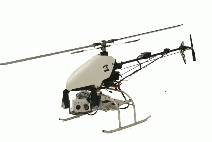
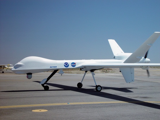
    Unmanned aerial vehicle (uav) used in the spoofing tests; owned by the University of Texas.

     A radio signal sent from a half-mile away deceived the GPS receiver of a UAV into thinking that it was rising straight up. In this way, the UAV’s dependence on civil GPS allowed the spoofer operator to force the UAV vertically downward in dramatic fashion as part of multiple capture demonstrations.

    In December 2011, Iran captured a U.S. Central Intelligence Agency (CIA) surveillance drone with only minor damage to the undercarriage of the drone, likely due to a rough landing when captured. An Iranian engineer claimed in an interview that “Iran managed to jam the drone’s communication links to American operators” causing the drone to shift into an autopilot mode that relies solely on GPS to guide itself back to its home base in Afghanistan. With the drone in this state, the Iranian engineer claimed that “Iran spoofed the drone’s GPS system with false coordinates, fooling it into thinking it was close to home and landing into Iran’s clutches.”

    Although the Iranian claims are highly questionable, this incident left many unanswered questions as to the security of GPS systems on unmanned aerial vehicles (UAVs). The CIA drone should have been guiding itself based on the encrypted military GPS signals, which would be incredibly difficult to spoof. However, some experts have conjectured that simultaneous jamming of the military signals and spoofing of the civilian signals might have worked if the drone had been programmed to fall back on the civilian GPS signals in the event that the military signals were jammed. This raises the question: How difficult would it be to spoof a UAV guiding itself based on civilian GPS signals?

    FAA Modernization Act

    In February of this year, Congress passed the FAA Modernization and Reform Act of 2012. According to the Library of Congress summary, this act “requires the Secretary [of Transportation] to develop a plan to accelerate safely the integration by September 30, 2015, of civil unmanned aircraft systems (UASes, or drones) into the national airspace system … [and] determine if certain drones may operate safely in the national airspace system before completion of the plan.”

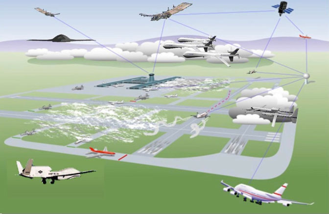
    Such civilian UAVs would be primarily guided by civil GPS, which has been shown to be readily spoofable in the lab. This would create a significant potential hazard in the national airspace if the problem of civil GPS spoofing is not fixed. Thousands of civilian UAVs (operated by postal services, police departments, research institutions, and others) could populate the skies in only a few years while still being vulnerable to remote hijacking via GPS spoofing. The passing of the FAA Modernization Act further emphasizes the need to examine the vulnerability of UAVs to GPS spoofing.

    Test

    On invitation of the Department of Homeland Security (DHS), unclassified spoofing tests against a UAV were performed at White Sands Missile Range (WSMR) on June 19, 2012 during the DHS GYPSY test exercise. These tests demonstrated the capability of a spoofer, built by the University of Texas (UT) Radionavigation Lab, to commandeer a civilian UAV by influencing the position-velocity-time (PVT) solution of the UAV’s GPS receiver.

    The Spoofer. The civil GPS spoofer used for these tests is an advanced version of the spoofer reported in “Assessing the Spoofing Threat,” GPS World, January 2009. A schematic representation of the spoofer is shown in Figure 1. It is the only spoofer reported in open literature to date that is capable of precisely aligning the spreading codes and navigation data of its counterfeit signals with those of the authentic GPS signals. Such alignment capability allows the spoofer to carry out a sophisticated spoofing attack in which no obvious clues remain to suggest that an attack is underway.


    Figure 1. This spooler is capable of precisely aligning the spreading code and navigation data of its counterfeit signals with GPS signals.

    The spoofer is implemented on a portable software-defined radio platform with a digital signal processor (DSP) at its core. This platform comprises:

    • A radio frequency (RF) front-end that down-mixes and digitizes GPS L1 and L2 frequencies
    • A DSP board that performs acquisition and tracking of GPS L1 C/A, calculates a navigation solution, predicts the L1 C/A databits, and produces a consistent set of up to 14 spoofed GPS L1 C/A signals with a user-controlled fictitious implied navigation and timing solution.
    • An RF back-end with a digital attenuator that converts the digital samples of the spoofed signals from the DSP to analog output at the GPS L1 frequency with a user-controlled broadcast power.
    • A single-board computer that handles communication between the spoofer and a remote computer over the Internet.

    The spoofer works by first acquiring and tracking GPS L1 C/A and L2C signals to obtain a navigation solution. It then enters its “feedback” mode, in which it produces a counterfeit, data-free feedback GPS signal that is summed with its own antenna input. The feedback signal is tracked by the spoofer and used to calibrate the delay between production of the digitized spoofed signal and output of the analog spoofed signal. This is necessary because the delay is non-deterministic on start-up of the receiver, although it stays constant thereafter.

    After feedback calibration is complete and enough time has elapsed to build up a navigation data bit library, the spoofer is ready to begin an attack. Initially, it produces signals that are aligned to within a few meters with the authentic signals at the location of the target antenna but have low enough power that they remain far below the target receiver’s noise floor. The spoofer then raises the power of the spoofed signals slightly above that of the authentic signals. At this point, the spoofer has taken control of the victim receiver’s tracking loops and can slowly lead the spoofed signals away from the authentic signals, carrying the receiver’s tracking loops with it.  The target receiver can be considered completely captured when either of the following are true:

    • each spoofed signal has shifted by 2 µs relative to the authentic signals, or
    • each spoofed signal is at least 10 dB more powerful than the corresponding authentic signal.

    The latter option ensures that there is no significant interaction between authentic and spoofed signals by simultaneously jamming and spoofing.
    The UT spoofer and attack strategy have been tested against a wide variety of civil GPS receivers and have always been successful in commandeering the target receiver.

    Test UAV.  The spoofing tests targeted a University-of-Texas-owned Hornet Mini UAV supplied by Adaptive Flight, which is shown in the  opening photo. The Hornet Mini is roughly five feet long and weighs about 10 pounds when fully loaded. The Mini’s sophisticated avionics package loosely couples an altimeter, magnetometer, and a MEMS IMU package to a GPS receiver via an extended Kalman filter.

    The Hornet Mini is representative of UAVs used by law enforcement. Thus, the results of the spoofing tests with the Mini also apply to other similarly-designed UAVs, including those used in most civil applications, whose navigation systems are centered on civil GPS. It should be noted that no special alterations were made to the Hornet Mini for this test – it was in its “as sold” or “stock” configuration.

    Setup. A schematic of the setup used for the spoofing tests against the civil UAV at WSMR appears in Figure 2. The spoofer was located on a hilltop with the receive antenna on the far side of the hilltop from the transmit antenna as shown in Figure 3. The UAV site was located in a sandy basin approximately 620 meters from the transmit antenna.


    Figure 2. Schematic of the test setup.


    Figure 3. Aerial view of the test site showing the spoofer location on a hilltop and the UAV site 0.62 kilometers away.

    Procedure. The UAV was commanded by its ground controller to hover approximately 60 feet above ground level at the UAV site. After the initial ground control command was sent, the UAV maintained its hovering position automatically based on the navigation solution of its extended Kalman filter, which is based in part on GPS. At this point in the test procedure, the spoofed signals were not being broadcast: the UAV was only under the influence of the authentic GPS signals.

    The spoofer was then commanded to begin transmitting spoofed signals. To ensure seamless capture of the UAV’s GPS unit, the code phases of the spoofed signals were aligned to within meters of the authentic signals at the location of the UAV’s GPS antenna. The spoofed signals overpowered their authentic counterparts and instantly captured the tracking loops within the UAV’s GPS receiver.

    Immediately after capture, the spoofer induced a false velocity and corresponding position change in the UAV’s GPS receiver, drawing the position reported by the UAV’s extended Kalman filter away from the UAV’s commanded hover position. To compensate, the UAV’s flight controller responded by moving in the opposite direction. A safety pilot was on hand to prevent the UAV from drifting out of control.  This was necessary because by commandeering the UAV’s GPS receiver, the spoofer operator effectively breaks the UAV autopilot’s feedback control loop. The spoofer operator must now act as an operator-in-the-loop, which requires real-time, meter-level knowledge of the UAV’s true location.

    Results. Between tests WSMR and UT, the spoofer demonstrated short-term 3-dimensional control of the UAV. Thus, we conclude that it is indeed possible to hijack a civil UAV — in this case, a fairly sophisticated one — by civil GPS spoofing.

    Interestingly, the Hornet Mini relies only on its altimeter for direct measurements of its vertical position; the GPS-measured vertical position is ignored. This can be done with reasonable accuracy because of the Hornet Mini’s short flight endurance (~20 minutes). However, the GPS vertical velocity does affect the extended Kalman filter’s vertical coordinate estimate because the filter propagates GPS velocity measurements through a UAV dynamics model to form an a priori vertical estimate that gets updated with the altimeter measurements. This dependence on GPS velocity allowed the spoofer operator to force the UAV vertically downward in dramatic fashion in the final three capture demonstrations.

    Developing a full spoofer-based control system for a UAV is a difficult problem that, in addition to the requirement for real-time true position feedback, requires the spoofer to model the UAV’s feedback control behavior and to estimate the UAV’s desired path. Causing a UAV to spin out of control and crash is not difficult with a spoofer, but fine-grained control certainly is.

    Implications

    These tests have demonstrated that civilian UAVs will be vulnerable to control by malefactors with a civil GPS spoofer looking to hijack or crash these UAVs unless their vulnerability to GPS spoofing is addressed. There are several reasons why someone may want to spoof a drone including fear over drones invading people’s privacy. This poses a significant safety concern that could result in mid-air collisions with other aerial vehicles or buildings, not to mention loss of property.

    Constructing from scratch a sophisticated GPS spoofer like the one developed by UT is not easy, nor is it within the capability of the average anonymous hacker. It is orders of magnitude harder than developing a GNSS jammer. Nonetheless, the trend toward software-defined GNSS receivers for research and development, where receiver functionality is defined entirely in software downstream of the A/D converter, has significantly lowered the bar to spoofer development in recent years.

    As a point of reference, we estimate that there are more than 100 researchers in universities around the globe who are well-enough versed in software-defined GPS that they could develop a sophisticated spoofer from scratch with a year of dedicated effort. More worrisome is the fact that one does not have to build a sophisticated spoofer like ours, capable of aligning its signals precisely with authentic signals at the location of a chosen target, to spoof a civil GPS receiver. A low-cost off-the-shelf GPS signal simulator would not permit the kind of seamless attack we carried out, but would be adequate to confuse and disrupt the navigation system of a commercial UAV.

    Fixing the Problem

    There is no quick, easy, and cheap fix for the civil GPS spoofing problem. Moreover, not even the most effective GPS spoofing defenses are foolproof. Nonetheless, there are many possible remedies to the spoofing problem that, while not foolproof, would vastly improve civil GPS security. These defenses can be broken up into two categories: cryptographic and non-cryptographic defenses.

    Cryptographic defenses come primarily in two forms, spread-spectrum security codes (SSSC) and navigation message authentication (NMA), depending on whether the unpredictable digital signature is placed on the spread-spectrum code or the navigation data. These cryptographic signatures could be placed on WAAS signals or existing or future GPS signals to provide authentication of the source of the WAAS or GPS signals. A cryptographic defense implemented with appropriate checks to protect against certain variants of spoofing attacks, described in “Straight Talk on Anti-Spoofing,” GPS World, January 2012, would significantly raise the bar for a would-be spoofer. Several proposals for cryptographic methods are currently on the table including a proposal by Logan Scott to place SSSC signatures on GPS L1C signals that will be broadcast by GPS Block III satellites. However, the current proposals for civil GPS cryptographic authentication schemes are still at least several years away from implementation and have a 5-minute window between authentications of each individual GPS signal. These proposals have currently gained no ground in being implemented because of a lack of dedicated funds for development and implementation.

    There are also a number of promising non-cryptographic techniques for civil GPS spoofing detection that include jamming-to-noise power detectors (J/N meters), correlation profile anomaly defenses, and antenna-based defenses. J/N meters are simple and easily-implementable and would prevent a spoofer from simultaneous jamming and spoofing. However, a J/N sensor will not typically detect a spoofing attack in which the spoofed signals are only slightly more powerful than their authentic counterparts. The inclusion of a J/N meter does ensure that the authentic signals will also be visible as a corruption to the correlation curve during a spoofing attack, due to the difficulty of nulling out the authentic signal. This allows correlation profile anomaly defenses to be viable. However, these methods suffer from the difficulty of distinguishing multipath effects from a spoofing attack, particularly in mobile receivers. Antenna-based defenses also present an attractive option for anti-spoofing, but most of these methods require additional hardware (multiple antennas) and cost. One promising new antenna-based defense is currently under development at Cornell University that does not require multiple antennas. This defense involves an extension of the signal spatial correlation technque developed by the University of Calgary PLAN group. However, this technique is still under development, and receivers implementing this technique would likely be several times more expensive than current receivers.

    For details on potential spoofing defenses, see Todd Humphrey’s congressional testimony in “The System.”

    Recommendations

    We recommend that for non-recreational operation in the national airspace, civil UAVs exceeding 18 pounds be required to employ navigation systems that are spoof-resistant. Spoof resistance will be defined through a series of four canned attack scenarios that can be recreated in a laboratory setting. A navigation system is declared spoof-resistant if, for each attack scenario, the system is either unaffected by or able to detect the spoofing attack. Spoofing detection combined with an appropriate GPS-denied mode for the UAV to fall back on will significantly increase the difficulty of mounting a successful spoofing attack.

    Additionally, civil GPS receivers in many critical infrastructures (communications networks, financial trade centers, and the power grid) are also vulnerable to civil GPS spoofing. These critical infrastructures primarily rely on GPS for timing, which is also susceptible to manipulation with varying consequences depending on the application. A discussion of power grid vulnerabilities to GPS spoofing is given in “Going Up Against Time” in this issue of the magazine on page 34. We also recommend that GPS-based timing or navigation systems having a non-trivial role in systems designated by DHS as national critical infrastructure be required to be spoof-resistant.

    Finally, we recommend that funding be committed for development and implementation of a cryptographic authentication signature in one of the existing or forthcoming civil GPS signals. The signature should at minimum take the form of a digital signature interleaved into the navigation message stream of the WAAS signals. A better plan would be to interleave the signature into the CNAV or CNAV2 GPS navigation message stream. The best plan for implementing a cryptographic authentication signature would be to implement the signature as an SSSC interleaved into the spreading code of the L1C data channel. Inclusion of a cryptographic signature would greatly aid manufacturers in developing receivers that are spoof-resistant.

    Manufacturers

    The Hornet Mini UAV carries a µ-blox GPS receiver.


    Daniel P. Shepard is pursuing M.S. and Ph.D. degrees in aerospace engineering at the University of Texas (UT) at Austin. He is a member of the Radionavigation Laboratory.

    Jahshan A. Bhatti is pursuing a Ph.D. in aerospace engineering and engineering mechanics at UT and is a member of the Radionavigation Laboratory.

    Todd E. Humphreys is an assistant professor of aerospace engineering and engineering mechanics at UT and director of the Radionavigation Laboratory. He received a Ph.D. in aerospace engineering from Cornell University.


  • The System: Fly the Pilotless Skies: UAS and UAV


    Unmanned aerial vehicles and civil aircraft may co-habit the airspace after September 2015.

     As the U.S. Federal Aviation Administration (FAA) moves ahead with plans for unmanned aerial systems/vehicles (UAS/UAV) to have regular access to U.S. airspace by 2015, it has encountered several barriers. For UAVs to be treated like manned aircraft, their systems likley need to be qualified to the same standards as civil avioncs. This is a challenge, as each UAS has largely unique systems. UAS equipment standards are emerging, but threats to GNSS abound, requiring defense/mitigation.

    Demand for UAS has produced many different types flying in a range of applications. With no apparent standard avionics fit or uniform safety standards, each UAS type is basically configured for specific tasks. Commercial UAS applications continue to emerge, and major market growth is anticipated. One forecast indicates that the UAS market could reach $7.26 billion this year alone. The promise of new and better ways to reduce costs, improve safety, and increase operational efficiency feeds market expansion.

    However, in the United States the FAA currently requires each UAS commercial project desiring access to controlled airspace to obtain an FAA-approved Certificate of Authorization. While the FAA has made efforts to speed up approvals, this process slowed widespread commercial adoption of UAS. Nevertheless, opportunities abound in pipeline and transmission line inspection, crop spraying, law enforcement, security, and surveillance, survey/mapping, remote area mail delivery, and hundreds of other applications. The FAA may have felt some pressure to move forward, because Congress has put in place the Modernization and Reform Act of 2012, which calls on the FAA to fully integrate unmanned systems, including those for commercial use, into the national airspace by September 2015.

    UAS in the NAS. Meanwhile, a project called the Unmanned Aircraft Systems Integration in the National Airspace System (UAS in the NAS), undertaken by NASA’s Dryden Flight Research Center, seeks to reduce technical barriers related to safety and operational challenges associated with enabling routine UAS access to the NAS.

    Europe has also launched a study on the integration of UAS in non-segregated airspace for the future Single European Sky. The ICONUS study will be carried out by a consortium within the European air traffic management program called Single European Sky ATM Research Programme (SESAR). The study will drive the definition of the requirements, capabilities, and equipment which UAS will need to operate safely and efficiently in the coming European SESAR environment.

    The U.S. RTCA SC-203 committee is drafting UAS operational requirements, and there has been significant progress towards publishing Minimum Aviation Performance Standards (MASPS), including requirements for navigation. Europe has similar activities underway aimed at improving UAS access to its airspace.

    MOPS. The big picture is that requirements for unmanned aircraft are being brought into conformance with the standards applied to the performance and behavior of manned aircraft. Navigation requirements for UAS are expected to specify that systems will need to be qualified to Minimum Operational Performance Standards (MOPS). This means that on-board electronics, including GNSS systems, will probably need to be FAA Technical Standard Orders (TSO) qualified, just as they are now for manned aircraft.

    Why do we need to investigate certified avionics now? In the scheme of avionics, more than two years breathing space to certify UAS avionics systems is not a long time, not at all, until the September 2015 deadline. FAA airborne software and hardware qualification will take much time and effort to implement, and re-configuration of systems, interfaces, and operating procedures may take even longer.

    For Manufacturers. UAS makers have the option to move forward in stages. For instance, by selecting a few existing airborne-qualified OEM avionics, they could minimize the internal effort to comply. As the first UAS with certified avionics emerge, they will probably get good support from FAA to adopt U.S. operating rules for the NAS. Embedding an existing certified GPS receiver in UAS avionics will reduce the internal work needed and allow more effort for developing commercial market opportunities that look to quickly adopt UAS.

    Meanwhile, efforts are in full swing to change the U.S. and European navigation landscapes over the next few years. So it would be better to be ready with a capable GNSS receiver that is already built to meet the challenges of NextGen and SESAR.

    GPS III and Galileo. The L5 civil GPS frequency may be operational around the time that UAS unrestricted access becomes possible. GPS L1/L5 dual-frequency operations will enable higher navigation accuracy, reliablity, and integrity. The FAA is already developing NextGen WAAS to include L5, and revisions to the GPS MOPS to include L5 should begin shortly, in time for a usable GPS L5 constellation in 2015/2016. The FAA is already preparing for L5 avionics, and industry investigative work is underway. Its possible that GPS L1/L5 may meet the accuracy and integrity requirements for CAT II/III automated landings. In Europe, Eurocae work is expected to gain momentum for the Galileo E1/E5a MOPS as the Galileo satellite navigation system becomes operational.

    The new GNSS environment also includes WAAS/SBAS precision approach (localizer performance with vertical guidance, or LPV) capability: LPV is available now in the United States and will soon be in wider operation in Europe. Automatic Dependendant Surveillance (ADS-B) is rolling out in the United States and around the world. ADS-B is being mandated within the U.S. NAS as the means for air-traffic control to track all aircraft, so UAS avionics will need to include certified ADS-B Out capability.

    In one commercial instance, the Septentrio AiRx2 receiver comes out of the box as a certified L1 GPS with ADS-B and WAAS LVP, but is also ready for GPS L5 and Galileo E1/E5a.

    Even as greater steps forward enhance how GNSS is used in this wider definition of aviation that will soon include UAS, a team at the University of Texas demonstrated how a UAV could be maliciously side-tracked (see article on page 30 of this issue) —  reminiscent of the Iranian downing of a U.S. surveillance drone in December 2011.

    Admittedly the GPS on the vehicle in the UT test was not a qualified airborne receiver, but how could this happen when there was also an inertial sensor and a radio-altimeter on the UAV? A good question, which UAV manufacturers will need to consider when they implement their on-board Kalman filters, knowing that spoofing is now an additional threat to parry.

    Couldn’t we detect that high-power RF spoofing signal at the front-end of the GPS receiver? Even if only to tell the on-board systems that there could be hazardous misleading information about? Or run separate GPS and GPS/inertial position solutions, detect significant divergence, and set the same warning flag? And multi-constellation, multi-frequency receivers, and even controlled radiation pattern antennas — all things to investigate.  More work for the aviation receiver guys who labor tirelessly to improve GNSS integrity.

    Of course if you hijack a UAV with a high-power spoofer, you are also spoofing civil transports operating in the same airspace, so now there is the potential to trigger a Federal investigation. It will probably be easier to detect this stuff with moving airborne sensors rather than the fixed ground equipment used to find jammers on trucks at Newark airport, and lots of pilots likely providing real-time location information on radios if their GPS goes even a little haywire. All would help to quickly locate and shut down any spoofer. Nevertheless, it’s a threat to be mitigated.

    Fatal Crash. In South Korea, the effects of intermittent North Korean jamming of GPS to disrupt seal, land, and air navigation in the South may have contributed to the recent fatal crash of a Schiebel Camcopter S-100 drone, a 150-kilogram rotorcraft capable of 220 km/h flight. It should have coped with loss of GPS as the Camcopter has multiple inertial measurement units that allow safe operation and recovery in the absence of GPS signals. Emergency procedures to ensure a safe recovery in such a situation do not appear to have been correctly and adequately followed, manufacturer Schiebel alleges.

    NovAtel may have found one way to help mitigate spoofing on UAVs; the company released a combined civil/SAASM GPS receiver, the OEM625S, aimed specifically at UAVs. Granted, the idea is to add SAASM anti-spoofing capability to a number of UAVs which currently use NovAtel commercial receivers, mostly in military systems. That may be motivated by the desire to avoid further Iranian incidents!

    BAE Systems has been thinking of giving GPS a back-up for just those situations where jamming or even spoofing is detected. BAE’s Navigation via Signals of Opportunity (NAVSOP) system was just announced at the Farnborough air show in the UK and is still in research phase, but looks extremely promising. It interrogates the radio environment for the ID and signal strength of local digital TV and radio signals, plus air traffic control radars, with finer grained adjustments coming from cellphone masts and Wi-Fi routers. Mapping the location of all these sources might be quite an undertaking, and given that these are all non-safety-of-life commercial signals, the sources are subject to the vagaries of power outages, regular maintenance, and breakdowns. Nevertheless, with such a multitude of signals, NAVSOP could well turn out to be a viable back-up for GNSS.

    So, shared access to civil airspace, wider applications in commercial operations, and changes in equipment qualification, along with potential solutions for GNSS jamming and spoofing: lots to consider for the UAS industry.


    Taking It to the House

    U.S. House of Representatives Committee on Homeland Security; Subcommittee on Oversight, Investigations, and Management; Hearing, July 19, 2012:  Using Unmanned Aerial Systems Within the Homeland: Security Game Changer?

    Testimony by Todd E. Humphreys, Ph.D.; Assistant Professor, Cockrell School of Engineering, The University of Texas at Austin. [Excerpted. Prof. Humphreys is a co-author of the article “Drone Hack” in the August issue of GPS World.]

    The vulnerability of civil GPS to spoofing has serious implications for civil unmanned aerial vehicles (UAVs), as was recently illustrated by a dramatic remote hijacking of a UAV at White Sands Missile Range.

    Hacking a UAV by GPS spoofing is but one expression of a larger problem: insecure civil GPS technology has over the last two decades been absorbed deeply into critical systems within our national infrastructure. Besides UAVs, civil GPS spoofing also presents a danger to manned aircraft, maritime craft, communications systems, banking and finance institutions, and the national power grid.

    Constructing from scratch a sophisticated GPS spoofer like the one developed by the University of Texas is not easy. It is not within the capability of the average person on the street, or even the average Anonymous hacker. But the emerging tools of software-defined radio and the availability of GPS signal simulators are putting spoofers within reach of ordinary malefactors.

    There is no quick, easy, and cheap fix for the civil GPS spoofing problem. What is more, not even the most effective GPS spoofing defenses are foolproof. But reasonable, cost-effective spoofing defenses exist which, if implemented, will make successful spoofing much harder.

    I recommend that for non-recreational operation in the national airspace civil UAVs exceeding 18 lbs be required to employ navigation systems that are spoof-resistant.

    More broadly, I recommend that GPS-based timing or navigation systems having a non-trivial role in systems designated by DHS as national critical infrastructure be required to be spoof-resistant.

    Finally, I recommend that the DHS commit to funding development and implementation of a cryptographic authentication signature in one of the existing or forthcoming civil GPS signals.

    Complete testimony (PDF) covers:

    • The potential vulnerabilities of U.S. national transportation, communications, banking and finance, and energy distribution infrastructure;
    • What does it take to build a spoofer? Buy a spoofer?
    • Range and required knowledge of target.
    • Fixing the problem:

    •    Jamming-to-noise sensing defense;
    •    Defense based on SSSC or NMA on WAAS signals;
    •    Multi-system multi-grequency defense;
    •    Single-antenna defense;
    •    Defense based on spread-spectrum security codes on L1C;
    •    Defense based on navigation message authentication on L1C, L2C, or L5;
    •    Correlation prole anomaly defense;
    •    Multi-antenna defense;
    •    Defense based on cross-correlation with military signals.

  • JNC Live Coverage: SAASM and M-Code Receiver Test

    News from the ION Joint Navigation Conference.

    NovAtel and L-3 Receiver Slated for UAV

    The new OEM625S Selective Availability Anti-Spoofing Module (SAASM) GNSS receiver from NovAtel, launched in a cooperative effort with SAASM expert L-3 Interstate Electronics Corporation (IEC), will get its first applications in the unmanned aerial vehicle (UAV) sector. NovAtel has brought forth the new product in part to meet requirements of UAV manufacturers who are now mandated to have SAASM onboard as well, for in-theater operations in areas of military activity.

    “The new SAASM regulations meant that integrators were looking at having to incorporate another receiver alongside their NovAtel unit, complicating user interface factors and increasing onboard space requirements,” said NovAtel Product Manager Neil Gerein. “The OEM625S gives our customers a drop-in form factor that easily replaces their existing NovAtel OEM receiver.”

    “NovAtel has supplied UAV integrators on the civil scientific side almost since our inception,” Gerein said, adding, “the military has become more and more involved in this market in recent years for budget and various other strategic reasons.” He mentioned that in its 20-year history selling GPS products, for the last 17 years NovAtel has provided receivers and expertise to U.S. and Canada defense contractors, and to defense research labs in Allied countries. Antcom, a wholly-owned NovAtel subsidiary specializing in antennas and microwave products, makes the majority of its sales into military areas.

    Examples of such products in this area — not necessarily from NovAtel customers, who remain unidentified — include hand-launched mini-UAVs like the Aerovironment RQ-11 Raven and Elbit Skylark I, and runway-capable tactical UAVs such as Textron RQ-7 Shadow, Aeronautics DS Aerostar, IAI Searcher II, and InSitu’s ScanEagle UAV system, quickly evolving into a mainstay with the U.S. Navy and its allies thanks to a partnership with Boeing.

    The InSitu ScanEagle was first developed to track dolphins and tuna from fishing boats, to ensure that fish labeled “dolphin-safe” actually are so. The same characteristics needed by commercial fishing boats — low infrastructure launch and recovery, small size, 20-hour long endurance, automated flight patterns — are key for naval operations from larger vessels, and for battlefield surveillance.

    At present the OEM625S, combining a commercial dual-frequency NovAtel GNSS receiver with an L-3 IEC XFACTOR SAASM, provides single-point positioning with SAASM for authorized defense customers. The SAASM position is provided via a dedicated communication port, as well as through NovAtel’s software command protocol, allowing for maximum flexibility. The small form factor and low power consumption expands range of potential defense applications requiring robust SAASM GPS positioning.

    The OEM625S measures 60 x 100 x 9.1 millimeters, and runs on field-upgradeable software. NovAtel will accept orders for the OEM625S from authorized customers starting in Q3 2012.


    L-3 Announces First-Ever Successful Gun Firing of Next-Generation M-Code GPS Receiver

    L-3 Communications announced  that its Interstate Electronics Corporation (L-3 IEC) business successfully completed multiple test firings of its next-generation Military Code (M-Code) GPS receiver technology. The milestone represents a significant breakthrough in GPS receiver modernization and validates the unit’s survivability and performance in extreme, guided munitions environments, according to the company.

    L-3’s gun-hardened, next-generation M-Code GPS receiver prototype was fired from a 155-mm howitzer and tracked the M-Prime signal from several modernized satellites to successful target impacts. This represents the first-ever use of the M-Code GPS technology in a weapon system, and provides critical validation of the hardware and software performance in a projectile.

    The successful test supports a Congressional mandate to implement M-Code technology on all future and existing U.S. Department of Defense (DoD) platforms and their objectives for technical innovations capable of offsetting future threats. L-3’s new design presents a flexible hardware and software configuration for GPS integrators and is capable of tracking legacy and modernized signals. The receiver will be applicable on a variety of host platforms, including guided munitions, unmanned aerial systems, soldier systems and ground mobile systems.

  • Wright State Wins 2012 ION Robotic Lawn Mower Competition

    Wright State Wins 2012 ION Robotic Lawn Mower Competition


    Photo: The Institute of Navigation (ION)

    The Institute of Navigation (ION) announces that Wright State University won top prize at the ninth annual 2012 Robotic Lawn Mower Competition held May 31 – June 2 at Siebenthaler’s Beaver Valley Garden Center in Dayton, Ohio.

    Sponsored by the Institute of Navigation Satellite Division and the Air Force Research Laboratory (AFRL) Sensors Directorate, the ION Annual Robotic Lawn Mower Competition is a national event for college and university students, future engineers and problem solvers, that challenges them to design and operate a robotic, unmanned lawn mower using the art and science of navigation to rapidly and accurately mow a field of grass.

    Eleven teams participated during the three day competition, each using unique design approaches. Teams included students and faculty advisors from Auburn University, Auburn, Alabama; Case Western Reserve University, Cleveland, Ohio; University of Florida, Gainesville, Florida (two teams); California State University, Fullerton, Fullerton, California; Miami University, Oxford, Ohio; University of Michigan Dearborn, Dearborn, Michigan; University of North Florida, Jacksonville, Florida; Syracuse University, Syracuse, New York; Southern Polytechnic State University, Marietta, Georgia; and Wright State University, Dayton, Ohio.

    The 2012 ION Robotic Lawn Mower Competition consisted of two separate categories: Basic Autonomous Mowing (Static) and Advanced Autonomous Mowing (Dynamic). The teams were judged in each category based on their total scores; 80% of the total score was  based on the mowing competition and 20% of the total score was based on the presentation and report.

    First place in the advanced Dynamic Competition, with $15,000 in prize money, was awarded to Wright State University, Dayton, Ohio. Second place in the Dynamic Competition, with $10,000 in prize money, was awarded to Miami University, Oxford, Ohio. Third place in the Dynamic Competition, with $5,000 in prize money, was awarded to Case Western Reserve University, Cleveland, Ohio.

    First place in the beginning Static Competition was awarded to the California State University, Fullerton, California. Second place prize in the Static Competition was awarded to the Syracuse University, Syracuse, New York. Third place in the Static Competition was awarded to the University of Michigan, Dearborn, Dearborn, Michigan.

    In addition to The Institute of Navigation Satellite Division and the Air Force Research Laboratory, sponsors included Honeywell, John Deere, The Joint Services Data Exchange, Northrop Grumman and Siebenthaler’s Garden Center.

    The Tenth Annual ION Robotic Lawn Mower Competition will be held May 30 – June 1, 2013, in Dayton, Ohio.


  • NovAtel SAASM to See First Action in Aerial Drones

    The new OEM625S Selective Availability Anti-Spoofing Module (SAASM) GNSS receiver from NovAtel, launched in a cooperative effort with SAASM expert L-3 Interstate Electronics Corporation (IEC), will get its first applications in the unmanned aerial vehicle (UAV) sector. NovAtel has brought forth the new product in part to meet requirements of UAV manufacturers who are now mandated to have SAASM onboard as well, for in-theater operations in areas of military activity.

    “The new SAASM regulations meant that integrators were looking at having to incorporate another receiver alongside their NovAtel unit, complicating user interface factors and increasing onboard space requirements,” said NovAtel Product Manager Neil Gerein. “The OEM625S gives our customers a drop-in form factor that easily replaces their existing NovAtel OEM receiver.”

    “NovAtel has supplied UAV integrators on the civil scientific side almost since our inception,” Gerein said, adding, “the military has become more and more involved in this market in recent years for budget and various other strategic reasons.” He mentioned that in its 20-year history selling GPS products, for the last 17 years NovAtel has provided receivers and expertise to U.S. and Canada defense contractors, and to defense research labs in Allied countries. Antcom, a wholly-owned NovAtel subsidiary specializing in antennas and microwave products, makes the majority of its sales into military areas.

    Examples of such products in this area — not necessarily from NovAtel customers, who remain unidentified — include hand-launched mini-UAVs like the Aerovironment RQ-11 Raven and Elbit Skylark I, and runway-capable tactical UAVs such as Textron RQ-7 Shadow, Aeronautics DS Aerostar, IAI Searcher II, and InSitu’s ScanEagle UAV system, quickly evolving into a mainstay with the U.S. Navy and its allies thanks to a partnership with Boeing.

    The InSitu ScanEagle was first developed to track dolphins and tuna from fishing boats, to ensure that fish labeled “dolphin-safe” actually are so. The same characteristics needed by commercial fishing boats — low infrastructure launch and recovery, small size, 20-hour long endurance, automated flight patterns — are key for naval operations from larger vessels, and for battlefield surveillance.

    At present the OEM625S, combining a commercial dual-frequency NovAtel GNSS receiver with an L-3 IEC XFACTOR SAASM, provides single-point positioning with SAASM for authorized defense customers. The SAASM position is provided via a dedicated communication port, as well as through NovAtel’s software command protocol, allowing for maximum flexibility. The small form factor and low power consumption expands range of potential defense applications requiring robust SAASM GPS positioning.

    The OEM625S measures 60 x 100 x 9.1 millimeters, and runs on field-upgradeable software. NovAtel will accept orders for the OEM625S from authorized customers starting in Q3 2012.

  • South Miami Senior High Wins 2012 ION Mini-Urban Challenge

    muc-2012-1st-place

    The Institute of Navigation (ION) announces that South Miami Senior High School won the 2012 ION Mini-Urban Challenge held May 26 at the Smithsonian’s Lemelson Center for the Study of Invention and Innovation at the National Museum of American History.

    Sponsored by the Institute of Navigation and the Air Force Research Laboratory (AFRL), the ION Mini-Urban Challenge is a national event that challenges high school students to work in teams to design and operate a robotic car, built from a LEGO Mindstorms NXT kit, that can accurately navigate autonomously through a model city. The competition is intended to expose students to the areas of science, technology, engineering, and mathematics (STEM).

    More than 600 students from 66 high schools competed in five regional competitions held in Louisiana, Florida, California, Washington, D.C., and Ohio. First- and second-place winners from each of the five ION Mini-Urban Challenge Regional Competitions were invited to compete in the National Competition. Each team was judged based on their cumulative scores earned throughout the competition phases: 30% of the total score was based on a technical presentation, and 70% of the total score was based on the course navigation portion of the competition.

    First place was awarded to the “Legotron” Team from South Miami Senior High School, Miami, Florida. The first place prize included $2,500 for the winner’s school and a trophy. Second place was awarded to the “305” Team, also from South Miami Senior High School. The second place prize included $1,000 for the winner’s school and a trophy. Third place was awarded to Perry High School, Perry, Ohio. The third place prize included $500 for the winner’s school and a trophy. Best in Show went to the “Legotron” Team from South Miami Senior High School and Best Presentation went to West High School, Torrance, California, who won based on their ambulance robot, complete with working siren.

    Sponsors for the 2012 ION Mini-Urban Challenge included: the Air Force Research Laboratory Munitions Directorate, The Smithsonian’s Lemelson Center for the Study of Invention and Innovation at the National Museum of American History, Boeing, John Deere, the Joint Services Data Exchange (JSDE), Northrop Grumman, Raytheon, the Consortium of Ohio Universities on Navigation & Timing (COUNT), CSR, JAVAD GNSS, Overlook Systems, The University of Calgary, Schulich School of Engineering, UrsaNav, and Lego.