Tag: autonomous vehicles

  • Seen & Heard: Autonomous vehicles and Apple AirTags

    Seen & Heard: Autonomous vehicles and Apple AirTags

    “Seen & Heard” is a monthly feature of GPS World magazine, traveling the world to capture interesting and unusual news stories involving the GNSS/PNT industry.


    Image: iStock/Getty Images Plus/Getty Images
    Image: iStock/Getty Images Plus/Getty Images

    San Francisco Not Keen on Avs

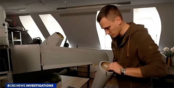
    San Francisco officials aren’t happy with autonomous vehicles (AV) on their streets. They say the AVs are at fault for traffic violations and congestion, delays in emergency response and public transport — even trips onto public sidewalks. California officials granted the first AV deployment permits this year, allowing companies to release self-driving cars onto city streets and to provide passenger service as robotaxis. State governments have the legal power to grant permits to AV companies to conduct testing and ride-hail services, leaving city officials powerless to control self-driving car incidents that affect public safety.
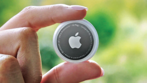

    (Image: Apple)
    Image: Apple

    AirTag under Fire 

    Two women have filed a class-action lawsuit against Apple, claiming its AirTag trackers are being used for malicious and criminal purposes. Both women say they were tracked by ex-partners using Apple AirTags hidden in their belongings. They are seeking damages for negligence and privacy violations, and are hoping to prevent Apple from continuing to manufacture the product with “design flaws.”


    (Image: TU Delft/Frank Auperlé)
    Image: TU Delft/Frank Auperlé

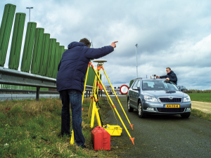
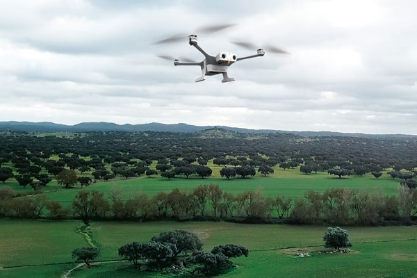
    Navigating Urban Canyons with SuperGPS 

    Researchers at Delft University of Technology, Vrije Universiteit Amsterdam and VSL have developed an alternative positioning system that is more robust and accurate than GPS, especially in urban settings. The aim of the project — SuperGPS — was to develop an alternative positioning system that makes use of mobile telecommunications networks instead of satellites and that has better accuracy than GPS. A prototype of the infrastructure achieved an accuracy of 10 centimeters. The new technology is important for the implementation of a range of location-based applications, including automated vehicles, quantum communication and next-generation mobile communication systems.


    (Image: Allison Usavage/Cornell University)
    Image: Allison Usavage/Cornell University

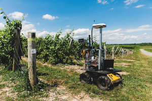
    Robots Head to Vineyards

    Cornell researchers have designed PhytoPatholoBots (PPB) that will be deployed in vineyards across the country next spring in the first of a four-year project at Cornell, which is led by the University of Minnesota. The autonomous robots will collect data on the health of each grapevine, helping growers to evaluate their vineyards. The robots are part of the Specialty Crops Research Initiative, bringing innovation to the wine and grape industries.

  • Unmanned and autonomous news

    Unmanned and autonomous news

    Browsing through the news from the Consumer Electronics Show (CES) in Las Vegas last week, there seems to have been the regular number and variety of ‘robots’ demonstrating various capabilities from basic movement to almost complete human-like animation and speech. There were also a few more demos related to navigation and autonomy that could be of more interest to our readership. In particular, the case was made for more extensive use of drones for deliveries and in agriculture.

    Apparently, the FAA was at the show – promoting the use of unmanned aerial vehicles (UAV) for ‘last mile’ deliveries. The gist of one presentation was that UAV deliveries could possibly reduce the need for people to drive to a store for a pick-up. If we drive, we periodically have accidents – probably someone has estimated the probability that anyone getting into a vehicle will have an accident and suffer varying degrees of damage to property, life or limb.

    So, if drone and automated ground vehicle deliveries were to be universally accepted and implemented, lives would be saved, people’s lives wouldn’t be as disrupted and costs for hospital care and vehicle repairs would be reduced. All good, right? However, people are still not sold on UAV flying over their neighborhoods because they might fall out of the sky and hurt someone or damage property, make lots of noise and disturb their peace and quiet or use the opportunity to invade their privacy. Therefore, delivery start-ups are still struggling through FAA and local red-tape to get airborne — which at this stage is probably not a bad thing — as we get safety objectives straight, and train people well enough to reduce error rates to below acceptable limits.

    Another example used by the FAA at CES was the health risks for pilots of crop spraying aircraft, which are largely used on medium to large scale farms in the United States. The health hazard of the pesticide spray and aircraft accidents during aircraft crop dusting — rapidly, repeated ‘swoop’ to low over the field, low level overflight to spray, then rapid climb and turn maneuver — could be largely avoided by UAV spraying systems, which have already been implemented in many countries around the world. The problem, however, is that the adoption of UAV spraying has perhaps been slower than anticipated.

    Photo:
    A UAV delivering groceries. Image: Walmart
    Photo:
    Crop dusting. Image: Stefan Krause


    Crop dusting aircraft can apparently treat about 600 acres/day on larger farms, while drones are only able to carry much smaller spray tanks, with a capacity of about 8 gallons, which enables spraying of 30 acres-per-hour. In addition, batteries on UAV need to be exchanged regularly, hopefully at the same time as spray tanks are refilled. While one pilot flies a crop duster aircraft, a UAV operation not only requires a skilled pilot to fly the UAV, but also a line-of-sight observer under FAA regulations. So, labor costs are higher, somewhat offsetting the lower operational costs of a UAV.

     Nevertheless, the limited number of crop dusters requires scheduling out days, several weeks even in the busy seasons. Whereas, if you own an agricultural UAV only the weather determines when you can treat your own crops.

    So why is it taking time for this alternative approach to take off?

    Let’s say you buy your own small UAV — one capable of 1-2 gallons-per-acre for a small farm. You would first need to take an operator’s course and qualify for a pilot’s license, then you would have to work city hall to obtain an aerial applicator’s license and a state pesticide applicator’s license. Then you would have to pass an FAA physical, and maybe obtain an exemption to fly a UAV over the standard 55 lb weight. If you wanted to fly after dark, you would also need a night operator’s license. If you wanted to fly several UAV simultaneously (a swarm) to get the job done quickly, you would need to train and become qualified. These things are a significant barrier to entry for individual farmers. Therefore, companies are springing up that will charge equivalent prices for turn-key UAV crop applications as for aerial crop dusting – say between $11 -14 per acre.

    Photo:
    Autonomous AG-116 crop-spraying drone. Image: Hilio

    UAV do have a place in the business of agriculture for crop spaying, even alongside conventional crop-dusting aircraft, and costs seem to be competitive if a farmer were to buy turn-key spraying. The obstacles to overcome for someone to start a UAV spraying business seem somewhat prohibitive, but companies are taking on the challenge and offering services. Farm owners who want to manage their own regular pesticide and fertilizer applications using their own UAV have a steep learning curve to climb.

  • BVLOS flights with North Dakota drone system approved

    BVLOS flights with North Dakota drone system approved

    Photo:
    Image: uAvionix

    uAvionix has received approval by the Federal Aviation Administration (FAA) to conduct beyond-visual-line-of-sight (BVLOS) small unmanned aerial flight in North Dakota. The test flight to secure approval took place at the Northern Plains UAS Test Site in North Dakota.

    Vantis is North Dakota’s UAS network, which serves many UAS operators across different sectors. By leveraging Vantis, uAvionix demonstrated to the FAA it had established adequate risk mitigations to satisfy required safety standards for BVLOS operation within the national airspace system.

    The Northern Plains UAS Test Site partnered with Thales USA to develop and implement Vantis. The UAS system enables UAS pilots to command and control the UAS and remain clear of other aircraft when flying BVLOS. Vantis includes ground-based aviation infrastructure, which lowers the barrier of entry to BVLOS flights for multiple users.

    The FAA approval to conduct BVLOS UAS flights is another step in bringing UAS to commercial sectors. UAvionix continues to collaborate with FAA as regulations evolve to ensure Vantis meets all necessary requirements.

  • FAA approves Percepto for an HA BVLOS UAV inspection

    FAA approves Percepto for an HA BVLOS UAV inspection

    Photo:
    Image: Percepto

    Percepto has announced the U.S. Federal Aviation Administration (FAA) has approved the use of its UAV-in-a-box solution to perform highly automated beyond visual line of sight (HA BVLOS) inspections and monitoring operations at a large solar power plant in Texas.

    The HA BVLOS UAV will fly at 200 feet above ground, which is double the altitude of any previously approved operation in the United States. The ability to fly at a higher altitude will enable greater operational flexibility to monitor large areas and tall structures in the future, including mapping and modeling.

    Percepto’s HA BVLOS UAV enables an automated detect and avoid cycle, eliminating the need for remote pilot in command interventions if other aircraft are detected.  Additionally, this capability negates the need for a pilot or visual observer on site.

    The FAA approval for the solar plant deployment serves as a model for other industries including mining and oil and gas, to potentially increase site efficiency through automated remote inspection operation.

  • UAvionix updates C2 solutions for UAS BVLOS operations

    UAvionix updates C2 solutions for UAS BVLOS operations

    In December 2022, uAvionix announced its updated product line for unmanned aerial systems (UAS) beyond visual line of sight (BVLOS) command and control (C2). The SkyLine C2 management platform and muLTElink airborne radio systems (ARS) are designed to integrate, which enables a self-healing C2 network capable of both path and link diversity. This eliminates lost-link possibilities over broad terrain and altitude ranges.

    Photo:
    Image: uAvionix
    Photo:
    Image: uAvionix

    MuLTElink ARS consists of two models — muLTElink915 and muLTElink5060, the core of the uAvionix C2 system. The muLTElink915 model combines globally licensed aviation LTE, enhanced with frequency hopping 902–928 MHz industrial, scientific and medical frequencies capability. The muLTElink5060 model combines global LTE with aviation-protected 5,030–5,091 MHz C-band for customers holding C-band licenses for control and non-payload communication (CNPC) operations.

    Each muLTElink model allows up to one external CNPC radio to be optionally connected to allow simultaneous use of all three frequency ranges, higher power C-band operation or future radio integrations.

    UAvionix updated its previous line of microLink and SkyLink ARS radios and relaunched them under the SkyLink ARS banner. Each SkyLink ARS can operate as a point-to-point radio or integrate with muLTElink and SkyLine for managed C2 operations. SkyLink915micro, formerly named microLink, offers a robust form factor and Lemo connector for UAS requiring hardened installations.

    SkyLink5060micro and SkyLink5060 offer 100 mW and 10 W 5,030–5,091 MHz aviation protected C-band CNPC options.

    Both platforms meet standards set by RTCA DO-362A and the U.S. Federal Aviation Administration’s draft Technical Standard Orders-C213a and may receive similar validated orders through other global aviation regulators.

  • TDK adds to its InvenSense SmartIndustrial family

    TDK adds to its InvenSense SmartIndustrial family

    Photo:
    Image: TDK

    On Jan. 4, TDK Corporation announced the addition of the IIM-42653 and IIM-42652-I platforms to its InvenSense SmartIndustrial family of compact and low-power sensor platforms. IIM-42653 and IIM-42652-I consist of 6-axis IMUs, which target industrial and navigation applications requiring high force sensitive resistor (FSR) performance or inertial navigation software.

    The IIM-42653 platform—a robust, low-noise, low-power, 6-axis IMU—is capable of a gyro-programmable output of 4,000 dps and an accelerometer-programmable output of 32 g. These features make IIM-42653 ideal for applications including industrial-grade or high-end automated guided vehicles, automated mobile robots and unmanned aerial vehicles.

    The IIM-42652-I platform, a compact 6-axis IMU, offers hardware authentication and can be integrated with TRACK dead reckoning software from Trusted Positioning, a TDK Group company. The TRACK software, which is available for purchase through a licensing agreement, filters GNSS multi-path errors and provides a continuous navigation solution when GNSS signals are unavailable.

    IIM-42653 is available now for select partners and customers only and will be available at TDK distribution partners in April. IIM-42652-I is available now at InvenSense-authorized distributors.

  • Autel Robotics announce EVO Max 4T UAV

    Autel Robotics announce EVO Max 4T UAV

    Photo:
    Image: Autel Robotics

    Autel Robotics has unveiled its EVO Max 4T UAV, an intelligent flight platform designed for enterprise and professional applications. The company made the announcement at CES 2023.

    EVO Max 4T’s autonomous flight technology and artificial intelligence features give it self-reliance and navigation capabilities. It has omnidirectional obstacle avoidance and tri-anti-interference capability to ensure flight safety and stability in high-interference environments.

    It is equipped with three high-quality cameras including a 48 MP telephoto camera, a 50 MP wide-angle camera and an infrared camera. The platform has a range of navigation and data-acquisition functions, including 3D flight routes, PinPoint Mode, Team Work, Polygon Mission, Waypoint Mission and Oblique Photography.

    Autel Robotics also released the Dragonfish NEST and the EVO NEST. Dragonfish NEST is an automated electric vertical takeoff and landing (eVTOL) support system, with a range of up to 75 miles between units, and is suitable for long-range corridor inspections and large area coverage. EVO NEST is a base for automatic take-off, landing, charging and mission planning for EVO series UAVs. It is designed for all-weather operation and can be easily transported.

  • TerraStar-X Enterprise test beds now available in China

    TerraStar-X Enterprise test beds now available in China

    Photo:
    Image: metamorworks/ /iStock/Getty Images Plus/Getty Images

    On Jan. 3, Hexagon and Dayou announced the availability of TerraStar-X Enterprise test beds in Beijing, Shanghai, Anqing and Shenzhen for OEMs in the automotive and micro-mobility industries. Terra-Star-X Enterprise precise-point positioning corrections provide lane-level accuracy with fast convergence for autonomous vehicles and mass-market use.

    The availability of the test beds follows the initial announcement by Hexagon’s Autonomy & Positioning division and Dayou of their partnership aiming to deliver GNSS correction services to the Chinese market. Users of autonomous platforms will now have a single correction service that works in China, North America and Europe.

    OEMs in China can now leverage the test beds with consumer and automotive-grade GNSS receivers to design advanced driver assistance systems (ADAS), and other products, such as mobile applications, safety-critical solutions and more.

  • DroneShield completes Defense Innovation Hub project

    DroneShield completes Defense Innovation Hub project

    On Jan. 5, DroneShield announced the completion of its Defense Innovation Hub project. This project resulted in improvements to its optical/thermal AI DroneOptID engine, as well as the development of a multi-sensor fusion artificial intelligence engine (SFAI).

    DroneShield’s DroneOptID is AI powered and designed for autonomous optical detection, classification and tracking of UAVs. This engine can be integrated with command-and-control platforms, such as DroneShield’s DroneSentry-C2, which the new SFAI engine will become a core part this year.

    The $800,000 project was first commissioned in November 2021 by the Australian Department of Defense, under phase two of the Defense Innovation Hub program. DroneShield was contracted to work on AI in multi-domain applications for the counter-unmanned aerial system space and more general military and government agency applications.

  • Iranian UAV downed in Ukraine contains western technology

    Iranian UAV downed in Ukraine contains western technology

    A Ukrainian intelligence assessment obtained by CNN and CBS reported an Iranian UAV downed in Ukraine contained technology from companies in the United States and other western countries. The White House has since launched an investigation as to how the technology — including semiconductors, GPS modules and engines — were obtained by Iran.

    Screenshot: CBS video
    Screenshot: CBS video

    The components removed from an Iranian Shahed-136 UAV totaled 52, 40 of which were manufactured by 13 different U.S. companies. The remaining components were manufactured by other western companies and companies based in Japan, Taiwan and China.The United States monitors exports and imposed restrictions and sanctions to prevent Iran from obtaining components for UAVs. Officials are now looking to enhance enforcement of the sanctions and are encouraging companies to monitor their supply chain, as well as identify third-party distributors who may be re-selling the technology to Iran.

    U.S. companies are not alone in having to closely monitor their supply chains. U-blox, a Swiss semiconductor company, made a statement reinforcing its company policy, which bans the use of its technology in weapons. This was after u-blox GNSS modules were reportedly found in Russian UAVs.

  • Honeywell, U.S. Army to deliver next-gen navigation solution

    Honeywell, U.S. Army to deliver next-gen navigation solution

    On Jan. 9, Honeywell announced it is ready to deliver its EAGLE-M Embedded Global Positioning System/Inertial Navigation System (EGI) with M-code capabilities this year, after the United States Army completed the first test flight.

    The Army tested the EGI units with enabled M-code on the MQ-1C Gray Eagle unmanned aerial system and validated it to be deployed on military aircraft. This year, the Army will begin migrating its fleet to the Honeywell EAGLE-M EGI with M-code, as this navigation solution enhances the resiliency of GPS navigation to enemy actions.

    Photo:
    Image: Honeywell

    The defense technology company has delivered more than 300 EGIs with M-code to customers and will deliver qualified units, featuring M-code GPS, to the Army. Honeywell is a leader in EGI for military applications and has provided more than 45,000 EGI units for several different types of aircraft in more than 30 countries.

  • Raytheon receives $207 million counter-UAS contract

    Raytheon receives $207 million counter-UAS contract

    File:Raytheon Technologies logo.svg - Wikimedia Commons

    In October 2022, Raytheon Missiles & Defense, a Raytheon Technologies company, received a $207 million contract from the United States Army for Ku-band radio frequency sensors (KuRFS) and Coyote effectors. The Army plans to equip two of its divisions with KuRFS and Coyote effectors to defend against threats from unmanned aerial systems (UAS).

    The KuRFS precision targeting radar and scaled Ku-720 mobile sensing radar provides 360-degree detection, identification and tracking of airborne threats. Coyote Block 2 kinetic and Block 3 non-kinetic effectors can defeat single UAS and swarms at high altitudes and long ranges.

    The Army’s Mobile-Low, Slow, Small, Unmanned Aircraft Integrated Defeat System, integrates KuRFS and Coyote effectors with Northrop Grumman’s Forward Area Air Defense Command-and-Control system and Syracuse Research Corporation’s electronic warfare system. This creates a mobile deployed system that provides a complete extended-range defense solution.