Cepton, a Silicon Valley-based lidar solutions company, and ALP.Lab GmbH, an Austrian-based provider of autonomous vehicle testing solutions and TE Connectivity, which produces sensors and connectors, have completed a proof-of-concept project called Periscope. Periscope is a vehicle-to-everything (V2X) solution, which extends a driver’s field of view using lidar sensors installed at intersections to warn of road hazards ahead before they are in view.
The companies created Periscope in response to the global issue of traffic accidents involving pedestrians and cyclists. The V2X solution communicates information about road conditions in real time, providing more time to react, preventing accidents and enhancing overall safety.
For the proof-of-concept project, Cepton provided its Helius Smart Lidar System, which combines lidar sensors with edge computing and perception software to provide real-time, 3D object detection and tracking. TE Connectivity contributed its V2X hardware components in the vehicle used for testing and for the surrounding infrastructure, as well as provided technology for an on-board display of the vehicle’s location and road hazards. ALP.Lab supervised the system integration and testing, while also providing the testing area and infrastructure.
Cepton, ALP.Lab and TE Connectivity are planning to collaborate on further testing this year to confirm Periscope’s initial findings.
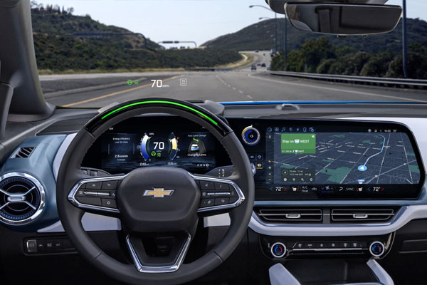
On Jan. 5, FocalPoint announced an investment from GM Ventures, and collaboration with General Motors (GM), on the integration of next-generation GPS technology in the automotive industry. This collaboration will explore the deployment of electric and autonomous vehicles and aims to apply FocalPoint’s technologies into future vehicles produced by GM to make navigation more precise, especially in urban environments.
Image: FocalPoint
FocalPoint’s Supercorrelation is designed to increase positioning accuracy in urban environments and is highly resilient to spoofing attacks. It will be integrated into GM vehicles to provide more accurate navigation. The goal of the integration is to enhance and expand GM’s Super Cruise, and upcoming Ultra Cruise, hands-free, driving assistance technology.
Supercorrelation is already licensed to u-blox and is in advanced trials with other major manufacturers including Molten Ventures, Greshham House, Passion Capital, IQ Capital, Cambridge Angels and more.
California lawmakers have passed a bill prohibiting OEMs of autonomous vehicles from marketing their vehicles as ‘fully self-driving.’ This law went into effect Jan. 1.
This legislation was passed in mid-September of 2022 and states that manufacturers are prohibited from selling new passenger vehicles with autonomous driving features without fully disclosing their capabilities and limitations. Companies such as Tesla, and other OEMs in California, will no longer be able to market vehicles as ‘fully autonomous,’ as the new bill states that it is “considered a misleading advertisement.”
Any violation of the new legislation will be punished as an infraction. Based on this, it is unclear what the exact punishment will be for OEMs that violate this policy.
Senate Bill No. 1398 will be added to Section 24011.5 of California’s vehicle code. The full bill can be found here.
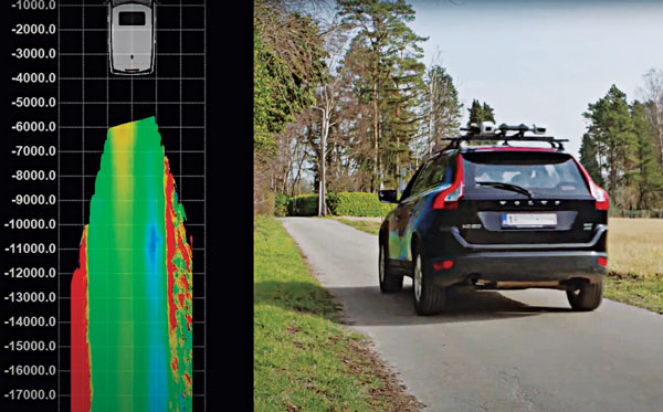
Multi-sensor clusters enable precise assessment of road conditions. (Photo: XenomatiX)
The success of higher levels of vehicular autonomy will depend on two types of roadway corridor digital twins: pre-mapped and augmented on the fly. No matter how well the corridors are pre-mapped, there will always be the need for the vehicle to be self-aware — not only of the proximity of other vehicles and pedestrians, but also of changes to fixed features. New vehicles are being provisioned with multi-sensor clusters, including GNSS, cameras, lidar, sonic and more. This provides an opportunity to more precisely assess the condition of the road surface, which affects the performance of vehicle suspension systems, tires, fuel efficiency and general wear and tear.
“Imagine that your car navigation map system included roadway conditions,” said Karsten Bronowski, sales and business development manager for XenomatiX, “a global view where roads are color-coded based on their surface types and roughness. And all of this is mapped by systems like ours or added to the mobile systems mapping all the roads.
“Our product actually came out of the automotive world, and we still have customers that use it as a reference system for active suspensions, for mass-spring damping systems,” Bronowski said. For these applications, the sensors were mounted facing forward for a preview mode. “We have worked with the Belgian Road Research Center and others with applications to readily provide the international roughness index.”
XenomatiX was formed in 2013, focused on developing true solid-state lidar. “The idea was to get the motor out of lidar,” said Bronowski. “You have moving parts, you have wear and tear, the effects of vibration, problems with long-term reliability and with controlling temperature. With true solid-state lidar, you eliminate these issues.” Micro-electromechanical systems (MEMS) lidar systems still have moving, opto-mechanical components. Bronowski said that the solid-state systems feature a CMOS-based detector generating high-density point clouds in all weather conditions, and a multi-beam laser projector generating a high-resolution grid of points.
The dual lidar sensor system gets its orientation and positioning from additional components, including GNSS and IMU. The system that Bronowski showed at Intergeo 2022 had Septentrio AsteRx-U3 GNSS/IMU units supporting dual antennas for heading. However, they are using other means to improve both relative and absolute positioning: “How we do this is one of our secrets. For one of our customers in Japan mapping local highways, we proved to have excellent compensation, even tracking precisely through a 4-kilometer-long tunnel.”
XenomatiX has developed software to analyze data for many applications, automate feature recognition, and even validate other data. For instance, one customer in the United States is a big player in the satellite imaging sector that wants to match that data with pavement markings the XenomatiX system picks up.
While there is a needed calibration step and the requirement to align the detector for the dedicated measurement vehicle, sensor systems such as this can be put on just about any type of vehicle — on- or off-road. The driver does not need to intervene much, and the processing is done on a standard PC or laptop. “The customer does not care about the systems, just the data that comes from it,” Bronowski said.
Tactical-grade IMUs enable UAVs to achieve the same locational accuracy as ground-based systems. (Photo: CHC Navigation)
We often hear the anecdote about an early lidar scanner that could take a shot every few seconds, yet it held a value proposition for certain applications. As the capabilities of successive mapping and surveying systems change rapidly, so does the conventional wisdom about which are best for various applications. Transportation corridor mapping — be it for improvements design, as-built surveys, asset management or digital twinning — has always been a balancing act between precision and efficient large-scale data capture.
“I remember 15 years ago, during my university time, the scanner was the size of a dining table,” said Andrei Gorb, segment manager for mobile mapping and unmanned aerial vehicle (UAV) systems, CHCNAV. At the top end of the mapping food chain were terrestrial scanners, targets, bore sighting, and registering point clouds mostly manually. As cumbersome and time-consuming as the legacy tools and methods were, these options still offered efficiency gains compared to conventional surveying with total stations. Then a decade ago, mobile-mapping systems began to change that paradigm. Departments of transportation found that mobile-mapping systems could meet their requirements for many design projects, and certainly for asset inventory and management. Unmanned aircraft systems (UAS) were not quite there yet.
The tech used depended on the application. “First, there was road maintenance, to understand the road condition,” Gorb said. “Previously, UAS did not meet the high requirements: centimeter in absolute and millimeter in relative. We now have mobile-mapping solutions, from us and other suppliers, that can be in the 8-9 mm absolute accuracy range on short road surfaces.” Yet for many transportation applications, the absolute accuracy may not be as important as the relative precision. This is where years of development in UAS has made the difference.
CHCNAV was not alone in recognizing that the gap was closing, and the company planned ahead. “Previously, UAS would fly for under an hour, and were mostly carrying cameras or early lidar, which was not suitable for highways,” Gorb said. “A few years of development, and we see it is practical to meet requirements with UAS flying between 50 and 100 meters — in Europe, many local regulations forbid flying above 120 meters anyhow.” Gorb attributes the advances to lidar sensors that UAS can carry. These sensors have become much better and less expensive. Plus, platforms like vertical-take-off-and-landing (VTOL) systems can stay in the air much longer.
The UAS boom of the past 10 years saw the dominance of consumer-prosumer market UAV platforms becoming quite commoditized, with certain vendors gaining majority market share. CHCNAV, instead, sought to develop enterprise solutions, for both mobile and UAS systems — large-platform rotor, fixed-wing and VTOL platforms. The company offers an amalgam of hardware and software, from Riegl scanner heads on some of their mobile-mapping systems to Honeywell inertial navigation systems (INS) for some of their UAS solutions.
Gorb echoes what we hear from many mapping practitioners, saying ground-control points are not as necessary in the densities required for legacy mobile and UAS mapping. He explained that everything from strip adjustments to processing of GNNS/IMU data has tightened both precision and accuracy. “We have a tactical-grade IMU in both our mobile mapping and UAS solutions, for a high-end trajectory,” Gorb said. “So, it means that we can get the same high-accuracy point cloud for highways from the ground and the air perspectives.”
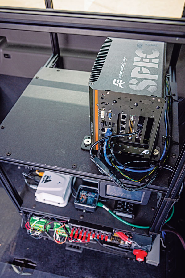
Hexagon | AutonomouStuff’s hardware rack inside the Ford Transit shuttle. (Photo: Hexagon | AutonomouStuff)
When it comes to ground transportation, most of the R&D regarding GNSS is aimed at developing driver-assist systems and, ultimately, driverless cars and trucks. For that purpose, GNSS receivers are integrated with inertial navigation systems, radar, lidar, computer vision and ultrasonics.
Leveraging decades of robotics experience and knowledge of control algorithms, AutonomouStuff, part of Hexagon’s Autonomy & Positioning division, has developed a software stack for autonomous vehicles based on the Apollo open-source software stack.
“Think of this software stack as a brain powering the autonomous platform,” said Kevin Fay, product manager for Hexagon’s platforms and vehicle software business. The software stack can be customized across platforms and to meet equipment needs.
Most recently, in a collaborative project with the National Advanced Driving Simulator at the University of Iowa, AutonomouStuff worked with the Automated Driving Systems for Rural America project to outfit a Ford Transit 350HD shuttle for autonomous operation. First, it created a drive-by-wire system that enabled electronic control of the vehicle, and then it installed positioning, navigation and perception sensors. The result is a platform ready to be autonomous as soon as the software stack is integrated.
Rural roads — which have a wider range of speeds than urban ones — may be encumbered by wildlife or heavy equipment. They also vary in surface from asphalt to gravel, providing a particularly challenging test environment for the autonomy software.
“The Iowa vehicle has done a sizable amount of automated driving on a combination of urban and rural roads, where traditional sensing falls flat,” Fay said. “It has excelled in areas such as gravel roads that have limited or no lane markings, or are narrower than normal. We deployed it earlier this year to do things such as traffic-light detection with the cameras on board, so that it navigates traffic-light intersections appropriately.”
While rural roads are generally free of the GNSS multipath challenges presented by urban canyons, they also provide fewer navigation landmarks. Another challenge is inclement weather. During snowstorms, Fay pointed out, country roads might be unplowed. “If you run on the right lane of the road all the time, you might be out of the ruts that are on the road, and then you’re struggling to get through.” The vehicle must learn to navigate appropriately in those conditions.
The University of Iowa Ford Transit shuttle is a limited deployment, mainly to collect data for research purposes. Meanwhile, it is giving real rides to residents, though with a safety driver. “They’re always attentive, but their hands will be next to the wheel,” Fay said. “There will be times where they may have to take over.”
Other universities and companies are using the platform to further their autonomy programs. Most of them are doing urban driving in complex routes with live traffic, for a total of a dozen vans nationwide.
Hexagon equips the vehicles with a variety of sensors, including a front-mounted adaptive radar, a roof-mounted Velodyne lidar, a roof-mounted NovAtel GNSS receiver and cameras mounted inside the vehicle. “Which ones we provide depends largely on the customer and on which software they’re deploying,” Fay said. “We provide our customers a complete package that can be used with minimal work out of the box. It has the software, the interface to the vehicle, and sensors on it. But we can also provide them with a vehicle that simply has an interface for control, and they add their own computer and software on top of it.”
Hexagon’s first Ford Transit was deployed in 2021. The company released the current version in the spring of 2022, and the Iowa project is slated to run through the middle of 2023. “We’ve not had something running in live traffic before,” Fay said, “so it allows us to continue to grow our skill sets and our overall expertise.”
ASENSING, a Chinese positioning solutions company for autonomous vehicles, is ready to provide its navigation systems globally. The company already has more than 500,000 autonomous vehicles integrated with its navigation systems and is discussing global product expansion with major Western brands.
ASENSING is the first in series production of an automotive solution that combines IMU and GNSS, enabling it to develop an algorithm to maintain navigation accuracy at various temperatures. Its positioning solutions are designed for autonomous driving at L2 level and above and meet functional safety requirements.
ASENSING has received nominations from more than 20 OEMs to provide solutions for more than 70 vehicle models. Additionally, the company has partnerships with traditional brands such as SAIC, Geely, and Chery, as well as with new energy vehicle makers, including XPeng, Li Auto, and NIO.
The company has three global branches, in the United States, Germany, and Japan with plans to launch more smart plants in east and south China to accommodate for an influx of orders. ASENSING will exhibit its mass-produced positioning solutions at the Consumer Technology Association’s Consumer Electronics Show 2023 in Las Vegas, Nevada.
On Dec. 20, u-blox banned the use of its GNSS modules in military UAVs in the war between Russia and Ukraine. The company had become aware that its GNSS modules were being used in certain Russian reconnaissance UAVs and stated that this use was against company policy.
U-blox obtained media reports that Russia had stocked up on components in anticipation of war, then integrated products from the company in UAVs it manufactured after attacking Ukraine.
After Russia began its invasion of Ukraine, the company halted all sales to Russia, Russian territories, and Russian-occupied areas, as it intends its GNSS modules and other products to be used only commercially. U-blox company policy bans the use of its products in weapons, including systems for target identification.
U-blox is investigating the infringement of its policy and plans to take legal action if it has been violated. The company also condemns the invasion of Ukraine by Russian forces.
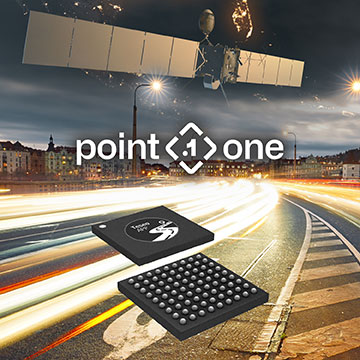
Point One’s FusionEngine software, which is rated for automotive safety integrity level (ASIL), is now compatible with STMicroelectronics’ Teseo ASIL Precise Positioning GNSS chipset (TeseoAPP). This assures functional safety as ASIL-B, a requirement for Level 3+ advanced driver assistance systems (ADAS).
FusionEngine can be integrated into several different host processors that are used for enabling high level ADAS and autonomous driving systems. The combination of TeseoAPP’s receiver and the STA5365S external RF front-end provides dual-band measurement data for all visible GNSS satellites to the main host processor into which FusionEngine is integrated.
FusionEngine software is a precise location solution for automotive applications. For accuracy and to ensure the safety and integrity required for high level autonomous vehicles it combines data from multiple sensors, including the TeseoAPP multi-band GNSS receiver. It also enables developers to complete the functional safety concept phase for host system software integration.
On Dec. 20, Hexagon announced a partnership to integrate its software positioning engine and correction services with ZF Group’s ProConnect connectivity platform. This will enable vehicle communication in advanced driver assistance systems (ADAS) and autonomous driving systems.
This integration is critical to providing the necessary functional safety, lane-level positioning accuracy and automotive safety integrity level (ASIL) rating that ZF’s automotive telematics platform requires. Hexagon’s TerraStar-X precise point positioning correction service will greatly improve the accuracy and reliability of ADAS and autonomous driving systems.
Hexagons’ dual frequency and multi-constellation GNSS receivers are tightly coupled with inertial capabilities that withstand vehicle dynamics in all driving conditions.
Both companies are focused on the next generation of mobility, including electric vehicles and autonomous systems, and this partnership helps advance safety and automation in the automotive and transportation industry. Hexagon and ZF plan to demonstrate their ADAS at the Consumer Electronics Show in Las Vegas in January 2023.
One of several derivative branches from unmanned air vehicles and their technologies is electric aircraft and air taxis. Referred to as eVTOL (electric Vertical Take-Off and Landing), a class of manned and unmanned aircraft is being developed and certified for short-hop passenger transit from down-town ‘Verti-Ports’ to classic airports, aimed at improving the economics and reducing the noise footprint of current helicopter services. Urban air transport is undergoing significant change as organizations such as United Airlines, Delta, American Airlines and others plow money into electric aircraft and the development of manned and unmanned air axis.
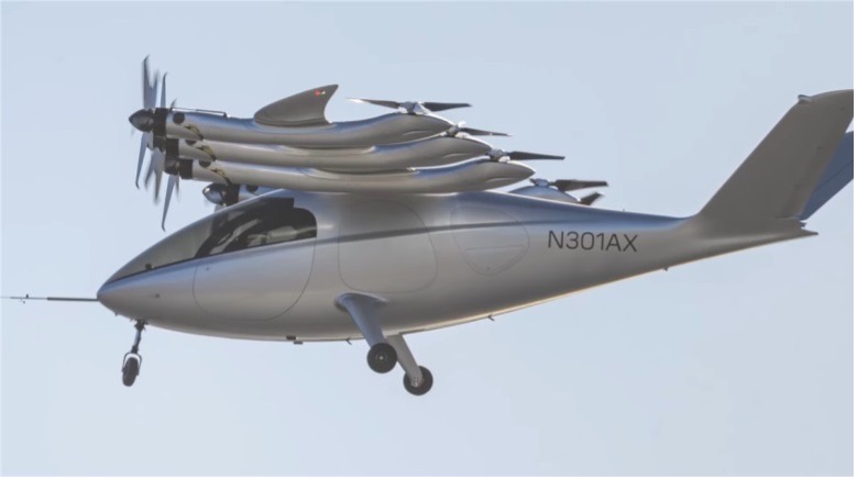
Archer Aviation is developing two such aircraft, with ‘Maker’ being the first cut flying test-bed, and ‘Midnight’ its so called ‘first production version.’ The vehicle design is similar in that they both have wings and are powered by six lift propellers and six tilting props that rotate vertically to lift for take-off and landing, then transition to horizontal for forward flight.
Image: Maker in forward flight/ArcherImage: Midnight/Archer
In the past, Archer has been somewhat secretive about its air-taxi program, but with the introduction of Midnight on Nov. 17, and with Maker achieving transition from hover to forward flight on Nov. 20, they released some useful information. Lift to forward transition is a big step for eVTOL, with the potential for a major set-back, almost like an irrecoverable stall for a fixed wing aircraft.
There are six battery ‘packs’ mounted in the wing near the engines – batteries, engines and FAA certification are key focal areas in their program, with fault tolerance and endurance being key considerations. An existing lithium battery has been selected following extensive testing, with a design objective of 10,000 average 20 mile trips, each trip with a 10 minute recharge cycle. Two similar electric motor types are used, with 95% commonality, and flight can allegedly be maintained through one complete engine or propeller failure. Each engine has redundant elements allowing one side to fail while still maintaining full operation. All these redundancies support the Archer plan for FAA certification which has now progressed through ‘Certification Basis’ and ‘Conceptual Design’ to ‘Preliminary Design’. There are many steps still to complete, with certification not anticipated until at least the second half of 2024.
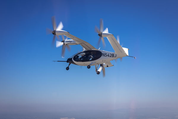
Meanwhile, Joby Aviation has been making significant progress with its flying prototype and pre-production aircraft, with the objective of developing a flying rideshare platform. With space for four passengers and a pilot, the Joby aircraft is smaller than the Archer vehicle, however smaller size means less weight and complexity and requires fewer lift props. The Joby vehicle has six large props that all transition from vertical for take-off and landing to horizontal for full forward flight.
Image: Courtesy of Joby Aviation. (c) Joby Aero, Inc.
Joby developed its own lithium-iron batteries and dual redundant electric motors and while developing flying prototype and pre-production aircraft, has also focused on teaming with key industrial partners who are assisted in key areas:
NASA has undertaken a study with Joby on 5 potential route configurations at Dallas/Fort-Worth airport for eVTOL traffic.
The US Department of Defence has provided flight range and facilities to enable airborne testing of the Joby prototypes. This contract has just been modified so that US Marine Corps personnel may flight test Joby’s eVTOL to evaluate DoD use-cases for the aircraft.
The company ‘Uber Elevate’ was purchased by Joby and is now integrated as the future provider of trip access for customers.
Toyota has not only invested in Joby, but is providing essential production facility knowledge and guidance as Joby begins its initial build out of volume manufacturing.
Delta has invested an initial $60 million, which could increase to $200 million provided progress towards certification and service entry meets certain milestones
Other eVTOL notable companies entering this market include Jaunt Air Mobility in Dallas, Texas; Velocopter in Bruschal, Germany; Lilium in Munich, Germany; Kittyhawk in California; Wisk in California and New Zealand; Airbus in Toulouse, France; Ehang in Guangzhow, China; Vertical Aerospace in Bristol, England; Urban Aeronautics in Tel Aviv, Israel; and Eve Mobility in Melbourne Florida.
So, just a small taste of two of many eVTOL hopefuls – but two with the backing of mainline commercial airlines – who knows who will actually make it through the arduous and expensive aviation certification process before the cash runs out? However, there are many significant investors who are currently standing by their selected hopefuls and others continue to jump in – let’s hope that by 2025 we’ll begin to see home-airport air-taxi services underway.
A roundup of recent products in the GNSS and inertial positioning industry from the December 2022 issue of GPS World magazine.
AUTONOMOUS
Flight Controller
Turns a UAV into a connected autonomous system
Photo: Auterion
Skynode reference-design hardware is built with Remote ID in mind, enabling UAV users to comply with the FCC rule Remote Identification of Unmanned Aircraft (Part 89). A built-in connectivity stack with 4G, Bluetooth and Wi-Fi enables automatic real-time data transmission from the UAV to the cloud. Built on open standards, Skynode is flexible and extensible, allowing users to leverage a variety of compatible software and hardware components. The connections enable automatic sending of logs, images and real-time video streams from the field to remote experts.
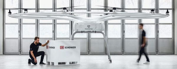
The VoloDrone is a fully electric, heavy-lift utility UAV with a range of up to 25 mi carrying a carrying a 440-lbs payload. The rotor area has a diameter of 30 ft, and the vehicle is 7.5 ft high. It can be remotely piloted or can fly autonomously on preset routes. Loads can be carried between the legs of the landing gear on standard rack mounts or slung below, or a tank and sprayer could be fitted for agricultural applications. The 18-rotor multicopter platform uses swappable lithium-ion batteries and an in-house flight control system, and benefits from existing development and test of the Volocopter air-taxi.
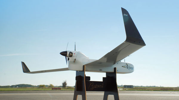
With a wingspan of 4.20 m, the BOREAL NRM remotely piloted aircraft integrates efficient photogrammetry devices for mapping large areas, even in areas inaccessible to traditional mapping aircraft. Its flight-control system is designed for image-capture management and optimal coverage of areas greater than 20,000 ha. The BOREAL NRM offers an overall and precise view of cultivated areas (1 cm to 3 cm per pixel), simplifying crop monitoring and facilitating human intervention in places that require it (such as water stress, treatment of pests).
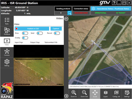
The IRIS unmanned vehicle command-and-control system provides intelligence, surveillance and reconnaissance (ISR) interoperability — essential aspects of any military operation. The IRIS system integrates unmanned vehicles with other command-and-control systems for monitoring and gathering information for a variety of operational scenarios. IRIS uses each unmanned vehicle’s own communication systems and 5G technology to provide situational awareness for decision makers before and during operations. A simplified interface allows integration of sensors and platforms into a command-and-control network, providing interoperability with other command, control, communication and computer ISR (C4ISR) systems. IRIS performed well during NATO’s REPMUS 22 (Robotic Experimentation and Prototyping Augmented by Maritime Unmanned Systems) exercise in September.
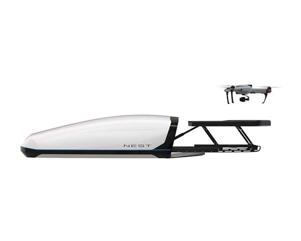
The AtlasNEST UAV system features a docking station to provide fully autonomous 24/7 readiness for infrastructure inspections, emergency situations and security missions requiring shared situational awareness and management. Using the AtlasSTATION interface, an operator sets a target destination, and the lightweight UAV deploys in less than three minutes. Sending a drone to collect visual data and reveal possible problems can help prevent putting personnel in unsafe circumstances. AtlasNEST has built-in artificial-intelligence technologies, including autonomous battery swapping. Using the AtlasSDK, AtlasNEST can be incorporated into current security systems.
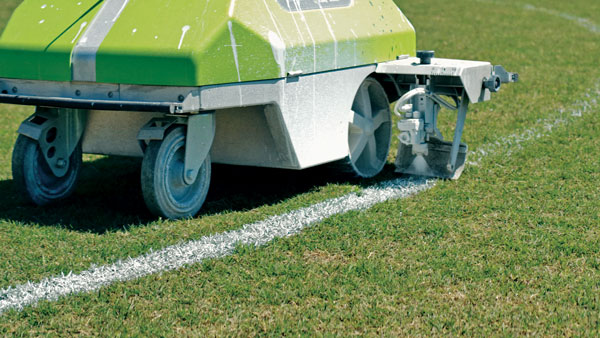
Turf Tank is an autonomous, GNSS-guided line-marking robot built specifically to paint lines on athletic fields. More than 550 Turf Tank robots are deployed across the United States, painting athletic fields at public schools, major colleges and universities, amateur and professional soccer clubs, local parks and recreation departments, and at two National Football League stadiums. The Turf Tank robots can paint a full soccer field in less than 30 minutes, compared to two or three hours for manual painting. Similarly, the robot can paint a football field in two or three hours compared to eight to 10 hours to paint a football field. The robots are eco-friendly — they’re powered by rechargeable batteries and use far less paint than most older paint machines.
The Autel EVO II Pro Series combines Carlson’s software and hardware surveying and mapping solutions with a UAV from Autel Robotics. The Carlson suite is designed to take professionals throughout a project’s lifecycle: setting ground control points with the Carlson BRx7 GNSS receiver and RT4 data collector with SurvPC field software, the drone flight, PC photo and data processing, and creating finished plans in CAD.
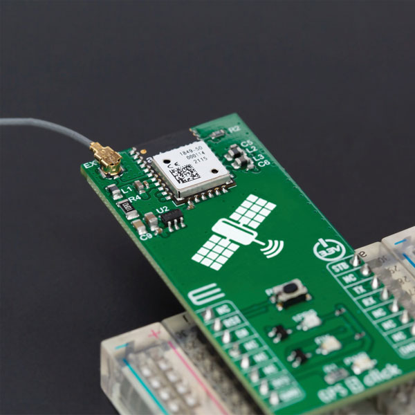
The GPS 5 Click is a compact add-on board that provides users with positioning, navigation and timing (PNT) services. The board features the M20050-1, a GPS module using the MediaTek MT3333 flash chip and an Antenova GNSS receiver for optimum performance. The receiver tracks three GNSS constellations concurrently (GPS + Galileo + GLONASS or GPS + Galileo + BeiDou) and has configurable low-power modes operating from a 3.3V power supply. In addition to the possibility of using an external antenna, backup power, and various visual indicators, the M20050-1 has an accurate 0.5 ppm TXCO ensuring short time-to-first-fix and multipath algorithms that improve position accuracy in urban environments.
Modules GT-100, GT-9001 and GT-90 are time-synchronization GNSS receiver modules compatible with all GNSS systems. The three modules deliver nanosecond precision for 5G mobile systems, radio communications systems, smart power grids and grandmaster clocks. Each suits different applications based on supported frequency bands and output signals. GT-100 supports concurrent L1 and L5 reception and delivers three outputs including 1 pulse per second (1 PPS) synchronized with UTC as well as user-programmable frequencies. The outputs can be set to 10 MHz, 2.048 MHz and 19.2 MHz, reducing time to market and saving costs through reduced component needs. GT-9001 supports L1 and delivers high-stability 1PPS and programmable clocks on three channels. GT-90 supports L1 and provides a 1 PPS high stability output. All models have time stability of 4.5 ns (1 sigma) and are equipped with multipath mitigation to minimize degradation of performance in urban areas.
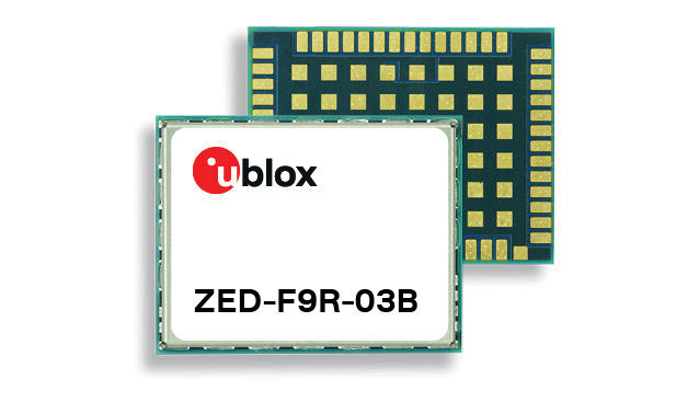
The latest firmware update for the u-blox ZED-F9R high-precision GNSS module adds support for Japan’s QZSS CLAS correction services (ZED-F9R-03B). The ZED-F9R also now supports u-blox SPARTN 2.0 correction data.
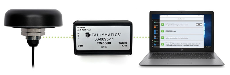
The TW5390 smart antenna has IP network and L-band augmentation service capability. Along with a Tallymatics antenna, it has a high-precision u-blox F9R GNSS receiver and DS9 L-band receiver modules. The combination delivers a reliable and convenient smart antenna yielding <6-cm accuracy, with precise point positioning/real-time kinematic (PPP/RTK) augmentation services via the PointPerfect subscription service. The antenna provides superior multipath rejection with Tallysman Accutenna technology, a low noise amplifier, Tallysman’s eXtended Filtering (XF) technology, which mitigates saturation from nearby RF signals (targeting LTE and Ligado), a tight, measured phase-center offset and low axial ratio, enabling accurate and precise positioning, direct decoding of PointPerfect, SPARTN formatted augmentation packets (u-blox specific)
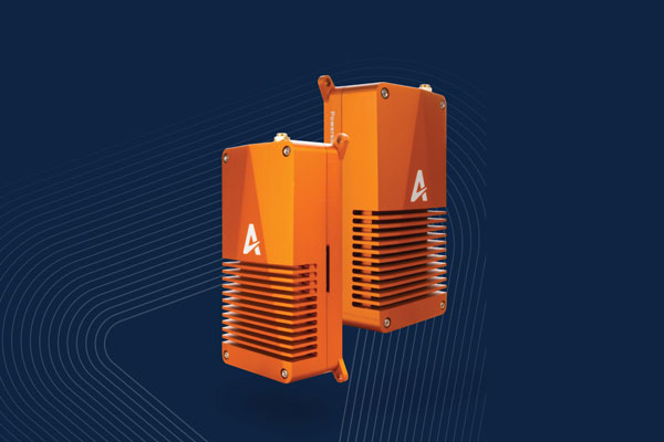
Tracking enables potential applications and projects
Photo: TE Connectivity
The Lembas LTE/GNSS USB modem provides plug-and-play GNSS tracking as well as LTE and CAT4 network connectivity via a robust USB interface to a variety of small-board computers utilizing the ARM chipset. Through a single-command setup process, users can have GNSS access to a wide variety of projects. The modem has been tested with Raspberry Pi Model B, Odroid XU4 and N2, ASUS Tinker Board, and NVIDIA Jetson Nano.
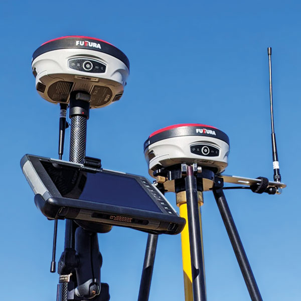
The universal construction site supervisor system is designed to help contractors manage all their job site activities. It includes the SiteMetrix Grade and the multi-frequency, multi-GNSS F631 RTK base and rover. SiteMetrix is user friendly, easy to understand and portable. Contractors can use the Futtura system to localize sites, check grade, configure base stations, set stakes and calculate volumes of material removed. Users will see the benefit of seamlessly performing data collection and layout, all in one easy-to-use application, the company says. The F631 GNSS receiver is powered by SureFix RTK technology, which offers a real-time dual-solution point verification. The F631 GNSS receiver is powered by Hemisphere GNSS’ Athena RTK technology. With Athena, F631 provides state-of-the-art RTK performance when receiving corrections from a static base station or network RTK correction system. With multiple connectivity options, the F631 allows for RTK corrections to be received over radio, cell modem, Wi-Fi, Bluetooth, or serial connection. F631 delivers centimeter-level accuracy with virtually instantaneous initialization times and robustness in challenging environments.
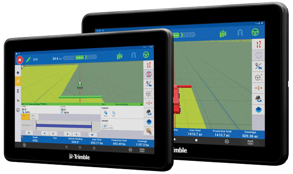
The Trimble GFX-1060 and GFX-1260 next-generation displays for precision agriculture applications enable farmers to complete in-field operations quickly and efficiently while also mapping and monitoring field information in real time with precision. Both displays feature an Android-based operating system and enhanced processing power for controlling and executing in-field work. The new flagship GFX-1260 is a 12-in (30.5 cm) display, while the GFX-1060 is a 10-in (25.6 cm) display, and both are compatible with the Trimble NAV-500 and NAV-900 GNSS guidance controllers. The displays are ISOBUS-compatible, which allows one display or terminal to control ISOBUS implements, regardless of manufacturer. The displays enable farmers to set up and configure their equipment through Trimble’s Precision-IQ field software, including manual guidance, assisted and automated steering, application controls, mapping and data logging, equipment profiles and camera feeds from attached inputs and other internet-based apps.
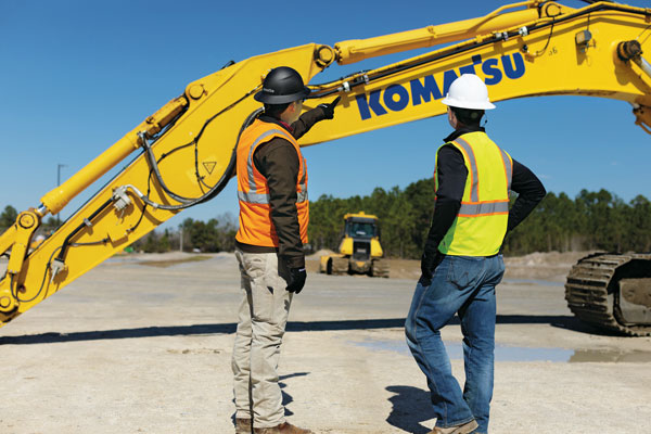
Enables affordable smart construction upgrades for fleets
Photo: Komatsu
The Smart Construction Retrofit kit turns a conventional Komatsu excavator “smart” with 3D guidance and payload monitoring. With a kit installed, an operator is no longer required to set up a laser or bench every time the machine moves. The kit’s GNSS receiver determines where a machine is on the job site and what the target grade is. The need for additional labor is reduced because the technology collects and delivers information directly to the operator. Designed to improve grading performance and provide more time- and cost-management tools, Smart Construction Retrofit kits can bring 3D to most Komatsu excavators in a fleet. The kit gives operators the latest design data, measures payload volumes and load counts, and allows managers to monitor production from the office by integrating Smart Construction applications. The payload meter helps prevent overloading trucks by promoting proper loading weights for on- and off-road vehicles, to reduce the potential for equipment damage and other risks.
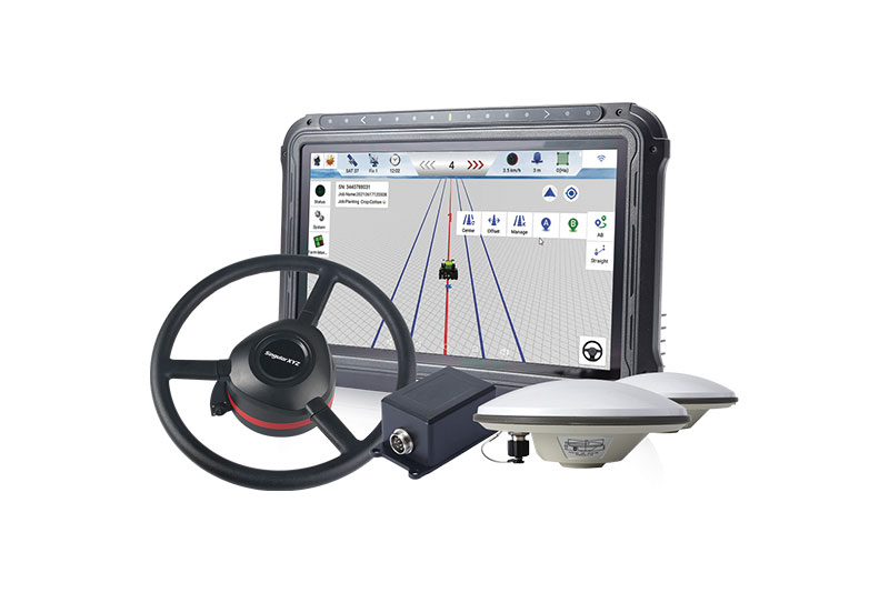
The SAgro10 GNSS is an upgradeable entry-level guidance system for precision agriculture, which can be easily upgraded to the SAgro100 automatic steering system. Equipped with a high-precision GNSS module, the SAgro10 tracks all constellations. For users with network coverage or a UHF base station, the SAgro10 system provides centimeter-level accuracy navigation in real-time kinematic mode. In the absence of base stations, it can still provide sub-meter navigation accuracy in single-point smoothing mode. The system is compatible with most agricultural tractors and can be installed in 15 minutes. It supports a 10-in sunlight-readable touchscreen with a clear graphic interface. The SAgro10 software can intelligently manage the work area and simplify user operations, such as recording the completed work area and planning the work route.