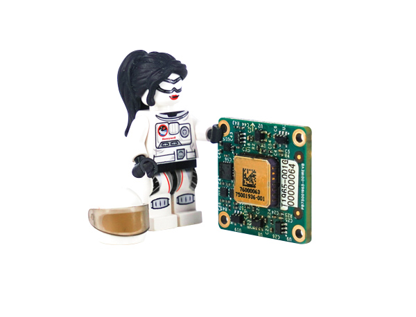
Topcon’s ultra-compact B111A GNSS receiver board can provide scalable positioning from sub-meter differential GPS to sub-centimeter real-time kinematic (RTK) positioning. The board’s flexible design — low power consumption, comprehensive communication interfaces and peripheral support — make it easy to integrate the B111A into any precise positioning application, Topcon said.
Besides in surveying and mapping, survey drones are now used in a broad spectrum of applications ranging from construction and mining to agriculture and environmental monitoring.
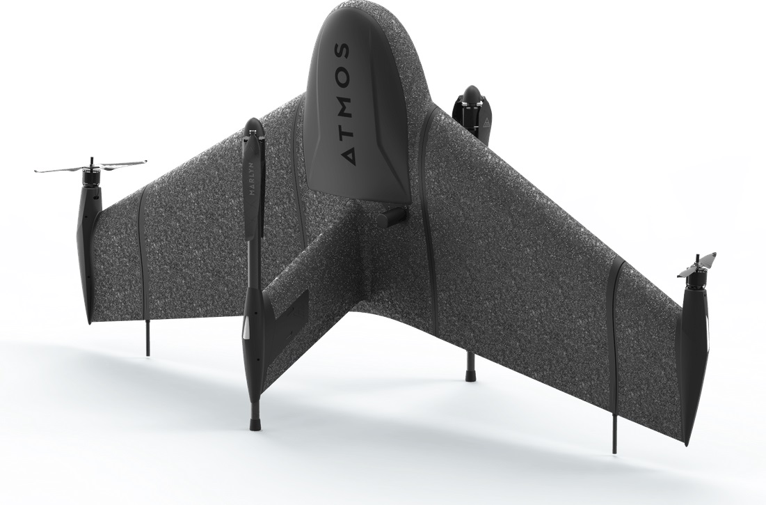
The Atmos Marlyn Cobalt is a vertical-takeoff-and-landing (VTOL) fixed-wing mapping drone developed by Atmos with the goal of allowing users to effortlessly collect accurate geospatial information and turn it into actionable insights. “Our mission is to provide professionals with the tool with which they can plan a better future with precision,” said Ruud Knoops, Atmos CEO.
To provide precise positioning accuracy, a GNSS board needs to compensate for inaccuracies caused by satellite constellations, receiver hardware and atmospheric conditions.
The use of Topnet Live — Topcon’s GNSS real-time correction service — provides high-accuracy positioning and survey-grade results to professionals through a 24/7 cross-border, consistent and reliable access. The combination removes the need for base stations, increasing efficiency leading to higher productivity and decreased costs.
A roundup of recent products in the GNSS and inertial positioning industry from the May 2022 issue of GPS World magazine.
SURVEYING
Measurement Workflows
Field-to-office inspection with survey-grade accuracy
Photo: Trimble
Trimble Access field software now connects with Infotech’s Appia service to streamline the workflow from survey to construction. Aimed at the inspection process for civil infrastructure projects, the software provides high-accuracy measurement workflows for daily work reports and inspection reporting for engineering, construction and public agencies. By streamlining the connection between data collected by Trimble GNSS rovers and simultaneously syncing Trimble Access, Infotech Mobile Inspector and Infotech Appia, inspectors can now complete their daily work reports more efficiently in the field and reduce errors. With manual processes removed, inspectors can more accurately represent infrastructure assets.
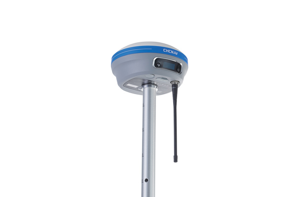
For surveying, mapping and construction professionals
Photo: CHCNav
The i83 GNSS receiver is powered by a multi-band GNSS receiver, iStar technology, and a calibration-free, high-end inertial measurement unit (IMU) for faster and reliable field GNSS surveying. The third-generation high-gain antenna with advanced CHCNAV iStar algorithm improves GNSS satellite signal tracking efficiency by more than 30%. The i83 GNSS receiver features 1,408 GNSS channels for high performance across GPS, GLONASS, BeiDou, Galileo and QZSS constellations. Its onboard GNSS technology delivers centimeter-level positioning, maintains reliable fixed real-time kinematic (RTK) accuracy, and collects points faster than previous models, even in demanding conditions. The i83 receiver’s built-in IMU automatically compensates for pole tilt. In less than 5 seconds, the 200-Hz inertial module is initialized to ensure survey-grade accuracy over a pole-tilt range of up to 30 degrees. Productivity is dramatically increased, RTK usability greatly improved, and potential human error reduced, whether you are an engineer, site foreman or surveyor.
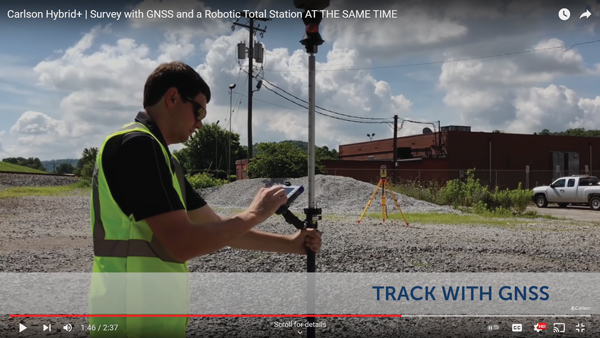
Simplifies surveying with both GPS and total station
Photo: Carlson Software
SurvPC Hybrid+ is a module for SurvCE version 6 software that enables surveying with mixed brands of GNSS receivers and total stations. SurvCE is a data-collection software package from Carlson Software. SurvPC Hybrid+ provides driver support for numerous devices, allowing the surveyor to interface with both types. Features include Follow Me, Smart Lock, Smart Staking, Cross Check, Backup Tracking, Hybrid-Resection, Auto-Localize, and Easy Setup Wizard.
SurPad 4.2 is designed to help surveyors work efficiently at all types of land surveying and road engineering projects in the field. It runs on eSurvey handhelds, Android smartphones and tablets, and third-party Android devices. It integrates with professional receiver control, point collection, stakeout, geographic information system (GIS) data collection, road measurement, road design, cross-section measurement and railway stakeout. SurPad 4.2 provides multiple operation and communication systems, has mapping and CAD functions, and has a coordinate system. It also includes a survey mode encompassing topo, control, quick point and COGO civil engineering programs.
The Leica AP20 AutoPole provides tilt compensation, automatic pole-height readings and unique target identification for automated total stations. It combines an intelligent sensor module with the AP Reflector Pole and operates with existing Leica Geosystems’ automated total stations to create a solution for autonomous workflows. Tilt compensation decreases measurement time and increases flexibility and safety on site by enabling measurement of points in inaccessible or risky locations. By updating the pole height automatically in the field software, the system ensures that the height on record is always correct.
INSITE Data Reviewer moves geospatial data validation to the cloud, giving key stakeholders the ability to collaborate in real time. The third module in the INSITE Lifecycle suite of products, INSITE Data Reviewer provides reviewers real-time access to aerial imagery, lidar data and geographic information system (GIS) layers via the cloud to standardize quality control. This increases data validation speed and reduces costs of geospatial projects. The INSITE Lifecycle suite combines Project Tracker, Data Delivery and Data Reviewer modules through which users can see their projects executed on a map, from data acquisition through processing.
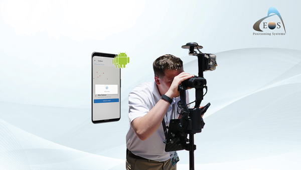
Eos Laser Mapping for ArcGIS is now available on Android devices. It allows mobile crews to capture high-accuracy laser offsets directly into ArcGIS Field Maps with Arrow Series GNSS receivers. The solution combines technology from geographic information system (GIS) provider Esri, laser rangefinders from Laser Tech, and Eos’ own Arrow Series GNSS receivers. The release supports three workflows: standard laser offset (range-azimuth), range-range (range-intersect) and range-backsight (a total station-like method).
The MV60 micro-electromechanical system (MEMS) accelerometer delivers high performance and reliability in a small, rugged and low-cost package. The MV60 measures the acceleration experienced by an object during movement and is designed for use in inertial measurement units and navigation systems deployed on land, air and sea vehicles to measure velocity. It has a compact footprint of 1.2 square inches and shock survivability of up to 5,000 g. It also offers bandwidth of greater than 300 Hz — important for environmentally demanding missions.
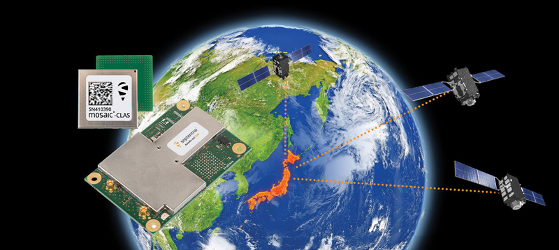
Receivers support Japan’s cm-level augmentation service
Photo: Septentrio
Three multi-frequency GNSS receivers now support the Centimeter-Level Augmentation Service (CLAS), receiving the L6 signal that transmits high-accuracy corrections from Japan’s QZSS constellation. The mosaic-CLAS receiver is in a small form-factor suitable for high-volume industrial applications. The AsteRx-m3 CLAS OEM board combines PPP-RTK CLAS with dual-antenna heading functionality. The AsteRx SB3 CLAS features a ruggedized IP68 enclosure to protect it in harsh environments.
The S1-V300 medium-altitude long-endurance (MALE) unmanned aerial system (UAS) prototype is based on the Saker MALE UAS design that achieved operational capability in 2020. The prototype features a new design and a more powerful heavy fuel engine with 260 HP, offering greater speed, payload and endurance of 28 hours with a range of 4,020 km. The aircraft features unique UAVOS avionics solutions and a redundant flight control system that will enable complex missions, including overland and maritime intelligence, surveillance and reconnaissance (ISR) missions. The improved S1-V300 prototype is equipped with both line-of-sight and beyond-visual-line-of-sight (BVLOS) datalink systems for over-the-horizon operations. It can be integrated with multiple ISR sensors, including electro-optical infrared cameras and a synthetic aperture radar that offers all-weather, day/night performance for a wide-area search capability.
Dragonfish Lite and Pro now available in United States
Photo: Autel Robotics
The rugged Dragonfish UAVs are capable of vertical takeoff and landing (VTOL) with both multi-rotor and winged flight, with an endurance of up to 180 minutes. They are suitable for professional applications such as energy, mining, defense and surveillance. Maximum winged flight speed is 30 m/s (108 km/h, 67 mph), and maximum video transmission range is 30 km (18.6 miles) with a base station. The aircraft can make a smart decision to either land or return to base in case of issues such as loss of GPS signal, loss of operator communications, or low battery power. The tilt-rotor system will automatically transition to multi-rotor mode if adverse conditions cause fixed-winged flight to stall or become unsustainable. The Dragonfish battery, barometer, positioning system, compass and inertial measurement unit all have backup modules to ensure flight safety.
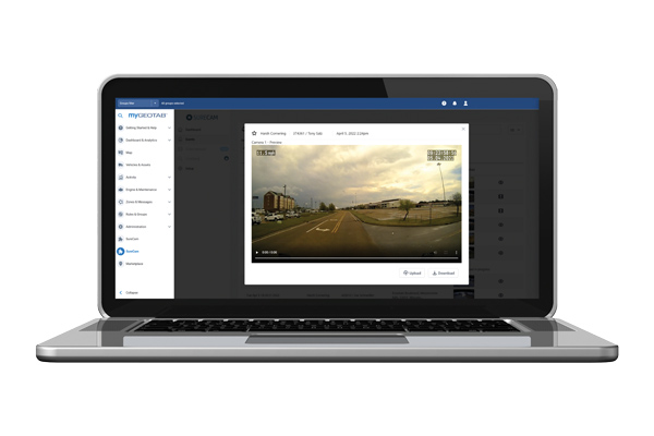
The SureCam connected dash camera system now features a method for capturing video footage from SureCam cameras using Geotab’s telematics device and rule-based system. This results in a seamless display of video within the MyGeotab platform. The enhanced SureCam fleet video solution leverages Geotab’s numerous data-based rules, such as improper seat belt usage and speeding. It also uses G-force triggered alerts that detect unsafe driving behaviors and automatically captures video footage that can be reviewed later. A new Video Request feature in GeoTab enables fleet managers to preview and download additional SureCam video, enabling them to investigate call-ins and other minor incidents that may not have been triggered by an event-based rule.
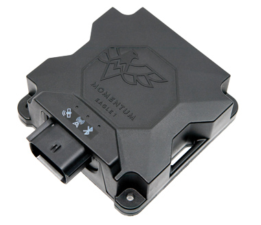
Momentum IoT’s long-life Eagle 1 tracker works without external power for more than six months after a single charge. The device switches on-the-fly between narrowband internet of things (NB-IoT) and LTE Cat-M. The Eagle 1 leverages Telit’s dual-mode ME310G1 module, which delivers low power consumption in a small footprint. The Eagle 1 detects movement with a built-in accelerometer. Using movement and signals from its GPS receiver to determine vehicle trip starts and stops, the device can go into hibernation mode during periods when the vehicle is not in use, further reducing power consumption. Applications include garbage and storage bins, portable toilets, roll-off containers, message-boards, coolers, and other equipment typically stationed in non-powered, remote places for extended periods.
This month our UAV and GNSS news ranges from a drone diving into the Boston subway to a GNSS receiver designed for Moon orbit. We also look at the types of drones heading to Ukraine to help fight the Russian invasion and rescue citizens from demolished buildings.
Boston cleanup
Bostonians’ morning commutes were disrupted at the end of March after 100 tons of demolition debris fell nine stories onto ground directly above subway tunnels, and the Massachusetts Bay Transport Authority (MBTA) closed the Orange and Green lines as a precaution.
The bad news got worse. A construction worker was killed when part of a parking garage under demolition collapsed. Apparently his jackhammer-construction vehicle — in the midst of demolition work — fell nine stories when the floor near the edge of the building buckled and crumbled away.
MBTA was concerned that damage could have occurred to the subway under the building from the huge amount of debris that fell on the ground above a tunnel. The agency closed the line passing through that section of the system. Hundreds of morning commuters were turned away from the subway at nearby station entrances and were directed to buses hastily brought on as temporary shuttles around the closed subway sections.
MBTA wanted to immediately, but carefully, inspect the tunnel for damage, but was concerned for the safety of its inspection personnel. As news of the disaster circulated, the Massachusetts Department of Transportation (MassDOT) Aeronautics Division became aware of the subway issue, and proposed a rapid solution to the dilemma — to fly a drone through the tunnel. The drone would transmit high-resolution video and gather data on the status of both tracks and tunnel structure.
Soon after, Bostonians were able to watch a 29-second video collected by the drone that was sent into the subway tunnel.
“As we work to safely restore service following the Gov Center Garage accident, we teamed with @MassDOT Aeronautics to scan Orange & Green Line tunnels with a drone. This allowed us to safely assess tunnel conditions before sending engineers in for in-depth structural inspections.” pic.twitter.com/LHGUfiou9r
MBTA was then able to gauge that live inspections would be safe. The tunnel was ultimately assessed as being sound and, following test trains being run, service was restored.
It has been difficult to establish which drone was used for these initial visual tunnel inspections, but in 2021 the Aeronautics Division was operating multiple drones, including the DJI Matrice, Inspire, Phantom and Mavic, as well as a few fixed-wing and multi-rotor models manufactured by Yuneec, SenseFly and Delair.
Flyability provides the Elios 2 drone, specifically built for indoor inspection, for such places as inside underground tunnels. Similar “caged” inspection drones include Droneball 360 by Imaze, the Skycopter Cobra drone, the Asio Caged Inspection Drone and several others.
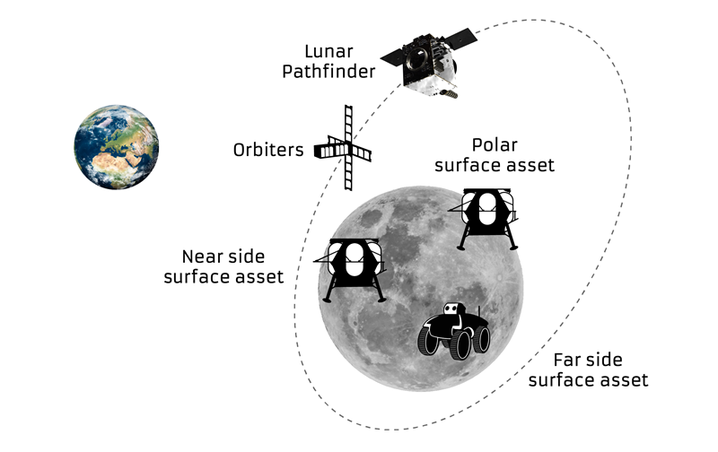
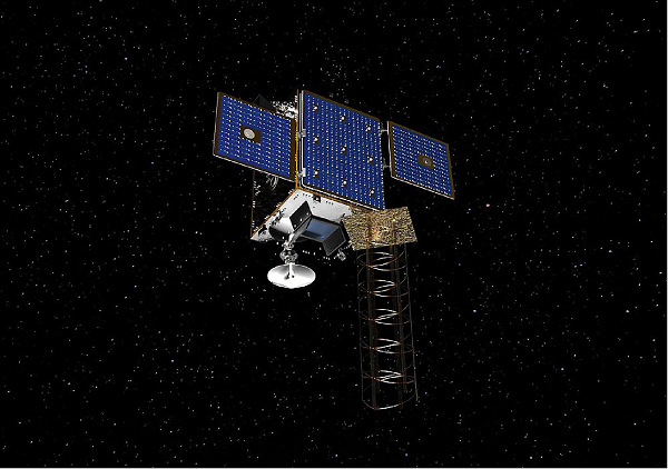
Turning our attention to space, the European Space Agency (ESA) will conduct a mission to place a refrigerator-sized satellite in orbit around the Moon. Of course, there have been many successful efforts to put things in lunar orbit since Russia first achieved the feat with Lunar 10 in 1966. NASA’s Lunar Reconnaissance Orbiter followed in 2009, along with India’s Chandrayaan-2 orbiter and its failed lander.
ESA has contracted Surrey Satellite Technology Ltd. (SSTL) in Guildford, UK, to develop the Lunar Pathfinder communications relay satellite — the first part of a project to provide communications and navigation for the Moon. This capability will enable assets on the lunar surface to communicate directly with the Pathfinder via S-band and UHF, which will then relay their signals onwards to Earth using X-band.
The satellite will also carry a laser retro-reflector and a space-weather payload designed to assess the radiation environment in orbit. This should help support landers carrying astronauts, such as the NASA Artemis, by broadcasting radiation intensity to the surface.
Artist illustration of the Pathfinder mission. (Image: SSTL)
The Lunar Pathfinder satellite. (Image: SSTL)The Pathfinder satellite will carry a few passenger payloads, but the most interesting to us might be the highly sensitive GNSS receiver, which will attempt to make position fixes from lunar orbit using GPS and Galileo satellites in Earth orbit.
The NaviMoon receiver designed by SpacePNT in Switzerland was implemented and tested by European Engineering & Consultancy, which added a special low-noise amplifier of its own design — essential for detecting minute satnav signals at 20 times the distance they usually travel to Earth’s surface from Earth orbit. In addition, antennas on GNSS satellites are designed for transmissions towards the Earth’s surface, not out toward space, further decreasing the signal strength in the vicinity of the Moon.
As you might expect, the view of the various constellations of GNSS satellites from orbit around the Moon is extremely limited. To give the NaviMoon receiver any sort of chance of picking up signals when they are in view, an onboard dynamic force model provides the receiver with its anticipated location along its orbit, and also derives the apparent direction from which signals should be observed. Even detecting a single satnav signal could assist the receiver in creating a position fix. SSTL will also reorient the Lunar Pathfinder satellite from time to time to enable the receiver to gain access to GNSS signals from Earth.
Measurements from Earth using laser ranging, aimed at the laser retro-reflector on the satellite, will be used as “truth” against which the position fixes by the NaviMoon receiver will be verified.
UAVs for Ukraine
Meanwhile, as the war in Ukraine continues to rage on, AeroVironment has been contracted by the U.S. Army to supply its RQ-20 Puma AE for use in Ukraine for almost $20 million. The package includes reconnaissance/surveillance and target acquisition kits, spares, logistics support and training for operators in Ukraine.
The Puma has an endurance of about three hours, carries a gimbaled visual/IR camera and is equipped with dual GPS receivers.
AeroVironment’s Puma is hand-launched. (Photo: Lance Cpl. Frank Cordoba/U.S. Marine Corps)
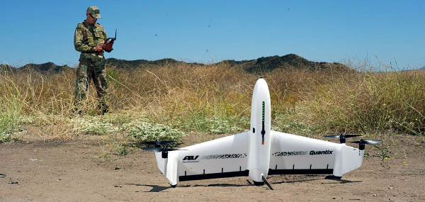
U.S. drone manufacturers have donated hundreds of other recon drones to Ukraine. The AeroVironment Quantix Recon drone takes off and lands vertically, but flies rapidly as a fixed-wing observation platform. While its endurance is not as long as the Puma’s, it flies faster so it can return with information more quickly.
Quantix lands vertically, but flies fixed wing. (Photo: AeroVironment)
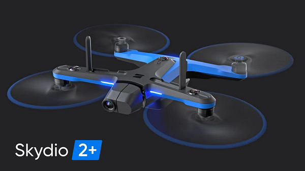
Brinc has also donated and sold its Lemur tactical drones to Ukraine for use in disaster recovery work in devastated buildings throughout the country. The rugged quadrotor drone has two-way voice communications, video and lidar, and has proven itself in difficult building-collapse search and recovery operations in confined spaces. Skydio has apparently donated and sold quadrotor drones to Ukraine with multi-view video from six 200-degree color cameras, also for use in collapsed building search and recovery.
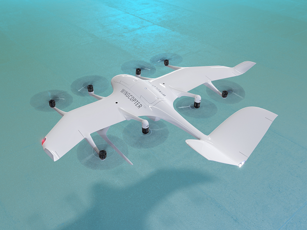
The U.S. Federal Aviation Administration (FAA) has issued the Special Class Airworthiness Criteria for the Wingcopter 198 U.S. unmanned aircraft. This approval marks a critical milestone in the certification process of Wingcopter’s flagship delivery drone in the United States.
Wingcopter is a German manufacturer of fixed-wing unmanned aircraft systems (UAS) and provider of drone delivery services, focused on optimizing medical supply chains, as well as last-mile logistics of packages, tools, spare parts, food, and groceries.
With the Airworthiness Criteria, the FAA defines technological requirements under title 14, Code of Federal Regulations (14 CFR), § 21.17(b) that must be met to have an aircraft type-certified for regular commercial operations in the United States.
The Wingcopter 198 is an electric vertical-takeoff-and-landing (eVTOL) drone engineered to meet stringent safety standards. In its development, Wingcopter was able to leverage the operational experience of more than five years with the company’s first delivery drone type in various geographical settings, from the Arctics to the Middle Eastern desert and from remote islands in the South Pacific to San Diego Bay in the United States.
Once type-certified, Wingcopter will be able to fly conventional routes through airspace and over populated areas, ultimately providing the basis for scaling commercial drone delivery operations across the United States that will help save and improve lives, the company said.
The certification is expected to have a positive impact on Wingcopter’s further certification efforts such as with the National Civil Aviation Agency (ANAC) in Brazil or the Japan Civil Aviation Bureau (JCAB).
Since applying for the Special Class Type Certificate in March 2020, Wingcopter has collaborated closely with the FAA. The issuance allows Wingcopter to focus its development efforts even more on what the FAA deems necessary for this particular aircraft to receive certification quickly and efficiently.
“We are proud to be among the first delivery drone companies worldwide to ever get their Airworthiness Criteria approved by the FAA,” said Tom Plümmer, co-founder and CEO of Wingcopter. “This is a very important milestone for us, not only in our Type Certification Process in the United States, but also for our international expansion efforts and for achieving our vision of building logistical highways in the sky. I would like to thank my team as well as the FAA for all the effort and great collaboration to reach this milestone.”
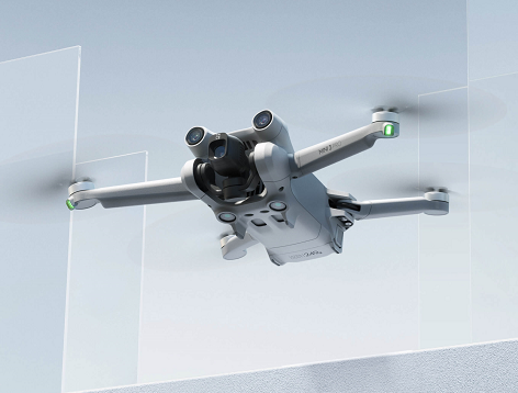
The DJI Mini 3 Pro is the high-end product of the DJI Mini series
DJI Mini 3 Pro. (Photo: DJI)
DJI has introduced the DJI Mini 3 Pro, its most powerful lightweight and portable camera drone. Weighing less than 249 grams — making it policy-friendly in many regions and countries — it delivers advanced features such as 4K/60 fps video, ActiveTrack, tri-directional obstacle sensing, and 90° gimbal rotation to shoot high-quality vertical imaging for social media. Its flight time extends past 30 minutes.
According to the regulations of many countries and regions, drones under 250 grams have been placed in the safest drone category. At under 249 grams, Mini 3 Pro’s weight, safety and performance is a new resource for content creators and new pilots.
Like its predecessors — Mavic Mini, Mini 2 and Mini SE — the Mini 3 can be folded for packing. Built-in features include enhanced flight performance, camera system, battery life and intelligent features previously available only in the Air and Mavic series.
New structural design. The arms and propellers have been adjusted for more aerodynamic flight, increasing flight time. Forward and backward dual-vision sensors broaden the sensing range for safer flight. A complete gimbal redesign unlocks more camera angles, enabling movements such as tilt-up shots and vertical shooting.
The Mini 3 Pro features tri-directional obstacle sensing, consisting of forward, backward and downward visual sensors. The forward and downward sensors have a wider field of view, providing seamless coverage for better route planning and environmental awareness. These sensors also enable Advanced Pilot Assistance System (APAS) 4.0, which automatically detects and finds a safer path around obstacles during flight.
In addition, these sensors enable the FocusTrack suite, which allows users to select a subject that the drone automatically keeps within the center of the frame during flight while automatically planning a safe flight route.
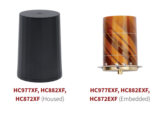
Tallysman Wireless has added eXtended Filtering (XF) to the housed and embedded lightweight HC977XF (triple-band + L-band), HC882XF (dual band + L-band) and HC872XF (dual-band (GPS and GLONASS) + L-band) precision helical GNSS antennas.
Tallysman has designed the XF feature to mitigate interference from all near-band signals and ensure that the antenna provides the purest GNSS signals.
The radio-frequency spectrum has become congested worldwide as many new LTE bands have been activated, and their signals or harmonic frequencies can affect GNSS antennas and receivers. In North America, the planned Ligado service, which will broadcast in the frequency range of 1526–1536 MHz, can affect GNSS antennas that receive space-based L-band correction service signals (1539–1559 MHz). New LTE signals in Europe (band 32, 1452–1496 MHz) and Japan (bands 11 and 21, 1476–1511 MHz) have also affected GNSS signals.
Tallysman’s housed helical antennas weigh ~42 g and are enclosed in a robust military-grade IP67 plastic enclosure. The antenna base has an integrated SMA connector, a waterproofing O-ring, and three screw holes to enable secure attachment. Tallysman’s embedded helical antennas weigh ~8 g and are easily mounted with an optional embedded helical mounting ring, which traps the outer edge of the antenna circuit board to the host circuit board or any flat surface.
An MCX connector is installed in the base of the antenna.
Tallysman helical antennas are suitable for a variety of applications, including lightweight unmanned autonomous vehicle navigation (land, sea and air), land survey devices, automotive positioning, timing and other precise-positioning applications.
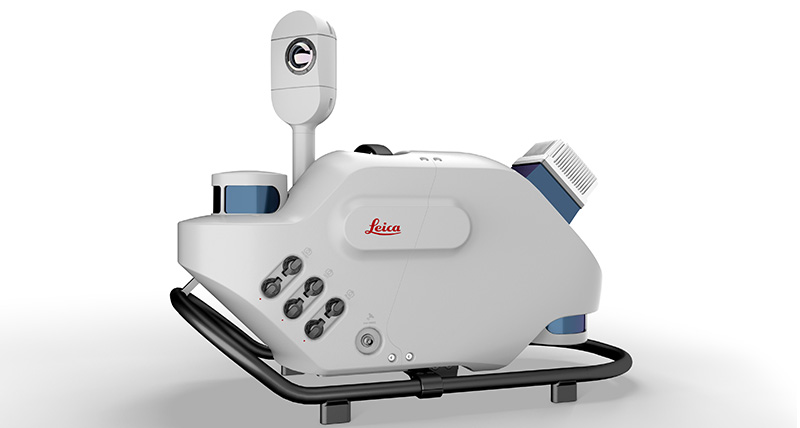
Leica Geosystems, part of Hexagon, has introduced Leica Pegasus TRK, a reality-capture mobile-mapping system that features artificial intelligence (AI), autonomous workflows and intuitive interfaces.
The Pegasus TRK features an AI-enhanced camera and automatic camera calibration. To comply with privacy regulations, its AI can identify and blur identifiers, such as people and vehicles, in real time.
Features include advanced dynamic laser scanning and an expandable imagery system for recording, measuring and visualizing environments. It also increases productivity with automated, intelligent workflows.
Light enough to be operated by one person, the Pegasus TRK is user-friendly, able to be used by professionals new to the technology. Its reliable, high-quality deliverables serve the needs of technical experts in various industries, including surveying, transportation and utilities.
The Pegasus TRK solution enables long-range mobile mapping for applications in asset management; road construction; rail and critical infrastructure; oil, gas and electricity industries and more. The system also is suitable for creating high-definition base maps for autonomous vehicles.
The Pegasus TRK connects with the new powerful Leica Pegasus FIELD software for fully autonomous and secure data collection and route planning in the field. It also connects with Leica Cyclone Pegasus OFFICE for seamless input into post-processing and publishing workflows.
“The Pegasus TRK solution is the most efficient mobile mapping product we’ve tried so far,” said Raymon Somford, CEO and owner of Rise3D. “It is lightweight and easy to use, guiding our team through the process of data collection. Its sensors that trigger automatically avoid missing details. We can achieve quality images regardless of the conditions, making mobile mapping almost effortless.”
“The Pegasus TRK solution offers flexibility, true-to-life image clarity and best-in-class accuracy while making mobile mapping more accessible and easier than ever before,” said Christian Schäfer, business director, Mobile Mapping at Leica Geosystems. “There is a growing demand for more autonomy. This solution raises the bar in data collection with automated route planning, guidance and collection processes that increase efficiency, improve data quality and reduce project costs.”
The Pegasus TRK will be a featured Tech Highlight at Hexagon’s flagship digital-reality solutions conference HxGN Live Global in Las Vegas, which takes place June 20-23.
The AR3 maritime surveillance drone, usually launched horizontally, can be launched vertically with attachable propellers. (Photo Tekever)
Tekever, a European maritime surveillance provider, has unveiled a new version of its AR3 unmanned aerial system (UAS). The AR3 now has a “hot-swappable” vertical-takeoff-and-landing (VTOL) capability, able to switch from horizontal launch to vertical. It also now has integrated synthetic aperture radar (SAR).
Tekever made the announcement at AUVSI Xponential 2022 in Orlando, Florida. The company specializes in maritime surveillance services that deliver actionable real-time intelligence. The AR3 is a shipborne UAS designed to support multiple types of maritime and land-based missions up to 16 hours. With the upgrade, the AR3 becomes more operationally flexible, the company said.
“Users no longer have to choose between having pure fixed-wing assets for longer endurance missions, or fixed-wing VTOL assets for more challenging deployment conditions,” explained Ricardo Mendes, Tekever CEO. “The AR3 combines both capabilities and provides users with the ability to decide the configuration just moments before takeoff.”
The newly added SAR provides the AR3 with a vastly greater operational range, and the ability to effectively detect, recognize and identify targets under any weather condition. Covering more than 20,000 square nautical miles per mission, the new AR3 is the suitable for wide-area surveillance missions.
“Our SAR, which we named Gamasar in honor of the Portuguese navigator Vasco da Gama, is designed and built by Tekever specifically to provide our customers with capabilities that are typically only available through much larger systems,” Mendes said. “With an extremely reduced logistics footprint, the unprecedented VTOL flexibility and the unique capabilities provided by Gamasar, the new AR3 is a game changer that provides our customers with tremendous value and cost effectiveness.”
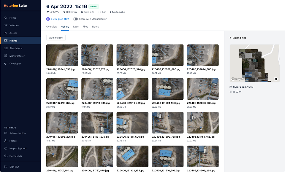
Auterion has introduced new capabilities for high-precision mapping missions and automated, end-to-end data workflows to make mapping more efficient, reliable and powerful across industries.
Unveiled at AUVSI Xponential 2022, updates to the Auterion OS serve enterprises with diverse use cases that need component and payload flexibility, alongside a centralized and streamlined software workflow.
Advantages for customers include:
Availability of precise mapping data in real time and automated processing that enables fast decision-making, saving time, ensuring consistency and reducing human errors.
Standardized process across any Auterion-powered vehicles, bringing an improved user experience, reducing training time, and affording easy scaling of operations.
Connectivity that enables automated end-to-end workflows with no need for manual data transfer, and integration with third-party data-processing software such as Esri Site Scan or Propeller.
“The mapping and workflow features included in this latest release of Auterion’s software focus on use cases from our enterprise customers,” said Markus Achtelik, vice president of engineering at Auterion. “We’re making sure that workflows are thoughtfully designed to meet customer needs and that the data they require is collected, automatically processed and streamlined through Auterion’s software platform for immediate use and longer term analysis.”
Auterion’s new platform capabilities are achieved through the enhancement of tightly integrated components. For example, the ground control app provides precise mission execution with fully integrated control of payloads, such as the Sony α7R IV camera. Then, capture and storage of geotagged images on the drone occur in real time.
Next, image data correction and processing happen seamlessly. This kind of automated workflow illustrates Auterion’s commitment to building efficient operational solutions for enterprise-ready drones, the company said.
“Auterion’s software is updated with its expanding open ecosystem in mind,” added Achtelik. “That gives customers the best options on the market, offering greater flexibility and choice to meet enterprise quality, scale, and regulatory needs.”
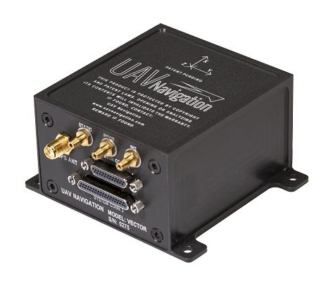
UAV Navigation has confirmed the safety and reliability of its Vector-600 autopilot for civil applications with an independent study. The study was performed as part of the European Union VaNeT project, and conducted by third-party company Anzen Engineering.
An autopilot system in an unmanned aerial vehicle (UAV) is the heart of the flight control system. For the Vector-600, the study included a reliability prediction report (RPR), failure mode effects and criticality analysis (FMECA) and fault tree analysis (FTA).
Reliability Prediction Report. The RPR analyzes probability of failure of every single sensor and component inside a system. It helps define component failure rates and, consequently, a prediction of the time that the VECTOR-600 is expected to operate free of failures under given operating conditions. According to this, the VECTOR-600 has shown a mean time between failures of more than 19,500 hours.
Failure Mode Effects and Criticality Analysis. A FMECA study identifies potential failures of system functions and assesses their effects, so that mitigation actions can be defined. It is a bottom-up analysis considering each single elementary failure mode and assessing its effects.
Fault Tree Analysis. Fault trees are a classic deductive analysis technique useful for both qualitative and quantitative analysis. For the Vector-600, a quantitative FTA provided probability estimates for major hazards, as well as identifying single-point failure modes and guiding further design for hazard reduction. According to the results, Vector-600 showed a probability of loss of mission per flight hour of 1,809E-05 under its operating conditions.
“The FMECA, RPR, and FTA analysis performed by the external and independent company Anzen have proven that our most advanced autopilot, Vector-600, is one of the most reliable GNC [guidance, navigation and control] systems for NATO Class I and II unmanned aircrafts available in the market and enables our clients to execute missions ensuring safety,” UAV Navigation stated in a press release.
The EU regulation framework defines three classes of operations: open, specific and certified. In specific and certified category operations, including most professional UAS flights, operators and aircraft manufacturers need to prove safe operation of their platforms. For this reason, the study of the reliability of the systems involved in the UAV becomes a must to demonstrate the system can operate free of failures under specific operational conditions.
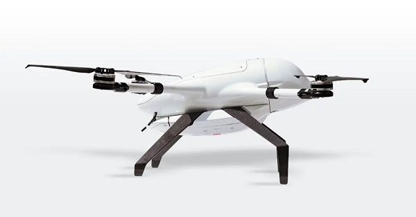
Beluga is a new generation of small unmanned aerial systems (sUAS), the result of three years of design and development. The Beluga sUAS is designed to perform a wide variety of tasks including medical transportation, precision farming, search and rescue, and last-mile delivery.
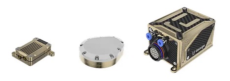
The system will include the uAvionix George G3, a CubePilot-based autopilot designed to DAL-C safety standards, and the truFYX EXT GPS which provides high-quality avionics at low size, weight and power consumption (SWaP) at a low cost. Beluga will soon include the ability to operate on skyLink C-band CNPC radios, fully integrated with George.
The George ecosystem includes a microLink radio, a truFYX GPS receiver and the George autopilot. (Photo: uAvionix)
This image shows the effect of increased elevation on surface area and obstacle avoidance. (Image: Advanced Navigation)
By Simon Harris, Advanced Navigation
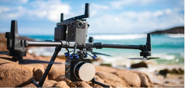
Lidar-based surveying is increasing in demand across a range of industries. Recent market analyses indicate that lidar surveying is a multi-billion dollar industry that is expected to deliver sustained growth for years to come. As lidar technology matures and performance increases, its range of use is broadening into surveying more complex and difficult terrain or at speeds and in environments previously unsuited to such technology. Naturally, increasing diversity and performance brings about demands for greater reliability, speed and accuracy whilst remaining within physical and regulatory limitations.
Keeping pace with market demands in UAV and rail sector lidar surveying is increasingly challenging and requires an evolving synthesis between the acquisition and processing of lidar and GNSS-INS georeferencing data. Companies such as Cordel and its subsidiary Nextcore are taking advantage of the latest technologies to develop systems that are setting new benchmarks in these sectors.
Benefits of Altitude, Faster Lidar and Precision INS
UAV lidar surveying is capable of high-resolution surveys of complex terrain, vegetated areas and in light conditions that may be unsuitable to photogrammetry. These qualities make it a preferred option in many applications. However, it must remain cost-competitive with alternative solutions to become widely adopted by the surveying industry.
Typical UAV lidar surveying is performed at ~40m AGL. This altitude commonly presents collision risks with terrain and vegetation and imposes limits where the topography changes dramatically, such as voids that increase AGL beyond acceptable limits. Higher altitude surveying, therefore, offers obvious advantages, but also deeply challenges lidar sensors and the INS. Any mismatch in operational performance and accuracy between these inevitably degrades survey quality and severely limits use of the system.
Nextcore accepted the challenge and set about developing a viable solution that could maintain a point cloud density of 200-500 points per m2 from a target altitude of 70 m. This equates to generating lidar point cloud data at millions of points per second. Achieving this required a GNSS-INS that provided suitably precise georeferencing data. Because survey data is derived from a source that is in constant motion in 3D space, the capability of the GNSS-INS is paramount in producing a digital twin of value and is critical to mission success.
After testing and evaluating various INSs from different manufacturers, Nextcore coupled its lidar with Advanced Navigation’s MEMs-based Certus Evo INS, which provides near-FOG performance and has a drift rate of 0.2 degrees/hour. This combination yielded exceptional results that allowed them to vastly extend the altitude ceiling to 120m while retaining consistent, accurate survey data.
“Operation at this altitude not only reduces the risk of collisions with trees, it enables surveyors to cover larger areas, greatly improving the solution’s efficiency,” said Ashley Cox, founder and COO of Nextcore.
Higher altitudes tend to increase the lidar swath width. The typical swath width at ~50m altitude is ~120m, depending on actual altitude and the resulting angle of incidence of lidar toward the edges of the swath. At 120m, a reliable swath width of 180m was achieved. This is a 50% increase over previous, equating to approximately 33% fewer flight-lines to survey a given area — a notable boost for productivity and efficiency to surveyors.
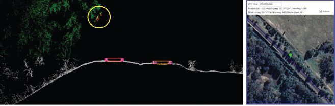
Example of rail track lidar showing encroaching vegetation, with associated map and location information. The yellow circle in the lidar data shows vegetation that is starting to intrude into the train’s path. (Images: Advanced Navigation)
Payload minimization also was a critical aspect in the search for an INS, as surveyors are always seeking longer flying time. This only can be achieved with a lighter technology stack payload. The team used an OEM version of the INS for a smaller form factor that could be integrated within a single ruggedized housing. This allows a design with greater strength, weather resistance and efficient payload setup.
“The industry is constantly seeking lighter payloads for longer flight times and to fit on smaller, safer UAVs,” Cox said. “Regulatory restrictions challenge the industry to meet certain specifications. The same is true for UAV lidar. We hit a ceiling. We need to be able to improve on that, although what we’re achieving now is a real game changer.”
The resulting survey material contains lidar point cloud data and the geo-referencing data from the INS. All data processing is performed post-flight to ensure the highest possible accuracy. PPK is used for correction of GNSS-INS position, roll, pitch and heading data. The processed INS data is then combined with the processed point cloud data to provide absolute position to the point cloud. This system realized consistent 30~40mm precision at 120m AGL. Nextcore has integrated the lidar and INS processing platforms to automate the synthesis of data sets, reducing the survey completion time. Depending on the survey’s size and complexity, this solution can process survey data into a 3D map within 30 minutes of mission completion.
Nextcore used a Certus Evo GNSS receiver, which internally uses the u-blox ZED-F9P chip. It logs GPS L1, L2, GLONASS L1, L2, Galileo GalE1, E5, and BeiDou B1, B2 frequencies at 8 Hz. It used the Kinematica correction service running a PPK filter.
Lidar sensors have become light enough to mount on UAVs (Photo: Advanced Navigation)
Scanning Rail Corridors Super Fast
Aerial surveying is not the only environment to present challenges to lidar and INS.
Train-mounted lidar for automated track and rail corridor surveying is another burgeoning market. This application typically uses lidar and position data to detect and identify areas of the railway that require maintenance and, perhaps more importantly, preventive maintenance. Rail surveying presents unique demands, including operating at speeds of 160km/h (100mp/h) or more, maintaining position accuracy during GNSS outages and variable environmental conditions.
Land-based surveying provides flexibility for selecting an INS compared to aerial applications, as size and weight are usually irrelevant. Rail surveying also requires an INS that provides the necessary performance while tolerating vibration and erratic movement from junctions, points and signals, and be absolutely dependable in GNSS-denied situations. Cox’s team found that the greater accuracy and better drift stability of FOG INS over MEMS provided an ideal platform for generating reliable and accurate paths of train trajectory.
Cordel tested Advanced Navigation’s Boreas digital FOG INS as a potential solution. Testing was carried out using cars as a simulation, travelling complex routes in two directions then overlaying the lidar point clouds to check for discrepancies or unsynchronized areas. The results provided the confidence to put the Boreas into service.
Railways typically traverse deep cuttings, lengthy tunnels and other environments that disrupt GNSS. It is mission-critical that the INS can apply dead reckoning the instant GNSS is disrupted and maintain accurate position for the entirety of the outage. Reliable path and location data during GNSS disruptions is central to the viability of automated rail surveying. Blind spots or zones of unreliable route data cannot be tolerated by rail operators from safety, track availability and financial perspectives.
The Cordel AI lidar analysis system can be “tuned” to the required metrics and is capable of self-learning. The AI enables the system to pre-emptively identify and flag areas of concern before they become an actual problem or hazard. Examples include measuring track gauge and alignment, ballast distribution and coverage, and clearance between potential hazards to the train. The entire route is logged, creating a “Google map” of the railway that maintains a historical record of survey data each time the track is used.
Clients can then view a representation of the lidar data to get a clear understanding of any issues and how to respond before sending personnel or assets to a location. This enables intervention before safety is compromised or remedial works become large-scale and disruptive. As a result, rail service providers can maintain safer railways, deliver more reliable services, and minimize operating costs.