The U.S. Department of Transportation’s Federal Aviation Administration (FAA) has announced $4.4 million in drone research, education and training grants to seven universities.
Research will focus on three areas:
electromagnetic compatibility
detect-and-avoid classifications
cybersecurity oversight.
“This funding and our ongoing partnerships with these universities will allow the FAA to safely integrate the airspace that has a growing number of diverse aircraft users,” said FAA Acting Administrator Billy Nolen.
The research initiatives and grant awardees include:
Evaluate Unmanned Aircraft Systems (UAS) Electromagnetic Compatibility
This research will assess the risks, identify drone design vulnerabilities, identify material and procedural mitigations, and propose guidance for safer electromagnetic compatibility with emitted and static fields.
University of North Dakota, $325,042
University of Kansas, $325,000
Drexel University, $325,830
Investigate Detect-and-Avoid Track Classification and Filtering
This research will provide proposed metrics, guidance and test methods to assess the effects of false or misleading information on detect-and-avoid capabilities. The findings will support beyond-visual-line-of-sight operations.
The Ohio State University, $732,441
Embry-Riddle Aeronautical University, $371,000
Mississippi State University, $330,000
University of North Dakota, $80,000
Illustrate the Need for UAS Cybersecurity Oversight and Risk Management
This research will address UAS cybersecurity oversight and risk management as it pertains to the National Airspace System and other FAA systems.
The ASSURE Center of Excellence is one of six that the FAA has established to help advance technology and educate the next generation of aviation professionals. Research conducted through ASSURE is focused on helping the drone market safely grow and integrate into the nation’s airspace.
More than 800,000 recreational and commercial drones are in the active drone fleet, and that number is expected to grow.
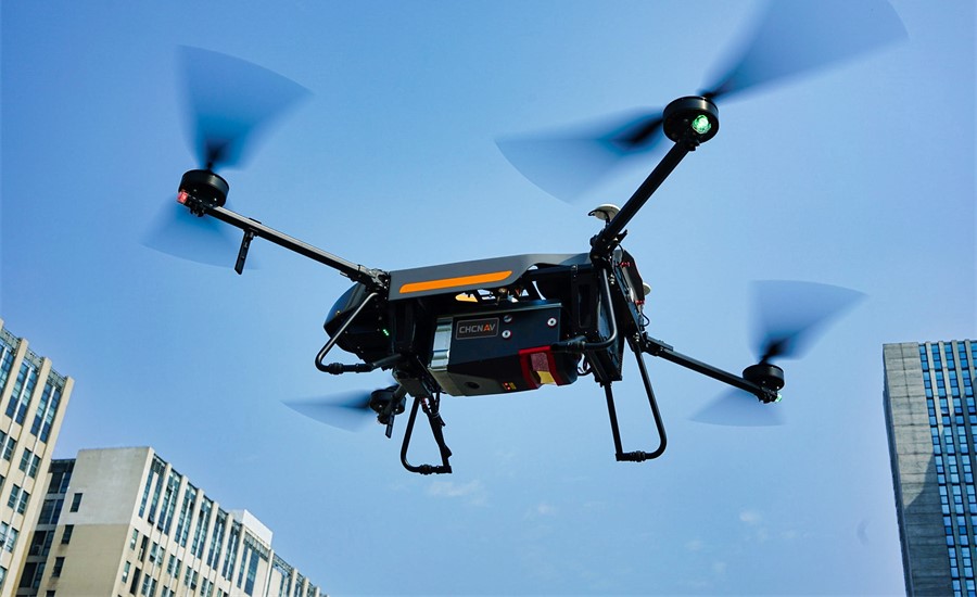
Both lightweight, compact airborne laser scanners are easily installed on various UAV platforms or small survey aircraft and helicopters. They are adapted to high-density point corridor mapping applications, day or night, under leaf-on and leaf-off conditions or with dense vegetation to provide reliable results.
“Nowadays, it is critical to obtain the highest data quality for the majority of aerial survey projects,” said Andrei Gorb, product manager of CHC Navigation’s Mapping and Geospatial Division.
Combining with industrial-grade GNSS receivers and high-precision inertial measurement units (IMUs), the AA1400 and AA2400 provide 2 to 5 cm survey-grade accuracy. They also integrate Riegl’s VUX lidars with waveform-lidar technology, allowing echo digitization and online waveform processing.
“Multi-target resolution is the basis for penetrating even dense foliage,” Gorb said. “The continuously rotating polygonal mirror wheel enables scanning speed of up to 400 lines per second, allowing for effective coverage of large areas when used from fast drones or aircraft.”
The BB4 UAV equipped with the AA2400 scanner for the city mapping task. (Photo: CHCNAV)
Their built-in premium Riegl VUX-120 and VUX-240 lidar sensors feature a high-speed data acquisition rate of up to 1.8 MHz and a scan speed up to 400 lines per second. This provides a linear accuracy of 1cm to 2 cm on long-range scanning, suitable for fixed-wing UAV corridor mapping.
CHCNAV offers several external cameras for add-ons to the AlphaAir. Setups can include nadir or nadir and oblique cameras from Sony or PhaseOne. By obtaining high-resolution geo-referenced and oblique imagery, more applications can be supported, increasing the return on investment for the client.
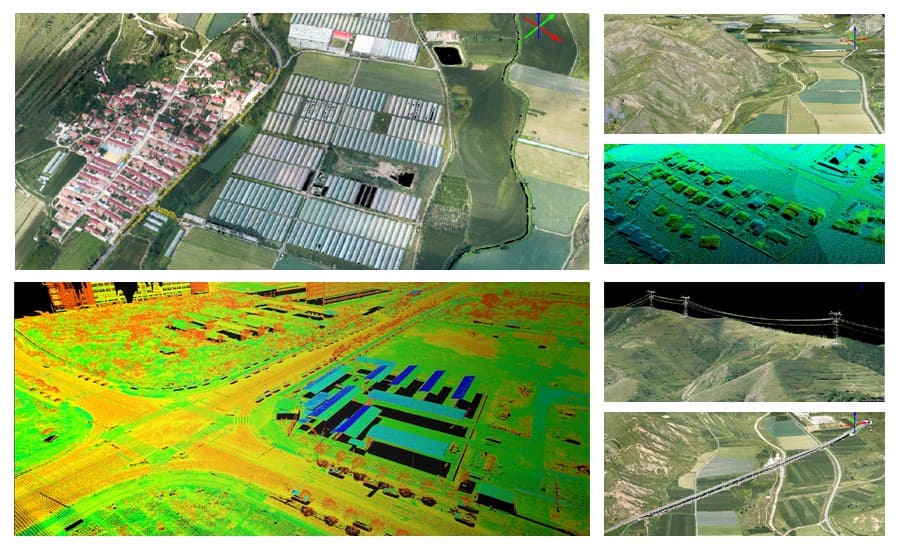
The scanning results of the AA1400 and 2400 lidar series. (Photo: CHCNAV)
The one-click connection of the AlphaPort to the power source and camera makes the installation of the AA1400 and AA2400 quick and easy, eliminating the need for additional accessories and time for camera calibration. The AA1400 and AA2400 reduce the risk of cable damage caused by aircraft vibration and acceleration during takeoff and landing.
CHCNAV provides a full range of solutions that allows a complete lidar solution to be added to the users’ geomatic services. The software suite includes CoCapture UAV field application for fully automated reality capture and real-time mission tracking, and the CoPre desktop software for semi-automated point cloud processing.
The AA1400 and AA2400 lidar series solutions are available worldwide today through the CHCNAV distribution network.
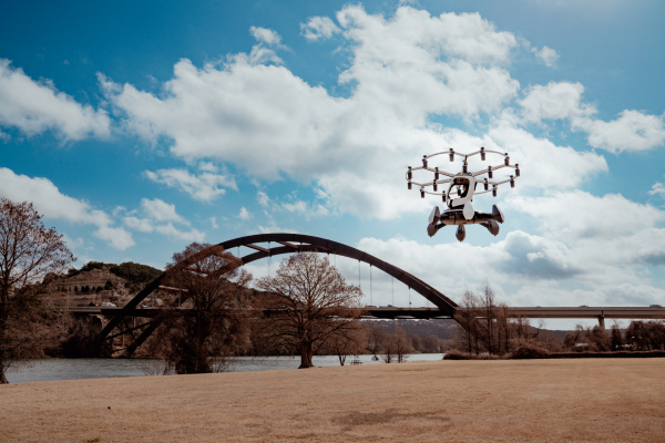
LIFT Aircraft Co. has been awarded a U.S. Air Force contract to continue experimentation and flight test efforts around its HEXA copter.
LIFT Aircraft Co. has been awarded a Phase 3 contract through the U.S. Air Force’s Agility Prime Program to continue experimentation and flight test efforts around HEXA, LIFT’s all-electric, single-seat vertical-takeoff-and-landing (VTOL) aircraft.
Since 2020, LIFT Aircraft has conducted flight testing with the support of the U.S. Air Force under a Phase 2 Small Business Innovation Research (SBIR) contract.
Working with Air Force subject-matter experts, LIFT achieved initial military airworthiness approval (military flight release) and proven transportability by moving the aircraft inside a C-130 military cargo plane. The company also explored a multitude of potential use-cases alongside the Agility Prime Test Team.
The Phase 3 contract will continue experimentation and use-case development through a fast-paced, rigorous flight testing program. The program will begin at Eglin AFB and may expand to other locations. It includes efforts such as flight envelope expansion, acoustics testing and developmental testing of a modular cargo adaptation for the airframe.
The aim is to accelerate and further develop HEXA for public and military applications such as emergency first response, personnel transport, base logistics and search-and-rescue missions. The development effort will also help accelerate the testing required for LIFT’s planned rollout of commercial flight locations.
“This partnership provides continued access to the unmatched expertise of the U.S. Air Force,” said LIFT Director of Business Development, Kevin Rustagi. “We’re excited about continuing to explore and develop a unique capability to the military: an aircraft that offers air mobility at a cost point comparable with ground transportation that, in the future, with mere hours of training, allows any service member to become a pilot.”
Testing will initially be performed at Eglin Air Force Base near Destin, Florida, alongside the 96th Test Wing and with the support of Air Force eVTOL initiative, Agility Prime.
LIFT has already begun coordinating with Col. Doug Creviston of the 96th Operations Group, which has tested systems for the F-15 Eagle, F-16 Falcon and A-10 Thunderbolt.
Photo: Lift
“LIFT is a great example of why Agility Prime exists — to further applications of eVTOL technology for both military and civilian use,” said Lt. Col. John Tekell, Air Force Agility Prime Lead at AFWERX.
Agility Prime has taken a flexible approach to contracting with the Phase 3 SBIR for LIFT. The contract is designed to be as agile as possible — it allows not only the Air Force, but any governmental entity to contract for flight-test activities with LIFT’s HEXA aircraft on an as-needed basis.
“This contract was designed to enable flexible flight test as a service of multiple HEXA aircraft for any government stakeholder, location and desired experiment,” said Sterling Alley, technology transition lead and LIFT program manager at Agility Prime. “We want it to be able to serve as a contract vehicle that accelerates HEXA towards fielding not just for the USAF, but the DOD and USG in general. We have a large number of interested stakeholders looking at use-cases for the aircraft and welcome growing the community even further in the future.”
“LIFT’s Phase III SBIR contract award is a meaningful vote of confidence from the U.S. Air Force,” said Eric Horan, former U.S. Navy government contracting officer and founding partner of Decisive Point, a venture capital firm that invests in dual-use technology startups and has invested in LIFT. “It means the Air Force has determined LIFT’s previous development and testing contracts were successful. This is an important step towards scaling access to LIFT’s HEXA eVTOL aircraft throughout the Department of Defense and federal government at large.”
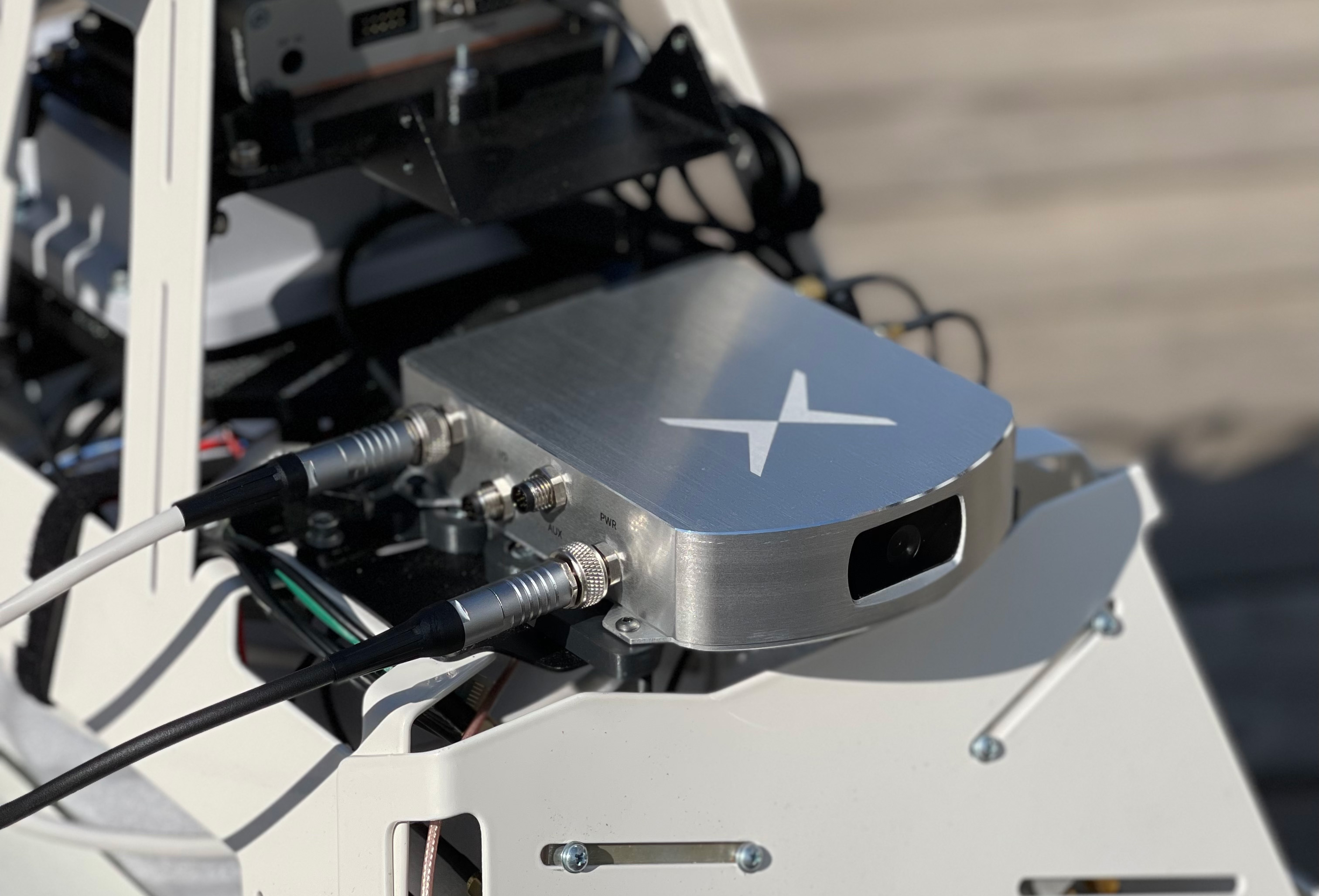
Fixposition, a Swiss technology company providing high-precision positioning solutions, has released a centimeter-level positioning sensor, the Vision-RTK 2.
The low power and compact, industrial-grade device is suitable for autonomous delivery and logistics vehicles, agriculture, mowing and landscaping machines, as well as any other application where precise, uninterrupted positioning must always be available everywhere.
“As vehicles and machines become increasingly autonomous, they must safely and precisely negotiate complex routes, even where GNSS visibility is degraded or blocked,” said Zhenzhong Su, CEO and co-founder of Fixposition. “With Vision-RTK 2, these applications are becoming possible. Our deep sensor-fusion technology combines GNSS technology with advanced computer vision and machine learning.”
“We are using a global optimization-based sensor fusion technique that is much more robust and powerful than traditional Kalman filters,” said Lukas Meier, CTO and co-founder of Fixposition. “Our computer vision-based dead-reckoning technology has clear advantages over purely IMU-based products.”
UAVOS has successfully completed the S1-V300 medium-altitude long-endurance (MALE) unmanned aerial system (UAS) prototype designed to check basic aircraft systems.
The advanced UAS model is based on the Saker MALE UAS design that achieved operational capability in 2020. The S1-V300 MALE UAS prototype is an upgrade to the unmanned system and features a new design and a more powerful heavy fuel engine with 260 HP offering greater speed, payload, and endurance of 28 hours with a range of 4,020 km.
Work performed under UAVOS’ MALE UAS program using its proven Saker aircraft capabilities has enabled it to create a new-generation S1-V300 MALE unmanned platform. The aircraft features unique UAVOS avionics solutions and a redundant flight control system that will enable complex missions.
The S1-V300 UAS will be able to support a variety of overland and maritime intelligence, surveillance and reconnaissance (ISR) missions. The improved S1-V300 prototype is equipped with both line-of-sight (LOS) and beyond-visual-line-of-sight (BVLOS) datalink systems for over-the-horizon operations. Additionally, the aircraft can be integrated with multiple ISR sensors, including electro-optical infrared (EO/IR) cameras and a synthetic aperture radar (SAR) that offers all-weather, day/night performance for a wide-area search capability.
The S1-V300 MALE UAS next-generation capabilities combined with medium-altitude persistence make it a suitable platform to add with long-range radar, signals intelligence (SIGINT) payloads, communication-relay payloads, and counter electronic-warfare systems. Additional retrofits include stronger wings and extra hard points for carrying an external payload of 300 kg.
The S1-V300 has fully autonomous operation capability. It is equipped with automatic taxi-takeoff and landing systems, satellite communication for extended range, and fully redundant avionics. It is designed to operate in harsh environments and is adapted to perform in extremely hostile, dry and dusty ambient air. The aircraft features a 8.7-meters-long fuselage and a 18.7 meters wingspan, is capable of flying at 220 km/h, and has an endurance of more than 28 hours.
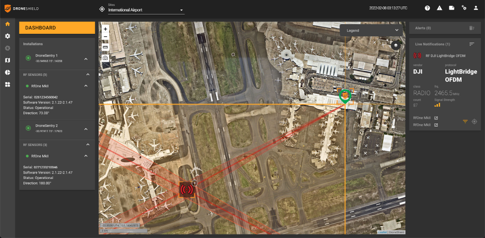
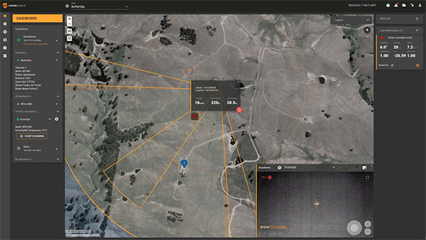
DroneSentry-C2 with Nearmap location data. (Screenshot: DroneShield)
DroneShield Limited, an Australian/U.S. global leader in artificial-intelligence-based platforms for protection against advanced threats such as drones and autonomous systems, has announced an enhanced version of its DroneSentry-C2 command-and-control software in partnership with location intelligence firm Nearmap.
Nearmap provides city-scale 3D content, artificial-intelligence data sets, geospatial tools, and high-resolution aerial imagery in Australia, New Zealand and North America.
DroneSentry-C2 provides an intuitive and feature-rich software platform, providing counter-UAS awareness and reporting capability. It integrates both DroneShield and third-party C-UAS sensors and effectors. Those include multiple AI-enabled sensing and tracking products, such as RfOne long-range direction-finding sensors for UAS detection and tracking, and camera-agnostic DroneOptID optical/thermal camera AI software.
DroneSentry-C2 will come with a standard mapping solution for cost-sensitive customers, and an optional Nearmap mapping upgrade for mapping data for markets requiring high performance, such as government, intelligence, Homeland Security and defense.
The software comes as an on-premises, air-gapped solution for intelligence, Homeland Security and defense users, or secure cloud for enterprise customers. The on-premises solution also includes a high-grade physical server. Both options come with regular mapping updates, including the ability for the user to load their own maps for sensitive locations.
“One of DroneShield’s differentiators is that we are both a sensor manufacturer and an integrator,” said Oleg Vornik, DroneShield CEO. “Providing a streamlined and standardized hardware / software bundle that gives our user community an easy-to-deploy and run command-and-control software will be critical as more fixed and pop-up site users seek to deploy counter-UAS products. Importantly, the offering is already validated by deployments such as U.S. Air Force and Australian Army, among a number of other tier 1 end users globally.”
The Autel Robotics Dragonfish Lite and Pro UAVs are now available in the United States, joining the Dragonfish Standard and providing more options and choices for UAV pilots.
The rugged Dragonfish UAVs are capable of vertical takeoff and landing (VTOL) with both multi-rotor and winged flight, with an endurance of up to 180 minutes. They are suitable for professional applications such as energy, mining, defense and surveillance. Maximum winged flight speed is 30 m/s (108 km/h, 67 mph), and maximum video transmission range is 30 km (18.6 miles) with a base station.
The 1-tap take-off and landing capability point-and-click user interface, and other smart autonomous features make the Dragonish simple for anyone to operate, according to maker Autel Robotics. The aircraft can make a smart decision to either land or return to base in case of issues such as loss of GPS signal, loss of operator communications, or low battery power.
The Dragonfish tilt-rotor system will automatically transition to multi-rotor mode if adverse conditions cause fixed-winged flight to stall or become unsustainable. The Dragonfish battery, barometer, positioning system, compass and inertial measurement unit all have backup modules to ensure flight safety.
Dragonfish UAVs can carry a variety of payloads, including standard high-resolution cameras, 50x optical zoom cameras, 12-megapixel wide-angle cameras, 1280 x 1024 high-resolution infrared cameras, and laser rangefinders for various imaging, surveillance and mapping tasks.
All Dragonfish UAVs are built from tough carbon-fiber and fiber-glass composite, providing excellent IP43 wind and weather resistance. Despite the strong construction, these aircraft are designed to be easily disassembled for space-saving transport. They can be assembled in three minutes without tools. Disassembled, Dragonfish fits in the back of any car or SUV.
The larger Dragonfish Pro provides the longest flight time of the series, 180 minutes with payload, and has a 6,000-m (19,685-ft) flight ceiling, making it suitable for applications such as discreet long-endurance surveillance and wide-area mapping. The maximum payload capacity is 2.5 kg.
Compact and lightweight at 4.5 kg (including two batteries) with a 1,600-mm wingspan, the Dragonfish Lite can carry a 1-kg payload up to its service ceiling of 4,000 m, and has 75 minutes’ flight endurance.
Dragonfish Standard is already available. Dragonfish Lite and Dragonfish Pro will be available in the U.S. starting in April.
Firmware Release
The company also announced that pilots of Autel Robotics’ EVO Nano and EVO Lite series drones can download a firmware update that adds features including Dynamic Track 2.1 (person only), SuperDownload, 8-bit Log video, HDR video and other improvements. Some of these new firmware features are available now for selected models, and other features will become available for the EVO Lite, Lite+, Nano and Nano+ series in the near future.
A roundup of recent products in the GNSS and inertial positioning industry from the March 2022 issue of GPS World magazine.
OEM
Correction Service
Achieves RTK-level accuracy
Photo: Hexagon
“RTK From the Sky” technology has been integrated into the core of the TerraStar-C PRO corrections service. As a result, TerraStar-C PRO provides centimeter-level accuracy, not just in open-sky environments but also across challenging conditions created by buildings and foliage. TerraStar-C PRO now converges in less than three minutes by utilizing quad-band receiver and antenna technology to leverage modernized BeiDou 3, GPS III and Galileo E6 signals. The resulting process generates state-of-the-art corrections for all GNSS frequencies. The service improvements are accessible through the 7.08.10 firmware release for users of OEM7700, OEM719 and OEM729 cards and their associated enclosures for land and air applications.
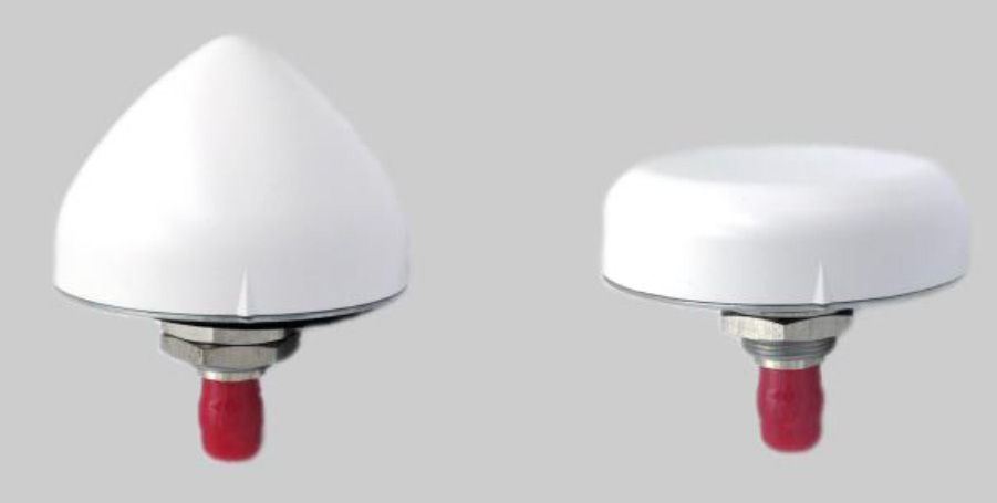
A north orientation mark is being added to the TW3000 family of Accutenna precision antennas and the TW5000 family of smart antennas. The new feature allows customers to align their antennas, standardize radiation patterns, and increase the synchronicity of their azimuth gain readings across multiple devices. The new north mark design has been thoroughly tested to ensure it conforms to or exceeds customer expectations and maintains each antenna’s stringent IP69K rating.
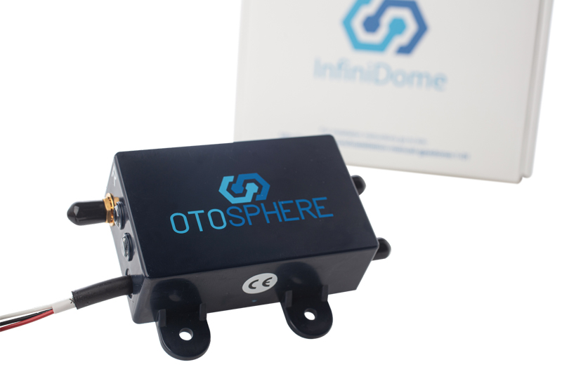
OtoSphere is a small, add-on module to the ViaLite GPS RF over fiber link and any GNSS-based system, providing GNSS protection against GPS jamming attacks, making any receiver more resilient. It ensures continuity of timing and navigation capability and enables normal operation during a jamming attack. According to ViaLite, no other solution that offers such protection is as small, light, affordable, or easy to install. The Otosphere protection module adds resilience to critical GPS timing services.Using OtoSphere, GPS receivers are up to 50 times more resilient to jamming attacks on positioning, navigation and timing (PNT) systems compared with having no protection. The GPS receiver can continue working normally throughout the attack. Timing-critical infrastructures in areas such as defense and cybersecurity can now be protected from these attacks. The Otosphere has a unique interference filtering algorithm that combines patterns from two external omnidirectional antennas that pinpoints the direction of the attack, then directs a null toward the unwanted signal to reject and reduce disruptions.
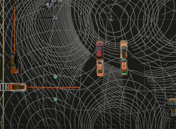
Infrastructure system for autonomous transportation
Photo: Seoul Robotics
The Level 5 Control Tower (LV5 CTRL TWR)) is a mesh network of sensors and computers on infrastructure that guides vehicles autonomously without requiring that sensors be placed on individual vehicles. The technology is automating last-mile fleet logistics at BMW’s manufacturing facility in Munich. The system has the potential to transform operations for a wide range of business applications, from vehicle distribution centers to car rental companies and trucking logistics.
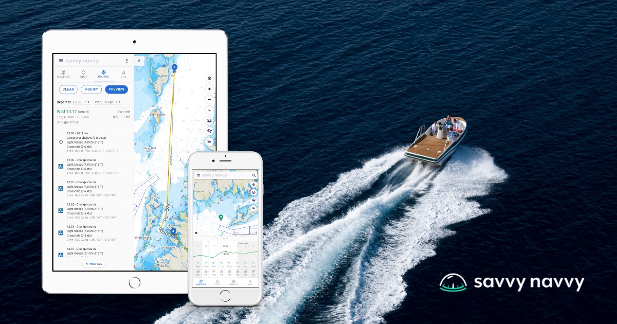
Savvy Navvy provides essential marine information, allowing boaters to cross-check their traditional navigation plans. It integrates plotting charts, weather and tide data, marina details and passage planning into one app. The app reduces the risk of human error as well as the stress of voyage preparation. It is used by boaters in more than 100 countries around the world, with more than 43 million miles plotted. It works on phones or tablets using Android, IOS, PC or Mac.
The Pix4D viDoc RTK handheld rover attaches to iOS devices to bring RTK accuracy to terrestrial scanning on iPhones and iPads. When paired with the PIX4Dcatch mobile app, the viDoc rover can replace survey tools such as RTK GNSS rovers and terrestrial scanners, the company said. The two products create a workflow that turns iPhones or iPads into an accurate terrestrial scanning device, with centimeter-accurate RTK positioning from an existing NTRIP network. The tools can be used to 3D model small areas or structures.
Bad Elf now provides an integrated laser-offset workflow for acquiring high-accuracy field data in GNSS-challenged environments using Esri ArcGIS Field Maps for Android, as well as iOS. The workflow integrates Bad Elf and Laser Tech (LTI) hardware in collaboration with ArcGIS technology from Esri. The Bad Elf Flex connects to any LTI TruPulse rangefinder over a wired or Bluetooth connection to deliver high-accuracy location data to Esri ArcGIS Field Maps. Mobile workers can efficiently complete position and height data collection in access-limited situations, saving time, money and effort.
A free global map created from processed satellite imagery is available. To create the world image, satellite imagery was processed to remove clouds and balance shades and tones, and then carefully stitched together to create a seamless map layer with beautiful colors. The input data is recent, from 2020 and 2021, and rendered as one tiled file with 13 zoom levels 0-13 for use in web applications. It is a viable, up-to-date alternative to Google maps for software developers, without privacy issues.
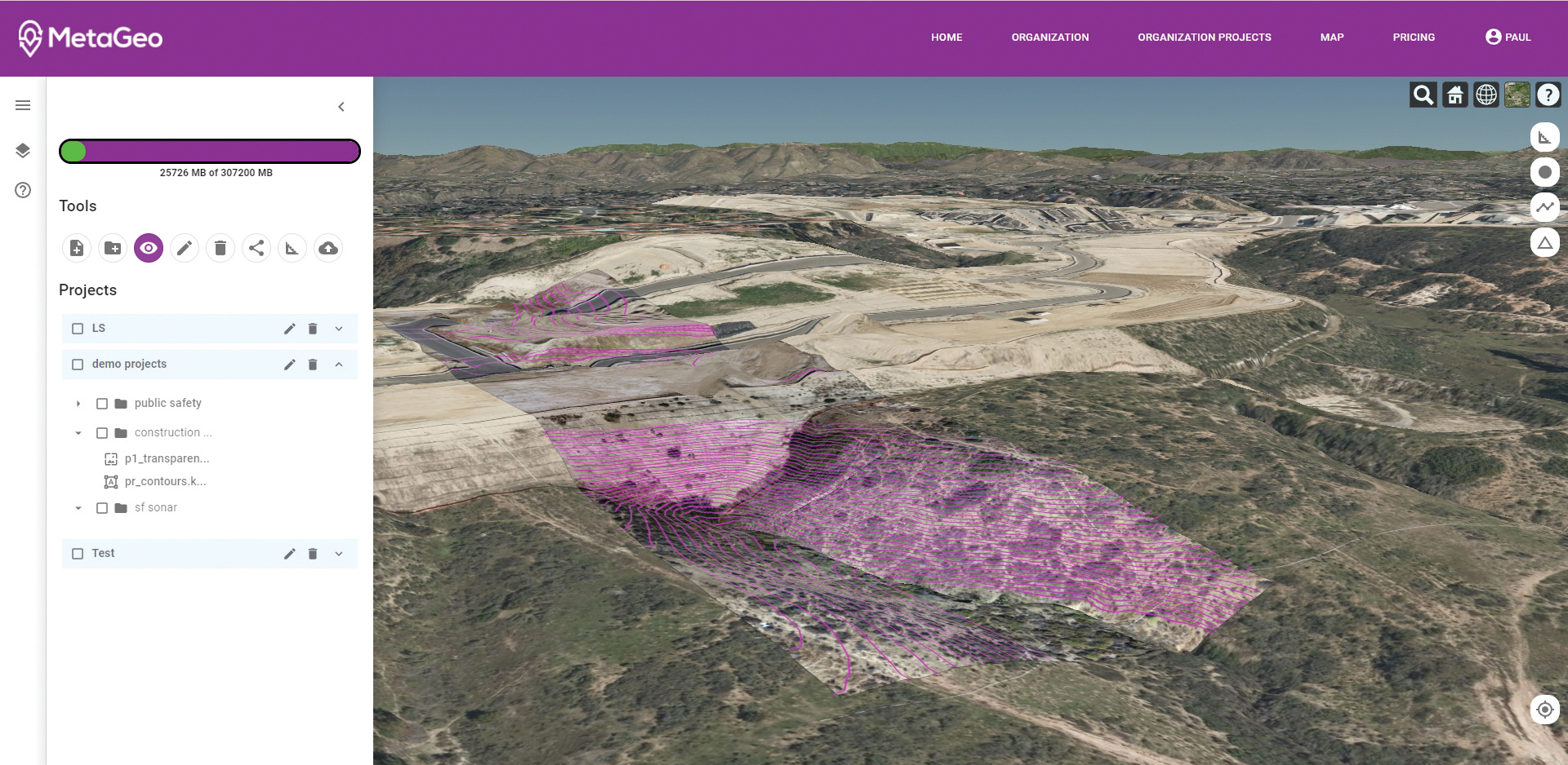
The MetaGeo geographic information system (GIS) platform enables organizations of all sizes to host, analyze, find and share 3D map datasets among any internet-capable devices. The platform processes location-based map or sensor data from the real world, combines it into a single 3D virtual environment, and streams it to any device or mapping platform. The affordable and easy-to-use platform can load data from multiple sources: satellites, drones, mobile devices, public and crowdsourced repositories, internet of things (IoT) sensor data, 3D models and topographic maps. The data is then processed by the MetaGeo platform into a 3D world and streamed to any internet-connected device, enabling live collaboration between the office and field via mobile or augmented reality device. A plug-in software development kit (SDK) allows for third-party tools to scale and fit user needs.
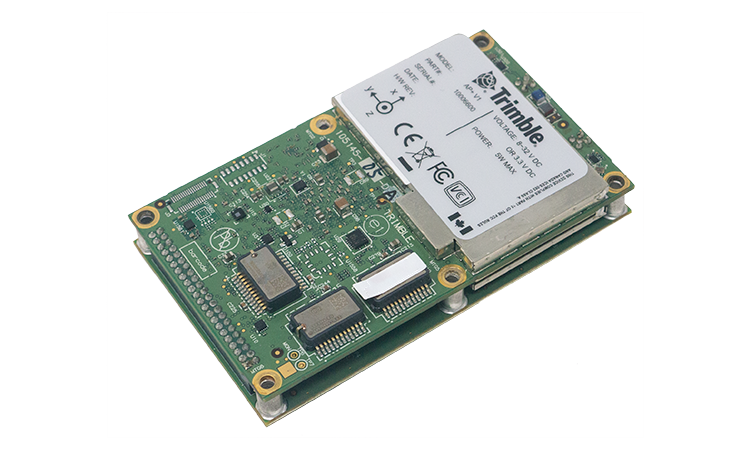
Trimble has launched the Trimble AP+ Land GNSS-inertial OEM platform for accurate and robust position and orientation for georeferencing sensors and positioning vehicles in land mobile-mapping applications. The platform enables users to accurately and efficiently track and monitor fleets and produce high-definition (HD) maps and 3D models. It can also serve as a reference solution for advanced driver-assistance systems (ADAS) testing, even in challenging GNSS environments. The comprehensive Trimble AP+ Land is small enough to integrate into compact mobile-mapping systems. It is compatible with virtually any type of mapping sensor, including single- or multi-lidar systems, video cameras, photogrammetric and panoramic cameras, and similar sensors.
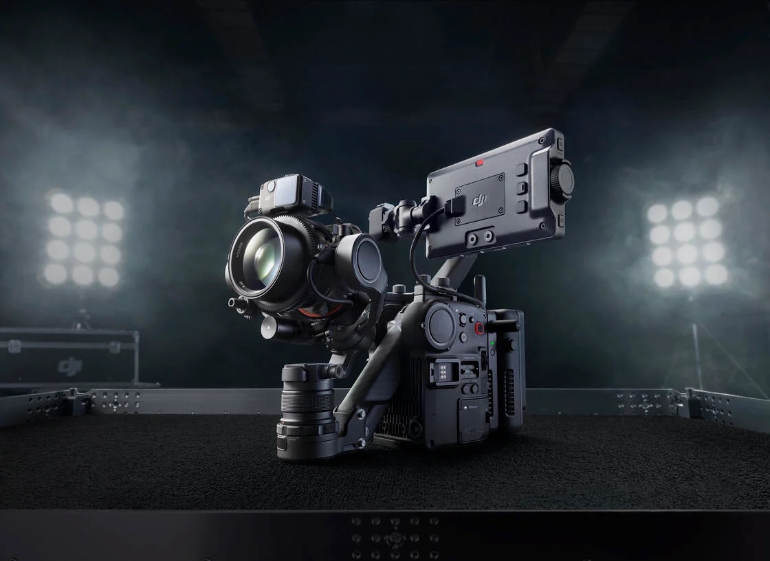
Ronin 4D, a professional cinema camera from DJI, incorporates the full-frame Zenmuse X9 gimbal camera, active four-axis stabilization, lidar focusing, and wireless transmission. Firmware available at launch will allow the remote monitor to view and control the main monitor, interface with mirror control mode, and allow a clean video stream over HDMI and SDI ports on the Remote Monitor Expansion Plate with no overlaid information. It will also support automatic calibration for some third-party auto lenses to realize Lidar Focusing System functions.
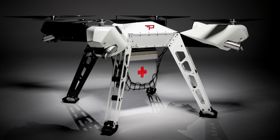
Parallel Hybrid Electric Multirotor (PHEM) drone technology improves flight time with a heavy payload, yielding increased efficiency and eliminating the large battery used in other hybrids. It has the potential to extend a UAV’s flight time from 15 minutes to well over an hour and drastically increase range. In the search-and-rescue field, a heavy-lift drone can enhance first responder capabilities by allowing for substantially quicker response times to remote locations. Other applications include military platforms, fighting wildfires, and medical and logistics missions.
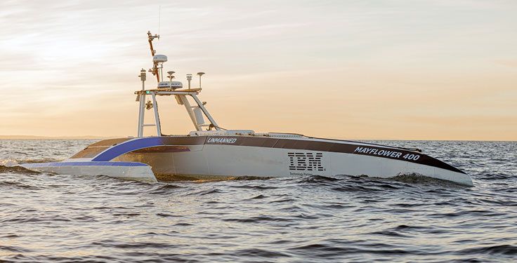
The Mayflower Autonomous Ship (MAS) is set to re-embark on its three-week trans-Atlantic journey in April 2022 equipped with two of Silicon Sensing’s AMU30 inertial measurement units (IMUs). These devices send highly precise motion data to the new ‘AI captain’ that guides the vessel. They also assist in measuring sea surface height as part of detailed scientific analysis of ocean topography.
AMU30 is a micro electro-mechanical system (MEMS) unit with excellent inertial performance, including very good bias stability and low noise characteristics, plus an embedded Kalman Filter-based AHRS (attitude and heading reference system) algorithm. It delivers precise 3-axis outputs of angular rate and acceleration, plus roll, pitch and heading angles, altitude and pressure, and temperature, at 200 Hz — all critical to precise maritime navigation.
“The two AMU30 are used to make real-time, precision measurements of the movement of the Mayflower Autonomous Ship in 6 degrees of freedom (DOF) so that the AI Captain may make minute manoeuvring adjustments to optimise vessel performance in a complex wavefield, while also providing redundant general navigation capability at sea,” said Brett Phaneuf, co-director of the project. “Furthermore, when coupled with optical and RTK (real time kinematics) GPS data, the AMU30 assists the ship in making highly accurate measurements of sea surface height, which are important for studying ocean tides, circulation and the amount of heat the ocean holds.”
The MAS journey across the Atlantic will celebrate the voyage of the original Mayflower some 400 years ago. It is just one element of an extensive scientific data gathering and research programme the vessel will complete in the coming years. The ship is guided by its new AI Captain, built using IBM cloud, artificial intelligence (AI) and edge computing technologies, and uses a hybrid engine that draws on solar power. Working with scientists and other autonomous vessels it provides a flexible platform for deepening understanding of issues such as climate change, ocean plastic pollution and marine mammal conservation. In parallel, the development of marine autonomous systems such as this will transform ocean-related industries such as shipping, oil & gas, telecommunications, security & defence, fishing & aquaculture.
Teledyne FLIR is extending its counter-UAS thermal-imaging sensing technology to the DroneShield platform, which has developed and applied its artificial intelligence and machine-learning software algorithms via radiofrequency (RF) sensing and computer vision technologies.
The addition of Teledyne FLIR thermal camera hardware and expertise will enable military customers to improve detection, including identifying and tracking numerous unmanned threats in the thermal and RF spectrums at considerable range, providing the capability within a single system.
A major Western military agency will be deploying the combined system at one of the best-known military testing ranges in the world.
The DroneShield DroneSentry-C2 command-and-control system with Teledyne FLIR thermal imaging sensing technology. (Screenshot: DroneShield)
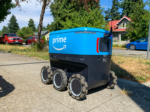
On university and business campuses, getting lunch and dinner is becoming a lot easier as robot delivery units hit the pathways.
If you were a student or faculty member at the University of Wisconsin – Madison campus (UW) during the 2020 COVID lockdown, you might have experienced a novel way to reduce contact with others when ordering a meal. People on campus could avoid a trip to the store and interaction with a delivery person. They could place an order on a special app, and a Starship Technologies robot would pick up and deliver their food.
Of course, for a student, technology that saves a trip to the store, especially anytime of the day or night, would be popular.
From demo to full production
At first, the meal-delivery robots at UW and other campuses were a demonstration to showcase how useful the small bots could be.
But after I soaked up robot-tech news from all over, I learned these little guys have found their way into towns, cities and campuses around the world: specifically, the United States, United Kingdom, Estonia, Germany and Denmark.
With 1,500 bots working every day, the demonstration phase is long over, and Starship robots are full production. Starship, based in San Francisco, has been in operation since 2014. Its robots now make more than 1,000 deliveries each day. They have made more than 2.5 million deliveries to date, and make 100,000 road-crossings each day.
In the United States alone, 16 states have approved delivery robots, including Virginia, Idaho, Wisconsin, Florida, Ohio, Utah, Arizona, Washington and Texas. At UW, three Starship employees manage maintenance and recover units if they get stuck (while autonomous, the bots need help every now and then).
To have a robot come to visit, UW users download the Starship Food Delivery app, select from a local store menu, pay and then indicate on a map exactly where the bot should deliver the order. The robot collects a minimal $2 delivery charge, which goes toward the $2,000 to $3,000 cost of the vehicle and its operation. (According to Starship, each unit costs the equivalent of a high-end laptop.)
The unit uses GNSS and computer vision to navigate detailed, stored maps. The on-site employees take the robots out on particular routes for their first test runs, and the bot learns each route. The on-board system also uses 12 cameras, ultrasonic sensors, radars and neural networks to form a collision-avoidance net around the vehicle. In this way, pedestrians, dogs and road vehicles (when the robots cross a road) can all be avoided.
When waiting to cross a road, the robot’s safety systems might prevent it from moving. In this case, the device will “phone home” for a support person come out and fix the issue.
What could go wrong?
So far, the robots have been welcomed on the university and industry campuses where they operate. People walk round them as they go about their business. Even better, students and other users have pulled the units out of snow mounds and other hang-ups, returning them to the sidewalk or making other small adjustments to send the bots on their way.
And no one has stolen a unit. That could be because a loud siren erupts if they are picked up. Presumably the units are programmed to remain within the bounds of their rigorously mapped environments. In any event, the food compartment remains locked until the order is removed by the customer.
Disrupting Doordash
Will robots disrupt today’s car-based delivery services, such as UberEats, Grubhub or DoorDash? Only for the last-mile section of a delivery. In a pinch, Starship robots can travel as far as three miles from their base. As the bots take on more territory, the auto-based delivery companies may be pushed toward the longer routes.
Deliveries such as time-sensitive medical materials could benefit from robotic short-distance, small-package carriers. Other robot delivery services, including Amazon Scout and Roxo, the FedEX SameDay Bot, are also making waves as testing progresses toward last-mile delivery automation from warehouse hubs to customer homes.
Federal, state and local laws may need to be enhanced to allow these autonomous delivery robots to progress toward widespread deployment.
One selling point: Fast robot deliveries lead to fewer delivery trucks, reducing traffic congestion and lowering exhaust pollution. We might have to wait awhile to realize these benefits.
The Navigation Laboratory of the European Space Agency (ESA) has acquired an unmanned aerial vehicle (UAV) that can carry different types of satellite navigation receivers to collect data for follow-on analysis.
The NavLab, based at ESA’s ESTEC technical centre in Noordwijk, the Netherlands, is focused on the testing, analysis and characterization of navigation systems for both ESA and external customers.
With UAVs representing a rapidly expanding user base, the new UAV is a timely addition to the NavLab’s suite of platforms for testing GNSS technologies and techniques, ESA said. Other tools include static, mobile and pedestrian platforms and a pair of test vans.
Along with receivers and antennas, the UAV can host radio-frequency spectrum samplers and support equipment such as inertial sensors and stereo cameras, allowing the assessment of performance in specific dynamics and environments related to UAV applications, such as approach, landing, flying beside buildings or indoors.