Tag: China

  • More than 80 million BeiDou chips sold

    More than 80 million BeiDou chips sold

    Photo: Maridav/Shutterstock.com
    Photo: Maridav/Shutterstock.com

    When I was a kid, two of my hometown’s burger drive-ins attracted the hungry attention of my sister and myself, causing us to hound our parents to take us “out to dinner” upon the slightest pretext. Only one of them, however, boasted a sign claiming “400 million served.”

    This was a staggering number to an eight-year-old. I hypothesized that everyone in the world must have consumed several by now — a very good argument for me to have one tonight.

    The desire to provoke similar reasoning could form part of the motivation for the China Satellite Navigation Office to announce that sales of BeiDou-based chips have exceeded 80 million. Ran Chengqi, director of the CSNO, delivered the number in a report on the 10th China Satellite Navigation Conference held in Beijing on May 22.


    “It would be stretching a point to say that satnav chips are the burgers of the future, but it’s not an exaggeration to assert that they are becoming a commodity on the world market.”


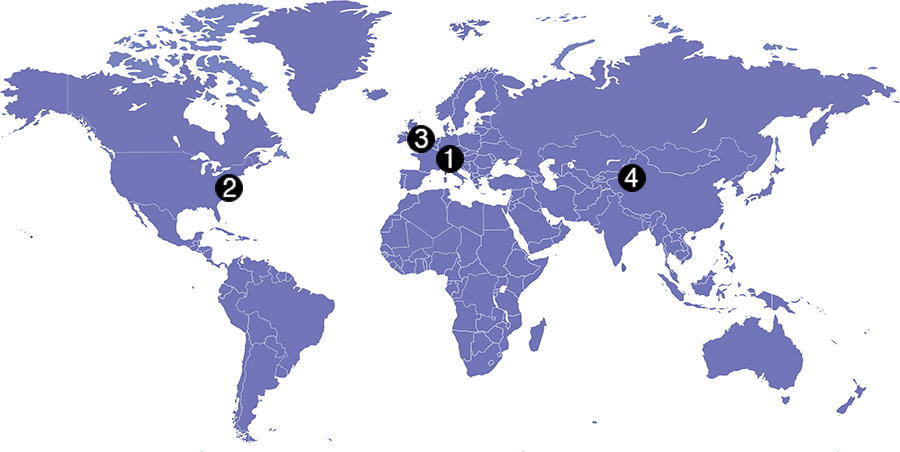
    Now, 80 million falls short of 400 million, but that next hurdle is well within reach, considering the size, potential and explosive growth of the Chinese market, to say nothing of others along the Great Belt and Road, a global development area of infrastructure development and investments in 152 countries and organizations in Asia, Europe, Africa and the Middle East.

    The BeiDou number pales in comparison to the 3.15 billion units of total GNSS chips that global consumption is expected to hit in 2022. By a reasonable projection, BeiDou-enabled chips will by then constitute a major if not the lion’s share of that number.

    Of course, GPS-enabled chips will form a greater majority, if not the totality. All chips will — unless the world radically changes — be GPS-enabled to start, and then have some combination of other GNSS in addition.

    Big Numbers. Ran Chengqi further said that 22-nanometer dual-frequency BeiDou chips are ready for commercial applications.

    According to the China Global Television Network, 116 new positioning-capable cellphone models applied to enter the Chinese market in the first quarter of 2019; 82 of them carry BeiDou-enabled chips. The latest government report on the scale of China’s satnav industry anticipates it will reach 400 billion yuan (US$ 57.8 billion) by 2020.

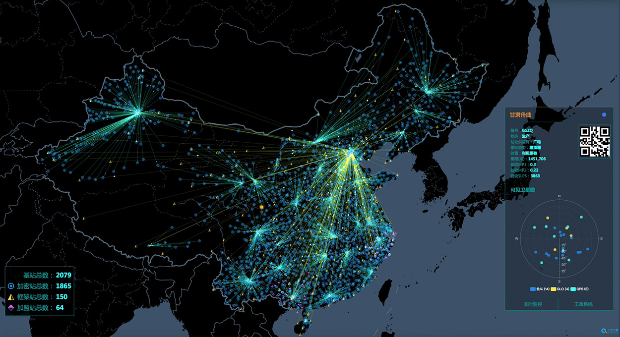
    The news agency stated that more than six million vehicles in 36 cities use BeiDou; long-distance operations and precision farming help raise output by 5% while saving 10% of fuel costs; and more than 70,000 fishing vessels employ BeiDou’s short messaging service.

    BeiDou’s rapid success in a relatively short term echoes that of GPS and GNSS in general. It would be stretching a point to say that satnav chips are the burgers of the future, but it’s not any exaggeration or distortion to assert that they are becoming — if they have not already become — a commodity on the world market.

    By the way, those golden arches have since 1994 stopped counting and updating their published burger tally. All the signs simply say “billions and billions served.”

  • China plans to complete BeiDou-3 by 2020

    China plans to complete BeiDou-3 by 2020

    Photo: Xinhuanet
    Photo: Xinhuanet

    China is planning to complete its updated navigation constellation by 2020, according to China’s news service Xinhuanet.

    With 35 satellites, the completed BeiDou-3 will provide better coverage inside buildings and in urban canyons, according to researcher Jin Shuanggen, Shanghai Astronomical Observatory. Shuanggen was addressing the second Beidou Summit Forum.

    China has deployed three systems, BDS-1, BDS-2 and BDS-3, to provide accurate positioning and navigation services to the world, said Jin Shuanggen, a researcher at the Chinese Academy of Sciences, at the second China (Nanjing) BeiDou Satellite Navigation Application Expo and Beidou Summit Forum.

    The BDS system currently has 38 in-orbit satellites including 18 BDS-2 and 20 BDS-3.

    “Traditional satellites navigation service is hardly available in the interior of buildings, underground, underwater and other locations. The BDS system provides better accuracy in these locations,” he said.

    “BDS will play a large role as it is used in different scenarios including smart city, agriculture and meteorology, autopilot, and intelligent transportation,” said Jing Guifei, dean of BeiDou Belt and Road School of Beihang University.

    Along with the summit, a three-day exposition displayed BeiDou applications with more than 400 exhibitors. Fields covered included drones, autonomous ships, surveying and mapping, and intelligent robots and vehicles.

  • Seen & Heard: Measuring Everest, GPS Rollover boo-boos

    Seen & Heard: Measuring Everest, GPS Rollover boo-boos

    Seen & Heard is a monthly feature of GPS World magazine, traveling the world to capture interesting and unusual news stories involving the GPS/GNSS industry.

    Photo: Mount Everest/Daniel Prudek/Shutterstock.com
    Photo: Mount Everest/Daniel Prudek/Shutterstock.com

    Surveying the highest height

    The precise height of Mount Everest — now listed as 29,029 feet, or 8,848 meters — has been contested since the first survey by British officers in 1849.

    On January 2020, Nepal plans to end the controversy and declare both snow and rock height of the world’s tallest mountain. This spring a two-member Nepali survey team will summit the mountain with a Trimble R10 GNSS receiver, gifted by New Zealand.

    Besides a GNSS survey at the summit, teams will conduct precise leveling, trigonometric leveling and gravity surveys. The GNSS survey will cover 285 points with 12 different observation stations, nine of which are in hills of Sankhuwasava, Bhojpur and Solukhumbu districts.

    Photo: e-Golf cars/Volkswagen
    Photo: e-Golf cars/Volkswagen

    Takin’ it to the (Hamburg) streets

    Five electric Volkswagen Golfs are now on the streets of Hamburg, Germany, being tested with Level 4 automation.

    The cars are designed to handle complex urban traffic patterns without help from drivers, although they must be ready to intervene.

    Level 5, the highest category, requires the vehicle to perform all tasks, turning every rider into a passenger.

    The cars are driving 1.9 miles (3 km) of urban roads where new signals and traffic management systems have been installed for autonomous driving.

    Boeing 787 Dreamliner Hainan airlines/aapsky/Shutterstock.com
    Boeing 787 Dreamliner Hainan airlines/aapsky/Shutterstock.com

    GPS Rollover gone wrong

    The April 6 GPS Week Number Rollover was supposed to pass without a hitch, with plenty of notice that updates might be required for legacy receivers. Instead, several systems crashed.

    In China, as many as 15 Boeing 777s and 787s were grounded pending a GPS update (the receivers gave the date as August 22, 1999.)

    In New York City, part of the wireless grid faulted, cutting information feeds to the NYPD (license plate cameras) and remote worksite communications.

    In Australia, weather balloons were grounded. In the United States, NOAA autonomous monitoring stations went offline. Fixes for all these systems are underway.

  • Seen & Heard: April 2019

    Seen & Heard: April 2019

    Check out some GPS developments that have recently taken place around the world. (Click to enlarge; Map: iStock.com/nadla)

    Map: iStock.com/nadla

    1. A new use for GNSS satellites

    University of Padua researchers say GNSS satellites make possible global quantum communication, beaming information between a satellite and an Earth-based ground station. They exchanged a single photon over 20,000 kilometers to prove secure quantum communications can be implemented on a global scale using GNSS. Results show the first exchange of a few photons per pulse between two GLONASS satellites, using the passive retro-reflectors mounted on the satellites, and the Space Geodesy Centre of the Italian Space Agency. The results could provide solutions for GNSS security for satellite-to-ground and inter-satellite links by using quantum information protocols for quantum key distribution.


    GRITSS to improve reference frame University of Massachusetts Lowell researchers have received a two-year, $1.2 million grant from NASA’s Earth Science Division to develop a Geodetic Reference Instrument Transponder for Small Satellites (GRITSS) to significantly improve the accuracy of the International Terrestrial Reference Frame — the basis of GPS positioning and navigation. A virtual map of the Earth, the ITRF pinpoints specific geographic positions and describes Earth’s precise shape, physical topography, orientation and rotation with time based on a stationary, Earth-centered coordinate system.  The location of each GPS satellite is defined within the ITRF. (Photo: NASA)
    Click to enlarge. (Photo: NASA)

    2. GRITSS to improve reference frame

    University of Massachusetts Lowell researchers have received a two-year, $1.2 million grant from NASA’s Earth Science Division to develop a Geodetic Reference Instrument Transponder for Small Satellites (GRITSS) to significantly improve the accuracy of the International Terrestrial Reference Frame — the basis of GPS positioning and navigation. A virtual map of the Earth, the ITRF pinpoints specific geographic positions and describes Earth’s precise shape, physical topography, orientation and rotation with time based on a stationary, Earth-centered coordinate system.  The location of each GPS satellite is defined within the ITRF.


    Pigeon scientists Engineers from the University of Birmingham have developed a compact backpack to collect climate and pollution data. When the birds return to their lofts, the sensors are retrieved and the data downloaded, including GPS location, temperature, humidity, ambient light and air pressure. So far, scientists have been able to collect data from five birds — they made a total of 41 flights with a total length of about 1,000 kilometers. (Photo: Rick Thomas)
    Click to enlarge. (Photo: Rick Thomas)

    3. Pigeon scientists

    Engineers from the University of Birmingham have developed a compact backpack to collect climate and pollution data. When the birds return to their lofts, the sensors are retrieved and the data downloaded, including GPS location, temperature, humidity, ambient light and air pressure. So far, scientists have been able to collect data from five birds — they made a total of 41 flights with a total length of about 1,000 kilometers.


    China’s big brother program Evidence that China is tracking its Uyghur Muslim population in the Xinjiang region has been uncovered. A facial recognition database was left open on the internet for months, Dutch security researcher Victor Gevers told ZDNet. The database contains information on 2.5 million people, along with a stream of GPS coordinates. Data includes detailed and sensitive information: names, ID card data, addresses, photos and employers, as well as GPS coordinates where the user had been seen via public cameras labeled mosque, hotel, police station, internet cafe, restaurant and more. (Photo: Victor Gevers/ZDNet)
    Click to enlarge. (Photo: Victor Gevers/ZDNet)

    4. China’s big brother program

    Evidence that China is tracking its Uyghur Muslim population in the Xinjiang region has been uncovered. A facial recognition database was left open on the internet for months, Dutch security researcher Victor Gevers told ZDNet. The database contains information on 2.5 million people, along with a stream of GPS coordinates. Data includes detailed and sensitive information: names, ID card data, addresses, photos and employers, as well as GPS coordinates where the user had been seen via public cameras labeled mosque, hotel, police station, internet cafe, restaurant and more.

  • China launches new GEO BeiDou satellite

    China launches new GEO BeiDou satellite

    China launched another BeiDou satellite into space from the Xichang Satellite Launch Center in Sichuan Province at 10:41 p.m. April 20, according to Xinhua.

    The inclined geosynchronous Earth orbit (IGEO) satellite was launched on a Long March-3B carrier rocket. It is the 44th satellite of the BDS satellite family and the first BDS-3 satellite in inclined geosynchronous Earth orbit.

    After in-orbit tests, the satellite will work with 18 other BDS-3 satellites in intermediate circular orbit and another IGEO satellite.

    Yang Changfeng, chief designer of the BeiDou system, told Xinhua that the hybrid constellation design will increase the number of visible satellites in the Asia-Pacific region.

    According to Yang, the positioning accuracy of the system has reached 10 meters globally and five meters in the Asia-Pacific Region after the system started to provide global service at the end of last year.

    The BDS has been widely used around the world, such as in building construction in Kuwait, precision agriculture in Myanmar, land survey and mapping in Uganda and warehousing and logistics in Thailand.

    About 8-10 BDS satellites are scheduled to be launched this year, wrapping up launch missions of all BDS-3 satellites in medium Earth orbit. The BDS-3 system is to be completed in 2020.

    China is also planning to finish building a high-precision national comprehensive positioning, navigation and timing (PNT) system based on BeiDou by 2035.


    Featured photo: Xinhuanet

  • China and Arab states promote BeiDou via Space Silk Road

    China and Arab states promote BeiDou via Space Silk Road

    China's National Reference Station Network. (Image: BeiDou)
    China’s National Reference Station Network. (Image: BeiDou)

    The second China-Arab States BDS Cooperation Forum, held April 1 in Tunis, Tunisia, covered measures and initiatives that will increase the use of China’s Beidou navigation satellite system (BDS) in the Arab world. The aim is to establish a Space Silk Road that  elevates cooperation in high-technology between China and the Middle East and North Africa, reports spacewatch global.

    The forum concluded that increased BDS use in the Arab world, as well as technological cooperation with China, could be achieved by establishing the Space Silk Road.

    By formally establishing a Silk Road conceptual theme, forum participants believe that Arab countries will step up their use of BDS for everything ranging from precision agriculture and maritime domain awareness to disaster management and telecommunications.

    “The BDS cooperation is the best example for the strategic cooperation between China and Arab states, as satellite navigation integrates many high-tech areas, including telecommunication and space technologies,” said Slim Khalbous, Tunisia’s minister for higher education and scientific research in an address to the forum. “This is an important opportunity for Tunisia, while the BDS cooperation also means the further upgrade of the China-Arab relations.”

    “Satellite navigation has provided many conveniences and benefits for us, and we are determined to push forward with our cooperation,” said Mohamed Ben Amor, secretary-general of the Arab Information and Communication Technologies Organization (AICTO), in the forum’s opening speech.

    Amor added that the establishment of the China-Arab States BDS/GNNS Centre in Tunis in 2018 is an important step in increasing Sino-Arab cooperation in satellite positioning, navigation, and timing (PNT) applications through BDS.

    Kamal Hassen Ali, assistant secretary general of the Arab League in charge of economic affairs, celebrated the burgeoning cooperation between China and Arab states. “The size of our cooperation will grow bigger, as the China-Tunisia cooperation has borne many fruits, and it will achieve greater progress in other countries in the region too.,” Ali said.

    The China-Arab States BDS Cooperation Forum is a multilateral initiative for promoting cooperation and exchanges between China and Arab states in the field of satellite navigation within the framework of the China-Arab States Cooperation Forum. The first forum was held in Shanghai, China, in May 2017.

    Photo: Xinhua.net
    Photo: Xinhua.net
  • Autotalks expands in China after C-V2X field test

    Autotalks, a V2X (vehicle-to-everything) communication company, is gaining momentum in the Chinese market following the successful completion of the C-V2X field test with a Chinese technology giant.

    The field trial evidenced Autotalks’ C-V2X capabilities on a public road, including 3GPP release 15 compliant transmit diversity, and remarkable communication range of over 2 kilometers with a nominal range of over 1.5 kilometers.

    As part of its momentum in China, Autotalks is growing its Chinese partner ecosystem and hiring for its operation in this giant market. Autotalks is a member of IMT-2020, CAICV and China ITS Industry Alliance, working on standardization and testing of C-V2X towards mass deployment. The company has also launched a Chinese website.

    China is a fast-growing region in the automotive and intelligent transportation systems (ITS) segments. LTE-V2X technology has been gaining strong momentum in China. In November 2018, Autotalks announced that it has recruited Xiaobing Yang, to lead Autotalks’ business development efforts in China out of Autotalks’ new branch in Beijing. Yang brings to Autotalks more than 25 years of experience in the Chinese telecom industry.

    In 2018, Autotalks launched a global V2X solution supporting both DSRC and LTE-V2X (also known as C-V2X) based on its second-generation mature chipset with the intention of expanding its global footprint into China. Autotalks’ LTE-V2X direct communications (PC5) solution is separated from the cellular Network Access Device (NAD), resulting in a secure and cost-effective standalone LTE-V2X solution.

    Autotalks announced in February that it has partnered with MediaTek. a global fabless semiconductor company that enables 1.5 billion connected devices a year. The two companies are cooperating on integrating V2X and telematics and have completed a joint reference design for Telematics Control Unit (TCU) integrated with a global V2X chipset.

    The reference design is based on Autotalks’ global V2X chipset and MediaTek’s newest technology, an automotive-grade cellular modem SoC, enabling a secure, robust and cost-effective global TCU architecture.

  • Smart tractor with BeiDou successfully tested in Tunisia

    Smart tractor with BeiDou successfully tested in Tunisia

    Self-driving tractors using BeiDou are helping farmers plant vegetables, such as at Tawan Village of Wuzhong City in China’s Ningxia Hui Autonomous Region. The smart tractor uses the BeiDou navigation system to help local farmers improve efficiency and modernize agricultural work. (Photo: Wang Peng, Xinhua News Agency)
    Photo: Wang Peng, Xinhua News Agency

    A self-driving tractor using the BeiDou Navigation Satellite System (BDS) was tested successfully March 10 in northwestern Tunisia, according to China.org.cn.

    The representatives of China-Arab BDS/GNSS center and the Arab Information and Communication Technologies Organization (AICTO), as well as the academic staff of an engineering school in Mjez El-Beb region in northwestern Tunisia, attended the test ceremony.

    The smart tractor, used in various agricultural activities, was equipped with a BDS receiver so that it could be controlled remotely without a driver.

    “I am very impressed and surprised by the quality of the equipment offered by BeiDou,” said Sami Trimech, the strategic planning and development director at AICTO.

    “We had a dream to bring BeiDou to the Arab countries,” said Nour Laabidi, the project manager at AICTO and head of China-Arab BDS/GNSS center in Tunisia.

    “This is a pilot project. We are happy to implement it in our country and I hope that all Arab countries will be able to use this Chinese technology,” Laabidi said.

    Hassan Kherroubi, a specialist in the mechanical industry at the Mjez El-Beb engineering school, stressed the contribution of this Chinese technology to the agricultural sector in Tunisia.

    Agricultural activities, including harvest, will be more profitable and more effective with such technologies, according to Kherroubi.

    “Our main concern is to benefit all Arab and African countries of this fruitful cooperation between Tunisia and China,” Kherroubi said, adding that this advanced technology will bring a bright future to the region.

    BDS is compatible with other navigation systems, such as GPS, and users can receive services from both systems at the same time, improving positioning accuracy.

  • BeiDou-guided ship completes first outbound trip; system eyes promotion in global markets

    A Chinese cargo ship, the Rongda Changsha, equipped with receivers downloading signals from the BeiDou Navigation Satellite System (BDS), arrived at Brunei, on the north coast of the island of Borneo in Southeast Asia, in February after embarking from Luojing Port in Shanghai. This marks the first public successful application of BeiDou terminal products in the South China Sea and unveils China’s ambition to promote BeiDou products in the international marketplace.

    The Shanghai-Brunei trip was a trial for not only examining BeiDou-3’s capacity, but for learning the users’ experience and needs. The data collected from the trip has been analyzed and applied for updating and prioritizing the marine navigation system, according to China Aerospace Science and Technology Corporation (CASC), manufacturer of the Beidou receivers on the ship.

    It is anticipated that more services will soon arrive, with Internet and voice calls facilitated by the messaging aspect of BDS, for further exploring industrial application scenarios and — importantly for government support of its GNSS — protecting Chinese outbound and inbound routes. The South China Sea is one of the world’s busiest waterways, and oil imports to China from the Middle East are a key strategic component of this traffic activity.

    Deployment of BeiDou-3 was completed in late 2018 (see http://stage.globalpositioningnews.com/directions-2019-beidou-accelerates-global-deployment/) with the aim of providing navigation services for countries and regions along the Belt and Road.

    BDS now covers more than 50 countries and more than 3 billion people. BDS-related products have gained access to the markets of more than 70 countries and regions, more than 30 of which are along the (land-based) Belt and (maritime) Road, in line with the Belt and Road Initiative. Through joint applications with other compatible navigation satellite systems, BDS provides global users with diversified choices for better application experience.

    “Chinese security interests encompass not only China itself and nearby areas, but also the sea lanes that enable the import of raw materials and export of finished goods,” wrote Scott Pace in GPS World, December 2010. “In recent years, China has shown an increasing interest in ‘maritime domain awareness,’ in which satellite navigation is used for monitoring the transit of ships in the Indian Ocean (for example, oil from the Middle East) and the South China Sea (minerals from Australia, fishing zones). Satellite navigation is a dual-use, commercial and military, interest for China, and this may have prompted support for the more advanced, independent GNSS that would become Beidou-2 or Compass.”

    Pace was chosen by the White House to serve as executive secretary of the National Space Council in July 2017. Pace is also director of the Space Policy Institute and Professor of Practice of International Affairs at George Washington University. He serves as a special counselor to the National Space-Based Positioning, Navigation and Timing (PNT) Advisory Board.

  • China completes BeiDou-3 constellation with another launch

    China completes BeiDou-3 constellation with another launch

    The launch and deployment of the 42nd and 43rd BeiDou satellites complete the basic BDS-3 constellation.

    China has successfully sent twin BeiDou satellites into space by a Long March-3B launch vehicle (with an Expedition-1 upper stage) from the Xichang Satellite Launch Center, at 02:07 am, on Nov. 19. The twins, both medium Earth orbit (MEO) satellites, are the 42nd and 43rd of the BeiDou Navigation Satellite System (BDS), and the 18th and 19th of the BeiDou-3 family.

    Photo: CASC screenshot
    Photo: CASC screenshot

    The satellites successfully entered their designated orbit after more than three hours of the launch, and will join the constellation with the 17 previously launched BDS-3 satellites, after completing in-orbit test.

    The successful launch marks that the basic BDS-3 constellation has successfully been deployed. Networking of the constellation and assessment on its performances will be carried out in the near future.

    Plans are for the BeiDou-3 constellation to be put into operation before the end of this year, to provide basic navigation services to countries and regions participating the Belt and Road initiative, which will be a key milestone for BDS in expanding service areas from regional to global.

    The BDS-3 project was officially launched in 2009 with state approval, and a demonstration system was completed in 2016. Having verified the new-generation navigation signal system architecture, the BDS-3 development followed up with a three-step pattern, to construct its pilot, basic and nominal constellations respectively, according to the China Satellite Navigation Office,

    On Nov. 5, 2017, the first pair of satellites for the BDS-3 constellation was launched from Xichang Satellite Launch Center. By the end of March 2018, a pilot constellation consisting of 8 BeiDou satellites was built.

    At present, the project is progressing smoothly, and the basic constellation consisting of 19 BDS satellites will soon be operational. In the future, BDS with global coverage will be completed by the end of 2020.

    Since November 2017, the past year has witnessed a highly intensive launch of the China’s BDS constellation. With the joint efforts of the whole team participating in this project, 11 launches have been completed within one year, while 19 BDS-3 satellites and 1 BDS-2 satellite have been successfully sent into space.

    In particular, since July 2018, seven launches have been conducted to deliver 12 BDS satellites into orbit, with the shortest interval between launches being only 17 days. Both highly intensive and high success rate of launches set a new record in the history of the BDS constellation development.

    The satellites and the launch vehicle (with an Expedition-upper stage) for this mission were developed by the China Academy of Space Technology and the China Academy of Launch Vehicle Technology respectively, both are affiliated to the China Aerospace Science and Technology Co., Ltd. The launch was the 291st mission of the Long March rocket series.

    Currently, the BeiDou system comprises two families of operational navigation satellites; BeiDou-2, also known as Compass, presently consists of 15 operational satellites in Geostationary Orbit (GEO), Geosynchronous Orbit (GSO), Inclined Geosynchronous Orbit (IGSO) and Medium Earth Orbit (MEO).

    The new BeiDou-3 series, on the other hand, only has operational MEO satellites at the moment, although China is testing the first BeiDou-3 GEO satellite (BeiDou-3G1) and plans to launch at least four GEO and GSO satellites in 2019.

  • China launches first geostationary BeiDou-3 satellite

    China launches first geostationary BeiDou-3 satellite

    Photo: Xinhua News Agency
    Photo: Xinhua News Agency

    China has launched its first geostationary satellite for the BeiDou constellation, according to press reports.

    The successful launch of satellite G1Q took place at 15:57 UTC on Nov. 1 from the LC2 Launch Complex of the Xichang Satellite Launch Center, Sichuan province, using a Long March-3B/G2 (Chang Zheng-3B/G2) launch vehicle.

    Beidou-3G satellites are the geostationary Earth orbit (GEO) component of the third phase of the Chinese Beidou satellite navigation system. The GEO satellites will be in high orbit, about 36,000 kilometers above the Earth, following the Earth’s rotation to view the same point on Earth continuously.

    In addition to navigation services, the satellite will serve as a satellite-based augmentation system (SBAS) and provide short message services (Research Data Shared Service, RDSS).

    The G1Q satellite is the 17th BeiDou-3 satellite and the 41st overall BeiDou satellite. Another pair of BeiDou-3 medium Earth orbit (MEO) satellites, M17 and M18, will be launched in mid-November.

    The recent BeiDou launches will expand the system to global navigation coverage.

    The G1Q satellite is based on the DFH-3B bus that features a phased array antenna for navigation signals and a laser retroreflector, and also is equipped with an apogee propulsion system for final orbit insertion. The satellite has a launch mass of about 4,600 kg.


  • China launches pair of BeiDou-3 satellites into orbit

    China launches pair of BeiDou-3 satellites into orbit

    China successfully launched a pair of BeiDou-3 navigation satellites into medium Earth orbits on Oct. 15, according to GB Times.

    Four hours after the launch, the two satellites were inserted into their intended orbits, according to the China Aerospace Science and Technology Corporation (CASC).  The satellites, numbered M15 and M16, are the 39th and 40th launched as part of China’s Beidou system, following the launch of the first in 2000.

    Another pair of BeiDou satellites is expected to be launched in November, according to Richard Langley’s Upcoming Satellite Launches.

    Liftoff of the Long March 3B rocket sending the Beidou-3 M15 and M15 satellites into orbit. (Photo: CALT)
    Liftoff of the Long March 3B rocket sending the Beidou-3 M15 and M16 satellites into orbit. (Photo: CALT)

    For the Oct. 15 launch, a Long March 3B rocket with a Yuanzheng-1 upper stage lifted off from the Xichang Satellite Launch Centre in southwest China at 04:23 universal time (12:23 local, 00:23 Eastern).

    The China Academy of Launch Vehicle Technology (CALT), which developed the Long March 3B rocket, reported that data logging and active tracking equipment was placed aboard for tests to determine to altitude and timing for future parachute landings for boosters.

    Expended rocket boosters frequently land in or near populated areas downrange of Xichang. The trial phase of parachute booster landings is expected in 2019.