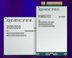
Quectel Wireless Solutions, a global supplier of modules for the internet of things (IoT), has announced the release of two new 5G New Radio (NR) module series, the RG500S and RM500S.
Based on the new Qualcomm 315 5G IoT Modem-RF System, both modules can support customers in building dedicated 5G devices for a variety of verticals including industrial IoT, retail, smart energy, private 5G networks, and many others.
The RG500S and RM500S both integrate a multi-constellation GNSS receiver, which simplifies the product design and provides accurate positioning services for users.
Utilizing the powerful Qualcomm 315 5G IoT modem, the RG500S and RM500S support extended-life software maintenance, helping create long-lasting IoT devices for the duration of their life span. Offering seamless integration, the RM500S is pin-to-pin compatible with Quectel’s LTE Cat 4 module EM05, Cat 6 module EM06, Cat 12 modules EM12-G/EM12xR-GL, Cat 16 module EM160R-GL and 5G module RM500Q, which provides more competitive 5G solutions to the IoT market. These features will help accelerate the 5G IoT market in the industrial and consumer IoT segments with use cases across robotics, automation, intelligent manufacturing, energy distribution, precision agriculture, construction, and mining.
Photo: Quectel
The RG500S and RM500S modules support 5G NR sub-6GHz bands in stand-alone mode offering backward compatibility with LTE networks. With network slicing in stand-alone mode, the two modules are able to offer end-to-end traffic isolation for critical traffic, guaranteed data rates and bandwidth, and lower latency than in non-standalone mode, which meets the demands of ultra-reliability and service-level agreements of typical industrial and enterprise scenarios.
The two modules are embedded with rich interfaces and incorporate high-speed USB 3.0/3.1, PCIe 3.0, U(SIM), RGMII and more, making them suitable for diversified industrial and consumer 5G applications such as industrial routers, robots, automation, intelligent manufacturing, smart cities, energy distribution, precision agriculture, construction and mining.
“Quectel has long been collaborating with Qualcomm Technologies to support the enablement of the 5G market in IoT,” said Patrick Qian, CEO, Quectel. “Based on the latest Qualcomm 315 5G IoT modem, the RG500S and RM500S are able to offer greater possibilities for the industrial and commercial IoT verticals. Features such as high performance and low latency as well as extended life software maintenance address the existing IoT market needs and can power a range of new 5G IoT use cases.”
“The Qualcomm 315 5G IoT modem solution was introduced to stimulate and scale the 5G IoT industry and enable the transitions needed to make 5G for IoT a reality. This solution is pin-to-pin compatible with legacy modules, which can accelerate device development and commercialization and promote growth and expansion in the 5G IoT industry. Integrating Qualcomm Technologies’ purpose-built modem into Quectel’s RG500S and RM500S modules will help deliver 5G to the IoT industry across industrial and enterprise applications,” said Jeffery Torrance, senior vice president, product management, Qualcomm Technologies.
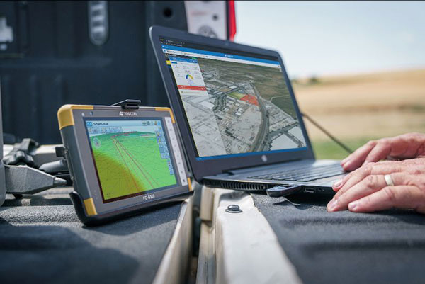
Survey and construction software suite MAGNET7 is now available from Topcon, using cloud-based connectivity to streamline workflows through GNSS receivers and other equipment.
Photo: Topcon
Survey and construction software suite MAGNET 7 is now available from Topcon Positioning Group.
MAGNET7 uses cloud-based connectivity to streamline workflows through GNSS receivers, total stations and other positioning tools and instruments. It addresses common needs to increase productivity, efficiency and profitability levels across the job site.
The software is also designed to improve accuracy while efficiently managing data and collaboration — in real time — with the project team.
Enhancements in the MAGNET7 field version improve 3D model support, reporting and interactivity in working directly on a visual map. Also improved is data handling for large and complex 3D projects.
Productivity features include an ability to connect to the newest version of the Sitelink3D job-site monitoring and management system. This enables office personnel to send machine models via the web portal directly to machines on site.
The new connection also allows access to the Haul Truck app, which dramatically improves efficiency in the mass-haul environment by sending real-time data — including haul volumes and truck locations — directly to the master schedule.
MAGNET7 provides new capability for calculating the International Roughness Index (IRI), a valuable indicator for resurfacing projects. The IRI data exports directly to ProVAL formats, commonly used in the paving industry, to report and validate road-surface smoothness against government guidelines.
Also provided are enhanced terrain-modeling capabilities for surveyors and an overall increase in file-type capability.
Addressing COVID-19
COVID-19-related demands placed on construction and survey professionals underscore the need for comprehensive, integrated software solutions to meet those challenges head on, according to Alok Srivastava, senior director, product management.
“The push to ramp up production levels and increase efficiency, while operating profitably, has never been greater,” Srivastava said. “Our suite — made up of field software, cloud services, tightly integrated office software and third-party integrations — is a key component of our digital ecosystem, all designed to enhance productivity in the field while helping the office efficiently manage the project dataset. It does so by tapping the power of integrated solutions to provide end-to-end workflows, superior data exchange and a far better level of collaboration.
“We’ve long recognized that many of the basic needs and challenges of today’s survey and construction disciplines are similar. With that in mind, this solution provides compatible, comprehensive, connected answers to many of those shared issues.”
“The need for digital connectivity, both on site and between the office and the job site, has never been greater,” Srivastava said. “With the continued push toward digitization in all facets of their jobs, today’s construction and survey professionals regularly risk loss of efficiency — and the financial costs associated with it — due to issues of incompatibility between equipment and systems. This upgrade of the MAGNET suite of productivity solutions takes connected field and office management to a new level, making the long sought-after ‘end-to-end workflow’ a reality while helping projects stay on schedule and under budget.”
Can GPS support a greener, more sustainable planet? The answer is an emphatic “yes,” and it is already doing so today.
GPS has become a fundamental technology across nearly every sector of the U.S. economy, including agriculture, transportation, construction and municipal services. In each of these industries, the use of GPS has produced substantial environmental benefits, such as lowered carbon emissions, increased water efficiency, decreased use of environmentally sensitive inputs, and reduced waste.
Agriculture
Let’s take a closer look at how GPS is protecting our nation’s critical environmental resources. We begin with agriculture where it is estimated that the absence of GPS during peak planting season could result in an economic loss of more than $15 billion, according to a National Institute of Standards and Technology report.
During the past two decades, GPS has transformed American farming, enabling increased crop yields, cost efficiencies, and environmental sustainability through the precise application of seed, water, fertilizers and pesticides and the efficient use of fuel. In sum, precision agriculture lets farmers do more with less wasted seed, less fertilizer, less fuel, less pesticide, and more crop yield.
GPS Innovation Alliance (GPSIA) founding member Deere & Company reports that precision agriculture technologies can have a huge impact on resource efficiency and sustainability. By 2030, GPS-enabled precision agriculture implemented globally could save 180 billion cubic meters of water, says the World Economic Forum.
Similarly, according to the U.S. Department of Agriculture’s Natural Resources Conservation Service (NRCS), if “[GPS] guidance systems were used on 10 percent of the planted acres in the United States, fuel use would be cut by 16 million gallons, herbicide use by two million quarts, and insecticide use by four million pounds per year.” For a single Midwest row crop farmer, with 6,500 acres using precision agriculture techniques, Deere & Company estimates that more than 1,600 gallons of fuel could be saved, and more than 400,000 kg CO2 equivalent emissions could be avoided, over the course of a production cycle — the equivalent of nearly a million (992,000) passenger car miles driven per year.
Infographic: GPS Innovation Alliance
Construction
Construction is another industry that has been revolutionized by GPS. Today, high-precision GPS is used to support the building of roads, bridges and other significant infrastructure projects. In 2019, testimony before the U.S. House Small Business Committee, an executive of GPSIA founding member Trimble described several examples of how digital construction technologies, including GPS, can more efficiently plan and execute complex construction projects.
In one such example from Southern California, the improvements “reduced the wetland impact by 58 acres; reduced the impact to sensitive species; reduced landslide risk; reduced residential displacement; and minimized the impact on existing utilities (resulting in few utility relocations to undisturbed areas).”
GPS receivers are also embedded in many bulldozers, excavators and graders, resulting in reduced waste and lower fuel consumption. They can reduce greenhouse gas emissions, with an estimate from Trimble suggesting that the use of machine control technologies can cut more than one billion pounds of CO2 usage per year.
NextGen Air
GPS is also at the heart of the Next Generation Air Transportation System, or NextGen, of the Federal Aviation Administration (FAA). Capt. Sully Sullenberger, during a 2020 GPSIA-sponsored event, described air traffic control modernization as depending “massively on the ubiquity and reliability of GPS.”
Along with the safety benefits of knowing the precise location of an aircraft, GPS enables optimized flight paths that the FAA says can reduce “flying time, fuel use, and aircraft exhaust emissions.” These efficiencies have already resulted in $1.2 billion in fuel savings, according to the FAA.
During a 2010 test flight over Puget Sound, Washington, Alaska Airlines found that the use of GPS-aided flight procedures reduced emissions by 35% compared to a conventional landing. Other airlines have also quantified these benefits, finding substantial savings in fuel consumption simply by cutting a single minute from each flight.
Weather and Disaster Forecasts
No one can argue the fact that weather events like hurricanes, floods and droughts have a huge impact on the environment and public safety. According to the National Oceanographic and Atmospheric Administration (NOAA), in 2020 such events cost $95 billion in damages. You may not realize, however, that NOAA uses GPS signals to support three-dimensional meteorology, space weather and geophysical applications throughout the United States.
Even NOAA’s Geostationary Operational Environmental Satellites (GOES) use GPS signals to enhance their ability to provide the data we all receive in each morning’s TV weather forecast, improving weather predictions and our own storm situational awareness. GPSIA member Lockheed Martin manufactures both the GOES-R series of weather satellites and the U.S. Space Force’s more powerful, next-generation GPS III satellites that are now being launched to modernize the GPS constellation.
Municipalities
Lastly, we examine the environmental benefits for municipalities that use GPS for key government services, including the real-time tracking of garbage trucks, snowplows and buses. Throughout the country, towns and cities have seen substantial savings in dollars, fuel and time from implementing GPS-enabled technologies.
In Niles, Illinois, for example, the Department of Public Works partnered with GPSIA founding member Garmin to optimize the routing of snowplows. Using GPS technology, drivers reduced the use of salt by as much as 40%, resulting in more than 700 tons saved. In 2020, in recognition of its innovative use of GPS, the department received the Management Innovation Award from the American Public Works Association. Similarly, GPSIA member CalAmp found that GPS use for vehicle tracking can result in fuel savings of $90 per vehicle per month.
Ensuring GPS
Ensuring these environmental benefits can continue to be realized requires that the spectrum used by GPS be protected from harmful interference. It will also depend on continued funding by Congress to modernize the GPS constellation and ground control. Additionally, as Congress considers a major infrastructure bill, including funding for states and localities, we would encourage projects to make use of GPS and other innovative technologies that can drive down costs, reduce carbon emissions, and eliminate waste — including advanced digital-construction management systems that use GPS data to reduce project costs and speed project delivery.
GPS has changed our everyday lives for the better, and as our dependence on this technology continues to grow, so will its impact on environmental sustainability efforts.
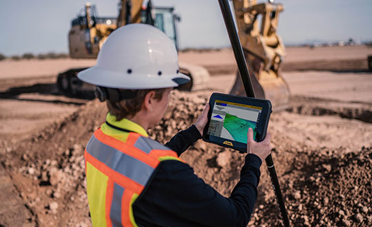
The T100 tablet is designed for use in the field. (Photo: Trimble)
Rugged tablet operates seamlessly with Trimble Site Positioning Systems and Trimble Siteworks Software
Trimble has announced the Trimble T100 Tablet, a high-performance tablet providing fast data processing for construction surveying applications. The rugged tablet brings fast computing and a large screen to the field, incorporating:
Directional keypad with programmable function keys
Large internal battery (92Wh)
Powerful Intel i5 processor for fast data collection, processing and quality assurance
USB-C fast-charging capabilities
Expandable dual EMPOWER module system, engineered to exceed the expectations of the outdoor field worker
User-configurable performance settings
IP-65 environmental specifications
Two bracket options for different display angles on the pole, enabling users to measure different locations more easily, with maximum flexibility for hard-to-measure locations
Optimized for Trimble Siteworks Software and supporting office applications such as Trimble Business Center, the T100 is suitable for both experienced and novice users. With accessories designed to specifically complement user workflows, the T100 avoids the burden of carrying multiple computing devices, while enabling users to complete quality assurance and quality control before leaving the field.
“The T100 tablet features the quality you expect from Trimble, with the flexibility to adapt to a variety of configurations and job site conditions,” said Scott Crozier, vice president of Trimble Civil Construction. “It is engineered to be ergonomic and portable on and off the pole, enabling users to stay mobile while they work, with features that increase productivity and reduce downtime.”
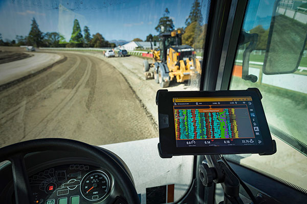
Earthworks Upgraded for Soil Compactors
Wider Range of Machine Types Now Available on the Trimble Earthworks Platform
Trimble Earthworks for soil compactors is a GNSS-based, 3D compaction control solution designed to make soil compaction more accurate, faster and easier. Operators will experience the same intuitive, easy-to-use Trimble Earthworks software interface currently available for excavators, dozers and motor graders for improved productivity.
Trimble Earthworks now includes soil compactors. (Photo: Trimble)
Compaction Control. Trimble Earthworks for soil compactors enables contractors to accurately control the compaction process, while reducing unnecessary passes that can result in over compaction. The platform makes the overall compaction process more efficient, with a higher level of accuracy and less rework. With soil compaction part of the extensible Trimble Earthworks platform, contractors can take advantage of shorter training times, less downtime and increased remote operator support in the field as well as benefiting from ongoing platform developments.
“Trimble Earthworks for soil compactors is easy to learn and more accessible for many different types of users because it leverages the intuitive Trimble machine-control interface and applies it to soil compactors,” said Scott Crozier, vice president of Trimble Civil Construction. “Adding this new machine type to the Trimble Earthworks platform gives contractors the ability to more easily manage their mixed fleets, train operators and manage jobsite data.”
Improvements in material/surface lifts and layer management allow for more accurate data and easier data management. Office-to-field connectivity enables efficient communication and data transferring across the project. In the field and office, contractors can easily interpret the valuable productivity data collected from the machine, such as work previously completed versus work completed that day.
Aceinna and Point One Navigation launch hardware and software platform for precise positioning in agriculture, construction, mapping, surveying, robotics and trucking
The OpenARC positioning service is now commercially available. OpenARC is a precise-positioning hardware and software platform for system integration of GNSS corrections with high-performance inertial navigation system (INS) and real-time kinematic (RTK) hardware.
OpenARC is offered by Aceinna, a developer of inertial-based guidance and navigation systems, and powered by Point One Navigation.
With an RTK positioning engine and GNSS corrections delivered from a ground-based network of secure base stations, OpenARC will reliably improve position accuracy for autonomous vehicles to centimeter-level accuracy. The platform combines Point One’s Polaris GNSS correction service with Aceinna’s OpenRTK330 hardware and software solution for developers of autonomous systems in trucking, precision agriculture, construction, mapping, surveying and robotics.
OpenARC provides high-precision positioning and localization applications, enabling centimeter-level accuracy for challenging tasks such as lane keeping, precision agricultural guidance, and UAV landing maneuvers.
OpenARC is integrated into the OpenRTK330LI navigation module to provide a secure, vertically integrated and easy-to-use positioning platform. OpenARC is very scalable, supporting single-unit installations and high-volume deployments.
Point One’s proprietary Polaris GNSS cloud correction service delivers superior station density in areas where operators need it the most, including urban centers and suburban surrounding areas, enabling cold convergence times of under 10 seconds.
Polaris provides continuous position monitoring and tracks all modern satellite constellations. Its base-station technology includes advanced anti-jam, interference mitigation, security and integrity monitoring. Its architecture allows for GNSS corrections in RTK or state space representation (SSR) configuration. Its open-source interfaces are compatible with multiple receivers and chipsets, and the service is compatible with any NTRIP/RTCM3 compliant receiver.
Centimeter-level positioning and high-accuracy orientation of machinery enable automation of many construction, mining and farming tasks, and take them one step closer to being performed by autonomous machines. Machine control increases jobsite safety, operational efficiency and productivity.
Using data from GNSS satellites, total stations and 3D models, machine-control hardware and software solutions determine a machine’s current position on the Earth and compare it with the desired design surface, mining task or cultivation technique. They also monitor and sometimes control the position and orientation of implements — such as blades, buckets and seeders — with respect to the machine. By talking directly to the machine’s hydraulics, machine automation shifts responsibility for accuracy and speed from the operator to the technology.
On construction sites, automation guides motor graders, excavators, dozers and other heavy machines, making operations easier to manage. This makes contractors more productive and experienced operators more efficient. With this technology, less experienced operators are able to take on more complex tasks, and all operators become more accurate. Machine automation also increases the capabilities of the machines themselves, so that excavators and compact machines are now doing finish grade work once reserved for larger and more expensive dozers.
Operators in the cab and engineers and supervisors at their desks can control and monitor progress in real time, with views of the whole layout as well as specific slopes, roads, ditches and other elements, including those under water.
Using GNSS guidance to aid application of fertilizer, pesticides and herbicides saves time and money. (Photo: Septentrio)
About half of all motor graders and a third of all dozers use positioning sensors and a display to provide operators with the position of the blade with reference to the target grade. A typical machine control set-up consists of a GNSS receiver and a display (jointly referred to as a “cab kit”) and inertial measurement units (IMUs) on the blades and other implements.
From the display, the operator loads a project design, which tells the system the cut, fill and other design information it needs. The operator then chooses a lane and may choose a vertical offset, which temporarily adjusts the design grade, making it possible to accomplish the work in steps, from rough to finish grading. Operators can also record points and scan a pavement in real time as they repair it.
While used by the construction industry on earthworks equipment since the late 1990s, machine control has recently benefited from:
The increase in the number of GNSS signals available, particularly on the new L5 frequency
IMUs, which measure blade movements with respect to the machine 100 times per second, one order of magnitude more than non-IMU grade-control systems
The growing availability of continuously operating reference stations (CORS) and other GPS networks, which eliminate the need to set up a base
New mastless systems, which integrate a receiver into the top of the cab and connect it wirelessly with IMUs to orient the blade, obviating the need to install a long mast pole on the blade and connect it by cable to the receiver and improving safety, visibility and equipment durability
New interfaces designed to be as easy to use as a cell phone, shortening the operators’ learning curve.
While these developments are hastening the advent of autonomous construction, mining and farming machines, remaining barriers to this vision include hardware and software issues as well as questions of data exchange, legal liability and operator training — issues analogous to those facing the development of autonomous cars and trucks.
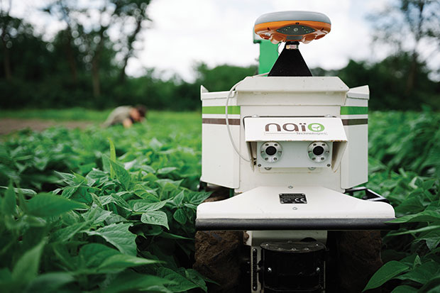
The DINO is a one-ton farming robot made by NAIO Technologies that operates autonomously using GNSS positioning and maps for navigation. Of the 170 NAIO farming robots currently in operation, about 30% are DINOs, which are typically used on large farms.
In 2016, NAIO and Septentrio, a manufacturer of industrial high-end GNSS technologies, began to research the integration of full GNSS solutions into NAIO’s robots.
Today, the DINO carries a Septentrio NR3, consisting of a GNSS receiver and antenna in a single housing, which provides it with RTK centimeter-level positioning accuracy. Farmers can use the NR3 to map their fields, then attach it to the DINO to guide it.
The DINO automates weeding within complex and quickly changing environments. NAIO plans to soon add seeding and fertilization to its robot’s capabilities.
To operate reliably in the narrow lanes between crops, the DINO requires an accurate GNSS receiver with strong resistance to multipath and jamming.
The safety of field hands and the protection of the crops also require the receiver to have good integrity, which is a measure of the trust that can be placed in the correctness of the information it supplies. Accuracy, robustness, and integrity are all strong suits of Septentrio’s NR3.
While the DINO mostly operates continuously, it sometimes stops to avoid animals or humans, or for other safety reasons. A major advantage of the NR3 and other sensors that NAIO is using, is that they enable the robot to perform cold-starts very rapidly and with a stable heading.
Machine control, guidance and automation defined
Using GNSS guidance to aid application of fertilizer, pesticides and herbicides saves time and money. (Photo: fotokostic/iStock/Getty Images Plus/Getty Images)
The terms machine control, machine guidance and machine automation are not interchangeable.
Machine control is a generic term that refers to the integration of positioning tools into a construction, mining or farming machine to determine its position on the Earth and relative to a desired design surface, mining task or cultivation technique.
Within machine control, machine guidancesystems display these data in the cab — assisting the machine’s operator in steering the machine and in maneuvering its implements to shape the ground, mine minerals, plant seeds or perform other related tasks — while machine automation systems directly steer the machine, achieving greater levels of precision than human operators could. The term automated machine guidance (AMG) is sometimes also used.
Trimble has introduced its SX12 Scanning Total Station, the next iteration of its 3D scanning total station that provides fast and efficient data capture for surveying, engineering and geospatial professionals.
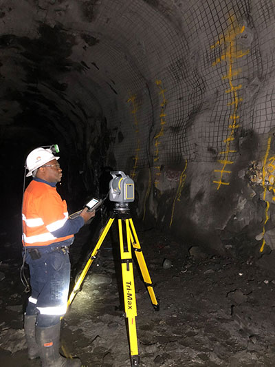
New features include a high-power laser pointer and high-resolution camera system, expand capabilities in surveying, and complex 3D modeling. The SX12 enables enable new workflows in tunneling and underground mining, Trimble said.
The Trimble SX12 merges high-speed 3D laser scanning, Trimble VISION imaging technology and high-accuracy total station measurements into familiar field and office workflows for surveyors.
A new green, focusable Class 1M laser pointer — safe for viewing with the naked eye — offers high-power visibility and makes it easy to see at a distance. An improved camera system provides enhanced pointing and site documentation capabilities.
“The new SX12 adds more features and applications to an already widely adopted, field-proven scanning total station,” said Gregory Lepere, marketing director of Optical and Imaging for Trimble Geospatial. “The addition of a premium laser pointer completes the picture for surveyors wanting an instrument that can operate as an everyday high-end total station with the added value of scanning and imagery.”
Tunnels and underground mining
The Trimble SX12 allows users to quickly and easily operate with common survey workflows, including new versions of Trimble’s field and office software.
With Trimble Access 2021 Field Software, users can harness the full potential of the Trimble SX12, whether performing accurate measurements or comparing 3D scanning as-built data in the field. The combination is designed for infrastructure projects such as utilities, roads, rail, water, transportation and telecom.
The laser pointer enables new applications for laser-guided drilling and excavation guidance, rock bolt and blast hole set out, and as-built verification for underground tunnel and mine construction.
By integrating rich data from the Trimble SX12 into intuitive office workflows, Trimble Business Center version 5.40 enables users to quickly create complete customer deliverables. With its enhanced point-cloud management, eCogAI automated information extraction, and interoperability to leading CAD and GIS packages, the solution empowers users to exceed even the toughest client demands.
The combination also enables the capture of tunnel point clouds for as-built comparison, automated tunnel extraction routines and detailed 3D mesh inspection resulting in intuitive reporting deliverables for construction verification.
“Tunneling projects are highly dependent on accurate positioning to precisely control equipment and track progress in difficult underground construction environments,” said Boris Skopljak, marketing director of Monitoring and Tunneling for Trimble Geospatial. “The combination of the SX12 and new software workflows, simplifies the capture of site conditions, enabling tunneling and mining surveyors to make accurate and informed decisions without the complexity and additional cost of multiple systems.”
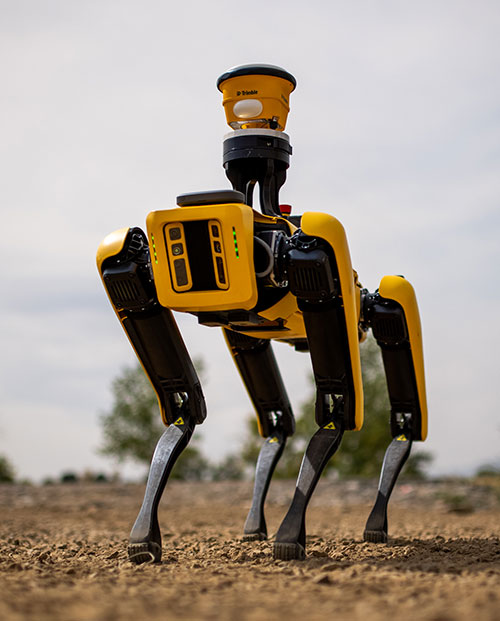
Spot, the robotic dog from Boston Dynamics, is equipped with the Trimble SPS986 smart antenna to collect data. (Photo: Trimble)
Trimble and Boston Dynamics plan to integrate a variety of data-collection technologies with the Spot (robot dog) platform for construction and other site applications.
The jointly developed solution will combine the Spot robot’s autonomous mobility with Trimble’s data-collection sensors and field control software to enable automation of repetitive tasks such as site scans, surveying and progress monitoring, while taking advantage of the robot’s unique capabilities to navigate dynamic and potentially unsafe environments.
The relationship gives Trimble exclusive rights sell and support the Spot robot with integrated scanning, total station and GNSS technologies for the construction market.
The turnkey solution will streamline operation of the robot and provide quality control for missions, enabling construction project managers to easily get a clear picture of jobsite progress on an ongoing basis. Trimble technologies integrated with the robot will enable accurate, scalable and rapid data acquisition, while Trimble’s construction collaboration platforms provide a continuous flow of information between field and office.
Mortenson, a Minneapolis builder, developer and engineering services provider, is one of the first customers to leverage the new technology combination. To eliminate jobsite waste and increase efficiency, the Mortenson team has been piloting Spot robots with the Trimble SPS986 GNSS solutions to autonomously navigate challenging exterior construction environments such as solar farms, continuously documenting site conditions.
An automated and repeatable approach to field-data capture can provide Mortenson with real-time awareness of project status, helping to accelerate project delivery. Through Trimble’s Early Experience Program, contractors such as Mortenson have advanced access to this technology for the purposes of evaluating its suitability in actual construction projects.
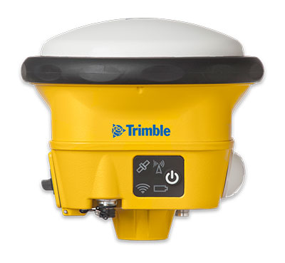
The Trimble SPS986 smart antenna. (Trimble: photo)
“Robots will play a crucial role in automated construction workflows and can augment the human workforce by handling dirty, dull and dangerous tasks,” said Martin Holmgren, general manager, Building Field Solutions at Trimble. “Our experience with early adopters like Mortenson gave us visibility into the transformative potential of an integrated solution that seamlessly marries a world-class robot with construction-specific sensors and workflows. We’re excited about this alliance and the potential to bring unprecedented improvements in safety, quality and productivity to our construction customers.”
“We believe the combination of Trimble’s experience and industry leadership in construction technologies and Boston Dynamics’ Spot can transform the way the industry operates,” said Michael Perry, vice president of business development at Boston Dynamics. “The integrated solution will enable any jobsite leader to deploy Spot and Trimble technologies to get an accurate view of construction progress through real-time data collection. With a more comprehensive view of site activity, project managers can take proactive measures to ensure on-time, on-budget and safer project delivery.”
The integrated solution is expected to be available by the second quarter of 2021 through Boston Dynamics, Trimble and select BuildingPoint and SITECH distribution partners in the U.S., Canada, the United Kingdom, the European Union, Australia, New Zealand and Japan.
Through Trimble’s Early Experience Program, select customers will have the opportunity to preview development of the solution in advance of general availability.
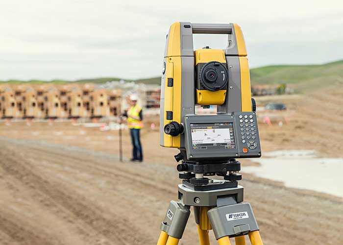
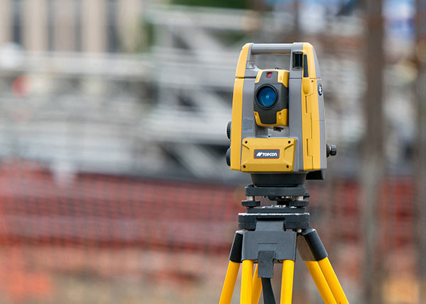
The new the GT series of total stations are part of a full workflow solution, including a new field computer, a full-version update to Topcon field and office software and GNSS receivers. The system is designed to work in sync for improved performance and better data handling with built-in, field-to-office connectivity.
The speed, tracking and accuracy of the GT series, combined with the intuitive software system, creates a flexible solution capable of satisfying the technology needs of surveyors and contractors performing survey, layout or machine guidance projects, Topcon said.
“The new total stations perform at a faster 10-Hz positioning update rate,” said Ray Kerwin, director of global product planning. “Combining the GT series with the new field computer and software enhancements, this tracking improvement makes layout easier and guidance more fluid, within an intuitive map view. More layout and survey points can be collected in less time.”
“Surveyors, contractors, as well as heavy machinery automation operators and other construction professionals can benefit from the time-savings and accuracy the series provides,” Kerwin said.
Advanced UltraTrac prism tracking combines optical sensing with a new ultrasonic motor control algorithm designed to maintain superior prism lock.
“Tracking fast-moving targets and maintaining prism lock is now easier on challenging job sites as well as in machine guidance applications. If you’re performing a machine control project where the prism is vibrating on the end of the blade, for instance, the GT will lock onto the prism better and provide smoother machine guidance,” Kerwin said.
Magnet software improves field-based quality reporting and data handling for larger files, graphical processing, and 3D models. Magnet Field features more visual- and map-based workflows in addition to menu-driven functionality popular with power users.
An optional upgrade incorporating hybrid positioning technology helps advanced users get instant location updates via GNSS receivers so positioning data points can be captured, even with the loss of line-of-sight from job site obstructions.
The complete GT series workflow solution — Magnet software, FC-6000 field computer, and HiPer Series GNSS receivers — combine for easy-to-use digital processes designed to help surveyors and contractors increase precision, reduce rework and improve quality control.
An IMU-RTK GNSS receiver that fits in your hand and a fully integrated GNSS base station add a new scale to GNSS surveying applications.
CHC Navigation (CHCNAV) has announced the immediate availability of the i73 GNSS, a versatile pocket-sized IMU-RTK GNSS rover with an integrated inertial module and the iBase GNSS, a rugged base GNSS receiver.
The combination of the i73 GNSS and the iBase GNSS offers a productive and affordable solution for measuring and staking out points in any surveying, mapping or construction application.
“Surveyors and construction professionals are forced to carry heavy and cumbersome GNSS receivers in most situations, resulting in unnecessary fatigue and lower productivity,” said Hans Huang, product manager of CHC Navigation’s Survey and Engineering Division. “Taking this into account, we have developed our pocket-sized i73 GNSS, the lightest GNSS rover powered by the latest IMU-RTK technology, and much more. Our iBase GNSS station follows the same concept of an all-in-one solution, making the need for external radio modems and other bulky accessories obsolete.”
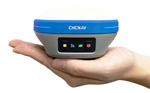
The i73 Pocket IMU-RTK GNSS: A new scale to GNSS
The i73 Pocket IMU-RTK GNSS. (Photo: CHCNAV)
Weighing only 730 grams yet with 15 hours of operating time, the i73 GNSS is one of the lightest and most rugged RTK GNSS receivers on the market.
Easy to carry and use, the i73 will not tire out field workers. It offers superior GNSS signal tracking enables surveys beyond the usual constraints. It features full 624-channel GNSS technology and connects seamlessly to RTK GNSS networks as well as to UHF GNSS station over its embedded UHF modem.
Automatic pole-tilt compensation. The i73 GNSS internal interference-free inertial module (IMU) allows automatic pole tilt compensation of up to 45 degrees. Projects are completed 30% faster and with increased efficiency and safety when measuring hard-to-reach points.
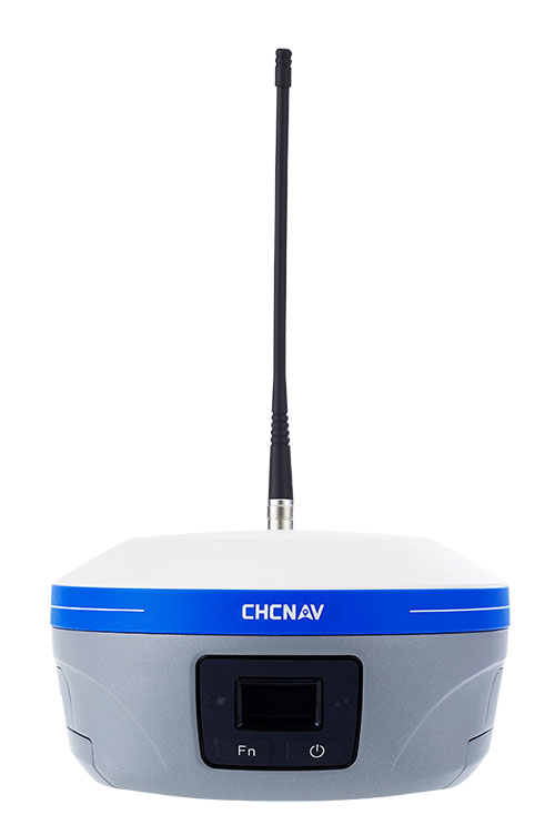
The iBASE GNSS: Redefining the concept of GNSS base station
The iBASE GNSS receiver. (Photo: CHCNAV)
The GNSS iBase is a fully integrated GNSS base station, specifically designed to meet 95% of surveyors’ needs when working in UHF GNSS base and rover mode. The performance of the iBase UHF base station compared to a conventional external UHF radio modem is virtually identical. But its unique design eliminates the need for a heavy external battery, bulky cables, an external radio, and a radio antenna. Its 5-watt radio module provides operational GNSS RTK coverage up to 8 km.
The global construction robot market was valued at USD 231.5 million in 2018 and is expected to reach USD 464.8 million by 2026, growing at a compound annual growth rate (CAGR) of 9.5% during the forecast period, according to an InForGrowth market report.
The construction industry is one of the least automated industries that features manual-intensive labor as a primary source of productivity. However, with the advancement in technology, the construction industry is utilizing robots to excel at repetitive tasks in a controlled environment.
Construction robots have a major impact on the construction industry. The construction industry is looking to automate more and more tasks for the sake of productivity and efficiency, which in turn is increasing the demand for construction robots.
The use of robots has grown considerably with increasing speed, efficiency, safety and profit concerns. Construction robots have provided a transformative experience for the entire industry and have helped in replacing or improving existing processes, making them more proficient as well as more precise.
Companies are deploying these new commercially viable robots in various applications such as 3D printing of large structures, disaster relief situations, construction of tall structures, and for assisting workers performing laborious tasks. These robots have helped in automating laborious and dangerous tasks to keep laborers away from hazardous activities and enable them to focus on more productive work.
3D printing. Moreover, the evolution of 3D printing in the construction industry is expected to create opportunities in the market. This will further enhance the market size of the global construction robot market. An increase in research and development activities to minimize the cost of robots will also enhance the market size over the forecast period.
However, the high cost associated with the deployment of robotic solutions is expected to hamper the growth of the global construction robot market during the forecast period.
Key findings. Based on the product type, the traditional robot segment accounted for the largest market size in the global construction robot market in 2018.
Based on automation, the semi-autonomous robot segment accounted for the largest market size in the global construction robot market in 2018.
Based on function, the demolition robot segment held the largest share in the global market in 2018.
Based on applications, the public infrastructure segment is expected to dominate the market during the forecast period. Europe accounted for nearly 30% share of the global market in 2018.
Recent industry news. In September 2019, Built Robotics closed a US$ 33 million Series B funding round, led by Next47, the global venture fund backed by Siemens, for autonomous construction equipment.
In August 2019, John Sisk & Son used MULE at Sisk’s residential Wembley Park E05 site in London to reduce fatigue and injuries among workers and increase productivity.
In June 2019, Boston Dynamics launched an inspection robot named SPOT, which is mounted with 3D cameras to inspect and map construction sites and identify hazards and work progress.
Hitec Commercial Drone Services expects to provide training, precision aerial missions and comprehensive data collection to a variety of industries, including
agriculture, construction, excavation, mining and aggregates, oil and gas, engineering and surveying, public safety and many other vertical sectors. Hitec maintains a fleet of unmanned vehicles. It offers proprietary mission-control software and data and photogrammetry collection techniques with its comprehensive unmanned aviation experience.
The new division’s field services director is Jim Bonnardel, an innovative entrepreneur with a history steeped in unmanned flight. Bonnardel established his own successful business in 1982, providing aerial services to business-to-business entities. His inventive nature and extensive flying prowess led him to become a certified and insured UAS service pilot and instructor.
Bonnardel has logged more than 1,750 precision mapping missions, inspected 2,000 utility structures, and flown more than 2,500 commercial and residential property shoots, as well as dozens of missions for creative projects involving both television and music videos.
He is also an instructor at Grossmont College in El Cajon, California. He has provided 850 hours of commercial instruction, as well as 550 hours of instructional field training and vetting for utility inspection crews. As a result of his training experience, Jim has issued 150 sUAS Utility Training Certificates.