Tag: drone

  • Drone payloads to become vital in supplying medicines, test results in COVID-19 pandemic

    Drone payloads to become vital in supplying medicines, test results in COVID-19 pandemic

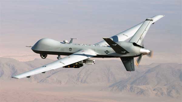
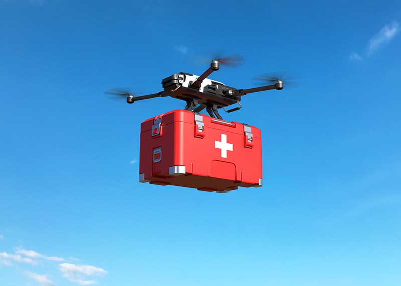
    As the world goes in quarantine and social-distancing has become a necessity with COVID-19 pandemic, various measures have been taken to fulfill basic needs of humans. The medical sector is facing a lot of troubles as the number of cases has been increasing day by day and keeping up with the enough supply of necessary equipment and medicines is becoming difficult. Among various measures taken by hospitals and government, utilizing drone payloads for supplying medicines, transferring tests and specimens, and spreading disinfectants has become a new way to facilitate operations. From India to Canada and the U.S., the governments and tech firms have been developing drones that can carry loads and travel up to certain distance to speed up medical and healthcare processes. The market for drone payload is gaining momentum. According to the report published by Allied Market Research, the global drone payload market is expected to generate $7.01 billion by 2022. Following are some of the activities taking place across the world.

    On the verge of COVID-19 outbreak, various measures have been taken by governments to control the spread and eliminate completely. Among the measures taken by various governments is disinfecting the cities. Bengaluru, a city from Karnataka, India has been disinfected with the help of drones. Six hexacopter drones have been deployed. They are equipped with 15 liters of disinfectants for various localities of the city. These drones have been developed by startups Alpha drones and Multiplex. It has five kilometer range and has ability to fly for 25–30 minutes based on the payload. The pre-set speed of drones is at 6 meters per second. Nearly 10–15 meters of area is covered based on the altitude. The cetrifuger automiser pump technology is utilized for spreading the disinfectant in air and on lands. Highly crowded areas such as markets, bus stops, railway stations, and others will be covered and drones will be operated for 6–7 hours each day.

    Along with spreading disinfectants, there have been another medical uses. Urban drone stations have been utilized for logistic medical payload exchange in hospitals. The Matternet Station at Mountain View, California, is a structure that can be mounted on ground or rooftops. It is three meters in height and offers personal safety. Hospitals can utilize the stations for transferring pathology specimens, blood diagnostics, and medicines to other facilities and suppliers. It also offers fast, secure, and predictable aerial delivery.

    Each Station is equipped with its own automated aerial deconfliction system for management of drone traffic at the Station. The Station enables Matternet M2 drones to carry out a precision landing. Then the drone is locked in the particular place and executes swapping of payload and battery. There is a Matternet Cloud that directs flight directors an ability to control and track operations. Moreover, an integrated authentication system enables only authorized personnel to insert or take out payload through scanning of hospital identification badge. Then there is a tracking of payload at each touch point for maintenance of strong custody. Ideally, it can hold four boxes of payloads that are held at the controlled temperature for maintaining integrity of specimen. Andreas Raptopoulos, CEO of Matternet, outlined that the technology platform will be utilized for rapid, point-to-point, and urban medical deliveries. This way, hospital systems are able to reduce patient waiting times and carry out savings of millions of dollars each year.

    Another company has taken measures to contribute to countering the outbreak of COVID-19. Drone Delivery Canada (DDC) would bring its own drone delivery system by the mid April for delivery of blood test, blood samples, and medicines. Michael Zahra, president and CEO of DDC, outlined that it is a necessity to bring an automated and unmanned delivery system of drones to supply medical necessities to the right people at rapid pace. The company possesses the drone that can take off from the starting point, reach destination, drop the cargo and return.

    Zahra have been encouraging hospitals, communities, pharmacies, healthcare centers, and others to build a case for the support from government. He added that logistics differ in each scenario, however, the basic setup can be achieved. There is a minimum required infrastructure available at the starting point. On the other hand, there is no infrastructure at the destination point.

    Its Sparrow drone can carry nearly 10 pounds of payload in a single trip and can travel up to 30 kilometers. The company has a portfolio of two drones. First is Robin, which carries the payload of 25 pounds with a travelling distance capability of 35 kilometers. Another is Condor, which have capability to carry 400 pounds and go up to 200 kilometers. With the Special Flight Operations Certificate, the company’s drones can navigate throughout Canada without the need to outline flight plans regarding routes prior to trips. Once it obtains the permission and support from government to implement drones for medical purposes, it would implement its model and accelerate the supply in this grave situation the world has been facing.


    Get detailed COVID-19 impact analysis on the drone payload industry here.


    Pratik Kirve holds a bachelor’s degree in Electronics and Telecommunication Engineering. He is currently a senior specialist — content writer at Allied Analytics LLP. He has avid interest in writing news articles across different verticals.


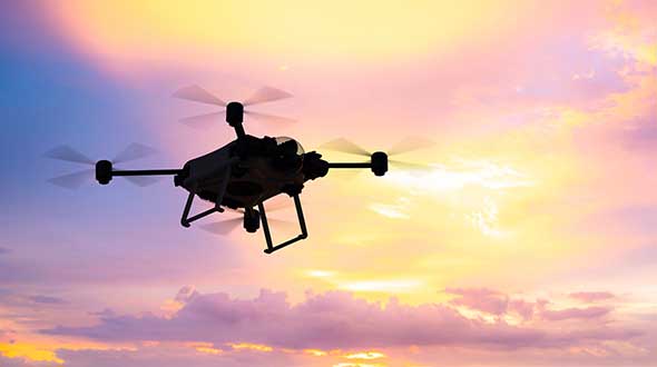
    Feature photo: sarawuth702/iStock / Getty Images Plus/Getty Images

  • Substitute satellites, a better Reaper and drone deliveries top UAV news

    Substitute satellites, a better Reaper and drone deliveries top UAV news

    UAV developments are taking flight across the globe.

    In one development, older technology might enable new capabilities for a pseudo-satellite UAV. Meanwhile, new technology adds significant landing capability to an Air Force drone. Finally, further trials are expected to help develop drone operational procedures and regulations in India.

    Spain’s Skydweller moves to Oklahoma

    An unmanned aircraft builder from Spain — Skydweller — is setting up operations in Oklahoma. This latest outfit to relocate is establishing its headquarters in Oklahoma City to develop a pseudo-satellite vehicle with a large payload capability.

    For anyone who has kept tabs on the Airbus Zephyr, the UAVOS ApusDuo, The Aurora/Boeing Odysseus, or the Softbank/AeroVironment Hawk30 high-flying drone programs, you might have noticed that the stratospheric pseudo-satellite business is not easy. None have yet made it to true operational status — loitering for months at +60,000 feet and living off only sunlight, while carrying significant payloads to provide communications services. That said, some trials to date have apparently been quite successful.

    All those existing UAVs are huge, flimsy, flex-wing aircraft that take an inordinate amount of care to handle in the difficult phases of take-off and landing. Airbus’ second prototype crashed in Australia in October 2019, and several other companies’ earlier prototypes have crumpled somewhat when they inadvertently contacted the ground.

    Now enter Skydweller. Skydweller is designed to carry a relatively large payload and fly persistently in the stratosphere.

    Photo: Skydweller
    Skydweller prototype pseudosatellite UAV. (Photo: Skydweller)

    The payload includes one or more communications relays: 4G/5G cellular, day/night full-motion video, satellite communication, and imaging radar. This looks like it could be one capable vehicle. The makers hope to capture business in commercial and government telecommunication, geospatial, meteorological and emergency operations. Skydweller has apparently been around since 2017 and has a lot of capability, so let’s see how they do with their new venture in Oklahoma.

    If you were wondering where this technology came from, it is today’s carry-over of the famous around-the-world flight by the Solar Impulse aircraft from 2016, which circled the globe without fuel, using electrical power generated by solar cells on its wings.

    GA Makes Improvements with Reaper

    In another life, I was quite attuned to what it took to “automatically” land a passenger jet, so a recent release from General Atomics (GA) about improving the auto-landing system on Reapers (new-generation Predators) caught my eye. GA has a U.S. Air Force contract to update these unmanned reconnaissance/attack drones with the latest and greatest, so making a working system better is one of those improvements.

    Actually, GA made three changes. The first enables the drone to divert to an alternate landing zone if the planned landing area is compromised — another word to express the possibility that hostile action or weather forced home base to send the vehicle elsewhere. Quite clever, in that the alternate site might not have a ground control station, along with someone who can fly the aircraft.

    MQ-9A Reaper drone, (Photo: USAF)
    MQ-9A Reaper drone, (Photo: USAF)

    The ground pilot at home base has to either enter coordinates for the new alternate landing zone and the aircraft flies there and lands itself, or he needs to overfly the landing zone so that the Reaper can collect its own waypoint with which it can automatically align and land.

    The second improvement has increased the speed limit of the cross wind in which the drone can land

    The third enhancement allows the drone to land heavier than previously — both essential elements of being able to divert in an emergency, when weather may be poor and the aircraft could be carrying unused ordnance and fuel.

    All this is a far cry from landing civilian air transports with GPS-based guidance, which is much more restrictive and with a whole mess of mathematical probabilities of the unlikeliness/likeliness of failure. Not so much for a Reaper drone on a mission during a “time of unrest.”

    Home Deliveries in India

    For those of you eagerly waiting for Amazon to start speedy deliveries of your online orders by drone, or Grubhub to drop in with an order of curry in a package dangling from a friendly unmanned air vehicle in your yard, there may be hope… especially if you live in India.

    Following our earlier report of anticipated food deliveries by drone in India, more trials are leading to regulations and control systems. Altitude Angel from the United Kingdom has teamed with Indian Sagar Defence Engineering for a series of beyond-visual-line-of-sight (BVLOS) drone trials.

    Altitude Angel’s GuardianUTM platform will be used to monitor and control these flights through real-life scenarios. Scenarios include medical and cargo transport, surveillance operations, survey and mapping, and search-and-rescue operations. Sagar will operate the cargo carrying drones; feedback from the GuardianUTM system will enable the BVLOS flights.

    While the Indian government has begun to grant permission for some commercial UAV undertakings, the intent is apparently to use the output from the Sagar/Altitude Angel BVLOS trials, taking place August through October, to help develop regulations for safe operation of drones over increasingly longer distances in Indian airspace.

    To sum up, intellectual property from an around-the-world photo-voltaic airplane may become a substitute for low-cost satellite TV and Wi-Fi, while auto-land is old hat for a Predator cousin and the Air Force has gained even greater landing flexibility for a principle recon/attack drone.

    Finally, we can expect at least one continent to get to regulations that allow drone deliveries to become a reality at last. As usual, there is a lot cooking in drone-land….

  • SPH Engineering announces bathymetric drone solution

    SPH Engineering has launched a new product to make bathymetric surveys of inland and coastal water.

    The system — an unmanned aerial vehicle (UAV) integrated with an echo sounder — is time- and cost-efficient. It is suitable for mapping, measuring and inspecting tasks as well as environmental monitoring.

    The system allows field workers to collect data with high accuracy quickly. It is easily transported, quickly deployed and twice as cost-efficient as traditional methods.

    The UAV/echo sounder system can be operated in hard to reach locations, and unsafe or hazardous environments. Locations not reachable by foot or that are dangerous for a human (steep coasts, mining pits, contaminated waters, terrain obstacles, etc.) as well as waters of ponds, lakes, and canals can be reached by the drone.

    “Since autumn 2018 we have been getting bathymetry-related requests,” said Lexey Dobrovolskiy, CTO of SPH Engineering. “Analyzing about 150 inquiries, we have come to the conclusion that a drone-based solution could open a new business opportunity for drone service companies to do bathymetry surveys of coastal and inland water, especially those for industrial needs.

    “Compared with a standard approach using a boat or an unmanned surface vehicle, a drone could save a lot for its user,” Dobrovolskiy said. “An echo sounder itself could be integrated into a client’s drone with no need to purchase additional equipment. Moreover, it is small and easy to transport and operate. At the same time, such research method guarantees data accuracy and employee safety.”

  • Skyward launches risk assessment for Aviation Management Platform

    Skyward launches risk assessment for Aviation Management Platform

    Skyward has released a new risk assessment tool for its Aviation Management Platform, which is designed to help drone program managers proactively identify and document critical risks to an operation.

    For assessing risk, users answer a series of risk questions developed by Skyward’s drone experts and based on aviation best practices. Each answer is assigned a risk level: low, moderate or high. As each question is answered, an overall risk summary score is generated based on the highest level of risk present, Skyward said.

    Photo: Skyward
    Photo: Skyward

    Users can also add mitigation for any risk level by adding explanations and adjusting the risk levels. The mitigated risk will be noted in the summary, and the note will be synced across the Skyward software platform.

    Skyward, based in Portland, Oregon, develops drone programs for industries such as construction, industrial inspection, media, insurance, real estate, mining, precision agriculture and more. Skyward was acquired by Verizon in 2017.

  • UAVOS parachute system for UAS proved effective

    UAVOS parachute system for UAS proved effective

    UAVOS has successfully tested its new two-stage parachute system. The new parachute system provides slow descent of a UAS at high speed. It includes two parachutes — the pilot chute and a main chute used to slow and stabilize the UAS.

    The decrease in the load speed on the UAS occurs due to the main chute opening delay function, when the pilot chute opens first. The parachute system is designed for UAS with speeds of up to 280 mph (450 kph) and weight of up to 110 lb (50 kg).

    Watch the parachute in action:

    The pilot chute allows safe, slow descent of the UAV during the main parachute deployment, as well as to open up the main chute at a minimum altitude.

    After landing, the group of the main parachute lines is automatically unfastened to collapse the canopy of the main chute and releases after touchdown to avoid dragging the aircraft along the ground. Unfastening is carried out by the lock of a three-step release:

    Stage 1: Opening the pilot chute
    Stage 2: Opening the main chute
    Stage 3: Release of the group of lines of the main parachute

    “In the aircraft safety developments, saving an entire aircraft through a deployable parachute system is a crucial thing,” said Aliaksei Stratsilatau, CEO and lead developer of UAVOS. These trials have generated an amount of data that allows us to quantify the performance of parachute system for future missions. Computer modeling cannot capture all the complexities. Parachutes encounter turbulent and dynamic airflow, which is almost impossible to replicate with computers. The only way to get a handle on all the possibilities is test.”

    Photo: UAVOS
    Photo: UAVOS
  • Drones equipped with GNSS, inertial a game changer

    Drones equipped with GNSS, inertial a game changer

    Why do we keep hearing about unmanned aircraft all the time, almost everywhere? Fortunately, the buzz has gone beyond next-door neighbors flying dangerously close to your roof or hovering annoyingly around a living room window, and incidents of UAV incursions shutting down airports seem to be getting fewer — improved enforcement and higher penalties may be slowing down these incidents.

    Now, UAV users are taking on productive, innovative tasks that couldn’t previously be done, or finishing projects surprisingly quickly and more affordably than ever before, with drones built or adapted for new applications. And equipment manufacturers are creating new sensors customized for use on drones.

    Commercial, integrated GNSS/inertial sensors are available that have extremely high performance — previously only available with expensive mil-spec electronics — but in lightweight, small packages, supported by real-time kinematic (RTK), precise point positioning (PPP) corrections or post-processed kinematic (PPK). UAVs carry still, video and multi-spectral cameras generating automatically geocoded outputs, ready for post processing into multi-layered formats — virtually everything a customer could ever dream of having. And lidar sensors enable drones to build accurate models of everything they overfly.

    Drones originated largely with military forces. Originally used for forward intelligence gathering, UAV tasks have multiplied and substantially expanded in scope.

    Commercial industries were quick to realize the benefits. Before drones, the cost of many tasks done manually would be prohibitive and too time-intensive. Fast, affordable data collection now allows us to quickly tackle and solve many problems.

    UAVs can pre-survey large, previously inaccessible tracts of difficult terrain, collect detailed visual representations of entire cities, monitor and support crop growth, or even survey underwater terrain using lidar. UAVs provide crop-growing support by flying autonomous patterns and spraying fields with pesticides or fertilizer. They also are being called into service to spray villages with disinfectant to control the spread of coronavirus, and to survey England’s beaches to monitor coastal erosion.

    Check out some case studies here:


    Featured photo: PhonlamaiPhoto/iStock / Getty Images Plus/Getty Images

  • Unicore GNSS guides XAG Drones in China

    Unicore GNSS guides XAG Drones in China

    XAG introduces agricultural drones for farmers in China. The XMission drone can reduce costs on fertilizer, pesticides and other treatments. (Photo: XAG/Unicore)
    XAG introduces agricultural drones for farmers in China. The XMission drone can reduce costs on fertilizer, pesticides and other treatments. (Photo: XAG/Unicore)

    Pesticides, fertilizers and water are the most important means to enhance agricultural crop production.

    The prevalent infestation of fall armyworm in China has resulted in reduced yields, threatening food security and the livelihood of smallholders. It’s impractical to conduct manual spraying over farmlands larger than 5 hectares, and this also runs both the risk of wasting large amounts of pesticides and chemical poisoning.

    Given the situation, smart agriculture devices such as drones have come in handy for fixing these problems, with minimal environmental impacts. In China, professional farmers and agricultural service providers have already harnessed existing drone technology to conduct appropriate chemical sprays to safeguard the country’s crop production.

    The XAG XMission drone has centimeter-level navigation and can operate fully autonomously over complex terrain and easily adapt itself to different spraying conditions for various crop species. Farmers are therefore relieved from much physical effort while no longer risking their health in the battle against fall armyworm.

    Equipped with Unicore’s high precision dual-antenna GNSS module (UM482), dual RTK plus GNSS positioning system, real-time centimeter-level flight positioning provides reliable data support in various air tasks. XAG’s drone carries a 4G communication module connected to the XAG Cloud RTK network in order to immediately start missions without setting up portable ground RTK bases.

    Unicore UM482. Unicore’s GNSS high precision module (UM482) provides centimeter-level accuracy real-time positioning, with 0.2°, 1-meter baseline course information. UM482 supports single-module dual-antenna signal access and has a dual-RTK engine, enabling high-precision, high-reliability directional heading and dual-RTK real-time positioning, with each RTK engine calculating position independently. This receiver meets the flight needs of different types of UAVs for many different scenarios.

    Virus Fighting. XAG’s drones have also joined the fight against the spread of the coronavirus. In Feburary, XAG announced a 5-million-yuan fund for coronavirus response, to be put toward aerial disinfectant sprays to curb the spread of the virus in rural areas. The company’s fleets were used in China’s Shandong province on Jan. 28, where they reportedly disinfected a local community of more than 300,000 square meters in less than 4 hours.

  • Wingtra brings wind energy to the Swiss Alps

    Wingtra brings wind energy to the Swiss Alps

    Photo: Wingtra
    Photo: Wingtra

    Site-survey preparations for a windfarm of 20 300-foot tall wind turbines might have been quite complex for a location in a 2,500-foot-high valley in the Swiss Alps.

    However, the contractor decided to use a drone with vertical take-off and landing (VTOL) capability supplied by Wingtra to speed up the work and produce highly accurate geo-referenced data. Although multirotor drones are normally used for detailed survey work, they can cover much less area than fixed-wing drones during the same flight time. Fixed-wing drones can fly longer, farther and carry more weight.

    Multicopters tend to carry more expensive, higher accuracy sensors because the sensors are not subject to potential damage from fixed-wing belly landings. Wingtra solved this problem by developing a drone with vertical take-off, the ability to transition to horizontal flight and to then land upright. When equipped with heavier, more accurate sensors, longer and more complex surveys are possible.

    The Septentrio AsteRx-m2 was also chosen for the WingtraOne drone. The AsteRx-m2 is a high-precision, multi-frequency, four-constellation, PPK, low weight and power GNSS module. The low-latency AsteRx-m2 works for both rotorary- and fixed-wing UAV applications.

    The WingtraOne VTOL drone is able to cover 400 hectares (an area of around 570 football fields) in one 55-minute flight. The resulting mapping accuracy is as high as 1.27 centimeters (0.5 inches). The drone was equipped with the full-frame 42MP Sony RX1RII camera, with seven ground control points for increased accuracy.

    The WingtraOne took off vertically and transitioned to fly horizontally at the planned 1,500-foot altitude. Each flight took about 20 minutes to plan and involved 30 minutes of flying time. The flights covered a total area of 1,100 hectares — each flight was 200–300 hectares.

    Aerial data collected from the site was converted to 3D models that allowed visualization of planned roads and wind-turbine locations in the wind farm. The data-collection workflow only took 4 hours rather than the days required with traditional surveying. Use of high-end sensors ensure survey-grade imagery and accuracy — in this case, the engineers obtained an accuracy of 3–4 cm.

    Flying in an area as difficult as the Swiss Alps to collect aerial data has been one of Wingtra’s most complicated challenges. By reducing costs and the time to complete the survey and evaluation of the proposed site, the customer was able to maintain the overall wind farm project timelines.

  • Canada approves BVLOS drone flights with Iris

    MVT Geo-solutions, in partnership with Iris Automation, has been granted the first beyond-visual-line-of-sight (BVLOS) Special Flight Operations Certificate (SFOC) by Transport Canada using only onboard detect-and-avoid (DAA) systems.

    The approval was granted based on the utilization of Iris Automation’s DAA system, called Casia, which provides commercial drones with automated collision avoidance maneuvers.

    The waiver permits flights within the Unmanned Aircraft Systems (UAS) Center of Excellence’s controlled airspace Remotely Piloted Aircraft System (RPAS) test range in Alma, Quebec. This is the first BVLOS flight at the location leveraging only onboard DAA for air risk mitigation, and does not require ground-based observers or radar.

    BVLOS flights unlock autonomous drone use for economically beneficial commercial applications including infrastructure inspection, mining, mapping, agriculture, emergency response and package delivery.

    “Achieving the first BVLOS approval in Canada further validates our technology alongside multiple permissions we have already received from regulators in the U.S. and South Africa,” said Iris Automation CEO Alexander Harmsen. ”This technology is critical to safely integrate drones into the airspace along with manned-aircraft, and we look forward to unlocking commercial operations for our customers in Canada.”

    Iris Automation’s onboard computer-vision DAA system is an effective, scalable and cost-effective technology to enable commercial BVLOS operations.

    “The UAS Center of Excellence is looking forward to leveraging Iris Automation’s DAA system and existing flight expertise within our network to conduct BVLOS flights with MVT Geo-solutions,” said UAS Center of Excellence Director William de Keiser. “We will continue to develop our partnership with Iris Automation to provide training to local operators and enable BVLOS flights in Canada.”

    The first BVLOS flights are scheduled to take place within weeks. The resulting data will inform more complex BVLOS operations in the future.

  • Draganfly tapped to detect dangerous unexploded landmines

    Draganfly tapped to detect dangerous unexploded landmines

    Photo: Gannet77/E+/Getty Images
    Photo: Gannet77/E+/Getty Images

    Draganfly Inc., a leading North American-based commercial drone company, is partnering with Windfall Geotek to develop drone-based solutions for landmine detection.

    Windfall Geotek is a Quebec-based technology services company and a leader in the use of artificial intelligence (AI) and advanced knowledge-extraction techniques in the mining sector.

    The companies will work to develop an artificial intelligence (AI) driven unmanned aerial systems solution for landmine detection in the defense, humanitarian and other sectors in which the companies have expertise.

    While landmines have been used since World War I, their deployment proliferated from the 1960s onwards. To this day, many unexploded devices are killing and maiming people who step on or trigger the bombs unintentionally.

    About 60 countries and territories are still contaminated with anti-personnel mines, and more than 120,000 people were killed or injured by landmines between 1999-2017, according to research by Landmine Monitor.

    Terms of the agreement include joint research, development and engineering support, drones and equipment o further commercialize an AI driven drone solution for the detection and elimination of landmines, unexploded ordnance and.improvised explosive devices (IEDs).

    In 2018, governments and nonprofits allocated nearly US$700 million in combined international
    and national support for mine action in 2018. The economic impact of landmines is estimated at $100 billion.

    “We have been evaluating drone solutions for nearly a year, and after an exhaustive analysis of the market and providers, it is exciting to select Draganfly as our first drone systems partner for this worthwhile initiative,” said Dinesh Kandanchatha, chairman of Windfall Geotek.

    “Windfall Geotek is the industry leader in AI-based digital exploration for mining. When they approached us on this project, it seemed like a natural fit to partner our engineering and drone capabilities, with their proven software and AI expertise,” sid Cameron Chell, CEO, Draganfly. “The two companies share a mission of saving lives through technology. We expect this partnership to generate new and expanded revenue streams for both companies in the defense sector, public safety and other markets where both companies have expertise.”

  • DJI urges FAA to reconsider ‘flawed’ remote ID rule in 89-page response

    DJI urges FAA to reconsider ‘flawed’ remote ID rule in 89-page response

    Photo: iStock.com/valio84sl
    Photo: iStock.com/valio84sl

    Drone-maker DJI has filed an 89-page formal comment urging the U.S. Federal Aviation Administration (FAA) to allow drone pilots to choose which method of remote identification to use with their drones.

    DJI’s filing includes an independent economic study that concludes the FAA’s Remote ID proposal would prove nine times as costly as the FAA’s estimates, imposing $5.6 billion worth of burdens on society over the next decade. The analysis finds many of those costs could be obviated if drone pilots could choose between two different methods of compliance, rather than doing both as the FAA proposed.

    The economic analysis was prepared by Christian Dippon, Managing Director at NERA Economic Consulting, who considered the societal costs of the FAA’s proposed rule. He concluded the average monthly cost of a remote ID network-based service for a drone user would be $9.83, rather than the FAA’s $2.50 estimate; that demand for drones would fall 10 percent if the FAA’s proposals were imposed as written; and that total costs over 10 years would be $5.6 billion instead of the FAA’s $582 million estimate.

    “We have known for years that Remote ID will be required by governments worldwide and will provide members of the public with confidence in productive drone uses, but the FAA’s deeply flawed proposal poses a real threat to how American businesses, governments, educators, photographers and enthusiasts can use drones,” said DJI vice president of Policy & Legal Affairs Brendan Schulman. “We hope our detailed economic analysis and comments, as well as tens of thousands of comments from other concerned parties, will encourage the FAA to develop a more risk-based, balanced and efficient remote ID rule, so our customers and the entire industry are not hurt by the final outcome.”

    DJI’s comment was one of more than 53,000 filed by the FAA’s March 2 deadline, available at this link. DJI’s comment is also available for download.

    Remote ID allows authorities to identify and monitor airborne drones in near-real time, so they can see the location of the drone as well as a serial number to identify its owner. Congress tasked the FAA in 2016 with exploring consensus-based technology standards that could lead to Remote ID regulatory solutions.

    In late 2019, the FAA proposed that almost all drones should broadcast that information directly to nearby receivers, as well as transmit it over wireless networks to a service provider’s database, with an anticipated monthly subscription fee for that service.

    DJI and many other drone stakeholders have instead said the FAA should let drone operators choose whether to use broadcast or network solutions for Remote ID. Any new Remote ID rule is unlikely to take effect before 2024.


  • UAV Navigation compatible with new Trimble UAS1 GNSS receiver

    UAV Navigation compatible with new Trimble UAS1 GNSS receiver

    UAV Navigation’s flight control solutions for remotely piloted air systems/unmanned aerial vehicles (RPAS/UAVs) are compatible with the Trimble UAS1 high-precision GNSS receiver. The core benefits of Trimble’s GNSS solution include centimeter-level precision and easy integration.

    Image: UAV Navigation and Trimble
    Image: UAV Navigation and Trimble

    The light, small Trimble UAS1 receiver is less vulnerable to vibrations or temperature fluctuations, making it suitable for UAVs and RPAS. In addition, the receiver can provide real-time kinematic (RTK) positioning using a base station, enabling users to achieve higher precision for their projects.

    Most UAV missions demand precision in its subsystems. The Trimble UAS1 receiver meets these requirements and includes a 336-channel high-precision GNSS engine. It tracks L1/L2 frequencies from the GPS, GLONASS, Galileo and BeiDou constellations.

    The Trimble UAS1 supports OmniSTAR and Trimble CenterPoint RTX GNSS corrections, which enable precise and robust positioning without the use of a base station via a subscription service. The receiver also offers an industry-standard camera hot-shoe interface and a wide DC voltage range to work in a broad range of UAVs.

    While Trimble is highly specialized in providing advanced GNSS solutions, UAV Navigation’s focus is on innovations in flight control systems. With this combined technology, current UAV/RPAS systems can now operate in more demanding environments and deliver higher precision through better navigation, UAV Navigation stated in a press release.