Xag is setting up a 5-million-yuan fund on coronavirus response, calling for voluntary drone disinfection operations in China.
According to Xag, the 5-million-yuan fund is committed to providing Xag’s agricultural drone users with technical support to properly carry out aerial disinfectant sprays that help curb the spread of virus, especially in rural villages with weaker health system and poorer sanitation condition.
Operations will target densely populated outdoor public places and those communities having confirmed or suspected cases of coronavirus, the company added. Another focus of the initiative is to clean and disinfect medical and epidemic prevention vehicles moving between affected and unaffected areas.
According to Xag, it will cover all the spare parts and maintenance expenses for those who voluntarily engage, and disinfection actions would be taken under the permission of Centre for Disease Control and Prevention and relevant government authorities.
Phase One Industrial, a provider of medium-format metric cameras and imaging solutions for aerial applications, has signed an agreement with AI-Survey GmbH, a developer of UAS survey packages, services and tailor-made solutions.
Together, the companies’ high-end products are opening up opportunities in drone-based high-accuracy mapping and inspection markets, the companies said.
Under this agreement, AI-Survey will support Phase One Industrial’s iXM range of cameras in the UAV market for high-accuracy mapping and inspection. AI-Survey offers fast and efficient, simple and reliable UAS solutions tailored for geodesists with millimetre imaging results.
“Our cameras exemplify AI-Survey’s mission to optimize, increase efficiency and inspire UAV mapping and inspection missions,”said Dov Kalinski, CEO, Phase One Industrial. “As an industry leader, we are confident that they will help our strategic efforts to evolve the industry through innovative solutions using Phase One Industrial technology.”
“We have developed long-term relationships and collaborations with many global technology partners, like Phase One Industrial,” said Carsten Rudolph, managing director, AI-Survey explains. “As an independent solutions provider, with such a large international network at our disposal, we are free to offer the best possible solutions to meet our customer needs and achieve their required accuracies. With Phase One iXM cameras, we now have the best global sensor for UAV mapping available, we believe.”
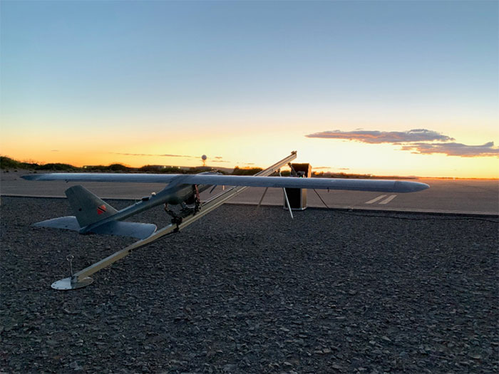
According to the company, the E1 is a solar electric, fixed wing unmanned aircraft system. It has a 20-pound payload capacity and a ceiling of 20,000 feet above ground level. It’s ideal for consumers who do not have the expertise to operate their own UAS, as SFUAS provides full service as well as sales, the company said.
The Silent Falcon E1 features 12 different sensor types, is vibration free and is beyond visual line of sight capable with a live feed. It also boasts four- to 12-hour duration configurations.
In addition, Silent Falcon has an application pending before the Federal Aviation Administration for type certification of the E1.
“Successfully passing 500 hours of flight is a significant milestone for the E1, confirming for federal regulators that it is a safe and durable aircraft model,” Silent Falcon said in a press release.
The full line of SFUAS products, services and support is now available via GSA Contract No. GS07F248BA, the company added.
The contract begins the offering for the purchase of complete drone solutions to all state agencies, commissions, political subdivisions, institutions and local public bodies allowed by law.
DroneUp is an end-to-end drone pilot service provider for aerial data collection. In August 2019, the company was awarded the Unmanned Aerial Systems (UAS) Services Master Agreement #E194-79435 by the Commonwealth of Virginia.
The services under this latest award (Contract Number #2020DRONE0002) are available for use by all 50 states, the District of Columbia, and the territories of the United States through the National Association of State Procurement Officials (NASPO) ValuePoint Cooperative Purchasing Organization.
The State of Alaska is now able to use the award for the benefit of state departments, institutions, agencies, political subdivisions, and other eligible entities.
DroneUp’s award includes but is not limited to service categories for
Emergency Support Services,
Law Enforcement Support,
Aerial Inspection or Mapping Data Services,
Agricultural and Gaming, and
Agency Media Relations and Marketing.
Primary users are expected to be
Agriculture & Game Management,
Emergency Management,
Transportation,
Forestry,
Mines,
Minerals and Energy, and
Public Universities and Community Colleges.
“We appreciate the efforts to streamline public sector access to leading-edge UAS services through the contract with the State of Alaska, and we look forward to supporting our hardworking state and local agencies,” said Tom Walker, DroneUp’s CEO.
The use of drones for precision agriculture is gaining momentum because of their capability to deliver the most updated information fast and efficiently. UAVs are transforming how agriculture is done. By implementing drone technology, farms and agriculture businesses can improve crop profit, save time, and make land-management decisions that improves long-term success.
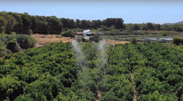
A few weeks ago Quaternium tested its innovative HYBRiX drone to spray fertilizers in the orange fields near Valencia, Spain. With its system of longer-than-average flight-duration, farmers have the opportunity to monitor and spray their fields precisely and rapidly.
“I am really glad to see that the entire spraying process in my orange fields has hardly taken six hours,” said farmer Pedro Andreu while operating the HYBRiX. “With other drones, we had to spend multiple hours waiting for batteries to charge and days to finish the work.”
The test convinced Andreu to use the technology to simplify his work. He engaged farmers in the neighborhood to join him and implement this technology in their work as well.
Alicia Fuentes, Quaternium CEO, accompanied the team for the field demonstration. She noted that farmers could benefit by using precision farming technology in a variety of ways: monitoring the health of their crops, estimating soil conditions, planting future crops, fighting infections and pests, updating the health of plants, and livestock monitoring.
Hybrid fuel system. HYBRiX UAS operates using a hybrid electric-fuel system. This makes it easy to operate the multi-rotor drone through the fields of a farm for an entire work whole day by refilling the spraying tank when needed and the fuel tank every 2-3 hours. Its built-in capacity of 5 liters of fuel enables HYBRiX to surpass the flying time from minutes to 2 to 4 hours.
The powerful propulsion system of HYBRiX allows the aircraft to carry up to 10 liters of liquid, with a maximum takeoff weight of 25 kg. The combination of hybrid power with its increased range extender capacity allows the farmer to cover large acres of land without carrying uncomfortable batteries and ensure long flight time in the field with the aircraft.
Quaternium is now focused on refining this technology to extend crop protection across the country so that farmers can benefit from the outcome to make their work more efficient.
A study by Future Market Insights (FMI) said the global geospatial solution market will witness growth at a compound annual growth rate of nearly 15% from 2019 to 2029.
According to the study, this strong growth outlook of the global geospatial solution market has been attributed to the advancements in computing capacity for geospatial solution-based research and applications.
The study highlighted geomedicine as a solution to potentially boost the growth of the geospatial solution market during the following years. Blockchain technology is estimated to witness massive adoption in the foreseeable future, FMI added. This technology can be geospatially enriched when combined with geospatial solution-based technologies such as Geographic Information Systems.
In addition, FMI reported that drones are estimated to witness a considerable adoption rate from 2019 to 2029, especially as new standards and legislations introduced by national governments are likely to motivate drone manufacturers and end users to operate more freely.
The study also determined that GPS is estimated to retain a substantial revenue share in geospatial solution market, and that remote sensing technology will register a significant compound annual growth rate over the projection period, as well.
The demand for geospatial solutions is rising from almost every end-use industry, FMI added, with one of the most noteworthy growth areas in the broad data processing arena being data visualization.
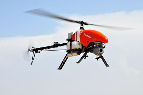
Emergency response providers participating in a Design Thinking workshop organized by the ResponDrone Project have indicated that they would like to use drones to gather and distribute crucial information and provide communication networks in disaster areas.
Preliminary results from the workshop, held in Thessaloniki, Greece, in November, indicate that first responders view the constant provision of real-time information in crisis situations as one of the most valuable benefits arising from using drones in disaster management missions.
The results of the Design Thinking workshop will be presented and discussed with the ResponDrone consortium at the project’s General Assembly, which will take place on Dec. 10–12 in Paris.
ResponDrone is an international project co-funded by the EU and the Korean government, which aims to develop an integrated solution for first responders to easily operate a fleet of drones for multiple synchronized missions to enhance their situation assessment capacity and their own protection.
The workshop, attended by representatives from first-responder organizations and industry partners of the ResponDrone consortium, took place to assess the best possible system requirements.
The aim of the ResponDrone project is to develop and evaluate a situation awareness system for first responders in emergency situations. The system will provide crucial information and communication services to all relevant stakeholders in a disaster situation.
First responders said they would like the ResponDrone system to:
provide reliable and validated real-time information
be flexible and open to information from already existing data sources
be able to visualize different information layers in a customizable manner
be fast and easy to deploy
be able to provide near future predictions regarding the development of the disaster situation.
Workshop participants included regional and national authorities in charge of first response, state agencies responsible for carrying out on the ground first response actions, rescue services and fire departments from Greece, France, Armenia, The Netherlands, Latvia, Bulgaria and Israel.
According to the first responders, a disaster can initially be described as a black box, which needs to be opened. Gathering relevant and reliable information from the disaster area and combining it with already available data, as well as rapid distribution of information to all relevant stakeholders, are the top priorities in disaster management.
The deployment of drones as a means of enabling the afore-mentioned capabilities seems to be a promising approach. It is crucial that the data gathered by drones is presented to the right people as soon as possible, preferably in real time.
“The workshop clearly showed the urgent need for the constant provision of real time information,” said ResponDrone project coordinator Max Friedrich from the German Aerospace Center (DLR).
“First responders wish to receive real-time data on current occurrences in the disaster area, on the position and status of potential victims and the first response units deployed in field, as well as the status and current location of available resources.”
Friedrich added that the ResponDrone system would be designed to provide highly accurate real-time information. The flexible system would gather information from various data sources and should be designed for fast and easy deployment.
ResponDrone has already begun developing an integrated solution for first responders to easily operate a fleet of drones with multiple synchronized missions to enhance their situation assessment capacity and their own protection. This system of systems will simplify and accelerate situation assessment and sharing, decision making and operations management, while requiring only a small crew to operate it.
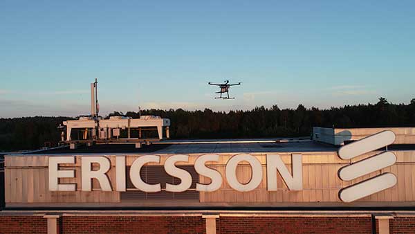
Test and measurement specialist Rohde & Schwarz has supplied mobile network testing tools used in drone-based network coverage, performance and operation tests managed by Ericsson, a global leader in network infrastructure.
Testing mobile coverage. A project team based in Jorvas, Finland, and led by Ericsson’s 5G Readiness Program RAN Technical Lead Richard Wirén, has developed— together with Centria University of Applied Sciences — a novel system for testing cellular mobile network coverage.
The new system uses mobile network-testing scanners and smartphones from Rohde & Schwarz mounted on a drone that can be programmed to execute automatic tests with considerable flexibility, for example for precise route selection and drone speed control.
This solution is especially valuable for industrial use cases. It also has the advantages over traditional walk and drive tests by providing unprecedented repeatability and positional accuracy with the ability to verify beamforming and map coverage in 3D.
Drone-mounted scanner. The R&S TSMA6 network scanner is mounted on a drone and is able to simultaneously verify important LTE and 5G NR coverage metrics such as reference signal received power (RSRP) and signal-to-interference-plus-noise ratio (SINR) in accordance with 3GPP standards.
When combined with the R&S QualiPoc Android smartphone-based optimizer, IP trace, application quality of service (QoS) metrics such as serving cell parameters are possible. The solution currently uses LTE user equipment (UE) but will soon be further developed to include 5G UEs such as the Samsung S10 5G.
The drone can be programmed to follow an exact three-dimensional route.
Repeatable tests. More than 20 successful measurement flights conducted so far have shown the solution procedure and results to be extremely repeatable. The drone flights were of various duration, altitudes and routes, depending on the test case.
Control, authentication and air traffic control are considerable challenges to the development of robust drone-based solutions. In this new system they are conducted over cellular networks, eliminating the requirement for line-of-sight connection between the drone and its pilot.
The unique procedure enables unprecedented 3D accessibility, positional accuracy and repeatability of the testing.
It also opens up new possibilities to ensure end-user QoS for demanding 5G use cases such as industry 4.0, automotive and public safety, Rohde & Scwarz said.
5G New Radio. The deployment of 5G New Radio (NR) brings new applications of cellular networks for subscribers, government and industry. It also makes the verification of the correct coverage, performance and operation of networks more critical, increasing the demand for accuracy and accessibility in traditional field network tests.
“For 5G to realize its promise, field verification of operation and quality is essential, and this development is a pioneering way to ensure our customers receive the network performance they require,” said Richard Wirén, 5G Readiness Program RAN Technical Lead from Ericsson. “We are delighted to utilize test solutions from Rohde & Schwarz that have proven themselves very reliable and are excited that we now have access to solutions based on commercially available 5G NR UEs such as the Samsung S10 5G.”
“We are delighted to combine our industry-leading mobile network testing know-how with Ericsson’s long tradition of network innovations to ensure the delivery of end-user Quality of Experience as 5G NR becomes a reality,” said Hanspeter Bobst, vice president of mobile network testing for Rohde & Schwarz.
Ericsson and Rohde & Schwarz are collaborating with Tampere University and Centria University of Applied Sciences, and the project forms part of the Business Finland 5G FORCE program.
Future developments will focus on testing critical 5G applications such as public safety and machine-type communications for Industry 4.0, extending the frequency to extremely high frequencies of the mmWave bands and testing in an urban environment.
A lot has happened in the world of unmanned aircraft over the last several weeks, and this month we’ve captured a cross-section of news that illustrates the variety of applications and goings-on across the industry. These include:
drone delivery to a nuclear submarine,
Uber Eats launching a new delivery drone,
a new heavy-lift UAV,
Chinese DJI drone use banned by the U.S. interior department,
the Grand Sky facility in North Dakota demonstrating control of a NASA Global Hawk over California,
runway inspection using drones at an airport in Canada, and
a drone-of-sorts completing 780 days in orbit.
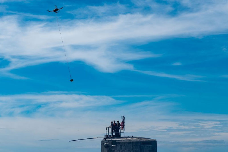
Package delivery to USS Hawaii (Photo: U.S. Navy/Mass Communication Specialist 1st Class Michael B. Zingaro)
Submarine delivery. The University of Hawaii and the U.S. Navy recently tested out a new way to supply an operational nuclear sub with a few essential items while the Virginia-class fast-attack submarine USS Hawaii was off the West coast of Oahu. A five-pound package of circuit cards, medical supplies and food too – which someone surely must have snuck in — was delivered using a Skyfront Perimeter gas-powered hybrid drone. The UAV has five-hour endurance, easily flying just one mile out to sea and back to complete the test delivery on Oct 10.
The package was lowered on a cable from the Perimeter drone and captured by a ‘snag’ pole extended off the sail of the submarine. This timely small package delivery to an underway sub has apparently led to the creation of the submarine force’s first UAV squadron in the Pacific, according to the Navy.
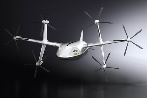
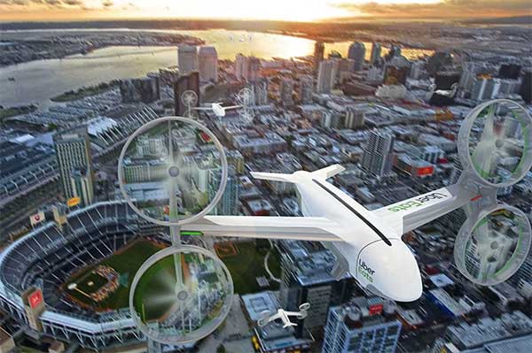
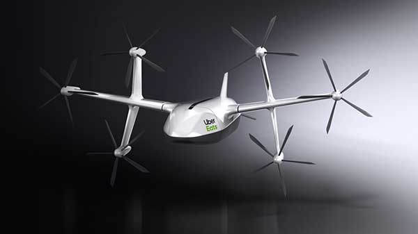
Uber Eats. Uber Eats has been testing food deliveries from McDonald’s near San Diego State University, and has just announced a new 6-rotor vertical take-off delivery drone it plans to use for more test deliveries next year in San Diego.
Uber Elevate delivery drone (Photo: Uber)
The ideal delivery profile for this drone is a meal for two picked up from a restaurant six miles away from dispatch in eight minutes, another six miles to make the delivery and then six miles to return to base — maybe less than 20-30 minutes all told. However, they have an intermediate drop-off to a ground-based delivery driver who then travels to the customer’s door to actually deliver the food. This process contrasts with Amazon’s approach — they are planning to lower packages on a cable directly to the customer – but food delivery might actually need a guy in a truck knocking on your door with hot food.
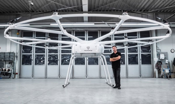
Heavy-lift drone. The Heavy-Lift VoloDrone, manufactured by Volocopter in Germany, flew for the first time in October. Targeted at the logistics sector, its anticipated that the large UAV may also find applications in agriculture, and other operations where a large – up to 440 pounds – payload is required. Velocopter has so far focused on unmanned air-taxi transports, but the larger scale involved in people transport appears to have spun off into a heavy-lift derivative UAV.
Christoph Hommet, chief engineer, with the heavy-lift VoloDrone. (Photo: Volocopter)
The VoloDrone is a powerful, fully electric, heavy-lift utility drone which is anticipated to have a range of up to 25 miles carrying a 440-pound payload. The rotor area has a diameter of 30 feet and the vehicle is 7.5 feet high. It can be remotely piloted or can fly autonomously on pre-set routes.
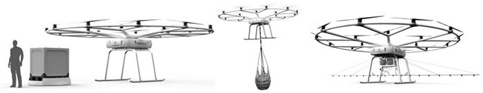
Loads can be carried between the legs of the landing gear on standard rack mounts or slung below, or a tank and sprayer could be fitted for agricultural applications. The 18 rotor multicopter platform uses swappable lithium-ion batteries and an in-house flight control system, and benefits from existing development and test of the air-taxi Velocopter.
Anywhere ground transportation or construction operations are challenged by difficult access, the VoloDrone might assist by providing an airborne option. It is designed as a universal air-lift vehicle which may be adapted to different use cases by the addition of special-purpose accessories.
Examples of VoloDrone load configurations. (Photo: Volocopter)
DJI drones barred. The U.S .Interior Dept. (DoI) has barred the use of DJI dones, except for emergency purposes. With a combined department fleet of over 800 drones, around 15% are supplied by Chinese manufacturer DJI.
Amid the on-going trade war between China and the U.S., members of Congress have grown increasingly concerned about American use of Chinese technology – whether DJI drones, or Huawei networking equipment. Recently Congress has proposed the American Drone Security Act to limit Government agencies’ use of Chinese equipment.
In anticipation of this issue DoI has already been working with DJI for over 15 months to identify possible security gaps in drone design, and DJI has come up with a “Government Edition” software load which ensures data is only gathered and stored on-board the drone and is isolated and downloaded for only DoI use after each flight — data transmission has been eliminated as a possible source of data leakage. DJI even volunteered to partial manufacture in the US. Therefore, DoI had previously resisted Congressional pressure to discontinue use of its fleet of DJI drones.
Nevertheless, DoI Secretary Bernhardt has ordered that Chinese drone use be now discontinued until an internal review is completed. In the meantime, DJI drones may only be operated by DoI for emergency purposes, “such as fighting wildfires, search and rescue, and dealing with natural disasters that may threaten life or property.”
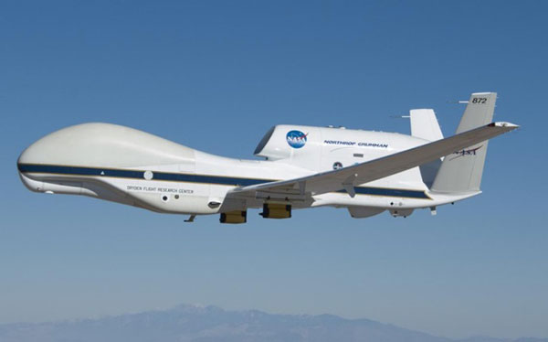
NASA Global Hawk UAV (Photo: NASA/Tom Miller)
Large BVLOS drones. The Grand Sky Beyond Visual Line of Sight (BVLOS) facility in North Dakota has become an operational base for large UAVs, including the General Atomics’ Predator and Northrup Grumman’s (NG) Global Hawk. The Grand Sky facility is immediately adjacent to Grand Forks Air Force Base, where the RQ-4 Global Hawk high altitude, long endurance autonomous aircraft is based.
In order to offer full operational capability to its intended customer base at Grand Sky, Northrup Grumman is building a hangar and has also established a Transportable Operations Center (TOC) in its Grand Sky Mission Control Center. It was through this TOC on October 10th that NG was able to take control of an in flight Global Hawk mission in California.
A NASA crew in California had managed the take off and flight of their Global Hawk from the NASA Armstrong Flight Research Center (AFRC) on Oct. 10, 2019. During the mission, the flight team at Grand Sky took over control of the aircraft and executed a series of flight maneuvers to demonstrate the operational capability of the TOC. This capability is key for the Grand Sky facility to become fully operational.
A Microdrone md4-1000 used in the surveys at EIA. (credit: EIA)
Runway inspection. Drones are never allowed to operate anywhere near an active airport, so it’s something of a switch to learn that the Edmonton International Airport (EIA) in Alberta, Canada , OK with operating a drone within the confines of the airport. Fortunately it’s a case of improving the safe operation and maintenance of the extensive runway infrastructure at the airport.
EIA has two million square feet of runways, taxiways and aircraft handling aprons which are all subject to wear by aircraft and suffer from the harsh weather extremes which are common in Canada. Therefore regular maintenance inspections are mandatory. Undertaking inspections manually in the past could take days to perform, so EIA adopted the use of drones to complete inspections much quicker and with higher accuracy.
The Microdrone md4-1000 drone is flown by Canadian company AERIUM to collect Lidar (Light Detection and Ranging) data and photographic/video imagery of EIA’s runways. The data collected is used to more accurately predict when to conduct preventative maintenance on ground infrastructure used by aircraft. Drone operations were approved by Edmonton Airport in collaboration with Nav Canada and AERIUM. EIA has previously flown a drone to minimize the number of birds on the airport during aircraft movements and in the process conducted the first-ever drone night flight at the airport.
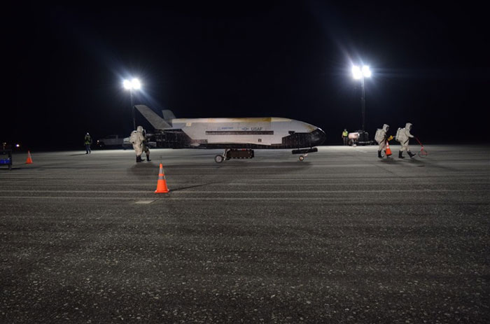
A X-37B lands at the Kennedy Space Center. (Photo: USAF)
X-37B orbital vehicle. Finally, the daddy-of-all applications for remotely piloted vehicles became more apparent on Oct. 27, at 3:51 in the morning when the U.S. Air Force’s X-37B Orbital Test Vehicle successfully landed at NASA’s Kennedy Space Center Shuttle Landing Facility after 780 days on orbit.
The fifth mission was launched on Sept. 7, 2017 from Cape Canaveral Air Force Station, Florida by a SpaceX Falcon 9 booster. Looking like a miniature version of one of the retired Space Shuttle fleet, the X-37B is managed by the Air Force Rapid Capabilities Office, and ‘performs risk reduction, experimentation and concept of operations development for reusable space vehicle technologies.’ Long endurance stuff – the previous flight lasted 718 days. “This mission successfully hosted Air Force Research Laboratory experiments, among others, as well as providing a ride for small satellites,” said an Air Force spokesman.
The X37B provides a unique capability to test new systems in space and return them to Earth and enables the U.S. to more efficiently, effectively and rapidly develop evolving space capabilities. The U.S. Air Force is preparing to launch the sixth X-37B mission in 2020.
Final thoughts. As drones chug steadily along the path towards a rapid airborne delivery system, urgent deliveries to both submarines and hungry people ordering food are making progress. Heavy-Lift capability is evolving out of air-taxi research. The effects of trade wars and security concerns are touching established drone operations. We can now control huge aircraft remotely from almost anywhere. Runway inspection is being automated just like any other drone inspection/surveillance mission, and remote space operations are now regular practice.
It’s an expanding world of applications for drones, with many more different and perhaps unanticipated ones yet to come.
Uber Elevate, Uber’s aviation division, unveiled a new food-delivery drone at Forbes’ Under 30 Summit in Detroit, according to various news reports.
The six-rotor UAV is vertical- and horizontal flight-capable, Uber Elevate head Eric Allison said at the conference. It has a range of 18 miles and an 18-minute flight time, and can carry enough food for two adults.
The drones will land in designated safe-landing zones, where human couriers will pick up the food and bring it to customers’ doors. The company might also land the drones on parked Uber cars (tagged with QR codes), which will carry the meals to their final destinations.
Uber’s Elevate Cloud Systems will track and guide the drone, as well as notify a delivery driver when and where to pick up the food.
The program is expected to roll out next summer in San Diego, where Uber Elevate has been testing urban aerial delivery via the UAS Integration Pilot Program (IPP).
Uber’s vision of a city sky filled with Eats delivery drones. (Image: Uber)
From growing crops to making movies, unmanned aerial vehicles (UAVs) are changing the way we work. UAVs — managed by unmanned aerial systems, or UAS — range from small indoor inspection units to giant Predator drones. They are streamlining how we manage mines and plants, deliver packages, and keep people safe. Read on to find out the latest in this skyrocketing market.
The unmanned aerial system (UAS) industry is in great shape! In the United States., the Federal Aviation Administration (FAA) appears to be helping commercial operations get off the ground, at least for those wishing to fly small unmanned aerial vehicles (UAVs).
Things are certainly hopping for unmanned aircraft in agriculture, mining and construction, facility inspection, newsgathering, movies and promotion. Package delivery is on the way, and, of course, defense is cooking with new innovations. Everywhere you look, a specialized drone or new application seems to appear that has good prospects for success.
One helpful aspect of today’s landscape for UAS operators in the U.S. is the FAA’s supportive approach to small UAS (sUAS) for commercial activities. After providing a regulatory framework with Part 107 rules, albeit with quite a few caveats that require a written waiver application, qualified drone operators are now able to fly their drones in many places — as long as they are below 400 feet, well away from airports, and nowhere near any restricted airspace.
Pilot qualification courses and proficiency testing are both readily available — at 676 commercial facilities across the U.S. according to the FAA website — and a successful online application process should result in a remote pilot’s certificate.
With a drone registered with the FAA, you can use the FAA’s B4UFLY mobile app to check if it’s safe to operate where you intend to. If it is, you can get approval in real time using the FAA’s Low Altitude Authorization and Notification Capability (LAANC) system. The FAA qualified LAANC to clear commercial drone operations, and the service is now provided by a large number of independent UAS service providers.
With the regulatory and approval path in place, it’s now possible for companies and individuals to earn a living with turn-key drone operations, providing services for many applications that have blossomed. There’s work to do beforehand, but it’s less arduous than for manned flight operations.
Let’s look at a few of the applications benefiting from the automation, enhancement and remote operations provided by UAVs as well as their on-board sensor suites and after-flight processing:
agriculture
mining and construction
facility inspection
newsgathering, movies and promotion
package delivery
defense
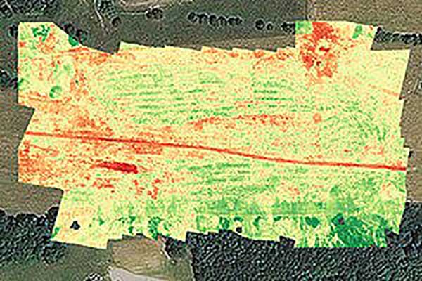
Crop health analysis: Precisionhawk’s software PrecisionAnalytics—Agriculture automatically generates georeferenced orthomosaics from data collected with drone sensors. (Map: PrecisionHawk)
Agriculture
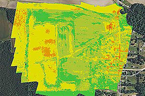
Agriculture has readily adopted UAVs to monitor, control and improve overall crop growth rates — a part of what is known as precision agriculture. Drones carrying optical, thermal and laser scanning payloads gather stacks of information about the condition and rates of growth in fields. The information is then fed into various analysis tools. A picture emerges over time that indicates the health of crops. This enables farmers to generate a formulas for the nutrient and weed-reduction chemicals used for spraying at various times of the year. It’s a customized “prescription” for each growing area.
Continuing UAV overflights during the growing cycle monitor the effects of growing conditions and the effectiveness of treatments, providing more feedback that lead to even further improvements.
Smaller tech-savvy farms might run their own programs, supported by local agrochemical suppliers that may provide analysis services or sell analysis tools.
However, there has been a real growth in the number of companies that supply an entire turn-key package — supplying and flying drones, gathering data, running analyses and providing written and graphic output to support the farming operation.
Unmanned aircraft are truly an integral part of this approach, which might only have been possible because of semi-autonomous UAS and the evolution of compact sensors: UAV-mounted infrared, high-precision optical and lidar.
A sample prescription map. (Map: PrecisionHawk)
Mining and Construction
Any mine site is a busy — even chaotic — place to conduct a commercial business.
Drones provide a way for mining operations to:
quickly collect information to enable volume calculations;
provide relatively inexpensive site surveys; and
manage traffic and set up daily road layouts.
In effect, drones enable more rapid control of a complex and dynamic undertaking. Additionally, they improve safety. Ground surveyors no longer need to dodge huge operating machines and tumbling ore, or scramble around difficult terrain.
An autonomous drone can gather timely, georeferenced imagery that can be turned into a precise 3D model of the site. Site managers can have immediate access to details of the UAV survey. They can see the extent of existing deposits and know where to support further mineral exploration, receive estimates of stockpiles and tailing volumes, ensure that personnel and equipment are in the correct locations, and compare aerial video and photography day by day to check progress and for record-keeping. Drones can carry a wide variety of imaging and sensor packages including visual, infrared, hyperspectral, lidar, sonar and radar.
It’s also quicker. For instance, using the senseFly eBee fixed-wing drone, a full aerial survey of an 88-hectare site took four to five hours, with about half of that time spent placing control points. To achieve the same level of detail, terrestrial surveying would take a single surveyor two to three weeks.
Construction Operations. The construction sector uses the same drone data-capture techniques for site details, off-line analysis and results tabulation to manage operations of complex work sites. Compared to mining, change can be more intensive during a construction project, so drone surveys might be repeated more often.
Surveying and GIS. Using drones is an industry unto itself, with high-precision RTK GNSS in the air and on the ground, and specialized analysis tools for high-accuracy applications. The speed of data gathering is the principal benefit to an industry that continues to be essential in many sectors. Lower precision GIS for asset tracking and the like could become a subset of the applications and tools already discussed.
Facility inspection. Outdoor and indoor facility inspection is definitely benefiting from the automation that suitably equipped drones and customized analysis tools can bring to both regular and infrequent inspection tasks. The number of regular complex refinery inspections can be significantly reduced. Inspections will no longer interfere with production and will improve safety for inspection staff. For instance, flame stacks that burn off excess gases can be prone to failure, so regular inspection is essential. Using a drone for the task is clearly much safer than using personnel.
An offshore oil and gas construction platform vents gases to relieve pressure. Flame stacks such as these require regular inspection. (Photo: Oil and Gas Photographer/Shutterstock.com)
BVLOS for Pipelines and Rail
Automated pipeline and railway track inspection have both become possible as drones are used over much greater distances, thanks to beyond visual line of sight (BVLOS) operational approvals by the FAA.
For BVLOS, users first need a validated sense-and-avoid technology on the drone. Also required is proven radio telemetry with uninterrupted command-and-control of the vehicle during flight, and an independent ground-monitoring system that confirms how the drone maneuvers throughout the flight.
In the case of a BVLOS flight this summer along the Trans-Alaska oil pipeline, a Perimeter UAV manufactured by Skyfront flew about 4 miles, maintaining a constant above-ground altitude of 400 feet with multiple ascents and descents of 1,000 feet on 45-degree slopes. The long-range hybrid multicopter drone was equipped with Iris Automation’s computer vision collision-avoidance system and was monitored by
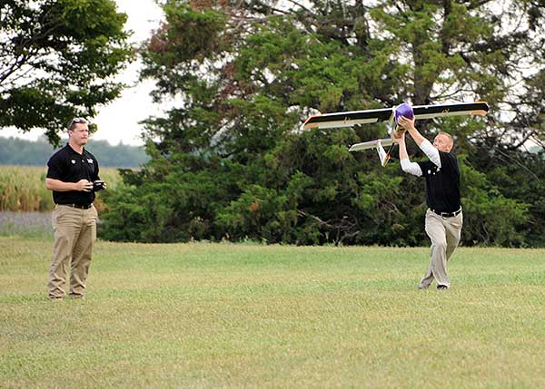
Launching a UAV for a BVLOS flight are (at left) Travis Balthazor, UAS flight operations manager, and Mike Kuni, UAS flight instructor/pilot, both of Kansas State University Polytechnic Campus. (Photo: KDOT, Division of Aviation)
Echodyne radars along the pipeline path, providing airspace situational awareness.
Another BVLOS operation built on the achievements of the Trans-Alaska pipeline trial has been authorized to fly a nine-mile linear inspection of power lines in rural Kansas.
Once again, the Iris Automation system will provide collision avoidance, but this drone also has an independent automated avoidance capability. This gives the drone the self-contained ability to fly around obstacles, so no ground radar or visual tracking is required.
Relieving the requirement for radar tracking or visual observers makes many new operations affordable. Previously, FAA Part 107 BVLOS waivers have all required visual observers or ground-based radar tracking — requirements that are not only expensive, but also restrict where flights are possible.
BVLOS operations like these demonstrate the cost-effectiveness of the technical solution, making long-duration, long-distance inspection using drones feasible.
Indoor inspection is becoming possible with specialized drones that circumvent the need to expose inspection staff to especially difficult facility environments, which in the past also required production shut-down to protect them. Thermal and visual sensors on swivel mounts enable protected inspection drones to fly into tight spaces — or even back out of tricky situations — and make visual records that may otherwise be virtually impossible.
Searching and recording inside containment vessels at the failed Fukushima nuclear facility may have been significantly advanced by using inspection drones.
Newsgathering, Movies and Promotion
All those panoramic, overhead, moving shots you see on the news, in movies and in ads used to be taken from a manned helicopter or fixed-wing aircraft. Now they are mostly taken by multi-copter drones with high-resolution cameras. This makes cinematography and newsgathering much more affordable, making these fields accessible by smaller operations. In the past, only large media groups could afford to rent a helicopter. And, of course, it’s much quicker to bring a UAV onto an incident site, operated by a crew on the ground.
You’ll need FAA approval to use a drone for commercial newsgathering purposes, or find a suitable qualified UAV and operator. After gaining FAA qualifications, news people are also taking on the job, buying and flying the equipment and managing the video-processing software themselves.
Others using drones for similar purposes are movie makers, producers of TV commercials and real estate agents, to name a few.
Delivery by Drone
The ultimate objective of many internet suppliers is to deliver goods that were just ordered within minutes of the order being placed. This is a pretty big objective. It requires a whole network of “fulfillment centers” in and around many cities, a massive purchasing and goods movement capability to keep these centers stocked, and a system that delivers to the end-customer. Currently, we mostly have manned panel trucks of various flavors handling that last step of the delivery process, with real people reading the notes we put on the porch about where to leave our package if we’re out.
Order and Receive. The next wave of delivery changes are expected to include drones carrying your package from the fulfillment center to your backyard. Amazon is looking for approval to begin trials with its larger 88-pound MK-27 Prime Air delivery drone, initially in sparsely populated areas. The MK-27 is equipped with intelligent sense-and-avoid capability, flying around any obstacles it encounters in flight and even during delivery.
UPS is also hoping to get to qualification of its own UAS delivery system by the end of this year, to the same standards that manned aircraft delivery systems are certificated.
Medical Deliveries. Many other trials are underway, especially involving medical deliveries and support. In Africa, trials are underway in Ghana, Malawi and Rwanda. UPS recently proposed a medical supplies delivery service using drones in North Carolina. Many companies that claim expertise in medical deliveries are operating drones.
Food on the Fly. Restaurant food delivery services have seen an upsurge in popularity. It seems likely that soon you’ll be able to order and receive lunch really quickly by drone food delivery services. Ground robot food deliveries at George Mason University are already a huge hit! Uber-Eats is experimenting with drone food deliveries, and 17 drone delivery routes have already been approved in an industrial park in Shanghai.
Meanwhile, Bell has flown its autonomous pod transport (APT) 70 near its base in Fort Worth, Texas, for the first time. The APT 70 can carry a 70-pound package load at over 100 mph, far faster and farther than existing drone delivery systems.
Bell is aiming for package delivery and critical medical transport for disaster relief for APT type drones. It is also participating in the NASA SOI program along with General Atomics’ SkyGuardian.
Drones are a new tool. The UAS industry will continue to change and adapt these products and this technology in as-yet-unthought-of ways. It’s an exciting time, and right now, there seems to be no end in sight.
For a look at drones in the defense industry, see Murfin’s article “Defense in front of UAV development,” published in September’s Professional OEM + UAV newsletter.
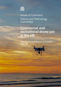
A committee of the U.K.’s House of Commons issued a report calling for greater drone regulations, including registration, drone ID transmission and geofencing around sensitive locations.
In its summary, it recalls drone sightings at Gatwick Airport in December 2018, which caused “significant disruption and highlighted the need for further recognition of the substantial rise in the purchase and use of commercial and civilian drones more widely.”
Restricted Airspace
The report calls for more studies, such as on airport/drone collisions. It recommends that the government complete an assessment of the risks that drones pose to manned commercial aircraft and publish the findings by the end of 2020.
“The committee is concerned that there is no agreed position on the likely consequences of a drone-airplane impact,” the report says.
The committee also recommends temporary drone flight restriction zones around helicopter landing zones and said the government should consider geo-fencing as a compulsory measure around prisons and high security areas.
“We recognise the importance of extending Flight Restriction Zones to five kilometres. However, these restriction zones are not clearly or consistently enforced,” the report states. “The lack of a standardised process results in inconsistent denials and permissions being granted to those applying. This is unacceptable.”
“The government should commission the production of a standardised and unified system through which drone operators can request access to Flight Restriction Zones. This could be achieved by working with National Air Traffic Services on its development of an Airspace User’s Portal. This should be completed no later than summer 2020.”
Drone Registration
The report recommends that the government begin a UAV registration system, enabling identification of lawful drone operators. Those registering would also have to pass a knowledge test. It also recommends that drones be “electronically conspicuous” with some form of electronic ID within two years. Both ID and geofencing should be standard in drones, the report said, with penalties for disabling these features.
If a drone user doesn’t register, “We recommend a sliding scale of penalties for failure to register, starting with a warning, and culminating in a fine and a prison sentence,” the report states.
BVLOS and UTM tech testing
A beyond-visual-line-of-sight (BVLOS) testing facility should be established so that unmanned traffic management (UTM) systems and related technologies can be tested, the report recommends.”Clear plans should be set out for this as soon as possible and further testing should begin no later than Summer 2020.”
The report concludes, “The government should produce a white paper by summer 2020 that outlines the vision for how drones will be integrated into UK communities over the coming years.”