Tag: emergency response

  • McMurdo Opens Emergency Response Experience Center

    McMurdo Opens Emergency Response Experience Center

    Photo: McMurdo

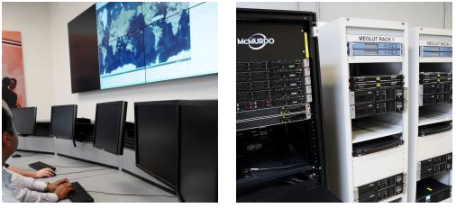
    McMurdo has opened an Emergency Readiness and Response Experience Center at its Washington, D.C., location. The center will showcase the latest innovations and technology developments for search and rescue (SAR) in an immersive experience with real-time demonstrations of the entire SAR process — from distress beacon activation to satellite-based location detection to emergency response coordination.

    The facility will feature a working MEOSAR (Medium Earth Orbit Search and Rescue) satellite-based search and rescue system, the next-generation version of the current Cospas-Sarsat satellite system that has saved more than 37,000 lives since 1982. When fully deployed in the next 3 to 5 years, MEOSAR will greatly improve the existing SAR process with global coverage, near instantaneous distress beacon detection and a unique Return Link Service feature that acknowledges distress signal receipt. MEOSAR’s advanced technologies will be able to accurately detect and locate a distress beacon signal almost instantaneously instead of taking up to 30 minutes today.


    For background on how GNSS satellites will be used in the MEOSAR system, see “The Distress Alerting Satellite System” Innovation article.


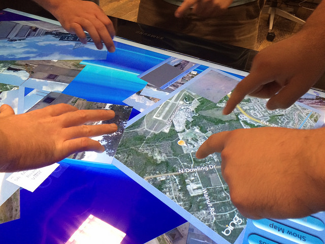
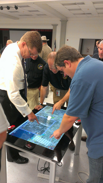
    Visitors to the center will gain an understanding of the different search and rescue technologies by taking part in various search and rescue scenarios. Participants will also have the opportunity to sit at the controls of mission control center and rescue coordination center systems, similar to the McMurdo solutions used around the world by NASA, National Oceanic and Atmospheric Administration (NOAA), Australia Maritime Safety Authority (AMSA), Maritime New Zealand (MNZ) and other SAR authorities.

    “This cutting-edge Experience Center allows us to demonstrate the incredible advancements being made in search and rescue all in a single location,” said Jean-Yves Courtois, CEO of McMurdo. “Our decades of experience in pioneering the latest SAR advancements, our leadership position as the only company that provides an end-to-end SAR ecosystem and our ongoing commitment to saving lives put us in the unique position to showcase these emergency readiness and response solutions for our customers, our partners and the industry.”

    Guests will also see SAR-enhanced applications such as fleet management, coastal surveillance and innovative partner solutions for aviation, fishing, maritime, military and other industries. Classroom training and other educational sessions led by industry experts and SAR specialists will take place at the new center.

    “The McMurdo Experience Center is unique in its ability to make the entire search and rescue process come to life, which we haven’t seen done before in a centralized setting,” said Bruce Reid, CEO, International Maritime Rescue Federation (IMRF). “We at the IMRF are delighted to be working with McMurdo on a variety of SAR training, education and awareness activities. Access to this location as a true center of excellence for the search and rescue sector can only enhance this activity.”

    Personalized, custom tours of the McMurdo Experience Center for customers, partners and press can be reserved.

    McMurdo products and services are used by some of the biggest names in the world including Airbus, Boeing, British Airways, Embraer, Southwest and United Airlines as well as the British Royal Navy, U.S. Coast Guard and numerous global search and rescue authorities. McMurdo was instrumental in the high-profile rescue of Clipper Round the World Race Sailor Andrew Taylor and was recently named as the official safety beacon partner of the hit reality series Deadliest Catch.

  • Esri CityEngine 2015 Provides Advanced 3D City Design

    esri-cityengine-2015-provides-advanced-3d-city-design-lg
    Modern layer management and enhanced real-time shadows based on daytime and location are available in the latest release of CityEngine.

    The release of Esri CityEngine 2015 allows GIS professionals, architects, planners, and urban designers to create 3D city models faster and share them easily via ArcGIS Online. These new features open the use of 3D models for every day, real-world simulation, emergency response, urban planning, and entertainment scenarios.

    “CityEngine 2015 is faster, sports higher-quality visuals, and introduces an innovative and unique 3D design experience. The latter is possible with Procedural Handles, a novel user interface for the intuitive editing of 3D models. We worked very hard on this and are excited to release it,” said Pascal Mueller, director of the Esri R&D Center, Zurich AG.

    Companies like Esri partner SmarterBetterCities use CityEngine to help clients view and investigate building development proposals in a true 3D environment.

    “CityEngine provides decision makers with the opportunity to do more advanced planning than when they are using a typical CAD or spreadsheet system,” said Antje Kunze, CEO, SmarterBetterCities. “We are now able to help our clients better visualize rules and regulations and perform analytics that no one has been able to address in the past.”

    Advancements from user requests—including a modern editor for managing layers, real-time shadows based on daytime and location, faster data export, and improved publishing workflows—have been implemented. More information can be found in the release notes.

    “With CityEngine 2015, we made a huge step forward in user experience and speed, resulting in less coding and more designing,” said Dominik Tarolli, director of international business development for 3D geodesign at Esri.

    CityEngine 2015 is available for Windows, Mac, and Linux platforms. A free 30-day trial with full export capabilities can be downloaded at esri.com/cityengine.

    Esri-CityEngine-O
    Credit: Esri website.
  • McMurdo Gets FAA, EASA Nods for Commercial Aircraft Locator

    McMurdo Group, maker of end-to-end search and rescue solutions, has received formal certification from the U.S. Federal Aviation Administration (FAA) and European Aviation Safety Agency (EASA) for its Kannad Integra ARINC 429 Navigation Interface.

    Based on the ARINC 429 GPS communications standard for most commercial aircraft, the interface, when used with the Kannad Integra Emergency Locator Transmitter (ELT), provides dual GPS redundancy that can result in aircraft being found much faster compared to standard ELTs in event of an emergency. The solution has already been selected by aircraft manufacturers including Pilatus, Embraer and Airbus Helicopters.

    Traditional ELTs rely on an aircraft’s external antenna and GPS equipment, which is subject to failure in the event of an emergency. The Kannad Integra ELT, however, can operate independently of the aircraft to provide key positioning data through its built-in internal antenna and embedded GPS receiver. The Integra ARINC 429 navigation interface stores the latest known position of the aircraft based on the aircraft navigation system data. This data is then used by the built-in Integra GPS for better location accuracy and a higher chance of rescue.

    In March, McMurdo introduced an Integra Smart Pack bundle, which provides similar redundancy for general aviation aircraft using the standard NMEA interface.

    The Kannad Integra ELT and Integra ARINC 429 Navigation Interface are suitable for commercial aircraft, helicopters, business jets and airlines. Once activated, the Integra ELT transmits a distress signal to alert international rescue services to the emergency location via the global Cospas-Sarsat Search and Rescue satellite system, which has helped to save more than 37,000 lives since 1982.

    “McMurdo’s Kannad products have been chosen by the world’s leading aircraft manufacturers and airlines for their quality, reliability and innovation,” said Christian Belleux, head of McMurdo’s Kannad Aviation Business Unit. “This new ARINC 429 interface is yet another example of how we are helping to shape the present and the future of aviation safety.”

  • Langley’s Ionosphere Research Focus of CBC Report

    Langley’s Ionosphere Research Focus of CBC Report

    Richard Langley describes the ionosphere study to CBC News reporter Shawn Fowler.
    Richard Langley describes the ionosphere study to CBC News reporter Shane Fowler. (Screen capture from CBC News video)

    CBC News interviewed GPS World Innovation Editor Richard Langley about his ionosphere interference research project with NASA, reported on earlier this week.

    Langley, a professor at the University of New Brunswick, is working with the Jet Propulsion Laboratory in California to better understand how the ionosphere is disturbed by a variety of phenomena including solar outbursts and other natural hazards such as tsunamis. They are using the signals from GPS satellites to probe the ionosphere with the signals being picked up by receivers both on the ground and in low-Earth-orbiting satellites. The research could help find ways to mitigate ionospheric interference to GPS signals themselves as well as to other types of radio communications.

    “GPS satellites are much higher than the ionosphere,” Langley told CBC News reporter Shane Fowler. “So the signals from the satellites have to come down through the ionosphere to receivers on or near the Earth’s surface. And as they come down through the ionosphere they get a little distorted. When you see auroras in the sky, that’s when you can tell the ionosphere is a bit disturbed. The average consumer may not notice these variances, but high-precision applications, like for scientific applications, we actually always see the effect of the ionosphere.”

    Screen capture from CBC news video.
    Screen capture from CBC news video.

    The research could also help develop early-detection systems for tsunamis. “The energy from that water displacement actually propagates up all the way into the atmosphere, all the way to the ionosphere,” Langley told CBC. “It basically moves around the electrons up there and GPS signals coming down from the satellites, through the ionosphere, pick up those small variations. It has the potential to save a lot of lives.”

    Solar flares can also affect GPS signals. The Carrington Event, a solar storm in 1859, knocked out some of Earth’s telegraph systems. “The effect on the Earth’s magnetic field was so strong that currents were set up,” Langley told the CBC. “Those currents were so strong that telegraphs could run without batteries. There was enough current from this disturbance that it could run the telegraphs. And in some cases there was too much and rumour has it started small fires. Luckily we haven’t had one of those again; it seems to be a one-in-100-year, or a one-in-a-200-year, event.”

  • GPS in McMurdo Transmitter Makes Finding Planes Easier

    The The Kannad Integra Smart Pack by McMurdo Group could make it twice as easy to find missing aircraft. Photo: McMurdo Group
    The The Kannad Integra Smart Pack by McMurdo Group could make it twice as easy to find missing aircraft. Photo: McMurdo Group

    McMurdo Group, maker of end-to-end search and rescue solutions, has launched the Kannad Integra Smart Pack, an aviation emergency locator transmitter (ELT) bundle with both GPS and antenna redundancy. The product can result in Integra Smart Pack-equipped aircraft being twice as likely to be found in the event of an emergency compared to standard ELTs.

    The Kannad Integra Smart Pack includes:

    • The Kannad Integra ELT – a small, light ELT with a built-in antenna and embedded GPS receiver.
    • The new Kannad Integra e-NAV NMEA – an NMEA-standard interface cable that connects the Integra ELT to the aircraft GPS. The latest known aircraft GPS position is continually updated and stored on the interface cable itself to provide an additional level of redundancy over the embedded Integra ELT GPS data.

    Traditional ELTs rely on an aircraft’s external antenna and GPS equipment, which is subject to failure in the event of an emergency. The Integra ELT, however, can operate independently of the aircraft to provide key positioning data through its internal antenna and GPS receiver.

    With the Integra Smart Pack bundle, in the event that the Integra ELT’s internal GPS antenna is unsuccessful for any reason, the positioning coordinates from the Integra e-NAV NMEA will be used. This additional GPS redundancy will result in better location positioning and higher chance of rescue.

    “McMurdo is delighted to continue its long history of aviation search and rescue innovation with the introduction of the Kannad Integra Smart Pack,” said Christian Belleux, head of McMurdo’s Kannad Aviation Business Unit. “The Integra Smart Pack is a must-have SAR [search-and-rescue] solution to help ensure accelerated rescue response in the event of an emergency and to ultimately save more lives.”

    The Integra ELT Smart Pack is suitable for all types of aircraft with specific versions to support helicopters, general aviation planes and large commercial jets. Once activated, the Integra ELT transmits a distress signal to alert international rescue services to the emergency location via the global Cospas-Sarsat Search and Rescue satellite system, which has helped to save more than 37,000 lives since 1982.

    The McMurdo Group is exhibiting this week at Heli Expo 2015, Booth 5465, in Orlando, Fla.

  • Two New Apps Enable Public to Help First Responders

    Photo credit: Texas A&M.
    Photo credit: Texas A&M.

    Two new apps developed at Texas A&M University-Corpus Christi use social media to help police officers, news stations, and the public navigate the many incidents and minor emergencies that may occur on a daily basis.

    Richard Smith, creator of the two emergency response apps, is collaborating with Michelle Maresh-Fuehrer, assistant professor of Communication at A&M-Corpus Christi, to identify how the apps could aid first responders during emergencies.

    “With the combination of SituMap and PhotoSorter, the public can be encouraged to submit photos and videos that may be helpful during an investigation,” said Smith, assistant professor of Geographic Information Science and Geospatial Surveying Engineering at the Island University. “For example, during an active shooter event, photos and videos of the suspect or their location can be taken with a cell phone and easily sent to responders. This could drastically improve response time and ultimately save lives.”

    TexasA&M-app-1
    Photo credit: Texas A&M

    Smith developed the mapping applications to provide a way for first responders to rapidly, and easily, receive and map information so they could have a more comprehensive awareness of emergency situations. Maresh-Fuehrer is working on extending the use of Smith’s social media mapping applications to enhance communication before, during, and after a crisis.

     “A crisis event is typically a time of high stress and increased uncertainty for organizations and responders,” said Maresh-Fuehrer, who studies crisis communication strategies. “The applications developed by Dr. Smith have several features that allow for more informed and efficient crisis response.”

    SituMap acts as a tablet-like digital command center that shows officers maps of the crisis area. With the touch of a finger the table-size display can be zoomed, rotated and drawn on. Like a personalized version of Google Maps, officers can search for locations and measure distances. But it goes further than Google Maps. A pin can be created in the application that could represent a person, police car, or groups of people. The pin can be strategically positioned around the area and directions can then be relayed to officers at the emergency location.

    “An organization’s crisis team, along with emergency responders, can use SituMap to identify where people should be during a specific crisis,” said Maresh-Fuehrer. “With this application, responders can even view floor plans. This could help to identify safe locations such as fire exits and stairwells.”

    PhotoSorter works in tandem with SituMap by allowing emergency responders, crisis planners and community members to share pictures or video of the crisis. Emergency responders can then upload the photos and video into SituMap to help in important decision-making situations.

    SituMap and PhotoSorter were designed and developed at the Island University by Smith. The University Police Department is currently using a beta version of SituMap in training sessions.

    In today’s digital world, people all over the globe can be connected through social media and, with the touch of a button, information about a major accident can be shared worldwide. With SituMap, important responders, as well as the community, can see real-time information on traffic congestion, roadblocks, and closed roads, which will aid in faster response times. The app also has a weather feature built into it which could be used during severe weather events such as a hurricane.

  • GTX Corp Partners with Life Button 24 on Emergency Response

    GTX Corp Partners with Life Button 24 on Emergency Response

    GPS-Smartsole
    Photo: GTX

    GTX Corp, a personal location wearables company, has entered a strategic partnership with Life Button 24, a division of World Wide Security Group and provider of life safety, dispatch and monitoring services since 1979.

    Under the strategic partnership, GTX Corp will offer Life Button 24 services to its GPS SmartSole customers, providing 24/7 access to live dispatch operators that can assist caregivers when a loved one goes missing. The premium service will be offered through GTX on a monthly subscription basis as an add-on to existing monthly tracking service plans provided by GTX.

    “Our GPS SmartSoles were specifically designed for caregivers to be able to react in real time to find a loved one who has wandered off,” commented Andrew Duncan, director of GTX Corp. “By partnering with Life Button 24, we will now offer our U.S. customers an enhanced level of service and extra layer of protection. The service will be able to provide a caregiver with the ability to contact a live person, who can assist in coordinating the successful search and rescue of the loved one, or assist in notifying the proper authorities if needed. By offering this service, we enable individual caregivers and assisted living staff, among others, with an additional level of 24/7 human response, when critical support is most needed.”

    “Life Button 24 is thrilled to provide 24-hour emergency response services in partnership with the GTX Corp SmartSole GPS system,” said Jeff Katz, director of project development for Life Button 24. “Addressing wandering issues of individuals afflicted with Alzheimer’s and autism is a growing concern for the millions of families and caregivers. Life Button 24 looks forward to being part of a greater solution that delivers peace-of-mind through advanced tracking technology and customized emergency response services, which were designed specifically to support applications such as the GPS SmartSole.”

    “With initial delivery dates for our GPS SmartSoles to consumers being confirmed next week and several pilot agreements with large organizations kicking off this month, the timing of this partnership with Life Button 24 couldn’t be better. “After several months of integrating and testing our platform and services and having socialized this new offering with some of our larger partners in law enforcement and the assisted living community, we are extremely excited to start offering this service and look forward to a successful partnership with the Life Button 24 team.” Commented Patrick Bertagna CEO of GTX Corp.

  • Aireon Plans Global Emergency Tracking Service for Aircraft

    Aireon LLC, developer of a space-based ADS-B global air traffic surveillance system, is planning the Aireon Aircraft Locating and Emergency Response Tracking (Aireon ALERT) service, a global emergency tracking service that will be provided free of charge to the aviation community beginning in 2017. The Aireon ALERT service will allow rescue agencies to request the location and last flight track of any 1090-MHz ADS-B equipped aircraft flying in airspace currently without surveillance.

    “A comprehensive, global aircraft tracking solution is essential in emergency situations, as evidenced by MH370 earlier this year and Air France 447 in 2009,” said Don Thoma, president and CEO, Aireon. “Aireon is being deployed to improve the efficiency and safety of aircraft operations in oceanic and unsurveilled airspace. The same technology behind these efficiency and safety gains can also make a significant difference in providing quick, accurate information in emergency situations. With one global view of ADS-B equipped aircraft, Aireon ALERT will provide accurate and real-time tracking data immediately to authorized search-and-rescue operations, without requiring airlines to equip aircraft with new avionics or the ANSPs and authorities to deploy new systems.”

    Aireon is deploying a global space-based ADS-B surveillance capability providing direct air traffic controller visibility of flights operating in oceanic or remote airspace, focused on improving the efficiency and safety of aircraft operations. When Aireon is fully operational, anticipated for 2017, it will create a powerful platform capable of tracking ADS-B equipped aircraft around the globe in real time.

    The Aireon ALERT service will be available soon after Aireon’s full deployment and will be provided through a 24/7 application and emergency call center. Historical track data will be available to pre-authorized users, including ANSPs, airlines, and search-and-rescue authorities, through Aireon ALERT soon after controller communications are lost with an aircraft. The system can also provide real-time tracking of aircraft in distress, provided ADS-B transmissions are still operational.

    “Tracking of aircraft in emergency and search-and-rescue situations is a complex issue,” said Cyriel Kronenburg, vice president sales and marketing for Aireon. “We plan to engage the various aviation stakeholders including the airlines, ANSPs, regulators, and search-and-rescue organizations over the next 12 months to define the technical, operational, and legal details of providing this data in emergency situations.”

    “We anticipate support from the world’s airlines for the approach taken by Aireon for emergency tracking,” said John Crichton, president and CEO of NAV CANADA. “Airlines already stand to gain over $125 million per year in fuel savings in the North Atlantic alone by using Aireon’s space-based surveillance service. The Aireon ALERT public service offers an additional benefit, free of charge, ensuring that ADS-B equipped aircraft can be tracked anywhere in the world, even in airspace managed by ANSPs that have not subscribed to the Aireon service.”

    Aireon is a joint venture among Iridium Communications Inc., NAV CANADA, ENAV, IAA, and Naviair, established to launch the Aireon system by hosting ADS-B receiver payloads on Iridium NEXT, Iridium’s second-generation satellite constellation, scheduled for first launch in 2015. This new capability will extend air traffic surveillance to the entire planet and increase the safety and efficiency of air travel over oceanic and remote regions.

  • Never Out of Reach

    Never Out of Reach

    John All takes an ice sample from a glacier in the Ishinca Valley, Peru.
    John All takes an ice sample from a glacier in the Ishinca Valley, Peru.

    A climate scientist relies on a GPS satellite communicator to get him out of tight spots.

    By Tracy Cozzens
    Photos by Clinton Lewis, Western Kentucky University


    Please call Global Rescue.  

    John broken arm, ribs, internal bleeding.

    Fell 70 ft crevasse.

    Climbed out.

    Himlung camp 2.

    Please hurry.

    That simple text message, sent May 19 via the DeLorme inReach communicator, alerted search-and-rescue monitors that the leader of a Himalayan research team was in dire straits.

    Dr. John All, director of the American Climber Science Program (ACSP), was leading a team collecting snow samples in the highest mountain range in the world to study the impacts of climate change when he tumbled into a crevasse. “After crawling back for hours to my tent, I sent texts via my sat messenger for help,” All told the local Kathmandu newspaper.

    Friends and family of the expedition followed the rescue efforts every step of the way as text messages were sent via the InReach to the ACSP’s Facebook page.

    The climate scientist was rescued via a helicopter and admitted to Norvic International Hospital in Kathmandu with five broken ribs, a dislocated shoulder, and internal bleeding. After a day in the ICU, he was discharged for a week of rest before returning for further care in the United States.

    
The DeLorme inReach Explorer.
    The DeLorme inReach Explorer.

    In an emergency such as All experienced, the interactive SOS capability of the inReach automatically triggers remote tracking and allows users to communicate via text with responders at GEOS, DeLorme’s partner for international 24/7 search-and-rescue monitoring.

    Going Out Again. All and his ACSP team departed for Huascaran National Park in Peru on June 23, just a month after his harrowing rescue in the Himalayas, for a two-month research expedition. All and several of his team members will be carrying the inReach devices.

    Just like in the Himalayas, the inReach will give the team the ability to send and receive 160-character text messages from the remotest locations, provide location updates with GPS tracking, and keep them within reach of rescue with its SOS capabilities.

    Besides providing peace of mind, the latest version of the inReach — the Explorer — allows the team to plan a route, mark waypoints, and create detailed track logs of their expedition.

    “Knowing we would consistently be out of cell-phone range, we researched all satellite communication options to keep us connected,” All said. “A satellite phone was more than we really needed, and as a volunteer-driven non-profit program, it wasn’t very cost effective. We needed to be able to communicate back and forth in the event of an emergency, but we also wanted to keep everyone updated on the day-to-day status of the mission.”

    Checking on the team’s status is as easy as visiting their Facebook page. Team members regularly post messages from anywhere in the world they might travel.

    s&r_opener

    In Peru, the team of 20 students and scientists will examine changing climate conditions and the impact of human land use in the mountainous Cordillera Blanca region of the Andes, where Huascaran National Park is located. The park, a magnet for American climbers, has more than 33 peaks higher than 6,000 meters and hundreds of 5,000+ meter peaks. ACSP has been sampling snow in the region for the past three years in an effort to quantify the glacial contamination levels.

    “Our work in Peru will be much more comprehensive than our high-elevation work in the Himalayas and will cover whole gamut of environmental parameters, from vegetation to water quality. The region is very remote and we will be collecting some samples from the walls of a crevasse to assess the seasonality of pollutants and their impact over time, so having an inReach with us is critical — both to communicate with each other and our team back home,” All said. Plus, he added, the students on his team will be able to communicate with their parents, providing their parents with peace of mind as their children travel to remote regions.

    “Now that we’ve seen how well inReach works, we are looking forward to having more of them on this next trip — especially the newest Explorer model, which will allow us to mark waypoints during data collection,” All said.

    In addition to the messaging, tracking and SOS capabilities, users of the company’s latest product inReach Explorer can view, create or navigate routes and waypoints. A map view displays routes, waypoints, tracks, and messages geo-located onscreen for backtracking or self-rescue. The built-in digital compass, barometric altimeter, and accelerometer sensors ensure accuracy and provide heading and bearing information, elevation readings, speed, and other useful trip statistics.

    inReach communicates over the Iridium satellite network, providing global two-way satellite connections, high network reliability and low-latency data links (less than 60-second delivery of messages end-to-end) anywhere on Earth, with no gaps, fringe or weak signal areas. inReach has the ability to maintain a satellite signal lock even in difficult GPS environments, such as in a steep canyon or under a heavy forest canopy, DeLorme said.

    The ACSP has visited Peru for climate research for three years, including in 2013 the Quillcayhuanca Valley (left) and the Ishinca Valley, places so remote that staying in touch can be a challenge. (Photos: Clinton Lewis/WKU)
    The ACSP has visited Peru for climate research for three years, including in 2013 the Quillcayhuanca Valley (left) and the Ishinca Valley, places so remote that staying in touch can be a challenge. (Photos: Clinton Lewis/WKU)

    PERU-Quillcayhuanca-Valley-5

    PERU-Quillcayhuanca-Valley-1

    PERU-Quillcayhuanca-Valley-3

    PERU-Quillcayhuanca-Valley-4

  • Public Safety Organizations Support FCC Rule to Help Find Wireless 911 Callers

    Many of the nation’s leading public safety and public health organizations submitted comments this week in support of a proposed Federal Communications Commission (FCC) rule to help emergency responders more quickly and accurately find 911 callers using wireless phones from indoor locations.  More than 300 individuals and organizations filed during the initial comment period with the overwhelming majority supporting the FCC proposal.

    Among those supporting the rule were many of the largest and most respected organizations representing 911 professionals, police officers, fire fighters, EMS workers, public safety professionals, older Americans, heart attack and Alzheimer’s patients, and the deaf and hard of hearing.  They were joined by hundreds of individual 911 dispatchers and first responders who submitted personal comments through the FCC’s web site or in survey responses that were filed with the FCC.

    “The support for this rule across the public safety and public communities is truly breathtaking,” said Jamie Barnett, director of the Find Me 911 Coalition and former chief of the FCC’s Public Safety and Homeland Security Bureau. “These organizations are on the front lines of emergency response, and they know that lives are being lost every day because 911 professionals cannot quickly find indoor callers using wireless phones.  The urgency of this rulemaking is unquestionable, and we commend Chairman Wheeler and the other commissioners for their leadership by taking fast action on it.”

    According to the FCC’s estimates, at least 10,000 lives a year could be saved by improvements in response time through the FCC’s proposed rule. All of the comments submitted are online.

    Find Me 911 is an effort supported by more than 200,000 individuals, as well as national and local organizations. The individuals and organizations represent a broad range of 911 operators and first responders — emergency medical services personnel, fire fighters and police. Find Me 911 seeks to ensure that the FCC moves forward quickly to establish a reasonable, measurable level of location accuracy for emergency calls made indoors, enabling first responders to locate emergency calls from wireless phones from all locations rapidly and efficiently.

    Among the organizations filing joint or individual comments in support of the FCC’s proposed rule were:

    • Law Enforcement
    • International Association of Chiefs of Police
    • National Sheriffs’ Association
    • Fire Fighters
    • International Association of Fire Fighters
    • International Association of Fire Chiefs
    • Emergency Medical Professionals
    • National Association of State Emergency Medical Services (EMS) Officials
    • National Association of EMS Physicians
    • National Association of EMTs
    • National EMS Management Association
    • American College of Emergency Physicians
    • 9-1-1 Professionals
    • National Association of State 911 Administrators
    • National Emergency Number Association
    • Association of Public Safety Communications Officials
    • CALNENA
    • Texas 9-1-1 Alliance
    • Texas Commission on State Emergency Communications
    • [Texas] Municipal Emergency Communication Districts Association
    • San Francisco Department of Emergency Management
    • Nebraska Public Safety Commission
    • Older Americans
    • AARP
    • Alliance for Retired Americans
    • Public Health
    • Alzheimer’s Association
    • American Heart Association
    • Public Safety
    • National Association of Regulatory Utility Commissioners
    • National Public Safety Telecommunications Council
    • Deaf and Hard of Hearing
    • Telecommunications for the Deaf and Hard of Hearing
    • National Association of the Deaf
    • Association of Late-Deafened Adults
    • Cerebral Palsy and Deaf Organization
    • California Coalition of Agencies Serving the Deaf and Hard of Hearing

    Deaf and Hard of Hearing Consumer Advocacy Network

    Technology Access Program, Gallaudet University


  • STMicroelectronics’ Chips Ready for Galileo eCall Approval

    Teseo-ecall
    The Teseo II chip is ready for eCall, a European initiative intended to bring rapid assistance to motorists involved in a collision anywhere in the European Union.

    STMicroelectronics, a global semiconductor company, has released its Teseo II single-chip satellite-tracking integrated circuit to the European Space Agency (ESA) and the European Commission Joint Research Center (JRC) for testing for eCall approval. The testing campaign is coordinated by the European GNSS Agency as part of its effort to accelerate Galileo adoption.

    The Galileo tests will be conducted by the ESA and JRC over the next months to validate ST’s latest firmware release, according to the European GNSS Agency (GSA) test plan. The testing campaign supports the upcoming Galileo early operational services that are expected to go live at the end of 2014. In addition, the tests will evaluate Teseo II compatibility with the European Geostationary Navigation Overlay Service (EGNOS) and with Galileo for the eCall in-vehicle system that automatically sends notification messages from vehicles involved in an accident. Beside static and dynamic test conditions, the testing plan foresees three different use cases, in systems for single-, dual-, and up to triple-constellation (GPS/Galileo/GLONASS) systems.

    Following the first position fix using Galileo in-orbit validation satellites conducted by ST and ESA in March 2013, STMicroelectronics has implemented the Galileo Golden-candidate production firmware as an additional constellation in its Teseo II chips. While the Teseo II ICs have always had the capability to be Galileo-ready, ST is enabling a firmware update from the Galileo navigation system. This update benefits consumers and doesn’t require any hardware modification.

    The Teseo II chips can simultaneously use signals from multiple satellite navigation systems, including the currently available Galileo satellites, and progressively, as future satellites are launched, the full satellite constellation.

    ST’s leadership in the multi-constellation reception delivers immediate use of the Galileo satellites already in orbit, and provides consumers with shorter time-to-first-fix, continuous tracking with enhanced accuracy, and effective operation under challenging circumstances, such as driving through urban canyons.

    In January, GPS World published a cover story on the next-generation Teseo-3 chip, which also provides background on the development of the Teseo II.

    Introduced in January 2011, ST’s Teseo II is a standalone satellite receiver able to use signals from multiple satellite navigation systems, including GPS, the European Galileo system, Russian GLONASS, and Japanese QZSS. This multi-constellation approach keeps many satellites in sight, delivering advantages such as shorter time-to-first-fix and continuous tracking with enhanced accuracy, even under challenging circumstances such as driving through urban canyons.

  • Connor-Winfield Offers COSPAS-SARSAT TCXO for Emergency Distress Transmitters

    Connor-Winfield Offers COSPAS-SARSAT TCXO for Emergency Distress Transmitters

    CSB-Photo-W
    photo: Connor-Winfield

    COSPAS-SARSAT beacons are battery operated emergency distress transmitters for locating ships or persons when time is critical for survival.  The new Connor-Winfield series CSBxx Series are Surface Mount, 5x7mm, 3.3V, LVCMOS or Clipped Sinewave Temperature Compensated Crystal Oscillators (TCXO) designed to be emergency beacon frequency references requiring tight ± 0.2 ppm frequency stability and frequency slope control of only ±0.7 ppb/min.

    The low power dissipation of 6mW allows it to power-up immediately with an accurate frequency. Class 1 devices operate over –40°C to 55°C and Class 2 devices operate–20°C to 55°C. Standard frequencies are 10.0, 12.688375, 12.688575, 12.688656, 12.68875, 16.367, and 20.0 MHz. To save time during the beacon certification process, temperature test data is available from a special on-line URL for each serialized TCXO.

    Features:

    • 3.3 Vdc Operation
    • Frequency Stability: ± 0.20 ppm
    • Mean Slope = ±0.7 ppb/min
    • Temperature Ranges Available:
    • Class I -40 to 55°C , Class II -20 to 55°C
    • LVCMOS or Clipped Sinewave Output
    • Ceramic Surface Mount Package
    • Tape and Reel Packaging
    • RoHS Compliant / Pb Free
    • Each unit is serialized and data is available on-line