Hotspot Map: Hotspots indicate some form of clustering in a spatial distribution. In this Incident Analyzer screenshot, the map layers are toggled on, showing how the hotspot layer provides insight into distribution and frequency of incidents.
The Incident Analyzer Smart M.App, by Hexagon, won the Wichmann Innovations Award 2016 for Best Software on Oct. 13 at Intergeo in Hamburg, Germany.
The Smart M.App helps a variety of industries visualize trends and identify correlations in mapping incident data.
Incident Analyzer provides an intuitive, user-friendly environment for consuming incident data in a dynamic information experience, according to Hexagon.
With Incident Analyzer and a few mouse clicks, almost anyone can create, manage, disseminate, share, and host a wide array of dynamic intelligence reports that depict meaningful spatial patterns within incident data sets in an interactive fashion, Hexagon said.
The app is useful for professionals in law enforcement, utilities, transportation, government, health and commercial enterprises.
The University of Maryland (UMD) Unmanned Aircraft Systems (UAS) Test Site, along with and Shore Regional Health, conducted on Aug. 24 the state’s first civil unmanned aerial delivery of simulated medical cargo. Engineers from UMD flew a Talon 120LE fixed-wing aircraft across the Chesapeake Bay with saline solution simulating four vials of Epinephrine to demonstrate the key role that UAS can play in emergency situations.
First Responsders. “This is a major achievement for our test site and for the University of Maryland,” said Darryll Pines, dean of the School of Engineering. “What this flight demonstrates is the incredible potential that UAS have in assisting first responders in emergencies. As more of these aircraft enter the skies, demonstrations of their use in service to humanity will grow substantially.”
Weighing 22 pounds at take-off, the small UAS was hand launched from the shores of Flag Ponds Nature Park in Lusby, and landed at Ragged Island Private Airport in Cambridge, flying 12 miles over 28 minutes. The flight was autonomous with man-on-the-loop with ability to intercede.
The UAV was greeted by a security officer from Shore Regional Health who retrieved the package and transported it to the Shore Medical Center at Dorchester.
“We wanted to simulate a situation when weather, traffic or other disaster made more traditional means of transportation impossible. UAS are faster to deploy, less weather dependent and less expensive,” said Matthew Scassero, director of the UMD UAS Test Site.
Flight path as recorded by aircraft GPS. The loiter midway allowed confirmation of the radio monitoring/control signal handoff. Loiter will not be necessary for operational flights.(Image: UMD)
The test also helped Shore Regional Health explore new ways of providing access to medical care to rural areas, according to William Huffner, Shore’s chief medical officer. UAS technology has the potential to bring supplies not only to medical staff, but also directly to patients in isolated areas.
“In emergency situations, every second counts,” Scassero said. “Imagine being able to deploy insulin or another critical medication to someone in need by landing or dropping it right in their backyard.”
Talon UAV. The Talon 120LE is made of 7075 aircraft-grade aluminum, foam and composite materials. Scassero said that the team chose a Talon 120LE because of its “payload capacity, stability and reliability.” With an endurance of greater than two hours, its modular nose payload section and wing pods, it can carry payloads up to 2.5 pounds. The aircraft flies autonomously and lands on its belly.
Scassero said the use of UAS will be critical in future emergencies. “Using UAS for cargo will allow them to operate in tandem with manned aircraft to work together for these types of humanitarian missions and others, such as search and rescue,” he said.
Next Steps. Following this successfull test, the test site is looking at different operational control paradigms (suc as network or satellite), health IT cueing of the system, different vehicles for various applications, and different flight environments.
With more than 70 percent of calls to emergency services coming from mobile phones, getting necessary help — fast — to the caller can be challenging if they don’t know where they are or can’t communicate for any number or reasons related to the emergency. Current emergency solutions rely on cell-tower location, with a location radius of up to several kilometers, or assisted GPS, subject to errors indoors and unable to establish a floor level in tall buildings.
The U.S Federal Communications Commission estimates “improved location accuracy which results in reducing wireless E911 response time by one minute can result in saving over 10,000 lives annually.”
Google has created and rolled out in two European countries the Emergency Location Service in Android, with other regions to follow. The feature, when supported by the caller’s network, sends location from phone to emergency services when an emergency number is dialed. The feature is solely for the use of emergency service providers, and the caller’s precise location is never seen or handled by phone apps, integrating Wi-Fi, GPS, and cell towers to produce a more reliable emergency location indoors and outdoors.
Emergency Location Service is supported by more than 99 percent of existing Android devices (version 2.3 out and upwards) through Google Play services. The service activates when supported by the mobile network operator or emergency infrastructure provider.
The new geographical location system can identify the source of a mobile phone emergency call to typically within 0.003 square kilometers (less than half the size of a football field) instead of an average of around 12 square kilometers.
According to a British telecomm communiqué, “We see 84 percent being less than 50 m radius, with 16 percent up to 9 meters, 27 percent between 10 and 19 meters’ radius and 41 percent with 20–49 meter radius.”
When an emergency call is made with an enabled Android smartphone, the phone automatically activates its location service and sends its position by text message to the 999 service. This usually takes less than 20 seconds. This text message is not visible on the handset and is not charged for.
The text is automatically matched to the voice call and compared to the network’s cell-based information to ensure it is valid. The location is then made available to the appropriate emergency service, supplementing the cell-based information.
Because Google has tweaked its core Android Play Services software, it no longer needs each handset manufacturer to modify their handsets. Instead they can all be enabled as part of Google’s regular updates to its Android mobile operating system. This means the service will reach more handsets much more quickly.
Horizontal indoor accuracy now, elusive z-axis by end of year
At their advent, mobile phones were conceived to be useful for when people were, well, mobile. And in 1996 when the U.S. Federal Communications Commission (FCC) first required that a handset’s location be sent to 911 dispatchers and meet accuracy performance standards, the FCC was understandably solely interested in calls made outdoors.
Indoor FCC rules
(rmnoa357 / Shutterstock.com)
In recognizing the pervasive use of mobile phones indoors and gains in location-determining technology, last year the FCC adopted new rules that establish accuracy requirements for indoor 911 calls.
The FCC didn’t stop there and tackled vertical positioning, ordering that within six years, the elusive z-axis, or altitude, be added to requirements and meet accuracy standards in cases when there is no dispatchable location. The z-axis is critical in finding a person in a building of more than one story, whether a high-rise apartment building in Brooklyn or a three-story dormitory at a university.
This spring, a testbed for verifying location technologies began operations. The FCC required that nationwide wireless providers create an independently administered and openly transparent test bed to verify location technologies used in meeting the accuracy requirements. CTIA, the trade association for the U.S. wireless communications industry, established the 9-1-1 Location Technologies Test Bed as an independent company.
Testing is designed and administered by ATIS, an industry standards association. The testbed regions are located in metropolitan Atlanta and San Francisco and cover a wide range of building types and terrain.
Indoor testing will be performed in 20 buildings within each test region, spanning four morphology types (dense-urban, urban, suburban and rural). Test bed administrators will not divulge the technologies being tested.
No Silver Bullet. The FCC acknowledges that there won’t be one silver bullet location technology, one size fits all that will be the best location solution in all situations.
In the order released on Feb. 3, 2015, the FCC writes, “To be sure, no single technological approach will solve the challenge of indoor location, and no solution can be implemented overnight. The requirements we adopt are technically feasible and technologically neutral, so that providers can choose the most effective solutions from a range of options.
“In addition, our requirements allow sufficient time for development of applicable standards, establishment of testing mechanisms, and deployment of new location technology in both handsets and networks… Clear and measurable timelines and benchmarks for all stakeholders are essential to drive the improvements that the public reasonably expects to see in 911 location performance.”
The 9-1-1 Location Technologies Test Bed has begun indoor testing of currently deployed horizontal location technologies, and its results will be used as part of location accuracy compliance reporting to meet FCC benchmarks.
Toward the end of this year, location technology vendors will use the Test Bed to test near-term emerging horizontal and vertical location technologies, such as z-axis, that are not currently deployed by the nationwide wireless carriers.
JANICE PARTYKA is GPS World’s contributing editor for wireless. She is principal at JGP Services and provides strategy and marketing consulting to the mobile industry. She reported on a previous round of tests, the 2013 FCC-chartered Communications Security, Reliability and Interoperability Council (CSRIC) trials of NextNav, Qualcomm and Polaris technologies. See gpsworld.com/indoor-trial-results-next-fcc-chief/.
Esri is hosting a free one-hour webinar “Effective Vector-Borne Disease Surveillance and Control” on Thursday, May 26, at 11 a.m. PDT. The webinar will help city and county staff implement a complete workflow that is driven by understanding the location of information.
Geographic information systems (GIS) technology plays a vital role in monitoring and eradicating mosquitos, and ramping up to fast and efficient response when outbreaks occur. The webinar will introduce how the Esri ArcGIS platform can help create smart communities when collecting and analyzing data, improving operations and response times, and communicating critical information with the public.
When vector-borne disease outbreaks occur, fast, effective response protects people from infection and its consequences,” said Este Geraghty, Chief Medical Office and Health Solutions Director, Esri. “Integrated pest management programs respond through the vital functions of prevention, surveillance, and control activities. Temporal and spatial information are critical to those efforts to curb the spread of disease. Organizations that harness the power of a location platform can achieve faster, more efficient response.”
Speakers are Este Geraghty, chief medical officer and health solutions director, Esri; and Jared Shoultz, health and human services technical specialist, Esri.
For more information on how Esri solutions help with vector-borne disease surveillance and control, visit go.esri.com/vector-ready.
Last month I raised my anxiety level by writing about a revenant threat from terrorist-initiated biological attacks.
The same concerns were also cited by Director of National Intelligence James Clapper during recent Congressional testimony. These “poor man’s nukes” could potentially be more devastating than 9/11 and reach into every community and even our own homes. Additionally, the threats are not easy to ferret out and just as difficult to stop in our very complex and interconnected world.
From bioterrorism to natural disaster emergency management, predictive analytics used with geospatial tools and big data is proving to be a powerful new intelligence tool that may help counter global threats.
TransVoyant Predictions
TransVoyant CEO Dennis Groseclose.
Last year there was a lot of buzz at GEOINT surrounding a relatively new company in this field called TransVoyant. Several weeks ago, I visited TransVoyant’s Alexandria, Virginia, headquarters to learn more about their capabilities first hand. I was fortunate to be able to speak with TransVoyant CEO Dennis Groseclose, an Air Force Academy graduate who, with Tim Fleischer, a Naval Academy graduate and successful entrepreneur (Radian, PD Systems), co-founded TransVoyant.
Previously, Dennis led industrial base optimization restructure for the $37 billion dollar unmanned space launch program for the U.S. Air Force; directed and implemented Worldwide Supply Chain Optimization for IBM; and served as vice president at Lockheed Martin. These experiences built his expertise to solve complex supply chain and global risk management problems using advanced analytical intelligence. In 2011, Dennis and Tim put their collective experience together to form TransVoyant, a company that specializes in creating live and predictive insights from real-time big data.
The Internet of Things (IoT) has been a key component of their operation. In the mid-80s, connected remote sensors numbered in the thousands. In 2016 that number is expected to reach 6 billion connected “things” worldwide with estimates of 30 billion by 2020.
TransVoyant collects, cleanses and analyzes over 200,000 external events around the world every minute (such as severe weather, natural disasters, labor strikes, inventory locations, news, terrorism incidents, disease outbreaks and energy prices) from real-time IoT data sources such as sensors, radar, GPS, satellites, smartphones and meters. It then continuously applies advanced data scientist-crafted analytics to these data streams to assess important current and future behaviors, impacts, correlations, patterns and exceptions that deliver live and predictive insights ranging from forecasts of port disruptions and precise shipment arrival times to forecasts of economic flows to real-time and predicted threats to people and assets. The resulting insights — provided via cloud services, system API connections, email and mobile applications — improve mission-critical decision making.
The geospatial grid connection
This was all sounding like science fiction and black magic until an “aha moment” for me, as Dennis explained how they use a “multi-dimensional grid cell mathematics” based data structure to apply complex algorithms to real-world data and events. This put the very complex process of continuous real-time machine analysis that “understands” normal and abnormal behavior, both current and future, into something that was familiar to me.
Decades ago, I used the first release of ArcINFO GRID, now called ArcGIS Spatial Analyst, to complete my master’s thesis. For those of you that haven’t used a grid-cell-based GIS, let me highlight the differences between that and traditional GIS software.
Traditional GIS software describes our world as points, lines or polygons with topology describing the mathematical spatial relationship between each geographic element and its linked record in a database. This topological model is somewhat cumbersome and slow because the shapes and topological relationships are complex.
Grid: David Kidner, Mark Dorey & Derek Smith, University of Glamorgan, Wales, U.K. CF37 1DL
The other kind of GIS is a grid cell or raster-based GIS. The data model is significantly simpler because — unlike a traditional GIS of points, lines and polygons — the grid-based GIS world is broken up into simple uniform grid cells.
The big advantage is that the data structure and tools lend themselves to very fast processing. Almost any mathematical formula can be used to operate on the individual or collective grid cells. Most grid-based systems use predefined mathematical operations such as shortest path analysis, interpolation including Kriging or very complex formulas using map algebra.
So, very similar to the famous Napoleon Hill quote, “Whatever the mind can conceive… it can achieve.” With a grid cell GIS, if an analyst can think of a way to describe an analytical process and predictive results as a mathematic expression or formula, it can be done very quickly in the grid cell environment. (See two previous columns for more in-depth information — “GRID Cell Modeling” and “Topology is not Topography”.)
So what does grid cell GIS look like in action?
Evacuations during a flood.
Proactive Emergency Response
In my discussions with Dennis, a TransVoyant customer segment that caught my attention was support of first responders. Emergency responders are using TransVoyant to help with very early disaster response. One specific example is evacuation of invalid patients before a flooding disaster becomes life threatening.
A hospital evacuation.
Using TransVoyant’s analytics on an extensive network of satellite imagery, 911 and 311 calls, water-stage sensors, street closures, weather forecasts, registries and more, responders can predict areas that are at high risk for flooding hours before flood waters rise. Among other essential emergency management actions, these early warnings provide emergency responders with the ability to identify specific neighborhoods and homes that have disabled residents who can be easily evacuated, increasing the safety and efficiency of their operations.
Here is a screen capture of TransVoyant Continuous Decision Intelligence (CDI) predicting a flood event.
TransVoyant Continuous Decision Intelligence (CDI) predicts a flood.
Other Clients
TransVoyant’s live and predictive insight solutions have attracted customers ranging from large multinational corporations to National Security and Intelligence agencies.
I know that one hears echoes of Minority Report when reviewing the tools and capabilities of TransVoyant. However, given the serious threat we face for a situation far worse than 9/11, I have no reservations about using open-source data aggregation and brilliant analytics that correlate and uncover patterns of life and global anomalies to divine a threat.
So, will predictive analytics be the tool that stops a bio terrorist or saves lives in critical emergency situations? I don’t know, but the potential threat is too grave not try every tool, including continuous precognition, in our collective toolbox.
TransVoyant will be an exhibitor at GEOINT 2016 this month, so stop by and learn more.
Since we are approaching Mother’s Day and Memorial Day, I’d like to call your attention to my May 2014 column. It’s the best column I ever wrote.
When I was the GIS manager of the Atlanta Regional Commission, the most rewarding and important work we did was geospatial support for our first responders. The culmination of this effort was creation of a portable GIS that we could set up in the field on short notice anywhere in the region to provide situational awareness for first responders.
The system consisted of two laptops, external hard drives, a HP “E”-size plotter, foam-board laminator and an LCD projector — all housed in a portable tent. We used ArcInfo and ArcView to build and overlay vector data on ortho/oblique aerial imagery to aid visualization.
We found that police and firefighters especially liked our large laminated plots of imagery overlaid with street data, because the aerial images were easy to understand and the GIS data provided needed location references. The hard-copy plots required no computer and could be marked up with grease pencils.
Helping in our small way, we provided the same kind of large plots of New Orleans to the Louisiana National Guard days after Hurricane Katrina hit. We later learned that the plots were used by National Guard headquarters to keep track of search-and-rescue efforts by marking up neighborhood blocks with grease pencils and recording search results. They crossed off buildings that had been searched and recorded urban rescue information such as who did the search, and the date and number of live or deceased bodies found. The hard-copy plots were a low-tech embodiment of higher tech GIS data and imagery.
Nine years later, the National Geospatial-Intelligence Agency (NGA) developed a similar but higher tech and more robust system called GeoQ.
GeoQ: Geographic Work Queueing and Tasking System
GeoQ is an open-source geographic tasking and management system that facilitates collection and display of diverse geographic and geographically tagged data across large areas to provide situational awareness for all involved. As needed, the large areas can be broken down into small grid squares and assigned to teams or team members for detailed analysis or tasking.
The system is designed to be very transparent so all involved can view the workflow and assist as needed, while avoiding duplication of effort. This NGA video is a well done and rapid overview of GeoQ.
GeoQ software was developed by NGA and the MITRE Corporation to leverage NGA tools and data to the benefit of Homeland Security personnel. In 2013, the leadership at NGA made a gutsy decision to share some of their unclassified geospatial tools with the nation’s first responders through GitHub, an open-source software developers’ online collaboration environment. With more than 2 million participating programmers, GitHub hosts more software source code than any other single service in the world.
GeoQ was the first NGA product shared through GitHub, and was in keeping with a change in philosophy at NGA to take advantage of feedback and improvements generated by the huge and diverse talent pool available through GitHub. NGA was the first intelligence agency to share some of its work in this open-source environment, and the results have been extremely beneficial to all involved.
The Huntsville Connection
With more than 70 geospatial firms and agencies, Huntsville, Ala., has always been an early adopter of geospatial technology. Several years ago it was again a Huntsville team that developed a first-ever Google Earth Enterprise-based emergency response system called Virtual Alabama. The system was so effective that eight other states adopted the model. Work was underway to build a national version when Google announced the phasing out of Google Earth Enterprise. We now know that Google was not motivated to build authoritative geospatial systems, but was focused on building products and services that attracted customers so it could accomplish its primary business of selling advertising.
Fortunately, the work of the Virtual Alabama team was not wasted. Team members became experts regarding first-responder operations and their unique situational awareness requirements. They learned that first responders needed much more than just a GIS. The best analogy I can think of is that one could use PowerPoint as a word processor, but that wouldn’t be a very efficient system. Likewise, MS Word could be used for presentations, but not as elegantly as PowerPoint. The same holds true for rapid dissemination, communication and perception of a common operational picture. Geospatial tools and analysis are part of situational awareness, but the work flow and many components are different, not necessarily spatial and need to be assembled and processed at their own pace.
The timing was almost perfect, since GeoQ was released as Google Earth Enterprise was being phased out. Huntsville again seized the opportunity to build on its experience, and GEOHuntsville became a prime GeoQ testbed. I recently met with Chris Johnson, one of the early Virtual Alabama leaders and president of A Visual Edge, Inc., a Huntsville geospatial firm. She demonstrated GeoQ and Huntsville’s role in advancing the technology.
GitHub has a very thorough description of GeoHuntsville, a non-profit 501c6, and its role with NGA to test and share lessons learned through a “Blueprint for Safety” pilot project involving other cities to improve rapid disaster response. The sharing of lessons learned, code sets and documentation through the multi-city collaboration is called “Exemplar City.”
Another aspect of the Blueprint for Safety is support of rapid sensor deployment in support of first responders through common standards. Sort of a “plug-and-play” for complex devices. (See the GeoQ projects page and the OpenSensorHub.)
There is quite an extensive collection of material on GitHub regarding GeoQ and other NGA, projects including support of FEMA and GeoQ technical specifications. NGA doesn’t directly support these efforts, with legal language such as “NGA assumes no responsibility for the use of the software by any parties, and makes no guarantees, expressed or implied, about the software quality, reliability, or any other characteristic.” Still, NGA is behind the creation of the software and is working on other tools and support that will expand the capabilities. Participation of both GeoHuntsville and the Federal Emergency Management Agency (FEMA) bodes well for future use, since I don’t envision the same situation we ran into with Google and Virtual Alabama/USA.
Update on What3Words
In February, I wrote about what3words. The simple what3words system is now available as a locator, accessible via the Esri ArcGIS platform.
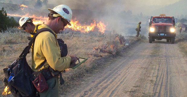
A San Juan interagency hotshot crew member refers to a map on his iPad as he coordinates execution of their burnout operation. (Photo credit: Esther Godson)
Every year thousands of acres of forests are engulfed in fires. Recognizing the benefits of geospatial technology, the United States Forest Service (USFS) Geospatial Management Office (GMO) is using Avenza System Inc.’s award-winning PDF Maps mobile app to deliver interactive digital maps to firefighters and emergency response teams situated in forests across the United States and its territories.
The USFS fights wildfires and other natural disasters in more than 155 national forests and 20 national grasslands, totaling an estimated 193 million acres or 30 percent of all federally managed lands. The USFS GMO is responsible for the implementation of the Forest Service geospatial program which includes using technologies such as GIS, remote sensing, cartography, geodesy and GPS.
The centered blue GPS position on an operations map pinpoints the user’s location. (Photo credit: Carl Beyerhelm)
With increased use of digital solutions, the USFS benefits from Avenza’s PDF Maps app geospatial technology in enabling its thousands of firefighters and support personnel. The PDF Maps app aids emergency response teams who use digital devices for work in the field.
The app provides constant access to geographic information and points of interest, with additional interactive features such as measuring, place marking and location tagging. The app operates without the risk of lost reception due to cell tower proximity and does not rely on an Internet connection to use map data. It uses GPS to obtain and display an accurate position on the ground regardless of network connectivity.
A hardcopy map is compared to its digital counterpart cached on a smartphone. (photo credit: Kari Greer)
“Accessing maps on mobile devices ensure responders have accurate and current geographic information while they’re out in the field,” said Carl Zulick, Geospatial Information Officer, USFS. “Avenza’s PDF Maps app makes it possible for teams to use any map digitally without requiring a data connection while involved in an emergency situation. Since the maps are location-aware and interactive, we can capture real-time data, photos, and locations. This data can be shared to assess the situation and make necessary strategic changes and improve situational awareness.”
The PDF Maps app is available now on the iTunes App Store and Google Play Store free of charge for personal recreational use. A Windows version is currently in public beta release. Commercial, government and academic use licensing is available for a nominal annual fee. Pricing of each map is set by the publisher and free maps remain free to users through the PDF Maps app in-app store. Commercial use licensing starts at US$49 per year and drops on a per-device basis as deployment numbers increase.
Mobile maps help air-tanker pilots avoid the mapped yellow areas, where application of aerial fire retardant is restricted. (Photo credit: Max Wahlberg)
A UAV project, POSEIDRON, took top honors in the 2015 European Satellite Navigation Competition, which recognizes the year’s best innovations in commercial applications of satellite technology. POSEIDRON won over the international jury of experts with its remote-controlled multicopter built to support maritime search-and-rescue services — and took home the grand prize ahead of the European Satellite Navigation Competition’s 29 other winners.
The award ceremony took place during the Satellite Masters Conference. The ceremony was held at the ddb forum in Berlin Oct. 20. The awards ceremony was held in conjunction with the Copernicus Masters awards for Earth observation.
Thorsten Rudolph, Ulrike Daniels (both Anwendungszentrum GmbH), David Argiles (ValSpace Consortium), Rudesindo Hernando Meliá, Maria Dolores Albiol Simo, Manuel Pedreira Gimenez, Jorge Esteve Ripollés and Enrique Martínez Asensi (all Sincratech Aeronautics) and Dorothee Bär (German Federal Ministry of Transport and Digital Infrastructure (BMVI)). (Photo: Anna Kreuz)
Enrique Martínez Asensi and his winning team hope to see Poseidron save lives far out at sea when people fall overboard or are involved in shipwrecks that occur during illegal immigration. Custom-developed by Sincratech Aeronautics — a start-up based in Valencia, Spain — POSEIDRON can be launched from ships or platforms under virtually any weather conditions. The multicopter uses thermal cameras and the European positioning service EGNOS to quickly locate people in the water and transmit an alarm to rescue teams along with precise information. Capable of carrying up to 70 kilogrammes, it can also transport a dinghy and deploy it as soon as casualties are found. This is what makes POSEIDRON both faster and more cost-effective than other rescue systems, which in turn significantly increases the chances of survival — particularly in cold waters.
In addition to winning the ESNC’s EUR 20,000 grand prize, the innovative project will now have the chance to enter a 12-month incubation programme at one of five Science Parks in Valencia as part of the region’s prize.
The ESNC set a new participation record this year, with 515 innovations entered by companies from more than 40 different countries around the world. The competition more than matched the successes of past editions in increasing its overall figures to 272 winners awarded and 3,343 ideas received from more than 10,000 participants throughout its 12 years in existence.
“Time synchronization and reliable positioning information are essential to today’s digital economy: Without corresponding satellite-based services, the development of these and other innovations — including the Internet of Things, machine-to-machine communication, and Industry 4.0 — would not be possible,” explained Thorsten Rudolph, CEO of ESNC initiator and organiser Anwendungszentrum GmbH Oberpfaffenhofen. “As the ideas submitted to this year’s ESNC have shown to impressive effect, it is these forward-thinking technologies in particular that present a great deal of potential waiting to be unleashed by high-tech start-ups.”
Under the patronage of the German Federal Ministry of Transport and Digital Infrastructure (BMVI), the ESNC presented prizes valued at approximately EUR 1 million in total at its festive Awards Ceremony.
The competition’s jury of 240 renowned experts selected both the overall victor and 30 other regional and special prize winners. With their innovations in areas such as connected mobility, smart cities, tourism and environmental protection, these entrants demonstrated how fundamental precise satellite navigation signals are to Europe’s digital society.
2015 Winners
Overall Winner
Loles Albiol Simó, Rudesindo Hernando Meliá, Jorge Esteve Ripollés, Manuel Pedreira Giménez, Enrique Martinez Asensi :: OVERALL WINNER – Valencian Community / Spain POSEIDRON: Remotely Piloted Aircraft System for Search and Rescue and Environmental Defence
Special Prize Winners
Rafael Olmedo, Juan Domingo, Laura Concepción :: GSA
KYNEO: The Open Navigation Platform for the GNSS of Things (Read more abut this prize here.)
Su Zhenzhong, Tonio Gsell, Alexander Wolf :: ESA
RTKNAV – A Low-Cost, Compact, User-Friendly, Centimetre-Accurate, Real-Time Navigation Solution
Dariusz Tanajewski, Grzegorz Grunwald :: DLR
Mobile Underwater Positioning System (MUPS)
Jukka Talvi, Joni Jämsä, Kalle Arola, Jukka-Pekka Alanissi, Antti Koponen :: BMVI/BMWi
HALI – Always Green Traffic Signals for Emergency Vehicles
Prof Dr Nick van de Giesen, Dr Eugenio Realini :: University Challenge
GNSS Monitoring of Precipitable Water Vapour over East Africa Using Low-Cost Receivers
Jasper Ettema, Sabine Ettema :: GNSS Living Lab
Position-Based Assistance in Case of Sudden Cardiac Arrest
Regional winners
Suresh Babu Mandalanka :: Asia
GeoKey – A Locking System That Uses Geographic Locations as Keys
Jasper Ettema, Sabine Ettema :: Austria
Position-Based Assistance in Case of Sudden Cardiac Arrest
Dr Walter Naumann :: Baden-Württemberg / Germany
ICARUS – A New Global Tracking Service for Small Objects
Ladislav Bartuška :: Czech Republic
Biological Protection of Airports Using Drones
Ronny Webers, Bart Lenaerts, Vincent Jorissen :: Flanders / Belgium
JobWalkr – The First Mobile App That Informs You About Job Opportunities in Your Neighbourhood
Daniel Neveux D’Agata, Laurent Kerbrat, Maïwenn Penhouët :: France
WIZAR – A new way to discover history and heritage
Alberto Gonzalez, Antonio Vazquez, Bibiano Fdz-Arruti, Aaron Nercellas, Diego Hurtado, Diego Nodar, Fernando Aguado, Franco Pérez :: Galicia / Spain
Point&Pin – Remote Localisation for Emergency Situations
Oscar Serradilla :: Gipuzkoa / Spain
Pothole Avoider
Sibylle Geiger, Jens Liebau, Nezar Mahmoud :: Hesse / Germany
Discover a Great Variety of Local Foods with the frimeo App
Aidan Flanagan, Colm Murphy :: Ireland
112GPS.com – More accurate emergency calls
Ronen Bitan, Tal Lavi :: Israel
Trailze – Complete Outdoors Experience
Dr Saulius Rudys, Mantautas Rudys :: Lithuania
Fully Camouflaged GNSS-GSM Anti-Theft System for Bicycles
Carlos Callejero Andrés, Julio Pantoja Dominguez, Ignacio Gómez Maqueda :: Madrid / Spain
VardiaN – Big Data Platform of Connected PPEs to Prevent Accidents in Hazardous Environments
Prof Dr Nick van de Giesen, Dr Eugenio Realini :: The Netherlands
GNSS Monitoring of Precipitable Water Vapour over East Africa Using Low-Cost Receivers
Thomas Jelle, Ingjard Sandhei, Åsmund Tokheim, Dag Jomar Mersland, Morten Tvenning, Iván Sánches Ortega, Robert Badnall :: Norway
MazeMap – High-quality, interactive, searchable, and linkable indoor maps
Jan Filipowiak, Radoslaw Jastrzebski, Maciej Glowacki :: Poland
Pastguide: Virtual Reality in Real Places
Florin Banica, Andreea Diana Banica :: Romania
Shared Ahead – A Truck-Sharing System
Su Zhenzhong, Tonio Gsell, Alexander Wolf :: Switzerland
RTKNAV – A Low-Cost, Compact, User-Friendly, Centimetre-Accurate, Real-Time Navigation Solution
Zoe Farrington, Andrew Richardson :: United Kingdom
REALRIDER®
Loles Albiol Simó, Rudesindo Hernando Meliá, Jorge Esteve Ripollés, Manuel Pedreira Giménez, Enrique Martinez Asensi :: Valencian Community / Spain
POSEIDRON: Remotely Piloted Aircraft System for Search and Rescue and Environmental Defence
Nicolas de Kerchove, Joel Mendez, Oscar Marí :: Wallonia / Belgium
A New Concept for a Location-based Mobile Game with an Innovative Monetisation Platform
STMicroelectronics is bringing next-generation satellite navigation to today’s drivers with the launch of enhanced, always-available, always-accurate 3D positioning on its TESEO III automotive-navigation integrated circuits (ICs).
The new TESEO DRAW firmware for ST’s multi-constellation positioning chips enables navigation devices to provide continuous, accurate location and turn-by-turn instructions even when satellite signals are poor or unavailable, such as in tunnels, covered car parks, or multi-level highways. TESEO DRAW also enhances performance in built-up areas, such as in urban canyons, where conventional navigation systems can lose accuracy.
TESEO DRAW merges the satellite information with data from vehicle sensors such as the gyroscope, accelerometer and wheel-speed sensors, to calculate location accurately in three dimensions including elevation. If the satellite signal is poor, TESEO DRAW compensates for the loss of accuracy, and if the signal becomes unavailable, navigation continues uninterrupted based on calculated location (dead reckoning). Road tests carried out by ST in difficult under-cover and urban environments have demonstrated continuous tracking from entry to exit in complex multi-level car parks, and at street level between tall buildings, where conventional systems have been unable to track the vehicle.
By enabling high-accuracy 3D dead reckoning, TESEO DRAW expands the opportunities for developers to commercialize new applications, the company said.
“TESEO DRAW strengthens GNSS performance and eliminates barriers to continuity, enabling exciting new services to emerge,” said Fabio Marchiò, Microcontroller and Infotainment Division general manager, Automotive Product Group, STMicroelectronics. “Users can also experience significant improvements in existing services such as fleet tracking, eCall, or ERA-GLONASS emergency response, usage-based insurance, road tolling, and anti-theft systems.”
TESEO DRAW firmware has multiple modes and is capable of referring to sensors on the vehicle’s CAN bus or discrete sensors such as the odometer, reverse sensor, MEMS accelerometer and gyroscope, or MEMS inertial module connected to the TESEO III IC.
ST is a supplier of MEMS motion sensors for automotive navigation, telematics and vehicle alarm systems, and is a provider of navigation engines with its TESEO IC family. With the launch of TESEO DRAW firmware, ST is able to provide a unified platform comprising navigation engines, 3D positioning capability and motion sensors.
TESEO III ICs loaded with the new TESEO DRAW firmware are sampling now, and will enter mass production in Q1 2016.
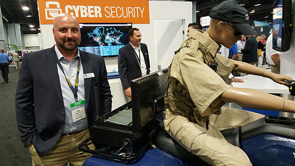
TCS’ Matt Vincent poses with public safety gear that includes Taoglas Storm Antenna at APCO.
It is refreshing to see nascent technology such as indoor location being used to enable accurate emergency services response. That’s what’s going on right now as beacons, Wi-Fi and other technology that works inside, where GPS doesn’t work, is being tested nationwide by companies hoping for government adoption. With new FCC regulations that are finally trying to keep up with commercial location products, it may be a reality soon. What really drove location into wireless handsets was the 1990s FCC regulations — will they now drive indoor positioning?
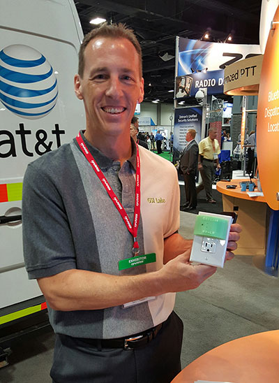
GSI Labs’ John Martin holds indoor beacon at APCO.
WASHINGTON — The same technology that allows consumers to find products indoors will allow emergency personnel to locate people in trouble in the coming years, said officials at the Association of Public-Safety Communications Officials (APCO) annual meeting here, held Aug. 16-19.
Companies are using existing commercial technologies, also used by retailers to determine customer preferences, to provide indoor location in combination with the National Emergency Address Database. This provides public-safety answering points, or PSAPs, accurate addresses and positions to dispatch emergency services to allow first responders to find people on specific floors and in rooms, not huge areas.
Beacons and Wi-Fi seem to be the lead technologies in use for emergency indoor location. Longmont, Colo.-based Intrado installed 65 Apple iBeacons at the Washington Convention Center to showcase its developing indoor positioning technology.
“Old 9-1-1 technology was just a dot on the map. Now people are saying, ‘how can Starbucks can find me, but 9-1-1 can’t?’” said John Snapp, Intrado senior technical officer.
Another company, TeleCommunication Systems, is getting into the indoor public safety market with its LocatE9-1-1 product that leverages the company’s indoor location engine, or ILE. The ILE connects to multiple databases that can be used during a 9-1-1 call to determine what location information is available for the wireless device.
“Deep inside buildings, location technology often fails us. Sometimes emergency workers have to rely on verbal information [from people at the scene],” said Tim Lorello, TCS senior vice president and chief marketing officer. “We are a location aggregator. However, we do know location won’t be deployed everywhere, but there are multiple technologies tied to Wi-Fi hotspots, barometric pressure and Bluetooth.”
In addition to government agencies, wireless carriers are taking notice of the indoor positioning capabilities for public safety. At APCO, GSI Labs, a 20-year-old business, was in the AT&T booth displaying its codeBlue-911 beacon system. “We think that for bigger venues such as warehouses and stores, this is a great public safety tool. The [Bluetooth Low Energy] beacons have about 20-to-50-foot accuracy, depending on the battery,” said GSI Labs’ John Martin. “A security company is looking at using the beacons to monitor employees during the night.”
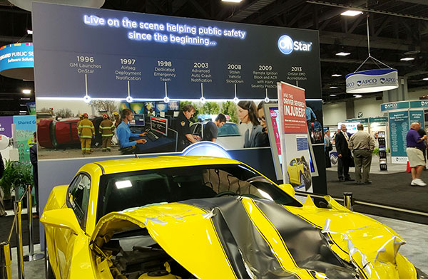
OnStar booth features wrecked car to portray emergency messaging capabilities at APCO.
FCC Still at Forefront of Location Accuracy Requirements
In an address at the conference, FCC Chairman Tom Wheeler said that the agency has taken steps to increase the reliability of the nation’s 9-1-1 system. “Uber can pinpoint [a potential customer]. We won’t tolerate 9-1-1 failures,” said Wheeler, who also called for a national maps database.
Some people newer to the location industry don’t remember it was the enhanced 9-1-1 FCC rules that drove the installation of GPS into cell phones in the mid-1990s. In several presentations at APCO, it was noted that more than 80 percent of all emergency calls are made with a wireless device, not landline.
The FCC announced new rules this year that require wireless operators to provide dispatchable location within 50 meters with these new deadlines and conditions: 40 percent of all wireless 9-1-1 calls within 2 years; 50 percent within 3 years; 70 percent within 5 years; and 80 percent within 6 years.
If anyone doesn’t think the FCC is the 800-pound regulatory gorilla for location, then they have missed the LightSquared GPS signal interference saga. According to published reports, LightSquared has hired Reed Hundt, former FCC chairman, as an attorney representing the company.
LightSquared, which is trying to emerge from bankruptcy, has been seeking FCC approval to transfer its spectrum licenses to its new entity. The company is trying to see if the GPS interference issues can be resolved.
In other APCO news, Time Machines rolled out its TM 2000A timing device that costs $499.95. The big deal about the timing device is the price — which has many of the same features that competitors offer for more than $5,000, said Doug Ehlers, Mindshare by CSS president, a sister company of Time Machines, who also said the company is expanding its distribution in Europe.
Gimbal Partners with Do It Outdoors Media
While emergency networks are getting big, the commercial networks are continuing to make inroads with advertising agencies and partners. Location and proximity-based marketing company Gimbal recently partnered with Do It Outdoors Media in a deal that will use Gimbal’s beacon technology.
Gimbal said that Do It Outdoors Media, which is the largest national mobile billboard and field marketing company, will create a smartphone campaign that provides proximity-based consumer offers to opt-in users.
Beacons will be placed in Do It Outdoors Media’s mobile billboard units, which are owned and operated by the company. In addition, there will be product placement on Segways, jet packs, brand ambassador teams and other marketing sites.
Gimbal says that when a consumer enters into a beacon zone, which is effective from 50 meters away, content will be delivered through a push notification within an advertiser’s or a third-party mobile app.
In other location news:
While a small trade show for a focused group of government communication professionals, APCO drew 5,700 attendees, with 282 exhibitors. Conference organizers said it was the highest attended show in seven years.
An updated version of the former GPS-Wireless conference will take place Dec. 2-3 at the Crowne Plaza San Francisco Airport Hotel. The conference, Location IoT, will focus on new markets for M2M and the Internet of Things. Topics will include indoor location markets, connected vehicles and many others. Two hosted networking receptions are included. Contact me, Kevin Dennehy, at kdennehy @g psworld.com for more information.
The Canadian government will begin providing search-and-rescue repeaters for the U.S. Air Force’s GPS III satellites, reports Space News. The repeaters provided by Canada’s Medium Earth Orbit Search and Rescue (MEOSAR) satellite project will significantly reduce the time it takes to locate a distress signal.
Canada’s Department of National Defence will begin negotiations with the U.S. Air Force to install 24 repeaters on GPS III satellites, starting with the 11th GPS III satellite. Canada’s MEOSAR satellite project includes construction of three ground stations, to be built by 2020.
The MEOSAR satellite payload is being developed for GPS III satellites.
The Canadian government first announced the MEOSAR project in 2013, awarding Com Dev International of Cambridge, Ontario, an initial contract worth 4.7 million Canadian dollars for research and design work on the repeaters. Despite completion of that phase, Canada’s Department of National Defence put the project on hold, possibly for budgetary reasons.
A contract award for the MEOSAR repeaters is now expected to be announced next year.
A MEOSAR repeater will be able to detect signals from emergency beacons and retransmit the signals to receiver stations on the ground. The emergency messages can then be sent to appropriate authorities so that people in danger can be quickly located and rescued.
MEOSAR will provide a more capable system than COSPAS-SARSAT, an international satellite-based search and rescue distress alert detection system established by Canada, France, the former Soviet Union and the United States in 1979. It is credited with saving more than 33,000 lives since its inception. MEOSAR will reduce the time it takes to detect and locate a distress signal from an hour to around five minutes.
Com Dev began the development of its MEOSAR technology in 2008 under a cost-shared research and development project with the Canadian Space Agency. Canada’s National Search and Rescue Secretariat also later provided additional R&D support.
The search and rescue transponders were originally destined for Galileo, according to Space News, but stalled because Canada lacked a defense certificate to be able to supply the Galileo program.