Tag: ESA

  • Galileo 9 and 10 now broadcasting navigation messages

    News from the European Space Agency

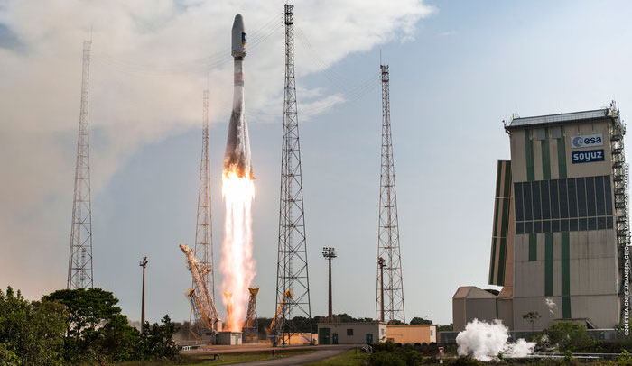
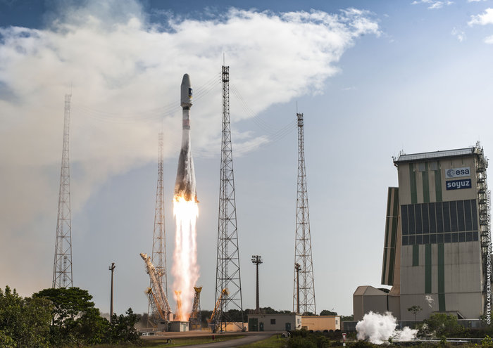
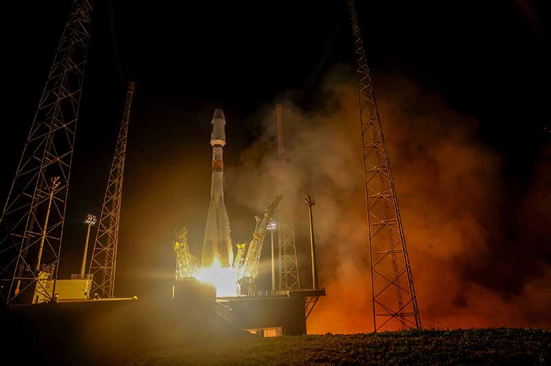
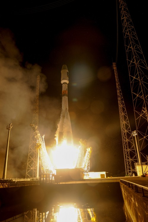
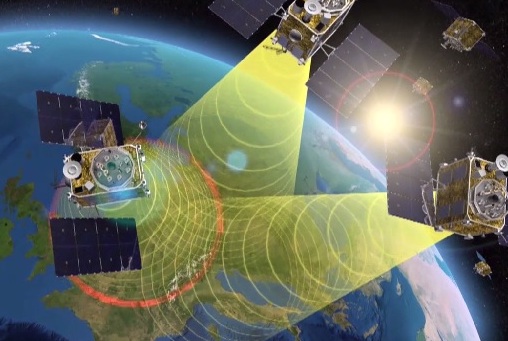
    Europe’s ninth and tenth Galileo satellites have started broadcasting working navigation messages. The two satellites were launched together on Sept. 11, 2015.

    Once safely in orbit and their systems activated, their navigation payloads and search and rescue transponders were subjected to a rigorous process of in-orbit testing, to ensure their performance reached the necessary specifications to become part of the Galileo system.

    Radio-frequency measurements of the Galileo signals were made from ESA’s Redu centre in Belgium. The site boasts a 20 m-diameter dish to analyze their signal shape in high resolution.

    Along with assessing that the satellites themselves were functioning as planned, the test campaign also confirmed they could mesh properly with the worldwide Galileo ground network.

    The testing was coordinated from the Galileo Control Centres in Oberpfaffenhofen in Germany – performing the command and control of the satellites — and Fucino in Italy — overseeing the provision of navigation messages to users.

    Source: GPS world staff
    An artist’s depiction of four Galileo satellites sending navigation signals. (ESA)

    “This is the first recurrent launch of Galileo Full Operational Capability satellites from an in-orbit test point of view,” comments Christian Lezy, supervising the measurement campaign in Redu.

    “All tests were conducted in a seamless manner in parallel with the ongoing routine operations of the rest of the fleet.”

    The operations team, successfully led by SpaceOpal GmbH, completed the testing campaign few days ahead of schedule, with the satellites beginning to broadcast valid navigation signals on Jan. 29.

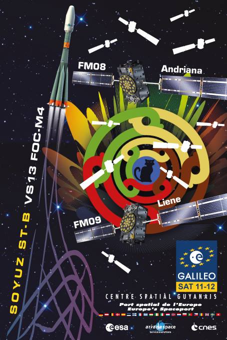
    The following two Galileos — satellites 11 and 12, launched on Dec. 17, 2015 — are undergoing their own in-orbit test campaign. Once their initial Launch and Early Operations Phase was completed at the Toulouse facility of France’s CNES space agency, both spacecraft were handed over to the Oberpfaffenhofen centre during the Christmas period.

    Platform commissioning and drift stop and fine positioning maneuvers have also been completed, placing both satellites into their final working orbits, while their payload activation is proceeding according to schedule.

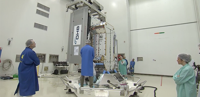
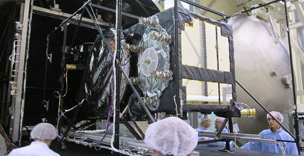
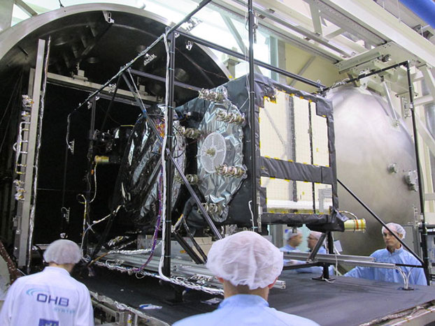
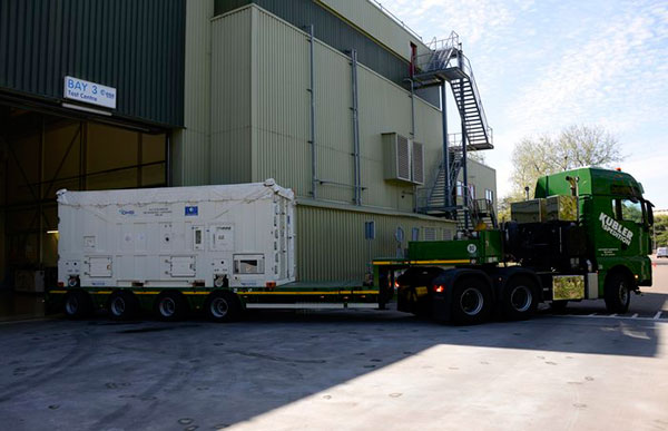
    Galileo satellites 13 and 14 have completed all pre-flight testing at ESA’s ESTEC test centre in Noordwijk, the Netherlands, and have been put into storage ahead of their launch. Production of the remaining 12 satellites is continuing around the clock at OHB’s facility in Bremen, Germany.

    The complete Galileo constellation will be made up of 24 satellites across three orbital planes, with two ‘active spare’ satellites per orbital plane, ready to plug any gap in service should an operational Galileo malfunction.

    At the moment the satellites are transmitting navigation signals for technical validation purposes, being employed by Galileo engineers as well as the rest of the satnav industry to prepare Galileo-compatible products and services.

    The current status of the overall Galileo constellation can be checked at the European Commission’s European GNSS Service Centre website.

  • Septentrio reference station receivers now shipping to UNAVCO

    Septentrio reference station receivers now shipping to UNAVCO

    Septentrio has started shipments to UNAVCO of its all new multi-frequency PolaRx5 reference receiver. This follows the 2015 announcement by UNAVCO that Septentrio was selected at the Geodesy Advancing Geosciences EarthScope (GAGE) Facility preferred vendor for next-generation GNSS reference station products.

    The Septentrio PolaRx5 GNSS receiver.
    The Septentrio PolaRx5 GNSS receiver.

    The PolaRx5 incorporates Septentrio’s most advanced multi-frequency GNSS engine, with support for all major satellite signals including GPS, GLONASS, Galileo and BeiDou, as well as the regional QZSS and IRNSS satellite systems.

    According to the UNAVCO GNSS Receiver Preferred Vendor RFP Evaluation Report, Septentrio consistently ranks highest in many areas of measurement quality and interference mitigation of the instruments tested. Moreover, the PolaRx5 offers low power consumption for its multi-constellation, multi-frequency GNSS reference receiver, operating on less than 2 Watts when receiving GPS and GLONASS satellite signals.

    “At UNAVCO, we are excited about the selection of the PolaRx5 for enhancement of the EarthScope Plate Boundary Observatory, the international standard for geodetic networks,” said M. Meghan Miller, president of UNAVCO. “We will work with Septentrio to modernize UNAVCO GPS networks, and explore the science innovation and broader applications that are possible in the rapidly evolving GNSS era.”

    UNAVCO is a non-profit university-governed consortium that facilitates geosciences research and education using geodesy. UNAVCO operates the GAGE Facility for the National Science Foundation with additional core support from NASA. The GAGE Facility includes more than 2,000 continuously operating GPS/GNSS reference stations around the world.

    UNAVCO-supported networks include EarthScope’s Plate Boundary Observatory (PBO), the Continuously Operating Caribbean GPS Observational Network (COCONet), the Trans-Boundary Land and Atmosphere Long-Term Observational and Collaboration Network (TLALOCNet) and the Polar Earth Observational Network (POLENet).

    Septentrio’s close cooperation with UNAVCO continues a tradition of partnering with leading scientific institutions and agencies that require high-performance GNSS technology in challenging environments. Septentrio partners include the European Space Agency (ESA) and the European GNSS Agency (GSA).

    “These deliveries mark a huge step in the modernization program for UNAVCO and UNAVCO partner networks around the globe,” said Neil Vancans, vice president of Septentrio Americas. “The use of new satellite technology will be the foundation for greater understanding of our planet. The entire Septentrio team is proud to be a part of this pivotal program.”

  • Galileo constellation now 12 after Thursday’s launch

    Galileo constellation now 12 after Thursday’s launch

    News from the European Space Agency

    The pace of deploying Europe’s own satellite navigation system continued to increase with today’s launch of the latest pair of Galileo satellites, doubling the number of satellites in space within nine months.

    Galileo 11 and 12 lifted off together at 11:51 GMT (12:51 CET, 08:51 local time) atop a Soyuz rocket from French Guiana.

    This sixth Galileo launch was a textbook operation: all Soyuz stages performed as planned, culminating in the Fregat upper stage deploying the twin satellites into orbit close to 23,500 km altitude, around 3 hours and 48 minutes after liftoff.

    Liftoff of Galileo satellites 11 and 12 aboard Soyuz VS13 took place at 11:51 GMT on Dec. 17, 2015.
    Liftoff of Galileo satellites 11 and 12 aboard Soyuz VS13 took place at 11:51 GMT on Dec. 17, 2015. (Photo: ESA)

    “With today’s launch, Europe has doubled the number of its Galileo satellites in orbit in just nine months,” commented Jan Woerner, director general of ESA.

    “Along with the ground stations put in place around the globe, this brings Galileo’s completion within reach. Initial Galileo services are scheduled to begin within next year, which proves the importance of this wise investment.”

    “The excellent performance of these satellites, as measured on the ground, allows Europe to join the club of the worldwide providers of satellite navigation services,” noted Didier Faivre, ESA’s Director of Galileo and Navigation-related Activities.

    “Production, testing and launch of the remaining satellites are now proceeding on a steady basis according to plan.

    The Fregat upper stage flew the latest two Galileo satellites most of the way up to medium-Earth orbit before they finally separated. (Artist's concept, courtesy of ESA).
    The Fregat upper stage flew the latest two Galileo satellites most of the way up to medium-Earth orbit before they finally separated. (Artist’s concept, courtesy of ESA).

    “Then, after the summer break in 2016, the tempo of deployment will increase further with the first of three customised Ariane 5 launchers that will carry four rather than two satellites into orbit each time.”

    This month will see the 10th anniversary of the launch of Europe’s very first navigation satellite: GIOVE-A, on Dece. 28, 2005. It secured the frequencies set aside for Galileo, gathered data on the medium-altitude orbit environment and flight-tested hardware for the working system.

    Watch the launch here:

    ESA declares success.
    Arianespace declares success.
  • Galileo satellites 11 and 12 integrated for Arianespace’s year-end mission

    Galileo satellites 11 and 12 integrated for Arianespace’s year-end mission

    Galileo-launch-11-12
    Launch poster for the upcoming launch of Adriana and Liene, also known as Galileo 11 and 12.

    The two spacecraft for Arianespace’s latest Soyuz launch at the service of Europe’s Galileo satellite-based navigation system — and the company’s record 12th mission overall in 2015 — have been integrated at the French Guiana Spaceport in preparation for their Dec. 17 liftoff.

    The launch of Galileo satellites 11 and 12 — dubbed Adriana and Liene — will conclude a year when the number of Galileo satellites in orbit will have doubled.

    With this launch, ten years after the launch of GIOVE A, on Dec. 28, 2005, the Galileo constellation will become a reality.

    During activity in the Spaceport’s S3B clean-room facility, the spacecraft pair was mated with their dispenser, which will deploy the satellites by firing a pyrotechnic system for separation in opposite directions at the orbital insertion point.

    The satellite/dispenser combination is ready for integration on Soyuz launcher’s Fregat upper stage, followed by the payload fairing encapsulation. This will create the “upper composite,” which is to be installed atop Soyuz once the vehicle has been moved to its Spaceport launch site.

    Arianespace’s Dec. 17 mission, designated Flight VS13 in the company’s launcher family numbering system, will orbit two Galileo FOC (Full Operational Capability) satellites, further augmenting the European constellation of navigation spacecraft.  The satellites are built by prime contractor OHB System in Bremen, Germany, with their onboard payloads supplied by UK-based Surrey Satellite Technology Ltd (SSTL), which is 99 percent owned by Airbus Defence & Space.

    Galileo-11-12-cleanroom
    Galileo 11 and 12 are prepared for launch in the clean room. (Video capture: ESA)

    The Galileo system is designed to provide high-quality positioning, navigation and timing services under civilian control. Its Full Operational Capability phase is managed and funded by the European Commission, with the European Space Agency (ESA) delegated as the design and procurement agent on the Commission’s behalf.

    Flight VS13 will close out a busy year — complementing the 11 previous missions in 2015, which were composed of two other launches with the medium-lift Soyuz, three using the light-lift Vega and six with the heavy-lift Ariane 5.

    Below is an ESA video about the upcoming launch.

    Follow Arianespace’s launch activity at www.arianespace.com.

  • Verhoef named Galileo director by ESA Council

    Verhoef named Galileo director by ESA Council

    Paul Verhoef
    Paul Verhoef

    The European Space Agency (ESA) has named Paul Verhoef its new Director of Galileo Programme and Navigation-Related Activities. Verhoef, former coordinator for Galileo activities with the European Commission, was named as one member of a new senior leadership team after a special meeting of the ESA Council in Paris on Nov. 21.

    At the weekend meeting, the agency selected several new managers for key positions. The new leadership team is expected to start work in early 2016.

    Space Applications

    • Director of Telecommunications and Integrated Applications (D/TIA), Magali Vaissiere
    • Director of Galileo Programme and Navigation-Related Activities (D/NAV), Paul Verhoef

    Science and Exploration

    • Director of Science (D/SCI), Alvaro Giménez Cañete
    • Director of Human Spaceflight and Robotic Exploration Programmes (D/HRE), David Parker

    Space Technology and Operations

    • Director of Technical and Quality Management (D/TEC), Franco Ongaro
    • Director of Operations (D/OPS), Rolf Densing

    Administration

    • Director of Internal Services: Human Resources, Facility Management, Finance and Controlling, Information Technology (D/HIF), Jean Max Puech
    • Director of Industry, Procurement and Legal Services (D/IPL), Eric Morel de Westgaver
  • Ten Galileo satellites now in orbit

    Ten Galileo satellites now in orbit

    Galileo 9 and 10 lift off. (Photo: ESA)
    Galileo 9 and 10 lift off. (Photo: ESA)

    News from the European Space Agency

    Europe’s own satellite navigation system has come a step nearer to completion today with Galileo 9 and 10, which lifted off together at 02:08 GMT on Sept. 11 from Europe’s Spaceport in French Guiana atop a Soyuz launcher.

    All the Soyuz stages performed as planned, with the Fregat upper stage releasing the satellites into their target orbit close to 23 500 km altitude, around 3 hours and 48 minutes after liftoff.

    “The deployment of Europe’s Galileo system is rapidly gathering pace,” said Jan Woerner, director general of the European Space Agency (ESA). “By steadily boosting the number of satellites in space, together with new stations on the ground across the world, Galileo will soon have a global reach. The day of Galileo’s full operational capability is approaching. It will be a great day for Europe.”

    Two more Galileo satellites are scheduled for launch by end of this year. These satellites have completed testing at ESA’s ESTEC technical centre in Noordwijk, the Netherlands, with the next two satellites also undergoing their own test campaigns.

    Galileo 9 and 10 lift off. (Photo: ESA)
    Galileo 9 and 10 lift off. (Photo: ESA)

    More Galileo satellites are being manufactured by OHB in Bremen, Germany, with navigation payloads coming from Surrey Satellite Technology Ltd in the UK, in turn utilizing elements sourced from all across Europe.

    “Production of the satellites has attained a regular rhythm,” said Didier Faivre, ESA’s Director of Galileo and Navigation-related Activities. “At the same time, all Galileo testing performed up to now — including that of the ground segment — has been returning extremely positive results.

    “And while the continuing deployment of Galileo remains our priority, along with exploitation of EGNOS — Europe’s already operational satellite navigation augmentation system — ESA is also looking farther ahead.

    “With the European Commission, we are doing the technical work to ensure Galileo goes on forever — locking in continuity of Europe’s navigation services into the long term, to meet performance on a par with the other global satellite navigation systems.”

    Next year the deployment of the Galileo system will be boosted by the entry into operation of a specially customized Ariane 5 launcher that can double, from two to four, the number of satellites that can be inserted into orbit with a single launch.

    Watch a replay of the launch below.

    Watch additional videos here.

  • Four Galileo Satellites Now at ESTEC

    Four Galileo Satellites Now at ESTEC

    chamber. Weeks of testing simulated the airlessness and temperature extremes of orbital space, taking place at the ESTEC Test Centre in Noordwijk, the Netherlands during May 2015. (Photo: ESA)
    Weeks of testing simulated the airlessness and temperature extremes of orbital space, taking place at the ESTEC Test Centre in Noordwijk, the Netherlands during May 2015. (Photo: ESA)

    News by the European Space Agency

    Europe’s latest Galileo was unboxed at ESA’s technical centre in the Netherlands in May, bringing the total number of satellites at the site to four.

    ESTEC in Noordwijk is the largest satellite test facility in Europe, with all the equipment needed to simulate every aspect of the launch and space environment under a single roof. It is an essential stop on the way to space for Europe’s Galileo satellites, built by OHB in Bremen, Germany, with navigation payloads from Surrey Satellite Technology Ltd. in Guildford, UK.

    The 12th Galileo arrived by lorry from Bremen on May 13, in a custom-built environmentally controlled container. The satellite will begin with a thermal vacuum test in a 4.5-meter-diameter stainless steel chamber, subjected to about five weeks of hard vacuum and the temperature extremes of space.

    Galileo-11 recently completed the same trial before moving on to final system testing, including a compatibility run with the ground network.

    Meanwhile, the ninth and tenth satellites are in storage at ESTEC, having passed their own checks. They will be flown to Europe’s Spaceport in French Guiana in late July for launch by Soyuz in September, which will bring the total in orbit into double figures.

    The 12th Galileo satellite, FOC FM-08, arrived at the ESTEC Test Centre on May 13. It was transported by lorry from Bremen in a protective air-conditioned container.
    The 12th Galileo satellite, FOC FM-08, arrived at the ESTEC Test Centre on May 13. It was transported by lorry from Bremen in a protective air-conditioned container.

    The first four Galileos, launched in 2011 and 2012, were in-orbit validation satellites, built by prime contractor Airbus Defence & Space. They confirmed that the overall system worked as planned, while also serving as the foundation of the full constellation to follow.

    The follow-up Full Operational Capability satellites are now being launched regularly to increase the size of the constellation to the point where early Galileo services can begin next year.

    European Partners. Galileo is a collaboration between ESA and the European Commission (EC). The validation phase was co-funded by ESA and the EC, while the full operational phase is funded by the EC. Under a delegation agreement, ESA acts as design and procurement agent on behalf of the commission.

  • Airbus Defence and Space Joins ESA BIC Bavaria as New Partner

    Photo: Airbus GroupESA BIC Bavaria, part of the European Space Agency’s Business Incubation Centre (BIC) program, is poised to expand its presence in the aerospace hotbed Bavaria with the opening of another branch office in Ottobrunn near Munich. The Bavarian state government — itself a longstanding ESA BIC partner and supporter — also hailed the program’s new partnership with Airbus Defence and Space at the Ludwig Bölkow Campus in Ottobrunn.

    “The new ESA BIC Bavaria branch location in Ottobrunn will enable us to drive the creation of new start-ups based on the research endeavours pursued on-campus,” explained Ilse Aigner, Bavaria’s State Minister of Economics. “Smaller companies in particular have the ability to provide fresh, innovative ideas to Bavaria’s aerospace industry. Much of this sector’s supplier landscape also focuses on the midmarket, which makes these firms’ contributions all the more important.”

    Airbus Defence and Space and the ESA BIC program expect their combined efforts to achieve another surge in the commercial use of space infrastructures and technologies.

    “The aerospace hub of Ottobrunn and its newly constructed Ludwig Bölkow Campus offer an ideal setting for new companies to grow in collaboration with research and development. This new location promises to integrate Ottobrunn into the ESA BIC Bavaria’s outstanding partner program,” said Thomas Müller, member of the Executive Committee of Airbus Defence and Space and responsible for the Airbus site in Ottobrunn.

    “The Ludwig Bölkow Campus is proud to figure amongst ESA’s Business Incubation Centres from now on,” added Alexander Mager, managing director of the Ludwig Bölkow Campus GmbH.

    The ESA BIC program now offers start-up entrepreneurs extensive financial and technical support at 20 locations in eight countries: Belgium, France, Germany, Italy, the Netherlands, Portugal, Spain, and the UK.

    “ESA’s incubation program has already helped to found 300 companies and is now supporting 100 new start-ups every year, making it the fastest-growing initiative of its kind in the space industry,” said ESA Director General Jean-Jacques Dordain, “and I am glad that the first one created was here in Bavaria with the strong support of the government and of the DLR.”

    Anwendungszentrum GmbH Oberpfaffenhofen (AZO), which manages the ESA BIC Bavaria, has been responsible for 98 of these new foundations and the creation of more than 1,200 new jobs, which — along with its impressive network of partners — gives it a place of prominence among ESA’s incubation centers in Europe. Bavaria’s ESA BIC program works closely with the German Aerospace Center (DLR) and the Fraunhofer-Gesellschaft, Germany’s two largest research institutions. Further support is provided by the Wirtschaftsförderung Berchtesgadener Land (a local business-promotion association) and Bavaria’s two most financially sound savings banks, Sparkasse Nürnberg and Kreissparkasse München-Starnberg-Ebersberg.

    Start-ups founded through the ESA BIC program benefit from a broad portfolio of space technologies and IP protection services, as well as from their cooperation with the various partners involved, according to ESA BIC Bavaria. “Europe’s space programs in satellite navigation (Galileo), Earth observation (Copernicus), and satellite communications also offer fantastic opportunities to established companies — and especially to those just getting their feet on the ground,” ESA BIC Bavaria said in a statement.

    “Airbus Defence and Space is the first industrial aerospace company to join our incubation program,” said Thorsten Rudolph, CEO of AZO. “With its help, we’ll now be able to offer our incubatees and new companies an even wider range of support, from financing and R&D all the way to market launch.”

  • ESA Aims to Map Sea Surfaces with GNSS Radio Occultation

    ESA Aims to Map Sea Surfaces with GNSS Radio Occultation

    The International Space Station. (Photo: ESA)
    The International Space Station. (Photo: ESA)

    Feature from the European Space Agency

    A new concept that involves mounting an instrument on the International Space Station and taking advantage of signals from navigation satellites could provide measurements of sea-surface height and information about features related to ocean currents, benefiting science and ocean forecasting.

    We have all seen the beautiful photographs of our planet taken by astronauts, but orbiting Earth 16 times a day just 400 km above, the Space Station also offers a platform from which to measure certain variables related to climate change.

    So, in 2011 the European Space Agency (ESA) called for proposals to explore how the Space Station could be used to make scientifically valid observations of Earth. After reviewing and assessing numerous proposals, the result is to further develop the GEROS-ISS mission concept.

    Jason Hatton, GEROS-ISS project coordinator, said, “The concept is still going through feasibility studies, but the aim is to launch the experiment towards the end of 2019. It would be carried to the Space Station on a cargo vehicle and installed on ESA’s Columbus space laboratory using a robotic arm, after which GEROS-ISS would run for at least a year.”

    GEROS-ISS stands for GNSS reflectometry, radio occultation and scatterometry on board the ISS. GPS and Galileo satellites send a continual stream of microwave signals to Earth for navigation purposes, but these signals also bounce off the surface and back into space.

    The idea is to install an instrument with an antenna on the Space Station that would capture signals directly from these satellites as well as signals that are reflected or scattered from Earth. This process could be used to calculate the height of the sea surface, and to measure waves — or “roughness” — that can then be used to work out the speed of surface winds.

    Sea-surface_height_cm-W
    Variations in sea-surface height (cm) obtained by merging multiple altimeter measurements. GEROS-ISS would be able to observe this variability so that maps covering latitudes 51° N to 51° S can be produced every four days. (Photo: ESA)

    GEROS-ISS is primarily an experiment to demonstrate new ways of observing Earth. However, if taken beyond the testing phase this new approach would complement measurements from satellites carrying altimeters such as CryoSat and Sentinel-3, and satellites carrying wind scatterometers such as MetOp.

    Importantly, it is the first concept to assess the potential of spaceborne GNSS reflectometry to determine and map ocean height at scales of 10–100 km or longer in less than four days. Current satellite altimeters, in comparison, offer global maps at scales of around 80 km, which are produced from multiple datasets every 10 days.

    A system based on GEROS-ISS would, therefore, complement existing satellite systems, helping to map ocean variability at finer spatial and temporal scales over a range of seas in tropical and temperate regions. It would also refine our understanding of how well the concept would work for measuring the roughness of the ocean surface.

    In this respect, the development of GEROS-ISS benefits from experience gained with the UK’s TechDemoSat-1, which also measures ocean-surface roughness using a similar technique. It is also hoped that NASA’s upcoming CYGNSS constellation of mini satellites will help pave the way for GEROS-ISS.

    In addition, GEROS-ISS uses a technique called radio occultation whereby the antenna receives signals that are refracted as they pass through the atmosphere. This can be used to generate vertical profiles of atmospheric humidity, pressure and temperature, as does the GRAS instrument on the MetOp satellites, for example.

    Europe’s Columbus space laboratory, photographed by ESA astronaut Luca Parmitano during his spacewalk on July 9, 2013.
    GEROS-ISS will be installed on the upper balcony of ESA’s Columbus space laboratory, which provides mechanical interface plates as well as power, command and data links to the ISS systems. (Photo: ESA, taken by ESA astronaut Luca Parmitano during his spacewalk on July 9, 2013. )

    “It is very flexible, combining different mission concepts and applications in one: GNSS-reflectometry to determine sea-surface height, scatterometry to measure sea-surface roughness and radio occultation for atmospheric studies,” said Jens Wickert who leads the science team that proposed GEROS-ISS.

    ESA engineer Manuel Martin-Neira noted, “The original concept actually goes back over 20 years and has matured considerably through numerous studies and campaigns, however, it has never been duly tested from space.”

    “Being able to use the International Space Station in this way means that we can quickly validate innovative observing techniques without having to build an entire satellite, and we expect this to lead to new opportunities for science,” added Michael Kern, ESA’s GEROS-ISS mission scientist.

    The GEROS-ISS feasibility studies are being carried out through ESA’s General Studies Programme.


    Editor’s Note: GPS World discussed the use of GPS for radio occultation in its March 1994 Innovation column, “Monitoring the Earth’s Atmosphere with GPS,” by Rob Kursinski.

  • Satnav Augmentation Systems Settle on Common Channels Post-2020

    Satnav Augmentation Systems Settle on Common Channels Post-2020

    EGNOS is Europe’s first venture into satellite navigation. EGNOS broadcasts augmented information through a trio of geostationary satellites linked to a network of monitoring ground stations, to sharpen the accuracy and reliability of GPS signals across the continent.
    EGNOS is Europe’s first venture into satellite navigation. EGNOS broadcasts augmented information through a trio of geostationary satellites linked to a network of monitoring ground stations, to sharpen the accuracy and reliability of GPS signals across the continent. (artist’s concept: ESA)

    News from the European Space Agency

    The next decade’s aircraft pilots will be able to rely on enhanced, reliable satellite navigation signals on a seamless basis across much of the world, thanks to decisions made at the latest gathering of worldwide satnav augmentation system providers and experts.

    The U.S. Wide Area Augmentation System (WAAS) and European Geostationary Navigation Overlay Service (EGNOS) are leading examples of satellite-based augmentation systems (SBAS) that apply additional ground stations and satellite transponders to sharpen the accuracy and reliability of existing satnav services across given geographical regions.

    These performance enhancements permit satnav to be employed for safety-of-life services, especially aviation. Such systems are based on the U.S. GPS for now, but plans are being laid to move to a multi-constellation design employing Europe’s Galileo, China’s Beidou and Russia’s GLONASS satnav systems beyond 2020.

    The 28th Satellite-based Augmentation Systems Interoperability Working Group (IWG), planning standardization of SBAS systems to come, was hosted at ESA’s ESTEC technical centre at Noordwijk, the Netherlands, on April 1-3.

    The ESTEC facility in Noordwijk, The Netherlands.
    The ESTEC facility in Noordwijk, The Netherlands. (Photo: ESA)

    All participants unanimously endorsed the “message definition” for a new secondary SBAS channel — to be known as L5, along with the current L1 — for the planned second-generation SBAS systems, which will utilize dual-frequency multi-constellation signals.

    Using dual frequencies greatly increases the accuracy of navigation systems, by allowing interference from the ionosphere — an electrically active outer layer of Earth’s atmosphere — to be largely subtracted from the final result.

    “This definition is presented in what is called the Dual Frequency Multi-Constellation Definition document,” explained Didier Flament, representing ESA. “It represents the outcome of a four-year activity, which started at IWG 19 in Japan, back in 2010, coordinated between all IWG members under the technical leadership of ESA and French space agency CNES on the European side, and the Federal Aviation Authority (FAA) and Stanford University on the U.S. side.

    “The formal IWG review loop for the document took six months to conclude, with this IWG 28 then allowing endorsements to be gathered by SBAS project managers, culminating in formal signatures to the document,” Flament said.

    Planned_SBAS_coverage_for_2020-W
    SBAS coverage for 2020: Comparing current worldwide SBAS coverage — based on WAAS, EGNOS and MSAS — to the situation envisaged for 2020–25: near-global coverage based on WAAS, EGNOS, MAAS, SDCM and GAGAN, with an expanded network of stations in the southern hemisphere, all based on a common dual-frequency/dual satnav standard being finalized by the SBAS Interoperability Working Group. (Image: ESA)

    IWG members now intend to have this document accepted by the official international SBAS standardization bodies: the International Civil Aviation Organisation, the U.S. Radio Technical Commission for Aeronautics (RTCA) and the European Organisation for Civil Aviation Equipment.

    “This next step is very important,” added Didier. “Not only for the coming 2016-22 implementation of the European EGNOS v3 but for implementation of other second generation SBAS in other regions of the world.”

    The meeting also reported on the state of development of the other global SBAS systems. Along with the four operational systems — the U.S. WAAS, European EGNOS, Japan’s Multi-functional Satellite Augmentation System (MSAS) and India’s GPS-aided geo-augmented navigation or GPS and geo-augmented navigation system (GAGAN) — these comprise South Korea’s KASS, China’s Beidou SBAS, Russia’s System for Differential Corrections and Monitoring (SDCM) and the West African Agency for Aerial Navigation Safety in Africa and Madagascar (ASECNA) SBAS.

    The follow-up IWG meeting will take place in October, hosted by the FAA in Washington, D.C., in conjunction with the next RTCA meeting.

  • GNSS Students Sought for ESA Summer School

    Students still have time to join the ESA International Summer School on Global Navigation Satellite Systems, which will take place in Barcelona, Spain, at the end of August.

    The 10-day course — lasting from the afternoon of Aug. 31 to the morning of Sept. 10 — will cover all aspects of satellite navigation, up to and including the creation of a satnav-based business.

    Hosted by the University of Barcelona at the four-star Hotel Alimara, the Summer School is open to graduate students, PhDs and postdoctoral researchers, as well as young engineers and academics working within industry or agencies, aged 35 or younger.

    Internationally renowned scientists and specialists will be giving lectures as well as overseeing practical exercises and lab work. Participants will receive a full-spectrum overview of satellite navigation, starting from the theoretical basis of the Global Navigation Satellite System (GNSS), its signals, the processing performed by signal receivers and how the position-navigation-time solution is worked out.

    Discussion will also be made of threats to satnav systems, such as spoofing or jamming, and the countermeasures available against them, along with back-up navigation solutions for a GNSS-denied environment.

    Practical exercises will include receiving the various satnav constellations now in orbit — including Europe’s eight-satellite Galileo, the foundation of the full system soon to come — to give course members direct, hands-on experience.

    In addition, lectures will cover business aspects, including patents and intellectual property rights.

    The main emphasis of the course will be the development of a group business project, building on an innovative idea to take in the planning of the product or service, its technical realization and finally its marketing to customers.

    Register before the end of May to benefit from an early registration discount. The number of participants is limited to 50, on a first-come, first-served basis.

    The ESA International Summer School is taking place in conjunction with the GNSS Summer School of the Joint Research Centre of the European Commission, and is organized by Universitat Politecnica de Catalunya (UPC) in cooperation with Stanford University in the US, the Institut Supérieur de l’Aeronautique et de l’Espace in France, Graz University of Technology in Austria and University FAF Munich in Germany.


  • Copernicus Masters Competition Submissions Due by July 13

    The Coperinicus Masters Cup Photo: Anwendungszentrum GmbH
    The Coperinicus Masters Cup
    Photo: Anwendungszentrum GmbH

    Copernicus Masters submissions of ideas, applications or business concepts involving innovative uses of Earth observation data are due by July 13. Along with cash prizes, the winners will gain access to an international network, corresponding data, start-up funding and other support valued at more than €300,000 ($322,444) total.

    The amount of data produced by Copernicus, the European Earth observation program, and its Sentinel satellites opens the door to products and applications in a wide array of business sectors. The European Space Agency (ESA) and Anwendungszentrum GmbH Oberpfaffenhofen (AZO) have thus initiated the Copernicus Masters competition to aid visionary entrepreneurs in bringing their innovations to market.

    “Start-ups and SMEs in particular stand to benefit from the virtually limitless scope of the data Copernicus provides,” said Prof Dr Volker Liebig, director of Earth observation programs and head of the European Space Research Institute (ESRIN), ESA. “The ideas submitted to previous editions of the Copernicus Masters have already demonstrated this to impressive effect, as has the constantly growing number of companies that are developing products and services based on Earth observation data in ESA’s business incubation program.”

    These companies operate in a diverse range of fields, where they address subjects such as resource efficiency in agriculture, construction and renewable energy. The Copernicus Masters also is looking for new services and products in forward-thinking segments such as big data, cloud computing, crowdsourcing, data visualisation and mobile applications, to name a few.

    In this year’s edition, prizes will be awarded in topic-specific challenges sponsored by partners, including: ESA, the German Aerospace Center (DLR), T-Systems International GmbH, Satellite Applications Catapult Ltd., Greece’s National Cadastre and Mapping Agency (NCMA), CloudEO AG and European Space Imaging GmbH. The new University Challenge specifically addresses students and research assistants around the world.

    “We and our partners are offering the participants space for innovation in areas that are already shaping the future — the Internet of Things (IoT), Industry 4.0, smart cities and renewable energy, for example,” said Thorsten Rudolph, AZO managing director. “We want to support them in realising their creative solutions to these global challenges.”

    Research and industry experts will select the winner of each challenge. The overall winner and 2015 Copernicus Master will receive, along with their challenge prize, €20,000 ($21,478) in cash and a satellite data package worth a further €60,000 ($64,434), which is being provided with the financial support of the European Commission.

    “Taking part in the Copernicus Masters gave us the chance to make some key contacts and gather valuable feedback,” said John Smedegaard, a co-founder of Ceptu, which won the CloudEO Farming Challenge in 2014. “The whole process was a huge help in advancing our idea and developing it into a commercial product through our new start-up.”

    All of the winners will be announced this fall and recognized at an awards ceremony.

    For details on this year’s prizes, partners and terms of participation, view the event website.