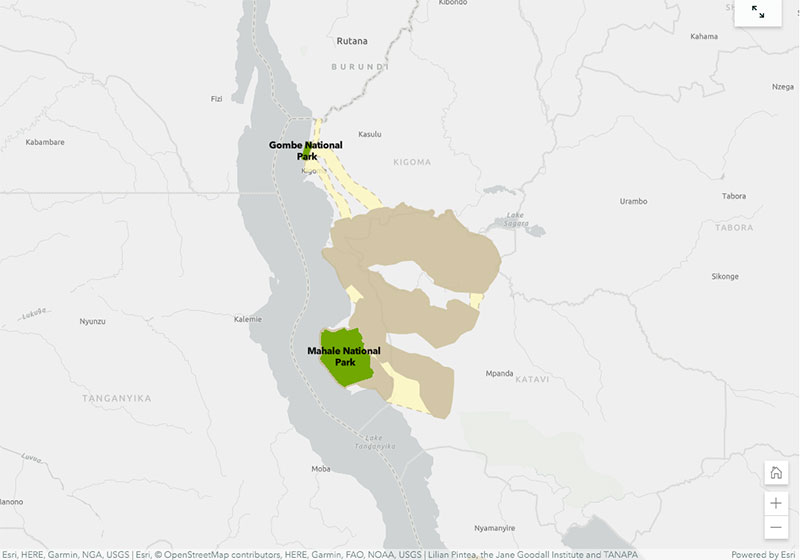
The StoryMap highlights how many remaining chimpanzee habitats are outside of protected areas, and how that habitat is in the care of local people and decision-makers. It also walks through JGI’s Tacare community-centered conservation approach which employs GIS and other tools to empower local communities in the pursuit of local conservation.
The StoryMap explains the start of Jane Goodall’s career and how she discovered that chimpanzees make and use tools, which led to the discovery that chimpanzees share 98.6% of human DNA. It also covers the importance of conserving chimpanzees and their habitats, specifically noting their habitats in Tanzania. Finally, it explains how Tanzanians are using mobile technology, paired with the Esri Survey-123 app, to turn land-use plans into reality.
The StorMap also offers an overview of JGI’s Tacare community-centered conservation approach, which emphasizes four steps: engage, listen, understand and act.
The GPS World staff reported live from the Institute of Navigation’s (ION) 2019 Joint Navigation Conference, which took place July 8-11 in Long Beach, California, and the Esri 2019 User Conference, which took place July 8-12 in San Diego. Check out news, photos and videos from the shows.
With more than 80 percent of the world’s oceans unmapped, the deep ocean is one of the last unknown areas on Earth. On May 31, teams with unique exploration solutions were honored with the Shell Ocean Discovery XPRIZE.
XPRIZE is a global competition to advance ocean technologies for rapid, unmanned and high-resolution ocean exploration and discovery. The teams invented new technologies for rapid, unmanned and high-resolution ocean exploration and discovery.
The results were revealed at an awards ceremony hosted at the Oceanographic Museum of Monaco, part of the Oceanographic Institute, Prince Albert I of Monaco Foundation.
The grand prize winner, receiving a total of $4 million, was GEBCO-NF Alumni, an international team based in the United States, while KUROSHIO, from Japan, claimed $1 million as the runner-up.
GEBCO-NF Alumni was led by Rochelle Wigley, Ph.D., and Yulia Zarayskaya, Ph.D. The 14-nation team integrated existing technologies and ocean-mapping experience with a robust and low-cost unmanned surface vessel, the SeaKIT, along with a novel cloud-based data processing system that allows for rapid seabed visualization, to contribute towards comprehensive mapping of the ocean floor by 2030.
Runner-up was KUROSHIO, from Yokosuka, Japan, led by Takeshi Nakatani, Ph.D. The team integrated technologies from their partners to create a surface vessel and software platform that can operate with different autonomous underwater vessels, which increases the versatility of their technology.
Field Testing. To determine winners, the panel of independent judges reviewed data from field testing conducted in Kalamata, Greece, and Ponce, Puerto Rico. In Kalamata, teams had up to 24 hours to map at least 250 square kilometers of the ocean seafloor at five meters horizontal resolution or higher.
The gold-standard high-resolution baseline maps, against which the team maps were judged, were provided by Ocean Infinity and Fugro, while Esri, the global leader in geographic information system (GIS) software and geodatabase management, donated its ArcGIS Online platform for the teams and judges to use.
NOAA Prize. The $1 million National Oceanic and Atmospheric Administration (NOAA) Bonus Prize went to teams for developing technology that could detect a chemical or biological signal underwater and autonomously track it to its source. The award was split between junior high school team Ocean Quest from San Jose, California, which claimed $800,000 as the winner, and Tampa Deep Sea Xplorers, from Florida, taking $200,000 as runner-up.
Additionally, the judges unanimously recommended a $200,000 Moonshot Award for Team Tao from the United Kingdom for its unique approach to seafloor mapping, even though they did not meet the criteria of the competition.
As part of the total $7 million prize purse, four teams opted to compete for the $1 million NOAA Bonus Prize. In a field test in Ponce, Puerto Rico, teams needed to demonstrate that their technology can “sniff out” a specified object in the ocean by first detecting and then tracing a biological or chemical signal to its source.
The judges determined that no single team was able to trace the signal to its source in the timeframe allowed, so the prize was divided among the two teams that came the closest. In 2018, nine finalist teams were awarded an equal share of the first $1 million of the $7 million prize purse, in recognition of their progress-to-date and to support the teams’ continued technological development.
Seabed 2030 and science fiction. As part of its post-prize impact work, XPRIZE announced a partnership with Seabed 2030, a collaborative project between The Nippon Foundation and The General Bathymetric Chart of the Oceans (GEBCO) to inspire the complete mapping of the world’s ocean by 2030 and to compile all bathymetric data into the freely-available GEBCO Ocean Map.
Additionally, and in anticipation of World Oceans Day on June 8th, XPRIZE will launch a science fiction ocean anthology featuring 19 original short stories and artwork set in a future when technology has helped unlock the secrets of the world’s oceans.
Since 1990, the urban population of Africa has doubled, with more than 80 percent of its denizens living in urban areas. Urbanization can contribute to sustainable growth, if managed well.
However, its speed and scale bring challenges, including meeting accelerated demand for affordable housing, transport systems, infrastructure, basic services and jobs.
Population data such as shown above is only a sample of the geospatial data available in Esri’s new Africa GeoPortal (www.africageoportal.com). The Esri-led initiative is a cloud-based platform that provides and receives geographic data and imagery from Esri and its partners.
The African Union, African Development Bank, other international agencies, nongovernmental organizations, academia, businesses and national government funds will be able to use the geoportal to address the most urgent development challenges facing the continent — including economic development, climate adaptation, conservation and health care.
The complimentary software-as-a-service geoportal is offered to anyone supporting African nations for positive economic, social and environmental outcomes — African citizens, NGOs and international development agencies. The geoportal offers access to spatial analytics capabilities and authoritative content for charting compelling, educational, informational, entertaining and beautiful maps of Africa.
The Global Human Settlement Layer from the European Commission’s Joint Research Centre (JRC) is a complete, consistent, global, free and open dataset on human settlements, and helps to quantify and understand the issues that drive urbanization. The above example comes from the JRC in its Esri story map “Building Knowledge for Sustainable Development in Africa,” which shows how the JRC contributes to the African Union (AU)-European Union (EU) partnership.
From left: Left to Right: Esri Director of Global Business Development Jeff Peters, Eos Sr. Marketing & Content Strategist Sarah Alban, Eos CTO Jean-Yves Lauture, Esri President Jack Dangermond. (Photo: Eos Positioning)
The award for “Energizing the Market with a Bundle” recognizes Eos’ seamless integration of its Arrow Series GNSS receivers with Esri mobile apps.
Eos Positioning Systems Inc., provider of submeter Bluetooth GPS and GNSS solutions, has received a 2019 Esri Partner Conference award in recognition of Eos’ contributions to Esri mobile applications.
Esri ArcGIS users benefit from bundling the Eos Arrow GNSS receivers and Esri mobile apps to create real-time, high-accuracy field GIS solutions on consumer devices such as iPads, tablets, and smartphones.
Photo: Eos Positioning
“As a long time Esri partner, this ‘Energizing the Market Award’ highlights the ongoing value Eos brings to our shared customers,” said Francis Kelly, Esri manager of Global Partner Programs. “Their thoughtful approach to connecting the field worker to the enterprise GIS creates customer satisfaction and significant ROI across our business sectors.”
“Eos has done tremendous work bringing affordable high-accuracy receivers to the Esri user community, whilst taking advantage of the latest Esri technology including Collector for ArcGIS and Survey123 for ArcGIS,” Esri Canada Director of Strategic Alliances Paul Salah said. “I couldn’t be more pleased to have them recognized for their innovation that brings such great value to field workers everywhere.”
Eos’ mission is to turn the complex world of high-accuracy submeter and RTK location into simple and affordable integrations to the Esri ArcGIS platform. This is achieved with behind-the-scenes transfers of high-level GNSS information with Esri mobile apps.
The exchange is nearly transparent to the end-user, and therefore minimizes the knowledge required for anyone to capture survey-grade 3D locations.
“It used to be really hard to collect high-accuracy data,” said Christa Campbell, Esri Global Water Practice Industry Specialist. “But now it’s very easy and affordable, so there are no limits any more. Anyone can do it.”
2018 saw small-system water utilities, municipalities, consultancies, co-ops and others adopt high-accuracy GIS at increasing rates. Eos believes this is due to a changing understanding of how easy and affordable high-accuracy data collection can be with the Eos/Esri bundle.
“We are showing that anyone can map an entire system, regardless of the size or the person’s familiarity with GNSS and GIS,” Eos CTO Jean-Yves Lauture said. “We are showing that it is simple, affordable, and profitable.”
The adoption of high-accuracy solutions among GIS users coincides with a general shift toward digitized asset management, away from paper maps and CAD drawings.
The shift is the natural result of more affordable and easier to use technologies, the proliferation of smart devices, and industry trends including increased regulations.
“Now more than ever, customers want to start taking advantage of the tremendous flexibility GIS has to offer,” Lauture said. “And the first step in creating an accurate system of record is field mapping with GPS.”
In 2018, Eos released two new innovative solutions for ArcGIS users.
The first was the result of a three-way partnership between Eos, Esri and Laser Technology, Inc.
Known as the “World’s First Laser Offset for Collector for ArcGIS,” this laser mapping solution allows field workers to collect highly accurate (submeter or centimeter) locations on their iPads and iPhones in otherwise challenging environments.
This includes GNSS-impaired environments, where view of the sky is obscured or limited, and places where occupying an asset would be unsafe or expensive (such as a manhole located in a road intersection).
“With the new collector-based laser mapping solution, organizations can save money, minimize risk and boost the efficiency of their field operations,” Esri Field Apps Product Lead Jeff Shaner said. “Without having to occupy assets in challenging environments, field workers can capture asset locations within inches of accuracy using the Eos Arrow and LTI rangefinder. This unique partnership provides advanced field data collection capabilities and drives new opportunities to extend the reach of ArcGIS.”
The second solution feeds real-time orthometric heights (Z values) directly into Collector and Survey123 for ArcGIS. By supporting real-time GEOID models, Eos eliminates the need to transform ellipsoidal heights into local vertical datum manually back at the office. This reduces time-consuming post-processing as well as makes accurate elevations instantly available for use in the field.
Eos is dedicated toward providing its customers with innovative solutions like this, which allow Esri users to stay within their existing ArcGIS mobile environments.
“This award acknowledges the work Eos has accomplished so far in bringing innovative solutions to our mutual customers with Esri,” Lauture said. “It is quite an honor for everyone at Eos, and we are especially thankful to all the Esri employees who have made the journey in getting here so enjoyable. It’s what makes us look forward to doing more in the future.”
Esri’s ArcGIS Hub is helping government agencies more easily and efficiently comply with new policies outlined in the Open, Public, Electronic and Necessary (OPEN) Government Data Act, Esri said.
The OPEN Government Data Act sets a presumption that all government information should be open data by default — machine readable and freely reusable.
According to Esri, federal agencies using the ArcGIS Hub can share data in open formats with only a few clicks and feed those data catalogs directly to data.gov, the government-wide website supported in the bill. In addition, apps and dashboards can help responders identify vulnerable populations areas, locate resources like shelters and hospitals, and visualize where and when routes to these resources are accessible in real time.
The ArcGIS Hub online portals also enable government agencies to direct their open data to deepen citizen engagement with apps, data, events and collaboration focused on specific civic initiatives. According to Esri, ArcGIS Hub lets citizens, businesses, academic institutions and nongovernmental organizations take advantage of their governments’ spatial analytics capabilities to collaborate and turn data-driven goals into policy.
“When authoritative data is unencumbered and interoperable, it enables effective and efficient government programs that save lives and money,” said Jill Saligoe-Simmel, Esri product manager for spatial data infrastructure. “Esri supports the OPEN Government Data Act — combined with the recently passed Geospatial Data Act — as an essential component to modern spatial data infrastructures.”
Enhancements include flexible pricing and easier app deployment experience
Esri has implemented major changes to ArcGIS for Developers, providing an enhanced mapping experience that the company says is more accessible and affordable.
These changes include a new pay-as-you-go plan for all of Esri’s location-based services, a decrease in the price of routing transactions and a new commercial app deployment experience for developers, the company said.
ArcGIS for Developers. (Photo: Esri)
This new experience brings the power of mapping to all developers and provides greater simplicity and flexibility. Esri has introduced a new monthly payment structure for the Builder plan in its developer subscription. The Builder plan is now offered at a monthly subscription rate of $125.
Esri has also introduced a 10 percent discount on existing annual Builder plan subscriptions. Customers who currently have an annual Builder plan subscription can continue to pay annually or switch to paying monthly.
“In addition to our existing subscription plans, we have introduced a new pay-as-you-go model that enables developers to pay only for services and transactions that they use,” said David Cardella, Esri product manager for developer technologies. “Developers can now access dozens of different maps from our Living Atlas, store their data securely, route, and geocode, as well as create and deploy apps with much greater ease and efficiency.”
Esri has additionally included a commercial app deployment license in all paid developer subscription plans (Builder plan and higher) at no additional cost. The price of routing services has also been reduced from $4 to $0.50 per 1,000 routes. This price decrease is applicable to all ArcGIS users, including the developer community.
ArcGIS for Developers offers a full suite of developer tools and development resources to build mapping and analytics solutions to support business needs. Developers use ArcGIS APIs to create location-based web and native applications for desktop and mobile devices.
The new enhancements and changes now give developers greater freedom to build, manage, and deploy apps as quickly as possible by allowing them to use the specific tools they need, when they need them, priced to fit their individual needs.
Geographic information systems and augmented reality are a part of our daily lives, so much so, we hardly notice them. GPS World columnist William Tewelow explores how these technologies will continue to change our lives.
Geographical information systems (GIS) and augmented reality (AR) have become a part of our daily lives, so much so that we hardly notice them. Those of us in the profession make our living by them; millions, soon billions more in the consumer world benefit from them without even realizing they are there.
The world is filled with data. Using AR, that data can be draped in front of us in a tapestry based upon our individual needs and interests. Applications multiply daily.Many physical tools now in use will become virtual tools; workspaces, living spaces and the commutes between them (if they even exist at all) will change almost unrecognizably.
The world is poised to become an amazing and magical place.
Before we jump whole hog into the future — something that AR assuredly enables us to do — a glance back at the past can fill out our understanding of these great tools, GIS and AR — each great in and of its own, but virtually invincible when combined. Come with me down the corridors of history . . .
When Great Swords Clash
World War II was a fight against global domination — mankind’s greatest struggle for survival. Tyranny or freedom hung in the balance. The greatest minds raced to harness the powers of nature and science, plying them towards victory. This culminated in the invention of the ultimate weapon, The Great Sword, able to lay waste entire cities and ending the Second Great War in 1945, the year the world returned to peace. Freedom reclaimed the throne, euphoria spread — but the celebration was short-lived.
Kazakhstan. (Map: CIA archives)
In the summer of 1949, the world split in half. In the United States, families gathered around the radio for comedy and drama before putting the children to bed, but on the other side of the world, deep in the center of a faraway, unknown land, on a cool Monday morning as the sun lazily rose over a barren terrain, a second blazing sun rose into the sky. The Soviet Union unsheathed and brandished its own Great Sword, making remote Kazakhstan the center of the world in that brief moment. The sound of the bomb was heard in Washington, D.C., and phones throughout the city rang into the night. Russian spies had stolen America’s atomic secrets. Nuclear annihilation was a reality. The Cold War had begun.
The threat of nuclear weapons in Soviet hands was too great a risk. The United States had to know the extent of the threat. Satellites did not yet exist. Airplanes had limited capabilities. The only way to know what was going on inside the Iron Curtain was intelligence assets on the ground, but the Soviets controlled the ground.
Play Your Aces High
Penetrating the skies over the Soviet Union became the top priority. In 1954 Operation AQUATONE began to build the first U-2 spy plane to fly at an altitude above the limits of enemy air defenses.
U-2 spy plane. (Photo: U.S. Air Force)
But Operation Aquatone was only half the challenge. In the vacuum-tube and wet-film era, building a camera small enough to fit on the U-2 and able to take pictures at the required resolution from so high an altitude was needed. These two efforts took place simultaneously on opposite sides of the country. Operation Aquatone took place in the Mojave Desert at what is now famously known as Area 51, and Operation HTAUTOMAT, the photogrammetry and photo-interpreters effort took place in Boston, Massachusetts and Washington, D.C. Both programs came together successfully in 1956 and the U-2 made its first reconnaissance flight over Eastern Europe.
Almost immediately, the demand for photo intelligence skyrocketed. In 1957 the Soviets launched Sputnik, the first manmade satellite to circle the Earth. Sputnik’s beeps could be understood in every language. Each of the beeps said, I am here above you no matter where on Earth you are, ultimately asking the question, What if I was a nuclear warhead? This elevated the need to surveil Khrushchev’s nuclear weapons capabilities. The Space Race had begun.
Five of a Kind Beats a Straight Flush
Satellite imagery from Discoverer XIV. (Photo: National Reconnaissance Office)
The U-2 flew unimpeded anywhere in the world for four years. But that ended in May 1960 when Captain Gary Powers, the U-2 pilot was shot down 300 miles east of Moscow. In August that same year the world sat transfixed watching the Soviet show trial of the captured U-2 pilot. President Eisenhower took full advantage of the diversion to launch the Discoverer XIV satellite, the first fully operational reconnaissance satellite under the CORONA program. A day later the satellite dropped its first payload, a 20-pound capsule of film. It was retrieved over the Pacific by a C-119 Flying Boxcar. It contained 1.6 million square miles of Soviet territory, providing more imagery than the entire U-2 program combined.
The Photo Interpreters Division (PID) was established to deal with the huge volume of imagery. It was renamed the National Photographic Interpretation Center (NPIC). NPIC used an ALWAC III computer, advanced for its time, but it ran on vacuum tubes and punch cards. It could calculate size and distance in imagery. Over 12 years, the CORONA program collected 2.1 million feet of film, but its processing could not keep pace with the flood of incoming imagery.
Development of the TX-2 computer in 1959 altered this picture, but two problems persisted. First, computers’ limitations prevented an analyst from working directly with imagery. Additionally, finding something noteworthy in an image was only half the problem; the other half was piecing together where on a map the feature belonged. Interior maps of the Soviet Union were vast, featureless, and not well developed.
Let Your Wild Horses Run
MIT graduate student Ivan Southerland solved the first problem, inventing a graphical user interface (GUI) on a TX-2 computer for his doctoral thesis, thereby revolutionizing computer graphics, computer-generated imagery (CGI), and computer-aided design (CAD). Southerland soon found himself heading the government’s Advanced Research Projects Agency (ARPA) to further develop the GUI. His innovations greatly advanced programs such as NPIC, allowing photo-interpreters to work directly with imagery displayed on a computer screen.
A visionary, Southerland saw computer-generated synthetic worlds merging man and computer; he created what became known as the Sword of Damocles, the first augmented-reality (AR) headset. It was so heavy it had to be suspended from the ceiling on cables in a big swindling contraption, hence its name. The Sword of Damocles evolved into the helmet-mounted display that military pilots use today, and became the foundation for development of Google Glass, Oculus Rift, Microsoft’s HoloLens and Meta.
Several years later, Southerland went to Harvard as an associate professor, continuing his work with computer graphics. During his tenure, a student working in Southerland’s computer graphics and spatial analysis lab saw the potential of combining CGI and CAD with his own knowledge of environmental science and landscape architecture. That student was Jack Dangermond, who created Esri in 1969.
Solitaire Takes Two
Thanks to Jack Dangermond and Ivan Southerland, GIS and AR are a part of our daily lives, so much so, we hardly notice them. They have changed how we watch sports. Long gone are the days of John Madden with an electronic pen scribbling out plays with great wit but terrible penmanship. Now, football shows a red scrimmage line on every play and the first down line in blue. We wonder why they have to take out the chains to measure the down because we can clearly see it on screen, but on the field they don’t have the luxury of AR.
Game highlights show a player encircled in a column of light for the commentator’s in-depth coverage. Live imagery projects the commentator into the image of the replay as if he or she is on the field in the midst of the action. Further back, advertisements appear on sideboards of the stadium stands, but only to television viewers. To those physically present at the game, the advertisements do not exist. You can observe this during an instant replay. Take notice of the sideboards during the game and then look at them during the replay. It is a blank, green board — same with baseball.
AR makes it easier to watch a hockey puck with a blurred red tail as it zips across the ice. In golf, a light green glow surrounds the ball on long drives enhancing our entertainment experience.
AR works by knowing where the observer is and where the observer is looking and integrating that information with line-of-sight data. Smartphones provide that capability, ushering in the age of personal AR apps. My personal favorite is FlightAware to track airplanes by aiming a phone’s viewfinder at the aircraft to know the altitude, speed and other information.
For identifying celestial objects, SkyMap helps find a planet, star or constellation. Real-world AR gaming is upon us, the most famous being PokemonGo. A more interesting game is Ingress, which uses real-world landmarks (featured in Nov 2017 article, Game-based learning improves training, engagement). MapBox has a location-based AR platform to support gaming.
Figments of Imagination
Museums consider AR the next frontier. Imagine putting on a pair of AR glasses and seeing things come alive. Stand on the Moon or Mars, or fly in the cockpit of an X-1B, the first supersonic aircraft. Go to an art museum and step into Van Gogh’s painting, Starry Night; the world around you becomes iridescent, globular, and thickly swirled in bold colors. (See Alex Mayhew’s exhibit, ReBlink at the Art Gallery of Ontario).
Walk through a park and statues become human, blink their eyes and speak to you. Dinosaurs, typically static monoliths, roar to life. It is no longer imagination. The Smithsonian’s National Museum of Natural History has an exhibit using your phone to do that very thing. It might seem as if AR is the future, but it is also revealing the past. Archaeology is using AR to see ancient cities as they once were. Those experiences enhance our learning, but what about more practical daily uses?
The world is filled with data. Using AR, that data can be draped in front of us in a tapestry based upon our individual needs and interests. That data can be passive, like location information such as place names appearing in the field of view as icons helping guide you where to go. No more looking down at a smartphone trying to figure out which way to walk. A light blue transparent dotted walking path will lie before you, leading to the icon above the door of the place you are going. Active AR, on the other hand, try to engage you, such as advertisements. A box will seemingly glitter and glow mesmerizing a person into buying it. Another will have tiny figures dancing on it enticing a customer. Look at a menu and the items will appear real for you to inspect before you order. The world is about to become an amazing and magical place.
How about workstations? They’ll be a thing of the past. No need for a monitor in the physical sense. It can be created as large as needed and placed anywhere as well a virtual keyboard. Interface directly and more naturally with the world around you.
Many of the physical tools now in use will become virtual tools, such as a measuring tape, a ruler, a laser level, a GPS receiver, and even pen and paper to some degree. They will just be apps in your smartglasses, call it AR-ware — mere programs, what we used to call figments of our imagination. Grab an AR-ware pen and paper and the handwriting appears perfectly normal but it is just digital text: save it, email it, or print it. Make up new tools or download tools as we do apps on our smartphones. Imagination will be the limiting factor.
Upload CAD blueprints and schematics into an AR generator and look around the house with x-ray vision and see inside or through walls and floors. A plumber can see pipes in the wall, their sizes and what they are made of. An electrician can see the wiring, frames, and pass-through holes. An insurance adjuster can look at damage, take notes in AR then pass everything along to the company who passes it on to the contractor.
Take that same scenario and scale it up to the size of a city. AR allows companies to see the vast network of utilities and assets hidden in the subsurface. The water company can know exactly where its water and sewer lines are located, as well as what other utilities are nearby? Contractors can see exactly where to dig, and just as importantly, where not to dig. INTUS Inc. is a leader in the rapidly growing field of subsurface assets using GIS and AR technology. INTUS’s CEO, Dimitris Agouridis, calls it “intelligent infrastructure.” He goes on to say the technology supports the Call Before You Dig law, and helps avoid costly mistakes that can destroy property, the environment and people’s lives. It saves time, money and resources, and reduces outages due to repairs that inconvenience residents. It also increases a city’s resiliency after a disaster.
The fascinating reality ahead of us is mere moments away measured in months and years. We will walk into museums and experience them in new ways. We will stand in an ancient place and see it reconstructed to its former glory from eons ago. We will work using smartglasses in ways we can only begin to imagine. Road crews will do precision repairs. One day, I will write this article, but not on a laptop, and instead sitting in a world part real, part virtual tied together by a perfect symmetry of place and time. A magical future awaits us created by merging GIS and AR.
My next column, coming in March, will go further into augmented reality and other emerging technologies that rely upon geographic information to build the next generation of intelligent infrastructure.
A new interactive app by Esri models the cumulative number of climate hazards likely to occur under different emissions scenarios for any place on Earth through 2100. The app visualizes the index of 11 hazards, including warming, drought, heatwaves, fires, precipitation, floods, storms, water scarcity, sea-level rise, and changes in natural land cover and ocean chemistry. Users can see how severely locations around the world will be affected by these cumulative hazards under different global mitigation scenarios.
Esri created the app in partnership with the University of Hawaii’s Camilo Mora, lead author of a study in Nature Climate Change, which provides a comprehensive assessment of the simultaneous occurrence of multiple climate hazards strengthened by increasing greenhouse gas emissions and their effect on humanity. Mora’s analysis of thousands of peer reviewed scientific papers reveals 467 ways in which human health, food, water, economy, infrastructure and security have been impacted by multiple climatic changes.
By clearly visualizing the threats that our world’s ecosystem faces at every level, the maps and data hammer home how location intelligence can help with understanding what is at stake in making decisions, even at a global scale. Visualize the data here.
The new system, called Guardacostas Pro, uses a combination of satellite imaging and signal processing to monitor vessels for illegal activities such as drug smuggling and fish poaching in the coastal waters of Argentina’s exclusive economic zone (EEZ).
As Argentina’s coast guard, Prefectura Naval deploys patrol vessels, helicopters and airplane spotters to protect its economic interests and to guard against the decline of its fishery.
This year, the Guardacostas Pro system allowed Prefectura Naval to track a Spanish vessel that entered the EEZ and attempted to return to international waters. The coast guard was able to catch the ship, which had poached roughly $380,000 worth of fish; escort it back to port; impound it; and fine the crew.
The captain had little ground to refute the charges because the coast guard had the data to prove the illegal activity.
“As of five years ago, we had very little information about the use of our seas,” said Ernesto Miguel Klocker, Prefectura Naval director of informatics and communications. “Now we have a good picture, which gives us electronic control of the sea, allowing us to send our air and naval units directly to the places where ships operate.”
Until recently, its primary enforcement tool was constant patrolling and investigation of all ships. Now Guardacostas Pro monitors signals that every vessel transmits to avoid collision and to provide data on vessel type, speed, and location. It combines this with satellite imaging and Esri’s spatial analytics capabilities to give coast guard personnel real-time alerts when a vessel is entering their waters.
“Prefectura Naval is setting a truly cutting-edge example of a forward-thinking organization,” said Dean Angelides, Esri head of international alliances and partners. “The best way to effectively enforce laws over such a large scale as the EEZ is to know exactly where things are happening and when, and Argentina is now leading the way in data-driven public safety.”
After being successfully proven at sea, the Guardacostas Pro system has been moved ashore and is now a multiagency tool to aid Argentina’s Ministry of Security’s homeland security mission. The Ministry of Security will use the system to track and locate its operative units through mobile phones, radio equipment, vehicles with location sensors, and search and rescue aircraft.
A roundup of recent products in the GNSS and inertial positioning industry from the October 2018 issue of GPS World magazine.
OEM
Anti-spoofing
Provides mitigation and reporting
Photo: Regulus
The Pyramid GNSS allows detection, mitigation and reporting of spoofing of the GNSS system, while still providing accurate positioning (jamming protection will be available in a future version). Version 2 of the Pyramid GNSS adds a software-only version, making it available to numerous applications and enabling GNSS to perform seamlessly under spoofing and jamming conditions. The device is designed for any system depending on GNSS navigation or precise timing, including cars, drones, ships, robots, financial institutions and stationary infrastructure, such as power plants and power grids. The Pyramid GNSS connects externally and integrates seamlessly with existing GNSS receivers, adding reliability and protection to the system. It offers full GNSS support including for BeiDou, Galileo and GLONASS.
Swift Navigation has upgraded the firmware of its flagship product — the Piksi Multi GNSS receiver. This marks the sixth major release to Piksi Multi since it was launched in February 2017. The upgrade is available free of charge to Swift customers. The firmware release also enhances Duro, the ruggedized version of the Piksi Multi receiver housed in a military-grade, weatherproof enclosure for long-term outdoor deployments. Firmware Release 2.0 for Piksi Multi and Duro supports two additional major satellite constellations — Chinese BeiDou (B1/B2) which, once completed, will contain 37 satellites, and Europe’s Galileo (E1/E5b), which will eventually consist of 30 satellites. Piksi Multi’s performance will further improve for future satellites. The addition of BeiDou and Galileo creates more robust positioning in a variety of challenging sky-view environments.
The G300D gyro is a three-axis, inertial rate system gyroscope. Measuring 0.67 cubic inches, it features low power and high speed, making it suitable for image stabilization applications. The G300D has message timing under 150 microseconds and output data rates up to 8 kHz with external sync. A micro-electro-mechanical gyroscope, it has an ARW of <0.0028 degrees/sec/√Hz and an option for both 24 and 32-bit LSB for exceptional resolution. Users can configure the G300D using a software development kit or through software protocols to simplify the integration process. The G300D gyro is non-ITAR.
Two new GNSS low-noise amplifier (LNA) front-end modules, the SKY65933-11 and SKY65943-11, integrate Skyworks’ proprietary TC-SAW filters. The modules are designed specifically for internet of things (IoT) applications including smartwatches, action cameras, drones, asset trackers and personal navigation devices. They are designed for wireless module and IoT device manufacturers, providing a turnkey GNSS connectivity solution in a compact form factor. Both solutions offer integrated pre- and post-filter LNA and matching to reduce printed circuit board (PCB) area versus a discrete implementation; single DC supply for design flexibility and simplicity; multi-GNSS compatibility to cover GPS, GLONASS, Galileo, BeiDou and QZSS receiver applications in the 1559–1606 MHz frequency range; extremely low leakage current (1 uA max) benefitting battery-powered IoT devices; and highly manufacturable and low-cost surface-mount technology in a 2.5 x 2.5-millimeter multi-chip module package.
The Net20 Pro provides high-quality data for users interested in the proximity and reliability of a reference station while eliminating real-time kinematic (RTK) corrections service charges. It uses multi-frequency, 555-channel technologies in a rugged casing to deliver accurate and effective positioning data even in harsh environments. It can be configured for correction data reception in client mode to calculate a fixed RTK position and to monitor the antenna position while continuing to work as a GNSS reference server. With NTRIP Caster software, the Net20 Pro provides superior connectivity with an unlimited number of mount points. Users can have permanent transmission of RTK corrections with a local internet connection. Its 32-GB internal and 32-GB external memory is enough for permanent recording even at a 100-Hz high data sampling rate. Its web user interface features upgrade, status and settings management as well as data downloading via smartphone, tablet or other internet-enabled device.
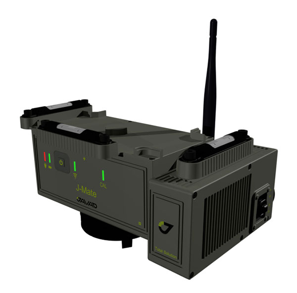
The J-Mate measurement module combines conventional measurement via laser scanning and photographic imagery with the multi-constellation location accuracy of the Triumph-LS receiver. It utilizes precision horizontal and vertical encoders for angular measurement, while the high-definition camera and laser module combine to locate the USB-powered target for accurate measurements. The target rests on top of the receiver and lights up for better visibility to the camera and sensor. The lighting power comes through the USB cord connected to the receiver. Coupled with the onboard data collector screen of the Triumph-LS, operation of the module is done visually with the LS mounted on top of the module or remotely on the J-Pod pole used for GNSS data collection. The module and software is also designed to be an efficient staking application.
The Trimble R10 Model 2 GNSS System is designed to help surveyors work more effectively by enabling reliable, fast and accurate data collection in the field. Enhancements in Model 2 include a custom Trimble survey GNSS ASIC with 672 GNSS channels including GPS, GLONASS, BeiDou, Galileo, QZSS and IRNSS as well as the full range of SBAS. It also will support planned GNSS signals. It has improved reliability against interference and spoofed signals, improved power management by 33 percent, and increased internal memory (6 GB) to store more than 10 years of raw observations. Support for Android and iOS platforms allow field crews to use their own mobile devices. The Trimble R10 Model 2 supports the recently released Trimble TSC7 controller and Trimble Access 2018 field software.
The TerraStar-C PRO correction service provides multi-constellation support, including GPS, GLONASS, Galileo and BeiDou. Combined with NovAtel’s OEM7 positioning technology, TerraStar-C PRO cuts initial convergence times by nearly 60 percent and offers 40 percent better horizontal accuracy than the current TerraStar-C service. In challenging signal conditions, it offers multipath, shading, interference and scintillation. High-rate TerraStar-C PRO corrections provide reconvergence in less than 60 seconds following brief GNSS signal interruptions. Corrections are generated using TerraStar’s proprietary global network of more than 100 GNSS reference stations. The data is delivered worldwide through overlapping geostationary satellites directly to a NovAtel receiver or via cellular IP network.
The C3UBE Command Center enables unmanned beyond-visual-line-of-sight (BVLOS) data collection and near real-time data streaming from almost any point within any critical infrastructure network. The mobile command and distribution center allows for the flight of unmanned aerial systems and is designed to not only allow AviSight to reach the maximum BVLOS distances permitted today, but also to expand its range for UAS operations as limits increase in the national airspace. In addition, it enables near-real-time transmission of data and imagery, which can be disseminated live to anywhere in the world via its proprietary distribution network located at Switch’s Tier 4 data center. It is aimed at the oil, gas, power, transportation and telecommunications sectors.
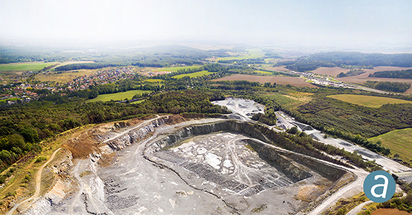
SimActive has updated its Correlator3D end-to-end photogrammetry software to include tools for users to generate precise statistics on mining activities, with improved volumetric calculation. The integrated tools allow users to generate precise statistics on mining activities. The Correlator3D software performs aerial triangulation and produces dense digital surface models, digital terrain models, point clouds, orthomosaics and vectorized 3D features. Applications like mineral extraction monitoring can be done seamlessly within the software. Users can process raw drone data, produce point clouds and DSMs, and perform volumetric calculations in the same Correlator3D workflow.
The improved TruPulse 360 laser features LTI’s TruVector 360° Compass Technology. The rangefinder measures slope distance, inclination and azimuth; instantly calculates horizontal and vertical distances; and calculates 3D missing line values. The enhanced device offers 33 percent increased distance accuracy, 25 percent better target acquisition and a higher azimuth accuracy of 0.5° root mean squared (RMS). Other features include reflectorless technology that enables data capture to any surface type; advanced targeting modes to achieve accurate, repeatable results of the intended target; seven-power superior optics technology that displays all measured and calculated solutions; and smart technology that recognizes adverse measurement conditions and prompts recalibration. Uses include forestry, utilities, construction and GIS mapping.
Synthetic aperture radar imagery from Maxar’s MDA RADARSAT-2 satellite is now available to SecureWatch subscribers. SecureWatch is DigitalGlobe’s powerful, cloud-based geospatial intelligence platform. The service has added the radar imagery to its high-resolution optical imagery, enabling defense and intelligence analysts to deliver actionable insights to decision makers regardless of weather and light conditions. The satellite will refresh hundreds of global sites on a weekly basis using a wide-ultra-fine format (3-meter resolution, 50-kilometer scene width). RADARSAT-2 imagery allows users to observe features and changes that go undetected using other imaging techniques, and provides day and night coverage regardless of weather. SecureWatch users can access timely RADARSAT-2 imagery using current subscription plans. When combined with 30-cm optical imagery, analysts will have a powerful and reliable toolset to make decisions with confidence.
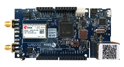
U-blox has introduced a toolset comprising the u-track software and the C030-R410M application board. The toolset is a rapid-prototyping platform that lets product designers test and optimize the position accuracy and power consumption of wireless location tracking applications that use LTE-M and NB-IoT cellular networks, as well as GNSS technology. The toolset targets product engineers working on battery-powered applications such as sport, people and asset trackers. An increasing number of battery-powered consumer and industrial products feature integrated GNSS receivers. These products include virtual reality headsets, smartwatches and devices to track elderly people, containers or parcels. With the ongoing roll-out of low power wide-area cellular networks (LPWAN) such as LTE-M and NB-IoT technologies around the world and the extremely low power consumption they enable, the range of use cases for wireless location trackers is expected to expand further. The u-track software runs from embedded firmware on the new u-blox C030-R410M application board. The board, specifically designed to rapidly prototype applications for the internet of things (IoT), includes an ultra-small, low-power u-blox ZOE-M8B GNSS receiver and a size-optimized SARA-R410M LTE-M/NB-IoT cellular communication module, and u-track includes a PC software application that lets users log, retrieve, and visualize power consumption, accuracy, and other important values, such as the GNSS time to first fix.
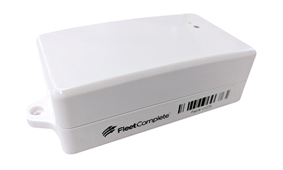
Add-on to AT&T Fleet Complete platform or for separate use
Photo: AT&T
The new GPS Asset Tracker One (AT1) from AT&T and Fleet Complete can track transportation as well as agriculture, food services, pharmaceuticals and emergency services. Users can monitor their assets through the Fleet Complete mobile app. Besides tracking location in near real-time, it also captures humidity, temperature, light exposure and more. AT&T’s nationwide LTE-M network is designed for devices that require low-cost, extended battery life, coverage underground and inside buildings, and carrier-grade security. Two high-capacity Lithium AA batteries power the AT1. They can last up to five years with a once-a-day use.
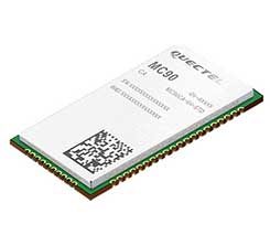
The MC90 is a quad-band GSM/GPRS/GNSS/Wi-Fi module that supports hybrid positioning technologies including GNSS, Cell ID and Wi-Fi aided positioning. It integrates the multi-GNSS system, including GPS, GLONASS, Galileo and QZSS, which makes it suitable for urban areas with high-rise buildings and complex environments. The MC90 also adopts Wi-Fi hotspot positioning technology for blind spots and satellite coverage. It integrates multi-aiding positioning technologies to offer customers with optimized GNSS performance. It also supports EPO technology, which provides predicted Extended Prediction Orbit to speed up TTFF without the need of an extra server. The MC90 features a compact design and lower power consumption, and supports dual SIM single standby function.
TomTom will offer free maps and traffic tiles on its mobile software developer kit (SDK) in both Android and iOS. With global coverage, the Mobile Maps SDKs and its free map tiles will guide developers of mobility and ride-sharing apps. The TomTom Maps APIs (application programming interfaces) also play a role in the internet of things, where traffic data is needed to enable self-driving cars and smart city planning.
MAGNET Inspect is designed for UAV data collection. (Photo: Topcon)
MAGNET Inspect software is designed to facilitate the data-processing workflow for UAV (unmanned aerial vehicle) infrastructure inspection by efficiently managing large UAV data sets to create inspection reports. It allows operators to visually navigate UAV photos, aligning 3D reality meshes with raw georeferenced images in one location and filtering them based on selected criteria including field of view. When combined with Intel Falcon 8+ Drone – Topcon Edition and Topcon ContextCapture, powered by Bentley Systems, the software enables operators to navigate, annotate and create reports with inspection photos, creating a strong end-to-end inspection workflow.
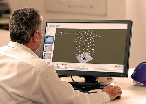
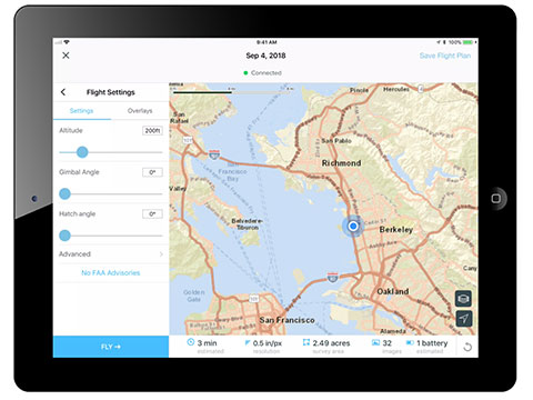
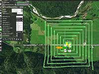
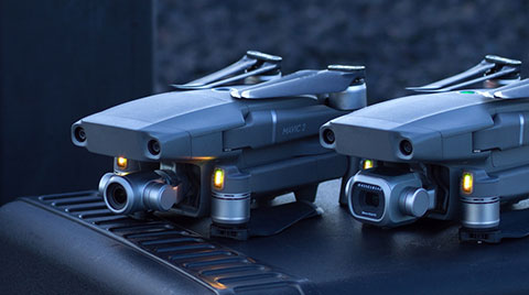
Site Scan Esri Edition is a custom version of the Site Scan iOS app for drone flight planning and data capture that works seamlessly with Esri’s ArcGIS Online and Drone2Map for ArcGIS. The Site Scan Esri Edition app complements Esri’s Drone2Map for ArcGIS software by providing full drone project mission planning and a simple workflow for transferring drone captured data into Esri ArcGIS. Users will be able to connect to ArcGIS Online with an Esri sign-in. The app will allow users to directly use Esri data layers from ArcGIS Online as base and reference data for their drone flight planning mission. Esri customers can use any drone supported by Site Scan, including a variety of DJI drones. Site Scan also supports a custom version of the new Yuneec H520 commercial drone by 3D, which is based on the Dronecode PX4 software and designed to be an open and secure drone option for use on U.S. government projects.
UAS mission-planning software company UgCS has joined with disaster response expert Airborne Response to develop a comprehensive search capability for drones. The search-pattern software, a new feature of the UgCS platform, allows remote pilots to more effectively conduct search-and-rescue operations. Customizable search patterns such as the “expanding square” and “creeping line” can be deployed. Based on the flight altitude input by the operator, the UgCS software will automatically calculate the course heading and track spacing necessary to provide the prescribed coverage area for a search target. UgCS software allows central management of all types and manufacturers of unmanned vehicles, enabling a user to control one or a fleet of drones on a single mission in multi-operator mode and multi-platform environments. Airborne Response will offer the UgCS mission planning software and associated training to public safety and emergency response professionals throughout the U.S.
The Mavic 2 Pro is designed for professionals, aerial photographers and content creators. With a folding design, the Mavic 2 is a powerful platform with new gimbal-stabilized cameras and advanced intelligent features like Hyperlapse and ActiveTrack for easier and more dynamic storytelling. Flight time is 31 minutes. Co-engineered in partnership with Hasselblad, the Mavic 2 Pro houses a 1-inch CMOS sensor with a 10-bit Dlog-M color profile. It can capture 20-megapixel aerial shots with utmost color accuracy using the Hasselblad Natural Color Solution (HNCS) technology, while an adjustable aperture from f/2.8-f/11 provides control across a wide variety of lighting conditions.
Esri cosponsored HACKtheMACHINE, the United States Navy’s Digital Experience presented by the Naval Sea Systems Command, which took place Sept. 21–23 in Seattle.
The Naval Sea Systems Command hosted the event to drive the development of innovative digital capabilities that will help the navy protect the sea, air, space and subsurface domains in the 21st century.
The Seattle event connected developers to the needs of our nation’s navy and provided developers with access to Esri APIs and software developer kits. This will allow developers to bring context to maritime security situations through access to location data and spatial analytics tools.
Computers, data and digital communications underpin the global economy and delivery of the world’s life-sustaining services like food, power and clean water.
“HACKtheMACHINE is looking to reach out to a new generation and engage them in meaningful conversations about maritime security,” said Zac Staples, Fathom5 CEO, who founded the event while serving as the director of the Naval Postgraduate School Center for Cyber Warfare. “It is designed to create opportunities to innovate, solve problems, and change the world for the better.”
“Esri is honored to be chosen as one of the sponsors for this event,” said Curt Hammill, navy account executive at Esri. “Our location intelligence solutions are used by all American military branches, and sponsoring HACKtheMACHINE gives us the opportunity to continue our proven history of supporting our armed services in their most critical missions.”
HACKtheMACHINE is composed of three tracks, and Esri participated in two of them. Track 2: Data Science & the Seven Seas, used data from ships under way on the high seas to develop algorithms to assist the navy with preventing collisions of human-operated and autonomous vessels.
Esri is also a solution provider for Track 3: Hack for the Oceans, in which teams put themselves in the position of the first responders after Hurricane Katrina. Each team will deploy applications to a similar environment to the navy’s Consolidated Afloat Networking and Enterprise Services (CANES) Agile Core Services system, emulating what value a first responder DevOps team could add in such a scenario.
Creative developers also had a chance to win an annual ArcGIS Developer Subscription for innovative use of the ArcGIS platform. Other prizes were awarded from other cosponsors.
HACKtheMACHINE was organized by Fathom5 and Booz Allen Hamilton, on behalf of the United States Navy.