Tag: European Space Agency

  • Inquiry Commission Appointed Following Galileo Anomaly

    Inquiry Commission Appointed Following Galileo Anomaly

    Following the major anomaly that occurred on August 22 during the Soyuz ST mission carrying two satellites in the Galileo constellation, Arianespace announced today, in conjunction with the European Space Agency (ESA) and the European Commission, the appointment of an independent inquiry commission.

    The commission is chaired by Peter Dubock, former ESA Inspector General. Its mandate is to establish the circumstances of the anomaly, to identify the root causes and associated aggravating factors, and make recommendations to correct the identified defect and to allow for a safe return to flight for all Soyuz launches from the Guiana Space Center (CSG).

    The commission will start its work on August 28 and submit its initial conclusions as early as September 8.

    The inquiry commission comprises the following members:

    • Peter Dubock, former ESA Inspector General, Chairman;
    • Professor Guido Colasurdo, University of Roma “Sapienza”, full professor of flight mechanics;
    • Michel Courtois, former ESA Technical Director;
    • Paul Flament, European Commission, Head of Unit, Galileo and Egnos Programmes Management, DG for Entreprise and Industry;
    • Giuliano Gatti, ESA, Galileo Program Technical Officer;
    • Professor Wolfgang Kubbat, former head of the Institute of Flight Systems and Automatic Control at the Technical University of Darmstadt;
    • Isabelle Rongier, CNES Inspector General;
    • Toni Tolker Nielsen, ESA Deputy Inspector General.

    To maintain links with the Russian partners in the Soyuz at CSG program, the head of the Russian space agency Roscosmos, on request from the head of Arianespace, has designated Alexander Daniliuk, Deputy Director General of TsNIImash, as board liaison.

    Arianespace Chairman and CEO Stéphane Israël said: “I would like to thank Peter Dubock for having accepted the chairmanship of this commission, which was appointed in conjunction with ESA and the European Commission and with the support of the space agencies from France (CNES), Germany (DLR) and Italy (ASI), along with a team of high-level European experts. The commission will now be able to carry out its work independently, operating under a very tight schedule. We sincerely hope that the commission’s recommendations will lead to a rapid resumption of missions, while ensuring the high reliability expected of our Soyuz launches from CSG.”

  • Galileo Satellites Not in Expected Orbit

    Galileo Satellites Not in Expected Orbit

    After the separation of the two Galileo satellites launched August 22, ongoing analysis of the data provided by the telemetry stations operated by the European Space Agency (ESA) and the French space agency CNES showed that the satellites were not in the expected orbit.

    According to the initial analyses, an anomaly is thought to have occurred during the flight phase involving the Fregat upper stage, causing the satellites to be injected into a noncompliant orbit.


    UPDATE: Inquiry Commission Appointed Following Galileo Anomaly


    The liftoff and first part of the mission proceeded nominally, reports Arianespace, leading to release of the satellites according to the planned timetable, and reception of signals from the satellites. However, the targeted orbit was circular, inclined at 55 degrees with a semi major axis of 29,900 kilometers. The satellites are now in an elliptical orbit, with excentricity of 0.23, a semi major axis of 26,200 km and inclined at 49.8 degrees.

    Both the Fregat upper stage and the two satellites are in a stable condition and position that entails no risk for people on the ground. The residual propellants on the Fregat stage have been purged and the stage was depressurized normally.

    Studies and data analyses are continuing in Kourou, French Guiana, and at Arianespace headquarters in Evry, near Paris, under the direction of Stéphane Israël, Chairman and CEO of Arianespace, in conjunction with the Russian partners in the Soyuz in French Guiana program (Russian space agency Roscomos and the manufacturers RKTs-Progress and NPO Lavotchkine), as well as Arianespace’s customer ESA and its industrial partners, to determine the scope of the anomaly and its impact on the mission.

    Following the announcement made by Arianespace on the anomalies of the orbit injection of the Galileo satellites, ESA said that the teams of industries and agencies involved in the early operations of the satellites are investigating the potential implications on the mission.

    Both satellites have been acquired and are safely controlled and operated from ESOC, ESA’s Operations Centre in Darmstadt, Germany. Further information on the status of the satellites will be made available after the preliminary analysis of the situation.

    “Our aim is of course to fully understand this anomaly,” said Stéphane Israël, Chairman and CEO of Arianespace. “Everybody at Arianespace is totally focused on meeting this objective. Starting Monday, Arianespace, in association with ESA and the European Commission, will designate an independent inquiry board to determine the exact causes of this anomaly and to draw conclusions and develop corrective actions that will allow us to resume launches of Soyuz from the Guiana Space Center (CSG) in complete safety and as quickly as possible. The board will coordinate its work with Russian partners in the Soyuz at CSG program. Arianespace is determined to help meet the European Union’s goals for the Galileo program without undue delay. We would like to thank ESA, the European Commission and CNES for the very productive discussions since becoming aware of the occurrence of the anomaly. While it is too early to determine the exact causes, we would like to offer our sincere excuses to ESA and the European Commission for this orbital injection that did not meet expectations.”

    New NORAD element sets from Sunday confirm that the satellites and the Fregat upper stage are in the wrong orbits:

    TBA – TO BE ASSIGNED

    1 40128U 14050A   14235.29903612 -.00000029  00000-0  00000+0 0    62

    2 40128 049.6865 087.6132 2327926 024.5112 345.1155 02.04736595    14

    TBA – TO BE ASSIGNED

    1 40129U 14050B   14235.68621972 -.00000026  00000-0  00000+0 0    36

    2 40129 049.6897 087.5935 2330669 024.6823 271.0168 02.04928670    16

    TBA – TO BE ASSIGNED

    1 40130U 14050C   14235.29836211 -.00000029  00000-0  00000+0 0    43

    2 40130 049.7055 087.6017 2323101 024.6200 345.0221 02.05021368    10

  • Arianespace, ESA Sign Contract for New Galileo Launches

    Arianespace, ESA Sign Contract for New Galileo Launches

    Arianespace and the European Space Agency (ESA), acting on behalf of the European Commission, have signed a contract for three launch services with Ariane 5 ES to step up deployment of Galileo satellites.

    With this new launch contract and thanks to the performance of Ariane 5 ES, a total of 12 Galileo FOC (Full Operational Capability) satellites will be launched using three dedicated Ariane 5 ES launch vehicles, each carrying four satellites. The Ariane 5 ES launches will take place from 2015 onwards.

    Arianespace will be responsible for ensuring all of the 22 FOC satellites manufactured by the German group OHB System alongside the British company Surrey Satellite Technology Ltd. are taken into circular orbit at an altitude of 23,522 km using a combination of five Soyuz launch vehicles (two satellites per launch) and three Ariane 5 ES launch vehicles (four satellites per launch). The 22 operational satellites will join the four IOV satellites launched successfully by Arianespace from the Guiana Space Center in 2011 and 2012.

    Arianespace and its subsidiary Starsem were responsible for launching in 2005 and 2008 from the Baikonur Cosmodrome the initial satellites in the Galileo constellation, GIOVE-A and GIOVE-B, which were able to secure the frequencies allocated to the constellation.

    The contract for Arianespace’s three Ariane 5 launches to orbit a total of 12 Galileo FOC satellites was signed at the Guiana Space Center by Chairman and CEO Stéphane Israël (seated, at left) and Didier Faivre, ESA director of the Galileo Program and Navigation-related Activities. Joining them were ESA Director General Jean-Jacques Dordain and Daniel Calleja Crespo, director general for Enterprise and Industry, European Commission.
    The contract for Arianespace’s three Ariane 5 launches to orbit a total of 12 Galileo FOC satellites was signed at the Guiana Space Center by Chairman and CEO Stéphane Israël (seated, at left) and Didier Faivre, ESA director of the Galileo Program and Navigation-related Activities. Joining them were ESA Director General Jean-Jacques Dordain and Daniel Calleja Crespo, director general for Enterprise and Industry, European Commission.

    Once the contract had been signed, Stéphane Israël, chairman and CEO of Arianespace, made the following statement: “With its Ariane 5 ES heavy-lift launch-vehicle, Arianespace is able to provide the most appropriate solution for stepping up the deployment of the entire Galileo constellation. Ariane has once again demonstrated its excellence as it lends its expertise to Europe’s ambitions in space. With the three Ariane, Vega and Soyuz launch-vehicles operated from the Guiana Space Center, European spaceport, Arianespace is giving Europe guaranteed access to space and suitable solutions to meet its wide-ranging needs. I would like to extend my heartfelt thanks to the European Commission and European Space Agency (ESA) for their continued trust. Being the launch operator of the Galileo program is an immense source of pride for Arianespace, its employees and its partners.”

  • Galileo Satellites Encapsulated for Launch

    UDPATE:

    After a one-day postponement, The fifth and sixth Galileo satellites were successfully launched and deployed.

    UPDATE:

    Arianespace has decided to postpone the launch of Soyuz flight VS09 carrying Europe’s fifth and sixth Galileo satellites. This is due to unfavorable weather conditions over the Guiana Space Centre.

    Another launch date will be decided depending on the evolution of the weather conditions in Kourou.


    Europe’s latest Galileo satellites have been sealed within their launch fairing, atop the Fregat upper stage that will carry them into their final orbit on August 21, ushering in the system deployment phase and paving the way for the start of initial services. Galileo SATs 5-6 are scheduled to lift off at 12:31 GMT from Europe’s Spaceport in French Guiana on top of a Soyuz rocket.

    The two Galileo satellites had been attached together on the dispenser that secures them during flight, and then delivers them into orbit. Then August 14 saw the follow-on installation of the stack — the two satellites plus dispenser — onto the Fregat stage. The following day was the last time the two Galileo satellites were seen by human eyes, as the two halves of the protective launch fairing were sealed around the satellites and their upper stage.

    Meanwhile, on August 18, the satellites’ three-stage Soyuz launcher was moved by rail onto its launch pad then lifted to the vertical position. The launcher’s mobile gantry was then moved into position around the upright launcher. This allows the next step of the launch campaign to take place, the hoisting up and attachment of the entire upper composite — the launch fairing containing the Galileo satellites, their dispenser and the Fregat fourth stage. At three hours, 47 minutes and 57 seconds after liftoff, the satellites will then be deployed from their Fregat by the dispenser’s pyrotechnic separation system, once their final 23,500 km altitude is reached.

    These new satellites will join four Galileo satellites already in orbit, launched in October 2011 and October 2012 respectively. This first quartet were in-orbit validation satellites, serving to demonstrate the Galileo system would function as planned. Now that work has been done, the Full Operational Capability (FOC) satellites being launched on Thursday are significant as the first of the rest of the Galileo constellation.

    The payloads generating navigation signals to Earth have been manufactured by Surrey Satellite Technology Ltd in the UK, while the satellites carrying them have been built by OHB in Germany.
    A steady stream of launches is planned for the next few years, with two Galileo satellites flown per Soyuz launch and four Galileo satellites flown per launch of an Ariane 5 variant currently in preparation.
    The definition, development and in-orbit validation phases of the Galileo program were carried out by ESA and co-funded by ESA and the EU. The Full Operational Capability phase is managed and fully funded by the European Commission. The Commission and ESA have signed a delegation agreement by which ESA acts as design and procurement agent on behalf of the Commission.

    The August 21 launch can be watched live here.

  • Europe Weighs Mandate of Galileo Chips in Mobile Phones

    The European Commission is considering a requirement for mobile phones, and perhaps other portable devices such as tablets, to be equipped with Galileo receivers that would automatically send location data as part of any emergency call to 112.

    E112 is a location-enhanced version of the 112 universal European emergency services number via telephone, equivalent to 911 in the United States, in which the telecoms operator receiving the call for help transmits location information to the emergency dispatch center, which has further connection to police, firefighters, medical, and other emergency services.

    A European Union Directive on E112 requires all mobile phone networks to provide emergency services with available information on the location of the caller. Currently this data is the cell id, which is of limited use in localising a call as, for example, in rural areas where the mobile cell may have a radius of two to twenty kilometres — not very helpful for police or medical emergency crews in finding someone in distress.

    Whether the Commission (EC) should mandate Galileo, or take a different option, is currently the subject of consultation.  The EC convoked a public hearing  in Brussels in May to chew over the pros and cons.

    Legal Obligation

    The Commission has a legal obligation to look at potential activities that can maximise the societal benefits of Europe’s huge investment in satellite navigation technologies such as Galileo and EGNOS. It is also tasked to assess how these technologies could reinforce Europe’s economic infrastructure. To me, the E112 mandate is a low-hanging fruit ready to be picked, and the majority of stakeholders who voiced an opinion at the hearing evinced great enthusiasm for the proposal.

    Interestingly, the regulatory route to achieve a mandated use of Galileo for E112 would be via a delegated act; the relevant radio equipment and telecommunication directives are already effectively in place. This means that if the Commission decides to mandate, it can do so without the need for further regulation.

    Mandating a specific GNSS system for a regional service of this type is not a new idea. Russia and China have both done so. As Richard Catmur of Spirent Communications put it: “We are not seeing Galileo being pushed like GLONASS and Beidou in the market. We need input from this forum.”

    Justyna Redelkiewicz of the European GNSS Agency (GSA) outlined some technical reasons for mandating Galileo. Over and above (yet to be fully proved) improved accuracy, availability. and a faster time to first fix, the likely inclusion of signal authentification in the Galileo open service would reduce any impact of spoofing — a very useful characteristic in what is essentially a safety-critical system.

    Johannes Vallesverd, who chairs the group within the European Conference of Postal and Telecommunications Administrations, Electronic Communications Committee tasked with delivering harmonisation of the 112 number across Europe, was also very positive: “We need to talk about how we could be saving lives Europe.” He advocated a proactive and rapid decision.

    This was reinforced by Gary Machado, CEO of the European Emergency Number Association (EENA). He estimated the annual economic cost of the delays induced by inaccurate location data at more than €4 billion across Europe. In contrast, the cost of implementing a system to relay GNSS location from equipped smart phones was of the order of €250 million. Economically, it is a no-brainer.

    Bruno Gagnou from Thales Alenia also thought that GNSS — and specifically Galileo — gives the right answer for E112 positioning. “The technology is reliable and accurate,” he said, “with obvious benefits for society. Lives will be saved, the security of citizens enhanced due to quicker intervention, and European industry will be supported.” He noted that this was also the experience in the United States when the enhanced 911 regulation was introduced.

    Gagnou thought that Galileo should be mandated in order to ensure a harmonised approach across Europe and avoid an anarchic, non-compliant deployment of technologies for E112. “EU emergency services should rely on EU technology,” he concluded. “EU citizens deserve the best E112 emergency service.” Galileo should be favoured, all mobile devices should be addressed, but this will require mandating. It seems to me that the Commission will agree with him.

    Quantum Navigation: Ultra-Cold Alternative to GNSS?

    Some potential future tech! The Quantum Timing, Navigation and Sensing Showcase at the UK’s National Physical Laboratory (NPL) in mid-May highlighted the possible use of quantum technology for highly accurate timekeeping and advanced, GNSS-independent, navigation. This so-called second quantum revolution’\ could make a big impact on the field of Timing, Navigation and Sensing (TNS) through technology based on ultra-cold, laser-cooled atoms.

    The meeting was organised by the UK’s Defence Science and Technology Laboratory (DSTL). It presented a number of research projects including a table-top quantum accelerometer designed to provide ultra-precise, highly reliable positional data for submerged submarines.

    As we know, GNSS does not work well underwater, so submarines navigate using accelerometers to register every twist and turn of the submerged vessel relative to its last surface GNSS fix.

    “Today, if a submarine goes a day without a GPS fix, we’ll have a navigation drift of the order of a kilometre when it surfaces,” said Neil Stansfield of DSTL. “A quantum accelerometer will reduce that to just one metre.”

    Once chilled to an ultra-cold state, the rubidium atoms in the accelerometer achieve a quantum state that is easily perturbed by an outside force. Another laser can then be used to track these perturbations and calculate the size of the outside force, and therefore the relative position.

    At present, such devices are only found in the laboratory, but research is pushing past classical physical limits towards optimal performance, as scientists investigate miniaturisation and the potential use of new materials to reduce costs and increase the practicality of the devices. Following land trials in late 2015, it is anticipated that a sea-going version will be demonstrated in a British sub during 2016.

    ”The defence industry often acts as a pioneer in the development of new technologies. The potential benefits of a future in which we can navigate by inner space rather than outer space will impact both the military and civilian world,” commented Neil Stansfield.

    Bob Cockshott from NPL said: “Whilst the most immediate applications are in the defence field, future quantum navigation technologies could also have significant civilian applications across a wide variety of activities, covering high frequency trading, network synchronisation, robust and ubiquitous navigation, geo-surveying, and mineral prospecting. With the first applications potentially ready for market in five years, now is the critical moment time to consider the opportunities provided by quantum.”

    Cockshott points out that chip-scale atomic clocks using similar principles are here now from Microsemi in the United States —  indeed, they have been integrated with GPS in some U.S. military applications — and can provide low-power, low-cost hold-over for timing applications. He expects to see European designs on the market within five years and a steady improvement in capability thereafter.

    “Cold atom accelerometers may also appear in high-value (probably military) applications within five years. These could form the basis of a quantum compass,” he predicts .

    GPS-like progression. He envisages something like the progression seen in GPS receivers from expensive military equipment to high-value professional users and then mass-market. DSTL and the UK’s Technology Strategy Board are working hard to get industrial suppliers of support equipment and of quantum devices working as quickly as possible to get these technologies to market, and consumer devices are certainly the ultimate aim.

    “I would see these technologies as complements to GNSS, at least in the short and medium term, providing hold-over in poor GNSS environments (such as urban canyons etc) and capability where GNSS will never work — in tunnels, for example,” comments Cockshott.

    Of course companies like Google would like to guide city dwellers through urban underground metro systems, switching seamlessly to GNSS when they step out into the open air. “The quantum compass will not of course provide position fixes, only information about positional changes from a known starting point,” he points out.

    However, in the long term, such gravity sensors combined with detailed maps of the Earth’s gravitational field may be able to provide GNSS-free positioning and navigation. Militaries are interested in this option because there is no known physics that could jam or spoof such sensors. “But it’s hard to see them matching the precision available from GNSS,” he concludes.

    Galileo First Fixers

    The European Space Agency (ESA)  handed out certificates to the first 50 global citizens to determine their position using only the Galileo system. They got responses from around the world.

    While half the applications for certificates came from Galileo’s home continent, Europe, others first-fixers came from Australia to Canada, Egypt to Vietnam.

    The first positioning fix using only Europe’s civil-owned navigation system took place at ESA’s Navigation Laboratory in Noordwijk, the Netherlands, on March 12,2013.

    The Galileo team knew of fixes being performed on an informal basis, so to mark the anniversary of the first positioning fix they decided to issue commemorative certificates to groups who had picked up the signals to perform their own fixes. Teams were asked to include details of the receiver they used, the start and finish of the fixes in Universal Time Coordinated (UTC), and a plot of their latitude/longitude positioning overlaid on a map.

    Italy turned out to be the single best represented country in Europe, with six separate fixes, followed closely by Germany and the UK with five  each. Several groups had achieved fixes on the same day as ESA in 2013.

    Most of the employed receivers were software-based radio systems, with signal processing performed by software on a computer linked to a radio-frequency front end. Professional receivers were also customised for the job.

    “Most of the applications were obtained with static receivers and simple position fixes with Galileo’s Open Service signals,” explains Galileo engineer Gaetano Galluzzo.

    Belgium’s Royal Military Academy performed Galileo’s first position fix at sea, aboard Belgian frigate Leopold-I, while sailing along the Norwegian coast.

    A German telecom company made use of the satellite signals for timing and network synchronisation – one of the most important applications of Galileo will be as a nanosecond-scale time source, enabling the effective synching of financial, power and data networks around the globe.

    Finally

    Talking of fixes – has anyone heard anything from Galileo GSAT0104 recently? According to the European GNSS Service Centre, the fourth IOV satellite is “unavailable until further notice.” The setting of unavailability may be due to in-orbit validation testing, as the website implies may be the case, but no further official statement has appeared, nor active user notifications (NAGUs) at http://www.gsc-europa.eu/system-status/user-notifications.

    There have been a number of NAGUs over the past couple of months concerning outages and, at different times, one or more of the Galileo satellites have been off line while this extended period of testing takes place.

    A bientôt, as they say in these parts.

  • ESA Recognizes First Galileo Navigation Fixes

    ESA Recognizes First Galileo Navigation Fixes

    ESA offered to issue certificates for the  first 50 Galileo positioning fixes — provoking responses from across the whole world. While half the applications came from Galileo’s home continent, others came from the rest of the world, including Australia, Canada, China, Egypt, New Zealand, Russia, United States, and Vietnam.
    ESA offered to issue certificates for the first 50 Galileo positioning fixes — provoking responses from across the whole world. While half the applications came from Galileo’s home continent, others came from the rest of the world, including Australia, Canada, China, Egypt, New Zealand, Russia, United States, and Vietnam.

    Billions of satnav position fixes are performed daily, but determining your place in the world using Europe’s Galileo system is quite new. Because of this, in March the European Space Agency (ESA) offered to issue certificates for the first 50 Galileo fixes.

    Responses to the offer came from around the world. While half the applications came from Galileo’s home continent, others came from Australia, Canada, China, Egypt, New Zealand, Russia, the United States, and Vietnam.

    The first two satellites of Europe’s Galileo constellation were launched in October 2011, followed by two more a year later. Four is the minimum needed for determining position, allowing testing of the full Galileo system to begin.

    Slovakian company GoSpace performed Galileo positioning while driving around Bratislava on 1 May 2014. The company was among those certified by ESA for their early Galileo positioning achievement.
    Slovakian company GoSpace performed Galileo positioning while driving around Bratislava on 1 May 2014. The company was among those certified by ESA for their early Galileo positioning achievement.

    The historic first positioning fix using only Europe’s civil-owned navigation system took place at ESA’s Navigation Laboratory in its ESTEC technical centre in Noordwijk, the Netherlands, on March 12, 2013.

    Galileo’s navigation signals could be picked up anywhere in the world that the orbiting satellites come into view, however. Equipped teams from industry, universities, research centers, and government institutions took the opportunity to perform their own fixes, along with a couple of private individuals.

    The Galileo team knew of fixes being performed on an informal basis. The idea came to mark the anniversary of the first positioning fix by issuing commemorative certificates to groups who had picked up the signals to perform their own fixes. Teams were asked to include details of the receiver they used, the start and finish of the fixes in Universal Time Coordinated (UTC) and a plot of their latitude/longitude positioning overlaid on a map, such as Google Earth.

    • Italy turned out to be the single best-represented country in Europe, with six separate fixes,
    • Germany and the UK followed Italy closely with five fixes each.
    • Several groups achieved fixes on the very same day as ESA.
    •     Figure 1. Positions obtained by only Galileo E1 Open Service (the antenna is located at the roof of the Ta Quang Buu library building inside HUST campus)
      Galileo positioning performed in the NAVIS Centre at the Hanoi University of Science and Technology in Vietnam on March 27, 2013, overlaid on a Google Earth map.

      Most of the receivers were software-based radio systems, with signal processing performed by software on a computer linked to a radio-frequency front end. Professional receivers were also customized.

    • A private individual from Gdansk, Poland, used his own receiver to perform a fix, intended for amateur rocketry.
    • An individual in Pec, Hungary, achieved a fix with a modified receiver.
    • Most of the applications were obtained with static receivers and simple position fixes with Galileo’s Open Service signals, but there were some special cases. These included precise point positioning, where offline processing is applied to give extremely precise centimeter-scale positioning — typically used in surveying, the oil and gas industries, and precision agriculture. Some of these fixes were actually performed before the first real-time positioning fixes, including fixes done at the University of New Brunswick.
    • Belgium’s Royal Military Academy performed Galileo’s first position fix at sea, aboard Belgian frigate Leopold-I, which sailed along the Norwegian coast.
    • A navigation company from New Zealand performed positioning while walking.
    • A technology firm in Slovakia performed drive testing.
    • A German telecom company made use of the satellite signals for timing and network synchronization. One of the most important applications of Galileo will be as a nanosecond-scale time source, enabling the effective synching of financial, power and data networks around the globe.
    A Trimble Navigation team used one of their own handheld receivers to perform Galileo-based positioning in pedestrian testing in Christchurch, New Zealand on 14 April 2014. The results are overlaid on a Google Earth map. 
    A Trimble Navigation team used one of their own handheld receivers to perform Galileo-based positioning in pedestrian testing in Christchurch, New Zealand on 14 April 2014. The results are overlaid on a Google Earth map.

    The certificates will be issued soon.

    General use of Galileo will begin as more satellites join the first four in orbit so the first services can be rolled out. The next two Galileo satellites are in French Guiana, beginning their preparations for launch.

    It should take only a slight software update to ready the current generations of satnav receivers to work with Galileo signals, ESA said.

    Sources of Galileo certification applications.
    Sources of Galileo certification applications.
  • Next Galileo Satellites Arrive in French Guiana

    Next Galileo Satellites Arrive in French Guiana

    Europe’s next two Galileo satellites are unloaded from the Boeing 747 cargo aircraft at Cayenne. The two satellites are scheduled to be launched together by Soyuz from Europe’s Spaceport this summer.
    Europe’s next two Galileo satellites are unloaded from the Boeing 747 cargo aircraft at Cayenne. The two satellites are scheduled to be launched together by Soyuz from Europe’s Spaceport this summer.

    The first two Galileo Full Operational Capability (FOC) satellites arrived safely at a clean room in Kourou, French Guiana, at 20:00 on Wednesday, May 7, in preparation for launch this summer.

    Named “Doresa” and “Milena,” the two Galileo FOC satellites arrived at the Félix Éboué international airport in French Guiana at 02:00 local time. They spent the day in an airlock to acclimatize before being taken to their new home, the S1A clean room, where they could be safely unpacked to begin the launch campaign.

    Europe’s two latest Galileo navigation satellites touched down at Europe’s Spaceport in French Guiana packed safely within protective and environmentally controlled containers. The satellites were carried across the Atlantic aboard a 747 cargo carrier, according to the European Space Agency.

    Manufactured by OHB in Bremen, Germany, with navigation payloads contributed by Surrey Satellite Technology Ltd. in Guildford, UK, these satellites – the first of 22 full-capability models — had spent several months at ESA’s Technical Centre, ESTEC, in Noordwijk, the Netherlands, where they underwent exhaustive testing in simulated space conditions.

    “Adam”, the third Galileo FOC satellite is currently undergoing testing under space conditions at ESTEC. The fourth Galileo FOC satellite, “Anastacia,” will begin final testing at OHB in Bremen before being shipped to ESTEC. The Galileo satellites are named for the children who won a painting competition organized by the European Commission in 2011.

    After successfully passing the Flight Readiness Review (FRR) last week, Doresa and Milena were released for shipment to the French overseas department. “Thanks to the good collaboration between the participating industrial teams and the experts at the European Space Agency ESA as our customer, OHB was able to successfully finish the FRR,” says OHB’s Director of Navigation Wolfgang Paetsch who will be personally overseeing the launch preparations in Kourou.

    On May 5, the two satellites left on a pair of lorries for Frankfurt Airport in Germany, from where they flew the following evening. After landing in French Guiana, the satellites were  driven to the clean room. The pair will be launched together aboard a Soyuz rocket, joining the four Galileos already in orbit. This initial quartet — the minimum number needed for achieving a position fix — has demonstrated the overall system works as planned, while also serving as the operational nucleus of the coming full constellation.

    “Similar arrival scenes should become familiar over the next couple of years,” said Giuliano Gatti, Head of ESA’s Galileo Space Segment Procurement Office. “These first two Full Operational Capability satellites are effectively preparing the way for the rest of the constellation, allowing the final validation of assembly, testing and launch preparation procedures. A steady stream of satellites is foreseen, coming from OHB to ESTEC for acceptance testing and then on to French Guiana. Thanks to the preparatory work done with these pioneer satellites, future Galileos will be processed more rapidly.”

    The definition, development and in-orbit validation phases of the Galileo programme were carried out by ESA and co-funded by ESA and the EU. The Full Operational Capability phase is managed and fully funded by the European Commission. The commission and ESA have signed a delegation agreement by which ESA acts as design and procurement agent on behalf of the commission. OHB System is the industrial prime contractor responsible for the total of 22 Galileo FOC satellites. 

    The two Galileo FOC satellites were enclosed in protective, air-conditioned containers for their flight.
    The two Galileo FOC satellites were enclosed in protective, air-conditioned containers for their flight.
    “Doresa” and “Milena” head to the clean room.
    “Doresa” and “Milena” head to the clean room.
    The two satellites in the clean room.
    The two satellites in the clean room.
    Dorese and Milena rest side by side in  clean room S1A.
    Dorese and Milena rest side by side in clean room S1A.
  • Galileo Maritime Tests Followed Route of Viking Ships

    Galileo Maritime Tests Followed Route of Viking Ships

    Belgian frigate Leopold I-F930 in rough water off Norway during Galileo maritime testing. In December 2013 the frigate participated in the first maritime trials outside mainland Europe of the Galileo satellite navigation system.
    Belgian frigate Leopold I-F930 in rough water off Norway during Galileo maritime testing. In December 2013 the frigate participated in the first maritime trials outside mainland Europe of the Galileo satellite navigation system.

    Results are being processed from the first Galileo maritime trials outside of mainland Europe. The long-range, high-latitude testing spanned the North Sea, following the same historical sailing route that Viking dragon-ships used 1200 years ago.

    Ancient manuscripts record Viking navigators relied on “sunstones” to find their way — archaeologists believe these may have been polarizing crystals to pinpoint the Sun even in overcast skies.

    By contrast, Belgian frigate Leopold I-F930, participating in the end-of-year trials, carried the most up-to-date equipment possible, with multiple Galileo receivers for both its public Open Service (OS) and secure Public Regulated Service (PRS).

    “Galileo is in a transition between its In-Orbit Validation (IOV) phase and follow-on Full Operational Capability phase,” said Miguel Manteiga Bautista, head of ESA’s GNSS Security Office. “This means we are engaging in all kinds of experimental demonstrations of all Galileo services, in particular PRS, which offers the most highly accurate positioning and timing performance, but with access strictly restricted to authorized users.”

    The recorded course of Belgian frigate Leopold I-F930  during the first high-latitude trials of Europe's Galileo satellite navigation system. The frigate sailed first from the Dutch marine base of Den Helder on 4 December 2013 to Stavanger in Norway. From there it progressed north in very rough seas with 10-m high waves, coming close to the Arctic circle on December 17 — a first for Galileo PRS observations — before heading homeward.
    The recorded course of Belgian frigate Leopold I-F930 during the first high-latitude trials of Europe’s Galileo satellite navigation system. The frigate sailed first from the Dutch marine base of Den Helder on 4 December 2013 to Stavanger in Norway. From there it progressed north in very rough seas with 10-m high waves, coming close to the Arctic circle on December 17 — a first for Galileo PRS observations — before heading homeward.

    The frigate sailed first from the Dutch marine base of Den Helder on December 4, 2013, to Stavanger in Norway. From there it progressed north in very rough seas with 10-meter-high waves, coming close to the Arctic circle on December 17 — a first for Galileo PRS observations — before heading home.

    The testing provided tangible in-situ evidence of Galileo signal stability across both its operating frequencies up at high latitudes, equaling low satellite elevations in the local sky.

    Following the completion of earlier road, then flight, testing last summer and autumn, the last challenge for Galileo’s IOV phase was to engage in a long-term maritime trial into high latitudes. The testing was performed as part of the PRS Participants to IOV project jointly managed by ESA and the European Commission, in collaboration with the European GNSS Office Agency and several Member States possessing PRS test receiver technology.

    The trials were performed by the Royal Military Academy of the Belgian Ministry of Defence, the UK Space Agency in collaboration with Nottingham Scientific Ltd. and ESA, to ensure PRS signals were available whenever the four Galileo satellites in orbit came into view.

    Two receivers, seen either side of the main antenna, were carried by Belgian frigate Leopold I-F930 during high-latitude testing of both Galileo's publicly-available Open Service and secure Public Regulated Service in December 2013.
    Two receivers, seen either side of the main antenna, were carried by Belgian frigate Leopold I-F930 during high-latitude testing of both Galileo’s publicly-available Open Service and secure Public Regulated Service in December 2013.

    A dual-test setup was fitted to the frigate at Den Helder. Belgium connected a PRS receiver and an OS receiver, both manufactured in Belgium by Septentrio NV, to a common antenna. The PRS receiver recorded raw PRS measurements on both frequencies while the OS receiver logged data from openly available Galileo, GPS and GLONASS signals at one-second intervals.

    Nottingham Scientific installed its Ultra system configured to record radio-frequency samples, allowing the detailed post-processing of Galileo OS and PRS signals.

    “As this was a first use of PRS equipment outside EU borders, the security issues were quite challenging,” said Bruno Vermeire, head of the Belgium Competent PRS Authority (Federal Public Service of Foreign Affairs). “Several partners from different countries and industries were involved. At all times the necessary security was assured, though this could not have been possible without the dedicated joint commitment of all partners.”

    David Parker, head of the UK Space Agency, commented, “This test is a significant milestone on the road to demonstrating early PRS capability across a range of platforms. It should serve as a model for wider international collaboration between national governments and industry to prove and demonstrate PRS in different applications.”

    Belgian frigate Leopold I-F930 at Den Helder dockyard in the Netherlands.
    Belgian frigate Leopold I-F930 at Den Helder dockyard in the Netherlands.

    Alain Muls, professor of the Royal Military Academy of Belgium, faced the challenge of coordinating the maritime trial without interfering with the normal operations of the frigate. “Thanks to the cooperation of with the Maritime Component of the Belgium Defence, in particular that of the frigate’s commander and crew, preliminary results look very promising. Reception of Galileo’s OS and PRS navigation services have been practically demonstrated under severe maritime conditions with waves of up to 10 meters in height.”

    “This activity is a truly collaborative effort at all levels. The trial involved UK and Belgian governments and industry partners with support from different European bodies as well as officials from the Netherlands and Norway,” said Mark Dumville, Nottingham Scientific general manager. “This team effort has enabled the concept of radio-frequency sampling processing of Galileo PRS signals to be tested in real-world operational environments. We have confirmed that the prototype receiver is now ready to support European governments and associated PRS applications.”

    The collaborative nature of this trial was formally recognized as the Leopold I-F930 reached Stavenger. Under the supervision of Belgium’s CPA, Jochen Devadder, the country’s Ambassador to Norway Michel Godfrind provided a Norwegian delegation with details of the testing.

    Results from the trial will guide future Galileo developments for years to come.

  • GNSS Future Glimpsed at Summit in Munich

    The Munich Satellite Navigation Summit annually gathers people involved with GNSS from around the world to report on current status and progress of the multiple systems. It is a high-level briefing of significant global importance. Of course Europe, Germany, Bavaria, and the European GNSS industry, now recognized around the world, all take the opportunity to present their capabilities and successes.

    This year’s Summit covered a lot of ground, and I’ve tried to do it justice in this column. For an overview, here are the main topics covered in what follows:

    • Opening Plenary
    • Constellation Updates
    • Regional and Augmentation Updates
    • Bavarian Highlights
    • GNSS Interference
    • Legal impacts of Personal Privacy Devices (PPDs)
    • Precise Point Positioning (PPP)
    • Future of GNSS in the User Segment

    I used to spend quite a lot of time in Munich working on a multi-national, multi-role fighter aircraft program, so returning for this year’s Summit stirred some good memories for me.

    Held in the opulent Residenz Muenchen, the conference derives a special atmosphere from these historic surroundings, some dating back to 1385.  The former royal palace of Bavarian monarchs, the labyrinthine palace has ten courtyards and 130 rooms. Overall, this is a delightful setting.

    Regional Flavor. Munich is in the southern German state of Bavaria, and Bavaria has taken a real interest in the promotion and success of Galileo; witness the expansive Bavarian booth at recent European and North American GNSS conferences, and the siting of a Galileo control center in Oberpfaffenhoffen, once a sleepy village in the Bavarian countryside 20 kilometers outside Munich, but now a significant high-tech research center with many aerospace facilities. Germany has of course been one of the lead nations funding Galileo from its inception.

    Opening Plenary: A View from the Top

    The host of the Summit is actually the University of the German Federal Army in Munich, and we received a warm welcome from two leading professors – Dr. Eissfeller and Dr. Niehuss, the president.

    The theme of the Summit is to move from implementation to utilization, and in typical European form, all parties were looking to shower potential users with funded solutions to problems of which users are not yet aware — so users clearly need government-provided education, pilot projects, and funding. Not exactly a North American concept, where we tend to encourage users to buy our innovative stuff by demonstrating how it can save them money or earn them more revenue. But there’s a city called Rome over here . . .

    The opening plenary session covered GNSS, Earth Observation (EO) and Telecommunications — an extensive mandate — with a panel headed by Ilse Aigner, Bavarian State Minister of Economic Affairs and Media, Energy and Technology, an equally extensive portfolio, even for a state-certified engineer who used to work for Eurocopter.

    The European Commission, the European Space Agency (ESA), the German Aerospace Agency (DLR), the European GNSS Agency (GSA), and leading manufacturers Airbus, OHB (providers of the Galileo full-operational capability (FOC) satellites), and Telespazio were also represented. The Minister did indeed associate with and praise the local area, claimed 1,000 jobs created related to Galileo through an incubation center at Oberpfaffenhofen, and declared whole-hearted Bavarian support for satellite navigation.

    Among important matters mentioned by the plenary panel:

    • an €11 billion budget for Galileo/EGNOS and Copernicus (an EO project) under the Horizon 2020 program;
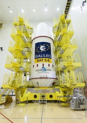
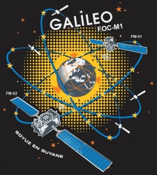
    • an intent to declare Early Service for Galileo before the end of this year with two or three dual Galileo satellite launches.

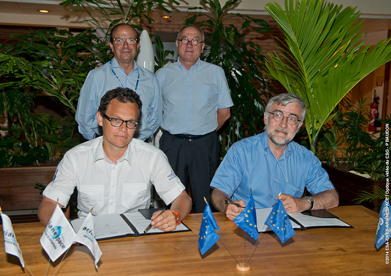
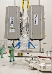
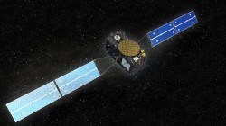
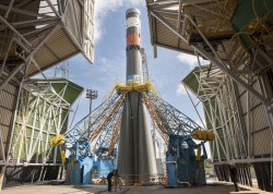
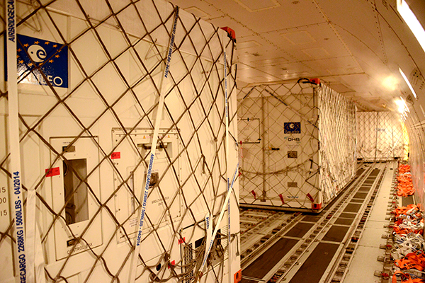
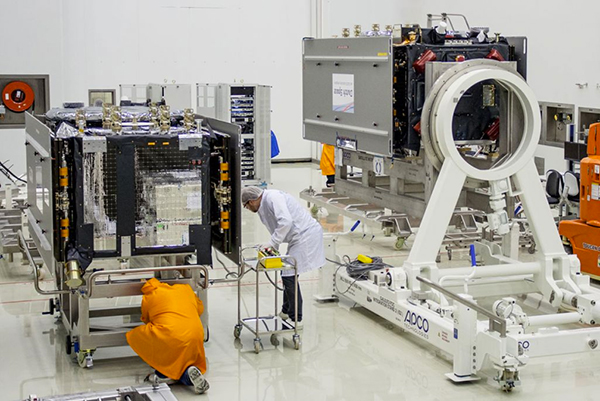
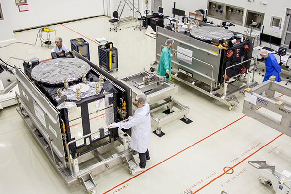
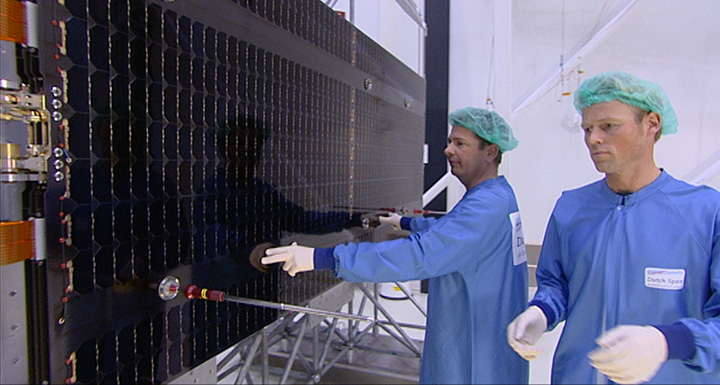
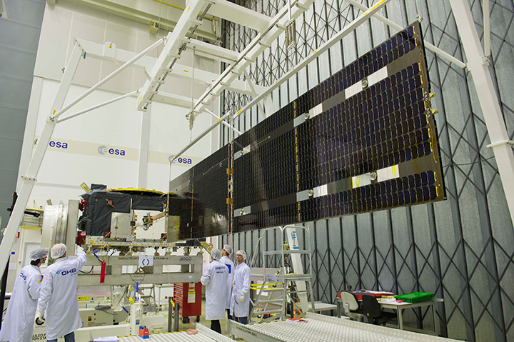
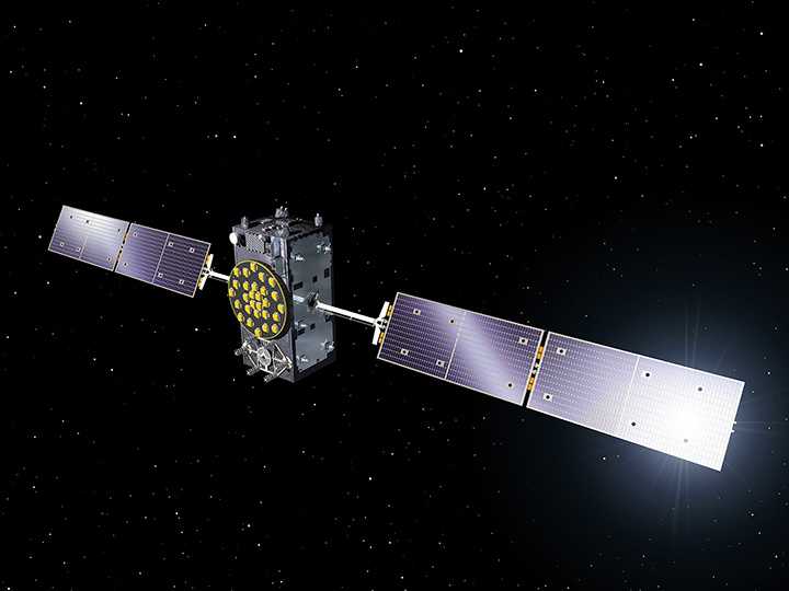
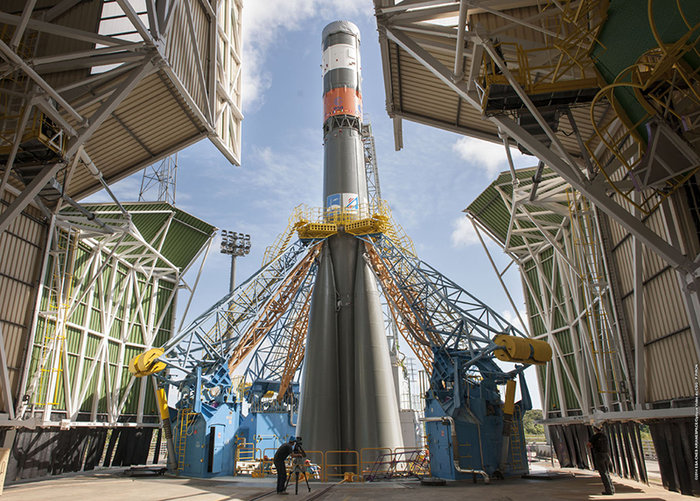
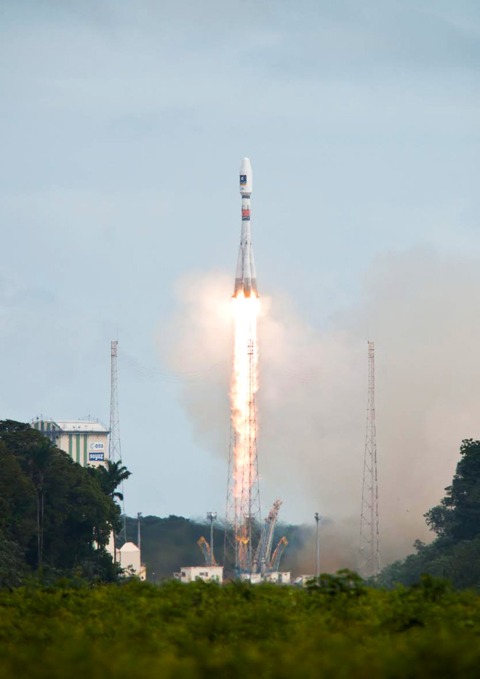
    Two Launches this Year. The first two FOC (production) SVs should go to the European launch center in Kourou in April in preparation for launch around June.  I heard in a corridor that launches may be planned for June, October and December, but an EU spokesman later said that there would only be two launches this year. OHB now has the contract to build 22 FOC Galileo SVs, each with a design life of 14 years, and they are bullish on their ability to deliver on time and budget.

    Constellation Updates

    • GPS. An estimated 2 billion GPS receivers are in use, and there may be ~10 billion by 2020. A return-on-investment (RoI) analysis is currently underway, but a rough guess is that costs are in the tens of $Billions, while annual returns are of the order of $60–100B/year. Another IIF satellite (SV) launched last month brought the total to 5 SVs transmitting L1, L2C, and L5 – with 7 more to come, and multiple launches are expected this year. There are 30 operational SVs on orbit. Signal performance significantly exceeds the specs, and consistent, dependable performance has been provided for more than 20 years.
    • Galileo. First fix achieved 12 March, 2013 with four SVs, two (maybe three?) launches of two SVs each planned for 2014 & early operational capability to be declared by end of this year. €7B funding provisioned for 2014-2020, 16-24 operational ground stations, Commercial Service (CS) planned by 2016 (more on this later), and a long-term evolution plan is being worked up during this year.
    • BeiDou. 14 SVs are on orbit: 5 geosynchronous orbit (GEO), 4 mid-Earth orbit (MEO) similar to GPS and other GNSS birds, and 5 inclined geosynchronous orbit (IGSO), together providing dual-frequency services. 30 total SVs are planned, and the intent is to provide open, compatible, interoperable signals with other GNSS, free of charge. There was not much other news to report, other than China intends to invest significantly in BeiDou to keep improving services.
    • GLONASS.  Russian delegates were notably absent, and there was much speculation that they declined to attend due to the Crimean situation. One U.S. delegate even inferred that they were ‘un-invited.’
    • United Nations ICG. Nine nations and the European Union = International Committee on GNSS (ICG), with 20 other associate and observer states.  Activities include GNSS compatibility/interoperability, GNSS enhancements, information sharing, and reference frames, timing & applications – lots of upcoming meetings and activities (see associated story).

    Regional & Augmentation Updates

    • WAAS (the U.S. Wide Area Augmentation System). Phase IV is underway with GEO replenishment begun, introduction of L5 to replace L2, and replacement of obsolete component parts. 100 GIII receivers were ordered with L1/L2C and L5 capability for delivery by September this year– and have capacity to also add Galileo. GIII receivers have already been fielded in six locations as part of initial integration testing. The Safety computer will also be upgraded starting this year.  3,912 LP/LPV approaches have been approved, of which 3,379 LPVs serve 1,667 Airports.
      GBAS CAT I is progressing with four US airport installations, system design approval began in January this year, and United Airlines has begun equipping more than 90 B737/B787 for GPS approach and landing. Alternative Positioning, Navigation and Timing (APNT) investigations are underway (as a backup to GPS) with a hybrid DME-pseudolite configuration currently favored. Stanford University subsequently presented this and other concepts.
    • EGNOS (the European Geostationary Navigation Overlay Service).  €1.58B budget approved, EGNOS V3 evolution is underway – introduction of L1/L5 and GEO (SES 5 and Astra 5B) replenishment, a requirement to expand East and West and to the North to provide full coverage to all EU States.There are ~100 EGNOS LPV approaches approved, this year it is hoped to add 150 more.
    • QZSS (Japan’s Quasi-Zenith Satellite System). Operational concept has been proven with 1st IGSO SV (Michibiki), so Japan is moving forward quickly to add another 3 SVs  (3xIGSO and 1xGEO) and ultimately would like to have a total of seven SVs in orbit providing QZSS services. L1/L1C/L2C/L5 signals are identical to GPS and L1s/L5s are augmentation signals, while L6 is proposed to be similar to Galileo E6, providing cm level PPP type service. QZSS essentially is intended to provide higher-elevation satellites to improve urban navigation in dense cities.
    • IRNSS (Indian Regional Navigation Satellite System).  Coverage extends 1500 kilometers beyond India’s land area, target is <20m accuracy, signals are in L5 and S band and can be used independently or in dual frequency combinations. A 2nd IRNSS-1B GEO satellite is scheduled to launch on April 4th.
    • GAGAN The Indian SBAS was commissioned and certified in February this year with a number of ground stations, redundant uplinks and two on-orbit GSAT 8 & 10 GEOs. Gagan is now qualified to provide RNP0.1 (navigation accuracy to 0.1 miles).

    Bavarian Highlights

    A collection of examples of Bavarian GNSS innovations followed in a very interesting session led off by an overview of Business Incubation Centers and their collaboration with government agencies and research centers. Small business start-ups are encouraged to apply during four annual time-slots, and receive two years’ incubation support and cash incentives.  This has lead to 81 new ventures and has apparently been the source of the 1,000 new jobs mentioned by the Minister of Economic Affairs.

    The annual European Satellite Navigation Competition and Galileo Masters competition have also generated a large number of ideas and concepts (8,000), some of which have found support through this incubation process.

    Airbus Defence gave a short overview of the testing work they accomplished in supporting the first Galileo fix. The company fix has prepared several vehicle test platforms, ready to take the next phase of Galileo testing to the streets in realistic, real-world environments.

    DLR provided insights into a number of their activities, namely: Iono mapping; signal distortion; multipath; jammer mitigation – adaptive antenna and processing; GNSS repeaters – how they can become unintentional jammers; spoofer and multipath investigations; antenna designs; GNSS evolution – maser and clock combination benefits.

    IFEN provided information on the activities at the GATE ground-based pseudolite range, which has enabled realistic outdoors testing of Galileo receivers, well in advance of signals from orbiting satellites. Recent testing has now been able to include the four operating Galileo SVs on orbit with GATE pseudolite signals. GATE will continue to evolve over the next few years to keep up as more Galileo orbital signals come on-line.

    Fraunhofer presented information on their 40-channel GPS/Galileo/GLONASS chip-receiver, claiming 1m accuracy, low-cost, robust reliable position solution, small form-factor and low-power. Following PRS test-bed development efforts, Fraunhofer has now received a contract to also deliver 20 pre-operational Galileo PRS receivers for use in initial pilot projects.

    GNSS Interference

    Vidal Ashkenazi, in his inimitable form, led a panel discussion on interference, jamming (in particular personal privacy devices (PPD)) and spoofing, and coaxed his panel members to provide a quantity of information on what’s being done, mitigation capabilities and potential enforcement. Unlike all the other sessions, panel members did not use presentations, instead responding to some wide-ranging questions on the subject from the session chair.

    David Turner, representing the U.S. Department of State, indicated that the ICG will meet shortly in Geneva hosted by the International Telecommunication Union (ITU) to focus on interference, jamming and mitigation. The recourse that nations have for use of PPDs by their people is the law — jammers are illegal, sale and purchase of them is illegal — however internet sales are very difficult to police. So detection and mitigation are required to find and shut them down. Dave’s presentation on the GPS.gov website indicates that the ICG is working on an education program for States to inform about GNSS sensitivity to interference and the threat to critical infrastructure if they are allowed to operate. The ICG also has a task force on detection, reporting and systems development.

    The Indian Space Research Organization (ISRO) indicated that PPD jammers in India are restricted but permitted for gatherings such as at churches where personal safety may be an issue. Ground-based detection is needed and stronger legal protection which may well prohibit use of PPDs altogether.

    Japan Aerospace Exploration Agency (JAXA) indicated that they are working on ‘signal proofing’ for QZSS.

    BeiDou said that they are building a monitor network in China which will detect jamming.

    There was a general discussion on whether receiver manufacturers should be mandated to make receivers which are resilient to jamming. Many thought that there have already been significant advances in the direction by manufacturers. The normal approach would be to develop requirements with industry, agency and user inputs, publish them and call up the requirements in equipment specifications. In the United States, the Department of Homeland Security is seeking an approach to detection and location.

    Legal impacts of Personal Privacy Devices (PPDs)

    While the audience may have had high hopes that the ‘Legal Eagles’ could come up with some magic prevention and prosecution solution, the next session was more of a legal background briefing, without any concrete conclusions (quite similar to other discussions I’ve had with some lawyers in the past, actually).

    The first briefing was from the European Commission/European Union who indicated that the EU doesn’t own the frequency rights to Galileo (uh-oh). They have to operate through a member state, which gets the rights through the International Telecommunication Union (ITU) and then licenses use to the EU – the bottom line being that EU enforcement of jamming protection laws maybe be difficult, as the legal framework only exists at the national level for each State. The EU is trying to get recognition under another class of ITU membership.

    EU regulations were presented, stating that GNSS re-transmitters can only be operated legally by governments or government contractors. Or can be used indoors for indoor navigation, but only for emergency services at fixed sites which are pre-approved. Pseudolites can only be operated indoors,and there should be no interference to other systems. Jammers are forbidden and cannot be placed on the market for sale. 

    Eurocontrol had a lot to say about the impact on aviation navigation infrastructure and receivers on aircraft. Existing ground nav aids have limitations, the world-wide equipment infrastructure is becoming quite old, aviation has generally moved away to GNSS and inertial based navigation, and uses ground navaids as backup. There is a conflict between regulating GNSS heavily for aviation and how people want to use it in the commercial world. We may have to consider a trade-off between heavily restricted GNSS operations, and wide open commercial GNSS applications.

    David Sobel from Electronic Frontier Foundation in the United States presented the contrary case for individual privacy. His argument is that sale of tracking devices is unregulated and can readily be purchased, so people may presumably use them to track others, thereby infringing their privacy. So why shouldn’t people be able to ‘defend their privacy’ by use of PPDs?

    Say an employer insists that a vehicle you are driving have a tracking device so he knows where you are, isn’t the driver also justified in trying to protect his privacy? Since U.S. police can no longer place tracking equipment on suspect vehicles without a warrant, tracking appears to be down to private individuals or companies, who it would appear, have the legal ability to attach tracking devices under most circumstances. So the argument goes that if people have a legitimate concern about privacy, there should be acceptable provisions to allow them to disrupt tracking.

    If there is a service such as road tolling, there is an incentive for people to avoid these costs. So systems should be robust enough to avoid disruption. Enforcement is a problem. Should police chase people they suspect have jammers, or should they rather chase criminals or help and protect citizens? Mitigation systems need testing, so to test these systems there has to be jamming transmission, which needs to be controlled and regulated. Restricting the import of bad devices into a country might be desired, but the manufacturing countries don’t tend to want to restrict exports, as exports help their economy. Again, the argument seems to be that of personal privacy over potential risks and damages to society.

    No solutions, but a healthy discussion of views from a legal perspective.

    Precise Point Positioning (PPP)

    The group discussing PPP options consisted of the GSA (charged with exploitation of Galileo services), several principal industry service providers of PPP, and the Federal agency which provides PPP-like services in Germany.

    The GSA presented its ideas concerning the provision of high-accuracy PPP corrections over the Galileo E6 signal – the so called Commercial Service (CS). The intent however would not be to disrupt the commercial market-place. Nevertheless, GSA is proposing a public-funded service  to be sold to users within a market that is already well served by commercial worldwide service providers who charge users for cm-level PPP service.

    While Trimble made a polite presentation on the many levels of capabilities of their TerraSat services, as did Veripos and to some extent Fugro, it was clear that the commercial providers are not eager to find competition in their market from a government entity. NovAtel also chimed in on this conflict as it will be involved in Veripos/TerraStar, following the acquisition of the latter by Hexagon, which also owns the former. Fugro appeared to be interested in acquiring rights to distribute CS on behalf of GSA.

    The German Federal agency promoted open data, source and standards from the IGS network to which they contribute: IGS is supported by numerous national agencies around the world. Orbit and Clock PPP service is available 24/7 from multiple sources. However, the service is offered on a best-efforts basis without a service guarantee and cannot achieve the accuracies or convergence times of commercial services.

    I talked subsequently with Michael Ritter, CEO of NovAtel to learn the background to the Veripos/TerraStar acquisition. It is clear that providing PPP services means added-value to NovAtel when it sells receivers with PPP capability, so it will quickly discontinue offering Omnistar subscriptions and will launch ‘NovAtel Correct’ shortly, offering Veripos (marine) and TerraStar (land) PPP subscription services. NovAtel is making significant inroads in the agriculture segment and sees PPP service as an essential element of this and other businesses. The acquisition was worth something on the order of $200 million, so there is a vested interest in making these services pay, and discouraging GSA entry into this market. Veripos will continue supplying other GNSS OEM receiver manufacturers — notably Septentrio — who use TerraStar services, now adding NovAtel, and potentially another major GNSS manufacturer.

    Future of GNSS in User Segment

    Chaired by Greg Turetzky of Intel, this session opened the third day of the Summit. The presenters offered their concepts for current and future GNSS equipment and systems.

    Stanford University outlined its work with the U.S. Federal Aviation Administratin (FAA) on an alternate PNT system to be used as a back-up to GNSS. It used to be that GNSS systems were designed to overcome ‘space-weather’ effects and faults in equipment design or manufacture. Nowadays there are ‘bad-guys’ out there and we need to ‘protect, toughen and augment’ these systems. Antennas can be built which impart a specific signature to the signals they transmit, and this may aid in finding and prosecuting the bad guys, but the main focus of work is development of a hybrid system using Distance Measuring Equipment (DME) and a pseudolite.

    Tests have demonstrated good performance and these prototype efforts could lead to aviation requirements (MOPS) development by 2018 and deployment by 2020.

    Septentrio has been involved in Galileo since it began and was the first company with Galileo receivers. Nowadays it fields receivers in multiple commercial applications including machine control, maritime, aviation, automation, and measurement, delivering accuracies from a meter down to a centimeter. It will add E6 to the AsteRx family of multiple-channel, multi-frequency, multi-constellation receivers, has developed a number of hardware and software mitigation techniques to combat jamming, interference and multipath, and integrate receivers with inertial units for aiding.

    Furuno is interested in resilient PNT for marine applications, and has examined the use of eLoran as an alternative to GPS, but has moved towards a system of radar beacons that detect radar pulses from passing ships and transmit their position, enabling position determination. In tests, accuracies of around 2 meters have been obtained with two beacons.

    Quascom adds ‘firewalls’ inside receivers which ‘toughen’ the processing and prevent distortion of position information. It believes this will be necessary until authentication can be added into the GNSS system itself, so that any data received is validated and is known to be good.

    Chris Rizos from the University of New South Wales, Australia drew attention to the ‘holes’ that exist in GNSS and reviewed a number of possible ‘band-aid’ fixes, such as WiFi especially for indoor location. However his solution seems to be to establish terrestrial networks transmitting GNSS-like signals.

    Eurocontrol indicated that aircraft currently use inertial and DME extensively as a back-up to GNSS navigation. By 2030 there will be multiple constellations, and dual-frequency use should become commonplace in aviation, so GNSS navigation should be much more robust. Aircraft approaches are required to be in conformance with Required Navigation Performance (RNP), so would it be possible to develop RNP procedures for DME and Inertial to be used as back-up during approaches in the event GNSS is disrupted?

    To conclude the session, Airbus provided a ‘starter-course’ overview on inertial systems – how they work, the range of different types available, what they can achieve, costs, strengths and weaknesses and integration with GNSS.

    The Summit continued with subsequent sessions on: space technologies and users; GNSS monitoring of Earth and disaster management; Copernicus – Earth Observation; GNSS Education. Unfortunately neither the space available here nor my deadline allowed me to attend these equally interesting presentations.

    manufacturers’ exhibit area at the Summit   fits into a couple of corridors near the main Hall, around 20 booths. I talked with several of the manufacturers, including Spirent who has launched its latest GSS9000 multi-frequency-constellation simulator, with a four-fold increase in system iteration rate over the previous model. Exhibitors appeared to be pleased to be at the Summit and the level of interest shown by the attendees.

    As this year’s Munich Summit concludes, where does it leave us? We’ve learned some new things about several GNSS topics and heard some interesting new concepts. Europe appears to be now focused on users and applications, to ensure there is market growth and use of Galileo.

    What stands out for me is the contrast between how European governments go about GNSS and how North America and the commercial world does the same thing without as much direct influence. This is nothing new of course, it is simply the European way.

    ——————–

    Tony Murfin is GPS World’s contributing editor for the Professional OEM e-newsletter.
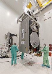
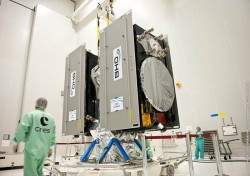
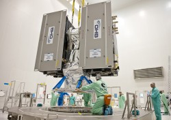
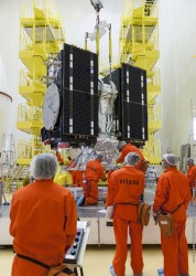
     

  • EGNOS, European Superiority, and the Need to Get ‘Very, Very Busy’

    The European GNSS scene received an early Easter present with the successful launch of two new-generation transponders for the European Geostationary Navigation Overlay Service (EGNOS) satellite-based augmentation system (SBAS). The two geostationary transponders, GEO-2, rose on board the SES ASTRA 5B satellite from the European Space Port in Kourou, French Guiana, on March 22 via an Ariane 5 lifter. The new transponders will provide higher accuracy positioning signals to those citizens and professionals using EGNOS enabled receivers.

    Together with the previous transponder replenishment on the SES-5 satellite launched in July 2012, GEO-2 will ensure the continuity and quality of the EGNOS open service and safety-of-life services for the next 15 years. Once validated in orbit, the signals will be introduced in current EGNOS operations and will support the new EGNOS generation (EGNOS V3). EGNOS V3 will provide dual-frequency signals on L1 and L5 bands and augment both GPS and Galileo constellations as part of the Multi-Constellations Regional System (MRS) concept.

    EGNOS is currently made up of transponders on board three geostationary satellites (Artemis, Inmarsat 3F2, Inmarsat 4F2), and an interconnected ground network of forty positioning stations and four control centres which cover most of the territory of the European Union. The ASTRA 5B payload for EGNOS will essentially extend transponder capacity and geographical reach over Eastern Europe and neighbouring potential markets.

    Europe’s first venture into satellite navigation, EGNOS represents a major stepping-stone towards Galileo. EGNOS improves the accuracy of GPS by providing a positioning accuracy to within three metres together with system integrity messages. The system offers three services: an Open Service that is free of charge; a Safety-of-life Service (SoL) that was certified for civil aviation in 2011; and a Commercial Service – the EGNOS Data Access Service (EDAS) that disseminates EGNOS data in real time.

    Since the beginning of 2014 the European GNSS Agency (GSA) has been responsible for the operation and service provision of EGNOS. “The successful launch is an important achievement in view of the enhanced performance that EGNOS will provide both today and in the future,” said Carlo des Dorides, GSA executive director.

    EGNOS Extension

    Future extension of EGNOS was discussed at the recent Munich Satellite Summit (see below and other articles in this issue of EAGER).

    While GSA is now EGNOS exploitation manager, the European Commission is responsible for the overall programme, said Ignacio Alcantarilla Medina, deputy EGNOS project manger at the Commission. With medium-term finances for the service secured, through a budget of € 1,580 million for the period 2014 to 2021, the main aim for service extension was to ensure complete coverage of all EU territories.

    “Coverage of Member States is the priority; that is what budget is for,” said Alcantarilla Medina. This essentially means reinforcing coverage in the east of Europe and extreme north and overall increase robustness.

    Currently (March 2014) there are 100 EGNOS-enabled LPV procedures for the civil air space published in Europe. During 2014 a further 150 LPV procedures should be completed, he stated.

    Once all EU territory is adequately served, then further extension might be possible. International projects in terms of demonstration were being undertaken under the European Commission’s FP7 and Horizon 2020 research programmes and funding for international extensions could come from third party or Commission sponsored development funding.

    Interestingly, in the light of recent political events, funding for extension of EGNOS to the Ukraine has already been allocated in the European Commission’s budget by DG Development. Other countries could benefit from this type of funding or from other international development aid. An ambitious flight test campaign over Moldova, Poland, Romania, and Ukraine was carried out in the second quarter of 2013 under the auspices of the EGNOS Extension to Eastern Europe: Applications (EEGS2) project. Full demonstration of EGNOS performances and capabilities was performed flying Instrument Landing System (ILS) overlay procedures and by providing real guidance to the pilots during final approach. In total, 19 flight trials were performed between April and June 2013.

    European Showcase at Munich Summit

    Perhaps the good EGNOS news created the warm glow bathing the Munich Satellite Summit in late March. While input arrived from all parts of the world and all major satellite navigation programmes — except Russia and GLONASS — the majority of the discussions focused on the European programmes, Galileo/EGNOS and Copernicus/Earth Observation, and thus by extension on European technological accomplishment.

    Matthias Petschke, Director of EU Satellite Navigation Programmes at the European Commission proclaimed: “Galileo is a reality. We are on track again!” But he stressed that infrastructure does not automatically generate services, and the focus must now be on service provision. On integration, Petschke emphasised that in most cases services meant applications, and few current applications relied on only one source of data. This meant it was not a question of “whether” for integration, but “what else” can be gained from integration of data.

    The big challenge is to transform space infrastructure into commercial service platforms that provide clear benefits to users and society. The introduction of Galileo Early Services, possibly as early as Q4 2014, would herald this move to service platforms and that was when Europe needed to “get very, very busy.”

    Galileo Boasts of Superiority. The plenary audience heard repeated statements from leading European figures on the ‘superiority’ of the Galileo system over current GPS satellites. The grinding of teeth from the various U.S. delegates was almost audible on some occasions but, in the spirit of world peace, they deigned to publicly challenge such statements.

    Typical was Jean-Jacques Dordain, director-general of ESA, who proclaimed Galileo as a success with technologies much better than GPS. Although he did concede that with 22 satellites still to launch this “was not the end of the process – but a real good start.”

    Evert Dudok of Airbus Defence and Space stated, “To develop from scratch a system significantly better than GPS is not easy, but we are creating the best system.” A number of delegates supported this, indicating Galileo’s better-quality code and phase measurement signals that were particularly important for higher-accuracy applications. The excellent, over-specification performance of the initial four in-orbit satellites was often quoted.

    From a commercial point of view, Carlo des Dorides of the GSA claimed that effectively the European Union already had a 25 percent share of the sat nav market and that one-third of the existing global receiver base was already Galileo compatible. He saw a great future for the system.

    “Galileo is unique compared to other GNSS due to its civil nature,” said des Dorides. And the user was at centre of the system’s evolution, with developments in Galileo moving from technology push to demand pull. The clear role of GSA was to ensure that both Galileo and EGNOS delivered the valuable services they are designed to deliver.

    Galileo’s public regulated service (PRS) should be a key factor in growing market share in secure civilian applications with its enhanced ability to counter intentional and unintentional signal interference – another main topic of the Summit. In a dedicated session on combating interference, the introduction of a ‘PRS-lite’ authentification signal on the Galileo open service was mooted, which could be a very interesting development.

    The absence of any Russian input to the Munich SatNav Summit — save for a small pile of the unexpectedly glossy GLONASS Herald publication outside the registration hall — brought the chill of geopolitics into the usually apolitical space arena.

    Does Augmentation Have a Future?

    Another interesting question raised at the Summit – given the near-future fact of four compatible GNSS constellations on station – was whether there will be a role for augmentation systems such as EGNOS and WAAS?

    Deborah Lawrence of the FAA was clear that her organisation was working to take advantage of the multi-constellation future and that the role of SBAS might change, but that the FAA is already looking towards what the requirements for SBAS in 2040 might be.

    European Commission spokespersons agreed with the need for multi-constellation, globally interoperable SBAS for the foreseeable future, not least because the currently installed receiver base in the aviation sector would likely have a 20-year replacement horizon.______________

    Tim Reynolds is director of Inta Communication Ltd. and a long-term Brussels observer writing on many aspects of European government policy and implementation for a range of clients and publications. The material presented here was first prepared in a somewhat different form for the GSA.
       He is the contributing editor for GPS World’s new quarterly e-newsletter, EAGER: the European GNSS and Earth Observation Report. Subscribe free at env-gpsworld-integration.kinsta.cloud/subscribe.

  • Squeeze at the Launchpad for Galileo

    With the first two full-operational-capability (FOC) Galileo satellites successfully through their thermal-vacuum tests, the program’s next hurdle is securing a firm launch date in June aboard a Europeanized Russian Soyuz rocket, operated from Europe’s spaceport on the northeast coast of South America.

    It will not be a walk in the park. Competing with the two Galileo FOC satellites for the same June Soyuz launch are four commercial broadband communications spacecraft owned by O3b Networks of Britain’s Channel Islands, a start-up that promises, if all goes well, to launch as many as 100 satellites.

    O3b and Galileo managers as of late March were rushing to complete final tests to be able to be first to ship their craft to the spaceport and thereby lay claim to priority rights aboard the June Soyuz. Both say they can be on a plane to the Guiana Space Center launch base in April. Should they arrive within days of each other, the already nightmarish dilemma confronting the Arianespace commercial launch consortium will only grow more complicated.

    Here’s the matchup.

    Powerful Backer. O3b, in addition to its plans to launch dozens of satellites if the business model proves out, is backed by SES of Luxembourg, the world’s second-largest satellite fleet operator and as such a big Arianespace customer.

    SES has already shown itself disinclined to maintain its loyalty to the heavy-lift Ariane 5 rocket operated by Arianespace by booking three less-expensive launches, one already completed, aboard the new Falcon 9 rocket operated by SpaceX of the United States. Arianespace can ill-afford to alienate SES, whose 50-satellite fleet requires 3-4 launches per year just to maintain its existing capacity.

    The four first O3b satellites in orbit all have a defect that could cause one or more of them to stop functioning at any time. Without at least four satellites — and preferably six — O3b does not have a business and its future is put into question.

    It would be, to say the least, a public relations calamity for the company if its initial commercial operations, which began in March, were to be suspended in the wake of a satellite failure while waiting for a second batch of four spacecraft. This explains the extraordinary pressure that SES is placing on Arianespace on behalf of a June Soyuz launch for O3b.

    Does it really matter, O3b backers say, if Galileo waits until the next Soyuz launch slot, tentatively set for August?

    Emphatic Politician. It matters to the European Commission, which owns Galileo. Commission Vice President Antonio Tajani has all but pounded the table, insisting that the European Space Agency, hired to oversee Galileo’s technical development, ensure three Galileo launches on Soyuz rockets in 2014.

    Four initial-operating-capability Galileo satellites are in orbit. Indications are that their performance exceeds specifications. Three Soyuz launches carrying two satellites at a time would bring the constellation to 10 spacecraft, enough to offer initial commercial services, according to the Commission.

    Tajani has made clear how much he wants that feather in his cap as he prepares to leave the EC this year, probably headed for a political career in Italy. Make no mistake: as is the case with many wounded animals, Tajani’s status as a lame duck has made him all the more fierce in his insistence that Galileo meet its three-launch schedule in 2014.

    Tajani has put very public pressure on the European Space Agency, which in turn is pressuring Arianespace, for Galileo launches.

    Ariane’s Quandary. Arianespace is already facing an exceptionally crowded launch manifest in 2014 as it coordinates the schedules of three vehicles: the small Vega rocket in addition to the medium-lift Soyuz and the heavy-lift Ariane 5. Because both O3b and Galileo are late, neither has an obvious claim of priority status at Arianespace, which is clearly hoping that the problem will solve itself when either O3b or Galileo arrives at least several weeks ahead of the other.

    At press time, the next Soyuz launch was scheduled for April 3, carrying a European Commission environment-monitoring satellite. Commission officials will attend the launch and no doubt use the occasion to press their case for Galileo.

    There is no telling how this will turn out. Satellites have been known to face last-minute problems even after arrival at the spaceport. This happened to O3b in 2013, as the in-orbit defect did not surface until just before its scheduled Soyuz launch.

    But if one were to hazard a guess, here is the most likely scenario: O3b arrives ready for launch several weeks ahead of Galileo and secures the June launch. Galileo moves to August and is promised a second launch in the autumn. O3b’s planned second launch in 2014 is moved to early 2015, as is the planned third launch of Galileo.

    The effect of these schedule slips on the cost of the Galileo program, which is about a year late — cost overruns that Tajani has vowed will not be paid by the Commission — is a subject for another day.

  • Dutch Company Powers Galileo Satellites

    Dutch Company Powers Galileo Satellites

    Solar arrays for a Galileo Full Operational Capability (FOC) satellite at the Dutch Space company near Leiden in the Netherlands. A pair of 5 m-long solar arrays supply 1.9 kilowatts of power – about the same as an average household’s consumption. The side of the solar array normally left in shadow is seen here.
    Solar arrays for a Galileo Full Operational Capability (FOC) satellite at the Dutch Space company near Leiden in the Netherlands. A pair of 5 m-long solar arrays supply 1.9 kilowatts of power – about the same as an average household’s consumption. The side of the solar array normally left in shadow is seen here.

    By the European Space Agency

    As they bathe the ground below them in test navigation messages, Europe’s Galileo satellites are kept alive by the Sun.

    A pair of 5 m-long solar arrays supply 1.9 kilowatts of power – about the same as an average household’s consumption. These arrays are sourced from the Dutch Space company in the Netherlands.

    Located just outside Leiden, a short drive from ESA’s Technical Centre, the Airbus Defence and Space subsidiary is based in what might appear to be a standard office building, the only clue to its space-based focus being an Ariane 5 frame outside.

    Inside its specialized facilities include a class 100 000 cleanroom, space simulation equipment and a “Very Large Sun Simulator” — a giant camera flash able to test the electrical performance of the solar arrays the company supplies to about two thirds of ESA missions — which includes all Galileo satellites commissioned to date, as well as one of their two GIOVE predecessors.

    “Think of us as the prime contractor for Galileo’s solar panels,” explains senior project manager Jan Zuidam, overseeing the work for Dutch Space. “We build nothing directly ourselves, but — working with a network of partner companies — oversee the panels’ design, engineering management, assembly and testing, all performed here in these buildings.

    The composite panel substrates, sourced from local Dutch company Airborne Composite, are equipped with solar cells in the Airbus Defence and Space facility in Ottobrunn, Germany, with the photovoltaic cells themselves sourced from German company Azur Space Solar Power. It is a bit like the way silicon chips are mounted on printed circuit boards, only on a much bigger scale.”

    The cells in question are state-of-the-art “triple junction” gallium arsenide designs, with sandwiched layers optimised for different segments of the solar spectrum.

    At Ottobrunn these cells are interconnected together into “strings” that run the length of each panel. The bare cells have also have protective cover glass added at this stage, without which they would be quickly tarnished by the radiation and unfiltered sunlight prevailing in orbit.

    Testing

    Before delivery to Dutch Space, each panel is thermal vacuum tested at IABG, Germany, followed by the absolute performance measurement and inspection.

    Solar arrays for a Galileo Full Operational Capability (FOC) satellite at the Dutch Space company near Leiden in the Netherlands. A pair of 5 m-long solar arrays supply 1.9 kilowatts of power – about the same as an average household’s consumption. The side of the solar array normally left in shadow is seen here.
    Solar arrays for a Galileo Full Operational Capability (FOC) satellite at the Dutch Space company near Leiden in the Netherlands. A pair of 5 m-long solar arrays supply 1.9 kilowatts of power – about the same as an average household’s consumption. The side of the solar array normally left in shadow is seen here.

    This includes flash testing to illuminate all the cells at once to check the arrays meet the set power requirements, as well as electrical luminescence testing, where an electrical current is run through each string to make them glow red, basically reversing the way solar cells usually work. Visual inspection is typically enough to ensure all connections are properly linked.

    At Dutch Space, the panels from Ottobrunn are integrated together with the mechanisms, typically sourced from local Dutch companies assembled and tested by Dutch Space, into complete solar array wings.

    The completed wings are suspended on specially weighted deployment rigs, to compensate for the presence of gravity the 29 kg wings are not designed to endure. Here alignment testing is performed, to check the wings will unfold in a straight line as planned.

    Galileo solar arrays being inspected in the Dutch Space cleanroom. The panels received from Ottobrunn in Germany are integrated together with the mechanisms, typically sourced from local Dutch companies assembled and tested by Dutch Space, into complete solar array wings. The completed wings are then suspended on specially weighted deployment rigs, to compensate for the presence of gravity the 29 kg wings are not designed to endure. Here alignment testing is performed, to check the wings will unfold in a straight line as planned.
    Galileo solar arrays being inspected in the Dutch Space cleanroom. The panels received from Ottobrunn in Germany are integrated together with the mechanisms, typically sourced from local Dutch companies assembled and tested by Dutch Space, into complete solar array wings. The completed wings are then suspended on specially weighted deployment rigs, to compensate for the presence of gravity the 29 kg wings are not designed to endure. Here alignment testing is performed, to check the wings will unfold in a straight line as planned.

    “Alignment testing involves the use of reference mirrors and theodolites to check the arrays’ straightness, down to a scale of a tenth of a millimeter at wing tip,” Jan explains.

    “In orbit, any bad alignment would be felt by the satellite’s attitude control system, and might even reduce a satellite’s operational life. We also make stiffness tests, which involves hanging weights on a rope on the end of the array, to see what the resulting displacement is. Flex to 100 mm is expected, but not more.”

    A large‘ambient pressure temperature test chamber can simulate the rapid temperature swings the arrays will experience as they pass between orbital daylight and darkness. A much smaller cabinet does the same in vacuum conditions, and is used for accelerated lifetime testing to simulate the total life of the arrays, although only for a 50 x 50 cm sample array.

    Dutch Space has been designing its Advanced Rigid Array family of arrays for space missions since the 1970s, Jan recalls: “Each mission has different requirements. Low-Earth orbiting arrays such as those for ESA’s Automated Transfer Vehicle need protection from erosive atomic oxygen, found at the top of the atmosphere, while deep space missions like Rosetta or the US Dawn spacecraft require low-intensity low-temperature LILT solar cells to go on producing power far from the Sun.

    Deployment of the solar wings on the first Galileo satellite 'Full Operational Capability' satellite is shown being checked at ESA’s ESTEC technical hub in the Netherlands at the end of June 2013. The navigation satellite’s pair of 1 x 5 m solar wings, carrying more than 2500 state-of-the-art gallium arsenide solar cells, will power the satellite during its 12-year working life.
    Deployment of the solar wings on the first Galileo satellite ‘Full Operational Capability’ satellite is shown being checked at ESA’s ESTEC technical hub in the Netherlands at the end of June 2013. The navigation satellite’s pair of 1 x 5 m solar wings, carrying more than 2500 state-of-the-art gallium arsenide solar cells, will power the satellite during its 12-year working life.

    “Galileo flies in medium-Earth orbit, and in the process passes through Earth’s radiation belts. This heightened radiation exposure implies a higher loss factor of cells, which is accounted for with higher capacity at the start. We design solar arrays based on their end-of-life performance — how can we ensure they will still meet mission requirements after 12 years in orbit?”

    Galileo’s solar arrays are also designed to guard against potential harmful electrostatic discharge — a spark caused by the build-up of static — by introducing gaps any charge cannot traverse, as well as other voltage safeguards.

    “As a safety margin, Galileo’s arrays can go on operating satisfactorily with the loss of one complete string of cells.”

    The completed arrays are sent on to Full Operational Capability (FOC) prime contractor OHB in Bremen, Germany for integration onto the satellites. Although this is not quite the end of the story for Dutch Space.

    “We have a 100% record of successfully deployed wings in space and we’d like to keep it that way,” Jan comments. “So we provide training to our customers on handling and storing the wings, and especially in working with our unique hold-down system that keeps the solar arrays stacked on either side of the satellite during launch.”

    The panels are delicate, composed of just four layers of carbon fibre, and would break easily if struck hard. They are therefore tied tight against the satellite during the violence of launch.

    The Kevlar restraint cables are then severed by thermal knives, with two in place per each hold-down point.

    “The Kevlar is weakened gradually instead of suddenly snapping,” Jan explains. “This reduces the amount of shock the arrays experience, compared to the pyros or unwinding rods that other companies use. The arrays then unfold gradually due to springs in the hinges, the process taking a few minutes in all.

    “But the system depends on correct tensioning at the outset, which is why we like to be there in person for this point.”

    A Galileo Full Operational Capability (FOC) satellite, following on from the first four Galileo satellites already in orbit. A total of 22 FOC satellites are on the way, built by OHB in Germany with navigation payloads from Surrey Satellite Technology Ltd. in the UK.
    A Galileo Full Operational Capability (FOC) satellite, following on from the first four Galileo satellites already in orbit. A total of 22 FOC satellites are on the way, built by OHB in Germany with navigation payloads from Surrey Satellite Technology Ltd. in the UK.

    Dutch Space is well ahead on its Galileo obligations, with 88 substrate panels manufactured and 72 panels equipped with solar cells ready for wing integration. They are carefully stored in gaseous nitrogen until needed,  separately from each other for the most part, with integration performed before delivery.“Our continued involvement with Galileo has been very important to the company,” reflects Jan.

    “Dutch Space has worked on batch production previously, such as with solar arrays for the ATV and the US Orbital company’s Cygnus supply vehicle to the International Space Station, but the scale of Galileo is even larger.

    We have had a valuable learning curve, finding ways to optimize our production flow and working methods so that we’ve been able to reduce the time needed by 50% from the initial satellite to the latest. And all the things we learn should make us leaner and cheaper for future one-off missions as well.”