Tag: European Space Agency

  • CGI to develop 5G for UAV positioning for ESA

    CGI to develop 5G for UAV positioning for ESA

    Image: KENGKAT/iStock/Getty Images Plus/Getty Images
    Image: KENGKAT/iStock/Getty Images Plus/Getty Images

    CGI has been awarded a contract by the European Space Agency (ESA) to develop a proof of concept to enhance the navigational capabilities of airspace users in areas where traditional navigation systems alone cannot provide sufficient performance.

    Future aircraft, such as UAVs and innovative air mobility solutions, will need to safely operate beyond visual line of sight (BVLOS) within cities and other built-up areas, where GNSS signals  are often disrupted.

    The concept being developed by CGI and its partners leverages 5G networks, alongside traditional navigation systems, to provide hybrid-positioning solutions. In addition to secure communications for command and control of vehicles, and delivery of high-quality streaming video for BVLOS operations, 5G networks can also be used as a source for navigational data that will improve the accuracy, integrity and availability beyond that which satellite navigation systems alone can provide. The service will also offer greater resilience against natural or intentional disruption of positioning, navigation and timing (PNT) services.

    “The UK is a leading innovator in aerospace and GNSS technology. It’s great to see the team developing resilient PNT solutions for aerospace leveraging existing communication infrastructure,” said Andy Proctor, UK Lead Delegate to the ESA Programme Board for Navigation & PNT Innovation lead at UK Research and Innovation (UKRI). “The 5G-PNT project will enable and promote future aviation applications in the UK and globally, especially in the fast-growing future air mobility sector that will enable wider economic growth in many key sectors.”

    “This exciting project brings together PNT and mission-critical systems integration expertise to advance the enabling technologies for future navigation applications,” John Hanley, Senior Vice President for UK & Australia Secure and Assured Space Solutions at CGI said. “The challenges posed by PNT service disruption have become a significant concern for operators and regulators and this project will help improve navigation capabilities to support both this challenge and further development of the aerospace sector.”

    CGI will work with ESA, u-blox, the Advanced Communication, Mobile Technology and IoT (ACMI) Research Centre at the University of Sussex and air navigation service provider NATS, to define use cases and system requirements for a 5G-based complement to existing GNSS receivers. This hybrid navigation solution will be targeted at installation on any air vehicles intended to operate within the coverage of commercial 5G networks.

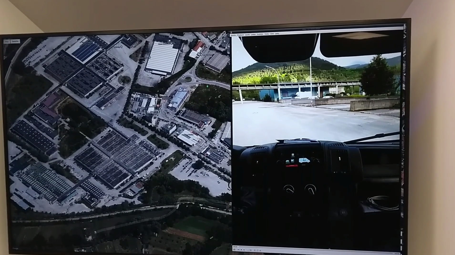
    The project will culminate in a real-world demonstration of the technology, comparing its performance to that offered by GNSS alone.

  • Orolia selected to deliver next-gen Galileo GNSS simulator

    Orolia selected to deliver next-gen Galileo GNSS simulator

    The European Commission and the European Space Agency (ESA) have selected Orolia to provide the core GNSS simulation engine for the Galileo Second Generation (G2G) RF Constellation Simulator (G2G RFCS).

    While the first launched Galileo satellites are reaching the end of their theoretical operational life, the G2G initiative includes the preparation of a future generation of Galileo global infrastructure, from satellites to ground segments, to maintain current services as well as provide improved performance and Required Navigation Performance (RNP) features to all users.

    In this context, Orolia has been selected to participate in the G2G RFCS activity, which will support G2G signals evolution requirements.

    The primary objective of the G2G RFCS initiative is to design, develop, manufacture and test an enhanced radio-frequency constellation simulator dedicated to Galileo engineering and experiments. This simulation technology will enable scientists and industries to verify, demonstrate and validate the future G2G configuration.

    To meet these requirements, Orolia will provide the core GNSS simulation engine based on its Skydel software technology, within a custom hardware configuration, to simulate all Galileo signals including Open Service (OS) and Public Regulated Service (PRS). Orolia’s GNSS simulators offer the high-end performance level and flexibility required to configure this new testing infrastructure in a software-defined solution.

    “With this project, Orolia demonstrates the Skydel platform’s exceptional flexibility to meet critical application requirements and serve as the core engine to design the next generation of GNSS signals,” said Orolia CEO Jean-Yves Courtois. “We are very proud to work with ESA, GMV and Tecnobit to help develop the next generation European Galileo constellation.”

    Image: ESA
    Image: ESA
  • ESA-backed autonomous driving lab coming to Italy

    ESA-backed autonomous driving lab coming to Italy

    Central Italy — already home to an ambitious national autonomous driving research initiative — will be the site of the P-CARS laboratory, intended to certify positioning devices for use within driverless cars.

    The new P-CARS laboratory is financed by the Italian Space Agency (ASI) through the Navigation Innovation and Support Programme (NAVISP) of the European Space Agency. The lab will support the goals of EMERGE, a public-private partnership for innovation established in 2018 between Italy’s Ministry of Economic Development, the University of L’Aquila and the mountainous Abruzzo region. Also in the partnership are the RadioLabs research consortium and the Leonardo, Telespazio and Elital companies.

    RadioLabs laboratory at the University of L'Aquila, part of Italy's EMERGE initiative developing autonomous and connected driving solutions. (Photo: RadioLabs)
    RadioLabs laboratory at the University of L’Aquila, part of Italy’s EMERGE initiative developing autonomous and connected driving solutions. (Photo: RadioLabs)

    EMERGE will develop satellite navigation and 5G solutions for connected, cybersecure and autonomous vehicles. The new P-CARS laboratory will be an independent venue for testing devices supporting autonomous and connected driving.

    “The idea behind it is to create a research ecosystem, focused on developing, testing, validating and promoting the use of Galileo and other GNSS — along with 5G communications — for connected and autonomous driving,” said Francesco Rispoli, chief satellite operations at Hitachi Rail STS and director general of RadioLabs.

    Abruzzo already hosts a manufacturing site for Stellantis’ Fiat Ducato light truck, the Galileo control center at Fucino, and the connected-car center of the University of L’Aquila. P-CARS will be integrated into the university’s Center of Excellence for Geo-localized, Connected and Cyber-secure vehicles.

    Italy's EMERGE initiative is developing GNSS and 5G technology for autonomous and connected driving. (Image: RadioLabs)
    Italy’s EMERGE initiative is developing GNSS and 5G technology for autonomous and connected driving. (Image: RadioLabs)

    “The P-CARS lab will have a 150-square-meter testbed area, beside an existing driving circuit, with the right to use the surrounding open space as well,” Rispoli said. “We’ll be addressing connected autonomous driving functions with GNSS technologies that are safety critical, the key point being that safety must be ensured through standardized test procedures, serving as a trusted third-party to validate specific solutions from companies.”

    “This is a valuable response to our national strategy, promoting the adoption of positioning, navigation and timing (PNT) solutions in the fast growing automotive sector by leveraging the latest technologies brought by Galileo and 5G,” said Alberto Tuozzi, head of ASI’s Navigation and Telecommunication Department. “Cross fertilization, cooperation and interaction among the stakeholders will be pursued in the unique ecosystem of the Abruzzo region, bringing together space and non-space stakeholders: ASI, ESA, satellite and automotive industries, universities and research centers.”

    Autonomous vehicles will have two distinct sets of inputs: sensors such as cameras, lidar and radar to know context around the car; and GNSS, inertial measurement systems and accelerometers to knowing where. The two sets work independently but come together to ensure safety. (Photo: RadioLabs)
    Autonomous vehicles will have two distinct sets of inputs: sensors such as cameras, lidar and radar to know the context around the car; and GNSS and inertial measurement systems to know its position. The two sets work independently but come together to ensure safety. (Photo: RadioLabs)

    Leveraging its expertise on Galileo and safety applications, ESA will support this initiative in two ways: with technical support and through cooperation and exchanges with other institutions and laboratories at the international level. ESA said P-CARS could become part of a network of centers of excellence in the PNT domain applied to autonomous cars and beyond.

    P-CARS will exploit the synergies between the rail and automotive sectors to provide benefits to both. “Car manufacturers produce millions of vehicles and are investing heavily in autonomy and safety systems, but had little experience in this field before they began investing a few years ago,” Rispoli said. “Meanwhile, the rail community has almost 20 years’ experience managing train driving functions with a high degree of autonomy, through the common European Rail Traffic Management System, ERTMS.”

    Hitachi Rail and Rio Tinto collaborated to build the world’s first driverless heavy freight train – an automated heavy haul freight transportation system delivering freight from mines to ports in Australia across thousands of kilometres every day. (Photo: Hitachi Rail)
    Hitachi Rail and Rio Tinto collaborated to build the world’s first driverless heavy freight train – an automated heavy haul freight transportation system delivering freight from mines to ports in Australia across thousands of kilometers every day. (Photo: Hitachi Rail)

    “It is well recognized that ERTMS guarantees the highest safety levels as a connected and autonomous driving system, where the human driver is largely bypassed, but not the volume for mass producing such systems for reducing their cost. By leveraging these two peculiarities it will be possible to get low cost but safety-proven GNSS-based devices,” Rispoli said.

    The emphasis will be on connectivity, with the vehicles linked to the infrastructure, including a centralized system of intelligent roads as well as other cars. 5G will enable low-latency communications and be a source of positioning data to extend the performance of GNSS.

    P-CARS is being supported through Element 3 of NAVISP, focused on supporting ESA member states’ navigation priorities.

  • ESA awards Euroconsult and ESPI with European space transportation study

    ESA awards Euroconsult and ESPI with European space transportation study

    Image: 3DSculptor/iStock/Getty Images Plus/Getty Plus
    Image: 3DSculptor/iStock/Getty Images Plus/Getty Plus

    The European Space Agency (ESA) has commissioned Euroconsult to conduct a study on the future of the European space transportation sector.

    Euroconsult, a global consulting firm specializing in space markets, has partnered with the European Space Policy Institute (ESPI) to investigate European institutional mission scenarios for the period beyond 2030 following the ITT on New European Space Transportation Solutions (NESTS).

    Euroconsult and ESPI will deliver an independent analysis focusing on the demand drivers of the future space transportation solutions in the period 2030–50 along already awarded contracts to ArianeGroup, Avio and Rocket Factory Augsburg (a subsidiary of OHB SE).

    Space transportation technologies are intrinsically complex, some needing long development cycles of up to a decade, explained ESA. In March, ESA signed within NESTS study contracts of €500,000 with ArianeGroup, Avio and Rocket Factory Augsburg (a subsidiary of OHB SE).

    These companies are tasked with carrying out research over the next few months. This will enable them to identify and recommend preliminary elements for future space transportation solutions to be used in the period 2030–50.

    “ESA, through its New European Space Transportation Solutions initiative, lays the foundations that enable us to prepare the future beyond Ariane 6 and Vega-C,” said Daniel Neuenschwander, ESA director of Space Transportation. “These system concept studies will include services that prioritize the future needs of Europe’s space programs but also allow us to address global market needs.”

    “Space transportation capabilities are evolving due to changes in launch demand and customers’ requirements and to the availability of innovative and cost-effective solutions serving these,” stated Euroconsult CEO Pacôme Revillon. “Euroconsult and ESPI expertise combined will guarantee the independence and neutrality of the results. All partners are fully committed to delivering a study that lays the groundwork for the future of the European space transportation sector,” he added.

    The studies will be completed before June and will feed the preparation of proposals to be submitted for decision at the next Council Meeting at Ministerial level in 2022.

  • Second-generation Galileo contract awarded to Thales

    Second-generation Galileo contract awarded to Thales

    Illustration: Thales Alenia Space
    Illustration: Thales Alenia Space

    Project will boost the positioning performance and real-time operability of the Galileo system.

    The European Space Agency (ESA) has selected Thales Alenia Space to support the implementation and experimentation of the navigation algorithms that will be used in the Galileo Second Generation program. Under the contract, Thales will develop the Advanced Orbit Determination and Time Synchronisation (ODTS) Algorithms Test Platform (A-OATP).

    Thales Alenia Space, a joint venture between Thales (67%) and Leonardo (33%), is the prime contractor for Galileo First Generation’s Ground Mission Segment,.

    ESA granted the contract on behalf of the European Commission in the Horizon 2020 Satellite Navigation Program (HSNAV).

    In a previous contract, Thales Alenia Space was chosen to provide six satellites and initiate the B2 phase of development and implementation of its ground segment for the Galileo Second Generation constellation.

    Using its long-standing legacy regarding navigation algorithms in addition to an innovative approach, Thales Alenia Space will develop and test a new Advanced ODTS solution. The new orbitography algorithms will allow a significant improvement in positioning performance and real-time operability of the Galileo system. It will exploit the accuracy of the GNSS orbit and clock estimation, with a solution optimized for the real-time generation of Galileo navigation messages, and take full advantage of the evolution of satellites and ground stations considered in the Galileo Second Generation.

    With this new contract, Thales Alenia Space applies on a deep experience concerning orbitography algorithms as well as knowledge of the Galileo system to strengthen its position as a major actor for the development of the new generation of this satellite system, the company stated in a press release.

  • ESA, public safety organization agree to support navigation services

    ESA, public safety organization agree to support navigation services

    Firefighters in Slovenia. (Photo: tomazl/E+/Getty Images)
    Firefighters in Slovenia. (Photo: tomazl/E+/Getty Images)

    Public Safety Communication Europe (PSCE) and the European Space Agency (ESA) have signed a Memorandum of Intent (MoI) to support the use of satellite applications for public safety.

    ESA and PSCE will work together under the new MoI towards establishing interoperable public safety communications systems.

    The MoI will support the emergence of space-based applications in the public-safety domain such as public safety services relying on secure mobile broadband communication solutions. These include applications within disaster preparedness, response and resilience, situational awareness, assessments of damages, navigation-based services for tracking and coordinating rescue forces on-site and for emergency vehicles.

    “ESA Space Solutions and the 4S Strategic Programme Line will support through this agreement the emergence of solutions making use of secure satellite communications for institutional public safety user communities,” said Rita Rinaldo, ESA. “This can be achieved as of today through existing satellite telecommunications infrastructures. In the future it will be possible to make use of new and innovative infrastructures with enhanced capabilities. Early pilots and demonstrations will showcase the unique benefits granted by satellites to the user communities and early adopters.”

    “The cooperation with ESA will help to explore complementary solutions that will contribute to cover capability gaps and needs for public safety. It is of extreme importance to improve public safety communication systems with cutting-edge and rapidly deployable solutions that will facilitate PPDR missions,” explained Marie-Christine Bonnamour, PSCE.

    The first step for ESA and PSCE cooperation will be PSCE participation in ongoing user studies on “Satellite Applications for Public Safety.” PSCE will help identify the needs of public safety stakeholders such as emergency services, fire brigades and law enforcement.

  • How Galileo performed its authenticated positioning fix

    How Galileo performed its authenticated positioning fix

    News from the European Space Agency (ESA)

    In a first for any satellite navigation system, Galileo has achieved a positioning fix based on open-service navigation signals carrying authenticated data. Intended as a way to combat malicious spoofing of satnav signals, this authentication testing began at ESA’s Navigation Laboratory — the same site where the very first Galileo positioning fix took place back in 2013.

    These historic first authenticated signal position, velocity and timing fixes were made using a total of eight Galileo satellites for around two hours on Nov. 18. The tests represent a first proof of concept for an eventual operational service offering positioning with authenticated data to users.

    Spoofing has, for instance, been demonstrated as a means of forcing down drones or redirecting ships, while some high security locations — as well as disrupted international borders — have become notorious for spoofing signals that prevent the reliable use of satnav in their vicinity.


    The Galileo Control Centres send the navigation signal to the GSC for the addition of the authentication code, which is then returned for uplink to the satellites.


    “When a receiver picks up a navigation signal from a satellite, up until now it has no way of confirming that was indeed its source,” said navigation engineer Stefano Binda, overseeing the project for ESA. “This can result in spoofing — malicious people and organisations using false signals to mislead users about their actual position. This authentication service offers a way to prevent such deception.”

    “In recent years, this problem has become sufficiently pronounced as a weak point that the European Commission, ESA and European GNSS Agency (GSA) decided to develop signal authentication as a differentiator for Galileo,” Binda said.

    An ESA Navigation Directorate team at the Agency’s ESTEC technical centre in the Netherlands worked with its GSA counterparts at the twin Galileo Control Centres (GCCs) in Italy and Germany and the Galileo Service Centre (GSC) in Spain. “In everyday authentication you might send a document that has been digitally signed, where both sender and recipient use compatible cryptographic keys to validate the document’s source of origin,” Binda said.

    “In this case we were working with a constrained amount of bandwidth within the navigation signal, so instead opted for a ‘delayed key’ approach. This means the initial data come along together a short tag which, within a short stretch of time usually not exceeding 30 seconds, is followed by a key, which is able to validate the tag and authenticate the data associated with it.”

    During the test campaign, the Galileo Control Centres send the navigation signal to the GSC for the addition of the authentication code, which is then returned for uplink to the satellites, to be received and authenticated by the test receivers at ESTEC’s Navigation Lab and elsewhere in Europe, in participating laboratories.

    To enabled the authentication test campaign, Thales Alenia Space in France served as prime contractor to upgrade of the Galileo Mission Segment — the world-spanning system that determines and create the navigation messages broadcast by Galileo satellites. Thales Alenia Space in Italy was responsible for the system level integration.

    No modification of onboard satellite systems has been required to support Open Service Navigation Message Authentication (OSNMA), as spare bandwidth was made use of.

    “We used our standard laboratory Septentrio test user receivers with a software add-on,” Binda said. “The beauty of this approach is that receivers will be able to make use of the future authenticated service without needing any new hardware, only software updates — apart from additional measures that might be mandated for operation in practice.”

    ESA and GSA are continuing their authentication testing, with a view to introducing an operational Open Service Navigation Message Authentication service for users in the near future.

    ESA’s Radio Frequency Systems, Payload and Technology Laboratories perform RF research for both the space and ground segments. (Photo: ESA)
    ESA’s Radio Frequency Systems, Payload and Technology Laboratories perform RF research for both the space and ground segments. (Photo: ESA)
  • Seen & Heard: Polar vortex tracking, Motional in Vegas

    Seen & Heard: Polar vortex tracking, Motional in Vegas

    “Seen & Heard” is a monthly feature of GPS World magazine, traveling the world to capture interesting and unusual news stories involving the GNSS/PNT industry.


    Image: ESA
    Image: ESA

    Caught in a vortex

    This winter’s polar vortex blasted the northern hemisphere. Understanding the vortex is the mission of the European Space Agency’s Aeolus satellite. Sudden stratospheric warming can disrupt the vortex, as it did this winter, causing the strong wind around the edge of the polar vortex to weaken or reverse (the processes involved are not fully understood). Aeolus emits short, powerful pulses of ultraviolet light from a laser and measures the Doppler shift from the light scattered back to the instrument from molecules and particles to deliver profiles of the horizontal speed of the world’s winds.


    Image: LiveEO
    Image: LiveEO

    Encroaching vegetation

    For the first time in history, according to Berlin-based start-up LiveEO, vegetation encroachment risk to the U.S. transmission grid has been analyzed from space. LiveEO used more than 15,000 satellite images to evaluate risk to 574,000 miles of electricity lines. The analysis covers the detection of vegetation along transmission corridors, as well as identification of grid segments exposed at dangerously close distances. Globally, vegetation causes up to 56% of externally triggered power interruptions.


    Photo: Motional
    Photo: Motional

    What happens in Vegas

    The Hyundai-Aptiv joint venture Motional in February tested its vehicles without safety drivers in Las Vegas. The tests came less than three months after the company received the green light from the state of Nevada to test its vehicles without a human safety driver. The vehicles navigated intersections, unprotected turns and interactions with pedestrians and cyclists. A Motional employee rode in the passenger seat and was capable of stopping the vehicle if needed.

  • ESA: Baltic ferry gathers data for self-aware sailing

    ESA: Baltic ferry gathers data for self-aware sailing

    News from European Space Agency (ESA)

    A day of ferry trips between Finland and Estonia became some of the best documented voyages in maritime history. Cameras, sensors, radio and satellite navigation receivers and even microphones recorded every instant of the crossings over the Baltic, gathering raw data for a new ESA-led project applying artificial intelligence (AI) to the situational awareness of shipping — as an important step to full autonomy.

    The Tallink shipping company’s new 212.2 meter-long Megastar passenger and car ferry was fitted with data-gathering devices for its sailings on the busy stretch of sea between Helsinki and Tallinn.

    The testing was overseen by a team from the Finnish Geospatial Research Institute (FGI) for an ESA project called Artificial Intelligence/Machine Learning Sensor Fusion for Autonomous Vessel Navigation, or Maritime AI-NAV.

    “Our aim is to show how AI can be applied to achieve autonomous situational awareness, so that a ship can reliably sense its own environment,” said FGI’s Sarang Thombre.

    Photo: European Space Agency
    Photo: European Space Agency

    “Such autonomous systems would initially be deployed in support of human crews, for enhanced safety and efficiency – with crewless ships a much longer-term goal.

    “The most experienced human ship captains will have the least trust in any single navigational device but will rather continuously cross reference between them. Similarly, our autonomous functionality will not be overly reliant on a single data source but combine and verify data from multiple sensors.

    “Having gathered many gigabytes of data during our initial August field campaign, then again in October with more days planned in December, we are applying the results to train and test our data-fusing algorithms. A follow-up seagoing test will then verify their performance in practice.”

    The Maritime AI-NAV team plans to employ a variety of sensor types, including satellite navigation receivers – also utilizing of Europe’s Galileo system — monocular and stereo cameras, standard radar, “laser radar” lidar and an array of microphones, along with “Automatic Identification System” radio signals. These AIS signals transmit position, size and routing information of all vessels above a certain class, as well as fixed infrastructure such as oil rigs or wind turbines.

    “Satellite navigation lets the ship know where it is in the sea, while the other sensors let it know what is around it, which is essential for identifying and avoiding any obstacles,” Thombre said. “The different data sources operate across a variety of ranges — so radar and AIS provide longer range detection out to the horizon, while cameras and lidars come into their own at shorter distances. Plus we had a trio of microphones aboard the Megastar, determining the angle of arrival of sound from other ships. The challenge now is to fully integrate all these sources using machine learning, to build up a holistic picture.”

    Maritime AI-NAV is supported through ESA’s Navigation Innovation and Support Programme, working with European industry and academia to develop innovative navigation technology.

    FGI is joined in the Maritime AI-NAV consortium by Aalto University’s Sensor Informatics and Medical Technology group and maritime IT startup Fleetrange.

  • Tests begin of Galileo’s OSNMA signal authentication service

    Tests begin of Galileo’s OSNMA signal authentication service

    In a first for any satellite navigation system, Galileo has achieved the first position fix based on navigation signals carrying authenticated data, according to the European Space Agency.

    Galileo’s Open Service Navigation Message Authentication (OSNMA) is intended as a way to combat malicious spoofing of satnav signals.

    OSNMA receivers successfully calculated an OSNMA-protected position fix after Galileo satellites started transmitting authentication data at 15:28 UTC on Nov. 18, 2020. The first tests used eight Galileo satellites for around two hours on Nov. 18. Tests have continued ever since, for intermittent periods, and will continue over the next months ahead of a public observation phase.

    The first authenticated signal position, velocity and timing fixes were made using a total of eight Galileo satellites for around two hours on Nov. 18, 2020. The tests represent a first proof of concept for an eventual operational service offering positioning with authenticated data to users. (Image: ESA)
    The first authenticated signal position, velocity and timing fixes were made using a total of eight Galileo satellites for around two hours on Nov. 18, 2020. The tests represent a first proof-of-concept for an eventual operational service offering positioning with authenticated data to users. (Image: ESA)

    Pioneering a long-awaited service

    The Galileo OSNMA authentication mechanism allows GNSS receivers to verify Galileo information, making sure that received data are indeed from Galileo and not modified in any way.

    “Ensuring the validity of positions elaborated by GNSS is one of the main challenges before addressing an entirely new set of applications demanding dependability and resilience,” said Matthias Petschke, director of space at the European Commission, DG DEFIS. “Galileo is now set on course to deliver on this highly anticipated feature and has many more novel features in store for the coming years.”

    Testing is taking place at ESA's Navigation Laboratory at ESTEC in the Netherlands, the same site where the first Galileo positioning fix took place in 2013.(Photo: ESA)
    Testing is taking place at ESA’s Navigation Laboratory at ESTEC in the Netherlands, the same site where the first Galileo positioning fix took place in 2013.(Photo: ESA)

    Increased robustness

    OSNMA test signals are being broadcast by the Galileo constellation using the spare bits from the current navigation message, therefore not impacting the legacy OS receivers implementing the current OS Signal-In-Space Interface Control Document (OS SIS ICD).

    “Galileo’s Open Service Navigation Message Authentication is one of its key differentiators,” said Rodrigo da Costa, executive director of the European GNSS Agency. “The additional robustness that it will provide to the Galileo signal will be critical for many applications, particularly those where security and trustworthiness are a priority, making the OSNMA a key component in any resilient PNT solution.”

    OSNMA works on a comparable basis to everyday encryption, where  sending a digitally signed document involves both sender and recipient using compatible cryptographic keys (private and public) to validate the document’s source of origin.

    “Up until now, as a navigation satellite disseminates navigation and timing data, there is no way of confirming these data are indeed coming from their apparent originator,” explained Paul Verhoef, director of navigation at the European Space Agency. “As a result, the data could be falsified, a phenomenon known as spoofing, where corrupt false signals mislead receivers about their position, misleading their users in turn, with potentially serious consequences.”

    An ESA Navigation Directorate team at the ESTEC technical centre in the Netherlands worked with their European GNSS Agency (GSA) counterparts at the twin Galileo Control Centres in Italy and Germany and the Galileo Service Centre (GSC) in Spain to develop and test the OSNMA.

    Next steps

    Upon successful completion of the internal testing phase, a public observation phase will begin, in which the OSNMA signal will be publicly accessible. In preparation for this phase, the OSNMA user Signal-In-Space Interface Control Document (OSNMA SIS ICD), receiver implementation guidelines, and the necessary cryptographic materials will be published. This will allow receiver manufacturers and application developers to test and prepare their products.

    During the public observation phase, feedback will be gathered from users, leading to the consolidation of the service.

    Testbed vehicle by ESA's Navigation Lab. (Photo: ESA)
    Testbed vehicle by ESA’s Navigation Lab. (Photo: ESA)
  • ESA-supported project tests autonomous vehicles in Finland

    ESA-supported project tests autonomous vehicles in Finland

    News from the European Space Agency (ESA)

    An ESA-supported project is testing autonomous vehicles on an intelligent road in Lapland, Finland.

    Known as Snowbox, this 10-km stretch of forest-lined roadway on Finland’s E8 highway has been specially equipped for autonomous driving tests, ESA said. Containing cameras, “laser radar” lidar, ultra-wideband antennas and reflective panels, the road itself is underpinned by power and fibre optic lines, and embedded with pressure sensors to record road surface conditions and the speed and type of vehicles driving along it.

    Known as Snowbox, this 10-km stretch of forest-lined roadway on Finland’s E8 highway has been specially equipped for autonomous driving tests, including FinnRef GNSS reference stations, as seen here. (Photo: ESA)
    Known as Snowbox, this 10-km stretch of forest-lined roadway on Finland’s E8 highway has been specially equipped for autonomous driving tests, including FinnRef GNSS reference stations, as seen here. (Photo: ESA)

    “If autonomous vehicles can drive well here, they can drive almost anywhere,” said Sarang Thombre of the Finnish Geospatial Research Institute, who’s managing the Arctic-PNT project. “Our project aimed at ensuring in particular that the precise positioning required by autonomous systems was available here, to establish this test site is indeed somewhere that driverless vehicle manufacturers should employ for testing. We carried out experiments with a robotic car over two successive seasons to show that the necessary precise positioning, down to 20 cm, is indeed accessible.”

    Snowbox is also linked to the FinnRef network of satellite navigation reference stations, to deliver corrections for precise satnav positioning. By performing positioning measurements continuously at fixed locations, these reference stations serve as a standard, allowing the identification of measurement errors to boost positioning accuracy on a localized basis, ESA added.

    Snowbox map. (Photo: ESA)
    Snowbox map. (Photo: ESA)

    “The Arctic is a difficult environment for autonomous driving in general,” Thombre said. “Signal disturbance due to the ionosphere, the electrically charged layer of the atmosphere, degrade satellite navigation performance. This effect is more pronounced in the Arctic region. And satnav augmentation systems also face challenges.

    “Because their signals are broadcast from geostationary satellites, they are only viewable here at an elevation of up to 10 degrees above the horizon. And mobile coverage — useful for providing correction data from reference networks — is also inconsistent.

    “In addition, possibility of mists and fog, snowstorms and rainfall make it difficult for cameras and lidar, while ice and snow on the road means wheel speed sensors may slip. And temperatures that can plunge down to below -30°C can impede the performance of electronics.”

    The Arctic-PNT team’s testing was based around a robotic car crammed with sensors and recording equipment. Called Martti, the vehicle was supplied by Finland’s VTT Technical Research Centre.

    Snowbox test roadway. (Photo: ESA)
    Snowbox test roadway. (Photo: ESA)

    “While Martti is capable of autonomous driving, we drove it manually,” Thombre said. “We were using it to capture all the data we needed. We started off using solely satellite navigation – including Europe’s Galileo and EGNOS – progressively adding more and more augmentation data, including in-car sensors, and corrections from the FinnRef stations, to reach the all-important precise positioning threshold of 20 cm.

    “To access the FinnRef corrections from the car systems we tested out various mobile sim cards. Adding to the challenge, we crossed an international border, because part of the E8 highway is instrumented on the Norwegian side as well — called Borealis.”

    The Snowbox infrastructure was established along the E8 because, while it is a remote roadway it is also economically important, with trucks heading south from Arctic fisheries.

    The Arctic-PNT test campaigns, starting from 2018, gave a positive bill of health to the Snowbox, which is available for experiment campaigns. The campaigns were supported through ESA’s strategic initiatives for the Arctic region.


    Feature image: The Arctic-PNT team’s testing was based around a robotic car crammed with sensors and recording equipment. Called Martti, the vehicle was supplied by Finland’s VTT Technical Research Centre. (Photo: ESA)

  • Galileo chalks up 500th ESA Engineering Board

    Galileo chalks up 500th ESA Engineering Board

    Image: ESA
    Image: ESA

    The end of 2020 marked a milestone for the Galileo First Generation, as the program chalked up its 500th European Space Agency (ESA) Engineering Board.

    For more than 12 years, ESA and industry engineers from all relevant disciplines — system, satellite, ground, signal, radio navigation, RAMS (reliability, availability, maintainability and safety), security and infrastructure — have put their best skills at the disposal of the board.

    The board is a forum where technical experts regularly meet to maintain, review and update the Galileo Project technical baseline, known as the System Technical Requirements Baseline (STRB). The STRB drives the implementation of the Galileo System and its infrastructure, the space and ground segments, along with associated interfaces and operations.

    The G1 system technical specification under ESA adds up to more than 22,000 separate requirements. These requirements are both unclassified and classified, with considerable interdependencies which all that need to be controlled in configuration.

    The Galileo G1 Engineering Board is chaired by ESA in accordance with its role as Galileo System Design Authority, assigned to it by the European Commission.

    Since the building of the first G1 Engineering Board in 2008, 26 Galileo satellites have been built, tested and flown. The Galileo system’s globe-spanning ground system has also been put in place and made operational. The board continues to be a crucial enabler for further robustness improvements and new service evolutions.

    A further 12 Batch 3 satellites are set to join the constellation in the coming decade. These satellites are being finalized at OHB Systems in Bremen, Germany, and then tested at ESA’s ESTEC Test Centre in the Netherlands.

    The worldwide Galileo ground segment includes two control centers (Italy and Germany) as well as various tracking, uplink and sensor stations and monitoring and test centers. (Image: ESA)
    The worldwide Galileo ground segment includes two control centers (Italy and Germany) as well as various tracking, uplink and sensor stations and monitoring and test centers. (Image: ESA)

    Galileo began initial operations in December 2016 and today serves more than 1.5 billion smartphones and devices.

    The G1 Engineering Board meetings will continue, complemented with Engineering Boards for the new Galileo Second Generation (G2 satellites are planned for later this decade), which are already well underway.