The U.S. Department of Transportation’s Federal Aviation Administration (FAA) has announced the largest civil penalty the FAA has proposed against a UAS operator for endangering the safety of the national airspace.
The FAA proposes a $1.9 million civil penalty against SkyPan International Inc. of Chicago. Between March 21, 2012, and Dec. 15, 2014, SkyPan conducted 65 unauthorized operations in some of the most congested airspace and heavily populated cities, violating airspace regulations and various operating rules, the FAA alleges. These operations were illegal and not without risk.
The FAA alleges that the company conducted 65 unauthorized commercial UAS flights over various locations in New York City and Chicago for aerial photography. Of those, 43 flew in the highly restricted New York Class B airspace.
“Flying unmanned aircraft in violation of the Federal Aviation Regulations is illegal and can be dangerous,” said FAA Administrator Michael Huerta. “We have the safest airspace in the world, and everyone who uses it must understand and observe our comprehensive set of rules and regulations.”
SkyPan operated the 43 flights in the New York Class B airspace without receiving an air traffic control clearance to access it, the FAA alleges. Additionally, the agency alleges the aircraft was not equipped with a two-way radio, transponder and altitude-reporting equipment.
The FAA further alleges that on all 65 flights, the aircraft lacked an airworthiness certificate and effective registration, and SkyPan did not have a Certificate of Waiver or Authorization for the operations.
SkyPan operated the aircraft in a careless or reckless manner so as to endanger lives or property, the FAA alleges.
SkyPan has 30 days after receiving the FAA’s enforcement letter to respond to the agency.
Air Line Pilots Association, Int’l (ALPA) is the newest supporter of the Know Before You Fly campaign, an initiative to promote the safe and responsible use of unmanned aircraft systems (UAS).
“Over the course of ALPA’s history, we have been a part of nearly every significant safety improvement in the airline industry, and have helped to make airline travel the safest mode of transportation in human history,” said Captain Tim Canoll, president of ALPA. “As a strong supporter of this UAS safety campaign, we will continue to promote and champion all aspects of aviation safety.”
The Know Before You Fly campaign was created by the Association for Unmanned Vehicle Systems International (AUVSI) and the Academy of Model Aeronautics (AMA). The campaign was launched in December 2014 in partnership with the Federal Aviation Administration (FAA) to provide UAS users with the information and guidance they need to fly safely and responsibly.
“ALPA’s support is significant and demonstrates how the airline pilot and unmanned aviation communities can work together to make the airspace safer for all users,” said Brian Wynne, president and CEO of AUVSI. “AUVSI’s members and ALPA’s members share a common commitment to the principles of airmanship that help foster a culture of safety.”
AMA President Bob Brown added, “The ties between model aviation and commercial aviation run deep. Model aviation has been a stepping stone to successful aviation careers. Many airline pilots report being influenced by model aviation early in life. Today, safety is a core principle shared within the aviation community.”
ALPA joins 23 other organizations that support Know Before You Fly, which include retailers, manufacturers, and distributors of UAS as well as several organizations representing the manned aviation community. For information, visit KnowBeforeYouFly.org or follow @FlyResponsibly on Twitter.
Denver International Airport and the Federal Aviation Administration (FAA) are partnering to raise awareness about safe unmanned aircraft operations.
The agencies teamed up on a public service announcement that will run on the video towers in the airport’s main terminal. The PSA uses the “No Drone Zone” slogan to drive home the point that flying an unmanned aircraft near a manned aircraft is illegal and dangerous. It refers viewers to the FAA’s unmanned aircraft website and to the knowbeforeyoufly.org website for further information and guidance on flying unmanned aircraft safely and responsibly.
The PSA will air all day today following its unveiling at an unmanned aircraft safety press event that the airport organized and hosted. After that, it will air for two weeks surrounding the winter holidays — a time when many people will be getting drones as gifts.
Denver also will post the PSA on the airport website so it will reach travelers every day of the year.
The FAA has partnered with leading unmanned aircraft industry and hobbyist groups in the Know Before You Fly education campaign, and the campaign materials are now featured in product packaging for several types of UAS.
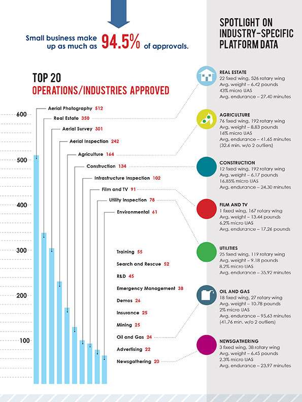
The Association for Unmanned Vehicle Systems International (AUVSI) today released a report that finds more than 25 types of business operations have been approved by the Federal Aviation Administration (FAA) to fly unmanned aircraft systems commercially in the National Airspace System (NAS). According to the report, aerial photography received the most exemptions followed by real estate and aerial surveying. The report also finds that exemptions have been approved in 49 states.
“These figures show that businesses across every industry sector have been waiting to use UAS for years and are excited to finally get this technology off the ground,” said Brian Wynne, president and CEO of AUVSI. “From inspecting bridges and power lines to filming movies and supporting emergency services, the applications of UAS are virtually limitless and enable researchers, public agencies and businesses to do things that were previously considered to be impossible.”
In May 2014, the FAA announced it would consider granting exemptions for certain low-risk commercial UAS applications under Section 333 of the FAA Modernization and Reform Act of 2012. Since then, the agency has received more than 2,700 requests and approved more than 1,400 petitions.
AUVSI analyzed the first 1,000 exemptions approved by the FAA. Specifically, the report finds:
The approved exemptions cover more than 25 types of business operations, with aerial photography receiving the most approvals with 512. Real estate followed with 350 exemptions and general aerial surveying with 301 exemptions.
Exemptions were approved for operators from 49 states. California received the most with 114, followed by Florida with 97 and Texas with 82.
California companies also manufactured the most platforms mentioned in the approvals, totaling 140. Florida followed with 19. In all, 22 states house manufacturers of platforms approved in the first 1,000 exemptions.
More than 90 percent of the first 1,000 exemptions were granted to small businesses.
Companies that received exemptions generate at least $500 billion to the U.S. economy annually and represent more than 600,000 jobs.
While the Section 333 process has continued to unlock the potential of UAS technology, AUVSI emphasized that regulating by exemption is no substitute for finalized rules.
“For the full potential of the UAS commercial market to be realized in the U.S., the FAA needs to finalize its small UAS rule as quickly as possible,” Wynne said. “Once this happens, we will have an established framework for UAS operations allowing anyone who follows the rule to fly. The positive effects of the regulation will be felt across the whole country.”
An economic impact study released by AUVSI in 2013 found the UAS industry will create more than 100,000 new jobs and more than $82 billion in economic impact within the first ten years following UAS integration.
The complete study, including state-by-state data, is available.
The Federal Aviation Administration (FAA) has released the beta version of a new smartphone application called B4UFLY for testing by up to 1,000 unmanned aircraft users.
The B4UFLY app, aimed primarily at model aircraft enthusiasts, is designed to give users information about restrictions or requirements in effect at their current or planned flight location. The FAA expects the beta test will yield valuable data on how well B4UFLY functions, as well as uncovering any software bugs.
FAA Administrator Michael Huerta first announced the initiative in May, asking for volunteers to test the app. The FAA has notified those who previously signed up and will be pushing the app to them directly in the coming days.
Many unmanned aircraft users today have little or no aviation experience, and some of them are flying where they could endanger manned aircraft. B4UFLY will give these flyers the tools and knowledge they need to operate safely.
Key features of the B4UFLY app include:
A clear “status” indicator that immediately informs operators about their current or planned location.
Information on the parameters that drive the status indicator.
A “Planner Mode” for future flights in different locations.
Informative, interactive maps with filtering options.
Links to other FAA UAS resources and regulatory information.
B4UFLY complements the Know Before You Fly educational campaign, which provides prospective UAS operators with information and guidance they need to fly safely and responsibly. The FAA is a partner in the effort with the Association for Unmanned Vehicle Systems International (AUVSI), Academy of Model Aeronautics (AMA), and the Small UAV Coalition.
Using the location services feature of a user’s smartphone, the app quickly determines restrictions or requirements in effect where they want to fly and gives the user a clear status icon. The status indicator function considers airspace, proximity to airports, temporary flight restrictions, current law and other FAA guidance and procedures.
Model aircraft operators who fly within five miles of an airport are required by law to notify the airport and the air traffic control tower — if there is one at the airport — prior to operating. The FAA is working on an electronic notification process to satisfy this requirement that will become part of a future version of B4UFLY. During the beta test, the FAA will collect user feedback and operational data and use it to develop this electronic notification process.
The beta test is expected to run for several months, after which the FAA plans to make B4UFLY available to the general public. The beta test will be for iOS devices only, but the FAA is working to ensure the full version will be compatible with Android devices as well.
The Federal Aviation Administration (FAA) wants to send out a clear message that operating drones around airplanes and helicopters is dangerous and illegal. Pilot reports of unmanned aircraft have increased dramatically over the past year, from a total of 238 sightings in all of 2014, to more than 650 by Aug. 9 of this year. Unauthorized operators may be subject to stiff fines and criminal charges, including possible jail time.
Pilots of a variety of different types of aircraft — including many large, commercial air carriers — reported spotting 16 unmanned aircraft in June 2014, and 36 the following month. This year, 138 pilots reported seeing drones at altitudes of up to 10,000 feet during the month of June, and another 137 in July.
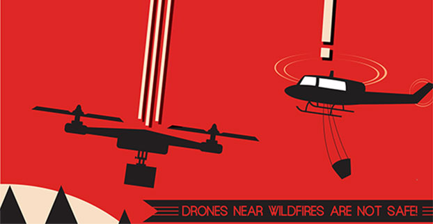
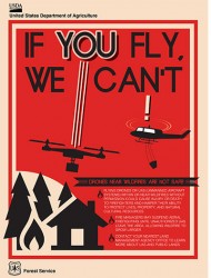
Meanwhile, firefighters battling wildfire blazes in the western part of the country have been forced to ground their operations on several occasions for safety reasons when they spotted one or more unmanned aircraft in their immediate vicinity.
The FAA says it will continue to work closely with industry partners through the “Know Before You Fly” campaign to educate unmanned aircraft users about where they can operate within the rules. The agency is also supporting the National Interagency Fire Center’s “If You Fly, We Can’t” efforts to help reduce interference with firefighting operations.
However, the FAA also is working closely with the law enforcement community to identify and investigate unauthorized unmanned aircraft operations. The FAA has levied civil penalties for a number of unauthorized flights in various parts of the country, and has dozens of open enforcement cases.
The FAA encourages the public to report unauthorized drone operations to local law enforcement and to help discourage this dangerous, illegal activity.
A Kentucky man shot down a drone when it crossed into “his airspace” over his backyard, and was subsequently arrested and charged with criminal mischief and wanton endangerment.
William Merideth told Ars Technia that he never would have shot the drone with Number 8 birdshot if it had only been flying past. But since it hovered, he felt it was an invasion of privacy. He claims the drone was flying 10 feet above his property and had been spying on his neighbor’s sunbathing daughter.
“It was just right there,” he told Ars. “It was hovering, I would never have shot it if it was flying. When he came down with a video camera right over my back deck, that’s not going to work. I know they’re neat little vehicles, but one of those uses shouldn’t be flying into people’s yards and videotaping.”
Merideth’s claims are disputed by the drone’s owner, who has evidence that rebuts Merideth. David Boggs, who was flying the drone, showed WDRB-TV a video of the flight path of the altitude of the drone, showing that the drone did not drop as low as 10 feet. Boggs, one of four owners of $1,800 drone, confronted Merideth and called police. Boggs told WDRB that he bought the drone just a few days before it was shot down and planned on using it to shoot video of his children riding motocross.
“I would just like [the drone owner] to get some education on his toy and learn to respect the rights of the people,” Merideth said. “It’s fine and dandy, and I think it’s cool there’s a camera on it, but just take it to a park or something — he’s not a responsible drone owner.”
In another incident involving drones and guns, an 18-year-old mechanical engineering student attached a semi-automatic gun to a quadcopter drone, and posted the result on YouTube in early July.
The video has been viewed more than 3 million times and was covered by the national media. The Federal Aviation Administration is investigating.
Peter Sachs, an attorney and drone advocate, welcomes the FAA investigation into the armed drone. “Drones should be used for good, not for evil,” Sachs said. “There are countless ways that drones can be useful. Using one as a remote-controlled weapon is not one of them, and I question the judgment of anyone who would attempt to do so.”
Amazon has announced a plan for its package-delivery drones, according to NBC News.
The proposal includes tiered flight zones that would limit small unmanned aircraft systems (sUAS) to slow speeds in airspace below 200 feet and allow them to fly faster for long-distance travel between 200 and 400 feet.
Commercial aircraft are governed by the Federal Aviation Administration’s (FAA’s) Air Traffic Control, and in Amazon’s vision, there would be a similar central command and control network that takes in data about the position of each drone and shares it with every other vehicle connected to the network. The command and control network would also have vehicle-to-vehicle communication, similar to networks proposed for autonomous automobiles.
Amazon’s plan would be to use the space below 500 feet — minus a 100-foot buffer — for small drones such as its Prime Air vehicles.
Access to the various layers of the airspace would be governed by how well a drone can communicate with its pilot, the command and control network and other drone, according to The Verge website. “Everyone can have access to the airspace,” said Gur Kimchi, who heads up Amazon’s Prime Air program. “It doesn’t matter if you’re a hobbyist or a corporation. If you’ve got the right equipment, you can fly.”
Someone operating a radio-controlled quadcopter with no Internet connection would be relegated to the area below 200 feet.
GPS World held a webinar on new unmanned aircraft initiatives on May 21 led by a panel of experts. On hand were Don Mark of the law firm Fafinski, Mark and Johnson; James Spicer and Adrien Perkins, both students in aeronautics and astronautics at Stanford University; and Peter Cosyn site manager and director of research and development at Gatewing, a Trimble company. I also participated.
Alan Cameron, editor-in-chief and publisher of GPS World, hosted the event and introduced the participants. Around 300 people signed up to listen to the webinar and ask questions.
Don Mark provided a legal overview of the FAA’s regulations for UAS, FAA and U.S. Senate initiatives, James Spicer and Adrien Perkins reviewed the Jäger UAV jammer detection project, and Peter Cosyn provided an overview of the Gatewing/Trimble UX5 UAS solution. I provided insight into recent UAS industry.
Finally, the panel discussed a few of several written questions submitted by the webinar attendees. We promised to publish both these questions and our attempt at providing answers. Please bear in mind that this is new area of technology, applications and regulations governing operations — so we welcome clarifications and inputs as we may miss the mark occasionally!
Q&A for GPS World Webinar:
“New Frontiers in Unmanned Flight: Hey You, UAV!”
Is the FAA going to keep requiring a pilot’s license to operate a UAV?
The draft sUAS rulemaking proposed by the FAA does not require a pilot’s license. Instead, there’s a requirement to pass an aeronautical knowledge test, obtain an FAA UAS operator certificate and to pass an FAA knowledge test every 24 months. However, the Section 333 exemptions granted by FAA so far have all required that the operator have a private pilot’s license.
What are the effects (operational, legal) of GNSS receiver failures in UAV missions and what are some technical measures to avoid them?
Most UAS used within a critical or commercial operation not only carry GNSS, but also have some form of navigation back-up system — MEMS inertial being the most common — so navigation is still possible, albeit for a short time with any degree of accuracy. And in the event of a communications link failure, the norm is to have the UAV follow a pre-programmed “return-to-base” route, so the vehicle returns safely to a known location.
What is the development of UAVs in the healthcare industry?
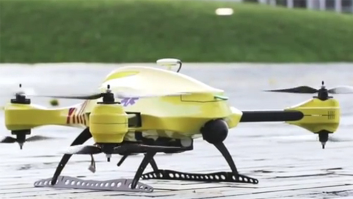
There are a number of ongoing and proposed applications of drones that are health related. A prototype system in Delft, Netherlands, carries a defibrillator to be used to revive heart-attack victims. The concept is that a network of geographically distributed drones would be called from a cellphone, and the closest UAV would be dispatched and would be able to arrive much quicker than a conventional ambulance.
This drone is part of a prototype healthcare delivery system in Delft, designed to carry a defibrillator to heart attack victims and caregivers.
Other healthcare applications could include the rapid delivery of vaccines, medications and supplies delivered right to the source of an outbreak. This could more rapidly reduce the incidence of life-threatening communicable diseases. Communication equipment, mobile technology and portable shelters could be delivered in a rapid fashion to areas where critical infrastructure damage would prevent ground or typical air transport. Drones have also been used extensively in disaster relief efforts.
Also, in July, unmanned aerial vehicles will deliver medical supplies to a free health clinic in Wise, Virginia. The most urgent prescriptions will be provided by pharmacies located out of town. To get the medicine to the community as soon as possible, the pharmacies will deliver them to their local airport, where they will be collected by NASA’s fixed-winged aircraft and be flown to Lonesome Pine Airport. When the prescriptions arrive there, they will be loaded onto Flirtey drones and delivered to the Wise County Fairground. Flirtey drones are expected to deliver around 24 packages of prescription medication.
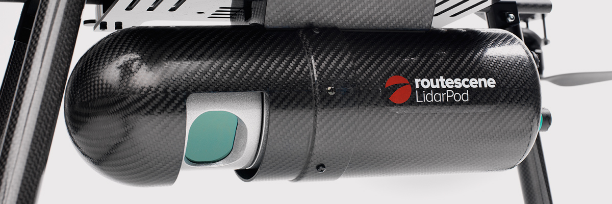
Please describe LiDAR systems available for UAVs.
There are many lightweight LIDAR systems on the market for UAV applications — some even come integrated within their own operational drone system. Coupling drone-mounted LiDAR systems with vision cameras, advanced computer processing and GPS, it has now become possible to create a remotely piloted flying LiDAR scanner.
Routescene’s LiDAR pod attached to the belly of a UAV.
Update us on legal matters within the European Union?
The EU has been very active in preparing for the commercial use of UAS, so drone use in the EU appears to be significantly higher than in North America because of the proactive effort of regulators to introduce drones into regular commercial applications. This Forbes article summarizes the approach being taken and the progress towards introducing regulations within the EU by the end of 2015.
You speak of “UAV navigation in environments where traditional GPS receivers may fail.” Are you considering indoors navigation or “just” urban environment?
It’s true that drones are being operated indoors — for instance, within restaurants. In these environments, all the typical indoor navigation techniques will be viable — RF/magnetic fingerprinting, Bluetooth beacons, Wi-Fi source databases, cellphone signals including small cells, and even optical sensors, all often combined with indoor maps.
Urban environments with a restricted view of the sky also continue to challenge GNSS only navigation, which has led to extensive use of integrated inertial/GNSS navigation sensors.
Modularity of UAVs? Different sensors for different types of applications using the same UAV?
A number of professional drone manufacturers offer UAS that could carry different payloads. However, most manufacturers seem to focus on particular applications (flying camera, LIDAR and/or video survey) and don’t carry an extensive range of optional third-party payload equipment.
What regulations are there for self-made UAS?
It’s hard to imagine that the regulations would be different for a commercially manufactured drone or a home-built UAS. Only time will tell as regulations are developed that include this category of UAS.
What background and abilities should a team possess if it wants to develop a UAV?
An engineering team that takes on developing a UAV needs to be aware of the basics of flight, navigation and control/communications — these are the principle elements of UAV operations.
Do you exploit software-defined radio techniques?
Software-defined radios may find their way into UAVs whenever weight/volume are an issue, but they potentially require higher computing capability, and maybe somewhat higher power to run co-processors. Weight and power consumption are at a premium on small UAVs, so any initiative that saves in these areas will no doubt be welcomed.
What are the emerging application areas for UAVs?
It would seem that the application areas for UAVs are virtually unlimited. High interest areas include agriculture, pipelines, buildings and transmission line inspection, aerial survey, filmmaking and newsgathering, wildlife and environmental monitoring, fishing and military reconnaissance/weapons delivery. But there are many, many applications, some of which might not fit into this summary of applications.
When will the UAV market move beyond focusing on the drone itself and get to the important topic of what sensor technology and back-office systems provide the best value to the user? The UAV is a commodity.
Good comment — the utility of the UAV comes from the payload it carries and the analysis of the data it collects and how it can be operated.
I’m curious if the UAV mission will be used in conjunction with autonomous agricultural tractors and construction machinery. I’m assuming an off-site tractor operator would benefit from the aerial data for their scope of work.
Absolutely — another possible UAV application.
Do you know when high-altitude long-endurance solar-powered UAVs will start being used?
The key application being pursued by Google using high-altitude, long-endurance, solar-powered drones is to provide Internet coverage in areas that currently have no ground infrastructure. A number of countries around the world would benefit from connection to the Internet using this approach. Unfortunately, the prototype aircraft built by Titan Aerospace recently crashed. But Google has vowed to continue with its efforts. Another development, called Project Loon, involves the use of high-altitude balloons and is already well underway.
I am currently enrolled in the UAV Pilots Certificate Training Program offered through the Unmanned Vehicle University. Is this certificate, which costs $3500, going to actually benefit me in my future commercial operations? Does the FAA recognize it as anything valid? So unless the certificate provides me some practical advantage, I’m not sure if it was legitimate or a scam. Any thoughts on this or experience with this “University”?
A recent Senate bill seeks to establish the six FAA test centers as the authorities for training UAS pilots. However, it would appear that currently no universal training course has yet been developed or approved for UAS pilot training — so it may be premature at this stage to engage with third parties for training until guidelines are published by the FAA.
What is the positional uncertainty associated with the locational measure of GPS systems on these UAVs? What will it be in five years?
Depending on the application, accuracies between 1 meter and a few centimeters are being achieved. For higher accuracy requirements such as precision surveying, post-processing of data collected during a survey can provide accuracies within a few millimeters.
In five years’ time there will be more satellites in more constellations, and it’s possible that accuracies could improve further. However, the most benefit will come from having more reliable signals, more often, thereby reducing re-test and operational costs.
What industry do you see being the fastest adopter of UAV technology in the USA?
The U.S. military is already leading in the number of applications, number of operational UAS and number of different types of vehicles. Commercial applications have increased substantially now that the FAA has authorized a large number of civilian operations in the last year or so. There are a number of film and TV applications for movie-making and newsgathering, and this appears to be a growing area for commercial UAS. Aerial survey is also growing in popularity, and there is a huge range of monitoring applications for building inspection, pipeline and transmission line inspection, and also for crop growth monitoring — which may turn out eventually to have the highest number of applications in the U.S.
How do you think the industry should protect UAVs from GPS spoofing and other forms of remote or internal component (example ICS or SCADA) attacks?
Solutions to mitigate GNSS spoofing and signal jamming are currently high on the list of most receiver manufacturers’ development agendas, with several options already having reached the market. Anti-jam antennas, improved signal rejection in RF front ends, and algorithms that claim to be able to deduce and overcome spoofing attacks — these are the leading solutions that have been fielded. But we have only just scraped the surface of deceptive techniques being used and the frequency with which they are being encountered, so we should continue to see the solutions evolving to counteract more sophisticated interference and spoofing capabilities over time.
Will the upcoming regulations only impact commercial users, or will they also directly affect non-commercial and/or recreational operators?
In the U.S., regulations governing the operation of recreational or hobby aircraft appear to be less stringent than, say, a drone operating commercially. As long as common sense rules are observed, hobby aircraft operators have been able to operate without the FAA looking over their shoulders — provided they stay below 400 feet in an open space away from sensitive areas such as schools or hospitals and don’t make an inordinate amount of noise, no one has yet proposed more restrictions for hobbyist model aircraft operators. The focus for the FAA is currently on bringing drones safely into the national airspace system for commercial operations, so regulations so far have been mostly formulated to enable this to happen.
Proposed legislation in the USA refers to one pilot per vehicle; no mention is made of swarming or control of multiple vehicles per pilot. Is it worth developing apps that use swarms of UAVs at the moment?
Certainly, it’s been difficult for the FAA to introduce regulations for UAS that are acceptable for most anticipated commercial operators, while still respecting and protecting current manned aircraft operations. So far, we’ve had case-by-case approval for specific operations, while regulations for small UAS (sUAS) have only just been circulated for comments — and a huge number of comments have been received. So regulations for “regular-sized” and operated drones and for larger vehicles have not yet seen the light of day. So, the more complex applications involving the operation of a swarm of UAS may not yet have been even considered by the FAA. It has taken years to get this far, and we still don’t have any published regulations for any class of UAS in commercial applications, so it’s doubtful that there is any work underway on regulations for swarming drones. So develop apps if you wish, but don’t expect much regulatory support for some time yet.
What assurance do we have that a UAV operator won’t deliver a weapon instead of an Amazon purchase?
The exemptions that have been published allow certain well-defined, specific commercial operations of UAS. The unmanned vehicle has to be registered to an individual and get a unique tail number. The operators have to be identified and must regularly demonstrate proficiency and adequate knowledge to become a recognized operator. So authorities get to inspect the UAV, know the owner and know the operator, and even get to review and approve the location of each UAS operation — not that that would prevent someone subsequently modifying the vehicle to carry ordinance, or knowingly attacking a target. It would, however, be pretty easy to track down the offender, but that doesn’t really prevent “weaponization” or delivery. But we are only at the small-vehicle-level currently, so its doubtful if major damage would be possible with small weapons, but an individual attack might still be lethal. Careful screening of individuals seems to be the route the regulators have taken to minimize this risk. This is still a difficult issue that is going to take some policing and close control.
Instead of an actual pilot’s license required for legal flight of a UAV, do you think an all-encompassing UAV pilot’s license will be required? I ask because I am a trained Trimble UX5 pilot, but I do not have my pilot’s license. I also build UAVs, and I am curious how I would get a UAV pilot’s license for a UAV I built? Unless they had an all-encompassing training course for pilot/flight safety.
The FAA proposed rulemaking for sUAS operations did not require operators to have a pilot’s license. Instead, UAS operators are required to undertake a specific recurrent training course for UAS operators, administered by FAA qualified trainers. Regulations relating to “home-built” UAS have yet to emerge, and may be some time away from publication.
It is said that mainland China has over 70% of the world UAV market? How did we fall so far behind?
Lack of regulations in the U.S. may have held back U.S. industry — see related comments by Amazon in testimony to the U.S. Congress.
But also the absence of restrictions in other countries may have helped overseas manufacturers get established and to gain initial market share. While the majority of done R&D was initially within the U.S., it’s clear that DJI and its Phantom line of drones have become very popular, very quickly. Strangely enough, the largest concentration of buyers and operators currently appears to be in the U.S.
Insurance against UAVs crashing and causing damage to humans: what progress has been made in this area?
Several insurance companies are now writing risk-coverage policies for UAS, including Global Aerospace, USAIG, Allianz and AIG.
We are operating a GNSS reference network in Greece, SmartNet-Greece (Leica Geosystems). Is there a tested NTRIP system on UAVs, to be connected and monitored to Ntrip caster? How could this augment real-time GNSS accuracy of UAVs?
Seems like you are trying to get RTCM corrections from a ground network to a flying UAV – correct? So do we need an Internet connection to get your ground network RTCM corrections onto the UAV? I’m not an expert on available mobile Internet hook-ups, but most smartphones have one, so it can’t be that hard to add this onto a UAV. Alternatively, wouldn’t it be easier to have the GNSS receiver on the UAV listen to a PPP broadcast from one of the several services providing these corrections? We could get down as far as 10 cm accuracy with one of these commercially available correction services.
Talk about the possibilities of precise positioning in UAVs, instead of mapping.
Precise real-time positioning on a UAV is a question of which GNSS receiver is onboard and which PPP or local RTK network transmissions are available in the area of UAV operations. Positioning accuracy is possible of a few centimeters down to a few millimeters post-processed.
Realistically, how close are we to being able to fly UAVs for commercial applications such as topographic surveys and earthworks applications such as mining sites?
As we heard during the webcast, obtaining an FAA section 333 exemption is quite possible for these applications, and some have already been granted. The FAA has been streamlining the process recently to reduce the time it takes to obtain these authorizations.
What is a practical ceiling for UAV flight?
The FAA has limited UAS operations to below 400 feet in the Section 333 exemptions that have been granted, while 500 feet is used as the maximum ceiling in the proposed draft sUAS regulations.
What is status of technology for “see and avoid” requirements for UAVs?
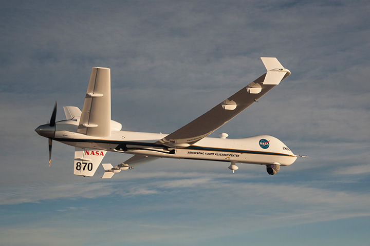
NASA, the Federal Aviation Administration (FAA), General Atomics Aeronautical Systems (GA-ASI) and Honeywell International Inc. have successfully demonstrated a UAS proof-of-concept sense-and-avoid (SAA) system. GA-ASI worked with NASA’s Armstrong Flight Research Center to integrate the new system aboard NASA’s Ikhana research aircraft, a civilian version of the company’s Predator B. The flight-test campaign in November and December 2014 evaluated the SAA system in a wide variety of collision-avoidance and self-separation encounters between two remotely piloted aircraft and various manned aircraft and included a sensor-fusion algorithm being developed by Honeywell.
NASA’s Ikhana Predator B drone.
An RTCA subcommittee is also working in parallel to develop the requirements for an SAA system, and these flight-test evaluations will contribute to those technical standards.
Other companies that are also thought to be active in SAA development include Rockwell/Collins, Sierra Nevada and Insitu/ Queensland University of Technology Australia.
So, a large number of questions on a pretty wide range of subjects — hopefully some of the answers we’ve provided will be of assistance — but please provide us with your comments if you have information to share.
Disclaimer: The statements, questions, views and opinions presented in this article are those of the author and webcast audience, and may not necessarily reflect the opinions of GPS World magazine, its owners or staff. Readers are also warned that the answers are provided on a best-effort basis and could be less than 100% correct.
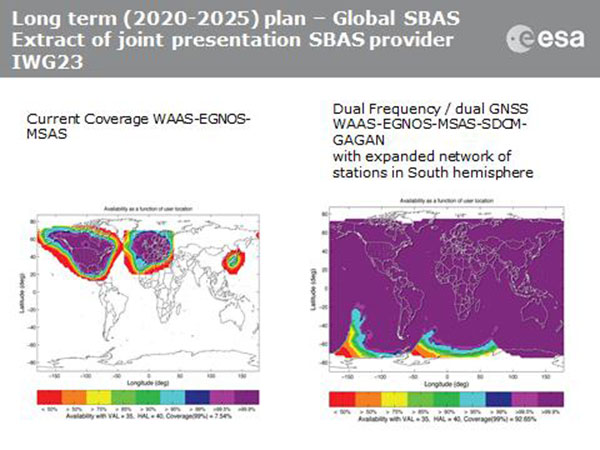
Current coverage (left) of WAAS, EGNOS and MSAS; long-term 2020–2025 (right) plan for dual-frequency, dual-GNSS WAAS-EGNOS-MSAS-SDCM-GAGAN.
SBAS Agree to Common Message
Aircraft navigation and safety will benefit from enhanced, reliable satellite navigation signals on a seamless basis across much of the world in the 2020–2025 timeframe. The 28th Satellite-based Augmentation Systems Interoperability Working Group (IWG) came to agreement on standardization of satellite-based augmentation systems (SBAS) in a meeting hosted by the European Space Agency in early April. The group planned a shift from reliance exclusively on GPS to a multi-constellation design employing Galileo, BeiDou and GLONASS after 2020.
The agreement centers around a message definition for a new secondary SBAS channel — to be known as L5, along with the current L1 — for second-generation SBAS systems, which will utilize dual-frequency multi-constellation signals, greatly increasing the accuracy of navigation systems available to airliners by largely eliminating ionospheric errors. Plans also call for an expanded network of stations in the Southern Hemisphere. The IWG document must now be accepted by the official international SBAS standardization bodies: the International Civil Aviation Organisation, the U.S. Radio Technical Commission for Aeronautics (RTCA) and the European Organisation for Civil Aviation Equipment.
The meeting also reported on the state of development of the other global SBAS systems. Along with the four operational systems — the U.S. WAAS, European EGNOS, Japan’s Multi-functional Satellite Augmentation System (MSAS) and India’s GAGAN (GPS and geo-augmented navigation system) — these comprise South Korea’s KASS, China’s Beidou SBAS, Russia’s System for Differential Corrections and Monitoring (SDCM) and the West African Agency for Aerial Navigation Safety in Africa and Madagascar (ASECNA) SBAS.
UAV Integration into Airspace
The Federal Aviation Administration (FAA) announced two new initiatives related to unmanned aircraft systems (UAS) at the Association for Unmanned Vehicle Systems International (AUVSI) Unmanned Systems 2015 conference in Atlanta, Ga., in early May.
FAA Administrator Michael Huertatold a large gathering of national journalists, “The unmanned aircraft industry is changing faster than any segment in the aircraft industry. A new project to harness that energy, the Pathfinder program, is partnering with three leading U.S. companies to expand unmanned aircraft operations in the United States.” The FAA is working with industry partners on three focus areas:
CNN will research visual line of sight (LOS) operations for newsgathering in urban areas. CNN will continue working with Georgia Tech University to improve newsgathering for all organizations.
PrecisionHawk will investigate agricultural operations for rural areas, flying outside LOS.
BNSF Railway, second-largest freight railroad network in North America, will undertake inspection of rail infrastructure, also beyond visual LOS.
Huerta said that the partners, collectively, “are trying to push the envelope, what can we accommodate safely and what can we learn from that.We’ll test a little, learn a little, then test some more. How do we see a staged implementation? To integrate unmanned aircraft, but to do it safely. We’re trying to push the edges of what we can allow, working with partners who have specific uses and resources.”
As to a timeframe to reach new UAV regulations, he replied, “I can’t comment a lot on the rule itself, but it’s fair to say that in the rulemaking comment process [closed on April 24], we received more than 4,500 comments. It’s too early to say how those comments will shape the final rulemaking.
“Assessment will be done in the coming months, perhaps by the end of the year, but that’s an aggressive timetable. That’s not accomplished in six months, nor should it take a million years.”
New Airbus EGNOS-Capable
The new Airbus A350 airliner, now entering service, comes fitted with EGNOS. The EGNOS system is being adopted by European airports to enable satellite-guided landing approaches. The A350’s Satellite Landing System allows pilots to perform precision-landing approaches guided by EGNOS or its U.S. equivalent, WAAS. The capability offers vertical landing guidance down to a minimum of 60 miles.
New Galileo Satellite on the Air
Monitoring by researchers at the German Aerospace Center (Deutsches Zentrum für Luft- und Raumfahrt, or DLR) indicates that one of the Galileo full-operational-capability (FOC) satellites launched on March 27 has begun transmitting standard L-band signals using pseudorandom-noise-code identifier 22.
The first E1 and E5 signals from GSAT0204, also known as FOC-FM4 and Galileo 8 and as NORAD object 40545, were received at an International GNSS Service Multi-GNSS Experiment tracking station in Windhoek, Namibia, at about 11:32 UTC May 21. The satellite’s signals were subsequently tracked by a station in Wettzell, Germany, and then by others.
The signals will be set unhealthy for use until satellite commissioning is completed.
News item courtesy of CANSPACE Listserv.
Euroship Gets eLoran as Backup
Container ship in port.
Ship management company EuroShip Services Ltd. has installed eLoran as a backup to GPS to ensure the safety of its vessels operating off the coast of the United Kingdom.
The trial installation may lead to implementation across the full fleet of16 vessels managed by Euroship, working routes in Northern Europe. The land-based radio navigation system is intended to seamlessly take over in the event of a GPS outage. EuroShip plans to simulate GPS outages to test eLoran provision of position, navigation and timing data automatically.
New GPS III RFP
The U.S. Air Force (USAF) has released a draft Request for Proposal for GPS III Launch Services, encompassing launch vehicle production, mission integration and launch operations.USAF reintroduces competition into the Evolved Expendable Launch Vehicle (EELV) program after more than a decade.
GPS III is the first of nine launches the Air Force intends to competebetween now and 2017, followed by 25 more from 2018 to 2022.
In this special section, GPS World focuses on automous positioning and navigation technology, including unmanned aerial vehicles (UAVs), unmanned aircraft systems (UAS) and unmanned ground vehicles (UGVs).
SenseFly Launches Intelligent Mapping and Inspection Drone
SenseFly launched the eXom, a quadcopter for mapping and inspection, at the AUVSI Unmanned Systems show, held May 4–7 in Atlanta.
The 3.7-pound quadcopter offers professionals such as civil engineers and land surveyors the situational awareness, imaging flexibility and durability they need for challenging tasks, senseFly said. The sensors — GPS, inertial measurement units, barometers, magnetometers and magnetic encoders — maximize stability and safety.
Septentrio Launches UAS Receiver, Software for Drones
The AsteRx-m UAS by Septentrio.
Septentrio has launched the AsteRx-m UAS, an RTK-accurate GNSS receiver solution specially designed for the drone market. The AsteRx-m UAS provides high-accuracy GNSS positioning with low power consumption, according to Septentrio.
The launch of the AsteRx-m UAS board is complemented by the release of GeoTagZ software suite. The GeoTagZ suite works with the UAS camera and image-processing solution to provide centimeter-accurate position tagging of images without the need for a real-time data link.
Despite being Septentrio’s smallest receiver, the AsteRx-m UAS provides consistent, robust and accurate positioning from Septentrio’s in-house GNSS+ algorithm technology. The receiver delivers cm-level accuracy at less than 600 mW with GPS and less than 700 mW with GLONASS.
Kairos Kit Makes Vehicles Unmanned
Kairos Autonomi’s Pronto4 robotic applique kit is an add-on vehicle autonomy system that provides unmanned capabilities to current manned vehicles, rendering them optionally unmanned. Pronto4 delivers the torque needed to control traction, braking, throttle and implements in heavy vehicles and equipment, as well as smarter robotic functions such as GPS path following and supervised autonomous behaviors. The kit can be installed in any heavy vehicle or machine, rendering that vehicle optionally unmanned, and the equipment can still operate manually.
Applications include government and academic research and development; military training and testing; range clearance; mining; and tactical military uses.
Kairos displayed its Pronto4 unmanned kits at May’s AUVSI show.
Exelis, FAA Test Sites to Research Safety
Exelis has signed agreements with four FAA-designated UAS test sites for airspace situational awareness and research. The research will use the Exelis Symphony RangeVue sense-and-avoid tool to aid in safe integration of unmanned aircraft into the national airspace. The test sites will gain situational awareness of the range airspace via Symphony RangeVue, while Exelis gains product feedback. Symphony RangeVue enables UAS operators to access real-time and historical surveillance information via a web-hosted platform, helping to manage mission operations across multiple locations.
FAA Names MSU as Its Center of Excellence
The FAA has selected a Mississippi State University team as its Center of Excellence for Unmanned Aircraft Systems (COE UAS). The COE will focus on research, education and training in areas critical to safe and successful integration of UAS into the nation’s airspace.
Bipartisan Bill Would Expedite Exemptions
Sen. Cory Booker (D-N.J.) and Sen. John Hoeven (R-N.D.) have introduced the Commercial UAS Modernization Act, which would set temporary rules for those who want to fly commercial unmanned aircraft systems before the FAA establishes permanent laws regarding drone use. The senators believe the U.S. is falling behind other countries when it comes to creating rules for commercial drones.
The nation’s six unmanned aircraft system test sites now have blanket authorizations to fly drones and no longer have to seek authorizations for each type of aircraft flown, according to new Federal Aviation Administration regulations.
The new regulations streamline the approval process for UAS research by the test sites. They also allow those with only a recreational- or sport-pilot certificate to conduct test-site operations. Previously, the rules required operators to have a private pilot’s license. A third-class medical certificate also is no longer required. Now an operator only needs a valid driver’s license to satisfy the medical requirement.
The FAA expects this improved access for the test sites will provide more opportunities for research that may help the agency integrate UAS into the nation’s airspace more quickly and easily.
Under the new regulations, drones under 55 pounds operated by test sites may fly during the day up to 200 feet above ground level anywhere in the country, except in restricted airspace or near airports and heliports.
The new Certificates of Waiver or Authorization (COAs) also let the test sites fly various types of UAS under a single COA, making it easier for them to conduct research missions. Previously, the FAA required authorization for each type of UAS the operators wanted to fly.
Brian Wynne, president and CEO of the Association of Unmanned Vehicle Systems International (AUVSI), praised the FAA announcement. “This new policy will make it easier for the test sites to perform the research needed to safely integrate UAS into the national airspace system. It is an exciting time for the unmanned aircraft systems industry and policies like this help further advance UAS innovation.”
When Wynne testified at the House Committee on Science, Space and Technology earlier in the year, he specifically called for a comprehensive industry-government UAS research plan, more resources for the federal government to coordinate UAS research and intellectual property protections for the companies that participate in UAS R&D.
According to Wynne’s take on the new policy, things are heading in the right direction. “This new policy, the Center of Excellence designation and the Pathfinder Program announced earlier this month, along with ongoing industry and government research efforts, all point to a future where the possible will become reality,” he says.
“Today’s FAA announcement is great news for the future of Nevada’s UAS Test Site effort,” says Tom Wilczek, aerospace and defense industry specialist for the Nevada Governor’s Office of Economic Development. “Nevada has been working diligently to get companies up and flying UAVs on our test sites, and the ability for us to implement public aircraft operations that fly under 200 feet … will significantly speed up the ability to test on our Nevada sites and move this emerging industry into commercial flights.”
The expanded operational parameters for the test sites are similar to those the FAA implemented in March for civil UAS operations authorized under a Section 333 exemption.
The six UAS test sites are the first public operators to receive this type of “blanket” airspace access across the United States, including Alaska and Hawaii. The sites may still fly outside the “blanket” COA parameters if they receive or retain separate COAs specific to the airspace requested for those operations.