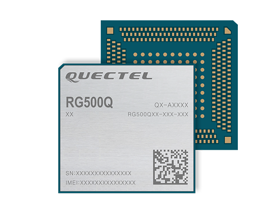
Quectel Wireless Solutions‘ RG500Q-EA 5G NR module has achieved commercial readiness and is now available to support global customers with mass deployment.
The module features the Qualcomm Snapdragon X55 5G modem. It is designed for a variety of industrial and consumer internet of things (IoT) applications, including business routers, home gateways, customer premises equipment (CPE), MiFi, industrial IoT (IIoT), industrial laptops, PDAs, video surveillance, digital signage, 4K/8K live streaming and many other bandwidth-intensive use cases.
The Quectel RG500Q-EA supports major sub-6GHz frequency bands as well as worldwide LTE-A and WCDMA network coverage, allowing customers to deploy their IoT solutions flexibly in Asia-Pacific, Europe and the Middle East.
Quectel RG500Q is a series of 5G Sub-6GHz modules optimized specially for IoT and M2M applications. Adopting the 3GPP Rel. 15 technology, it supports both 5G NSA and SA modes.
The RG500Q is provided in two variants: RG500Q-EA and RG500Q-NA. The module supports Qualcomm IZat location technology Gen9C Lite (GPS, GLONASS, BeiDou/Compass, Galileo and QZSS). The integrated GNSS receiver greatly simplifies product design and provides quicker, more accurate and more dependable positioning capability.
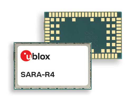
U-blox, a global provider of leading positioning and wireless communication technologies, has extended its SARA-R4 family of LTE-M / NB-IoT and EGPRS cellular modules to include variants with the hardware and software features necessary to enable end-to-end security features and services for internet of things (IoT) data, devices and ecosystems.
“The new SARA-R422 product series offers superior security protection, industrial output power to grant best coverage even in weak signal conditions, and everywhere location using state-of-the-art u-blox GNSS technology,” said Rado Sustersic, senior product manager, Product Center Cellular at u‑blox. “These represent valuable functionalities tailored specifically to the LPWA IoT market.”
M8 GNSS. The SARA-R422M8S is pre-integrated with the u-blox M8 GNSS (global navigation satellite system) receiver and a separate GNSS antenna interface. This provides highly reliable, accurate positioning data simultaneously with LTE communications.
The module also supports hybrid positioning strategies, in which positioning data provided by satellite constellations is enhanced with data from the u-blox CellLocate service, ensuring that location data is always available everywhere.
The SARA-R4 series is designed for a wide range of mission-critical IoT solutions such as connected healthcare, industrial monitoring, point of sale and vending terminals, tracking and telematics devices, as well as smart lighting solutions and building automation.
Security. Security features include a unique and immutable root of trust (RoT) for each device, as well as access to a scalable pre-shared key (PSK) management system. This provides the foundation for a trusted set of advanced security functionalities to enable data encryption and decryption, both on‑device as well as from‑device‑to‑cloud.
The choice of PSK-based security, rather than the more complex and computationally intensive public key infrastructure (PKI) approach, strikes the right balance between implementation costs and level of security protection for many IoT applications.
Robustness. All SARA-R422 modules provide 23-dBm output power, allowing the end device to properly operate in all network conditions. This means no issues at cell edges, no coverage issues in weak signal conditions, and, even more importantly, no unwanted re-transmission that shortens battery life by increasing transmit time and overall system power consumption.
The series is designed for long working lifetimes in the field, through the inclusion of support for LWM2M, a lightweight machine-to-machine communications protocol ideal for IoT applications with the possibility of updating the firmware of modules already in the field over the air via the uFOTA (Firmware Over The Air) client/server firmware service provided by u-blox.
The u-blox SARA-R4 series will be presented at Embedded World in Nuremberg, Germany, Feb. 25-27, at Hall 3/Stand 3-139.
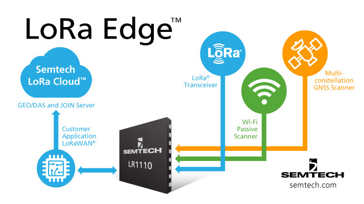
Semtech Corporation, supplier of high-performance analog and mixed-signal semiconductors and advanced algorithms, has launched LoRa Edge, a versatile and low-power software defined LoRa-based platform.
Semtech said LoRa Edge will enable a wide portfolio of applications for indoor and outdoor asset management, targeting industrial, building, home, agriculture, transportation and logistics markets.
The first product from this portfolio is a geolocation solution for development of internet of things (IoT) devices for asset management applications. It features low-power Wi-Fi and GNSS sniffing capabilities combined with LoRa Cloud geolocation and device management services to significantly reduce the cost and complexity of locating and monitoring IoT assets.
“Semtech continually delivers internet of things (IoT) solutions that simplify and accelerate the development of LPWAN applications,” said Pedro Pachuca, director of IoT Wireless in Semtech’s Wireless and Sensing Products Group. “LoRa Edge and LoRa Cloud geolocation services enable customers to develop ultra-low power applications for a variety of industries and will expand the mass adoption of LoRa in the IoT ecosystem.”
Over the next decade, 500 billion devices are expected to connect to the internet (according to Cisco), as organizations continue to shift towards a more IoT-focused business strategy, and the majority of those IoT devices require some form of localization capability either at point of install or through the assets life.
The LoRa Edge geolocation platform will enable solution providers to leverage the unique localization capabilities of LoRa as well as GNSS and Wi-Fi scanning capabilities from a single chip solution, allowing customers to choose the best localization tool for the application task they are addressing.
By removing the need for incremental GNSS and Wi-Fi components, LoRa Edge reduces the bill of material (BOM) costs of devices and significantly reduces design and procurement complexity, Semtech said.
The first LoRa Edge chipset targeted with geolocation (LR1110) is available today; more products from this portfolio will be released in the first half of this year.
Product Features
Multi-Purpose Radio Front-End
150 – 2700 MHz continuous frequency synthesizer range
GPS/BeiDou scanning
Wi-Fi passive scanning
Low-Power LoRa/(G)FSK RF Transceiver
Worldwide frequency bands support in the range 150 – 960 MHz
High power PA path +22 dBm
High efficiency PA path +15 dBm
Fully compatible with the LoRaWAN standard
Cryptographic Engine
Hardware support for AES-128 encryption/decryption based algorithms
Handling device parameters such as DevEUI and JoinEUI
Protects confidential information such as encryption keys
Stores NwkKey, AppKey, as defined in the LoRaWAN standard
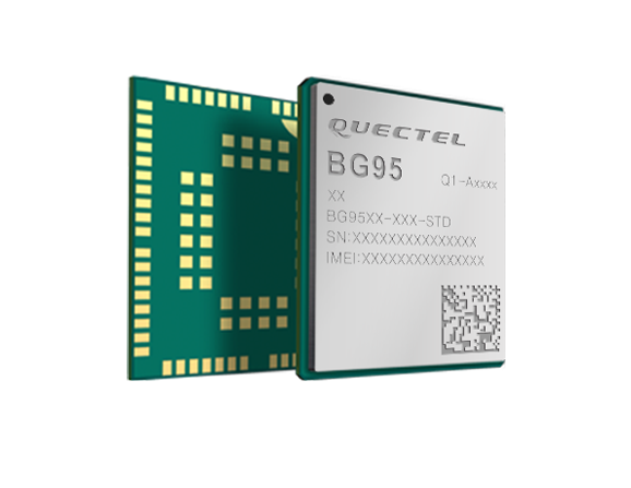
Quectel Wireless Solutions is collaborating with Microsoft and Qualcomm Technologies to integrate its new LPWA module BG95 with Microsoft’s Azure Device SDK.
The integration will provide direct and secure connections to Azure IoT Hub and provide full support for Azure device management capabilities.
Targeting global markets, the BG95 module is a cost-optimized, highly-integrated variant supporting integrated GNSS, Cat M1, Cat NB2 and EGPRS (also called EDGE). The module complies with 3GPP Release 14 and delivers improved capabilities in power consumption, data rates and hardware-based security.
The BG95 cellular module is based on the Qualcomm 9205 LTE modem, to be integrated with Microsoft’s Azure Device software development kit (SDK). As a result, customers can connect their BG95 devices to the Microsoft Azure cloud where they can build, manage and deploy internet of things (IoT) solutions at scale, significantly accelerating time to market.
By integrating RAM/flash, an ARM Cortex A7 processor supporting ThreadX, the BG95 is engineered to reduce power consumption significantly in idle mode.
By doing this, the BG95 has the potential to support decade-plus battery life, which is critical for IoT devices serving long life spans, such as asset trackers, smart meters, smart city sensors, home security and wearable trackers.
Additionally, Azure IoT is built for security. It simplifies the complexity of IoT security solutions with built-in protection at each stage of deployment (including cloud services and devices) and minimizes security weaknesses wherever they exist. Leveraging Azure IoT security features, Quectel BG95 will offer IoT devices end-to-end security capability in order to prevent potential risks.
“We’re excited for the Azure edge device ecosystem to continue to grow. Our partnership with Quectel and Qualcomm Technologies will deliver what our customers need — bringing together ultra-low power cellular modules and Azure to drive their digital transformation,” said Roanne Sones, corporate vice president at Microsoft.
“The BG95 module is the first Qualcomm 9205 platform to support IoT Plug and Play, accelerating LPWAN solution deployments like smart meters and asset trackers that connect seamlessly to our IoT Central offering,” Sones said.
“With its cutting-edge performance and power-saving capabilities, the Qualcomm 9205 LTE Modem is the gold standard for multimode IoT modules looking to offer NB-IoT, Cat-M1, GPRS, and GNSS connectivity,” said Jeffery Torrance, vice president, business development, Qualcomm Technologies, Inc. “We are proud to continue our long-standing collaboration with Quectel to jointly drive the IoT forward.”
“We are happy that the BG95-M3 has been verified on Microsoft Azure IoT Plug and Play. This validates our ability to jumpstart customers’ IoT projects with pre-tested modules and operating system combinations. Leveraging our close relationship with Microsoft and Qualcomm Technologies, we will jointly provide more integral ‘Device-Cloud’ solutions to customers,” said Doron Zhang, Chief Operation Officer, Quectel. “As one of the first wave Azure IoT PnP partners, Quectel has worked with Microsoft on LTE Mobile Broadband (MBB) modules, which have been widely adopted by top laptop OEMs. In the future, we will extend the partnership to more fields, such as Artificial Intelligence (AI) and Intelligent Edge, in order to help the Microsoft partner ecosystem connect their devices even more intelligently.”
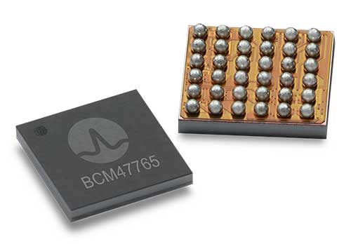
BCM4776 chip utilizes 30 new L5 signals to deliver higher navigational accuracy and yield
Photo: Broadcom
Broadcom introduced in 2017 the first mass-market implementation of dual frequency: BCM4775. This chip makes use not only of the classic L1 frequency broadcast by every satellite, but also of the more advanced L5 signal broadcast by a subset of the satellites.
The use of this enhanced L5 signal improves the accuracy of GNSS in an urban scenario, as it mitigates the main source of error: the reflections in the nearby buildings, also known as multipath. It also improves GNSS in an open-sky scenario, allowing submeter accuracy, a previously unmet performance bar in smartphones until now. Ever since, the BCM4775 has been adopted in flagship smartphones, smartwatches and fitness devices.
Given the unabated need for better precision and accuracy, Broadcom has introduced its second-generation dual-frequency GNSS solution — the BCM4776.
The new chip is capable of using the new BeiDou-3 constellation’s B2a signals (the Chinese indicator for L5). It will be able to track 30 new L5 signals (60 percent more) with a significant impact on accuracy. End users will experience much higher reliability of the submeter accuracy inherent to dual-frequency L1-L5.
Image: Broadcom
Second generation dual-frequency GNSS will be used for innovative lane-level driving navigation instructions, allowing driving applications to know which highway lane the vehicle is in. Expect instructions like “move one lane to the right so you don’t miss your next highway exit” or “move one lane to the left to take the pool lane and save 10 minutes.”
Module designed for developers creating guidance and navigation systems for autonomous vehicles, robots, drones, industrial, construction and agricultural machinery
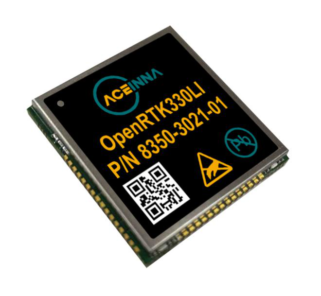
Aceinna launched its OpenRTK330L at CES 2020, the massive annual consumer electronics show taking place Jan. 7-10 in Las Vegas. The company is located at Booth 6738, CES North Hall, Automotive Pavilion.
OpenRTK330L is a low-cost,high-performance triple-band RTK/GNSS receiver with built-in triple redundant inertial sensors. Designed to replace the expensive and bulky precision RTK/INS systems used in today’s autonomous systems, the compact navigation solution meets the challenging performance, reliability and cost requirements of the automotive market along with the needs of robot, drone, construction and agriculture systems, Aceinna said.
Demonstration Drive
Aceinna is demonstrating its GNSS/INS-based autonomous vehicle localization technologies on its test vehicle, which drove from Silicon Valley to Las Vegas.
The company is recording live drive-test data that demonstrates how its precision positioning solutions provide high accuracy and reliability. Precision location capability is critical for all levels of autonomous driving.
OpenRTK330L includes a triple-band RTK/GNSS receiver coupled with redundant inertial sensor arrays to provide cm-level accuracy, enhanced reliability, and superior performance during GNSS outages.
The OpenRTK330L integrates a precise 2 Degree/Hour IMU to offer ten to 30 seconds of high accuracy localization during full GNSS denial. This enables autonomous system developers to safely deliver highly accurate localization and position capabilities in their vehicles at prices that meet their budgets.
Image: Aceinna
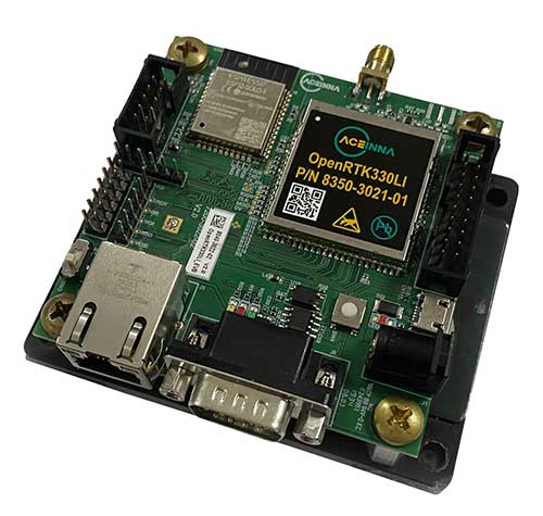
OpenRTK330L’s embedded Ethernet interface allows easy and direct connection to GNSS correction networks around the world. OpenRTK330L’s CAN bus interface allows simple integration into existing vehicle architectures.
The multi-band GNSS receiver can monitor all global constellations (GPS, GLONASS, BeiDou, Galileo, QZSS, NAVIC, SBAS) and simultaneously track up to 80 channels. The module has RF and baseband support for the L1, L2 and L5 GPS bands and their international constellation signal equivalents.
The inertial measurement unit and dead reckoning function contains a total of 9 accelerometer and 9 rate gyro channels based on Aceinna’s unique triple redundant six-axis IMU array. By integrating a triple-redundant IMU array, the OpenRTK330L is able to recognize and utilize only valid sensor data, ensuring high-accuracy protection limits and certifiability under ISO26262 standards.
Open Navigation Platform
“The combination of a triple-band GNSS receiver and a high-precision IMU has enabled us to make a remarkably accurate, small, reliable and cost-effective GNSS/INS solution,” said Mike Horton, CTO of Aceinna. “The OpenRTK Precise Positioning Engine optimizes satellite tracking and high RTK fixes rates while integrating seamlessly with Aceinna’s open-source, developer-friendly Open Navigation Platform.”
The Open Navigation Platform allows custom embedded application development on top of Aceinna’s positioning engine and dead-reckoning algorithms. Autonomous solution developers have full access to all resources on the OpenRTK330L module including the GNSS receiver measurement data, IMU measurement data and all interfaces.
The OpenRTK330L GNSS receiver supports GPS (L1 C/A, L2C and L5), GLONASS (L1OF, L2OF), BeiDou (B1I, B2I), GALILEO (E1, E5a, E5b, E6) QZSS (L1 C/A), and NAVIC. The IMU sensor array includes a triple-redundant, 3-axis MEMS angular rate sensor, and a triple-redundant, 3-axis MEMS accelerometer.
Hardware also includes, Ethernet, UART, SPI and CAN interfaces for versatile integration into a host system. Additional specifications include operating temperature range of -40C to +85C, and qualification to standard automotive shock and vibration levels.
Septentrio’s GNSS devices are being used for high-accuracy positioning solutions by two companies.
Compact multi-frequency GPS/GNSS receiver module provides robust centimeter-level positioning for advanced driver assistance systems (ADAS) provided by NXP.
Septentrio and Analog Devices collaborate on high-performance GNSS/INS solutions.
Image: Sepentrio
NXP V2X Integration
NXP, a leader in communication technology for embedded applications, is integrating Septentrio GNSS technology into its V2X (vehicle-to-everything) reference design and development boards.
Septentrio, a leading high-accuracy GNSS positioning company, is providing to NXP its mosaic module. Mosaic is a multi-frequency, multi-constellation GNSS receiver that delivers accurate and reliable global localization even in harsh environments.
V2X technology enables cars to communicate with infrastructure as well as other vehicles, making driving safer and more efficient. It enables cars to “see” what’s around the corner or through the dense urban environment warning the driver about road works, traffic congestion and emergency vehicles.
Precise GNSS-assisted localization combined with V2X communication enables a wide array of ADAS functionality such as automatic braking if slowing traffic is detected ahead or truck platooning.
Septentrio’s mosaic is a compact high-accuracy GNSS receiver module which is integrated into NXP’s V2X development boards. True multi-frequency multi-constellation technology gives mosaic access to every possible signal from all available GNSS constellations including the U.S. GPS, European Galileo, Russian GLONASS, Chinese BeiDou and Japanese QZSS satellites.
Septentrio’s advanced, field-proven algorithms exploit this signal diversity to deliver maximum positioning availability even in difficult environments such as under foliage or in urban areas.
“Reliable lane-accurate positioning is vital for many road-safety applications of V2X, such as queue and emergency stop warnings or blind spot warning,” said Andrew Turley, NXP’s senior director of innovation and V2X business development. “Septentrio’s unique easy-to-integrate GNSS module provides field-proven, reliable and robust positioning. Integration of mosaic into our reference design gives our customers a direct solution for developing these and other advanced V2X services.”
”We are excited that NXP selected our GNSS solution for their V2X reference design,” said Jan Van Hees, business development director at Septentrio. “NXP is a world-leader in complete solutions for V2X communications for active safety systems and intelligent transport system (ITS) management. Working with NXP gives us an excellent opportunity to bring the best of V2X and reliable GNSS to our customers.”
Inside a car GPS signals can become “jammed” by nearby electronics or illegal devices called “jammers” which are used by some drivers to avoid road tolling. mosaic uses jamming-resistant signal processing making it robust against interference. Its design is centered around continuous, reliable high-accuracy positioning making mosaic suitable for safety-critical applications such as ADAS and autonomous navigation.
Consumer Electronics Show. The Septentrio mosaic GNSS module will be showcased at CES in Las Vegas, January 7-10. Visitors are welcome to see mosaic and talk to Septentrio GPS experts about V2X, ADAS, INS and other automotive positioning solutions in booth 1135 at the Paradise West Center. A personal meeting can be booked in the Septentrio Suite at the Westgate Las Vegas Resort & Casino.
Combining with Analog Devices on INS
In December, Septentrio announced a collaboration with Analog Devices. The two companies are combining Analog Devices’ high-quality inertial measurement units (IMUs) with Septentrio’s multi-frequency, multi-constellation GNSS receivers.
The resulting high-performance GNSS/inertial navigation systems (GNSS/INS) deliver centimeter-accurate positioning together with 3D orientation (heading, pitch and roll), suitable for applications such as automotive ADAS and industrial automation.
“We are excited to work with Septentrio,” said Tony Zarola, general manager of inertial sensors, Analog Devices. ”Septentrio’s GNSS technology provides a unique combination of accuracy and robustness which is aligned well with the capabilities of our sensors. The company’s deep know-how of GNSS and focus on providing reliable solutions even in harsh environments complements Analog Devices’ focus to solve the toughest engineering challenges for our customers.”
“ADI’s high-end industrial IMU systems are a reference in the industry and we are very pleased to be working together with them,” said Danilo Sabbatini, product manager at Septentrio. “Combining ADI’s IMU experience with our GNSS expertise enables creation of high-performance, easy-to-integrate systems that allow our customers to tackle demanding applications. As a result, customers can expect a faster go-to-market due to the interoperability between the GNSS and INS components.”
Septentrio will incorporate Analog Devices’ advanced industrial-grade IMUs into a selection of its GNSS/INS products. Working directly with Analog Devices allows Septentrio to provide faster and more efficient GNSS/INS integration solutions for high-volume customers. This collaboration promises a solid foundation for design and production of top-performance integrated positioning and inertial solutions, with first products available in spring 2020.
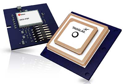
Taoglas, a provider of next-generation internet of things (IoT) solutions, has launched Edge Locate, a GNSS L1/L2/E5 module that combines antenna, RF electronics and receiver technology to deliver reliable centimeter-level positioning.
Taoglas, in partnership with u-blox, created a smart antenna that uses multi-band GNSS technology, providing between 1- to 3-centimeter-level accuracy.
With Edge Locate, manufacturers can quickly and effectively build devices with centimeter-level positioning technology, without having to invest in costly and lengthy RF design, integration and testing processes.
The device features multiband GNSS positioning that can be used in conjunction with cost-effective real-time kinematic (RTK) positioning capability.
Traditionally, most IoT devices use single-band GPS technology, delivering on average 10-meter accuracy with existing GPS modules and antennas, Taoglas said in a press release. This enables location-specific, mission-critical services such as emergency response, smart infrastructure, precision agriculture and microbility mobility applications where precise location provides critical value to the IoT application.
Taoglas can also consult and install the RTK network in any global location for any IoT use case.
“Centimeter-level positioning is absolutely key to the next-generation of IoT enabled applications,” said Ronan Quinlan, Co-CEO of Taoglas. “Take an example from the burgeoning micro-mobility industry. When granting licenses from a trial, the city authorities would like to monitor the riders of e-scooters, ensuring riders are staying off footpaths, or parking in designated areas. The problem is that today’s legacy GPS solutions don’t often know which side of the road a scooter is on. Whereas with our solution, fleet operators can pinpoint within just a few centimeters where a device is located. We do this by working with our customers to enable the whole solution and we make sure it works reliably in real life.”
Edge Locate can greatly accelerate the latest GNSS multiband product launch plans by offering a plug-and-play product that uses a common connector for integration into any electronics device. It also connects directly to the Taoglas Edge board for immediately connectivity options.
Taoglas is exhibiting at Mobile World Congress Americas, Booth 2602 in the South Hall of the Los Angeles Convention Center.
Quectel Wireless Solutions Co. Ltd., in association with STMicroelectronics, has released the LG69T module, an automotive-grade dual-band high-precision GNSS module that integrates dead-reckoning (DR) and real-time kinematic (RTK) technologies.
The new Quectel module, announced at 2019 Apsara Conference in Hangzhou, is designed to facilitate open-sky positioning performance with an accuracy of up to 10 centimeters, which is currently the industry’s most advanced positioning technology for the automotive market. LG69T will support next-generation precision positioning capabilities for smart vehicles and autonomous driving scenarios.
The Quectel LG69T GNSS module is based on ST’s STA8100GA, the latest Automotive-grade dual frequency positioning chip with 80 tracking channels and four rapid-acquisition channels that are compatible with many constellations: GPS, BeiDou, Galileo, NAVIC/IRNSS and QZSS.
It is an AEC-Q100-qualified dual-band (L1 + L5) GNSS module that integrates multi-band RTK technology for centimeter-level accuracy.
The LG69T module’s dead-reckoning capabilities feature an integrated inertial measurement unit (IMU) that provides continuous high-precision positioning. The LG69T supports corrections input for standard Radio Technical Commission for Maritime Services (RTCM) and centimeter-level navigation by using RTCM data from a third — local base stations. The module performs well under the highly challenging conditions of urban canyon environments.
“We are thrilled to collaborate with STMicroelectronics on our newest generation of high-precision positioning module,” said Min Wang, Quectel’s automotive product line general manager. “With this highly-integrated LG69T module, automakers and Tier 1 suppliers will no longer have to spend time selecting components, integrating hardware, adapting interfaces and conducting tests and verifications, which will greatly cut their time-to-market and costs, and help them accelerate the deployment of autonomous driving to seize early opportunities.”
“ST has strong experience and is the Global Automotive High Precise Positioning Technology and Market Leader. We are very proud to cooperate with leading Chinese smart driving high technology company,” said MH TEY, Greater China, South Asia and Korea automotive marketing and application head of department, STMicroelectronics. “Today, there is growing dependency on high-performance GNSS in automotive applications such as navigation, safety and autonomous driving. With this cooperation, we are very confident to become the market leader by providing cost-effective and unique best-in-class solution for autonomous vehicle.”
Engineering samples of Quectel’s LG69T module will be offered to automakers and Tier 1 suppliers by the end of 2019, and the product will be commercially available around mid-2020 and is expected to be deployed in mass produced models as early as 2021.
Septentrio’s Gustavo Lopez gives GPS World an overview of the company’s AsteRx-i S UAS GNSS/INS receiver for drones and Mosaic GNSS receiver module at Intergeo 2019, which took place Sept. 17-19 in Stuttgart, Germany.
A roundup of recent products in the GNSS and inertial positioning industry from the September 2019 issue of GPS World magazine.
OEM
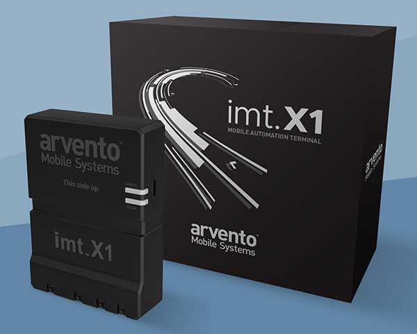
Vehicle tracker
Uses u-blox to detect panic breaking
Photo: u-blox
Arvento’s imt.x1 has a six-axis gyro sensor that can sense three-dimensional movement caused by emergency acceleration, panic braking and directional yaw and drift. With connectivity options including dual CANBus and Bluetooth, the system is eCall compatible and captures and provides data for accident analysis and other vehicle tracking functions. The system also uses the next-generation powerful Arm-based microcontroller. The system’s high position sensitivity and accuracy are based on integration of u-blox’s 2G, 4G and 5G-ready cellular modules as well as GNSS modules.
The compact LC79D module features concurrent multi-constellation GNSS receivers on dual GNSS bands. It uses L1 and L5 for GPS, Galileo and QZSS, L1 band for GLONASS and BeiDou, and L5 band for IRNSS. It can generally increase the number of visible satellites, significantly improve positioning drifting when driving in urban canyons and enhance positioning accuracy. Embedded with a low-noise amplifier (LNA) and multi-tone active interference, the module provides high sensitivity and reliable anti-jamming capability, ensuring exceptional acquisition and tracking even in weak signal areas.
The mosaic development kit helps integrate mosaic into an existing system. Mosaic is a compact high-precision multi-frequency GPS/GNSS module that brings precision and reliability of high-end multi-frequency GNSS to mass-market applications. Its light weight and low power consumption makes mosaic suitable for robotics, automation, telematics and wearables. The kit supports connectivity through internet, COM ports, USB 2.0 and an SD Card slot. Mosaic provides Advanced Interference Mitigation (AIM+); extensive corrections support for high-accuracy positioning; integrity needed for safety-critical applications such as autonomous vehicles; and a 100-Hz update rate, suitable for robotics and fast-moving vehicles.
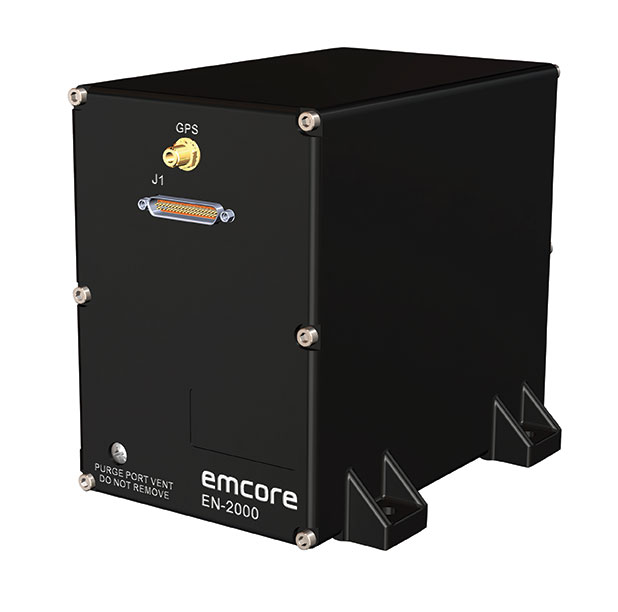
The EN-2000 is the newest addition to the Emcore-Orion series of micro-inertial navigation (MINAV) systems. It is compact and lightweight, weighing less than 7 pounds, with very low power consumption of 10 watts. It can deliver twice the performance of the EN-1000 with the same form factor. With its low size, weight and power (SWaP), the compact EN-2000 is suitable for unmanned aerial vehicles, unmanned underwater vehicles, unmanned ground vehicles, manned aircraft, rotorcraft and dismounted soldier applications. Its three-axis design uses a solid-state optical transceiver with advanced integrated optics, combined with new field programmable gate array (FPGA) electronics to deliver stand-alone aircraft-grade navigator performance at one-third the SWaP of legacy systems.
The Miniature PLGR Engine – M-Code (MPE-M) GPS receiver is a small Type II form factor ground receiver, and incorporates the company’s recently certified Common GPS Module (CGM). As a drop-in replacement for the thousands of customers using Collins’ Miniature PLGR Engine-SAASM (MPE-S) GPS receiver, the new MPE-M technology provides 10 times stronger anti-jamming capabilities for the direct acquisition of GPS signals than its predecessor. The MPE-M receives the current military Y-code GPS signal along M-code. It provides warfighters with improved security and assured positioning, and it satisfies the U.S. government’s requirement for all military GPS equipment to be M-code capable. It is designed for lightweight, ground-based applications such as radios, blue force trackers, targeting devices, vehicle line-replaceable units (LRUs) and small unmanned aircraft. The MPE-M’s security certification makes the receiver eligible for export to U.S. allies through the Foreign Military Sales (FMS) program.
The Catalyst software-defined GNSS receiver for Android phones and tablets is now available with a usage-based service plan: Trimble Catalyst On Demand. The new service plan meets the needs of industries and organizations that need a more flexible payment model. Organizations use Catalyst to record positions, navigate to points, measure relative distance and create digital maps. Trimble Catalyst On Demand provides scalable access to real-time kinematic (RTK)-quality GNSS positioning using a pay-per-use hourly pricing model in addition to the current Catalyst monthly plans. The service also enables automated domain-level email address access, which streamlines license allocation for organizations with a large number of users. (Pictured: Catalyst DA1 antenna).
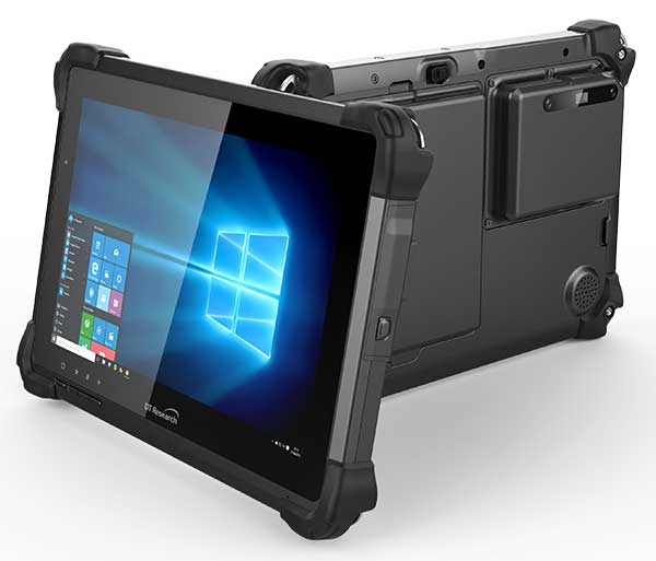
The DT301X is designed for 3D mapping. Its Intel RealSense Depth camera provides real-time 3D imaging combined with a dual-frequency GNSS module for real-time mapping and positioning. The digital images are better than high-definition standard, and are suitable for construction building information management (BIM) graphics. The highly durable IP65 and MIL-STD-810G-rated tablet in a slim case can be used in the field, office and vehicles. A bright 10.1-inch touchscreen provides indoor/outdoor viewing. The tablet includes long-range Bluetooth and 4G LTE mobile broadband for the latest in high-speed communications. An Intel 8th-generation Core i5 or i7 processor offers high performance while still being energy efficient.
Mapper for wide-area, mountain, urban and corridor surveys
Photo: Teledyne Optech
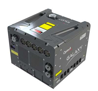
The ALTM Galaxy PRIME wide-area lidar sensor offers collection efficiency, a small form factor and high-quality data sets that meet rigorous USGS lidar standards. It has a 6,000-meter above-ground-level (AGL) collection envelope and 1-MHz on-ground collection rate. Galaxy PRIME includes lidar technology enhancements to increase sensor performance and collection efficiency, improve data quality, and simplify the collection process. It can be used either gyro-stabilized or fixed-mounted, one camera or six, and full waveform or discrete. PulseTRAK technology enables a continuous operating envelope by eliminating data coverage gaps and irregular point density. Applications include wide-area mapping, urban mapping, natural resource management, engineering, infrastructure modeling, and powerline and transportation corridors.
The Leica BLK247 real-time reality-capture device uses sensor fusion technology to detect and report physical changes within a space. It is designed for continuous 3D reality capture, extending capabilities for safety and security applications. The sensor provides real-time situational awareness through edge computing and lidar-enabled change-detection technology. Using artificial intelligence, the BLK247 can tell the difference between still and moving objects — such as a person walking who leaves a suitcase behind — and identify security threats to provide real-time alerts.
Version 15 of Grapher has new capabilities to improve the ability to model, analyze and interpret data as well as communicate the results. Grapher users can now access new Fit Curve, Axes and Statistical Plotting capabilities. Also, users are provided greater color customization functions in the latest release. Enhancements give Grapher users a more powerful ability to display and communicate the results of their work to others. The software provides 80 different 2D and 3D plot types for analyzing and displaying scientific data.
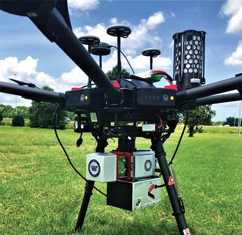
The Harris Aerial H4/H6 Hybrid multicopter is now offered as an integrated package with any Lidar USA scanning system. The Harris Hybrid can provide longer flights with lidar and industrial-grade cameras. The Harris Hybrids use a small generator running on 95 or higher octane fuel to power the UAV for up to five hours.The H6 can carry an A-series high-definition lidar system of 3 kg for 2.5 hours and a V-series of 5 kg up to 1.5 hours. For the lidar operator, this means most projects will require only one or two flights.
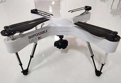
The US-1 was built with sensitive enterprise and government customers in mind. It was designed from the ground up in the United States with a battery-first approach to enable electric aircraft to compete with conventionally fueled incumbents. The US-1 runs on a secure open-source operating system by Auterion. It provides 78 minutes of flight time and high-resolution optical and thermal cameras. US-1 UAVs have been deployed to fight fires, locate pipeline leaks, and track armed suspects.
Impossible Aerospace, impossible.aero
The DRS-M600 reusable parachute safety solution, developed for DJI M600 and DJI M600 Pro, meets specifications of the ASTM F3322-18 standard. The successful completion of the ASTM standard test makes it possible for the Federal Aviation Administration to issue permits for its use on drones over crowds. The ASTM F3322-18 standard is the first standard for parachute systems designed specifically for small UAVs.
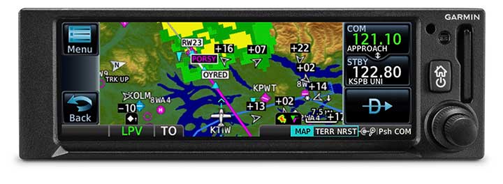
The GNC 355 is a GPS navigator with localizer performance with vertical (LPV) approach guidance. (Photo: Garmin)
The GNS 355 GPS navigator with localizer performance with vertical (LPV) approach guidance gives pilots the benefits of WAAS/SBAS GPS guidance with a modern communications radio. Intended for Class I/II aircraft that weigh 6,000 lbs./2,721 kg. or less, the GNC 355 is certified for more than 700 aircraft makes and models. Aircraft owners can incorporate the GNC 355 into an existing avionics stack because of its standard 6.25-inch wide by 2-inch tall design. The responsive touchscreen display allows pilots to quickly access direct-to functionality, moving map, flight plan, nearest, procedures, waypoint and terrain pages and create customizable data fields and shortcuts for quick, one-touch access to important information. Fully WAAS/SBAS IFR-approach-capable, the GNC 355 gives pilots the benefit of flying LPV, as well as Area Navigation (RNAV) approaches. Many approaches offer vertical approach guidance as low as 200-feet above ground level (AGL).
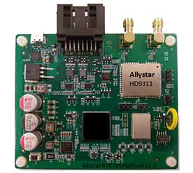
The Allystar INS Platform is a dual-antenna, multi-frequency, multi-GNSS inertial navigation system (INS) that delivers accurate and reliable position, velocity and orientation. It combines high-grade, six-axis, temperature-calibrated accelerometers and gyroscopes with a multi-frequency, multi-GNSS engine, the HD9300 series. The HD9300 is a dual-antenna chip-grade real-time kinematic (RTK) GNSS receiver for accurate positioning and heading. The Allystar INS platform contains an on-board sensor-fusion filter, plus navigation and calibration algorithms for different dynamic motions of land vehicles. The Allystar OBD Data Adapter (v1.0) enables users to read and monitor various sensors built into cars, obtaining real-time vehicle speed and gear signals from the on-board diagnostics (OBD) interface, and then output AT (attention) commands by serial port or serial peripheral interface (SPI).
The u-blox ZED-F9P, a high-precision GNSS module that delivers centimeter-level accuracy within seconds, has been incorporated into the latest electric Tron F90+ fixed-wing unmanned aerial vehicles (UAVs).
Quantum-Systems, a German company that specializes in electric VTOL (vertical take-off and landing) aircraft for civilian use, manufactures the Tron F90+, which is employed in mission-critical logistical activities such transporting emergency blood reserves to remote locations. Other uses include mining and agriculture-related tasks.
Quantum-Systems and u-blox are both exhibiting at Intergeo in Stuttgart, Germany, Sept. 17-20. Quantum-Systems is at booth K1.074, and u-blox at booth L1.025.
The Tron F90+ has a 3.5-meter wingspan and can travel at speeds of up to 160 km/hour with a 100-km flight range. It is the latest addition to the Quantum-Systems eVTOL UAV platform designed for cargo, inspection, survey and mapping, and reconnaissance in adverse conditions. Other models include the Trinity F9, Scorpion and Vector UAVs, all of which feature u-blox F9 high-precision GNSS technology.
In developing the Tron F90+ UAV, the Quantum-Systems engineering team needed accurate enough position data to ensure that VTOL operations would always go smoothly, and the valuable payloads were protected from damage.
Through the multi-band real-time kinematic (RTK) and raw code and carrier-phase data available to the ZED-F9P, the necessary positioning correction is assured and the pilot can complete even difficult maneuvers. Absolute position accuracy can be brought down to 3-5 centimeters.