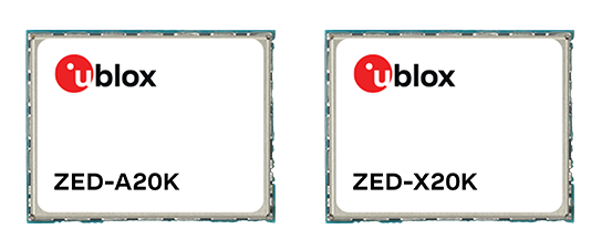
U-blox has expanded its automotive GNSS portfolio with the launch of two highly specialized modules: the ZED-X20K and the ZED-A20K. This dual release addresses engineering needs of both mass-market advanced driver assistance systems (ADAS) and safety-critical autonomous architectures.
Both modules feature pin-to-pin compatibility, enabling platform flexibility and simplifying product development across vehicle generations as well as jamming and spoofing detection to mitigate the impact of security risks.
The ZED-X20K is designed for mass-market ADAS L3 and TCU/IVI applications, delivering lane-level accuracy worldwide using all-band GNSS and native Galileo High Accuracy Service (HAS). By eliminating the need for paid correction services, backend infrastructure, or service management, it reduces total cost and accelerates time-to-market while maintaining consistent global performance.
For applications that require a functional-safety concept for GNSS sensors, the ZED-A20K introduces a new architectural approach. It provides ISO 26262 ASIL-B(D)-compliant GNSS RAW data simultaneously to high-performance QM positioning outputs within a single module. This enables OEMs to transition from traditional dual hardware based-GNSS systems to a single module approach, reducing system complexity and cost.
With flexible support of externally hosted positioning engines, especially for ADAS of Levels 3 and up, the A20 concept enables enhanced flexibility for SDV–based architectures. The form-factor compatibility between ZED-X20K and ZED-A20K allows the flexibility to equip different trim levels with or without functional safety requirements out of a single socket.
The ZED-X20K has reached the engineering sample stage, and its evaluation kit is available. Samples for the ZED-A20K will be available starting in August.
The small-form-factor Galileo OS (Open Service) or PRS (Public Regulated Service) sensors are designed to enhanced GNSS receivers and resilient multi-sensor navigation systems, ensuring safer and more reliable satellite-based navigation.
The Galileo PRS core module integrates a certified, single-chip, application-specific integrated circuit (ASIC) security module that incorporates all the necessary Galileo PRS security and navigation functions. It provides dual-frequency (E1/E6) iono-free Galileo PRS positioning, velocity and timing services. It also provides pseudorange and delta pseudorange raw data, along with GPS C/A (coarse acquisition).
The low-SWaP (size, weight and power) digital solution has been designed to work with any European GNSS receiver manufacturer seeking a standardized, easy-to-integrate Galileo module with which to develop their own GNSS receivers.
Credit: Thales
The modules can meet the requirements of a wide range of applications for manned or unmanned vehicles, combat aircraft, helicopters, high-dynamic missiles, and the navy. Their small form factor also makes them suitable for platforms with size constraints, such as ground vehicles, small drones and guided munitions.
The modules feature standardized interfaces, enabling the Galileo PRS function to be easily integrated into the host system. Furthermore, the TopStar Galileo core module can be embedded with minimum impact by using the analog RF front end of the host receiver.
The Galileo OS core module version enables the early integration of Galileo functionalities into the host system, as well as export to countries not authorized to use PRS. The PRS core module version provides an easy upgrade to Public Regulated Service capability, offering greater resilience against jamming and crucial protection against spoofing.
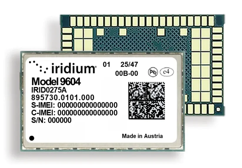
Iridium Communications, a provider of global voice, data, and positioning, navigation and timing (PNT) satellite services, has unveiled the Iridium 9604, a compact, three-in-one IoT module that integrates Iridium short burst data (SBD) satellite service, LTE-M cellular connectivity, and GNSS positioning into a single platform.
By combining these features in one device, the Iridium 9604 reduces solution complexity, lowers costs, and accelerates time to market, making dual-mode IoT connectivity viable for price-sensitive, high-volume deployments.
The Iridium 9604 beta program — launched earlier this year and oversubscribed by a select group of companies — has generated positive industry feedback highlighting:
Lower costs, simplified design, and enabling of location-aware network selection
Savings of 60 percent or more in board space with the 3-in-1 module, Iridium’s smallest ever form factor
Easy-to-use developer resources.
“As an early Iridium 9604 developer, utilizing the three-in-one module has already fundamentally changed our product economics,” said Alastair MacLeod, CEO, Ground Control. “We eliminated two components from our bill of materials, reduced our board size, and simplified our power architecture.”
MacLeod continued, “Additionally, having dual mode connectivity options enables a smarter, location-aware network selection in our application. The Iridium 9604 turned what would have been a complex multi-component design into a single-module solution. This is a major breakthrough for our IoT solutions.”
“Our customers require essential data and real-time intelligence to operate with confidence anywhere in the world,” said Dean Welten, CEO, Everlink. “By integrating the Iridium 9604 with our secure cloud platform, we can now enable global connectivity, greater operational efficiency, and measurable impact at scale.”
Representing the next phase of Iridium’s IoT strategy, the Iridium 9604 is moving the company beyond traditional satellite-only modules to a unified, multi-mode connectivity architecture. The Iridium network now offers customers three IoT service paths to follow:
Iridium SBD packaged with cellular and GNSS in the Iridium 9604 or SBD/Iridium Burst dedicated modules
Iridium NTN Direct for standards-based direct-to-device using third-party chips
Iridium Messaging Transport-based (IMT) for industrial-scale, larger payload capabilities with the Iridium Certus 9704
The Iridium 9604, built on the u-blox SARA-R5 platform, delivers a compact 16 mm x 26 mm x 2.4 mm form factor, best for dual-mode IoT deployments previously cost-prohibitive across industrial, infrastructure, and mobility applications.
Commercial availability begins in June 2026 with the Iridium 9604 Development Kit made available for testing satellite and cellular services. Reserve priority access at www.iridium.com/9604.
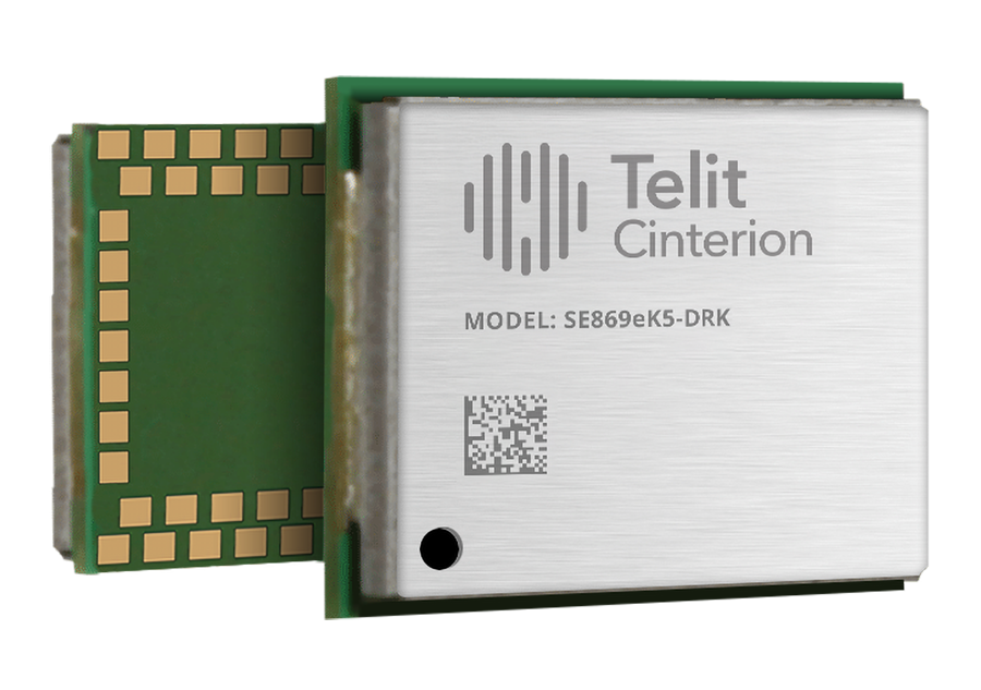
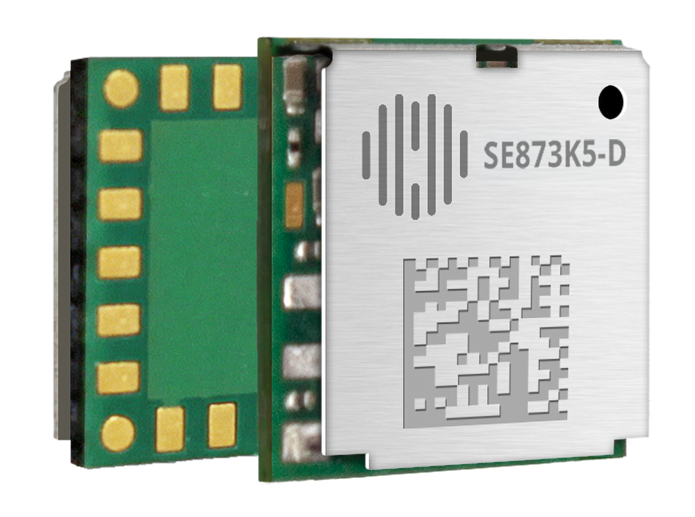
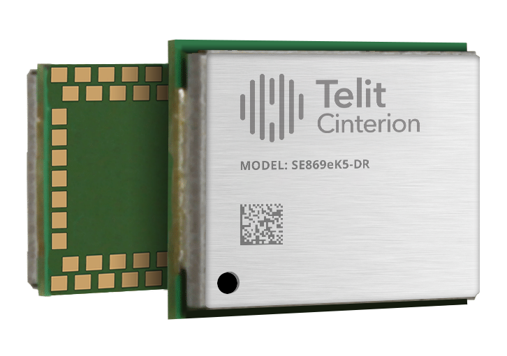
Telit Cinterion, an end-to-end IoT solutions enabler, has expaned its GNSS portfolio with two dual-band positioning modules: the ultracompact SE873K5-D and the high-end SE869eK5-DRK.
Built on the AG3335 chipset series from long-time partner Airoha, the new modules support space- and power-constrained internet of things (IoT) devices and use cases that require continuous, ultraprecise positioning.
The SE873K5-D and SE869eK5-DRK provide a scalable path to adopt dual-band L1 + L5 GNSS. Device manufacturers can add advanced correction technologies and resilient positioning architectures without redesigning hardware.
When combined with Telit Cinterion cellular connectivity solutions, the modules support the injection of RTCM corrections worldwide. This feature enables higher accuracy across connected IoT deployments.
SE873K5-D The SE873K5-D expands the established SE873K5 family with a dual-band L1 + L5 variant. It is designed for size- and power-constrained applications.
This new module maintains the same 7 x 7 mm footprint and pin-to-pin compatibility as the single-frequency SE873K5. OEMs can scale performance without changing hardware designs.
The SE873K5-D supports multiconstellation GNSS across the L1 and L5 bands. Compared to single-frequency solutions, it improves accuracy and robustness against interference and multipath effects.
With DGNSS support via RTCM corrections, the module enables submeter accuracy. It is ideal for myriad use cases, from wearables to fleet management.
Two power supply variants enable designers to optimize for either minimal size or ultralow power consumption in battery-operated devices. Multiple configurable usage profiles, such as tracking and drone modes, provide added flexibility across IoT verticals.
SE869eK5-DRK The SE869eK5-DRK is the next evolution of Telit Cinterion’s high-end GNSS offering. Based on the upper tier of the AG3335 chipset family, this module builds on the previously announced SE869eK5-DR. It adds support for RTK positioning with untethered dead reckoning.
This powerful combination enables uninterrupted, centimeter-level positioning. It maintains performance even when GNSS signals are degraded or unavailable due to interference or signal blockage.
The SE869eK5-DRK has an embedded inertial measurement unit. This feature helps maintain accurate position fixes in environments like tunnels and dense urban areas. The module supports DGNSS for submeter accuracy when RTK corrections are unavailable or when centimeter-level precision is not needed.
The SE869eK5-DRK is designed in an industry-standard 16 x 12.2 mm form factor. It introduces a proprietary extended pinout while remaining backward-compatible with existing designs. The added pins enable future-proof implementations and customization. OEMs can expand capabilities over time without redesigning their products.
Engineering validation testing samples of the SE873K5-D are available now. Design validation testing samples are expected soon. Mass production is planned for Q2 2026.
Design validation testing samples for the SE869eK5-DRK are available now. Mass production is planned for Q2 2026.
For more information about the SE873K5-D and the SE869eK5-DRK, visit Telit Cinterion at Embedded World at Booth #3-620. The event runs March 10-12 at the Exhibition Centre Nüremberg.
etherWhere has partnered with AsiaRF to offer two new GNSS modules based on its EW6181, a module that offers low power consumption with fast acquisition time.
AsiaRF is offering two module designs (10.1 × 9.7 × 2.3 mm and 18 × 18 × 6.2 mm). The modules are targeted for wireless solutions, including Wi-Fi 7 access points, body-worn cameras, and asset tracking solutions.
etherWhere specializes in low-power GNSS chipset solutions, and Asia RF is a leader in wireless connectivity. Both companies are attending CES 2026 (visit etherWhere at LVCC – North Hall Booth No. 10763; see the modules on display at the nearby Asia RF booth, No. 10676.)
For customers with challenging applications, etherWhere offers performance improvement through the use of accuWhere cloud. accuWhere’s multi-modal operation can reduce power consumption for battery operated devices or improve accuracy for demanding applications.
“We’re thrilled to work with AsiaRF, a leader in wireless connectivity solutions, targeting the enterprise, IoT, and public safety markets. Location awareness is becoming a key requirement across the industry, and we’re excited to be partnering with AsiaRF to bring solutions to the market,” said Michael Raam, CEO of etherWhere.
“Our partnership with etherWhere marks a significant milestone in AsiaRF’s mission to push the boundaries of wireless innovation,” said Paul Lai, CEO of AsiaRF. “The new GNSS modules address critical market demand for high precision and ultra-low power consumption in compact form factors. We are excited to showcase these solutions at CES 2026, offering our clients the perfect synergy of Wi-Fi 7 connectivity and state-of-the-art geolocation.”
Telit Cinterion, an end-to-end IoT solutions enabler based in Irvine, California, has launched the SE869eK5-DR, a dual-band, multi-constellation positioning receiver with untethered dead reckoning (UDR) built on the Airoha AG3335 chipset family.
The UDR ensures reliable, continuous positioning even when satellite signals are lost due to jamming, interference or physical obstructions, delivering continuous and reliable location data for mission-critical applications without depending on a car connection.
With its power-efficient design, the module is ideal for mission-critical applications in business and government that demand ultra-reliable location information, and long battery life. Applications include fleet management, automotive telematics systems, and high-value asset tracking, where uninterrupted and precise location data is critical for operational efficiency.
Building on the successful Telit Cinterion SL869 series, the SE869eK5-DR adds an integrated six-axis sensor for UDR. This allows the module to maintain a position fix even when signals are blocked or jammed, able to track high-value assets deep inside buildings or in underground parking garages.
The SE869eK5-DR also supports L1 and L5 bands, which maximizes resiliency through frequency redundancy. If one band’s signals are degraded by physical obstructions, the other band provides an alternative set of signals. The module also supports differential GNSS (DGNSS) positioning for applications that require sub-meter-level accuracy.
The SE869eK5-DR includes features that streamline product development. Its UDR technology is simple to integrate because it doesn’t require any external application information, which shortens the design phase. It also automatically identifies the direction of movement (forward or reverse), eliminating the need for a separate heading pin. While the SE869eK5-DR introduces an additional 34 pins for future use, it remains backward compatible with previous 24-pin generations, allowing device OEMs to upgrade existing designs.
SE869eK5-DR engineering validation testing (EVT) samples are available now, with design validation testing (DVT) samples scheduled for November.
Visit the Telit Cinterion booth (E314) at SIDO Sept. 17-18, 2025 in Lyon, France, to learn more.
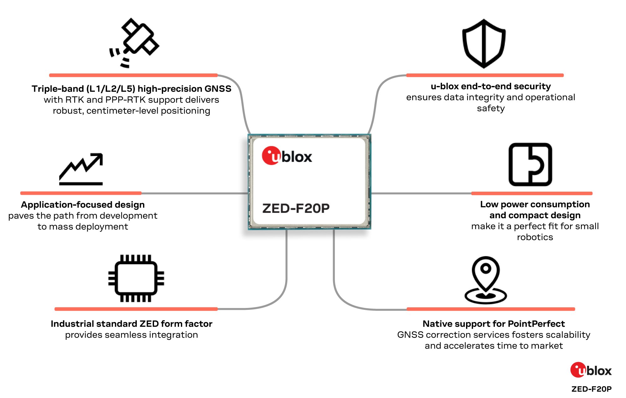
u-blox has expanded its ZED form-factor portfolio with the ZED-F20P, a L1/L2/L5 triple-band GNSS module designed for high precision applications in ground and air robotics.
The ZED-F20P provides OEMs deploying fleets of ground robots, drone light shows, and other dynamic autonomous platforms with centimeter-level RTK and PPP-RTK positioning, fast convergence times, and integrated security features.
Within the u-blox high precision receiver family, the ZED-F20P is a dedicated L1/L2/L5 triple-band specialist. It delivers deterministic, centimeter-level RTK and PPP-RTK accuracy tailored to the needs of lightweight and dynamic platforms. Its end-to-end silicon-to-firmware architecture supports 25 Hz update rates, robust security features, and low power consumption in a streamlined design.
These capabilities combine to deliver industrial-grade reliability and enable smooth scaling from proof-of-concept to high-volume deployment without increasing system cost, power consumption, or integration complexity.
Compatible with the established ZED footprint and UBX protocol, the ZED-F20P fits directly into existing layouts. The expanded ZED portfolio now covers dual-, triple- and all-band GNSS options, giving developers the flexibility to select the best fit while reusing the same board layout. This enables both flexible design choices and a straightforward upgrade from earlier products.
The ZED-F20P pairs with the u-blox ANN-MB2 all-band high precision antenna to ensure optimal RF performance, offering a one-stop solution for streamlined evaluation and integration. This consistent design approach accelerates time to market while preserving hardware and software continuity.
PointPerfect Flex and Live native support:
When combined with u-blox PointPerfect Flex and Live GNSS correction services, the ZED-F20P becomes a complete, production-ready GNSS solution that delivers centimeter-level accuracy in seconds, without the need for a local base station. The triple-band L1/L2/L5 architecture ensures rapid convergence and resilience in challenging environments, while PointPerfect provides reliable corrections across key regions. This tight integration simplifies development and accelerates time-to-market for mass-market autonomous platforms.
“The ZED-F20P delivers the precision and reliability required for today’s ground and air robotics,” said Mårten Ström, director of product management at u-blox. “It strikes a rare balance between performance, integration simplicity, and application-specific focus, enabling engineering teams to move from prototype to fleet deployment with confidence. We’re already seeing strong interest from robotic lawnmower markets preparing for large-scale rollout.”
Engineering samples of the ZED-F20P are available now. Developers can evaluate the module using the EVK-X20P evaluation kit, with a simple configuration.
A roundup of recent products in the GNSS and inertial positioning industry from the March 2023 issue of GPS World magazine.
UAV
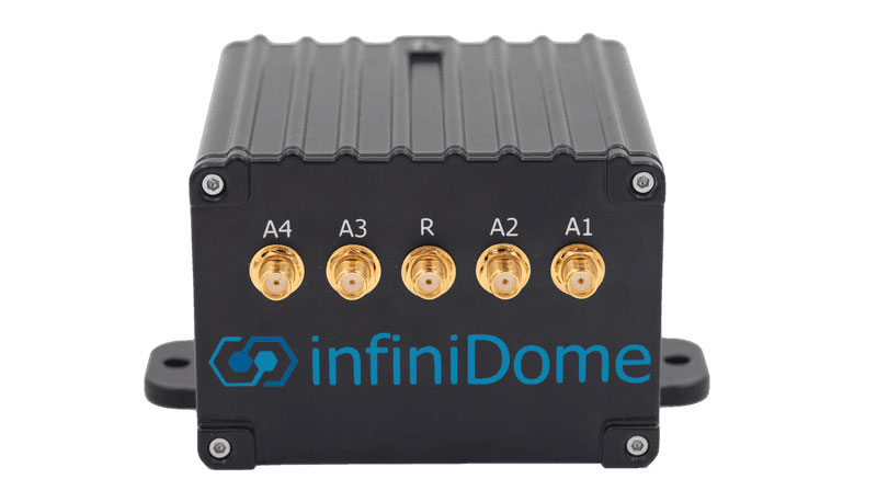
Image: InfiniDome
Anti-Jamming Device Provides protection from three directions of attack
The GPSdome 2 is tailored to defend small- to medium-sized tactical UAVs as well as manned and unmanned ground vehicles. With a small form factor (500 g, 87 mm x 91 mm x 61.55 mm) and minimal power consumption, GPSdome 2 is suitable for loitering munitions as well as UAVs. Fully retrofit and completely standalone, the system is compatible with almost any off-the-shelf GNSS receiver as well as standard active GNSS antennas, meaning that it can be integrated into existing GPS systems or into new product lines, manned or unmanned. With sophisticated algorithms and a proprietary RFIC, GPSdome 2 analyzes RF interference in the environment and combines multiple antenna patterns to create and dynamically steer three nulls in the direction of any hostile signal. GPSdome 2 provides simultaneous dual-frequency protection (GPS L1 + L2 or GPS L1 + GLONASS G1), creating up to three nulls, protecting from three jamming directions within each band in real time, making it suitable for PNT applications. The GPSdome 2 is a dual-use, non-ITAR device and comes with optional mil-spec compliance. InfiniDome, infinidome.com
Image: uAvionix
Command and Control Designed for easy integration
The SkyLine C2 management platform and muLTElink airborne radio systems (ARS) are designed to integrate, which enables a self-healing command-and-control network capable of both path and link diversity. This eliminates lost-link possibilities over broad terrain and altitude ranges. MuLTElink ARS consists of two models — muLTElink915 and muLTElink5060, the core of the uAvionix C2 system. The muLTElink915 model combines globally licensed aviation LTE, enhanced with frequency hopping 902 MHz – 928 MHz industrial, scientific and medical frequencies capability. The muLTElink5060 model combines global LTE with aviation-protected 5,030 MHz – 5,091 MHz C-band. Each muLTElink model allows up to one external CNPC radio to be optionally connected to allow simultaneous use of all three frequency ranges, higher power C-band operation or future radio integrations. uAvionix, uAvionix.com
Image: Atmos
VTOL UAV With Sony a7R mark III and IV camera
Atmos has integrated the Sony a7R mark III and IV cameras into its vertical take-off and landing (VTOL) fixed-wing UAV, the Marlyn Cobalt. This will increase coverage and accuracy achieved in a single flight for surveyors. Both cameras have an ISO of 32,000, which is expandable to 102,400, and camera sensors with high megapixel count — 42,4 MP for the a7R III and 61 MP for the a7R IV. When combined with Zeiss’ 35 mm and 21 mm lenses, it enables UAV surveyors to achieve ground sample distance levels below one 1 cm. The integration of the two cameras enables Marlyn Cobalt users to map an area of 210 ha with centimeter-level accuracy in a single flight. Atmos, atmosuav.com
Trueview 720. (Image: GeoCue)
TrueView 535. (Image: GeoCue)
Accuracy Star. (Image: GeoCue)
UAV and Lidar Systems Suitable for geospatial professionals
TrueView 535 consists of updated lidar sensors, adding a third return, increasing mapping abilities below canopy. An additional third nadir camera offers another point of view and improves photogrammetry quality. It also includes a longer, usable lidar range to increase flexibility. TrueView 720 is a fourth-generation Riegl VUX-120 with three laser beam orientations. It provides high-point density corridor mapping. Using the Riegl VUX-120 with three laser beam orientations (nadir, +10 degrees forward and –10 degrees backward) and three oblique/nadir cameras enables data collection from more surfaces in one flight path. One application of TrueView 720 is scanning power lines. Users can capture the poles vertically, front and back. The extreme range of this system means it can be integrated with UAVs, airplanes or helicopters. In addition to the two sensor payloads, GeoCue has launched its LP360 software add-on for processing and visualization — the 3D Accuracy and the Accuracy Star hardware.
GeoCue, geocue.com
OEM
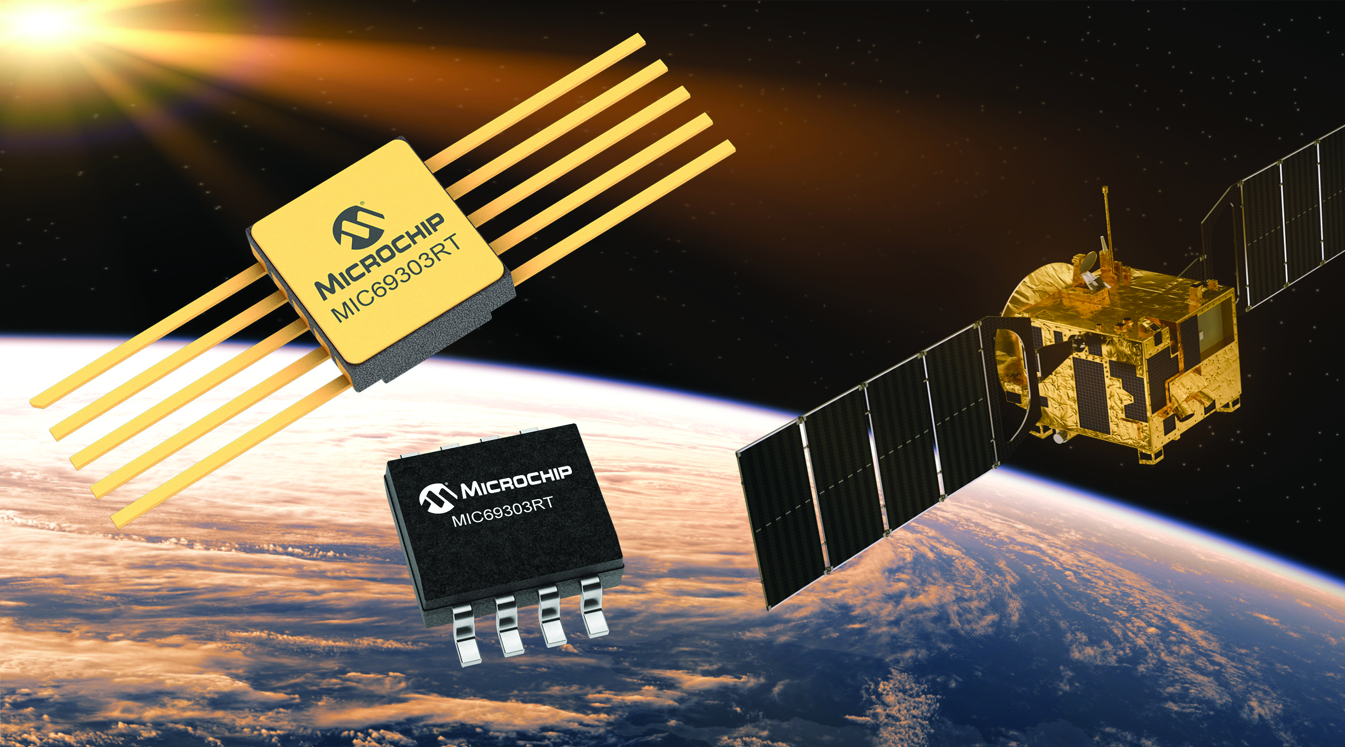
Image: Microchip
Voltage Regulator Device for LEO space application
The MIC69303RT is a radiation-tolerant power management device for space application developers. It is a high-current, low-voltage device targeting low-Earth orbit space applications. The MIC69303RT operates from a single low-voltage supply of 1.65 v to 5.5 v and can supply output voltages as low as 0.5 v at high currents. It offers high-precision and low dropout voltages of 500 mv under extreme conditions. The MIC69303RT is a companion power source solution for microcontrollers, such as the SAM71Q21RT and PolarFire field-programmable gate arrays. MIC69303RT is designed for harsh aerospace applications and remains operational in temperature ranges from -55 C to +125 C. Microchip Technology, microchip.com
Image: Spirent Communications
LEO Satellite Device Designed for GNSS/PNT lab testing
SimORBIT is a low-Earth-orbit (LEO) satellite solution software designed to aid developers in determining LEO orbits more accurately for GNSS/PNT lab testing. The software replicates LEO orbits so that simulations can provide the realistic environment of a LEO satellite, including gravitational and atmospheric impacts the satellite could encounter in space. Developers can create non-ICD signals via I/Q injection, or by the “Flex” feature, generating space-centered PNT signals to be developed in the lab as realistically as possible. Spirent Communications developed SimORBIT in partnership with SpacePNT. Spirent Communications, spirent.com
Image: Sony
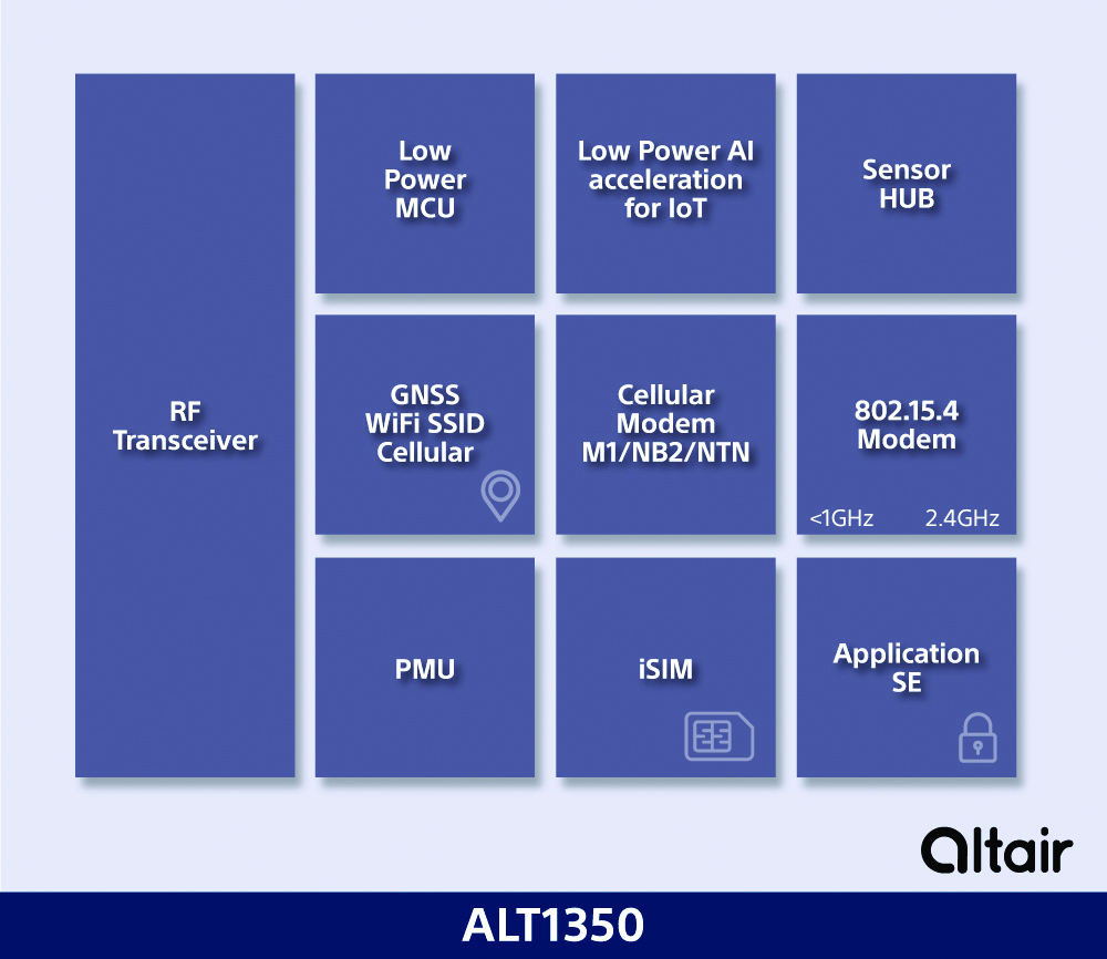
5G Chipset Includes GNSS
The ALT1350 implements GNSS, cellular and Wi-Fi-based location in a single chipset. The cellular LTE-M/NB-IoT chipset is designed to enable additional low-power, wide-area (LPWA) communication protocols; intermittent LTE and GNSS (GPS/GLONASS) navigation for low-cost applications; and concurrent LTE and L1/L5 GNSS for tracking applications. The ALT1350 incorporates a sensor hub to collect data from the sensors while maintaining ultra-low power consumption. It also provides cellular and Wi-Fi-based positioning and is tightly integrated to provide power-optimized concurrent LTE and GNSS to accommodate various tracking applications, which can be demanding with a single chip. The chip is designed to enable deployments for the internet of things (IoT), including location technologies. Sony, altair.sony-semicon.com
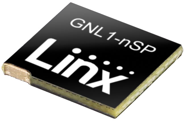
The ANT-GNL1-nSP is a surface-mount embedded GNSS antenna supporting GPS, Galileo, GLONASS, BeiDou and QZSS in the L1/E1/B1 bands. The ANT-GNL1-nSP antenna exhibits high performance in a compact size (10 mm x 8 mm x 1 mm) and features linear polarization and an omnidirectional radiation pattern. The antenna is available in tape and reel packaging and is designed for reflow-solder mounting directly to a printed circuit board for high-volume applications. Linx Technologies, linxtechnologies.com
Image: OriginGPS
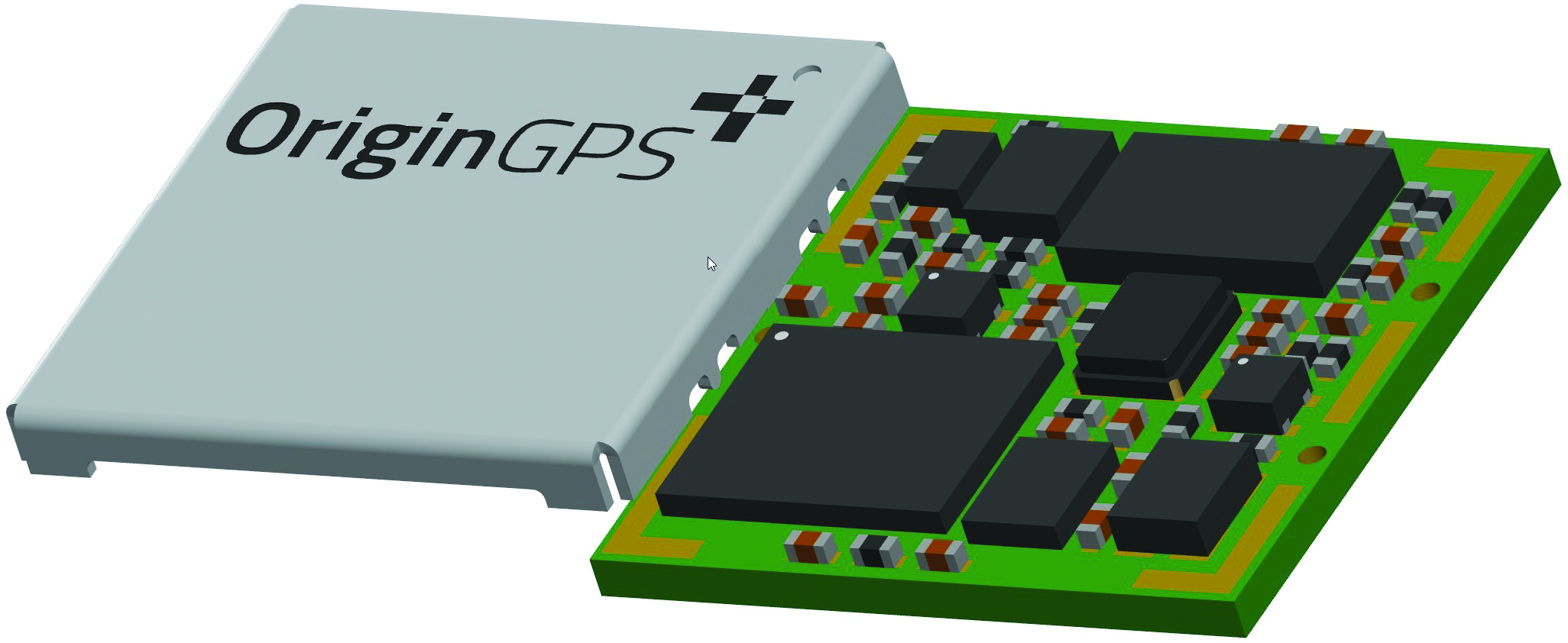
GNSS Module Based on a MediaTek chipset
The ORG4600-MK01 dual-frequency module provides higher precision than the company’s previous modules. It has sub-1 m precision at a cost lower than that of the company’s first L1+L5 module, the ORG4600-B01, which is based on Broadcom’s chipset. The 10 mm x 10 mm ORG4600-MK01 was designed for applications deployed in challenging environmental conditions. The solution also includes RTCM, a logger and accurate orbit prediction. OriginGPS, origingps.com
MAPPING
Image: Mapbox
Navigation Software Includes enhancements to existing software and more
Navigation software development kit version 2.9 provides pre-built applications compatible with Android and IOS. SDK v2.9 provides the primary navigation components across a workflow using lines of code instead of starting from square one. The drop-in user interface is customizable to reflect a developer’s brand, obviating the need to manually develop a full end-to-end application. Navigation SDK Copilot — a backend analytics tool for CX on navigation applications — collects trace files of navigation sessions and search analytics data from users. Developers can use this data to gather feedback and collective user data to create touch points with users and improve application experience based on their data-drawn conclusions. Matrix API has been updated to support scheduled departure times and provide optimal driving routes, creating a more accurate estimated time of arrival. Mapbox, mapbox.com
Image: Hexagon
Defense Platform For developing Android applications
LuciadCPillar is designed for the development of mobile applications for dismounted soldiers in the field. Developers can build applications with 2D and 3D views. It features military symbology and supports many geospatial data types including vector data, raster data, elevation data, point clouds and 3D meshes. It has the same capabilities found in desktops, in-vehicle and browser applications built with LuciadLightspeed, LuciadCPillar and LuciadRIA. The platform offers capabilities to match high-resolution screens, graphic processing units and multi-core processors including the ability to display 3D data in mobile applications. LuciadCPillar supports ARM processors and an application programming interface, which aligns with the Android developer experience. Impact, a French system integrator, partnered with Hexagon to test LuciadCPillar and will integrate it into its Delta Suite product, which is used by the French Special Operations Command. LuciadCPillar is part of Luciad 2022.1, which is available now globally. Hexagon, hexagon.com
Image: Golden Software
Surface Mapping Designed for 3D surface mapping
The Surfer package is designed for 3D surface mapping and provides robust subsurface visualization and modeling functionality by incorporating many true 3D gridding and visualization tools. With the enhanced functionality, users can now model an additional variable, a C variable, such as a contaminant or chemical concentration, along with the traditional X, Y, Z values. Surfer also includes the ability to create a 2D map of a slice-through 3D grid, which users can move up and down through the grid, illustrating how the C value changes with depth. Part of Surfer’s enhancements is isosurface creation, enabling visualization of the 3D grid in the 3D view as an isosurface, providing another way to see how C data varies with depth or elevation. The new 3D-rendered volume functionality also allows users to visualize the 3D grid in the 3D view as a solid body by assigning colors to different C values, highlighting variations in the data. Golden Software, goldensoftware.com
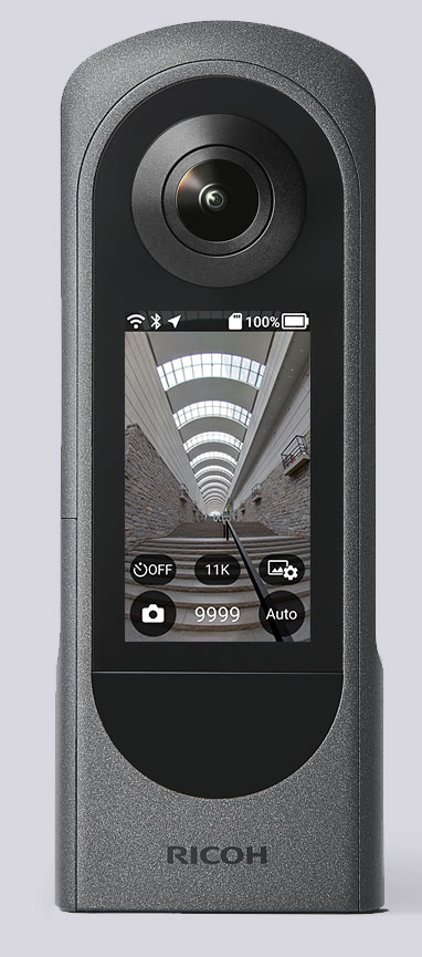
The Ricoh Theta X 360° camera uses a u-blox module for its location metadata. (Photo: Ricoh)
The ZOE-M8B GNSS module from u-blox is integrated into the new RicohTheta X camera. The camera allows users to shoot high-quality 360-degree spherical images and videos in one click and visualize them immediately on an LCD touch panel.
The u-blox ZOE-M8B enables the Ricoh Theta X’s built-in location system, one of its key features. The module is listed on the u-blox site as receiving GPS, BeiDou and GLONASS signals as well as QZSS, but the Ricoh Theta X specifications list only GPS + QZSS along with assisted GPS.
The u-blox receiver automatically embeds highly accurate location information for each image taken, without the need for a smartphone or another external device.
An icon on the LCD touch panel displays the availability of the GPS signals depending on the user’s location, ensuring the location information has been reliably acquired before shooting begins. The location is accurate down to a 5-meter radius, suitable for a wide range of industrial and consumer applications.
The u-blox ZOE-M8B GNSS module is an ultra-small (4.5 mm x 4.5 x 1.0 mm) system-in-package offering highly accurate positioning with concurrent reception of up to three satellite constellations. The Super-E (Super-Efficient) mode guarantees power consumption as low as 12 mW, and built-in SAW and LNA make it suitable for passive antennas. The u-blox ZOE-M8B targets applications that require a small size without compromising performance.
Part of a 360° spherical image shot with the Theta X. (Photo: Ricoh)
“We chose the u-blox module because of the highly accurate location information it offers, alongside easy integration and low power consumption,” said Kenji Daigo, GPS Function Developer for Theta X at Ricoh.
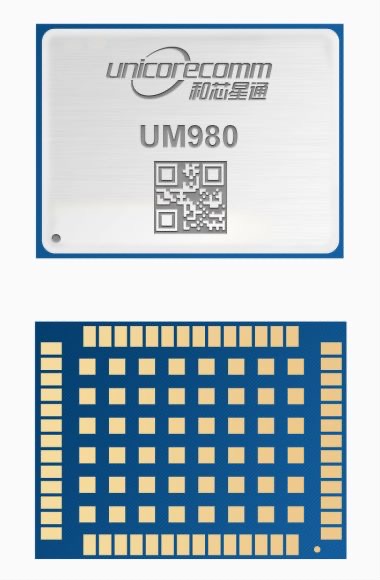
Unicore Communications has released its new generation of high-precision GNSS module. The UM980 uses real-time kinematic (RTK) technology to achieve centimeter-level positioning accuracy.
The UM980 is based on the small high-performance system-on-chip NebulasIV, which integrates radio frequency, baseband and high-precision algorithms on a single chip. It has 1,408 channels to concurrently receive satellite signals from multiple constellations and multiple frequencies.
The UM980 module can track BDS B1I/B2I/B3I/B1C/B2a/B2b, GPS L1/L2/L5, GLONASS L1/L2, Galileo E1/E5a/E5b/E6 and QZSS L1/L2/L5, as well as supporting SBAS.
Its advanced multi-mode multi-frequency computing engine provides powerful signal processing ability, characterized by fast initialization time, accurate positioning results, and a high data-update rate of up to 20 Hz.
The UM980 features low power consumption, typically 480 mW. The module is a surface mount device (SMD) measuring 17 x 22 x 2.6 millimeters. Compared to Unicore’s previous generation of high-precision GNSS modules, the UM980 is nearly half the size while the performance remains excellent.
The UM980’s compact form occupies less printed-circuit-board area and makes the product more portable. The UM980 is also equipped with an advanced anti-jamming unit, which ensures high reliability even in complex electromagnetic environments.
Thanks to its high precision, high performance and high reliability, UM980 is suitable for applications in surveying, mapping and precision agriculture. The UM980 is qualified according to the international quality standards (RoHS, REACH, CE, FCC, and IC) and is in mass production.
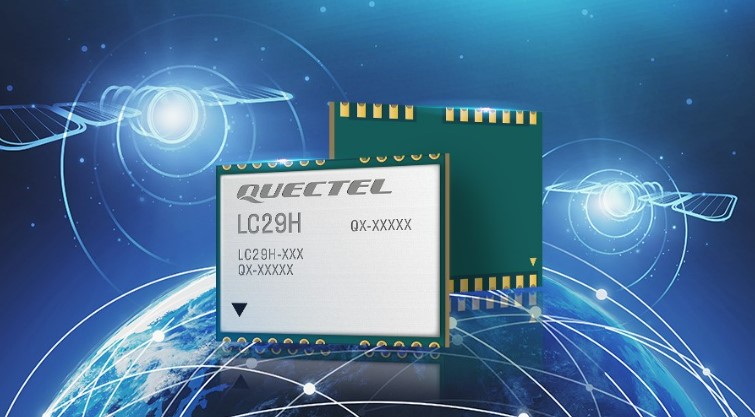
Quectel Wireless Solutions has released the LC29H, a dual-band multi-constellation GNSS module. Built using the Airoha AG3335 platform, the LC29H is available in multiple variants and optionally integrates real-time kinematic (RTK) and dead reckoning.
The LC29H series offers high performance with power efficiency to meet the market needs of high-precision positioning at the centimeter and decimeter levels. The modules are suited to an expanding market for autonomous lawn mowers, drones, precision agriculture, micro-mobility scooters and delivery robots as well as other industrial and autonomous applications.
“High-precision positioning with centimeter-level accuracy is becoming increasingly vital for many new IoT [internet of things] applications,” said Patrick Qian, Quectel CEO. “Robotics, UAV and industrial applications needing precise navigation are driving new market requirements, and we are very excited to launch our newest generation of high-precision positioning modules.”
The LC29H concurrently receives and processes signals from GPS, GLONASS, BeiDou, Galileo and QZSS. The module supports L1 and L5 dual-band signal reception, speeding up convergence time, improving positioning accuracy, and achieving fast response times even when signals are interrupted. The dual-band design significantly mitigates the multipath effect experienced near high-rise buildings or in deep urban canyons, and provides reliable positioning performance, Quectel stated.
In addition, some versions of the LC29H contain a six-axis inertial measurement unit (with three-axis accelerometer and three-axis gyroscope) and integrate RTK and dead-reckoning positioning algorithms, allowing for continuous lane-level positioning where the satellite signal is partially or completely blocked, such as underground parking lots, tunnels, urban-canyons or forests. When the satellite signal is reacquired, the LC29H combines inertial sensor data with GNSS signals, and the integrated navigation can provide fast convergence times and decimeter level positioning accuracies.
The LC29H is available in variants, each targeting different application scenarios. The LC29H(EA) is aimed at the growing market of agricultural drones as well as electricity power detection terminals, and can improve the anti-interference capability of complex systems. The LC29H(BA) is well suited to agricultural machinery and specialized vehicles, and the LC29H(DA) can enable centimeter-level accuracy in connected lawnmowers and safety helmets.
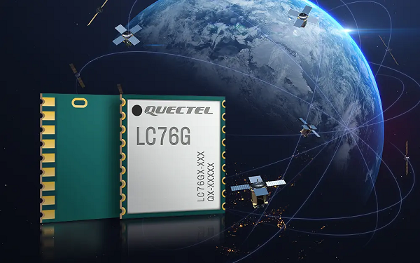
Quectel Wireless Solutions, a global IoT solutions provider, has released the LC76G module, a single-band compact GNSS module featuring fast and accurate location performance as well as ultra-low power consumption.
The LC76G is on display at Embedded World Nuremberg, Booth No 171, Hall 5, June 21- 23.
The LC76G has already entered mass production with sufficient supply to meet the needs of the global positioning market. Based on the Airoha AG3352 platform, the LC76G can concurrently receive and process signals from all four global constellations and the regional QZSS.
The LC76G module can receive signals from up to 47 satellites and achieve 1.5 m (CEP50 open-sky) positioning accuracy representing a 40% improvement over previous generations of devices.
Available in a cost-optimized version as well as a low-power version, the LC76G low-power version consumes less than 9 mA@3V with all four constellations enabled, allowing for a 72% reduction in power required compared to what was previously possible.
This makes the LC76G suitable for battery-operated devices such as wearable personal trackers, wildlife and livestock tracking, toll tags, portable container trackers and a host of traditional markets such as shared mobility and low-cost asset trackers.
Featuring an internal SAW filter and integrated LNA, the LC76G can be connected directly to a passive patch antenna and provides filtering against unwanted interference, ensuring excellent performance even while driving through dense urban canyons.
EPO and EASY improve TTFF
Integrated assisted-GNSS technology Extended Prediction Orbit (Quectel’s EPO) is supported on the LC76G module. EPO reduces the time to first fix (TTFF) with a hot start taking less than 1 second, a warm start within 2 seconds, while the cold start can obtain accurate tracking fixes within 15 seconds. The faster GNSS fixes make it possible to use accurate positioning and navigation services anytime and anywhere with a smaller power budget than previously possible.
While EPO requires manual download of predicted orbits, the LC76G also supports the Embedded Assist System (EASY), where predicted orbit information is collected directly from the satellites and provides for up to three days of accelerated fixes.
Both EPO and Easy are available for each constellation, allowing for faster TTFF and reduced dependency on any particular constellation.
Featuring an LCC form factor and an ultra-compact size of 10.1 × 9.7 ×2.4 mm, the footprint of the LC76G is compatible with other industry solutions as well as Quectel’s legacy L76 and L76-LB modules, allowing for a smooth migration of existing designs to the latest low-power GNSS technology.
In addition, Quectel offers a wide range of off-the-shelf and customized high-performance antennas which boost wireless connectivity significantly. The C76G can be combined with a selection of GNSS L1 antennas to enable various positioning requirements. Customized connector type and cable length as well as comprehensive antenna design and test support are also available.