Tag: GNSS module

  • Quectel releases quad-band GSM/GPRS/GNSS/Wi-Fi module

    Quectel releases quad-band GSM/GPRS/GNSS/Wi-Fi module

    Photo: Quectel Wireless Solutions
    Photo: Quectel Wireless Solutions

    Quectel Wireless Solutions has launched the MC90, a quad-band GSM/GPRS/GNSS/Wi-Fi module.

    According to the company, the module supports hybrid positioning technologies including GNSS, Cell ID and Wi-Fi aided positioning, and enables position tracking in both indoor and outdoor environments.

    Quectel’s MC90 integrates the multi-GNSS system, including GPS, GLONASS, Galileo and QZSS, which makes it suitable for urban areas with high-rise buildings and complex environments, the company added.

    The MC90 also adopts Wi-Fi hotspot positioning technology for blind spots and satellite coverage. It integrates multi-aiding positioning technologies to offer customers with optimized GNSS performance. It also supports EPO technology, which provides predicted Extended Prediction Orbit to speed up TTFF without the need of any extra server.

    The MC90 features a compact design, low power consumption and supports dual SIM single standby function. According to Quectel, it can be used for a wide range of internet of things applications, including bicycle sharing, student ID card, vehicle tracker, wearable device, pet tracker, asset tracker, driving recorder and more.

  • OEM module makes light work of mapping

    OEM module makes light work of mapping

    The BYes “GetYourSpace” service collects and analyzes lighting in urban environments using a GIS-based approach and the Trimble MB-TWO GNSS module.

    One of the most visible services provided by cities and municipalities is the illumination of streets and public spaces. To optimize the use of public funds, cities need timely, comprehensive information on how their lighting systems are working. Operators use the data to monitor system performance and plan maintenance, repairs and upgrades.

    Gathering data on street lighting is often performed manually. Technicians carrying photometers and clipboards visit individual light poles to collect information on the lighting output. The work, which must be performed at night, is slow and labor-intensive and can pose safety issues for the field technicians.

    GetYourSpace debuts

    GetYourSpace platform: The white G-Nav smart antenna contains the Trimble MB-TWO GNSS module. (Photo: Trimble)
    GetYourSpace platform: The white G-Nav smart antenna contains the Trimble MB-TWO GNSS module. (Photo: Trimble)

    The French company Bouygues Energies & Services (BYes) provides solutions that help cities operate efficiently. The company recognized the need for a mobile, automated system to collect lighting data and produce results accessible by a variety of users.

    The opportunity evolved into the BYes “GetYourSpace” service, which collects and analyzes lighting and other facets of urban environments. It uses a GIS-based approach to provide mapping and visualization functions.

    BYes set out to develop a compact platform that could detect and measure sources and characteristics of light. To present information using GIS, the GetYourSpace platform needed to include reliable geolocation. BYes called on Cadden, a French developer of location systems for marine and industrial applications, to provide the positioning component for the GetYourSpace platform.

    Reliable geolocation

    MB-Two module by Trimble.
    MB-Two module by Trimble.

    For the GetYourSpace collaboration, Cadden proposed a version of its G-Nav smart antenna, a product from Cadden’s GEOD brand. The G-Nav is built around a Trimble MB-TWO compact OEM GNSS module, an advanced GNSS receiver in a compact form designed for easy integration. The MB-TWO provides a range of GNSS configuration options, which allowed Cadden to produce a positioning system tailored to the BYes requirements.

    The communications ability of the MB-TWO enabled Cadden to streamline the development process. The module provides multiple input/output options and can be configured and controlled using a web interface as well as a simple ASCII command set. Cadden leveraged the module’s small size and low power requirements to embed it into a compact, robust GNSS unit that combines power and data into a single connection.

    High-speed data collection

    Heat map of lighting data collected by GetYourSpace. Accurate geolocation is essential to producing easy-to-use results. (Image: BYes, Trimble)
    Heat map of lighting data collected by GetYourSpace. Accurate geolocation is essential to producing easy-to-use results. (Image: BYes, Trimble)

    Cadden’s implementation of Trimble GNSS provided key enabling technology for GetYourSpace. With an area of 1 square meter, the mobile platform includes the GNSS, light and environmental sensors, system controller and data logging.

    The MB-TWO rapid update rate (up to 50 Hz) enables the GetYourSpace platform to capture accurate information even while moving at high speed. The low-power, lightweight platform can be mounted on a small car or towed behind a bicycle and requires minimal interaction with the operator or driver.

  • Launchpad: Rugged handhelds, aerial pollinator

    Launchpad: Rugged handhelds, aerial pollinator

    A roundup of recent products in the GNSS and inertial positioning industry from the May 2018 issue of GPS World magazine.

    SURVEY & MAPPING

    Rugged handhelds

    Operate in harsh environments

    The UT series of GNSS-capable rugged handheld devices support industries such as construction, survey, GIS, mapping, asset/logistics management, public safety, utilities and military. The UT10 6-inch rugged phone and UT30 8-inch rugged tablet both feature Android 8.0 operating systems with Qualcomm octa-core 2.2 GHz processors, 4 GB of RAM and 32GB onboard storage.The UT50 10.1-inch full-rugged tablet features the Windows 10 operating system with an Intel Core Skylake i5 processor up to 2.8 GHz, 8 GB RAM and 128 GB of onboard storage. All three new UT models provide the latest high-resolution, capacitive touchscreen and direct sunlight-readable display technology for ease of visibility in all situations. The UT50 also has a 10-finger multi-touchscreen and supports wet hands and gloves operation. The devices have dual built-in cameras. They are designed to be drop-resistant from heights of 1.2 meters (1.5 meters for the UT10), are rated at IP67 (IP68 for UT50), and are certified to both MIL-STD-810G and MIL-STD-461F military standards to ensure durability in most outdoor or challenging environments.

    Hemisphere GNSS, hemispheregnss.com

    Controller and apps

    For GNSS or total station operations

    Trimble TSC7 controller.

    The Trimble TSC7 controller is a new field solution for land and civil construction surveyors. Equipped with GPS, it provides a tablet experience with a physical keyboard and a sunlight-readable 7-inch touchscreen that supports pinch, tap and slide gestures. Front- and rear-facing cameras allow users to video conference their office from the field for on-the-job support, and capture high-definition videos and images that provide valuable context to their data and clients. The TSC7 uses Windows 10 Professional with an Intel Pentium 64-bit quad-core processor. The processor and operating system make it easy to process data in spreadsheets and run office software programs. An ergonomic form factor, IP68-certified rugged design and optional, user-interchangeable modules make the TSC7 a flexible solution for all surveying applications.

    Trimble, www.trimble.com


    UAV

    OEM GNSS/IMU Module

    Enhances light UAVs

    The AsteRx-i combines a multi-frequency multi-constellation GNSS engine with an external industrial-grade MEMS-based inertial measurement unit (IMU) to deliver positioning to the centimeter level as well as full 3D attitude at high update rates and low latency. The AsteRx-i is suitable for optical inspection and photogrammetry. Accompanied by a UAS-tailored carrier board, it integrates seamlessly into light UAVs. It also features Septentrio’s AIM+ interference monitoring and mitigation system.

    Septentrio, septentrio.com

    Aerial pollinator

    Aids fruit tree growers

    DropCopter’s pollen distribution system.

    UAS startup DropCopter has initiated a drone pollination service that uses multi-rotor drones to dust almonds, pistachios and cherries, boosting crops by up to 15 percent. Dropcopter’s patent-pending Worker-Bee pollinator helps growers overcome environmental factors like bee shortages, as well as wind, cold, and night time that would prevent honeybee activity. The company is partnered with GENIUS NY and The NUAIR Alliance.

    DropCopter, dropcopter.com

    Drone Camera

    Sensor Optimized for Drone Applications (S.O.D.A.)

    Photo: sensefly
    Photo: senseFly

    The senseFly S.O.D.A. camera is built for professional drone photogrammetry work. It captures sharp aerial images across a range of light conditions, allowing users to produce detailed, vivid orthomosaics and ultra-accurate 3D digital surface models. It has a 1-inch 20 megapixel RGB sensor that provides ground resolution of 2.9 centimeters per pixel flying at 400 feet (122 meters) above ground level. It has built-in dust and shock protection, enabling mapping across challenging terrain.

    senseFly, www.sensefly.com

  • u-blox high-precision GNSS module based on its F9 technology

    u-blox, a global provider of leading positioning and wireless communication technologies, has released the ZED-F9P multi-band GNSS module with integrated multi-band real-time kinematics (RTK) technology for machine control, ground robotic vehicles and high-precision unmanned aerial vehicles (UAV) applications.

    The ZED‑F9P measures 22 x 17 x 2.4 millimeters and uses technology from the recently announced u‑blox F9 platform to deliver robust high-precision positioning performance in seconds.

    The u-blox ZED-F9P is a mass market multi-band receiver that concurrently uses GNSS signals from all four GNSS constellations (GPS, GLONASS, Galileo and BeiDou). Combining GNSS signals from multiple frequency bands (L1/L2/L5) and RTK technology lets the ZED‑F9P achieve centimeter-level accuracy in seconds, the company said.

    Receiving more satellite signals at any given time maximizes the availability of centimeter-level accuracy even in challenging environments such as in cities.

    With its high update rate, the ZED‑F9P is suitable for highly dynamic applications such as UAVs. Featuring on-chip integration of advanced multi-band RTK algorithms, it requires no additional hardware or third-party RTK libraries. Ready to use on delivery and easy to integrate, it helps product developers quickly bring their ideas to the market.

    ZED-F9P is fully geared to clearing the three main hurdles that have kept centimeter-level positioning accuracy from breaking into mass-market applications: cost, size and power consumption. Significantly smaller and more energy efficient than existing solutions, and as a cost efficient alternative, the ZED-F9P will enable new high-precision positioning applications for the mass market.

    “The new ZED-F9P GNSS receiver builds on the success of our NEO-M8P high-precision GNSS module, but takes performance to another level by leveraging all the available GNSS signals,” said Mårten Ström, senior principal product management, product center positioning at u‑blox. “By making robust and affordable high-precision positioning technology more accessible, we hope to fuel innovation and enable a new generation of high-precision GNSS navigation applications.”

    Engineering samples will be available at the end of July.

  • Firmware release upgrades Piksi Multi with GLONASS

    Firmware release upgrades Piksi Multi with GLONASS

    Swift ​​Navigation​, ​​a ​​San ​​Francisco-based ​​tech ​​firm that is ​​building centimeter-accurate ​​GPS ​​technology ​​for autonomous ​​vehicles, ​​has released ​​the latest ​​firmware ​​upgrade to ​​its ​​flagship ​​product, the ​​​Piksi Multi GNSS ​​module.

    Firmware update 1.4 is the fourth improvement since Piksi Multi began shipping one year ago.

    Duro – Piksi enclosure.

    ​​The firmware release also enhances Duro, the ruggedized version of the Piksi Multi receiver housed in a military-grade, weatherproof enclosure designed specifically for outdoor deployments.

    The ​​upgrade ​​is available ​​at ​​no ​​cost ​​to ​​Piksi ​​Multi ​​and Duro users ​​and ​​provides ​​full ​​support ​​for ​​ GLONASS, in addition to the GPS satellite constellation. Access to dual constellations greatly improves availability, reliability and range between GNSS base and rover devices, the company said.

    According to Swift Navigation, the firmware release also adds NMEA GGA output capability to existing NTRIP (Networked Transport of RTCM via Internet Protocol), enabling Piksi Multi and Duro to seamlessly position by sending and receiving data from CORS (Continuously Operating Reference Station) base stations over the Internet.

    Firmware ​​Version ​​1.4 ​​Enhanced Receiver Performance Highlights

    • GLONASS ​​+ GPS support. The ​​new ​​firmware ​​provides ​​full and reliable integer ambiguity resolution for ​​GLONASS (G1/G2) + GPS (L1/L2C) for use with Swift Navigation products and most third-party base stations.
    • RTCM 1230 and 1033 interoperability. This allows Piksi Multi and Duro to communicate with many third-party industry-standard receivers.
    • NTRIP NMEA GGA support. This enables network RTK solutions and virtual base network (VBN) services.
    • Additional Fundamental Improvements
      • Full position and velocity covariances now published for advanced users for use in autonomous systems.
      • Carrier phase reacquisition was improved by seconds.
      • Fix reliability and availability was enhanced for extremely precise positioning accuracy in SPP mode was increased when RTK is not available.

    “The ​​1.4 ​​firmware ​​release is a step change improvement for our customers deploying ​​Piksi ​​Multi and Duro,” said Fergus Noble, CTO of Swift Navigation. “The addition of a second GLONASS satellite constellation enhances reliability and centimeter-accurate positioning in challenging environments, better supporting ground applications in precision agriculture, robotics and autonomous vehicles. Best of all, our customers benefit from new features delivered as a software update, at no additional cost and with no changes to their Piksi Multi or Duro hardware, underscoring Swift’s commitment to continuous improvements in our product lines.” ​

    For ​ ​​detailed ​​information ​​about ​​these ​​upgrades, ​ ​​refer ​​to ​​the Piksi Multi 1.4 Firmware Release Notes. ​​For ​​detailed ​​instructions ​​on ​​how ​​to ​​upgrade ​​a ​​Piksi ​​Multi ​​device, ​​refer ​​to ​​Section ​​7 ​​of ​​the Getting ​​Started ​​Guide ​​​Piksi ​​Multi ​​- ​​Upgrading ​​Firmware​​​. ​​For ​​firmware ​​release ​​binaries ​​and product ​​support ​​documentation, ​​visit ​​​support.swiftnav.com​.

  • SkyTraq introduces GPS/GAGAN receiver module for Indian market

    SkyTraq introduces GPS/GAGAN receiver module for Indian market

    SkyTraq Technology Inc., a fabless GNSS positioning technology company, has introduced the S1216F8-GI2, a NavIC + GPS/GAGAN receiver module for the emerging Indian market.

    It integrates L1/L5 RF front-end and baseband processor capable of receiving up to 14 L5 NavIC signals and up to 20 L1 GPS/GAGAN signals simultaneously. With currently usable six NavIC signals and three GAGAN signals, it offers a total of 18-23 usable signals for navigation compared to 9-14 usable signals with conventional GPS receivers, providing improved accuracy in urban canyon environments with signals often blocked by high buildings.

    The S1216F8-GI2 has form-factor and pin-out compatability with popular 12 x 16-millimeter GPS receiver modules, so customers using those GPS modules can effortlessly migrate to NavIC/GPS capability by drop-in replacement and changing to an L1/L5 antenna.

    For emerging intelligent transport systems (ITS) applications requiring NavIC/GPS capability in India, S1216F8-GI2 enables fast time-to-market for product manufacturers, the company said.

    NavIC sub-frame data output is a useful feature of the S1216F8-GI2. It can output NavIC broadcast warning messages related to weather alerts, forecast, and natural disasters such as cyclones, earthquakes and tsunamis.

    An S1216F8-GI2 engineering sample, evaluation kit and datasheet is available. Volume delivery to customers begins in late March. The S1216F8-GI2 is manufactured with ISO/TS 16949 automotive certification.

  • u-blox automotive-grade GNSS module features extended operating temperatures

    u-blox automotive-grade GNSS module features extended operating temperatures

    u‑blox is offering the automotive-grade MAX‑M8Q‑01A GNSS module, which measures 9.7 x 10.1 x 2.5 millimeters and has an operating temperature range from –40 degrees Celsius to 105 degrees Celsius.

    The MAX‑M8Q is the company’s third automotive-grade GNSS module to date, alongside the NEO‑M8Q‑01A and NEO‑M8L‑03A modules.

    MAX‑M8Q‑01A is designed to meet the stringent requirements of the automotive market, providing superior positioning accuracy even in challenging environments such as urban canyons. Its extended temperature range ensures reliable performance even in harsh environments, e.g. when mounted in a car‑roof antenna.

    Produced in adherence to the u‑blox 0 ppm program, which aims to bring down product failures rates to zero and consistently achieve high production quality, the module is delivered with the automotive industry’s standard PPAP documentation to ensure compliance with customer requirements.

    The module offers product developers a reduction of design and qualification time and effort, shortening time‑to‑market and considerably reducing risks for new product development.

    “We developed this automotive grade GNSS module in the small MAX form factor in response to customer requests for a GNSS receiver that operates reliably in an extended temperature range,” said Franck Berny, senior principal, automotive market development, u-blox. “We are confident that the module’s high quality, robust and secure performance, and small form factor will appeal to the automotive industry at large.”

  • Microsemi timing module designed for IEEE 1588 protocols

    Microsemi timing module designed for IEEE 1588 protocols

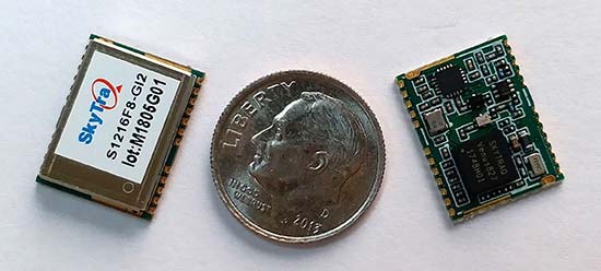
    Microsemi Corporation has launched a new IEEE 1588 timing synchronization module, offering a complete self-contained platform for customers to implement IEEE 1588 network timing client protocols.

    The solution, which consists of hardware, firmware and software, combines capabilities from Microsemi’s broad product portfolios by leveraging the company’s SmartFusion2 system-on-chip (SoC) field programmable gate array (FPGA), ZL30363 IEEE 1588 phase-locked loop (PLL) and VSC8575 Ethernet PHY devices.

    Microsemi’s new IEEE 1588 timing synchronization module streamlines customers’ developments to add synchronization network timing to their designs, simplifies the sourcing process and reduces development time while providing an easy integration.

    The module also includes drivers, servos/algorithm firmware, IEEE 1588 Precision Time Protocol (PTP) stack software, a user guide and reference board schematics to deliver a fully tested chip-set solution from a trusted tier-one vendor.

    The IEEE 1588 timing synchronization module blends Microsemi’s expertise in nanosecond-level accurate timestamping for IEEE 1588 via the VSC8575 Ethernet PHY; embedded IEEE 1588 protocol engine and servo via its SmartFusion2 SoC FPGA host processor; and high precision clock generation, holdover and reference switching via its ZL30363 system synchronizer.

    The solution is addressed via a command line interface to minimize software integration efforts.

    The combination of these capabilities makes the new solution suitable for applications within the industrial networking, smart grids, communications, defense and data center markets.

    Depending on the applications holdover and reliability requirements, either an XO, TCXO or OCXO can be used to provide holdover supported by the IEEE 1588 timing synchronization module.

    According to a 2017 GNSS Market Report, issue 5, the timing capability offered by satellite navigation systems is at the core of most vital infrastructures; telecom networks operation, energy distribution, financial transactions and TV broadcast are some examples of areas where a GNSS is used for timing or synchronization purposes.

    The annual shipments of GNSS devices used in the timing and synchronization market will exceed 300,000 units in 2017 and are expected to grow at a compound annual growth rate (CAGR) of 5.3 percent over 2017-2025.

    Catering to this growth opportunity, Microsemi’s new IEEE 1588 timing synchronization module is designed specifically for such applications, which require much more precise timing, including base stations and small cell markets for 5G, 4G, 4G LTE, LTE-Advanced, microwave and millimeter wave based fixed wireless networks, smart grids and secure edge networks.

    Other key features of Microsemi’s new IEEE 1588 timing synchronization module include:

    • High accuracy timestamping of less than 4 nanoseconds
    • Frequency and phase synchronization
    • Holdover with initial accuracy of <1ppb and long-term holdover of 1.5µs over 24 hours using the appropriate performance OCXO
    • Hitless reference switching
    • Precision frequency and phase control
    • Multiple profiles, including IEEE 1588-2008 Annex J.3 End-to-End
    • IEEE 1588-2008 Annex J.4 Peer-to-Peer
    • IEEE C37.238-2011 Power Profile
    • ITU-T G.8275.1 Telecom Profile for Phase
    • ITU-T G.8265.1 Telecom Profile for Frequency
  • NVS Technologies showcases GNSS receivers, modules at Intergeo 2017

    NVS Technologies provides a company overview, as well as a look at its latest GNSS receivers and modules, at Intergeo 2017, which took place Sept. 26-28 in Berlin, Germany.

  • Unicore launches high-precision GNSS receiver module

    Unicore launches high-precision GNSS receiver module

    Unicore has launched its next-generation quad-system GNSS module, the UM482.

    The UM482 is a multi-frequency high-precision heading module with a small footprint, supporting the satellite signals BDS B1/B2, GPS L1/L2, GLONASS L1/L2, Galileo E1/ E5b and SBAS.

    The module is designed for applications such as robotics, drones, intelligent drives and mechanical control.

    Unicore’s UM482 high-precision heading/positioning module.

    Key features of the UM482 module:

    • Tiny 30 × 40 millimeter footprint, all-system multi-frequency high-precision heading module, surface-mount (SMD) packaging
    • Supports GPS L1/L2, BDS B1/B2, GLONASS L1/ L2, Galileo E1/E5b
    • 1-cm RTK positioning accuracy and 0.2-degree heading accuracy with 1-m baseline
    • Dual antenna input with support of antenna signal detection
    • Supporting simultaneous output of heading and positioning, 20-Hz data output rate
    • Adaptive recognition of RTCM input data format
    • On-board micro-electro-mechanical system (MEMS) integrated navigation

    The UM482 GNSS RTK module adopts Unicore’s new-generation Nebulas II chip and UGypsophila real-time kinematic (RTK) algorithm.

    Based on high performance data-sharing technology and the simplified operation system of the Nebulas II chip, the UGypsophila RTK algorithm dramatically optimizes matrix processing, the company said. It can involve all satellites from GPS, BDS, GLONASS and Galileo in RTK and heading processing, shorten RTK and heading initialization time to 5 seconds and significantly improve the reliability and accuracy of RTK and heading.

    Furthermore, the UM482 integrates the onboard MEMS chip and U-Fusion integrated navigation algorithm, resulting in optimized continuity and reliability of accurate heading and positioning output in tough environments such as city canyons, tunnels and overpasses. Inputs of odometer and external higher performance inertial components are supported.

    The UM482, along with all the UM and UB family of receivers, will be on display at booth B4018 for the duration of the Intergeo 2017 trade show, which takes place Sept. 26-28 at Berlin Exhibition Center, Berlin, Germany.

  • Low-power GNSS module targeted at small consumer devices

    Low-power GNSS module targeted at small consumer devices

    u‑blox has introduced a new member of its ZOE‑M8 series of ultra-small GNSS system‑in‑package (SiP). The ZOE‑M8B is a power-efficient GNSS SiP designed available for small battery-powered consumer devices. It combines superior performance with ultra-low power for portable and wearable devices in the fitness, health monitoring and personal tracker markets, the company said.

    The ZOE-M8B by u-blox is designed for small consumer products. (IMAGE: u-blox)

    Small battery-powered devices are defined by their limited size, weight and power — any GNSS solution targeting this application space must provide exceptional performance while consuming minimal system resources.

    The ZOE‑M8B has been designed for this class of applications. It consumes 25 mW on average in most environments (including urban), and as little as 12 mW during instantaneous tracking. This is a three-fold improvement in power efficiency when compared with other variants in the ZOE‑M8 series.

    “The ZOE‑M8B SiP offers the best trade-off between power consumption and location accuracy,” said Uffe Pless, u-blox positioning product manager. “This will enable manufacturers to develop entirely new battery-powered devices that integrate GNSS functionality, without comprising performance or the user experience.”

    The ZOE‑M8B uses u-blox’s proprietary Super‑E mode of operation, which automatically adjusts the power consumed by the system components based on the external conditions.

    The footprint of a design with a chip and individual external components is about 50 percent larger than the printed circuit board (PCB) footprint of the ZOE-M8B. Measuring 4.5 x 4.5 x 1.0 mm, the ZOE‑M8B integrates a GNSS receiver, TCXO, SAW and LNA, making it easy to add accurate location and positioning functionality to almost any device, u-blox said.

    The ZOE-M8B is the latest addition to the ZOE-M8 GNSS module family, which consists of the ZOE-M8G for 1.8- powered devices and the ZOE-M8Q for 3.0-volt devices, both focusing on maximum accuracy.

    u-blox will display the ZOE-M8B at MWC Americas in booth N.352 (M2M Zone). The show takes place Sept.12-14 in San Francisco.

  • Telit receives AT&T certification for automotive-grade module

    Telit’s 300-Mbps LE940B6-NA LTE Cat 6 module has received AT&T certification for use on the carrier’s North American LTE wireless networks. The smart module is the first 300 Mbps Cat 6 automotive-grade solution certified by AT&T, Telit announced in a press release.

    With advanced security features, the LE940B6 aligns with automakers’ vehicle roadmaps which include requirements for secure, high-speed mobile data that support next generation applications such as advanced diagnostics, infotainment and remote software updates.

    “The automotive industry is continuously raising the bar on internet connection speeds to the car,” said Yossi Moscovitz, CEO of Telit Automotive Solutions. “Along with higher speeds, there are increasing requirements for security, quality and environmental performance which Telit has achieved with the LE940B6. With certification of the North American LTE-Advanced LE940B6-NA module variant, auto makers can immediately start delivering car models in the United States with these new modules.”

    The LE940B6 powers the entire connected-car platform, supporting current needs while including advanced features that enable future integration of up-coming value-added, telematics and managed services.

    The module can run in-vehicle applications inside a secure processing environment from the built-in 64-bit application processor, storage and memory. Automotive application programs can run entirely and securely on the module itself protected by advanced cyber-security capabilities.