Tag: GNSS receiver

  • Topcon’s MAGNET gets new upgrade, service plans

    Topcon’s MAGNET gets new upgrade, service plans

    Photo: Topcon
    Photo: Topcon

    Topcon releases upgrade of MAGNET software suite with new features and organization.

    Topcon Positioning Group released the newest edition of its suite of software solutions — MAGNET 5.1. The upgrade is packed with new features, modules and support, as well as a reconfiguration of the Office portfolio designed for simplicity.

    The HiPerVR GNSS receiver. (Photo: Topcon)
    The HiPerVR GNSS receiver. (Photo: Topcon)

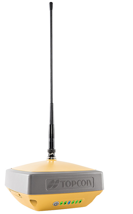
    New updates to MAGNET Field include support for the new HiPer VR GNSS receiver, a piping and trenching module with new capabilities specifically for the oil and gas segment, as well as the ability to orient and scale a PDF directly on a field controller and set it as a background image.

    “The new piping and trenching module greatly improves the COGO, mapping, and exchange functions for in-field oil and gas pipeline design and construction,” said Jason Hallett, vice president of global software business development at Topcon. “Simplified workflows deliver an alignment, profile, and cross-section set for loading into 3DMC for pipe trench excavation. Additionally, customers can now import a PDF drawing as a background image in MAGNET Field. Simply set the insertion point and then rotate and scale by selecting points or lines,” said Hallett.

    New additions to MAGNET Office include a reconfiguration of the portfolio, designed for simplicity, integrated workflows and better service plans. The service plans and subscriptions for MAGNET Office now include MAGNET Enterprise, license check-in and check-out, direct email support and an eLearning fundamentals course.

    Additionally, the E-commerce user-experience has been greatly improved with a new webstore. Direct email user support is currently offered at this web address.

    “The newly optimized product portfolio allows customers to easily select the appropriate Office software product best for their common project demands. The new office structure includes five main products named: project, construction, site, survey and layout, which are consolidated packages of the various MAGNET software services for ease of use and bundling.

    “MAGNET Site, MAGNET Construction, and MAGNET Project now include all of the Viasys VDC Modeler and Explorer functionality for infrastructure BIM modeling and visualization, and MAGNET Project adds even more power by including the DynaRoad mass-haul modules Plan, Schedule and Control,” said Hallett.

    Additionally, MAGNET Enterprise now offers concurrent login to MAGNET Field, Enterprise and Office with a single set of login credentials.

  • No-charge GNSS smartwatch uses u-blox technology

    No-charge GNSS smartwatch uses u-blox technology

    Photo: u-blox
    Photo: u-blox

    U-blox, a global provider of positioning and wireless communication technologies, is partnering with TransSiP and Matrix Industries to create PowerWatch 2, a GPS smartwatch that doesn’t need to be charged.

    The smartwatch features the ultra-small, ultra-low power u-blox ZOE-M8B GNSS receiver to track position, in addition to calories burned, activity level, and sleep, making it an ideal companion for runners, hikers, and swimmers. All this is enabled by TransSiP PI technology which ensures energy harvested is used at maximum efficiency and provides crystal clean power enabling optimum performance.

    The PowerWatch 2 does away with cables and external batteries by continually topping up its battery using thermoelectric energy generated from body heat as well as solar energy. The watch also connects to smartphones and displays notifications on your wrist, tracks activities and visualizes them using dedicated iOS and Android apps, as well as with popular third party health and fitness platforms.

    The PowerWatch 2 delivers location tracking using the low-power u-blox ZOE-M8B GNSS receiver module that consumes as low as 12 mW. Packaged as a (System-in-Package), the 4.5 x 4.5 x1.0 mm module helps achieve the watch’s comparatively low 16-mm thickness. And concurrent reception of up to three GNSS constellations means that it delivers high accuracy positioning in challenging situations such as urban or dense forest environments and when swimming.

    Satellite-based positioning is typically the most power-hungry process on a sports watch. Providing highly efficient conversion of harvested energy into a very quiet supply of DC power, TransSiP PI enhances the ability of the ZOE-M8B GNSS receiver module incorporating u-blox Super-E technology, to strike an ideal balance between power and performance. Working on a tight power budget, the watch supports 30 minutes of continuous GNSS tracking per day, with unused time accumulating in the watch’s battery pack, such as powering two hours of location tracking every four days.

    “We put a lot of effort into tailoring the ZOE-M8B to the needs of small battery powered applications. We couldn’t have wished for a better product to showcase our ZOE-M8B’s potential for wearables than the PowerWatch 2,” says Florian Bousquet, principal product manager in Standard Precision GNSS at u-blox.

    Douglas Tham, CTO of Matrix Industries added, “TransSiP PI makes it possible to deliver high performance and high efficiency simultaneously by reducing system noise, eliminating time spent re-acquiring data, and minimizing the need for additional processing. This means power savings across-the-board and enables applications which can be powered solely by energy harvesting.”

    “Not only were size, cost and power constrained in developing the PowerWatch 2, we also had to make sure that it met the high performance demands that athletes expect,” said Akram Boukai, CEO and co-founder of Matrix Industries. “The combination of TransSiP PI and the ZOE-M8B solved all of these pain points for us, enabling the watch to quickly lock in on its position even in weak signal environments.”

    Backers of the project on Indiegogo are expected to receive their orders in June 2019.

  • Topcon introduces HiPer VR GNSS receiver at Intergeo 2018

    Topcon Positioning Group’s Raymond Dimas discusses the company’s HiPer VR GNSS receiver at Intergeo 2018 in Frankfurt, Germany. According to the company, the HiPer VR is a complete solution can can be used for static or kinematic GNSS post-processed surveys, as a network RTK rover with the FC-5000’s internal 4G/LTE cellular modem and as a UHF/FH/Longlink jobsite RTK rover.

  • Emlid showcases Reach RS+ GNSS receiver at Intergeo 2018

    Emlid co-founder and CEO Igor Vereninov gives GPS World a rundown on the company’s Reach RS+ GNSS receiver at Intergeo 2018 in Frankfurt, Germany. According to Emlid, Reach RS+ was designed to create survey projects to manage data collection.


    Background image: iStock.com/imaginima

  • Sokkia introduces integrated receiver for diverse applications

    Sokkia introduces integrated receiver for diverse applications

    Sokkia introduced the latest addition to its GNSS integrated receiver line — the GRX3. According to the company, the GRX3 is designed to provide a smaller, lighter and fully integrated GNSS solution.

    Photo: Sokkia
    Photo: Sokkia

    “The multi-constellation GRX3 receiver is built to offer a complete and versatile solution to provide best-in-class positioning performance for a wide variety of precision applications,” said Alok Srivastava, director of product management.

    “Whether using the receiver for GNSS post-processed surveying, or RTK using wireless technologies including network RTK option with a cellular-equipped field computer, a SiteComm RTK rover, or paired with a Sokkia total station for fusion positioning, the GRX3 provides the most advanced and powerful GNSS technology available in a more compact and lightweight housing that can withstand the harshest of environmental conditions. Combine it with one of Sokkia’s data collectors and field software for maximum versatility and convenience, increasing fieldwork efficiency from start to finish.”

    The receiver features Sokkia Tilt technology, which includes a 9-axis inertial measurement unit and ultra-compact eCompass designed to compensate for mis-leveled field measurements by as much as 15 degrees.

    “The GRX3 is designed as a ‘future-proof’ solution with an advanced GNSS chipset with Universal Tracking Channels technology that automatically tracks signals from all available and planned constellations — including GPS, GLONASS, Galileo, Beidou, IRNSS, QZSS, SBAS,” Srivastava said.

    The receiver has been tested to meet IP67 certification for protection against harsh environmental weather conditions.

  • Industry experts share GNSS trends in the ag industry

    Industry experts share GNSS trends in the ag industry

    Industry experts share how GNSS can be used for precision agriculture.


    Headshot: Vazquez
    Vazquez

    EUROPEAN SATELLITE SERVICES PROVIDER (ESSP)
    Juan Vazquez
    Team Leader, EDAS Service Provision

    Pass-to-pass accuracy is the key performance indicator to assess the precision of guidance systems, characterizing the short-term dynamic performance determined from off-track errors along the straight segment passes (error with respect to the desired path in the direction perpendicular to the tractor trajectory).

    The results of the tests reported in this article, jointly performed by Topcon Agriculture and ESSP, confirm that EDAS DGPS corrections can support a wide range of precision agriculture applications and represent a real alternative for cereal farms, when located in the vicinity (at least up to 260 km away) of an EGNOS reference station, complementing the benefits that the EGNOS signal-in-space is already providing to a large number of agriculture users in Europe.

    More info on EDAS is available at [email protected].


    Headshot: Keable-Vézina
    Keable-Vézina

    EFFIGIS GEO-SOLUTIONS
    Nicos Keable-Vézina
    Director of Precision Agriculture

    Thanks to artificial intelligence, variable-rate application of nitrogen has made great strides in recent years. Science has demonstrated that effective nitrogen management requires an array of technologies, including massive databases. Data is geospatial (positioning signal and satellite imagery enabling the identification of changes in nitrogen requirements), agronomic (mainly soil texture and seasonal weather), and economic (grain and nitrogen price).

    To automate extraction and analysis of such data, combining very low-cost positioning technologies, satellite imagery and artificial intelligence is paramount. A democratized access to technology has led to the development of scientifically proven nitrogen prescribing platforms, among them FieldApex, that calculate the most profitable nitrogen rates and generate prescriptions in seconds without soil sampling. Further technological and platform integrations are likely to bolster such innovation.


    Headshot: Rioja
    Rioja

    TOPCON AGRICULTURE
    Julian Rioja
    Channel Development and Business Intelligence Manager

    All tests were performed using Topcon receivers, vehicles and auto-steering systems. Two different Topcon guidance systems on board tractors ran simultaneously to assess the EDAS DGPS positioning performance with respect to the reference provided by a real-time kinematic (RTK) system. Hence, two independent positioning outputs were continuously available (the receivers were placed along the same longitudinal axis on the roof of the tractor):

    • RTK position: provided by the AGI-4 receiver fed by Topcon’s Hiper V RTK base.
    • DGPS position: provided by the AGI-4 receiver fed by the EDAS Ntrip service.

    On board the tractor, two Topcon X35 consoles were each connected to one of the receivers. A Topcon AES-25 electric steering system was installed on the tractor so that the selected navigation input (RTK or EDAS DGPS) could be used to automatically guide the tractor along the defined reference pattern.


    Headshot: McClure
    McClure

    HEMISPHERE GNSS
    John McClure
    Engineering Manager, Precision Agriculture

    Precision agriculture is expanding the use of ISOBUS for CAN communication between a common terminal and implements, to reduce clutter in the cab. These virtual terminals now act as display and user entry for multiple applications including GNSS receivers and factory or after-market steering systems.

    INS-aided GNSS solutions, typically using RTK or satellite-based correctors such as Atlas, provide time/position data for rate and section control and auto-steering. CAN-based NMEA 2000 is the commonly used receiver protocol for position data, replacing serial NMEA 0183.
    All major tractor, agricultural equipment, and GNSS manufacturers attend regular “Plugfest” meetings, organized by the Agriculture Industry Electronics Foundation, to test interoperability of products and set common standards.

    Smart CAN dongles are being developed to read sensors and control systems, supplying positioned data via telematics as the Big Data for real-time and post analysis.


    More: Precision agriculture aided by internet, SBAS

  • Eos adds GEOID height support for Arrow GNSS receivers

    Eos adds GEOID height support for Arrow GNSS receivers

    Orthometric height support (survey-grade elevations) enables Arrow GNSS receivers to collect high-accuracy, survey-grade vertical data with any data-collection software.

    Eos Positioning Systems Inc. has added support for GEOID height models within its Arrow Series GNSS receivers. Eos manufactures high-accuracy GNSS receivers for any app running on iOS/Android/Windows devices and using the Eos Arrow Series.

    “You can use Arrow Series receivers with any data-collection software in the world, and benefit from accurate orthometric heights,” Eos CTO Jean-Yves Lauture said. “Our Arrow receivers will output accurate GNSS elevations no matter which data-collection software you use to capture it.”

    Image: Eos Positioning
    Image: Eos Positioning

    With support for GEOID models, Arrow receivers automatically output survey-grade elevations to all iOS and Android data collection software. Support will also soon be available for Windows devices.

    The Arrow receivers now support the entire United States to provide survey-grade elevation in NAVD88 orthometric heights through the GEOID12B (US) model. The Arrow receivers also support the Canadian CGG2013a and HTv2.0 GEOID models for the CGVD2013 and CGVD28 vertical datums, respectively. Additional GEOID models for other countries are planned.

    “Eos is intensely focused on supporting high-accuracy GIS, engineering, surveying and construction users by supporting the latest GEOID elevation models within our GNSS monitoring software,” Lauture said. “Our roadmap remains focused on high-accuracy BYOD users by supporting all iOS, Android and Windows users with this capability.”

    The problem is that typical Bluetooth GNSS receivers usually provide inaccurate, built-in elevation models. This inaccuracy is reflected in the Mean Sea Level  elevation output by those receivers. By outputting orthometric height, the Arrow now solves this problem and turns any smartphone or tablet into a 3D, survey-grade accurate data collection device, the company said.

    Eos has designed this new feature so that users will easily be able to update to new GEOID models as they become available.

    Field technicians in pipeline, construction, engineering, architecture, water and any other industry are finally able to enjoy GNSS location with survey-grade vertical accuracy on their iOS and Android devices, with the data-collection app of their choice and their Eos Arrow receivers.

  • Supercorrelation: Enhancing accuracy, sensitivity of commercial receivers

    Figure 1: Reflected signals in the local environment suffer different Doppler variations than the desired line­of­sight signal. This means that the supercorrelator that is created for a given satellite broadcast couples strongly to the desired line of sight version  of the signal, but attenuates any reflected  signals  arriving from different directions.  (Figure: Focal Point Positioning)
    Figure 1: Reflected signals in the local environment suffer different Doppler variations than the desired line­of­sight signal. This means that the supercorrelator that is created for a given satellite broadcast couples strongly to the desired line of sight version of the signal, but attenuates any reflected signals arriving from different directions. (Figure: Focal Point Positioning)

    The S­GPS/S­GNSS technology is a patent-protected suite of methods that provides software-based improvements to existing GNSS receivers. All methods within the software suite build upon a core technology called supercorrelation, which enables over a second of coherent integration while undergoing complex motions on low-cost platforms. The benefit is high sensitivity coupled with strong multipath mitigation capabilities, providing a high-accuracy and high-integrity positioning solution in traditionally difficult environments.

    Many GNSS receivers perform a small amount of coherent integration, typically less than 20 milliseconds, and then optionally incoherently integrate over many hundreds of milliseconds to boost sensitivity if needed. The major problem with this approach is the resulting susceptibility to multipath interference. Incoherent integration destroys the phase information stored within the captured data before combining it, resulting in line-of-sight and non-line-of-sight signals accumulating within the same correlation peak, producing a distortion of the desired line-of-sight information. This distortion leads to erroneous codephase estimates, which in turn leads to erroneous position estimates.

    Coherent integration can decorrelate signals arriving from different directions, but the degree of decorrelation depends on the user speed and the coherent integration time. Supercorrelator technology creates a clock-and-motion-compensated phasor correction sequence that provides over a second of coherent integration on low-cost consumer platforms. The outcome is signal tracking sensitivities down to nearly zero dBHz, combined with high multipath mitigation performance. Such long coherent integration times allow signals arriving from different directions to be separated out in the frequency domain, permitting new capabilities in anti-spoofing and 3D map-aiding methods by directly resolving GNSS angle-of-arrival using a single moving antenna.

    Figure 2: The result of supercorrelation on positioning performance in the urban canyons of central San Francisco. The red line is a standard state­-of-­the-­art vector tracking GPS solution, and the green line is the same positioning engine with supercorrelation processing enabled. (Image: Focal Point Positioning)
    Figure 2: The result of supercorrelation on positioning performance in the urban canyons of central San Francisco. The red line is a standard state­-of-­the-­art vector tracking GPS solution, and the green line is the same positioning engine with supercorrelation processing enabled. (Image: Focal Point Positioning)

    Traditionally, very long coherent integration times were not practical on consumer devices due to limitations of data modulation bits, crystal oscillator stability, and unknown (often complicated) receiver motion. Supercorrelation overcomes these limitations with signal processing and sensor fusion. Data modulation bits are not an issue for modern pilot signals, and for legacy signals they can be removed with a variety of methods, ranging from prediction or provision of the bits over a datalink, to stripping them directly with signal-squaring methods. Receiver motion can be inferred from inertial sensors mounted alongside the GNSS receiver, as is the case for smartphones and smartwatches, or can be modeled using multi-hypothesis methods. Low-cost crystal oscillators cause phase instabilities which traditionally reduce coherent integration time, but can also be accounted for by multi-hypothesis testing and by joint estimation processes across multiple channels.

    A decade ago, consumer GNSS receivers were typically an ASIC or similar hard-wired design. Modern designs incorporate a front-end correlator bank which may or may not be reprogrammable, feeding into a DSP stage which handles all tracking and navigation processing from the DLL, PLL, FLL stages onwards. The flexibility of reprogramming the code running on the DSP stage permits existing GNSS chipsets to be easily upgraded to support supercorrelation, without needing to design and fabricate a new receiver.

    Focal Point aims to have S-GNSS enabled chips by early 2020, with licensing opportunities available from summer 2019 onwards.

  • Regulus Cyber miniaturizes anti-spoofing GNSS receiver

    Photo: Regulus
    Photo: Regulus

    Regulus Cyber is showcasing its anti-spoofing GNSS receiver at the Consumer Electronics Show, being held Jan. 8-11 in Las Vegas.

    Previously introduced in our Launchpad feature, the Regulus Cyber solves GNSS spoofing attacks that threaten the automotive, aviation, maritime and mobile industries with a unique technology applicable both as a fortified GNSS receiver, capable of detecting spoofing attacks, and at the chip level, allowing mobile phones, cars and internet of things (IoT) devices to receive GNSS spoofing protection for the first time, the company said.

    The company was able to miniaturize its technology into a form factor that provides customers more flexibility with integration.

    The Regulus Pyramid GNSS Receiver is a fully functional GNSS receiver, fortified with the spoofing detection capability. The receiver contains patented technology that enables it to differentiate between real GNSS signals and fake ones generated by an attacker.

    The Pyramid GNSS receiver is a direct replacement to any automotive GNSS receiver. The upcoming chip-level technology offers both spoofing detection and spoofing mitigation to any GNSS-based device, including mobile phones, the company added.

    The Spoofing Problem. Any vehicle guided by a GNSS system can be spoofed using open-source software and a software defined radio (SDR) legally purchased from Amazon for under $300. A spoofer can generate and transmit fake GNSS signals that can be used by the vehicle’s navigation system to calculate a false destination, directing the vehicle to an entirely different location, a potentially life-threatening hazard.

    In addition, spoofing is a growing concern to any application or device that uses satellite positioning, navigation or time. While real attacks are expanding, anti-spoofing solutions remain a luxury that only high-end, defense markets can afford.

    While current solutions are big, heavy and expensive, Pyramid GNSS offers industry-standard size and price. Industries such as automotive, aviation, maritime, and mobile phones can defend themselves against this sophisticated emerging threat, at an affordable price and relevant size, power consumption and weight, the company said.

    “We designed our product to be a fraction of the size that is currently available on the market so that all types of companies – whether it is a car manufacturer or telecom provider relying on GNSS – can integrate it seamlessly,” said Yonatan Zur, CEO of Regulus Cyber. “GNSS spoofing will need to be a major security focus during 2019 since it leaves so many industries vulnerable to attacks.”

    To meet Regulus Cyber at CES, visit booth #2602 at the Westgate.

  • Allystar releases multi-band GNSS raw data chip and module

    Allystar releases multi-band GNSS raw data chip and module

    Allystar Technology Co. Ltd., headquartered in Shenzhen, China, has released a multi-band multi-GNSS chipset, the HD9310. The new product is based on the Cynosure III architecture integrating multi-band multi-system GNSS RF and baseband.

    A multi-band, multi-system system-on-chip, it supports BeiDou-3 and is capable of tracking all global civil navigation systems (GPS, BeiDou, Galileo, GLONASS, IRNSS, QZSS and SBAS) in all bands (L1, L2, L5, L6), said Simon Sun, Allystar general manager.

    Photo: Allystar Technology
    Photo: Allystar Technology

    Designed for high-precision applications, the HD9310 measures 5.0mm x 5.0mm. The architecture integrates floating-point arithmetic units based on ARM CortexM4, 160 KB RAM, 32KB backup RAM with VBAT, 386 KB embedded FLASH and peripheral interfaces UART, I2C, SPI, GPIO, CAN.

    In terms of the manufacturing processes, it adopts a 40nm process and incorporates a variety of advanced design technologies, endowing it with very power consumption: less than 50mA.

    The quad-flat no-leads package allows customers to reduce printed circuit board and bill of materials costs while reducing the number of peripheral devices. This chip supports CAN interface and can be widely used in vehicle management, car navigation, wearable devices, GIS data collection, precision agriculture, smart logistics, driverless, engineering survey and other fields.

    “The HD9310 supports three options of RF setting — A, B, C — for product developers to quickly bring their ideas to the different application and markets,” added Shi Xian Yang, high precision project manager at Allystar.

    Three available options for the HD9310 chipset. Graphic: Allystar Technology
    Three available options for the HD9310 chipset. Graphic: Allystar Technology
    • Option A, focused on L5 band, L5/E5, maximizes measurement accuracy and improves multipath mitigation based on higher chip rate.
    • Option B is focused on L2 band, and suitable for relative position applications, for example, real-time kinematic (RTK), because worldwide continuously operating reference stations (CORS) commonly support L1/L2/L1OF/L2OF.
    • Option C is focused on the L6 band and is designed for PPP applications, receiving state space representation (SSR)-type corrections to be broadcast from satellites in the coming future, and supporting B3I already.

    The HD9310 comes with built-in support for standard RTCM Protocol (MSM), supporting multi-band multi-system high-precision raw data output, including pseudo range, phase range, Doppler, SNR for any kind of 3rd party integration and application.

    Module.  Allystar Technology also has launched a multi-band multi-GNSS module, TAU1302, which integrates the HD9310 chipset and measures 12 × 16 × 2.3 millimeters.

    With the features of small size, low power consumption (<50 mA), and ease of integration and mass production, HD9310 is suitable for high-precision applications such as vehicle management, car navigation, wearable devices, GIS data collection, precision agriculture, smart logistics, driverless, engineering survey and other fields.

    Customer samples of the HD9310 chipset are available now.

  • CHC Navigation unveils Alpha3D mobile mapping solution at Intergeo 2018

    CHC Navigation debuted its new Alpha3D mobile mapping solution at Intergeo 2018, which took place Oct. 16-18 in Frankfurt, Germany. Alpha3D combines a laser scanner, high-resolution HDR panoramic camera, GNSS receiver and high precision IMU.

  • Tersus introduces Oscar GNSS RTK system

    Tersus introduces Oscar GNSS RTK system

    Photo: Tersus GNSS
    Photo: Tersus GNSS

    Tersus GNSS Inc. has launched Tersus Oscar, its new generation GNSS real-time kinematic (RTK) system.

    Oscar is an all-in-one GNSS receiver that can be used as rover or base system. Paired with a Tersus TC20 controller or A11 mobile terminal, Oscar can more efficiently meet customer application requirements for the optimal surveying solution, according to Xiaohua Wen, founder and CEO of Tersus GNSS.

    “Last year, we launched the David GNSS receiver,” Xiaohua said. “This year, we are very excited to introduce an advanced version of David; we named it Oscar.”

    Oscar supports calibration-free tilt compensation function, meaning a leveling pole is no longer required. Configuration is made easy with a 1.3-inch interactive screen. With an internal high-performance multi-constellation and multi-frequency GNSS board, the Oscar GNSS receiver can provide high accuracy and stable signal detection, the company said.

    The high-performance antenna can speed the time to first fix and improve anti-jamming performance. The built-in large capacity battery can support up to 10 hours of fieldwork.

    A radio module in the package supports long-distance communication. With its rugged housing material, Oscar is protected from harsh environments.