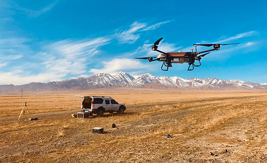
Unmanned aerial vehicles (UAVs) are something of a Swiss Army knife for the surveying and mapping communities. Commercial applications continue to grow, with UAVS — known as drones in the vernacular — gathering data and observations for agriculture, mining, utility inspections, natural resources, historical preservation, security, and many more applications.
UAVs perform high-risk tasks that keep workers out of harm’s way. They fly in places and situations difficult or impossible for aircraft to reach. They collect high-resolution imagery across the spectrum, accompanied by exact positioning and location data. They detect and help preserve the past in rich detail.
A study by Polaris Market Research predicts the UAV market will reach $15.62 billion By 2026, spurred not only by new use cases, but through miniaturization and improvement of components. Payload components that continue to improve include GNSS receivers, inertial measurement units, micro-electromechanical components, cameras of all types (RGB, thermal, hyperspectral and high-resolution video) and lidar. (For more on lidar with UAVs, see Diving into UAV lidar surveys.)
In these pages, we share a variety of case studies from companies taking part in the UAV revolution. In many of these use cases, companies saved considerable money using UAVs rather than more traditional surveying methods. In others, UAVs are helping to keep people safe.
In all cases, using UAVs provides a wealth of data that offer new insights, no matter the application.
Avalanches can be a danger for skiers as well as for the resort towns that welcome them. For protection, towns erect steel fences to act as barriers along the ski slopes. But before these snow barriers can be built, steep rock faces and cliffs need to be surveyed.
Darnuzer Ingenieure AG, a Swiss-based surveying and mapping company, uses a drone with a built-in high-performance GPS receiver to survey these harsh areas in hours.
“Drones have made mapping workflows faster, safer and more efficient,” said Septentrio’s senior market access manager Gustavo Lopez. “GNSS technology has led to the evolution of post-processing kinematic (PPK) methods, which help make the photogrammetry process efficient and accurate.”
Every year, thousands of tourists visit Davos in the Swiss Alps. To protect the town and the skiers, avalanche barriers were built along the steep slopes. To plan the work along the uneven rock face, a detailed 3D reconstruction of the area was needed, but getting to the survey site would be a rock-climbing feat.
Darnuzer Ingenieure used the WingtraOne fixed-winged drone, which features a top-quality camera and a Septentrio high-performance GNSS receiver. A single surveyor took the drone to the rocky Parsenn slope during the summer season, capturing ground images — without snow — that were needed for the 3D model.
WingtraOne PPK enabled high-precision mapping without the need for ground control points. During the flight, each image was accurately time-stamped and raw GNSS data from the Septentrio AsteRx-m2 receiver was carefully logged.
Even in this mountainous region, where peaks obstruct the sky, the receiver delivered continuous positioning. The GNSS data was processed by the GeoTagZ software library, which used corrections from a nearby base station to generate real-time kinematic (RTK) centimeter-level positioning.
The GeoTagZ software library incorporated Septentrio’s core GNSS algorithms to assure the best positioning performance. Accurate positioning was then synchronized with the images in the next step of the post-processing workflow.
It only took Wingtra a few days to integrate the GeoTagZ library into its WingtraHub software package. Integration of GeoTagZ into WingtraHub simplifies mapping jobs for customers like Darnuzer Ingenieure.
“The beauty of this solution is that the drone benefits from the receiver’s high-quality raw measurements without the need for a real-time corrections link for accuracy,” Lopez said. “The quality of the measurements comes from the technology built into Septentrio’s receivers, which is designed to be resilient to radio frequency interference and multipath. In post-processing, the GeoTagZ software enables the most accurate positioning, thanks to its high-performance RTK engine.”
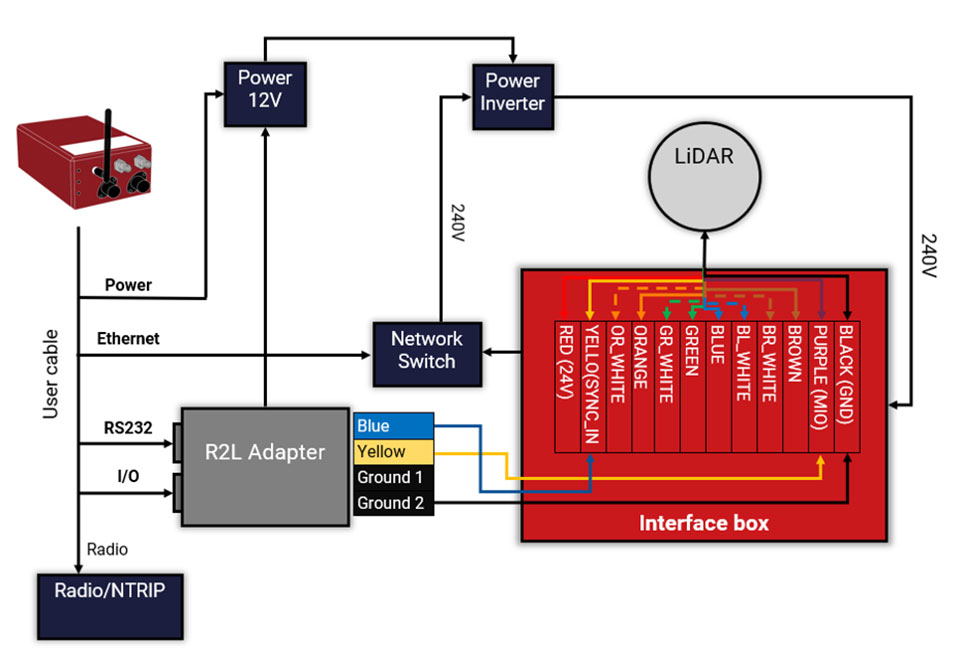
Oxford Technical Services (OxTS) has launched precision time protocol (PTP) master functionality on all of its next-generation inertial navigation systems (INS).
PTP is a network-based time synchronization protocol used to synchronize all clocks throughout a computer network. It is used in many industries, but most notably in finance to synchronize transactions, mobile-phone tower transmissions and subsea acoustic arrays.
Time synchronization
In many commercial organizations, millisecond-level device synchronization as offered with network time protocol (NTP) is sufficient. However, in surveying and automotive testing environments where there is more than one clock source (lidar and inertial navigation systems, or INS, for example), final results can suffer from time drift if millisecond — and not microsecond — synchronization is used.
Time drift becomes relevant as soon as you introduce more than one data acquisition system working in parallel. This is because each system will have its own timing error, and over time this error will grow and create drift.
For surveyors, time drift can negatively impact point clouds by making object recognition difficult, subsequently leading to blurring and double vision.
For automotive engineers, when running campaigns, analysis of events within your data may be misaligned, making the analysis more difficult and/or less efficient.
Stamp out time drift
To stamp out time drift, it is important to use the most accurate clock source available.
A key component of an INS is the GNSS receiver. The GNSS receiver acquires data, including timing information, directly from multiple GNSS constellations (GPS, GLONASS, BeiDou and Galileo). The GNSS receiver, coupled with the inertial measurement unit within the INS, allows users to benefit from the centimeter-level position accuracy that is so important in surveying and automotive testing environments.
These satellite systems house the most accurate time source possible — atomic clocks — meaning that devices connected to a network that includes an INS can take advantage of this time source owing to the GNSS receiver within the INS.
Simpler setup for lidar use
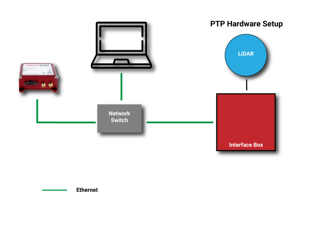
By migrating from a traditional PPS hardware set-up, which involves connecting and wiring multiple cables, to a PTP setup, which is essentially an Ethernet “plug-and-play” solution, users can also make day-to-day use of the equipment simpler and more efficient.
Without PTP – using PPS setup. (Image: OxTS)An example PPS hardware setup with a PTP-enabled network. (Image: OxTS)
This much-improved hardware setup allows surveyors and automotive test engineers to be up and running in a much shorter time frame than previously possible.
Adding value to the automotive industry
The addition of PTP also adds value for automotive users. With cars-under-test incorporating multiple sensors (lidars, cameras, etc.), synchronizing all that data can help support accurate analysis after the test is complete.
OxTS is continuing to develop its PTP solution by working on PTP slave functionality and improving the configuration process, which will provide greater flexibility in typical automotive setups that use data acquisition (DAQ) for larger sensor networks.
Summary
PTP as a time synchronization method is becoming more popular, particularly in the lidar industry, with manufacturers such as Ouster and Hesai enabling PTP on their sensors.
The shorter “time to survey” gives customers a much-enhanced user experience, and the higher quality final output on offer means that many users will demand their sensors are PTP-compatible before considering them for their projects.
Manufacturers of complimentary sensors, such as INS, need to build the capability into their product sets to allow them to be fit for the future.
Various OxTS INS are available to use PTP, including the new xNAV650, the company’s new small, lightweight and affordable INS for applications where payload size and weight matter. Learn more about the xNAV650 INS.
Users can also find out more about OxTS and its range of PTP-enabled devices by visiting its dedicated landing page, OxTS PTP-enabled INS devices.
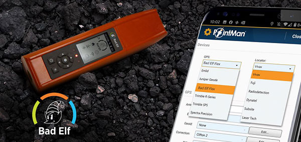
Mapping company ProStar Holdings Inc. and survey device company Bad Elf have partnered to produce a solution designed to gather the precise location of surface and subsurface utility data.
PointMan combined with Bad Elf is designed to quickly and precisely, locate, identify and display critical surface and subsurface utility data.
Bad Elf’s survey-grade GPS/GNSS receiver combined with ProStar’s flagship mobile-mapping solution, PointMan, now provides a powerful and user friendly solution for any industry requiring precision mapping including subsurface utility engineering (SUE) and utility locating professionals.
“The Bad Elf Flex was quickly configured by ProStar and performed flawlessly with the PointMan app. We found that consistent high accuracy was easy to maintain while collecting data,” said Larry Fox, vice president of marketing and business development at Bad Elf. “The depth of collection tools and export facilities exceeded our expectations. Given the seamless integration with Bad Elf Flex, PointMan demonstrated it’s a top-tier app for utility management, and expands our ability to provide best in class solutions to our users worldwide.”
“Equipment manufacturers like Bad Elf and their distribution networks are an important component of our sales and marketing strategy,” said Page Tucker, CEO and founder of ProStar. “Our goal is to continue to work with leading equipment manufacturers around the world to provide the most comprehensive, modern, and low-cost data collection solutions.”
ProStar’s flagship product, PointMan, is natively cloud and mobile, offered as a Software as a Solution (SaaS). ProStar’s solutions are being adopted by some of the largest entities in North America, including Fortune 500 construction firms, the largest subsurface utilities engineering (SUE) firms, and government agencies.
ProStar’s strategic partnerships are with geospatial technology and data-collection equipment manufactures and their dealer networks, including Trimble, Juniper Systems, Vivax-Metrotech, Radiodetection, Bad Elf and Subsite Electronics.
On March 20, a South Korean Earth Observation satellite will be sent to space, carrying a navigation receiver from RUAG Space to determine the satellite’s position in orbit. The Earth Observation satellite is being launched by the Korea Aerospace Research Institute (KARI), South Korea’s space agency.
The precision single-frequency low Earth orbit GNSS receiver, called LEORIX, is a GPS + Galileo receiver from RUAG Space’s new generation of receivers.
More than 80 RUAG Space receivers of the latest generation (LEORIX for Low Earth Orbit, GEORIX Geostationary Orbit and PODRIX) have been ordered by customers in Asia, Europe, Middle East and the United States. They will be launched for various low and geostationary Earth Orbit missions within the next few months and years.
Currently, 22 navigation receivers from RUAG Space are in orbit. The satellite CAS-500-1 will be launched aboard a Russian Soyuz-2 launch vehicle from the spaceport in Baikonur, Kazakhstan.
After the launch of CAS-500-1, South Korea plans to send the CAS500-2 satellite to space. A launch date of this second mission is not yet defined. The CAS500-2 mission also will fly with a LEORIX receiver from RUAG Space. The satellite builder — Korea Aerospace Industries (KAI) — already has received the space-borne navigation receiver.
PODRIX in Space
Since November 2020, two new Precise Orbit Determination Receivers (PODRIX) from RUAG Space have been in orbit. They determine the position of ocean-monitoring satellite Sentinel-6.
The PODRIX GNSS spaceborne receiver achieves a very high, real-time in-orbit accuracy of the satellite’s position in orbit from below one meter to a few centimeters using on-ground post-processing. The high accuracy is achieved through simultaneously processing of multi-frequency signals from GPS and Galileo.
PODRIX GNSS spaceborne receivers are built on the experience of the more than 20 GPS-only receivers of the RUAG Space legacy receiver generation now in orbit.
The receivers precisely determine the position of a satellite once in orbit, which improves the satellite’s performance. Sentinel-6 measures the sea level on a global scale with unprecedented accuracy, which is crucial for climate change research. Every millimeter or centimeter in further precision highly improves the performance of the mission. The more precise the Sentinel-6 spaceborne GNSS receiver from RUAG Space works, the more precise are the data of this climate mission.
RUAG Space is a supplier to the space industry in Europe, and has a growing presence in the United States. It develops and manufactures products for satellites and launch vehicles, playing a key role both in the institutional and commercial space market. RUAG Space is part of RUAG International, a Swiss technology group focusing on the aerospace industry.
OSNMA (Open Service Navigation Message Authentication) offers end-to-end authentication on a civilian signal, protecting receivers from spoofing attacks.
OSNMA is being pioneered by the Galileo Program, with Septentrio providing a testbed for this technology from the end-user point of view. The anti-spoofing capabilities of OSNMA will complement Septentrio’s already available anti-jamming technology, AIM+, and further strengthen the overall security of Septentrio GNSS receivers.
“The authentication of the Galileo signal using the OSNMA technology is yet another first that we are pleased to share with our close partner ESA [European Space Agency],” commented Bruno Bougard, R&D director at Septentrio. “Septentrio is proud and thankful to be able to contribute to the realization of one of Galileo’s key differentiators. “
With OSNMA, Galileo is the first satellite system to introduce an anti-spoofing service directly on a civil GNSS signal.
OSNMA is a free service on the Galileo E1 frequency. It enables authentication of the navigation data on Galileo and even GPS satellites. Such navigation data carries information about satellite location — if altered, it will result in wrong receiver positioning computation.
While currently in development, OSNMA is planned to become publicly available in the near future. GPS is experimenting with satellite-based anti-spoofing for civil users with its Chimera authentication system.
Within the scope of the FANTASTIC project led by GSA, OSNMA anti-spoofing protection was implemented on a Septentrio receiver.
“Septentrio is committed to providing highly accurate and secure positioning and timing solutions to industrial applications and critical infrastructure. This is another example where Septentrio demonstrates its leadership in end-to-end GNSS receiver security with its breakthrough anti-jamming and anti-spoofing technology,” said François Freulon, head of Product Management at Septentrio. “Thanks to our future proof products, we will be rolling out OSNMA in our portfolio as soon as it is available. This will further enhance the security of our receivers, ensuring robust, trustworthy and reliable operation even in the most challenging environments.”
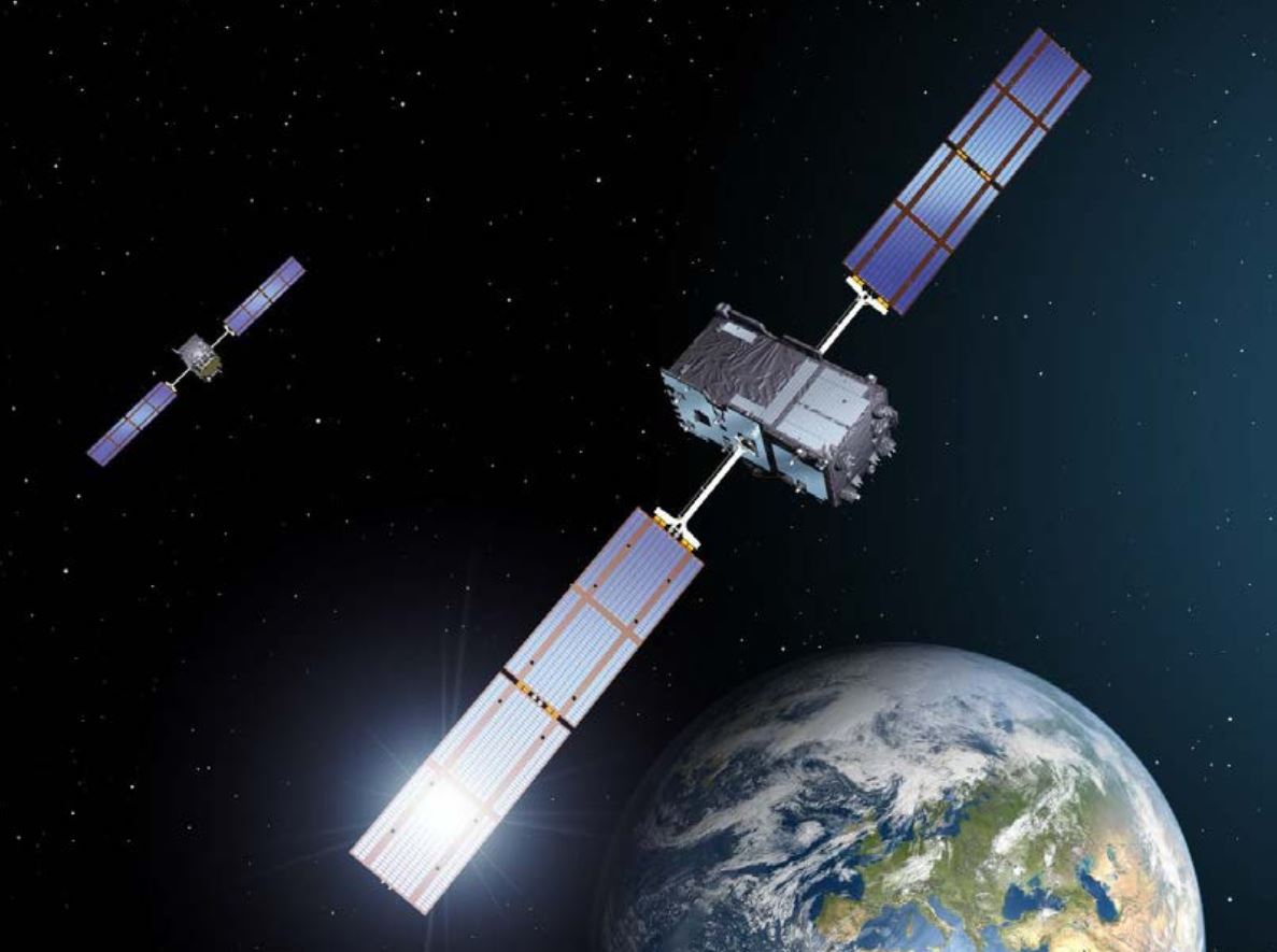
European Galileo satellites provide an open authentication service on the E1 signal and a commercial authentication service on the E6 signal. (Image: European Space Agency)
ESA and GSA (European GNSS Agency) have now commenced the testing phase of the OSNMA authentication, which will continue during the coming months. To find out more about spoofing and OSNMA, see this article. For more information about GNSS signals and the value they bring, see Septentrio’s free webinar More GNSS signals: What’s in it for you?
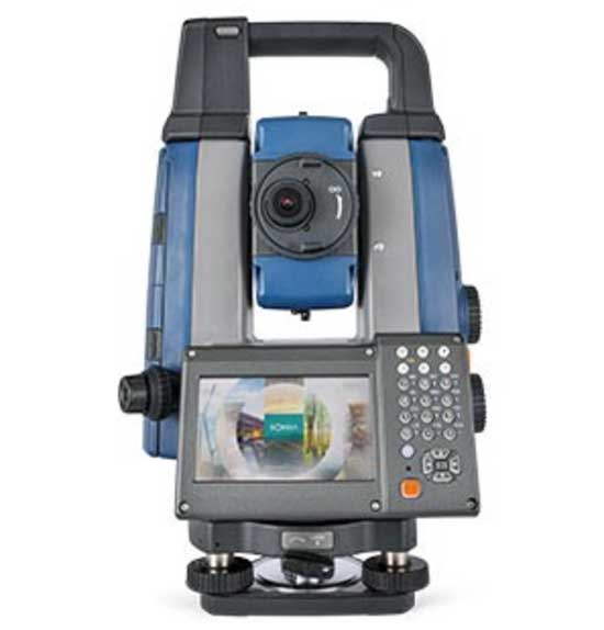
Sokkia has launched two robotic total stations designed to improve job site productivity: the iX-1200 and iX-600.
According to Sokkia, the total stations, designed as a part of a full workflow solution, are professional-level positioning tools for survey and layout in the building construction and infrastructure trades. They’re engineered for integration with field controllers, software and GNSS receivers.
In addition, advanced users can take measurements in almost any environment while switching to the most appropriate technology — total station measurement integrated with GNSS measurement — through an optional upgrade to Hybrid Positioning technology, Sokkia said. The stations also can be seamlessly integrated into BIM workflows.
“The high-performance technologies incorporated into the design provide increased prism-tracking strength,” said Ray Kerwin, director of global product planning. “Through a combination of optical sensing and ultrasonic motors, UltraTrac technology helps users stay locked onto the prism — and productive with less down time resulting from the need to reacquire prism lock — even in dynamic job site conditions. The system also features the RC-PR5A remote controller option used on the prism pole so the user can quickly and simply reestablish the connection between prism and total station.”
The total stations, available in multiple accuracy models, can be used with the SHC6000 field controller and GeoPro or MAGNET Field software for optimal performance, Sokkia added.
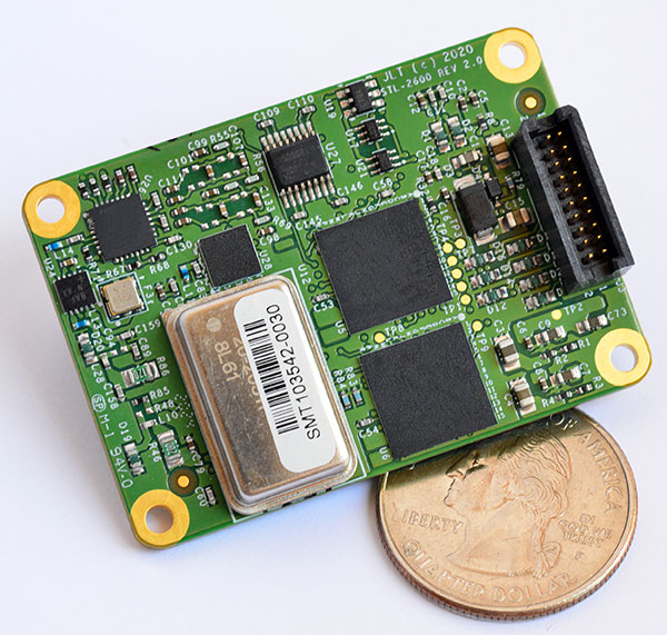
The STL-2600 STL-capable receiver provides a GNSS-independent low SWaP-C UTC-time and location capability
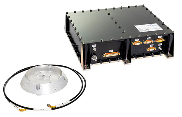
Jackson Labs Technologies Inc. (JLT), a designer and manufacturer of GNSS, timing and frequency equipment, has announced the availability of the STL-2600 Satellite Timing and Location (STL) receiver designed in partnership with Satelles Inc., the STL service provider.
The STL-2600 commercial receiver provides a completely GNSS-independent, low-cost capability to generate UTC nanosecond timing and meters-accurate positioning anywhere in the world. It operates in a way similar to GPS, but without GPS or GNSS. The STL signal has 30-db (1,000 times) higher power compared to GPS signals, allowing the receiver to operate deep indoors independent of any GPS/GNSS signal.
“Useful for non-GNSS-based E911 location and UTC(NIST) timing applications, the STL-2600 receiver is deployable today to fulfill critical infrastructure PNT objectives such as those outlined in Executive Order 13905 on the responsible use of PNT in the U.S. and the emerging mandates for a GNSS-independent backup solution in Europe,” said Said Jackson, president of JLT.
The STL-2600 receiver is also useful in marine applications where GNSS signals are regularly denied or manipulated and for stationary high-accuracy timing applications such as 5G.
The STL-2600 receiver can be directly connected to JLT’s GPS Transcoder products for glue-less retrofit capability of existing customer legacy GPS-only receiver systems to Galileo, GLONASS, BeiDou, QZSS and SBAS as well as adding the STL and optional atomic holdover capability to these legacy systems.
The receiver module combines a custom-designed STL L1 LEO receiver and a latest-generation concurrent-GNSS receiver with a disciplined high-stability reference oscillator sub-system on one circuit board.
Features and specifications of the STL-2600
Photo: JLT
Form factor: 1.4″ x 2.0″ x 0.5″ (36mm x 51 mm x 13mm)
Switching modes: User-selectable automatic and manual switching between GNSS and STL signal reception during jamming or manipulation events
Integration: Incorporates into user systems just like a legacy GNSS receiver would using NMEA and SCPI serial messages, with the use of standard NMEA messages for STL positioning and timing features making system integration trivially easy
Oscillator options and performance: Internal high-stability TXCO standard; capable of directly and gluelessly disciplining numerous optional DOCXO, CSAC and rubidium oscillators for holdover capability, with ultra-stable ADEV performance from 0.1s to infinity with better than 10E-12 stability when using a DOCXO or Rubidium as the holdover oscillator
Low-power consumption: Ranges between 0.7 W to 1.45 W (depending on configuration) allowing for long-term battery operation for use cases without AC power
Antenna support: One GNSS/STL combined standard; optional support of a second antenna for diversity
Interfaces: TTL serial port standard; optional USB serial port allow easy evaluation and design-in
Upgrades: One-button firmware updates performed in situ through any of the serial ports
The receiver includes JLT’s proven frequency and timing disciplining and holdover IP deeply embedded into the entire signal chain for ultra-low phase noise performance and high-stability 1PPS and 10 MHz operation, even when using only the built-in TCXO oscillator.
The unit operates fully autonomously from just a USB cable and is compatible with a customized version of the GPSCon software — offered at no cost to JLT customers — for monitoring and control.
The STL signal has been deployed worldwide since 2016 and can be evaluated and implemented SWaP-C-effectively today via this receiver module.
The STL-2600 is available now. Contact Jackson Labs Technologies for configuration and pricing information.
integration with inertial measurement units (IMUs) and other sensors
positioning using cell phones and other consumer devices
any other areas or challenges they find particularly significant.
All four respondents in this issue, like to those in the January issue, report that they are making full use of the new GNSS signals available, taking hardware and software measures to counter jamming and spoofing, and integrating IMUs and other sensors with their GNSS receivers to help achieve continuous navigation and positioning in obstructed environments. In addition, they are continuing to develop mass-market applications, because high-precision positioning is becoming increasingly important for cellphones and wearable devices. For a fuller review of these trends, see my introduction to the first installment.
Notably, two of the companies featured in this issue, ComNav Technology and Unicore, are Chinese.
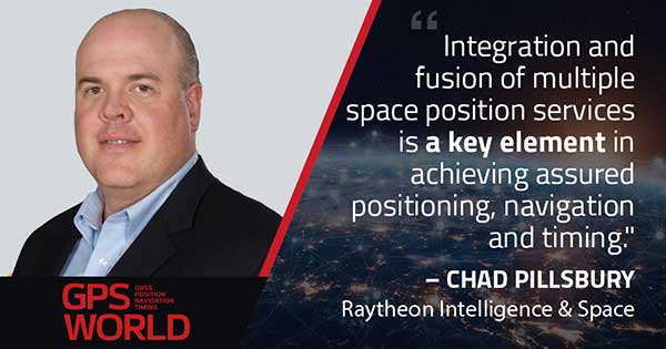
With Chad Pillsbury, Senior Director, Raytheon Intelligence & Space’s Resilient Navigation and Reconnaissance Solutions
Utilizing Galileo and BeiDou
Integration and fusion of multiple space position services is a key element in achieving assured positioning, navigation and timing (PNT). A combination of commercial and military-code navigation signals, when coupled with evolving sensors, provide more resilient methods of navigation and enable new concepts of operations related to PNT. Over the next two years, RI&S will customize these concepts of operation (CONOPS) for our United States and international allies to harness the power of fusion in resilience.
Dealing with jamming and spoofing
As threats to GPS continue to evolve and mature, RI&S continues to develop alternative navigation solutions, as well as GPS-capable receivers and antennas, aimed at defending against a variety of spoofing and jamming technologies. Our latest anti-jam, anti-spoof and high-precision solutions leverage a recent technology breakthrough that lowers size, weight, power and cost while boosting performance in the new M-code and alternative navigation applications.
Integration with IMUs and other sensors
IMUs are the cornerstone of high-performance navigation systems and will continue to be in the future. Recent innovations allow some systems to become more IMU agnostic, or even to consider microelectromechanical systems (MEMS) IMUs depending on performance, which can allow the customer greater flexibility and a more open architecture.
Positioning with consumer devices
RI&S sees 5G as a game-changing technology, with a lot of possibilities in the assured navigation market. We also look to cellphones as a great area of interest — especially for exploring unforeseen signals, considering human international models, and learning how the next generation of GPS users expect to see PNT information displayed.
Other significant challenges and opportunities
The future of GPS lies in a system-of-systems approach. Using time as a backbone, navigation systems can securely share time, data, position and intent across the network. Broadly, this approach can be used in civil, commercial and military environments. RI&S is fully focused on developing capabilities to achieve this ideal state.
Unicore Communications
With Gao Jingbo, Marketing Director
Utilizing Galileo and BeiDou
Most of Unicore’s high-precision products support all constellations and multiple frequencies. The new BeiDou 3 provides precise point positioning (PPP) service from three geostationary satellites via the B2b frequency, while Galileo offers up to five frequencies — E1, E5a, E5b, E5 AltBOC and E6. End users will benefit from improved PNT availability, reliability and continuity as access to those signals greatly reduces multipath effects and allows faster PPP convergence times.
Dealing with jamming and spoofing
To effectively deal with signal jamming and spoofing, it is important to know their sources. GNSS receivers also are susceptible to electronic interference and vulnerable to complex electromagnetic environments. Unicore integrates GNSS RF, baseband and algorithms into a single GNSS system-on-chip (SoC) that mitigates external interference. Joint time-frequency domain interference mitigation technology also is adopted in chip design.
Photo: Unicore Communications
Integration with IMUs and other sensors
Demand for seamless, accurate indoor-outdoor location is increasing. The integration of GNSS with IMUs, lidar, cameras and other sensors helps achieve continuous navigation and positioning in obstructed environments such as urban canyons and tunnels. Unicore offers receivers integrated with both high-end IMUs and affordable MEMS-based devices. Dual-frequency GNSS plus MEMS provides an ideal positioning solution for automotive applications.
Positioning with consumer devices
High-precision positioning is becoming increasingly important for cellphones and wearable devices, and multi-scenario adaptation is necessary. Instead of integrating standalone GNSS chips with smartphone processors, cellphone manufacturers prefer to cooperate with GNSS manufacturers through GNSS intellectual property (IP) licensing. To ensure high-precision service, better cellphone antennas are also important.
Other significant challenges and opportunities
We strive to deliver reliable, timely and smart positioning for anything, anywhere, anytime. Next-generation GNSS location products and services should be more end-user-friendly. The hardware interface will be more universal, flexible, configurable and adaptable with different algorithms for a diverse range of applications.
Teleorbit
With Daniel Seybold, CEO
Utilizing Galileo and BeiDou
Our GOOSE receiver has been able to use Galileo since its beginning and BeiDou since the forth quarter of 2020. Signals from both can be used individually or with other signals (GPS, Galileo, GLONASS and BeiDou, plus SBAS).
Dealing with jamming and spoofing
Open Service Navigation Message Authentication (OSNMA) is now implemented on the GOOSE, which helps mitigate spoofing attacks. GOOSE’s recording function enables users to record simulated jamming/spoofing attacks, and then analyze the behavior of the GOOSE and the received signals. We are developing various GNSS antenna arrays for nulling and beamforming, as well as a left- and right-hand circular polarized (LHCP/RHCP) antenna with GOOSE adaption for signal processing.
Signal conditioning on the GOOSE platform is based on a high-rate discrete Fourier transform (DFT)-based data manipulator algorithm, known as an HDDM algorithm, that fulfills multiple roles. The HDDM algorithm removes a wide range of interference signals, equalizes the spectrum, or restructures the spectrum.
Image: Teleorbit
Integration with IMUs and other sensors
We offer a GNSS antenna with an integrated IMU. Thanks to its open software interface, fusing IMU or other sensor data with GNSS data is easily done with GOOSE. Vector tracking, deep coupling and other sensor fusions (for example, 5G) are on the GOOSE roadmap.
Positioning with consumer devices
Our ongoing AMELIE project will study advanced techniques for the miniaturization and radiation enhancement of GNSS mass-market antennas to be applied in the design, manufacturing and testing of a multi-frequency, low-cost, high-gain dual circularly polarized antenna for the next generation of consumer devices. In 2021, we will build the following antenna demonstrators: single-frequency (L1/E1), dual-frequency (L1/G1/E1, L5/E5a/E5b) and multi-frequency (L1/G1/E1, L5/E5a/E5b, L2, E6).
Other significant challenges and opportunities
GOOSE can track the Galileo E5AltBOC (wideband) signal, which provides code-range variances below a few decimeters. This offers a significant increase in the accuracy of code measurements in terms of reduced noise and mitigation of multipath effects, compared to conventional signals. GOOSE will provide two different approaches for robust tracking: vector tracking for dealing with challenging environments where multipath occurs or buildings block signals, and adaptive tracking to allow the receiver to acclimate to its surroundings by adapting the bandwidth in the loop depending on movement, such as high dynamics.
ComNav Technology
With Min Xu, Director of GNSS Technology R&D Department
Utilizing Galileo and BeiDou
We keep up with the development of GNSS. Our new K8 series of high-precision GNSS modules support the recently completed BDS-3 and Galileo constellations concurrently, significantly improving positioning accuracy especially when signals are partially obstructed. Despite their complex design, the size of K8 modules decreased by almost 36% from their precursors and power consumption dropped to 1.0W, making them easier to integrate.
Dealing with jamming and spoofing
We have developed algorithms to eliminate specific forms of jamming and spoofing, with a focus on narrowband interference. The newly released Quantum III SoC chip — integrated with wideband signal-receiving technology, wideband and narrowband anti-interference technology, and anti-continuous wave interference technology — can provide high-quality observation information in a complex electromagnetic environment.
Photo: ComNav Technology
Integration with IMUs and other sensors
There is an increasing need to add IMUs to supplement obstructed GNSS signals. Empowered by a high-precision IMU, our N5 receiver supports tilt survey with accuracy of less than 2.5 cm. Users can survey without a centering bubble as its calibration-free tilt compensation protects it from magnetic disturbances. We are also focusing on image sensors, such as cameras and radars, to make data collection more flexible and reliable.
Positioning with consumer devices
Our high-precision products are mainly used in professional fields such as land surveying, deformation monitoring, and UAVs. We are continuing to explore GNSS products for consumer markets, which are sensitive to power consumption and cost. The upcoming M10 GNSS is a compact and portable receiver for mass-market applications, such as person or vehicle tracking and fleet management.
Other significant challenges and opportunities
GNSS technology can be widely applied in agriculture, transportation and infrastructure construction. We developed the AG360/AG360 Pro Agricultural Automatic Driving system, which drives autonomously without damaging crops. We collaborated with China Mobile to build more than 2,000 CORS stations to provide high-precision positioning services in support of smart-city construction, IoT and location-based services.
Orolia, through its Orolia Defense & Security business, announced in November 2020 the launch of M-code military GPS receivers in its line of positioning, navigation and timing (PNT) solutions.
The line includes M-code-enabled mobile mission timing and synchronization platforms, such as the SecureSync IDM resilient time and frequency reference solution, the first time server approved by the Defense Information Systems Agency (DISA), and the Versa mobile PNT platform to meet rugged size, weight, power and cost (SWaP-C) requirements.
M-code is a military signal used in the L1 and L2 GPS bands. It is required by congressional mandate for U.S. Department of Defense (DOD) military operations.
M-code is designed to enhance PNT capabilities and improved resistance to existing and emerging threats to GPS, such as jamming and spoofing. Operational benefits of M-code include:
a higher power signal that offers improved resistance to jamming and interference
advanced security features to prevent unauthorized access or exploitation
improved message formats and signal modulation techniques for faster and more accurate performance.
Orolia has long supported the DOD’s need for selective availability anti-spoofing module (SAASM)-enabled PNT equipment, explained Hironori Sasaki, president of Orolia Defense & Security. “This announcement emphasizes our move toward M-code and the availability of M-code in our products,” Sasaki said. “Our focus has always been on staying in sync with the DOD and providing the latest and greatest technologies.”
Orolia now supports M-code in all its user products and offers two capabilities: simulation and M-code-enabled end-user devices. “They will each have a different approval process for export,” Sasaki said. “We follow DOD guidance on getting that capability out there.”
SecureSync, which is SAASM-enabled, has been deployed with DOD for many years, so Orolia has “a very good install base” of these devices, according to Sasaki. “We are providing a very easy and seamless upgrade path to go from SAASM to M-code in that platform.” The company’s Versa platform consists of the VersaSync and the VersaPNT, both small form-factor PNT devices designed for rugged application in military vehicles or military aircraft.
DOD has given Orolia approval to advertise the fact that it has these capabilities in its products. “We are expecting shipments to start in early 2021,” said Sasaki. “So, we are well on our way in development, implementation and productization.”
“We have been focusing on providing products that have a modular architecture, both in software and hardware,” Sasaki added. “We are embracing this approach of open architecture and continue to support the DOD in providing different layers of sensing and PNT protection in a way that can be incorporated into future DOD systems.
“We have already demonstrated our ability to deliver PNT solutions in various form factors, so I think we are in a good position to continue pushing forward with that open architecture approach,” Sasaki said.
As in January 2020, we are starting the year by providing insights from manufacturers of GNSS receivers. We asked these industry leaders to look back at the past two years and forward at the next two, and discuss key innovations in the following areas:
utilizing Galileo and BeiDou
dealing with jamming and spoofing
integration with inertial measurement units (IMUs) and other sensors
positioning using cell phones and other consumer devices
any other areas or challenges they find particularly significant
Photo: Emma Hardy/Eos Positioning Systems
The single most important trend that emerges from manufacturers’ responses is the improvement in receiver performance due to the increase in the number of satellites (now 150) and signals (now more than 100). With four usable constellations, GNSS is now a reality. Multi-constellation receivers are quickly becoming the norm, even in consumer devices, and new user segments are benefiting from satellite-based PNT. Already, some smartphones and tablets are achieving decimeter-level or even centimeter-level accuracy. Over the next two years, new GNSS services will become available and, as the GNSS constellations continue to develop, the availability, reliability and repeatability of their signals will improve further.
A second important trend is the growth in satellite-delivered correction data, which substantially lowers the entry barrier for high accuracy applications by obviating the need for costly local infrastructure. This is starting to change the traditional cost-benefit calculation regarding real-time kinematic (RTK) vs. precise point positioning (PPP) corrections (see also our Editorial Advisory Board PNT Q&A).
A third and continuing trend is the increasing threat from intentional and unintentional jamming and interference across the globe, paralleling the increasing ubiquity of GNSS and potentially impacting most users. Therefore, receiver manufacturers continue to improve hardware and software techniques to defeat, or at least mitigate, this threat, greatly assisted by the increase in the number of available signals.
Finally, as automakers and high technology companies continue their efforts to develop autonomous vehicles (aka “self-driving cars”), the concept of GNSS integrity is getting renewed attention. Here, too, the increase in the number of available signals is extremely helpful.
With François Martin, Vice General Manager, International Division
Utilizing Galileo and BeiDou
The addition of Galileo and BeiDou to GPS and GLONASS not only extends GNSS positioning to more obstructed environments, but also allows the use of new survey methods, such as the hybrid IMU-GNSS pole-tilt compensated surveying and stakeout with survey-grade accuracy. Further expansion of GNSS navigation systems will result in even greater availability, reliability and repeatability.
Dealing with jamming and spoofing
As an integrator and developer of GNSS systems, we focus our design on strong electromagnetic shielding and sealed isolation chambers. From a technology standpoint, the combination of advanced GNSS signal processing, optimized antenna design, and advanced filtering ensures minimal interference.
Photo: CHC Navigation
Integration with IMUs and other sensors
The integration of interference-free, high-dynamic IMU fused with GNSS technology brings an obvious benefit to surveying and autonomous navigation applications. The latest algorithm developments make it possible to get rid of tedious initialization processes, increase the productivity of typical survey tasks, bring extra safety to operators, and compensate for transient GNSS outages.
Positioning with consumer devices
Multi-constellation GNSS chips are accelerating the development of untapped user segments, but the repeatability of position accuracy remains an issue. The integration of high-performance GNSS chips and helical antennas as high-precision add-on modules on smartphones and tablets enables centimeter- or decimeter-level accuracy. This democratization of technology is increasing earlier adoption of GNSS technologies by a broader user base.
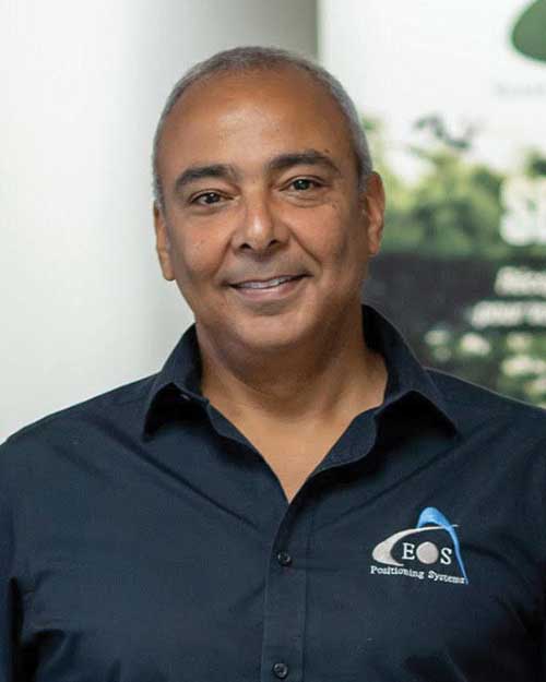
Eos Positioning Systems
With Jean-Yves Lauture, Chief Technology Officer
Utilizing Galileo and BeiDou
The past two years have seen considerable maturation of the Galileo and BeiDou constellations. Considering the now four usable GNSS constellations and the aggressive launches of Galileo and BeiDou, the number of available satellites and the list of frequencies they use have considerably increased. Accuracy itself is slightly improving with the availability of BeiDou phase 3 signals, whereas performance and productivity experience a significant boost under tougher conditions with more satellites and stronger signal availability. It is not uncommon for our customers to use 30 to 35 satellites out of 40+ in view using an Arrow Series GNSS receiver. We are waiting for the availability of the High Accuracy Service (HAS) (PPP) on the Galileo E6 frequency, hopefully in a couple of years.
Photo: Eos Positioning Systems
Integration with IMUs and other sensors
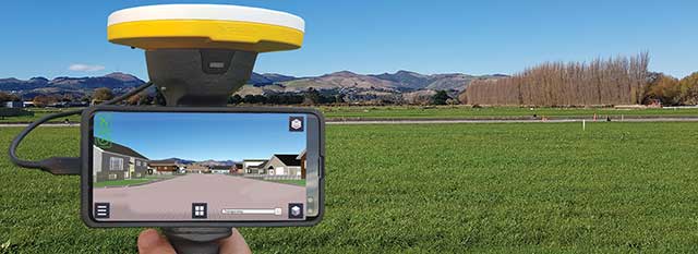
Eos has put a lot of effort recently in supporting external sensors and accessories to facilitate mapping of certain types of assets or mapping in certain types of conditions. For instance, this past year Eos released our underground mapping solution called Eos Locate for ArcGIS (see cover photo), which integrates with external utility locate devices to allow a user to precisely map buried assets. Eos Laser for ArcGIS interfaces with laser rangefinders to map assets in GNSS-impaired environments.
Positioning using consumer devices
With our bring-your-own-device (BYOD) approach on the market to support high-accuracy data collection for GIS, we have made it possible to override the consumer devices’ locations with accuracies down to the centimeter from our Arrow receivers. Customers can use any of their cell phones or tablets and immediately start mapping with submeter or centimeter accuracy.
Hemisphere GNSS
With Kirk Burnell, Senior Product Manager
Utilizing Galileo and BeiDou
The Galileo and BeiDou phase 3 systems introduce modern signal structures that allow more accurate measurements to be made than GPS first introduced. The new signals and increased satellite count are significantly improving receiver performance. Our Phantom and Vega product lines harness these new signals.
Dealing with jamming and spoofing
The increasing number of incidents of intentional and unintentional jamming and interference across the globe has impacted nearly every type of GNSS user. Our Cygnus interference mitigation technology automatically detects and mitigates the interference in real time, as well as providing spectrum analysis of the GNSS signal bands.
Photo: Hemisphere GNSS
Integration with IMUs and other sensors
Today’s autonomous-focused environment increases the need to share data across platforms. Both Vector and Vega provide robust GNSS heading, position and velocity to marine, machine control, UAV and internet of things (IoT) integrators, helping augment their sensor data.
Positioning with consumer devices
Positioning in consumer products will continue to drive innovation, while chasing accuracy and precision requires a strong understanding of geodesy fundamentals. As design requirements push well beyond the limits of what consumer GNSS delivers, and with the help of our knowledgeable staff, our precision receivers are delivering reliable performance in some very impressive applications.
Other significant challenges and opportunities
New GNSS signals and new surrounding technologies continue to come online, and the RF environment continues to see increased activities. Our underlying Lyra II ASIC technology and Cygnus enable our Phantom and Vega integrators and users to reliably coexist with these changes.
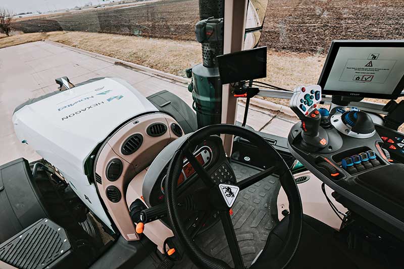
Hexagon | Novatel
With Sandy Kennedy, Vice President Innovation, Hexagon’s Autonomy & Positioning division
Utilizing Galileo and BeiDou
GNSS is now reality, not just inclusive phrasing to replace GPS. We are well into the era of multi-constellation receivers, and users will notice distinct improvements in solution availability with the addition of Galileo and BeiDou measurements. Over the next two years, we expect users in a variety of applications to start exploiting our globally available, fast-converging RTK From the Sky technology, which is enabled by the addition of quad-frequency signals supplied by Galileo and BeiDou (see page 29).
Dealing with jamming and spoofing
The RF spectrum is crowded and will only become more crowded over time. In 2020, we introduced our GNSS Resilience and Integrity Technology (GRIT), a suite of firmware options for the OEM7 receiver family. In addition to interference detection and mitigation, GRIT adds spoofing detection and time-tagged digitized samples for advanced situational awareness of the RF spectrum. With GRIT’s spoofing detection, opponents can try to spoof us. But fool us? Not a chance.
Photo: Hexagon | NovAtel
Integration with IMUs and other sensors
IMUs have become more accessible to more applications due to size, weight, power and cost reductions. At the same time, our algorithmic capability has significantly advanced to use lower quality inertial measurements for greater benefit. Originally reserved for truth systems, high-end mapping, and aerospace and defense applications, GNSS+INS solutions are now available in products like our SMART7 line of smart antennas for precision agriculture applications. Closer integration of the inertial and GNSS processing will bring further benefits in hostile RF or just plain difficult positioning environments. There is no perfect single sensor, but you can get more accurate by combining a set of sensors that offset each other’s vulnerabilities and limitations.
Positioning with consumer devices
The general population is accustomed to looking at their smartphone to see not only their location, but also the size of the “blue dot” of positioning uncertainty that accompanies it. We have always said accuracy is addictive, and we will no doubt start to see consumer demands for smaller blue dots with increasingly accurate positions. Making the digital reality match our real world demands continuously available and reliable positioning. Being lost is a terrifying feeling, especially for those who have been staring at their phone for the past 30 minutes and have no recollection of the physical world through which they have passed.
Other challenges and opportunities
The transition to autonomous vehicles, for both on-road consumer and off-road industrial applications, is inevitable. It is becoming increasingly necessary to prioritize the development of functional safety and integrity requirements to achieve the safe operations of autonomous systems. These requirements are necessary and entirely non-trivial to develop.
Photo: Stephen Drake
Javad GNSS
With the Javad GNSS Team
Utilizing Galileo and BeiDou
Simultaneous RTK and PPK processing of all available GPS, GLONASS, Galileo and BeiDou signals in receivers powered by our 874-channel TRIUMPH chip has resulted in significant productivity gains. User Darren Clemons told us “These Plus units are at least 40%–50% faster… The combination of the four super engines and the RTPK is unbeatable. You can get an accurate shot just about anywhere.”
Dealing with jamming and spoofing
Usually, more than 100 signals are available at any given time, and we need only a small number to compute a position. By tracking and verifying all these constellations and their signals, it is extremely unlikely that we can be spoofed without our knowledge. Javad GNSS receivers will immediately recognize spoofing and take corrective actions. Spoofing protection is available on all Javad GNSS receivers and OEM boards.
Integration with IMUs and other sensors
The Javad GNSS engineering team relentlessly works to identify and integrate the latest sensor technologies that can boost productivity. Our TRIUMPH-LS’s integrated camera sensor has for years supported onboard photogrammetry, and now our TRIUMPH-3 receiver’s integrated IMU provides high-precision tilt compensation.
Other challenges and opportunities
Our innovative RTPK feature is improving GNSS surveying and monitoring. Our Triumph-LS and Triumph-3 RTK rover systems combine the strengths of RTK and PPK into a system that can post-process RTK data and verify its results in parallel and real time. Users get the best of both worlds. If RTK fails, RTPK comes to the rescue in a fraction of a second.
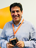
Septentrio
With Gustavo Lopez (pictured) and Stef van der Loo, Market Access Managers
Utilizing Galileo and BeiDou [GL]
With 150 GNSS satellites in space, multi-constellation has been a natural transition for improved GNSS availability. We see this in rover applications and in upgraded reference networks modernizing correction services. The next two years will be transcendent as constellations finally start delivering new services. We see our products soon integrating
GAL-OSNMA for anti-spoofing and then moving to new high-accuracy services.
Dealing with jamming and spoofing [GL]
We have witnessed a large increase in jamming and spoofing events as GNSS ubiquity increases. Users are becoming conscious of this, yet many integrations are still using vulnerable receivers, and we see manufacturers falsely claiming to have proper resilience. Septentrio’s AIM+ technology uniquely mitigates all these risks, and users come to us for expert advice on this area. In the coming years, we expect further receiver innovations and developments in adjacent technologies.
In 2020, Septentrio opened an R&D center in Espoo, Finland. (Photo: izhairguns/iStock/Getty Images Plus/Getty Images)
Integration with IMUs and other sensors [SVL]
Integration of sensors and sensor fusion moved from the research stage to the major production and adoption phase as an element in autonomous systems. Using a GNSS/INS (see our AsteRx-i products) is crucial for various applications — for example, being able to work in difficult environments — and for vehicle orientation. The development of lower cost IMUs while keeping high performance will enable a shift in focus from hardware to software. This will result in multi-sensor technology that is better scalable, easier to use, and more stable to integrate in relation to a full system with various sensors.
Positioning with consumer devices [GL]
We see further integration of dual-frequency GNSS chipsets in mobile technology for increased accuracy, which is key for future consumer applications. Septentrio has also witnessed the important involvement of telecom operators in GNSS correction services. Septentrio products (such as the PolaRx5 or AsteRx-SB) are deployed on new generation networks as operators prepare for the new generation of positioning in cell technology.
Other significant challenges and opportunities [GL]
Two areas are emerging thanks to the autonomy era and due to further regulations in the market. The first is the concept of GNSS integrity, which has a strong link to the reliability of autonomous solutions. The second is security, which, beyond anti-spoofing, is linked to the cybersecurity of GNSS systems as the demand increases for the protection of electronics and software.
Trimble
With Stuart Riley, Vice President of GNSS Technology
Utilizing Galileo and BeiDou
Most Trimble precision receivers can utilize any combination of GNSS satellite constellations (GPS, GLONASS, Galileo, BeiDou and QZSS) to deliver centimeter accuracy and optimize performance, even in degraded conditions. Users can select the constellations they want the receiver to use.
Dealing with jamming and spoofing
Spoofing is rare and low risk in locations in which Trimble’s precision GNSS agriculture, construction and geospatial customers operate. However, to protect users, modern Trimble Maxwell-based GNSS receivers implement hardware- and software-based techniques to detect and mitigate spoofing. Jamming sometimes impacts customers, but is not their primary challenge. The same issues are still present today as they were in the early days of precision GNSS. The main productivity concerns remain related to multipath and problems around obstructions and trees. Trimble continues to improve our GNSS systems’ robustness with advances in processing algorithms and hardware enhancements such as integrating inertial technology.
Trimble SiteVision uses Catalyst and augmented reality to preview a new housing development in an open field. (Photo: Trimble)
Integration with IMUs and other sensors
The Trimble R12i and SPS986 represent Trimble’s third-generation receivers (preceded by the R10 and the R12) capable of integrating inertial measurements into 3D GNSS positioning. In addition to speed and convenience for the user, integration with IMU provides immunity to magnetic interference and real-time integrity monitoring.
With the introduction of the Trimble R12 with the ProPoint GNSS positioning engine, we significantly improved the performance in challenging environments. This was further enhanced with the addition of an IMU for tilt compensation in the R12i. The new solution provides a system that delivers more accurate results in more places and in less time.
Positioning with consumer devices
The Trimble SiteVision augmented reality solution and Trimble Catalyst GNSS receiver operate on Android devices. Trimble Catalyst technology provides a software-defined GNSS receiver capable of survey-grade accuracy. Catalyst is the ideal solution for third-party applications that benefit from precise real-time positioning. Trimble SiteVision combines Catalyst positioning with augmented reality to deliver real-time, on-site visualization of proposed structures and existing underground assets.
Other significant challenges and opportunities
An ongoing challenge in GNSS positioning is the ability to obtain positions with suitable accuracy when and where they are needed. Solutions such as RTK and VRS provide solid performance at local and regional levels. Today, these technologies are complemented by subscription-based Trimble RTX positioning services, a global approach that uses a network of GNSS tracking stations and satellite-delivered correction data to achieve required accuracies. In 2020, coverage for Trimble CenterPoint RTX Fast, which enables users to achieve two-centimeter or better accuracy with initialization time of less than one minute, was expanded to cover the continental United States as well as much of Canada and Western Europe. The CenterPoint RTX Fast network now covers more than 5 million square miles worldwide. Trimble RTX coverage enables global users such as farmers, land surveyors and GIS professionals using RTX-capable receivers, to untether from the cost and complexities of GNSS base stations. In addition, the service offers a single, continuous corrections network ideal for enabling a broad range of safety-critical autonomous applications in markets such as automotive, agriculture and construction.
SPH Engineering has launched a drone-integrated metal detection system with a Geonics EM61Lite metal detector, a new product of UgCS Industrial Solutions. The same performance and robustness available for users of the standard EM61-MK2 time domain metal detector are now available for airborne use.
The new system is capable of detecting metallic (magnetic and non-magnetic) items in the first few meters under the surface, finding metallic objects in hard-to-reach or dangerous areas.
Applications include unexploded ordnance (UXO) search, detection of underground infrastructure and archaeology. The integrated system has been extensively tested at SPH Engineering’s test range, and has shown excellent performance and repeatability for targets such as pipes (steel, stainless steel, reinforced concrete) and steel drums.
The system uses an airborne (less heavy) modification of the Geonics EM61-MK2 ground metal detector. The EM61 Lite airborne variant integrates with the UgCS SkyHub onboard computer and ground control station.
Features include automatic data logging in geotagged form and automatic terrain following with radar altimeter. The use of UgCS SkyHub enables the drone to fly in true terrain following (TTF) mode with the help of the radar altimeter and to log geotagged sensor data.
An optional RTK/PPK GNSS receiver on the drone will geotag the data with centimeter-level precision.