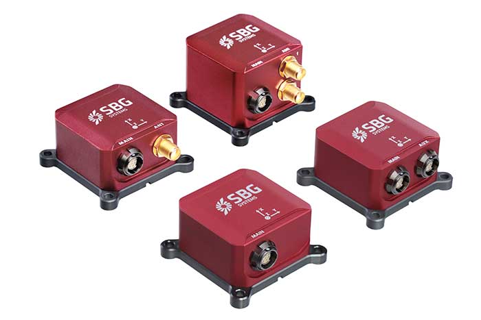
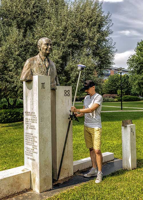
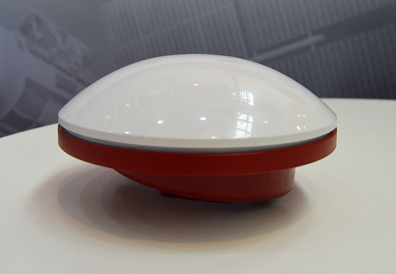
Third Generation of the Ellipse Series of IMUs. Clockwise from top: Models D, E, A and N. (Photo: SBG Systems)
Not just supporting players, alternative positioning, navigation and timing (PNT) systems strengthen, augment and — when needed — replace GNSS. GPS World explores how companies are using alternative PNT, and talks with Alexis Guinamard of SBG Systems about the company’s latest developments.
GPS World: What are the main challenges to GNSS that require developing alternatives?
Alexis Guinamard: GNSS technology can be easily disturbed by a wide variety of factors. Urban canyons or foliage environments can obstruct GNSS signals or cause multipath effects. Intentional and unintentional jamming and spoofing are also a big concern for PNT users.
Alternative technologies are developed to add robustness to GNSS positioning and useful features like orientation tracking (inertial + GNSS), or ultimately to work in pure GNSS-denied environments (SLAM).
GPS World: What is your range of products?
AG: We develop and produce GNSS-aided inertial navigation systems, but also provide a post-processing software (Qinertia). Our latest innovation is the third generation of the Ellipse series — our best-selling product — which is an industrial-grade INS. Based on the same inertial core, we integrated cutting-edge technologies, such as a multi-frequency GNSS receiver and RTK capability, within a miniature form factor.
A multi-constellation, multi-frequency receiver is much harder to jam or to spoof, which makes the Ellipse-N very robust and able to operate despite interference.
Finally, the new Ellipse-D, which provides dual-antenna heading capability, has been drastically improved in terms of size, weight and power.
Our post-processing software is compatible with all our INS products. So, we can post-process these data to obtain centimeter precision in a PPK mode. Qinertia is running a tightly coupled navigation filter to obtain the best navigation performance in post-processed applications.Thanks to the raw data output of the Ellipse’s sensors, it’s really straightforward to do post-processing with Qinertia PPK software and obtain the highest level of accuracy.
We worked hard to make the user experience as easy as possible. The latest version of Qinertia allows the customer to process either INS systems with GNSS or purely GNSS data.
GPS World: What are primary uses of your systems?
AG: We have many advanced robotics applications, including UAV, driverless cars, and agricultural robots. We divide them into mapping applications, remote-sensing applications and control applications.
Inertial sensors can help a lot for the control applications because we are able to reject false GNSS measurements in both loosely and tightly coupled schemes. We can also use them to provide a precise heading, which is required by many of these applications. So, I would say that advanced robotics is one of the major growth areas for us.
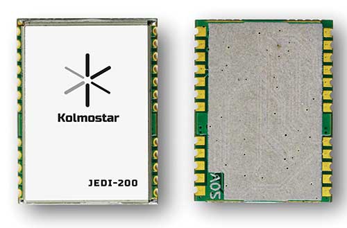
Kolmostar’s ultra-low power, instant cold boot GNSS module JEDI-200 and its evaluation kit are now fully released and available for purchase.
The JEDI-200 was recognized by IoT World — one of the largest internet of things (IoT) conferences — as one of the most innovative consumer internet of things solutions earlier this year.
JEDI-200 specification highlights include:
Low energy consumption of 25 mJ/position fix
Short cold-boot TTFF of 1 second
5.0 meter CEP positioning accuracy
Supports GPS and BeiDou constellations
50 Byte/12-hour compressed ephemeris (EPH) for speedy download, enabling A-GPS via LPWAN while significantly reducing EPH download power consumption overhead
High-performance cloud computing for minimum end device power consumption and seamless integration with customers’ backend data analytics platforms and dashboard applications
Integrated SAW filter, stand-alone LNA and TCXO
12mm x 16mm industry-proven standard form factor for easy wireless connectivity integration
Specially designed for IoT applications such as pet and personal object tracking, livestock tracking, fixed and nomadic logistics, infrastructure tracking and shared economy, JEDI-200’s reduced level of power consumption and optimized efficiency with LPWAN solve IoT endpoint deployment’s pain-point of needing frequent recharges or a large battery.
“Kolmostar’s JEDI-200 is a breakthrough in the IoT asset and personnel tracking application domain,” said Lucy Fan, VP of marketing and sales at Kolmostar. “JEDI-200 is well suited for battery-powered IoT applications which have stringent requirements on product size, weight, response time, battery life and GPS reporting frequency.”
Worldwide customers have started developing based on JEDI-200, and field deployments are expected in the second half of 2020.
“We have seen unparalleled advantages of the JEDI-200, enabling unique features and use cases which cannot be achieved before with traditional GNSS solutions,” Fan said. “With the latest developments in cellular and non-cellular low-power wide-area network technologies, such as NB-IoT, LTE-M, LoRaWAN and Sigfox, JEDI-200 is well positioned to enable more rapid deployment of IoT asset tracking use cases for our customers worldwide.”
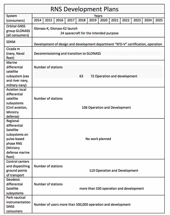
On Oct. 24, 2019, representatives from 11 nations met in Moscow and agreed to a “Radio Navigation Development Plan for Participating Commonwealth of Independent States for 2019 to 2024.” The Russian version is here; a version in English produced by Google Translate can be found here.
Most government documents like this, regardless of the country, tend to be more overviews of current systems vice real plans for a way forward. In this case, though, this seems to be much more of a plan. It documents existing systems, recent accomplishments, user needs, and the upgrades and changes required to meet those needs.
The plan makes clear Russia’s significant concern with GNSS signal disruption (one might opine this is justified as they disrupt the signals so much themselves). As a result, the plan dedicates significant space to combatting disruption and making users more resilient by integrating space and terrestrial systems into a more robust and resilient PNT architecture.
It also seems to confirm a mobile terrestrial PNT capability, likely for military use, that has received little public attention.
Note on Translation and Terminology: The copy of the plan we found was in Russian. We used Google Translate to create an English version. One translation issue that we noticed was several variations of the way the Russian terrestrial Loran PNT system is described. The Russian Loran system is named “Chayka,” literally “Seagull” in English. References in the translated version to “Chaika,” “Loran,” “Laurent,” “Seagull” and “Tropic” are all some version of “Loran.”
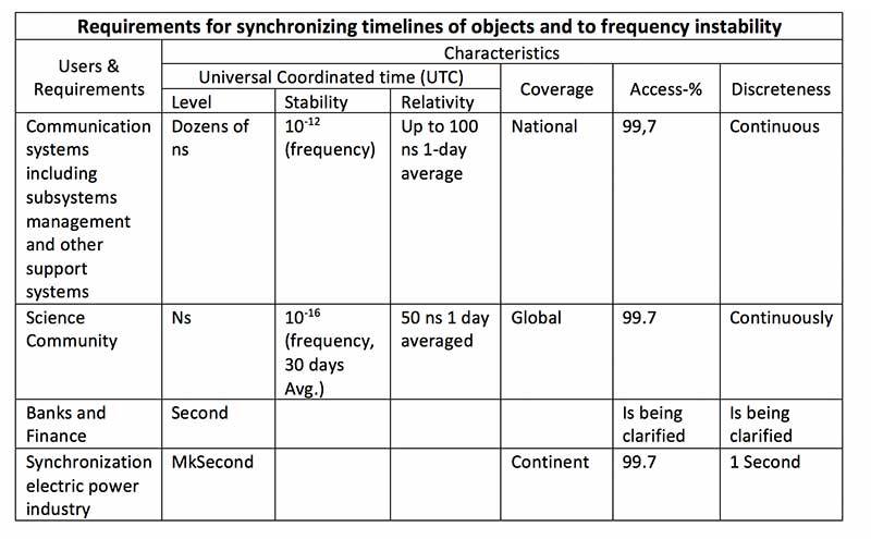
User requirements
Early on the plan provides a detailed discussion of user requirements for each mode of transportation and for timing users. This user focus continues throughout the document. The table for timing users did not transition well during conversion of the document to English and is reproduced below:
Click to enlarge. (Source: “Radio Navigation Development Plan for Participating Commonwealth of Independent States for 2019 to 2024”)
Strategic approach
While not overtly stated, one can see that Russia and its Commonwealth of Independent States (CIS) partners have a very strategic view of PNT and how they can leverage it.
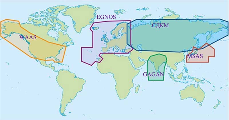
Click to enlarge. (Map: “Radio Navigation Development Plan for Participating Commonwealth of Independent States for 2019 to 2024”)
This graphic from the plan speaks volumes. Russian/CIS domestic PNT covers 14% of the earth’s land mass (compared to 6.6% for the U.S.). A good portion of China’s belt and road passes through. Resilient and robust navigation is going to be especially important for a wide variety of reasons.
Concerns about i nterference
The plan discusses GNSS interference at length, listing 13 operational electronic systems (radars, TV channels, etc.) with emissions that could impact reception.
Among the recommendations to counter interference, the plan suggests creation of a system to monitor GNSS frequencies and identify disruptions, use of multiple GLONASS frequencies, and integrating GLONASS, GPS and terrestrial systems within users’ receivers.
“Integration of terrestrial and space RNS will allow creating separate navigation areas superior in technical the characteristics of each of its constituent systems…One of the ways to integrate ground and space RNS is integration of systems like “Seagull” [Loran] and GLONASS. Integrated systems “Seagull” / GLONASS may in the future used as the main systems for route stages navigation.”
Integration of inertial and Loran sensors with GNSS has already been done for some “consumer equipment.” The plan also says that at least one version of Seagull/Loran is being modernized.
Loran and GNSS
Russia’s version of Differential GNSS and Eurofix is done using Loran towers and signals.
In the Russian Federation and the Republic of Belarus there is a ground navigation base that supports control technology transmission corrective information from regional differential GNSS satellite subsystems using Eurofix technology. In Russian Federation, this base is presented in the form of pulse-phase RNS types “The Seagull,” “Tropic-2V” and “Tropic-2C.” Modernization in progress a similar station located in the city of Slonim of the Republic of Belarus.
Some of the advantages of this are listed as coverage of a large area (600- 2,200 km) at relatively low cost, improved channel uptime and availability, data transmission in urban and mountainous areas, and that Loran and GLONASS/GPS are complementary and provide backups for each other.
It also points out that Loran and GNSS are mutually supportive in other ways:
GNSS location determinations can be used to calibration of readings RSDN and compensate for errors due to the propagation of radio wave. In turn the data Laurent-C/Seagull can be used to monitor the integrity of satellite RNS.
Mobile Loran/Scorpio
One system that we have heard very little about in the last five years is Russia’s “Scorpio” or “Skorpion.” It was initially assessed by a US Army journal as a mobile, military PNT system, for space-denied battle.
This document shows it as an on-going Ministry of Defense research and development modernization program. Also, as a mobile form of the Tropic-2P variant of Seagull/Loran.
In the period until 2020, a planned replacement of mobile long-range radio navigation systems “Tropic-2P” to the information system coordinate-temporal support “Scorpio”. As part of the complex equipment there are local control and correction stations, which can significantly improve the accuracy of determining coordinates consumers.
The way forward
At over a hundred pages, this plan has a lot of information. It includes a table of 19 different navigation systems maintained by the government and the plan for each. This table also suffered when the document was transformed into the English version. The manual re-recreation is below:
Click to enlarge. (Source: “Radio Navigation Development Plan for Participating Commonwealth of Independent States for 2019 to 2024”)Click to enlarge. (Source: “Radio Navigation Development Plan for Participating Commonwealth of Independent States for 2019 to 2024”)
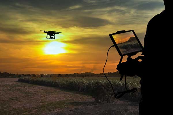
Why do we keep hearing about unmanned aircraft all the time, almost everywhere? Fortunately, the buzz has gone beyond next-door neighbors flying dangerously close to your roof or hovering annoyingly around a living room window, and incidents of UAV incursions shutting down airports seem to be getting fewer — improved enforcement and higher penalties may be slowing down these incidents.
Now, UAV users are taking on productive, innovative tasks that couldn’t previously be done, or finishing projects surprisingly quickly and more affordably than ever before, with drones built or adapted for new applications. And equipment manufacturers are creating new sensors customized for use on drones.
Commercial, integrated GNSS/inertial sensors are available that have extremely high performance — previously only available with expensive mil-spec electronics — but in lightweight, small packages, supported by real-time kinematic (RTK), precise point positioning (PPP) corrections or post-processed kinematic (PPK). UAVs carry still, video and multi-spectral cameras generating automatically geocoded outputs, ready for post processing into multi-layered formats — virtually everything a customer could ever dream of having. And lidar sensors enable drones to build accurate models of everything they overfly.
Drones originated largely with military forces. Originally used for forward intelligence gathering, UAV tasks have multiplied and substantially expanded in scope.
Commercial industries were quick to realize the benefits. Before drones, the cost of many tasks done manually would be prohibitive and too time-intensive. Fast, affordable data collection now allows us to quickly tackle and solve many problems.
UAVs can pre-survey large, previously inaccessible tracts of difficult terrain, collect detailed visual representations of entire cities, monitor and support crop growth, or even survey underwater terrain using lidar. UAVs provide crop-growing support by flying autonomous patterns and spraying fields with pesticides or fertilizer. They also are being called into service to spray villages with disinfectant to control the spread of coronavirus, and to survey England’s beaches to monitor coastal erosion.
Technology continues to develop and put more capability, data storage and ease of use into many professional’s hands, and surveyors are no different in their needs.
Spatial data collection has become an important task in the diverse service world of today’s surveyor with a variety of platforms, sensors and techniques being used to provide this operation.
The movement toward completing a “digital twin” of existing improvements and facilities worldwide has opened the door for new means and methods for data collection. Surveyors are taking a front-line role in producing the spatial data necessary for much of the internal and external infrastructure being used in today’s cutting-edge digital modeling.
Necessary accuracy and precision
However, not all data-collection systems offer the accuracy and precision deemed necessary by today’s surveying profession. These systems also need to be tough enough to handle the environmental conditions surveyors face in their everyday work, yet be user-friendly enough to make the data-collection process efficient.
Surveyors require a system designed for rugged use, yet built with a high-visibility screen, easy-to-use interface and reasonable battery life to allow effective and confident data collection. Many data collectors tout these features, but many of them fail when subjected to the harsh conditions of surveying and construction sites.
Times, however, are a changing and a new tablet is raising eyebrows.
DT Research Inc., a Silicon Valley electronics provider, has provided mobile and medical computing devices to many professions for more than 20 years. They have taken one of their most popular models, the DT301, and added integrated significant upgrades that brings it squarely into the surveying and geospatial world.
This rugged tablet can now include a multi-frequency GNSS module and a second, 3D-capable, stereo-imaging camera for capturing photometric information.
High-capacity, hot-swappable battery pack with power-saving modes
IP65-rated for water and dust resistance
MIL-STD-810G for shock and vibration protection
MIL-STD-461F for EMI and EMC tolerance
Multi-frequency GNSS (including GPS, GLONASS, Galileo and BeiDou)
External GNSS antenna capable
Intel RealSense Depth camera, 2D barcode scanner
Long-range Bluetooth, 4G LTE, digital pen support
Sturdy external keyboard with various mounts for static installation
Rugged yet reasonable weight of 3.1 pounds
Multiple mounting options for precise measurement
Rugged, but not too heavy
The first impression a new user of the DT301X-TR will notice is that while it is heavier than the normal personal tablet, it is very rugged yet not noticeably heavy. The additional weight it does carry, however, gives the user a sense of durability and confidence to take it into fouler environments without fear of infiltration or hazardous climate concerns.
The external bumpers can take significant abuse, and the rubber rear guard is used for gripping the tablet effectively during data collection tasks. Several mounts are available for this unit, including a pole mount in conjunction with the external GNSS antenna for higher accuracy location determination.
This unit runs the Microsoft Windows 10 IoT (internet of things) Enterprise operating system, so most users will already have a general feel for the overall interface. All the normal Windows tools are there (email, browser, etc.), so little training is needed for beginners.
Connectivity is available through dual-band Wi-Fi and/or 4G LTE communications as well as long-range Bluetooth connections where needed. The unit runs on an Intel 8th-generation core processor and SSD storage for fast computing and data access needs.
In addition to computing performance, this model also exceeds expectations with its robust screen. Where most high-def screens on phones and tablets suffer in daylight conditions, the DT301X-TR allows the user to maintain great visibility and keep working with visual confidence.
GNSS module and antenna
The DT301X-TR can be loaded with several data-collection software packages, depending on your application. For traditional surveying, Microsurvey’s Field Genius is used for locating survey points with the GNSS module. Several programs for data collection are available, depending on the accuracy required by the user.
Photo: DT Research
A helical mobile dual-frequency GNSS antenna is mounted directly on the tablet for receiving survey-grade positions with an RTK correction service. The tablet can also be used with an external GNSS antenna mounted on an extendable pole for a more conventional surveyor-style method of data collection while providing stability for the user.
The data-collection process for mapping is intuitive and allows for uploading existing shapefiles for reference to existing conditions. Exporting information after the data-collection task can be completed in two different formats: shapefiles and KML files.
Photo: DT Research
For the higher accuracies typically required for surveyors, the unit utilizes the pole mount to ensure the accuracy level is not compromised by human interaction, and it connects to an external GNSS antenna. The software allows the user to collect more precise locations through several means: static, real-time kinematic from the user’s base station, or through a real-time network solution from an external source.
The data collection process in Field Genius is very user friendly and allows for customized point naming and automatic linework between points. Field Genius also contains standard COGO tools and routines that allow the user to perform field calculations right on the job, saving valuable time and money for the practitioner and the client.
Exporting of field data is robust and allows for creation of DXF/DWG files of linework and LandXML files for surface and point downloads. The user can also export raw data in a GNSS Survey format or the industry standard “field book” format as well. Importing background files is just as simple, so the user can have additional information at their fingertips for reference during their data collection process.
Also, the DT301X-TR can be utilized for construction staking with an extensive array of staking reports available for user verification. Proposed TIN surface models can be imported for site and roadway staking for placing cut/fill points on the fly.
Cameras make it shine
The DT301X-TR, however, is not just a fancy conventional surveying data collector; the Intel RealSense Depth camera and DOT3D Pro software from DOT Product is the latest development to be added to the rugged tablet that makes this platform shine. This latest technology from Intel allows the user to photograph and video spaces that even the newest laser and lidar scanning equipment can’t access.
Stereo depth modeling is enhancing the data-collection process for surveyors as a new tool to collect important information for engineers, architects and contractors. By collecting close quarters information in real time, a more complete BIM and/or “digital twin” data set can be accomplished faster and more cost efficiently than ever.
This version of remote sensing is becoming very popular with other vehicles and platforms (such as UAVs), yet being integrated into a single unit with GNSS capability is key to making the DT301X-TR a game changer.
The divide between the macro (GIS mapping) and micro (traditional surveying) of spatial data collection is closing, but it will take some time before satisfying the surveying community. The DT301X-TR is closing that gap by marrying the accuracy of GNSS measurement with the precision of 3D analyzation technology.
DT Research began by creating a bulletproof tablet made for durability and dependability, but has raised the bar with a state-of-the-art satellite measurement module and remote-sensing capability through the RealSense camera system.
Wrapping all this technology into a rugged unit running on an industry-standard software platform, DT Research has provided an insight to what the future of data collection looks like, no matter what profession one is in.
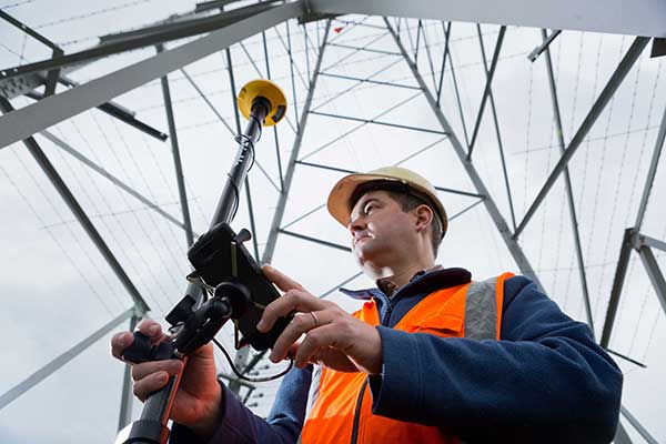
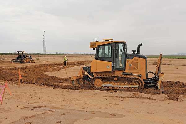
GNSS, coupled with inertial systems and software, is enabling greater accuracy in construction and agriculture. Other markets using machine control include unmanned vehicles, mining, surveying, mapping and defense.
At construction sites, GNSS receivers can be found in heavy equipment such as bulldozers, excavators, graders and pavers. On farms and in orchards, GNSS increases productivity of machines ranging from tractors to UAVs.
A new MarketsandMarkets report predicts the machine control system market will grow to $6.6 billion by 2024, a compound annual growth rate (CAGR) of 8.16%.
For precision agriculture, the outlook is even brighter. Grand View Research anticipates the market will reach $12.9 billion by 2027, a CAGR of 13% over the period.
Machine control speeds projects and increases efficiency under tight timelines. Using GNSS to guide the heavy lifting also alleviates safety concerns related to workers and construction machinery, and provides situational awareness to field operators.
In this month’s feature, we share case studies from companies that specialize in these markets, provide product details, and review the status of real-time kinematic (RTK) GNSS in agriculture.
Check out some use cases for how GNSS, inertial systems and software are enabling greater accuracy in construction and agriculture.
When completed, the underwater auto and rail tunnel will connect Germany and Denmark. (Image: Femern A/S)
A European megaproject is relying on GNSS to guide supportive earthworks during construction. The Fehmarn Belt Fixed Link is a planned underwater tunnel that would allow travelers to go by car or train between Germany and Denmark in only seven to 10 minutes. Once completed, the 18-kilometer-long tunnel will be the world’s largest of its kind and is expected to employ up to 3,000 people.
The 7 billion Euro project is expected to be completed in nine years. Danish construction company Holbøll A/S is building earthworks for 56 bridges on the main route crossing Denmark to where the tunnel would start. Holbøll’s undertakings include ramps and drainage work for the new bridges.
Holbøll has 130 employees and a machine park of 22 machines equipped with machine control from Leica Geosystems, enabling it to deliver innovative and sustainable solutions on time and at the agreed price.
At one of the bridges in Vordingborg, operator Flemming Ove Nielsen uses a Leica iCON GD4 3D system on the 61PX Komatsu dozer to perform the first rough work for building the slopes. Using the the iCON GPS 80 receiver, the iCON grade iGG4 system ensures fast and reliable grading with GNSS. Nielsen uses machine control to create the slope, and then the excavator takes over for the final grading work.
Image: Femern A/S
“The dozer is very efficient for this sort of work because it can move so much dirt and, with machine control, hold the correct angle of the blade,” explained Carl-Ole Holbøll, co-owner and managing director of Holbøll. The dual GNSS solution for the dozer is an advantage because the slope is so steep, and to achieve an accurate cross-slope, dual GNSS is required.
On another bridge, an excavator is using the Leica iCON iXE3 3D system for the finishing layer of the ramp slope. The operator can document the height of the different dirt layers simply by placing the bucket and letting the iXE3 register the height. This saves time — the operator doesn’t have to wait for a surveyor to conduct as-built documentation for each layer.
The Fehmarn Belt Fixed Link prime contractor, Femern A/S, has taken the next steps to develop the area where the factory for the tunnel elements will be built. Continued archaeological surveys, preparatory supply infrastructure and drainage has been financed at 55 million Euros.
Geared with Leica Geosystems, Holbøll A/S has prequalified for several of the derived projects, including the draining and moving of eight hectares in Strandholm Lake in Denmark.
As we close the book on 2019 and head into the next decade, much has changed during the 2010s and the 21st century. This article will focus on the technological changes that made a significant impact on the surveying world, with the biggest advances being specifically GNSS-based improvements.
No, we will not debate the true beginning of a century (Jan. 1, 2000, versus Jan. 1, 2001), but instead look at the predicted issues with computers and the Y2K hysteria leading up to the end of 1999 as part of our nostalgic tour.
For the millennials and Gen-Z readers, bear with us old-timers for a few paragraphs while we take a trip down memory lane.
The tale of two centuries…
“It was the best of times, it was the worst of times, it was the age of wisdom, it was the age of foolishness, it was the epoch of belief, it was the epoch of incredulity, it was the season of Light, it was the season of Darkness, it was the spring of hope, it was the winter of despair, we had everything before us, we had nothing before us, we were all going direct to Heaven, we were all going direct the other way — in short, the period was so far like the present period, that some of its noisiest authorities insisted on its being received, for good or for evil, in the superlative degree of comparison only.”
In 1859, Charles Dickens wrote this opening paragraph for his well-known novel, “Tale of Two Cities,” to describe two environments (in this case being London versus Paris) at a significant transitional time. Such was the case for surveying and technology in the late 1990s with the rapid utilization of GNSS technology, expanded capability of robotic equipment and data collection. Some practitioners were excited about the new century while others yearned for bygone eras of less complicated procedures.
“Gonna party like it’s 1999…”
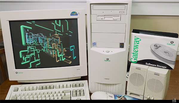
A 1999 Gateway PC refurbished by LRG. (Screenshot: LRG video, click to view)
With apologies to the late singer Prince and his 1982 hit song, the news surrounding the year 2000 was bleak when it came to computers and technology. For many of our readers, the technology available in 1999 might seem like the Stone Age. Most homes still used telephone land lines, “state of the art” cellphones were being produced by Nokia, personal computers (manufactured by Dell, Gateway, HP and IBM) were utilizing Pentium III processors (at a whopping 450 MHz!) with 5-10 GB storage. Internet Explorer was the web browser of choice, and Napster was gaining users exponentially sharing music downloads. Google was only one year old but rapidly replacing AltaVista and WebCrawler for our internet search engines. Life seemed good, but a storm was brewing…
The Y2K bug was front and center in all media outlets as many computerized systems were not programmed with the year 2000 in mind. This issue was unique in that it was a software and hardware problem to address. Replacement or patching of software, while taking a significant amount of time and money, can be much easier than computers and hardware loaded with chipsets that cannot be reprogrammed.
The Napster logo
Most system programming utilized a two-digit year designation instead of a four-digit version (99 versus 1999) and thus a date entry for January 1, 2000, normally composed as 1/1/00 in older systems would be recognized as January 1, 1900, instead. Because of this situation, many experts were predicting a global meltdown with government, utility company and banking disruptions that would render most computer systems unusable.
In the United States alone, over $100 billion was spent on computer upgrades and troubleshooting of the potential crisis. Thankfully, most of these systems had already been taken offline and replaced, but a few still lingered in critical systems. Because of pre-Y2K upgrade planning, many systems were tested and proven to be immune from the potential crash.
Specific Y2K issues that took place within the U.S. satellite system were isolated mostly to the units dedicated to surveillance, and not the navigation section used by surveyors. There was a small issue with the U.S. Naval Observatory, in which the date was deemed to be “Jan. 1, 19100” but that was rectified quickly.
The U.S. spy satellites, however, were knocked out by a faulty software patch rather than the original programming. These units were producing unusable information for three days before programmers were able to fix the problem. Imagine if that situation had happened to the navigational satellites and was impacting surveyors; we can only hope the GNSS system would have simply provided obvious bogus information.
Embracing RTK
By 1999, surveying had begun to embrace RTK systems for everyday measurement needs. Because of the constant focus of GPS technology moving forward, the operating systems for RTK were ahead of the curve for the Y2K issue. Fortunately, the navigational satellites as mentioned above did not fail with the date and time issues that were being predicted.
Logo of the now-defunct U.S. government Y2K website.
The Y2K bug did, however, affect a few users of older technology and software. Older data collectors, including ones based upon handheld calculators, were susceptible to date issues. Systems that were designed in the 1970s and ’80s should have been replaced with newer technology before 2000, but old surveyors stick to the adage: “If it isn’t broke, don’t fix it!”
For many, it wasn’t simply an upgrade in technology, but more of a radical change in known processes and procedures. New instruments and data collectors required new computers, which required new software, which required learning a completely new system.
Handheld GPS technology, introduced in the mid-1990s, was beginning to grow as the general public was embracing the new ability to determine geographical positions. While their use is quite simplified by today’s standards, nonetheless these devices captured the tech lover’s need for more accurate location determination.
In the end, Y2K wasn’t nearly the technological apocalypse many educated minds feared. While there were a few isolated incidents worldwide, everyday life went on without much of a blip on the radar. Planes didn’t fall out of the sky; financial systems didn’t come crashing down and life went on. Thankfully, surveyors everywhere went about their business on Monday, Jan. 3, 2000 as if nothing happened.
Then 20 years go by…
The new millennium has brought the surveying community many new exciting technologies and vast enhancements to age-old procedures. Field book notes has been mostly replaced with electronic data collectors, cellphone cameras and point clouds. Data is efficiently transferred between field and office with a remote connection and a blink of an eye. These past 20 years has seen a landslide of technological improvements, yet the future looks incredibly bright with more to come.
With the new year and decade, let’s look at where we are today and what advances we are anticipating:
GNSS CAPABILITY
GPS (Global Positioning System) began working in the U.S. in 1978 and as a true global system in 1994. This system was originally designed to work strictly for the United State military, but was discovered to have consumer applications shortly after implementation. There are currently 30 operational satellites in the GPS constellation with two (2) Block III versions being evaluated at press time. A total of ten (10) Block III satellites are planned to be operational by late 2023 or early 2024. These Block III versions will have an enhanced signal capability (L5 band) and will provide more accuracy and increased protection from jamming and spoofing.
GLONASS (GLObal NAvigation Satellite System) is the navigation system designed and implemented by Russia. This system was deemed operational in 1993 and currently has 28 operational satellites. Most surveying equipment in the United States has GLONASS tracking capability to greatly increase the accuracy and precision of most GNSS receivers.
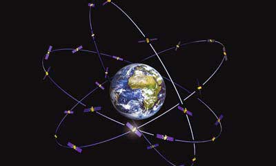
China launched two more BeiDou satellites on Aug. 25, 2018. (Photo: CCTV)
Galileo is the satellite constellation system created by the European Union. It reached limited capability in 2016 with full expanded reach targeted for 2020. However, the reliability of the system is now in question as a total system outage occurred for seven days in July 2019. The satellites themselves were operational; it was the main control center that experienced the shutdown during a system maintenance upgrade. The overall integrity of the system has been restored and the planned rollout of full operational capability is still scheduled for 2020.
BeiDou, the national navigation system of China, has achieved 35 operational satellites with 13 additional vehicles currently being evaluated for implementation. With the increased number of satellites, many GNSS receiver manufacturers are including BeiDou as standard channel reception to greatly increase accuracy and precision for navigational purposes.
Two additional regional systems, QZSS (Quasi-Zenith Satellite System) from Japan and IRNSS (Indian Regional Navigation Satellite System) from India are currently working to install more satellites and provide navigation signals soon. Because these are regional systems, access to these signals for U.S.-based surveyors will not be available.
In 20 short years, we went from having two good systems to four very robust systems and two regional organizations.
While it is still unclear how political relationships will affect the ability to use a system from another country, the simple fact is that more vehicles in space will only increase the coverage, reliability and effectiveness of GNSS navigational data. Increased signal type and strength will also provide many benefits, so surveyors should look forward to even better GNSS days ahead.
ADDITIONAL CELLPHONE CAPABILITY
Several increases in cellphone technology will greatly enhance not only the consumer’s use of GNSS but the surveyor’s. This involves a two-step increase in value with the rollout of 5G signal technology and dual-frequency GNSS receiver hardware within the cellphone.
5G is being introduced in various markets around the country, but won’t see full potential until 2021 and beyond. Those who can use it in the short term will see greater bandwidth for data connectivity, but surveyors will start utilizing navigational enhancements because of the signal and transmitter technology.
Add to this mix the future implementation of dual-frequency GNSS chipsets to provide much more accurate location, and the surveyor will have more data-collection power in their pocket. Dual frequency was a gamechanger for GPS receivers in their infancy, so one can only imagine how much it will enhance the navigation accuracy when included in the cellphone.
REAL-TIME NETWORKS (GNSS)
Most urban and suburban surveyors already enjoy the benefit of a real-time network, either from a private or public system. With 5G and expanded use of more satellites and L5 signal, the RTN will become a better tool for surveyors everywhere. A reduction of setting up a base station increased productivity, less theft and less equipment costs. The RTN will become a standard operational tool just like having a total station in your survey rig.
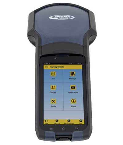
DATA COLLECTORS
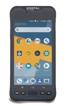
Photo: Spectra Geospatial
The technology hasn’t stopped with the unveiling of new data collectors and platforms. Small handheld devices used to rule the field surveyor’s world; now those devices have become bigger and more advanced than ever.
While most collectors already had touchscreens, the actual screen is increasing in size and functionality. Some are adopting the tablet-style format (8- and 10-inch screens), others are incorporating larger screens (7 inches) within the body of the traditional collector. All of them are including better cameras and enhanced connection capability through Wi-Fi, Bluetooth and cellular methods.
Also catching on is the use of bring-your-own-device (BYOD) with specialized apps for connecting to newer GNSS receivers. This allows surveyors to keep down costs of equipment by not having to purchase a dedicated data collector. As mentioned previously, once the cellphone becomes equipped with 5G and/or dual-frequency GNSS, it will become an excellent system for surveying that will produce extraordinary value for the surveyor.
SPATIAL DATA
The biggest revolution for surveyors in the coming years will be the ability to collect spatial data through a variety of equipment and sensors. Besides the obvious explosion of UAV capability, the small-format laser scanner is becoming user- and drafter-friendly as well as much more affordable. Now a surveyor can perform dozens (if not more) of small area scans with simplified orientation and scan formatting to create a great looking point cloud for data extraction and/or Building Information Modeling (BIM). Surveyors are beginning to understand how to utilize this technology and data to reach inaccessible areas and densified regions quickly. In addition to scanning technology, SLAM (simultaneous localization and mapping) will also become more mainstream as more surveyors are adopting the method for data collection.
What we’ve learned
“The days are long, but the years are short.” – Gretchen Rubin, author
Gretchen hit the nail on the head, as these past two decades have rolled on. When the end of 1999 was upon us, it seemed to be a big deal because of the potential of Y2K issues. There we were, surveyors with exciting technology in our hands, and now the forefathers of computers were going to erase it all due to not looking ahead to the next century.
We easily got past it, yet the memories of Y2K still linger on for some of us. The jump to 2010 didn’t foreshadow any drama (other than climbing out of a recession) and I personally didn’t think any different while moving the calendar to January 2020. But somehow in the last few months of 2019, there were many stories about the Y2K predicament, and it rekindled old memories of those weeks leading up to January 1, 2000.
Long story short, we survived and lived to survey many more days. Having time to look back and compare where we were 20 years ago to where we are now, I find it simply amazing. No, Rick Deckard isn’t flying by in his car catching bad guys (Blade Runner was set in 2019!), but surveying continues to amaze me with continued technological changes.
Top receiver manufacturers discuss what’s on the horizon for GNSS receivers. The companies reveal recent and upcoming innovations, how to combat spoofing and jamming, fusing GNSS with other sensors, and the impact of increasing accuracy both for professional surveyors and consumers.
With regard to jamming and spoofing, the preferred approach is a combination of monitoring, detection and filtering. However, shielding, the use of IMUs and other third-party sensors, and advances in processing algorithms also help mitigate interference. In a few years, hopefully, encrypted or “watermarked” signals will substantially reduce this problem.
IMUs and other sensors are now routinely integrated with GNSS receivers, with their outputs fused. This trend is largely propelled on the demand side by the needs of the emerging market for autonomous vehicles and on the supply side by smaller, cheaper and more accurate IMUs and lidar scanners. Meanwhile, developments in algorithms have improved the modeling of errors to correct for the inherent tendency of IMUs to drift. Additionally, digital cameras, lidar and other industry-specific sensors are increasingly common, especially for collision avoidance in human-machine interactions.
In surveying, the use of all constellations and frequencies, as they become available, is an industry trend. Costs will continue to drop as the growth in the adoption of GNSS solutions enables manufacturers to take greater advantage of economies of scale. Precise point positioning (PPP), which benefits greatly from the growth in GNSS constellations, is now giving real-time kinematic (RTK) positioning a run for its money. Available applications enable Android mobile devices to achieve centimeter accuracy, while innovations continue in core positioning algorithms.
In the world of mobile consumer devices, dual-frequency, multi-constellation GNSS chipsets are increasingly prevalent. As increased accuracy fuels expectations for even higher accuracy, precision positioning may become the norm in the consumer space, and new applications for these devices may emerge. Already, crowdsourcing the monitoring of both GNSS signals and interference helps improve accuracy for everyone, in a positive feedback loop.
Other notable trends include the introduction and expansion of 5G data networks, the increased use of satellite-based correction services, and continued efforts to develop precise positioning for indoor areas. (See part 2 of this feature here.)
Topcon
Jamming and Spoofing. “We continue to develop and deploy patented technology to detect spoofing,” said Alok Srivastava, director, product management. “We already have cutting edge GNSS antenna technology to provide stellar support for interference rejection and filtering.” All Topcon end products have this advanced antenna and filtering technology.
Sensor Fusion. “Topcon has been using inertial systems for decades for a variety of positioning applications — such as machine control, mobile mapping, and agriculture,” said Srivastava. “In recent years, advancements in IMU technology have progressed to where the size and cost of these sensors are at levels to be utilized at a larger scale. For example, the recently released Topcon HiPer VR takes advantage of inertial technology to improve productivity in real time with our Topcon Integrated Leveling Technology (TILT), which compensates for mis-leveled field measurements out of plumb by as much as 15 degrees.”
Surveying. Topcon continues to invest in its core positioning algorithms to innovate such features as quartz lock loop, advanced multi-engine platform, and VHD heading technology into its positioning engines, Srivastava said. “We also produce solutions such as our Millimeter GPS and Hybrid Positioning innovations, which are designed around improving accuracy, higher reliability, and greater flexibility by converging positioning technologies.”
Consumer Devices. “GNSS in consumer devices and other commercial systems is used to aid other positioning sensors,” Srivastava said. “So, it may not be in the best of interest to offer that level of accuracy from GNSS alone.”
Other Challenges. Precise indoor positioning is a requirement of the vertical construction industry. “Topcon’s combined optical instrument takes a unique approach to solve that problem by integrating a compact laser scanner with a fully featured robotic total station,” Srivastava said.
Photo: CHC Navigation
CHC Navigation
Jamming and Spoofing.CHCNav is currently taking a twofold approach to GNSS interference, said François Martin, vice general manager, International Division. “As a GNSS system integrator, we focus our design around strong electromagnetic shielding and sealed isolation chambers.” Additionally, he pointed out, the advanced filtering of GNSS signals and an antenna patch produce optimal interference mitigation.
Sensor Fusion. Integrating interference-free, high-dynamic IMUs instead of MEMS has brought the full benefits of tilt compensation to users, Martin said. The latest development in algorithms dramatically obviated the need for the annoying process of initializing GNSS IMU receivers and boosted the availability of GNSS RTK in demanding environments.
Surveying. The fast adoption of GNSS solutions by large user segments has reduced costs by enabling a sizable manufacturing economy of scale, Martin pointed out. “Tighter combination of embedded technologies such as GNSS and connectivity modules are sustaining that cost reduction process.”
Consumer Devices. “The emergence of dual frequency multi-constellation GNSS chipsets supports the development of untapped user segments, but the position accuracy repeatability remains an issue,” Martin said. “The integration of GNSS chipset and high-performance helical antennas, as precision add-on modules, onto rugged Android cell phone and tablets is creating a prosumer-grade centimeter to decimeter accuracy answering to a wide range of mobile workforce applications.”
Other Challenges. A growing number of positioning and navigation applications require the fusion of technologies to increase productivity, Martin said. “The integration of advanced tightly integrated positioning algorithms, scanners, IMUs, HDR cameras, IoT and cloud-based connected solutions are a clear trend.” However, their adoption by a large user base remains limited by their current price point.
Photo: Septentrio
Septentrio
Jamming and Spoofing. “Recent developments in receiver-antenna combinations maximize the benefits of anti-jamming techniques,” said Gustavo Lopez, market access manager. Third party sensors, such as IMUs, also help mitigate interference, he pointed out. “Septentrio’s advanced receiver technology such as AIM+, a standard feature on all the company’s products, bring not only real time monitoring but also jamming/spoofing mitigation. Galileo and GPS have clear roadmaps bringing signal authentication in order to avoid spoofing.”
Sensor Fusion. Smaller IMUs with higher grade performance now on the market are enabling new use cases in autonomous applications, said Lopez. Other important elements are a new generation of compact high-performance sensors and the growing importance of multi-sensor technology “to provide even higher levels of positioning integrity.” He cited Septentrio’s AsteRx-i family of products as an example of GNSS/INS integrated solutions.
Surveying. As an example of Septentrio’s survey-specific products, which “continuously benefit from advanced developments being rolled out in our platform,” Lopez cited the Altus NR3.
Consumer Devices. The increasing positioning accuracy of cell phones, Lopez pointed out, “has spurred innovations such as PPP and the use of mobile phone measurements,” as well as “other purposes, such as interference detection and crowdsourcing.”
Other Challenges. “Sensor fusion is a key element in positioning and orientation,” Lopez said. “Easy integration is a key element in this trend. Also, integrity in error reporting and positioning will be required as well as reliable raw measurements which can be integrated with other sensors. This drives the requirement for receivers capable of running customer proprietary software. Another important element will also be the possibility of running positioning algorithms on a third-party processor.”
Photo: Hemisphere GNSS
Hemisphere GNSS
Jamming and Spoofing. “Hemisphere’s new Lyra II ASIC platform used in our Phantom and Vega series positioning and heading boards,” said Miles Ware, director of marketing, “introduces new technology and filtering methods to identify and mitigate known and unknown interference sources that typically have an adverse effect on GNSS performance.”
Sensor Fusion. “Advancements in IMU integration and sensor fusion,” Ware said, “will continue to be a key focus for Hemisphere to support the growth and adoption of the expanding autonomous vehicle and application marketplace. The positioning and heading technology offered in our Vega 28 will be a core component for autonomous marine, machine control, and agriculture solutions for new and emerging markets.”
Surveying. “Access to modern and future signals like BeiDou Phase III, ALTBOC and BS-ACEBOC significantly enhance GNSS accuracy, especially in challenging environments where satellite visibility is compromised by the topography and or the structures present,” Ware pointed out. “Survey solutions that can not only track but also use all the available GNSS measurements in their RTK solution will have a substantial advantage in the market.”
Consumer Devices. “As mobile phones and consumer devices continue to adopt hardware designs that can access the latest GNSS signals,” Ware said, “the opportunities for solutions where high precision measurement engines can be hosted within mobile devices opens up a new realm of solutions that can leverage the high accuracy positioning performance found in Hemisphere technology and products. We see this as a very exciting and emerging area.”
Other Challenges. Ware pointed to “leveraging GNSS technology to further support environmentally friendly transportation solutions and sustainable agriculture,” for which GNSS continues to be an integral component.
Photo: Unicore
Unicore Communications
Sensor Fusion. “We are implementing GNSS with different level IMUs, including low-cost and high-end, targeting automotive, intelligent driving, and robot application scenarios,” said Gao Jingbo, marketing director. “The algorithm can also integrate with the already-existing sensors on the platform, such as IMUs, cameras and odometers. The solution can be done on the GNSS side, with high information synchronization accuracy, or processed on the platform.”
Surveying. Products with Unicore boards inside can provide centimeter- to millimeter-level positioning accuracy, said Jingbo. “Unicore’s high-precision boards and modules can track all frequencies of all satellite systems. The UGypsophila RTK technology can make the most of the observation data of all frequencies in all systems even without the observations of the base station in the RTK solution, thus greatly improving the usability, reliability and accuracy of RTK.” The company is now also working to reduce the dimensions and cost of its products, Jingbo pointed out. “With Unicore’s single GNSS SoC on board, the UB4B0M and UM4B0 modules are making affordable high-end high precision surveying possible.”
Consumer Devices. Algorithms and hardware are ready now to implement PPP+RTK in cell phones, Jingbo said, and this increase in positioning accuracy will enable many more applications. “We have rich experience in high precision GNSS, but the antenna might be a challenge. Our new generation 22 nm GNSS SoC features low power consumption and support of sensor fusion. Additionally, true point technology by Rx-Networks (also a BDStar company) can provide sub-meter data service, which also enables users to access centimeter-level accuracy location data through their mobile phones and wearable technologies, without increasing the demand for processing power.”
Photo: Trimble
Trimble
Jamming and Spoofing. “Trimble’s latest GNSS receivers leverage our seventh-generation Maxwell technology, which implements hardware- and software-based techniques to detect and mitigate spoofing,” said Stuart Riley, vice president, GNSS Technology. “In addition, Trimble continues to improve the robustness of our GNSS receivers with advances in processing algorithms and hardware enhancements such as the integration of inertial technology.”
Sensor Fusion. “For many years, IMUs have been widely used in Trimble agriculture and Applanix products,” Riley said. “Over the past few years, we’ve created a new line of lower-cost inertially integrated board-level GNSS receivers. We have also integrated inertial components into survey and construction products, including tilt compensation in the Trimble R10, R12 and SPS986 receivers. Trimble also combines its GNSS solutions with optical, laser, lidar and other sensors.”
Surveying. Trimble’s GNSS products, Riley pointed out, range from GIS handhelds to high-performance mobile mapping systems.
Consumer Devices. “The Trimble Catalyst system uses Android-based smartphones or tablets to run an application that includes a software-defined GNSS receiver,” Riley said. “The recently introduced SiteVision system builds on this ecosystem and integrates Google’s ARCore platform with precision GNSS to provide an augmented reality solution for a variety of professional applications.”
Other Challenges. To address signal masking and multipath, Trimble has “continued to improve performance in difficult environments with products such as the Trimble R12 receiver, which provides sophisticated multipath mitigation and an advanced precision processing engine.” Riley said, “Trimble’s RTX Correction Services, delivered via satellite, enable users to achieve RTK speed and accuracy nearly anywhere on the planet without the need for local reference stations.”
Photo: NovAtel
NovAtel
Jamming and Spoofing. “The RF environment is at best crowded and at worst hostile,” said Sandy Kennedy, vice president of innovation, Hexagon’s Positioning Intelligence division. “The NovAtel OEM7 generation of receivers was launched in 2016, with interference detection and mitigation as key features on every variant. Protecting authenticity, availability, and precision for multifrequency measurements is the challenge going forward — in all segments of the system: constellation management and SIS, antenna, receiver design and processing in FW/SW.”
Sensor Fusion. In the last three years, Kennedy pointed out, IMU manufacturers have made significant improvements in the performance offered in smaller, cheaper IMUs. “At the same time, new methods to improve error modelling (to control positioning errors) have been added to the NovAtel SPAN product line, especially in SPAN Land profile. Extended GNSS outages are easily handled now.”
Surveying. “PPP has become a strong competitor to RTK, as convergence times have decreased, and this will continue in service offerings like Terrastar-X from NovAtel,” Kennedy said.
Consumer Devices. The devices, Kennedy said, offer “the tantalizing promise of quality measurements from a common utility device with huge computing horsepower and data connectivity built in! It’s fun to watch, and we shall see if accuracy is truly addictive enough to fuel development for general use of precision positioning.”
Other Challenges. “In the past 20 years, users have moved from awe and wonder that centimeter-level positioning is possible — to utter contempt when it is not,” Kennedy said. “This will continue, with an added requirement of integrity and functional safety. Continuously available positioning within a usable protection level is a requirement for autonomous vehicles.”
New modules enable entertainment, advanced connectivity features and next-generation artificial intelligence
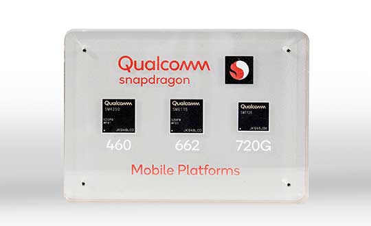
Qualcomm Technologies has launched three new mobile platforms — the Qualcomm Snapdragon 720G, 662 and 460 — to enable enhanced user experiences across connectivity, gaming and entertainment.
The new mobile platforms support dual-frequency (L1 and L5) GNSS to improve location positioning accuracy and robustness. The system-on-chip solutions also support the Indian NavIC (Navigation with Indian Constellation).
Seven constellations. For the first time supported on mobile, the Qualcomm Location Suite now supports up to seven satellite constellations concurrently, including the use of all of NavIC’s operating satellites for more accurate location performance, faster time-to-first-fix (TTFF) position acquisition, and improved robustness of location-based services.
“ISRO is satisfied with the efforts of Qualcomm Technologies Inc. towards incorporating NavIC and we urge OEMs to leverage it for future handset launches in India,” said K. Sivan, chairman, ISRO. “The availability of NavIC across multiple mobile platforms will help enhance the geolocation capabilities of smartphones in the region and bring the benefits of this indigenous solution to Indian consumers for their day-to-day use.”
The new modules also enable fast 4G connectivity speeds, deliver key Wi-Fi 6 features and integrated Bluetooth 5.1 with advanced audio via the Qualcomm FastConnect 6-series subsystems.
Artificial Intelligence. Designed to deliver new and improved AI user experiences across photography, voice assistants and virtually always-on scenarios for increased contextual awareness, the new platforms also feature the Qualcomm AI Engine and Qualcomm Sensing Hub.
“While we see a fast adoption of 5G across geographies globally, we do recognize the phenomenal boost that 4G has given towards enabling broadband connectivity for Indian consumers. 4G will continue to remain a focus area for Qualcomm Technologies for regions like India, where it will stay a key technology for connectivity,” said Rajen Vagadia, vice president and president, Qualcomm India Pvt. Ltd. “Our goal is to enable our partners to continue creating solutions that offer seamless connectivity access and exceptional mobile experiences, that consumers can count on.”
“Today’s smartphone users want fast, seamless connectivity, advanced features and long-lasting battery life,” said Kedar Kondap, vice president, product management, Qualcomm Technologies, Inc. “This expansion of our 4G lineup enables our partners to offer sophisticated solutions that meet global demand and enable a remarkable gaming experience across multiple tiers and price segments.”
Photo: Qualcomm
Snapdragon 720G
Snapdragon 720G reimagines extraordinary gaming and entertainment experiences with select Qualcomm Snapdragon Elite Gaming features, striking capture capabilities, and intelligent performance. Leveraging select Snapdragon Elite Gaming features from premium-tier mobile platforms, Snapdragon 720G delivers smooth HDR game play, dynamic color range and contrast, realistic and immersive in-game environments, and high-quality, synchronized sound with Qualcomm aptX Adaptive.
In addition to gaming, users will have a “home theater in their pocket” with HDR viewing and super-smooth video streaming with the Qualcomm Spectra 350L ISP, Qualcomm said. They can also capture 4K video or snap massive 192-megapixel photos.
Snapdragon 720G also features the latest fifth-generation Qualcomm AI Engine with the improved Qualcomm Hexagon Tensor Accelerator that will enable a host of new AI experiences for gaming, photography, voice assistants and virtually always-on contextual awareness.
The integrated Snapdragon X15 LTE modem supports 3-carrier aggregation, 4×4 MIMO on two carriers and 256-QAM modulation for fast download speeds up to 800 Mbps — allowing for quick app downloads and smooth video streaming and sharing.
In addition, Snapdragon 720G, with the FastConnect 6200 subsystem, virtually doubles Wi-Fi speed and range for online gaming and web browsing, compared to single antenna devices, while also delivering key Wi-Fi 6 features such as 8×8 sounding with multi-user MIMO for up to 2x improvement over competitive Wi-Fi 6 devices, Target Wake Time for up to 67% better power efficiency and the complete WPA3 security suite, as well as integrated Bluetooth 5.1 with advanced audio capabilities.
Finally, users will experience power savings and improved performance due to the Snapdragon 720G’s 8-nm process technology and upgraded CPU architecture.
Snapdragon 662
Snapdragon 662 brings astonishing camera and AI capabilities to the 6-series for the first time. It will feature the new Qualcomm Spectra 340T, which supports triple camera configurations and smooth switching between them — a first in the 6-series. A more robust ISP will enable support for photo capture in the HEIF file format for stunning image quality at half the file size.
The addition of the third-generation Qualcomm AI Engine with Hexagon Vector Extensions and the Qualcomm Spectra 340T will enable AI-based user experiences such as avatars, night photography, and face and voice authentication.
Snapdragon 662 also features the new Snapdragon X11 LTE modem with peak download speeds up to 390 Mbps thanks to 2-carrier aggregation, 2×2 MIMO and 256-QAM modulation, along with 150 Mbps peak uploads to support a snappy web browsing and social media experience.
Snapdragon 460
Snapdragon 460 boasts a gigantic leap in performance across the board in the 4-series, as well as significant boosts in connectivity, AI and camera improvements[1] for the next-generation of mass market smartphones. For the first time in the 4-series, Snapdragon 460 features performance CPU cores and an updated GPU architecture that translates into up to 70% and 60% increase in performance, respectively.
Overall system performance, meanwhile, delivers a 2x increase compared the previous generation. The Hexagon processor with Qualcomm Hexagon Vector eXtensions (HVX) is also introduced into the 4-series for the first time, thereby equipping it with a 3rd generation Qualcomm AI Engine and the Qualcomm Sensing Hub for new AI experiences for photography and voice assistance.
The Qualcomm Spectra 340 ISP is also among the many new additions to the 4-series, enabling the platform to capture stunning photographs and support for triple cameras. An integrated Snapdragon X11 LTE modem allows for download speeds up to 390 Mbps and uploads up to 150 Mbps.
To date, more than 85 commercial devices based on Snapdragon 7-series mobile platforms, more than 1600 commercial devices based on Snapdragon 6-series mobile platforms, and more than 2,500 commercial devices based on Snapdragon 4-series mobile platforms have been announced by global OEMs. Together, the 7-, 6- and 4-series amount to over 4,000 designs — an impressive feat for these segments.
Devices based on Snapdragon 720G are expected to be commercially available in Q1 2020 and devices based on Snapdragon 662 and 460 are expected to be commercially available by the end of 2020. For more information, please visit the product details pages for the Snapdragon 720G Mobile Platform, Snapdragon 662 Mobile Platform, and Snapdragon 460 Mobile Platform.
A roundup of recent products in the GNSS and inertial positioning industry from the December 2019 issue of GPS World magazine.
OEM
GNSS simulator
Testing for signals and sensors
Photo: Orolia
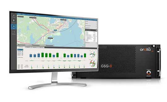
The GSG-8 is an advanced software-defined simulator that offers ultra-high performance and flexibility in an easy-to-use format. It was developed to deliver the highest standard of GNSS signal testing and sensor simulation performance in an upgradable, scalable platform. The GSG-8 uses the robust 1000-Hz Skydel software engine. It is designed for customers who require complex capabilities to validate product and program performance in harsh, high-risk environments where failure is not an option, such as government agencies, space programs and specialized commercial programs.
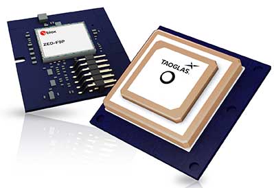
The Edge Locate GNSS L1/L2/E5 module combines antenna, RF electronics and receiver technology to deliver reliable centimeter-level positioning for the internet of things (IoT). It provides 1- to 3-centimeter-level accuracy using multi-band GNSS technology. With Edge Locate, manufacturers can quickly and effectively build devices with centimeter-level positioning technology. Its multi-band GNSS positioning can be used in conjunction with real-time kinematic (RTK) positioning capability. It uses a common connector for integration into any electronics device. It also connects directly to the Taoglas Edge board for immediate connectivity options.
The VSP600L VeroStar precision antenna supports the full GNSS spectrum, as well as L-band correction services, and provides low-elevation satellite tracking with a high-efficiency radiating element. It is suitable for real-time kinematic (RTK) and precise point positioning (PPP) applications, and features a light, compact and robust design. It also has a low axial ratio through all elevation angles, providing strong multipath rejection. The VSP600L VeroStar provides high receive gain over the full GNSS spectrum: low GNSS band (1164 MHz to 1300 MHz), L-band correction services (1539 MHz to 1559 MHz) and high GNSS band (1559 MHz to 1610 MHz).
Tallysman, www.tallysman.com
L1 + L5 chip
Suitable for IoT and auto OBD
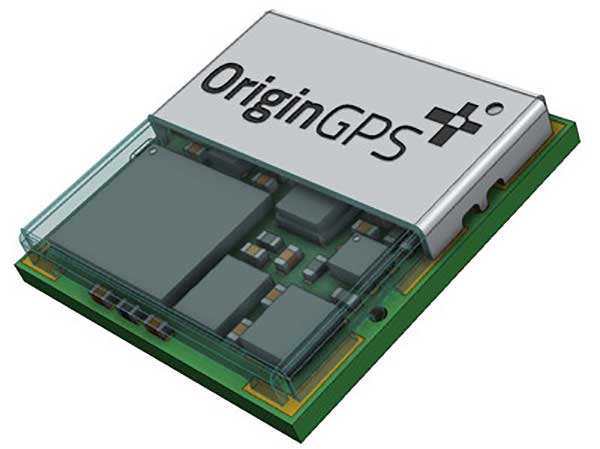
Photo: OriginGPS
The ORG4600-B01, OriginGPS’ first dual-frequency GNSS module, is supported by the BCM47758 chip, enabling ultra-accurate GNSS positioning. It was developed for solutions requiring super-precision GNSS and a dual-frequency combination. The module enables customers to build solutions with sub-1-meter accuracy without implementing external components. Measuring 10 x 10 millimeters, the ORG4600-B01 supports L1 + L5 GNSS reception with one RF port, enabling use of a low-cost, dual-band antenna delivering sub-1-meter accuracy performance in real-world conditions. An alternate build option allows for separate L1/L5 RF outputs when dual antennas are required. The module is suitable for solutions requiring ultra-accurate positioning, such as telematics, the internet of things (IoT) and auto OBD applications.
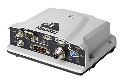
The PwrPak7-E2 contains an advanced Epson G370N MEMS inertial measurement unit (IMU) to deliver NovAtel SPAN technology in an integrated, single-box solution. It has a powerful OEM7 GNSS engine, built-in Wi-Fi, onboard NTRIP client and server support, and 16 GB of internal storage with higher performance and INS data rate. Connection options include serial, USB, CAN and Ethernet. Features include a 555-channel, all-constellation, multi-frequency positioning solution and multi-channel L-band that supports TerraStar correction services. It can be paired with an external receiver to support ALIGN GNSS azimuth aiding for low dynamic applications.
The MobileMapper 60 is a durable, efficient and accurate handheld device for geographic information system (GIS) and professional data-collection applications. The all-in-one GNSS receiver and smartphone offers 2-4 meter positioning accuracy in an all-weather design with a hand strap. It operates in extreme temperatures and rugged field conditions. It features a 6-inch high-resolution screen, large capacity all-day battery, Android 8.0 operating system and 2.2-GHz processor. Its 4 GB of memory and 64 GB of storage can manage large data sets with ease and speed. Bluetooth 4.1, 4G LTE and Wi-Fi capable, the MobileMapper 60 is suitable for cadastral, survey, topography and forestry.
Spectra Geospatial, spectrageospatial.com
Outdoor AR
Enables visualization of 3D data
Photo: Trimble
The SiteVision outdoor augmented reality (AR) system enables users to visualize 2D and 3D data with cellular or internet connectivity for planning, collaboration and reporting. Combining hardware and software in an integrated, lightweight handheld or pole-mounted solution, users can view 3D models and assets in a real-world environment at a 1:1 scale, from any angle or position. SiteVision integrates a Trimble Catalyst DA1 antenna, electronic distance measurement (EDM) rangefinder and power management into a lightweight, handheld device that connects to a user-supplied Android mobile phone. The SiteVision subscription is available monthly or yearly, and combines Trimble’s high-accuracy positioning services and cloud-based processing technology to create a centimeter-accurate AR system. Users can visualize digital models from a wide range of data collection, design and constructible modeling tools in open industry-standard formats, including IFC and LandXML. For civil projects, SiteVision accurately visualizes data from Trimble’s Quantm, Business Center and Novapoint; design data from Civil 3D and Bentley OpenRoads; and GIS data from Esri ArcGIS software.
The S621, powered by the Phantom 40 GNSS OEM board, is a redesign of Hemisphere’s previous S321+. It processes and supports more than 800 channels with flexible and scalable simultaneous tracking of every modern and planned GNSS constellation and signal including GPS, GLONASS, BeiDou (including Phase 3), Galileo, QZSS, IRNSS, SBAS and Atlas L-band. The S621 combines Hemisphere’s Athena GNSS engine and Atlas L-band correction technologies with a new web user interface. It meets IP67 requirements and is immune to magnetic interference. It is designed for use in land or marine survey, GIS, mapping, construction or other applications requiring high-performance precision and positioning.
Records and transfers raw data for post processing
Photo: Geneq
The SXblue ToolBox is now available for iOS-compatible devices. The application was developed with special interest paid to raw data recording and NTRIP service connection. The Android application debuted in 2018. With the new iOS application, iPhone and iPad users can analyze the position data provided by the SXblue receiver, as well as location metadata. The application can record, save and transfer raw data from the GNSS receiver, thereby allowing post-processing activities. The application also acts as an NTRIP client, capable of connecting to an NTRIP server for real-time kinematic (RTK) corrections, and thus allows the receiver to issue very accurate location information. Receiver configuration is easy through the application, with the ability to set up and save user-defined commands for subsequent use. The settings include constellation to be used, differential source, NTRIP login credentials list and more.
TRANSPORTATION
Telematics for Ford
Simplifies mixed-fleet management
Photo: Ford
The Geotab Integrated Solution for Ford Vehicles integrates Ford vehicle data into the MyGeotab platform to give fleet managers a dedicated portal to process data. Ford Data Services securely transfers data from Ford vehicles with a factory installed or plug-in modem to Geotab’s cloud environment. It provides access to the Geotab Marketplace, a portfolio of mobile apps, hardware add-ons and software add-ins.
The M9 platform is designed for demanding automotive, telematics and UAV applications. With the u-blox UBX-M9140 GNSS chip, the M9 technology platform and the NEO-M9N (the first module based on the platform) can receive signals from GPS, GLONASS, BeiDou and Galileo concurrently. It can achieve high positional accuracy in difficult conditions such as deep urban canyons. The M9 offers a position update rate of up to 25 Hz, enabling dynamic applications to receive position information with low latency and has special filtering against RF interference, jamming and spoofing. U-blox also provides Explorer Kit M9 (XPLR-M9) for developers.
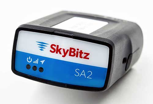
The SA2012 GPS tracker is equipped with the latest 4G LTE with 3G fallback. It is designed for customers looking for a scalable vehicle telematics solution. The hardware can be installed using the SkyBitz Ops Center mobile device, either directly plugging it into the vehicle diagnostic port or covertly installing it behind the dashboard. Once installed, the device feeds into the Ops Center platform, where users can manage the new device and others via a single interface. Coverage is across North America.
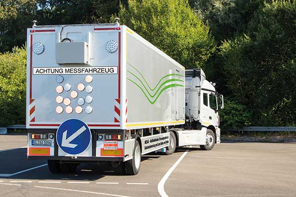
Germany’s Federal Highway Research Institute (BASt) is using a specialized semi-truck to analyze and map road surfaces. The research vehicle uses GNSS, scanner and camera equipment to record the condition of road surfaces and the substance of the asphalt surface, providing the basis for optimum maintenance planning.
The truck is part of the BASt’s MESAS program, which began in 2018. The unique measuring vehicle is a multi-functional assessment tool for fast-moving substance detection, such as for structural evaluation and design of pavements.
For the MESAS program, innovative measurement technology was installed on a single-axle semi-trailer, with all measurement systems synchronized and georeferenced using a GNSS system.
The MESAS measuring vehicle is 14.5 meters long and weighs 22 tons. At speeds of up to 80 km/h, MESAS records road condition parameters with high precision. (Photo: BASt)
The vehicle includes:
the Pavement Profile Scanner PPS-Plus from Fraunhofer IPM
a laser-based Traffic Speed Deflectometer (TSD) that measures short-term reversible deformations of the road surface
a georadar that detects layer thicknesses and inhomogeneity of the road superstructure
ambient cameras that provide images for interpreting the georadar measurements
During test runs, the vehicle system successfully measured more than 11,000 kilometers of the country’s trunk-road network. Now it begins regular operation.
“MESAS is a globally innovative measuring system,” said Dirk Jansen, department head, BASt. “Here we have a really powerful tool at our disposal with which we can make an innovative and significant contribution to the further development of conservation planning.”
Millimeter precision. The Pavement Profile Scanner PPS-Plus records the transverse evenness of the road surface with high precision. The scanner, the size of a shoe box, is mounted on measuring vehicles and scans the road surface with an eye-safe laser beam over a width of about 4 meters. The distance to the road surface is determined with sub-millimeter accuracy using phase-shift technology.
The laser scans the surface with the aid of a rotating polygon mirror perpendicular to the forward movement of the vehicle and generates 800 profiles per second. Each profile consists of up to 900 measuring points, depending on the selected measuring frequency. In this way, the PPS generates a detailed 3D height profile of the road surface.
At traveling speeds of 80 km/h, the measuring point distance in the longitudinal direction is approximately 28 millimeters; in the transverse direction it is 4.5 millimeters. It also provides photorealistic grey-scale images of the road surface that show millimeter-thin structures, such as small repairs and patches.