A new post-Brexit GNSS “must be secured,” according to the UKspace trade association. On Nov. 21, UKspace published its manifesto for a future British government to consider, which includes actions that will enable Britain to compete in the “new space race.”
Among the recommendations is a satellite system to provide navigation services.
“The UK’s post-Brexit participation in a new global satellite navigation system must be secured, whether through ESA or a sovereign capability,” the manifesto said.
“The 2019 Spending Review committed to continuing to provide £191M of funding to support Brexit-related activities ‘including the development of a UK Global Navigation Satellite System option and delivering business stability for company law and audit.’
“Following this initial design phase, the estimated cost of the programme is £5B. This needs to be reflected in long-term budget lines to sustain key precision, navigation and timing skills in the industry.”
Other topics in the manifesto include increased funding for the European Space Agency (ESA), establishment of a national space program, continuing to partner on Copernicus, and funding for the new National Space Council.
UPDATE: The search was called off on Tuesday afternoon. Additional information is available in this Evening Standard article.
David Last (Photo: @harriethallphoto via Dana Goward)
Just before 13:00 GMT on Nov. 25, a private plane piloted by David Last, former president of the Royal Institute of Navigation, disappeared from radar and hit the sea approximately two miles off the coast of Wales.
On-going search and rescue efforts have recovered pieces of wreckage and personal effects.
“Last was one of the most respected and well-loved figures in the worldwide positioning, navigation, and timing community. His loss creates a hole that cannot be filled,” said Dana Goward, president of the Resilient Navigation and Timing Foundation. “David was a close personal friend. Our grieving will not be brief.”
According to BBC News, the search for the missing plane and its pilot off the Welsh coast resumed on Nov. 26. North Wales Police said the light aircraft was flying from Caernarfon Airport to the Great Orme, Llandudno, and back on Monday when it disappeared. There were no other passengers and officers were supporting the missing pilot’s family.
The Maritime and Coastguard Agency said the search has resumed around Puffin Island, near Penmon, Anglesey. A plane carrying a sonar technology camera is searching the area as well as a lifeboat, helicopter and coastguard teams on foot.
David Last was a U.K. consultant engineer specializing in radio navigation and communications systems, professor emeritus at the University of Bangor, Wales, and past president of the Royal Institute of Navigation.
He also was a member of the expert panel and co-author of the January 2018 Blackett Report.
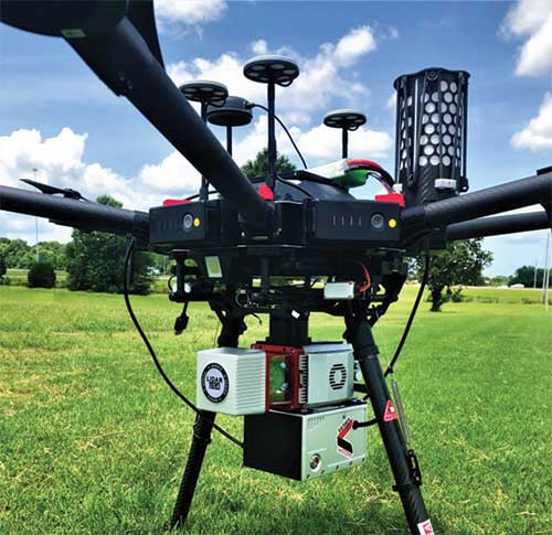
Autonomous vehicle startup announces availability of driving sensing solutions for purchase to OEMs
DeepRoute has released for sale its autonomous vehicle sensing solution, DeepRoute-Sense. DeepRoute is a CES 2020 Innovation Award Honoree.
Photo: DeepRoute
DeepRoute-Sense is an L4-level self-driving full-stalk solution that aims to enable the autonomous vehicle industry to achieve quicker sensor deployment. It includes a sleek, lightweight set-top box and sensor-fusion calibration service.
The roof box consists of GNSS, eight vehicle cameras, three lidars and a series of other sensors to help correspondence and data synchronization between the controllers.
DeepRoute has independently designed the mechanical structure of the roof box, which has outstanding diversion, heat dissipation and sealing functions. The set-top box is lightweight, small and with high impact resistance. With four tripods, the roof box can be easily mounted to the roof of different vehicle models for sensor deployment.
“The team at DeepRoute has worked hard on the development of DeepRoute-Sense and we are excited to finally share our technology with the industry,” said Shuang Gao, COO of DeepRoute. “By bringing this to the market, we are hoping to fuel progress within the industry and bring full vehicle autonomy to be one step closer to the masses.”
The solution uses a DeepRoute-developed in-vehicle camera that features anti-glare, anti-ghosting and highly reliable signal detection. Compared with industrial cameras, the camera comes at a lower cost, but also offers a higher dynamic range.
The roof box has been developed to accommodate different and extreme weather conditions, whether it be during intense sunlight or nighttime high-beam illumination, and can stably handle the exposure and avoid overexposure.
The set-top box includes a sensor data-processing device, the ADS Synchronous Controller. It is pre-processed and fused with the massive data from GNSS, cameras, lidars and other sensors through high-precision time and space synchronization. The ADS Synchronous Controller also supports DNN and SLAM hardware acceleration, which greatly increases computational efficiency.
A roundup of recent products in the GNSS and inertial positioning industry from the November 2019 issue of GPS World magazine.
SURVEYING & MAPPING
IMU-RTK receiver
Increases GNSS availability and reliability
Photo: CHC Navigation
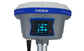
The i90 IMU-RTK GNSS series receiver is designed to dramatically increase GNSS real-time kinematic (RTK) availability and reliability. The i90 is powered by the company’s latest inertial measurement unit (IMU) and RTK technology to provide robust and accurate GNSS positioning in any circumstances. Unlike standard micro-electro-mechanical (MEMS)-based GNSS receivers, the i90 GNSS IMU-RTK combines a high-end calibration and interference-free IMU sensor with a state-of-the-art GNSS RTK engine and advanced GNSS tracking capabilities. The i90 is designed to increase the productivity and reliability of survey projects, with no complicated calibration process, rotation, leveling or accessories are necessary. A few meters’ walk will initialize the i90 internal IMU sensor and enable RTK survey in difficult field environments. The i90 GNSS automatic pole-tilt compensation boosts survey and stakeout speed by up to 20%.
Both accurate and rugged for machine control, logistics
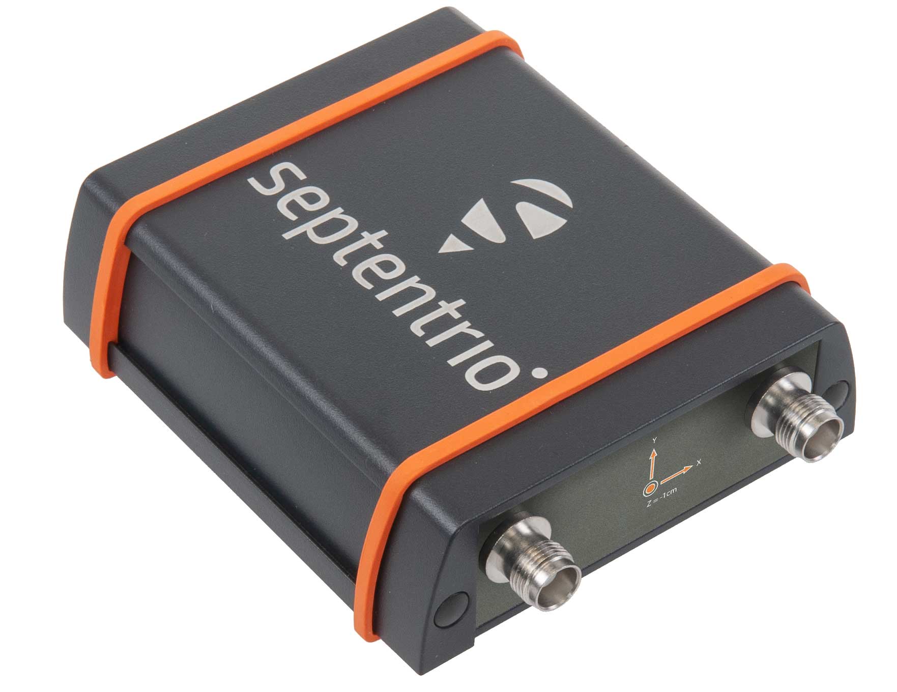
The AsteRX-SBi has a rugged housing, making it suitable for machine control and other outdoor uses. (Photo: Septentrio)
Septentrio has expanded its GNSS/INS portfolio with the AsteRx SBi, a new housed GNSS/INS receiver. The ruggedized AsteRx SBi fuses high-accuracy GPS/GNSS with a high-performance inertial sensor to provide reliable positioning and 3D orientation for machine control and logistic applications. Within its rugged, waterproof enclosure, a high-performance GPS/GNSS is coupled with an industrial-grade inertial sensor to provide high-accuracy, reliable positioning and 3D orientation (heading, pitch, roll). Offering the flexibility of either single or dual antenna, the AsteRx SBi is designed for quick and easy integration into any machine monitoring or control system. Reliable location and 3D orientation data is streamed with a high update rate and constant low latency. Septentrio’s reliable centimeter-level positioning is based on true multi-frequency, multi-constellation GNSS (GPS, GLONASS, Galileo, BeiDou, QZSS) technology.
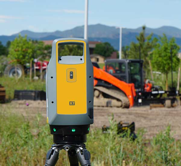
The Trimble X7 laser scanning system is designed for surveying, construction, industrial and forensic applications. It enables professionals to quickly and easily capture precise 3D scanning data to produce high-quality deliverables. The X7 features Trimble X-Drive technology, survey-grade self-leveling and a smart calibration system. It integrates streamlined workflows to provide automatic registration of point-cloud data in the field with Trimble Registration Assist, bringing scans together through self-leveling inertial measurement unit technologies and cloud-based software.
The Bluesky MetroVista range includes high-resolution imagery combined with high-accuracy, wide-scale 3D models. (Image: Bluesky)
The MetroVista city mapping service for Europe incorporates the Leica CityMapper hybrid airborne sensor designed for 3D city modeling and urban mapping. The sensor includes a vertical camera and survey-grade oblique cameras, and incorporates lidar to accurately collect elevation and infrared data. The MetroVista range includes high-resolution imagery combined with high-accuracy, wide-scale 3D models. CityMapper has already been used to capture MetroVista data for cities across the United Kingdom, including London, Manchester, Newcastle and Bristol.
The enhanced GSS9000 series GNSS constellation simulator has been updated to provide significantly improved capability, flexibility and performance to meet the test needs of high-performance navigation systems. It doubles the number of supported channels (320 in a single chassis) while maintaining its full performance specification in key areas such as signal iteration rate and low latency under maximum signal dynamics. These attributes, together with the ability to produce a comprehensive range of emulated multi-GNSS, multi-frequency RF signals, enables full and future-proofed testing of advanced applications. Greater signal flexibility is also built into the enhanced GSS9000 through its open application program interface (API) and flexible architecture. This delivers a highly sophisticated arbitrary waveform generator (AWG) capability.
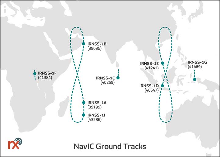
Rx Networks has added NavIC constellation support to its real-time and predicted-assistance data service. The company’s technology partners — semiconductor vendors, mass-market mobile device manufacturers and network operators — now have global support for all satellite navigation systems and L1 satellite-based augmentation systems (SBAS) for any region around the world. Used daily by more than two billion devices, Rx Networks data is delivered via ephemeris in RINEX and via the Location.io interface, with predictions in SP3. Predictions for NavIC via the Location.io platform will be added in the first quarter of 2020.
Endura micro-electro-mechanical system (MEMS) timing solutions are designed for aerospace and defense applications including precision GNSS. They provide high performance in harsh conditions such as severe shock, vibration and extreme temperature. SiTime offers customers 5 million possible part numbers that can be created from 17 programmable products. Solutions accommodate 4 parts per trillion per g force of acceleration (50 times better than quartz); support for –55° C and +125° C operation; timing specifications conforming to MIL-PRF-55310; and Endura Super-TCXOs (temperature compensated oscillators) for use in GNSS applications.
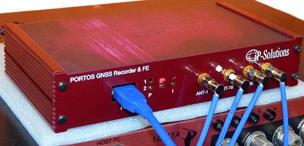
Portos Team paired with the Ninja. (Photo: IP-Solutions)
Portos Team is a new GNSS RF signal record-and-playback system. It can record and play back — or simulate —multi-frequency, multi-system GNSS signals when paired with the company’s Replicator. It can do the same for CRPA signals when paired with the company’s Ninja. The Portos itself can also operate as multi-frequency or CRPA front end for a GNSS software receiver.
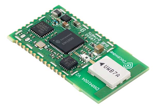
The DWM1004 module targets time difference of arrival (TDoA) tag applications that require years of battery life and a compact design. Based on the DW1000 chipset, the DWM1004C offers high-accuracy, real-time-location capability with a 6.8-Mbps data rate. It delivers more than five years of battery life. Real-time location systems (RTLS) enable managers to have a real-time view of their operations through data collected from connected objects such as tools, pallets, forklifts, badges and collars. The DW1000 is immune to multipath fading, with 2-centimeter precision in indoor environments.
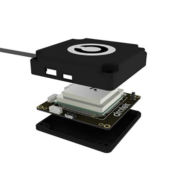
The F9P Sirius RTK GNSS rover is designed to be mounted on a moving vehicle. The u-blox ZED-F9P module inside provides 1-cm position accuracy, a convergence time under 10 seconds and a navigation update rate up to 20 Hz. The rover has a built-in active antenna patch. It receives GPS, Galileo, Beidou and GLONASS signals, providing additional accuracy. It is designed to fit most setup designs as well as integrate easily into a vehicle. Its six-pin JST-GH connector makes it plug-and-play with the Pixhawk Pro 3 autopilot.
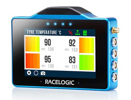
The VBOX Touch is a highly flexible GNSS datalogger with enhanced accuracy. The powerful hardware can be used diverse automotive tests such as acceleration, braking, speed verification, tire temperature monitoring, lap-timing and durability. The VBOX Touch comes preloaded with a sophisticated performance application that covers common use cases; applications can be downloaded from an online library. Racelogic can also write custom Python scripts based on customer requirements.
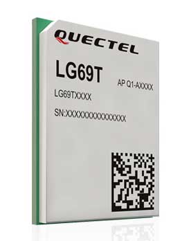
The LG69T GNSS module is an automotive-grade dual-band high-precision GNSS module that integrates dead-reckoning (DR) and real-time kinematic (RTK) technologies. The module facilitates open-sky positioning performance with an accuracy of up to 10 centimeters. It supports next-generation precision positioning capabilities for smart vehicles and autonomous driving scenarios. The LG69T module is based on ST’s STA8100GA, the latest automotive-grade dual-frequency positioning chip with 80 tracking channels and four rapid-acquisition channels compatible with GPS, BeiDou, Galileo, Navic and QZSS. The AEC-Q100-qualified dual-band module integrates multi-band RTK technology for centimeter-level accuracy. The LG69T module’s dead-reckoning capabilities feature an integrated inertial measurement unit (IMU) that provides continuous high-precision positioning.
The Coach II antenna with GNSS L1/L2/L5 is designed to provide greater precision and reliability for advanced rail communications systems, enabling next-generation positive train control (PTC) and passenger Wi-Fi. The Coach II features global multi-GNSS compatibility, dual-port 4G LTE / sub-6 GHz 5G NR and 802.11ac Wi-Fi / Bluetooth connectivity. It is AAR compliant for railway applications and is IP67-rated.
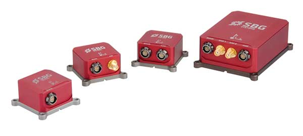
Includes new automotive package for Ellipse GNSS/IMU products
Photo: SBG Systems
New features have been added to the Ellipse product line with firmware update version 1.7. The update better answers needs of the autonomous testing and driving markets such as a CAN odometer. Users now have the choice to connect an external odometer (DMI) with pulses or use their car odometer with velocity information. New outputs include body velocity and slip angle, which calculate the drift angle between the vehicle’s assumed trajectory and its actual trajectory. For precision applications as well as low dynamics and reduced warm-up time, the new firmware allows users to run the Ellipse Kalman filter with no lever-arm estimation. This will ensure centimeter pass-to-pass accuracy for real-time kinematic (RTK) applications and allow operation in lower dynamics while reducing warm-up time. The firmware update also provides new features for advanced marine applications.
A roundup of recent products in the GNSS and inertial positioning industry from the October 2019 issue of GPS World magazine.
OEM
Multi-GNSS receiver
Refined in the Galileo Online project for rail applications
Photo: TeleOrbit
The multi-GNSS receiver GOOSE, distributed by TeleOrbit GmbH and developed by Fraunhofer IIS, is now available in a new housing. GOOSE now also includes the new OS-NMA beta standard, available by the end of 2019, which was integrated within the research project PRoPART. GOOSE is a flexible, professional GNSS receiver development platform with an open software interface, which can be adapted to a variety of applications and application-specific correction services. The flexible development platform offers multi-system and multi-signal real-time processing; integrated antenna receiver combination (smart antenna); guaranteed stable phase center for all GNSS frequencies; and deployment in commercial PC or as an embedded platform. It allows deep coupling and vector tracking in real time; access to correlation values; and record and replay of IF samples. It also offers access to SBAS data including upcoming augmentation systems and differential augmentation systems. The platform has been refined in the Galileo Online project for specific usage in rail applications. It has also been further upgraded as a robust and reliable Galileo position sensor for autonomous truck applications.
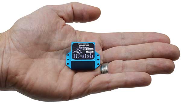
Low-noise performance for high dynamic applications
Photo: Gladiator Technologies
The LandMark 007 inertial measurement unit (IMU) combines low noise, high range sensors and Velox high-speed output in a rugged package measuring 0.7 inches square. With rate ranges up to 2000°/s and acceleration ranges as high as 200 g, the LandMark 007 IMU provides demanding, precision performance for a range of high dynamic, rugged applications. High-speed output data rates (up to 10 kHz) for measurement accuracy and flexibility are complemented by low-noise gyros and accelerometers. A development kit is available.
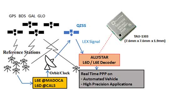
The QZSS L6 decoder module TAU-1303 supports tracking QZSS signals L6D (CLAS) and L6E (MADOCA). It can decode corrections data broadcast from L6D and L6E signals, and assist developers in applying the centimeter-level accuracy by PPP-RTK algorithm with the correction data. Within its 7.6 × 7.6-millimeter size, the module provides six channels to support tracking L6D and L6E at the same time. CLAS on L6D channel corrects satellite clock, orbit, code bias, phase bias ionosphere delay and tropospheric delay. MADOCA on L6E channel corrects satellite clock, orbit, code bias and phase bias. The TAU-1303 offers superior performance through an on-board 26-MHz temperature-compensated crystal oscillator (TCXO) and a reduced time to first fix because of its dedicated 32-KHz real-time clock oscillator. Based on 40-nanometer manufacturing processes of the Cynosure III GNSS chipset, the TAU-1303 has very low power consumption of less than 40 mA at 3.3V.
ViaLite’s new Local Integrated GPS Splitter was designed to minimize rack space. The unit provides a fan-out of GPS/GNSS signals within a local area, can accept optical inputs from up to four antennas, and has a 1000-1800-MHz frequency range. Though it has a height of only one rack unit, the system is useful for feeding timing and synchronization signals to single or multiple floors or rooms through eight to 32 optical fiber links with no system loss. It includes built-in simple network management protocol (SNMP) control as well as dual-redundant power supply units. Built for data centers, banking institutions, scientific research establishments, cellular test environments, fixed satcom stations, oil and gas platforms, and big data.
Pointfuse point-cloud processing software converts the millions of individual measurements captured by laser scanning and photogrammetry into 3D mesh models.The latest release features streamlined classification to ensure maximum efficiency and multicore processing for unlimited conversion power. The ability to classify objects and compare as-built objects with the design enables more accurate clash detection, reducing the number of false clashes being flagged. Intelligently optimized mesh models reduce the working data size by a factor of up to 100, making them easy to share with online 3D collaboration platforms, such as BIM 360, 3D Repo, Revitzo and Trimble Connect.
FieldGenius for Android, version 1.0, is multi-platform data-collection software built on Android OS. The brand-neutral data-collection software supports most popular GNSS sensors on the market. Features include dynamic data panels synchronized with map views, intuitive interface, simplified workflows and readily available data that surveyors require to make informed decisions in the field. Early adopters receive additional benefits and participate in the newly created MicroSurvey Technology Innovation Group.
The SP20 handheld GNSS receiver offers innovative camera-enabled centimeter-accurate logging in an everyday GIS and survey tool. Rugged, lightweight and versatile, the SP20 delivers high-end performance. It is an easy-to-use tool that delivers accuracy from meter to centimeter, depending on the job. Android-based, it is useful for cadastral, construction or topographic surveys; a range of GIS jobs from data collection to inspection and maintenance; and non-traditional geospatial professionals. The 5.3-inch screen displays the new workflow using a camera to ensure 2D centimeter accuracy handheld and 3D centimeter accuracy with monopole setup.
TerraFlex users can now synchronize data directly to their on-premise Esri geographic information system without cloud services. The new software workflow — called offline data transfer — is possible through the integration of Trimble TerraFlex and the Trimble Positions Desktop add-in for Esri ArcGIS Desktop. TerraFlex is a field solution that enables mobile workers to easily collect, manage and edit their geospatial feature data. The new workflow provides an alternative to using Trimble cloud services for storing and transferring GIS feature data collected with the TerraFlex platform. In addition, TerraFlex field data collected via this workflow using a Trimble GNSS receiver can be post-processed directly inside the Trimble Positions Desktop add-in for improved positional accuracy. The mobile apps are available in Apple’s App Store and the Google Play store.The Trimble Positions Desktop add-in is available through the Trimble Geospatial distribution channel.
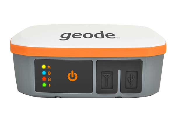
The Geode GNS2 sub-meter GPS receiver features connectivity with a range of iPhone and iPad devices, made possible by the Geode’s new MFi certification. Features of the Geode GNS2 include an IP-68 rating to withstand harsh environments, all-day battery life, multiple correction sources for precise real-time data, and an open interface that works with a wide range of Windows, Android, iPhone, and iPad devices as well as Juniper Systems’ handhelds.
With Brexit on the horizon, the U.K. Space Agency is interested in creating its own GNSS.
The agency is investing in research and development that explores challenges and ideas around receivers for a future UK global navigation satellite system.
Specifically, the agency is seeking UK organizations that are interested in investigating and developing concepts for satellite system receivers.
Following Brexit, the UK would be locked out from the European Union’s Galileo-provided services, including the upcoming Public Regulated Service (PRS), an encrypted navigation signal for governmental-authorized users and sensitive applications such as the military.
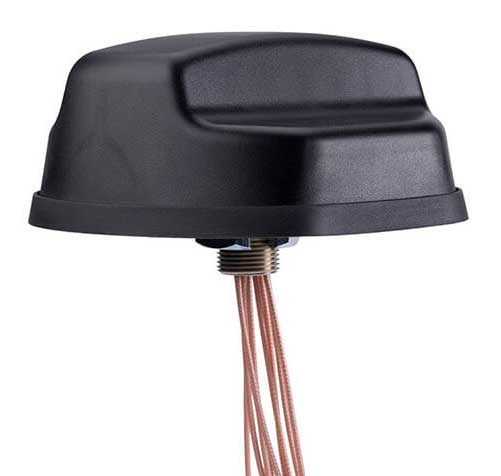
The new Mobile Mark nine-cable LTMG944 multiband antenna is designed for 5G-ready routers and gateways covering dual-carrier LTE MIMO, Wi-Fi MIMO and GNSS.
The LTM508 antenna. (Photo: Mobile Mark)
The 9-in-1 dual-carrier antenna expands Mobile Mark’s LTM series, used for public transit communications, public safety and vehicle fleet management. It contains nine separate antenna elements housed within a single antenna radome. The antenna has:
four cellular/LTE elements
four Wi-Fi elements
one GNSS element covering GPS, GLONASS and Galileo.
The LTM900 series can also be configured with fewer elements — for example, the LTMG942 contains four LTE, two Wi-Fi and one GNSS element.
The LTMG944 model can be paired with multi-connection 5G-ready routers and gateways already on the market. The cellular/LTE elements are designed to accommodate dual-carrier MIMO coverage (i.e. 2xMIMO on two different cellular carriers) or 4xMIMO for 5G.
Complete cellular coverage is offered from 694-960 and 1710-3700 MHz, with GNSS coverage on GPS and Galileo (1575 MHz) and GLONASS (1612 MHz), and dual-band Wi-Fi coverage on 2.4 and 5 GHz.
“Our new dual-carrier antenna solution series is compatible with the latest fleet management modems and routers offering dual-carrier coverage,” said Michael Berry, Mobile Mark president and CEO. “A single antenna provides MIMO coverage for each carrier.”
The antenna also provides broadband coverage. “We are happy to report that Mobile Mark’s new 9-cable 5G-ready antennas are in production today with efficient, 5 dBi gain on the FCC allocated 5G mid-bands of 3550-3700 MHz as well as being backwards compatible for other cellular frequencies,” Berry said.
The antenna is housed in the attractive, recognizable LTM radome in a choice of black or white. It is sold as a kit with 1-foot pigtails (LMR-100 except RG174 on GPS) and 14-foot jumper cables. The antenna elements fit in a compact radome that measures 5.5-inches in diameter by 2.38 inches high (140 mm x 60 mm). The LTMG944 series antennas are available as surface mounted antennas, but not as mag-mounts.
For high-vibration applications such as mining or large earth-moving equipment, Mobile Mark has developed a proprietary construction technique with superior shock and vibration test results. This option is available for the LTM944 series antennas.
The dual-carrier antenna is made in the USA, in Mobile Mark’s Itasca, Illinois, factory.”
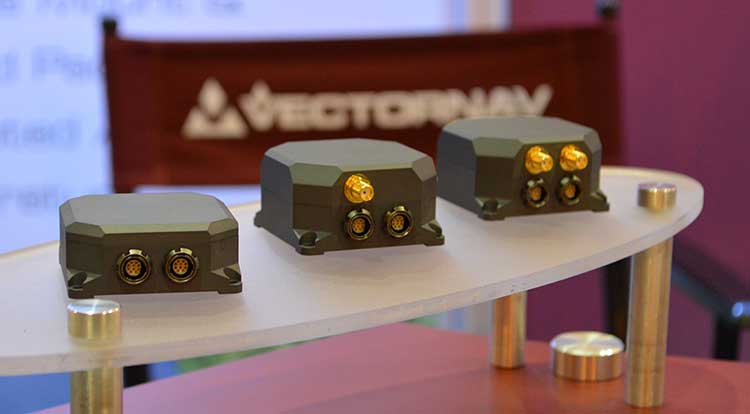
VectorNav Technologies’ tactical series line of inertial measurement units (IMUs) and GNSS-aided inertial navigation systems (GNSS/INS) have completed independent testing for MIL-STD-810G, DO-160G, MIL-STD-1275E and MIL-STD-461.
Completion of the MIL-STD and DO-160 qualification tests proves the robustness of the tactical series to a range of temperature, shock, vibration and other environments, as well as conformance to numerous electrical interface and EMI standards.
The testing demonstrates an advantage of the tactical series for defense and aerospace applications. Other advantages are the modules’ SWAP-C (size, weight, power and cost) and performance characteristics.
“There is high demand for dependable, tactical-grade navigation solutions that perform in challenging environmental and operating conditions,” stated VectorNav Director of Sales and Marketing Jakub Maslikowski.
VectorNav’s tactical series includes the VN-110 IMU/AHRS, the VN-210 GNSS/INS and the VN-310 GNSS-compass aided GNSS/INS.
VectorNav’s new Tactical Series includes the VN-110 IMU/AHRS, the VN-210 GPS/INS and the VN-310 dual-antenna GPS/INS. (Photo: GPS World)
The products include an onboard tactical-grade IMU (<1˚/hr in-run gyro bias stability), along with VectorNav’s proprietary filtering, INS and GNSS-compass algorithms.
The products offer 1 to 2 mrad attitude performance in compact, rugged enclosures and include a 10-pin auxiliary port for integration with external real-time kinematic and SAASM-based GNSS receivers, as well as higher-performance IMUs.
Testing for the MIL-STD and DO-160 standards was performed by independent, certified testing companies in Plano, Texas, and Huntsville, Alabama.
Trade wars may be THE only serious limiting factor
The GNSS chip market worldwide is projected to grow by $2.7 billion, guided by a compounded growth of 8%, to 2025, according to ResearchandMarkets. Other market reports cite “huge growth” and “strong development” in GNSS-related markets such as simulators, aviation and defense. We can count ourselves lucky — or remarkably prescient — to be part of such a robust industry, in such uncertain times.
The world conquest by smartphones, smart cities and the internet of things (IoT) will strongly support this market growth. Also on the horizon is the rising tide of GPS-enabled vehicles, putting automotive telematics on the road to assisted-driver and ultimately autonomous driving.
M&A. Meanwhile, the fast pace of mergers and acquisitions among manufacturers and integrators will strengthen the GNSS economy and propel it even higher. Such interactivity will bring higher revenue shares to key players as well as support overall profitability increases to come.
Accurate monitoring of operations and assets; the astonishing rise of drones to active roles in many industries; and the constant innovation and imagination churning out new products, solutions and augmented services — all will consolidate the strength of our remarkable economy. The much-heralded arrivals of BeiDou and Galileo fully upon the scene will only make the immediate future stronger for our industry.
Chart: GPS World
PNT Broadly. Where GPS, GNSS, and multi-GNSS go, they carry other positioning technologies along on their coat tails: inertial, signals of opportunity, Wi-Fi, ultra-wideband and more. The growing pie is certainly big enough for all to get a large share.
That’s not to say there are no barriers to growth, no clouds on the horizon. Licensing, laws and regulations will, as ever, constrict growth. This is not always a bad thing. Controlled growth and wise use benefit us all, and prevent runaway bubbles that can burst for lack of proper internal support.
Mapping. Meanwhile, a host of well-established businesses and nascent enterprises exploit the increased interest in location-based information as an enabler for many consumer, organizational and governmental services. This means that mapping and all manner of technologies associated with it — laser, lidar, infrared and more — may grow at even faster rates.
A brave new world awaits. Once GNSS is integrated with artificial intelligence, there’s no telling where we’re headed.
Of the many uncertainties across the globe, economic warfare poses a greater risk to GNSS than does military conflict. The latter, cynically enough, will actually benefit the industry in the short run, though its effect may chill in the long run.
Chart: GPS World
Trade. One of the biggest questions confronting the industry now is whether the trade and tariff war between the U.S. and China will continue, and what effect it will have. Experts disagree widely on both questions, though almost all of them, except the leaders who are supposed to listen to them, agree that it’s generally a bad thing.
As was stated in these pages at this time last year, if business confidence falls as a result, global output could also drop.
Opportunities Outweigh Obstacles
Industry leaders confront spectrum issues, jamming
In contrast to the rosy forecast on the previous page, serious issues confront the GNSS market. None of them are more serious, thornier or difficult to resolve (despite the many solutions offered) than spoofing and jamming.
Like a tragic hero, GNSS carries a potentially fatal weakness within its strength. To be ubiquitous and highly precise, the signals come from space. Coming from space, they are weak and susceptible to malicious meddling.
Other political and technological obstacles put pressure on the GNSS industry, and therefore upon the whole PNT industry. GNSS always will be the backbone, the center core holding together various adjunct positioning, navigation and timing technologies.
These issues, following closely on the heels of spoofing and jamming, include but are not limited to: spectrum competition and spectrum management; cybersecurity; privacy; net neutrality; national security export controls; product liability; and failure, however temporary, of GNSS systems.
We’ve seen this last most recently with Galileo, but all the GNSS have suffered such setbacks, and surely will again. The nature of the response to each occurrence is the most critical factor.
Keep on the Sunny Side. However, the opportunities far outweigh the obstacles. The greatest opportunities always arise from the greatest asset that the industry possesses: intellectual capital.
Many of the opportunities are cited on the previous page. While high precision will continue to lead the innovation charge and provide the highest profit margins, the smartphone and the automobile will increasingly take up the MVP (most valuable positioner) role within the industry.
Market Intelligence. All these factors make unprecedented demands on management attention and agility. Executives need good market intelligence to keep abreast and ahead of fast-developing research and development trends, market shifts, developments in neighboring or competing technologies, and protectionist tariffs and import/export controls.
Insight provided by all regions, sectors and job titles
This year’s State of the GNSS Industry Survey provides insight from around the globe.
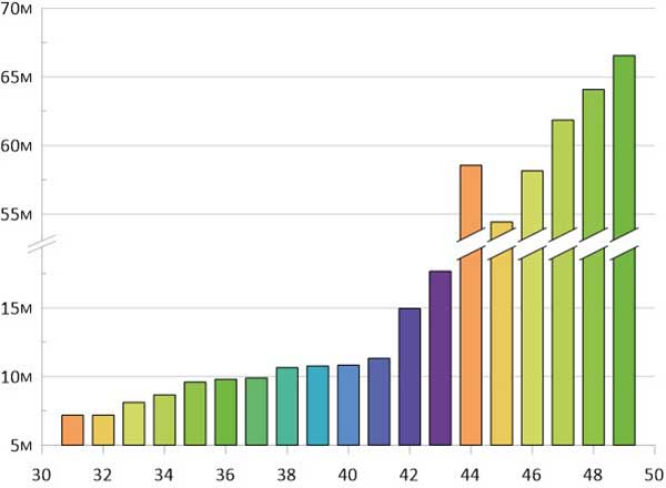
Just over half our respondents work for companies or organizations headquartered in North America; 15% are from Asia-based operations; roughly 10% each for enterprises in Europe and Latin America; slightly less for the Pacific region; and the rest of the replies scattered across Africa, the Middle East and Russia. Truly an international sampling!
Chart: GPS WorldChart: GPS WorldChart: GPS WorldChart: GPS World
Demographics. For job titles, we drew in-depth data from:
owner/president/CEO, 21%
engineer, 20%
general, product or program manager, 19%
other, mostly surveyors or GIS analysts, 18%
researcher, 10%
vice president, CTO, COO, CFO or similar, 6%
sales and marketing, 5%
Sector. The intelligence in the following pages accumulated from these industry verticals:
survey and high precision, 29%
defense, security, government, 19%
mapping, data acquisition/processing, GIS, 14%
satellites, signals and simulation, 9%
machine control, precision agriculture, or transportation (non-autonomous), 6%
A roundup of recent products in the GNSS and inertial positioning industry from the September 2019 issue of GPS World magazine.
OEM
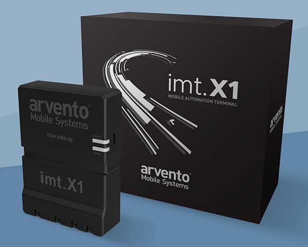
Vehicle tracker
Uses u-blox to detect panic breaking
Photo: u-blox
Arvento’s imt.x1 has a six-axis gyro sensor that can sense three-dimensional movement caused by emergency acceleration, panic braking and directional yaw and drift. With connectivity options including dual CANBus and Bluetooth, the system is eCall compatible and captures and provides data for accident analysis and other vehicle tracking functions. The system also uses the next-generation powerful Arm-based microcontroller. The system’s high position sensitivity and accuracy are based on integration of u-blox’s 2G, 4G and 5G-ready cellular modules as well as GNSS modules.
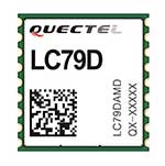
The compact LC79D module features concurrent multi-constellation GNSS receivers on dual GNSS bands. It uses L1 and L5 for GPS, Galileo and QZSS, L1 band for GLONASS and BeiDou, and L5 band for IRNSS. It can generally increase the number of visible satellites, significantly improve positioning drifting when driving in urban canyons and enhance positioning accuracy. Embedded with a low-noise amplifier (LNA) and multi-tone active interference, the module provides high sensitivity and reliable anti-jamming capability, ensuring exceptional acquisition and tracking even in weak signal areas.
The mosaic development kit helps integrate mosaic into an existing system. Mosaic is a compact high-precision multi-frequency GPS/GNSS module that brings precision and reliability of high-end multi-frequency GNSS to mass-market applications. Its light weight and low power consumption makes mosaic suitable for robotics, automation, telematics and wearables. The kit supports connectivity through internet, COM ports, USB 2.0 and an SD Card slot. Mosaic provides Advanced Interference Mitigation (AIM+); extensive corrections support for high-accuracy positioning; integrity needed for safety-critical applications such as autonomous vehicles; and a 100-Hz update rate, suitable for robotics and fast-moving vehicles.
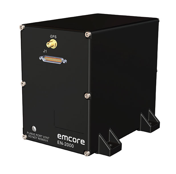
The EN-2000 is the newest addition to the Emcore-Orion series of micro-inertial navigation (MINAV) systems. It is compact and lightweight, weighing less than 7 pounds, with very low power consumption of 10 watts. It can deliver twice the performance of the EN-1000 with the same form factor. With its low size, weight and power (SWaP), the compact EN-2000 is suitable for unmanned aerial vehicles, unmanned underwater vehicles, unmanned ground vehicles, manned aircraft, rotorcraft and dismounted soldier applications. Its three-axis design uses a solid-state optical transceiver with advanced integrated optics, combined with new field programmable gate array (FPGA) electronics to deliver stand-alone aircraft-grade navigator performance at one-third the SWaP of legacy systems.
The Miniature PLGR Engine – M-Code (MPE-M) GPS receiver is a small Type II form factor ground receiver, and incorporates the company’s recently certified Common GPS Module (CGM). As a drop-in replacement for the thousands of customers using Collins’ Miniature PLGR Engine-SAASM (MPE-S) GPS receiver, the new MPE-M technology provides 10 times stronger anti-jamming capabilities for the direct acquisition of GPS signals than its predecessor. The MPE-M receives the current military Y-code GPS signal along M-code. It provides warfighters with improved security and assured positioning, and it satisfies the U.S. government’s requirement for all military GPS equipment to be M-code capable. It is designed for lightweight, ground-based applications such as radios, blue force trackers, targeting devices, vehicle line-replaceable units (LRUs) and small unmanned aircraft. The MPE-M’s security certification makes the receiver eligible for export to U.S. allies through the Foreign Military Sales (FMS) program.
The Catalyst software-defined GNSS receiver for Android phones and tablets is now available with a usage-based service plan: Trimble Catalyst On Demand. The new service plan meets the needs of industries and organizations that need a more flexible payment model. Organizations use Catalyst to record positions, navigate to points, measure relative distance and create digital maps. Trimble Catalyst On Demand provides scalable access to real-time kinematic (RTK)-quality GNSS positioning using a pay-per-use hourly pricing model in addition to the current Catalyst monthly plans. The service also enables automated domain-level email address access, which streamlines license allocation for organizations with a large number of users. (Pictured: Catalyst DA1 antenna).
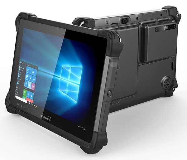
The DT301X is designed for 3D mapping. Its Intel RealSense Depth camera provides real-time 3D imaging combined with a dual-frequency GNSS module for real-time mapping and positioning. The digital images are better than high-definition standard, and are suitable for construction building information management (BIM) graphics. The highly durable IP65 and MIL-STD-810G-rated tablet in a slim case can be used in the field, office and vehicles. A bright 10.1-inch touchscreen provides indoor/outdoor viewing. The tablet includes long-range Bluetooth and 4G LTE mobile broadband for the latest in high-speed communications. An Intel 8th-generation Core i5 or i7 processor offers high performance while still being energy efficient.
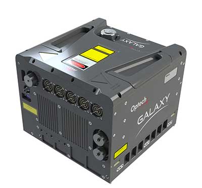
Mapper for wide-area, mountain, urban and corridor surveys
Photo: Teledyne Optech
The ALTM Galaxy PRIME wide-area lidar sensor offers collection efficiency, a small form factor and high-quality data sets that meet rigorous USGS lidar standards. It has a 6,000-meter above-ground-level (AGL) collection envelope and 1-MHz on-ground collection rate. Galaxy PRIME includes lidar technology enhancements to increase sensor performance and collection efficiency, improve data quality, and simplify the collection process. It can be used either gyro-stabilized or fixed-mounted, one camera or six, and full waveform or discrete. PulseTRAK technology enables a continuous operating envelope by eliminating data coverage gaps and irregular point density. Applications include wide-area mapping, urban mapping, natural resource management, engineering, infrastructure modeling, and powerline and transportation corridors.
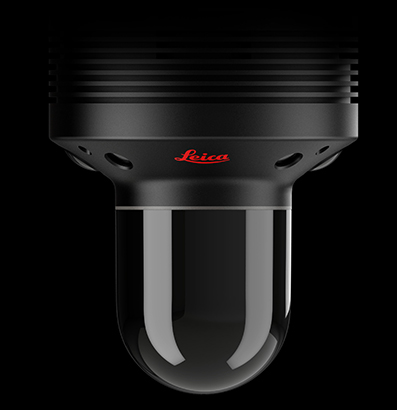
The Leica BLK247 real-time reality-capture device uses sensor fusion technology to detect and report physical changes within a space. It is designed for continuous 3D reality capture, extending capabilities for safety and security applications. The sensor provides real-time situational awareness through edge computing and lidar-enabled change-detection technology. Using artificial intelligence, the BLK247 can tell the difference between still and moving objects — such as a person walking who leaves a suitcase behind — and identify security threats to provide real-time alerts.
Version 15 of Grapher has new capabilities to improve the ability to model, analyze and interpret data as well as communicate the results. Grapher users can now access new Fit Curve, Axes and Statistical Plotting capabilities. Also, users are provided greater color customization functions in the latest release. Enhancements give Grapher users a more powerful ability to display and communicate the results of their work to others. The software provides 80 different 2D and 3D plot types for analyzing and displaying scientific data.
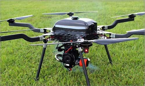
The Harris Aerial H4/H6 Hybrid multicopter is now offered as an integrated package with any Lidar USA scanning system. The Harris Hybrid can provide longer flights with lidar and industrial-grade cameras. The Harris Hybrids use a small generator running on 95 or higher octane fuel to power the UAV for up to five hours.The H6 can carry an A-series high-definition lidar system of 3 kg for 2.5 hours and a V-series of 5 kg up to 1.5 hours. For the lidar operator, this means most projects will require only one or two flights.
The US-1 was built with sensitive enterprise and government customers in mind. It was designed from the ground up in the United States with a battery-first approach to enable electric aircraft to compete with conventionally fueled incumbents. The US-1 runs on a secure open-source operating system by Auterion. It provides 78 minutes of flight time and high-resolution optical and thermal cameras. US-1 UAVs have been deployed to fight fires, locate pipeline leaks, and track armed suspects.
Impossible Aerospace, impossible.aero
The DRS-M600 reusable parachute safety solution, developed for DJI M600 and DJI M600 Pro, meets specifications of the ASTM F3322-18 standard. The successful completion of the ASTM standard test makes it possible for the Federal Aviation Administration to issue permits for its use on drones over crowds. The ASTM F3322-18 standard is the first standard for parachute systems designed specifically for small UAVs.
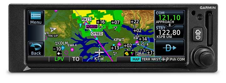
The GNC 355 is a GPS navigator with localizer performance with vertical (LPV) approach guidance. (Photo: Garmin)
The GNS 355 GPS navigator with localizer performance with vertical (LPV) approach guidance gives pilots the benefits of WAAS/SBAS GPS guidance with a modern communications radio. Intended for Class I/II aircraft that weigh 6,000 lbs./2,721 kg. or less, the GNC 355 is certified for more than 700 aircraft makes and models. Aircraft owners can incorporate the GNC 355 into an existing avionics stack because of its standard 6.25-inch wide by 2-inch tall design. The responsive touchscreen display allows pilots to quickly access direct-to functionality, moving map, flight plan, nearest, procedures, waypoint and terrain pages and create customizable data fields and shortcuts for quick, one-touch access to important information. Fully WAAS/SBAS IFR-approach-capable, the GNC 355 gives pilots the benefit of flying LPV, as well as Area Navigation (RNAV) approaches. Many approaches offer vertical approach guidance as low as 200-feet above ground level (AGL).
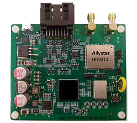
The Allystar INS Platform is a dual-antenna, multi-frequency, multi-GNSS inertial navigation system (INS) that delivers accurate and reliable position, velocity and orientation. It combines high-grade, six-axis, temperature-calibrated accelerometers and gyroscopes with a multi-frequency, multi-GNSS engine, the HD9300 series. The HD9300 is a dual-antenna chip-grade real-time kinematic (RTK) GNSS receiver for accurate positioning and heading. The Allystar INS platform contains an on-board sensor-fusion filter, plus navigation and calibration algorithms for different dynamic motions of land vehicles. The Allystar OBD Data Adapter (v1.0) enables users to read and monitor various sensors built into cars, obtaining real-time vehicle speed and gear signals from the on-board diagnostics (OBD) interface, and then output AT (attention) commands by serial port or serial peripheral interface (SPI).
The GPS World staff reported live from Intergeo Sept. 17-19 in Stuttgart, Germany. The massive trade show, dubbed the “global hub of the geospatial community,” brings together more than 19,000 visitors from more than 114 countries and features approximately 640 exhibitors. Check out the latest industry news, as well as photos and videos from the event.
KVH Industries’ Bill Houtz offers an overview of the KVH TACNAV 3D, a fiber optic 3D inertial navigation systems with embedded GNSS, at the Institute of Navigation’s 2019 Joint Navigation Conference in Long Beach, California. According to the company, TACNAV 3D’s modular tactical design and flexible architecture allow it to function as either a standalone navigation solution or as the core of a multi-functional Battlefield Management System.