The first eight GPS III satellites are under contract and in production at Lockheed Martin’s GPS III Processing Facility outside of Denver.
The U.S. Air Force Space and Missile Systems Center awarded a contract option to Lockheed Martin Space Systems Company to procure two additional GPS III satellites, space vehicles nine and 10 of the next generation. The contract option procures long lead and production hardware.
“The GPS III SV 9 and 10 satellites are expected to be ready for launch in 2022, thus sustaining the GPS constellation and the global utility the world has come to expect,” said Lt. Gen. Samuel Greaves, the Space and Missile Systems Center’s commander and Air Force program executive officer for space.
The Lockheed Martin team is finishing up final testing and integration activities on the first GPS III satellite, GPS III SV01, and is preparing to deliver it to the Air Force later this year. The second satellite, GPS III SV02, is poised to have its major functional systems fully integrated into one space vehicle prior to starting its own environmental testing. GPS III SV03 also is beginning to take form in the company’s production clean room as its major subcomponents are being assembled. \All eight of the first set of GPS III satellites are in various stages of production at Lockheed Martin’s GPS III Processing Facility outside of Denver.
The government expects to compete future purchases of GPS III satellites, beginning with GPS III SV 11. This competition will maintain the current technical baseline of GPS III and will add additional hosted payloads to increase system accuracy, search and rescue capability, and universal S-band compatibility.
Harris Corporation delivered the first of 34 modernized receivers to support the GPS Next-Generation Operational Control System (OCX). They will receive the signals sent by the current GPS satellite constellation plus the new signals sent by the next generation GPS III — 13 military and civilian signals in all.
The receiver was shipped to the prime contractor, Raytheon Company, in Aurora, Colorado, after it passed a critical electromagnetic interference test, the first of many stringent qualification requirements. Though the receivers will be placed throughout the world, this first production unit will be installed in Aurora as OCX software development and integration continues.
OCX will replace the existing ground control system that receives signals from the 31 operational GPS satellites already orbiting Earth. Only OCX will be able to receive and decrypt all GPS III military and civil signals, however.
In addition to receivers, Harris has delivered 14 ground encryptors that will help protect the GPS signal. Harris also is providing critical software elements, which provide the fundamental navigation data to the GPS satellites and enable U.S. Air Force operators to better know and monitor the exact position and timing of the GPS constellation.
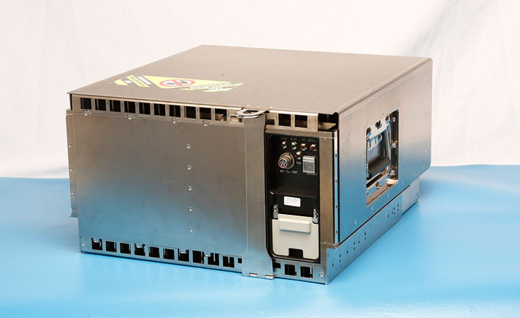
Pictured here is the advanced MDU on navigation payloads being delivered for GPS III Space Vehicles 1-10. (Photo: Harris)
All-in-one time-and-frequency master time and clock server
Spectracom’s VelaSync time server and grandmaster clock.
When the VelaSync time server platform was introduced in 2014, it met the needs of financial trading networks’ move to 10 gigabit-per-second networking. Now available with 40-GbE network interfaces, it offers high-performance synchronization for time-sensitive networks. Matching network speeds between timing and data on a single low-latency high-throughput network enhances synchronization accuracy and eliminates queuing delays and hidden time errors caused by slower connections. The availability of a network timing appliance with 40-GbE interfaces benefits any deployment of critical network infrastructure at high data rates.
The TW3970 / TW3965 antennas have superior cross polarization rejection to enhance multi path signal rejection, tight phase center variation and an excellent axial ratio. The TW3970 is a pole mount or through-hole mount antenna; the TW3965 is an embeddable form. Bothemploy Tallysman’s Accutenna technology and are capable of receiving GPS L1/L2/L5, GLONASS G1/G2/G5, BeiDou B1/B2, Galileo E1/E5a+b plus L-band correction services (1164 MHz to 1254 MHz + 1525MHz to 1606 MHz). The antennas are designed for precision agriculture, autonomous vehicles and other precision applications. The ability of the antennas to access L-band correction services extends its utility to a wider range of applications.
The Tactical Series of inertial navigation systems (INS) is a next-generation family for high performance. Built on a common tactical-grade proprietary micro-electro-mechanical (MEMS) inertial sensing core, the Tactical Series includes the VN-110 inertial measurement unit and attitude heading reference system (IMU/AHRS), the VN-210 GPS-aided INS (GPS/INS), and the VN-310 dual-antenna GPS/INS. The Tactical Series offers the same functionality and features as the Industrial Series for integrators of SWaP-C (size, weight, power and cost) constrained manned and unmanned systems. The Tactical Series takes advantage of the latest developments in solid-state MEMS technology to incorporate a three-axis gyro with <1°/hour in-run bias stability, leading to an attitude accuracy of 1 to 2 milliradian. In addition to the improved IMU core, the Tactical Series enclosure is designed to DO-160G airborne standards and rated IP68 for deployment in harsh and extreme environments.
Plug n’ fly control system for UAV, UAS, USV and UGV systems
Veronte Autopilot is a miniaturized fail-safe avionics system with an embedded suite of sensors and processors for advanced control of unmanned systems. The OEM version weighs 90 grams, and the version with an aluminum enclosure weighs 200 grams. Both versions include a datalink radio. The control system is fully configurable — payload, platform layout, control phases, control channels and the user interface layout can be user defined, making it cost effective for a wide range of professional applications. The embedded GPS module offers RTK-like positioning with centimeter precision. It meets DO-178C / ED-12, DO-254 and DO-160G aircract regulations.
Critical coverage for autonomous driving development
TomTom’s HD (high-definition) Map and RoadDNA are highly accurate digital map products helping automated vehicles precisely locate themselves on the road and plan maneuvers, even when traveling at high speeds. These technologies are being rolled out in strategic geographies and are the subject of key partnerships with other automotive suppliers. TomTom now offers more than 122,000 kilometers of HD Map coverage globally, including Interstates in Connecticut, Delaware, District of Columbia, Georgia, Idaho, Kansas, Louisiana, New Hampshire, New Mexico, North Carolina, Ohio, Pennsylvania, Rhode Island, South Dakota, Tennessee, Texas, and Vermont; Interstates and highways in California, Michigan and Nevada; and the Autobahn network in Germany.
Applications range from infrastructure to infotainment
Smart Antennas by Laird Technologies combine antenna elements and radio receivers in the same robust package. Compared to traditional architectures, the Smart Antenna provides signifcant performance improvement and system-wide cost savings. Custom solutions are available, including 4G LTE cellular, GNSS, Wi-Fi and Bluetooth, as well as the emerging dedicated short-range communications (DSRC) technology with a 1,000-meter range for V2X. Applications include navigation systems, vehicle-to-vehicle communication,vehicle to infrastructure communication and infotainment. Operating temperature range is –40 C to 85° C.
The CEESCOPE-USV is a waterproof one-box echo sounder, GNSS and broadband radio telemetry package that can be installed on practically any remotely operated unmanned surface vehicle (USV). The self-contained unit requires no interface with the USV, eliminating challenges of instrument data integration on the vehicle. Using real-time broadband radio telemetry, detailed 20-Hz dual-frequency soundings, up to 20-Hz RTK GNSS and a 3200-sample-per-ping digital echogram are available to the USV operator on shore via the CEE-LINK radio base station. Data from the CEESCOPE-USV telemetry link allows the operator to steer the USV along the survey line like in any manned boat survey. The CEESCOPE-USV offers users a range to their vehicle of more than 1,000 meters.
The new ALS80-UP airborne sensor enables even more flexible data acquisition with extended range measurement capability. It takes advantage of the dual-output optical system pioneered in the ALS70 and enhanced in the originl ALS80. The AL80-UP has higher Multiple Pulse in Air (MPiA) operation settings, enabling data collection in extreme terrains with minimal variation in swath width due to terrain elevation variations. The ALS80-UP works perfectly in a wide variety of scenarios, including wide-area mapping, detail mapping from high-flying heights and detail mapping over mountainous terrain. With its expanded maximum range, the system has demonstrated good results at up to 6,000 meters above terrain and with terrain relief of up to 2,300 meters.
The Settop Repeater allows rover-RTK network users in areas of low or no GSM coverage to receive differential corrections via radio. It can connect to any external radio model on the market for precision agriculture systems or machine control. Repeater field application versatility is managed by an intuitive software controlled using a touchscreen. It can also be used for land surveying and marine work. It reduces the need for an RTK base station and offers flexible field configuration.
Expanded toolsets and capabilities for speed and accuracy
FieldGenius 8 software takes advantage of the high-power processors, high-definition displays and larger memory in modern Windows Mobile powered data collectors and Windows 7 powered tablets. It provides tight control through expanded toolsets. Features include easy GNSS local transformation with the ability to export and import localization files; enhanced DXF support; advanced point averaging, which allows users to take multiple GNSS measurements and calculate an averaged position; support for integrated inertial sensors; native unicode support;and simplified GIS mapping. FieldGenius 8 also has improved road alignments, an onboard basic measurement mode, dynamic screen rotation and expanded ASCII export options. Supported coordinate systems, geoids, instruments and data collectors have been expanded, making it easier to integrate into existing survey operations.
The FLIR Vue Pro R adds radiometric functionality to the Vue Pro camera, giving drone operators the ability to save pictures for post-flight image analysis and accurately measure the temperatures of individual image pixels. Calibrated radiometric imaging allows it to capture the temperature data of every pixel in an image. When saved in Radiometric JPEG format, still images can be imported into FLIR Tools software for detailed analysis and reporting. FLIR Tools, a free download on FLIR.com, lets drone operators adjust settings including object emissivity, background temperature, target distance, relative humidity and thermal sensitivity, as well as assigning various color palettes for each image. The Vue Pro R records digital thermal video, along with radiometric thermal still images, to an on-board micro-SD card. For applications such as electrical inspection, infrastructure assessment and precision mapping, the onboard recording allows operators to capture high-quality thermal data for post processing and analysis.
Reconnaissance for disaster relief, time sensitive situations
The Digital Mapping Reconnaissance Toolkit (DMRT) creates up-to-date orthomosaic maps and 3D models. Users can fly a drone to survey the landscape for real-time solutions, and geotag reference points in impacted areas without a time lag. Seeing what the drone sees, pilots can create search patterns and map with situational awareness. Modular aerial and land-based solutions are available.
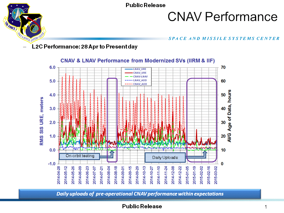
A quarterly meeting of the U.S. GPS Program’s interagency Civil Navigation Signals (CNAV) Tiger Team on March 5 focused on the new L2C and L5 GPS civil signals. “CNAV Message Types 10, 11, 30 and 33 are currently transmitted on seven GPS IIR-M (L2C) and eight GPS IIF satellites (L2C and L5),” wrote Rick Hamilton, CGSIC Executive Secretariat, USCG Navigation Center, in a status email to the Civil Global Positioning System Service Interface Committee (CGSIC).
“A Modernized Navigation (MODNAV) Tool integrated with the GPS ground control software (Architecture Evolution Plan or AEP) is generating the CNAV data messages,” Hamilton wrote. “Daily CNAV uploads began December 31, 2014, and the U.S. Air Force reports that signal performance of CNAV matches or slightly outperforms Legacy performance: average user range error (RMS URE) from 25 February – 3 March 2015 was 0.50 m for Legacy and 0.57 m for Modernized; best week for Modernized signals since the broadcast initiated April 2014 was 0.42 m for 6 – 13 January 2015.
The graph above, from the Coast Guard Navigation Center website, illustrates the CNAV performance.
“Users are reminded that these CNAV signals are ‘pre-operational’ and should be used with discretion until they become fully operational; the L5 message is currently set unhealthy,” Hamilton concluded.
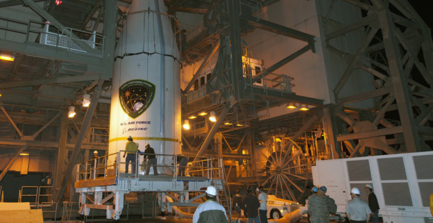
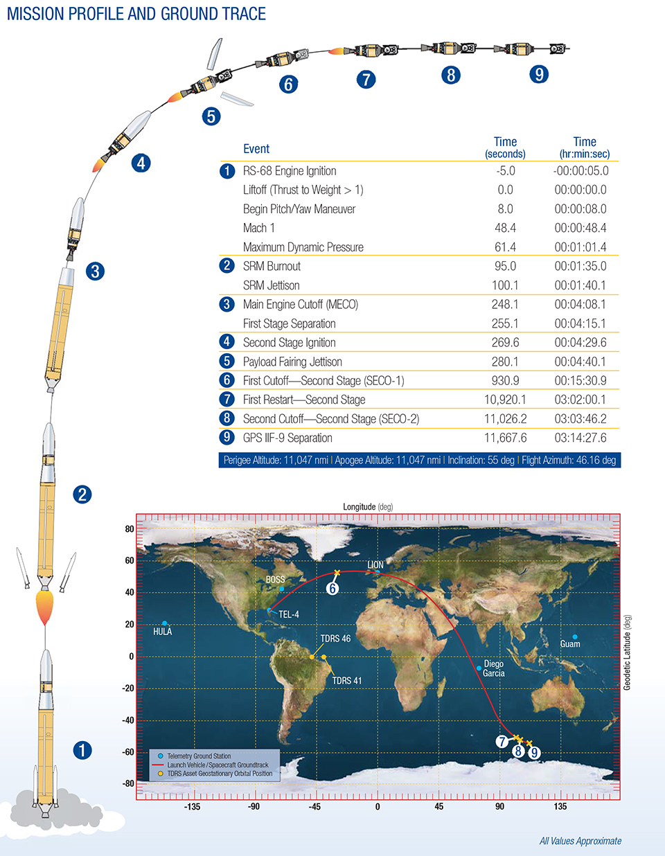
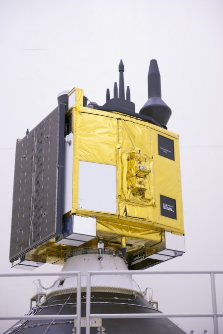
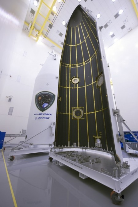
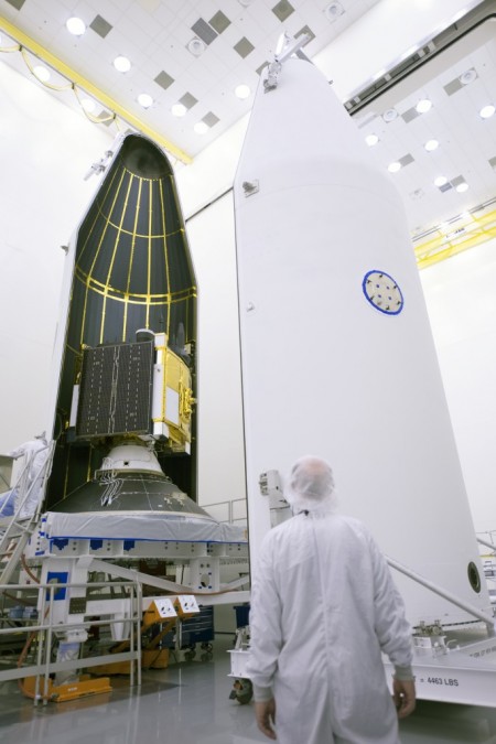
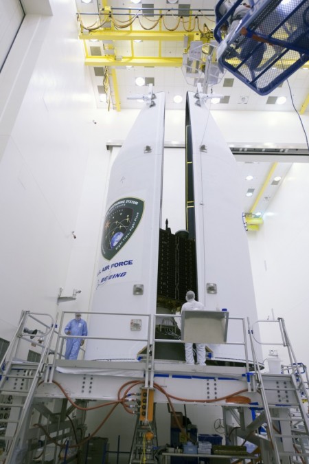
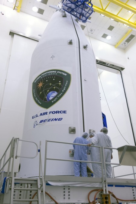
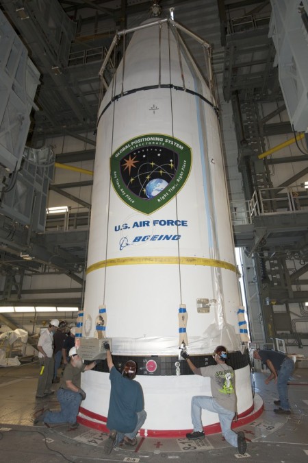
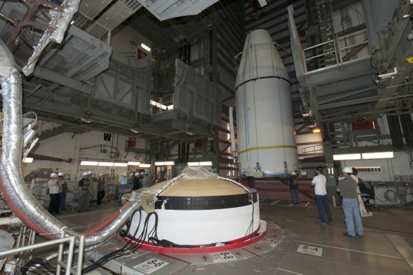
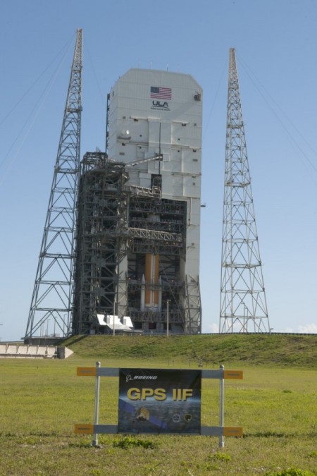
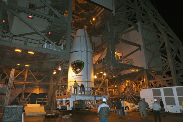
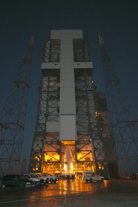
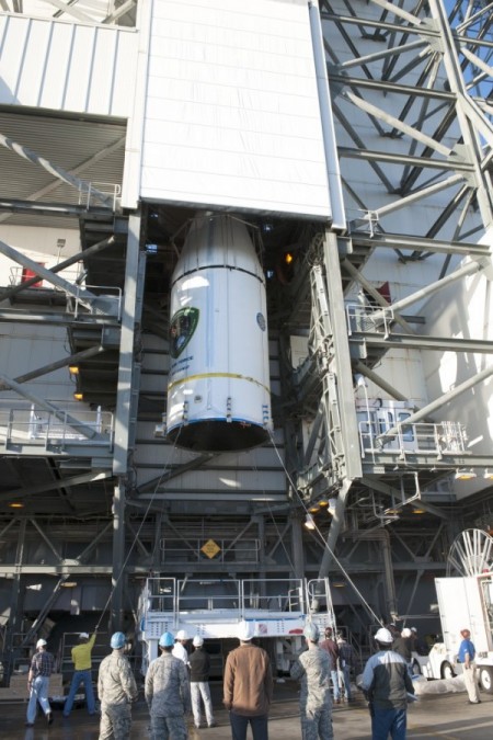
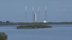
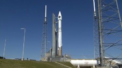
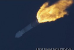
The U.S. Air Force’s ninth GPS Block IIF satellite (GPS IIF-9) has been encapsulated in the Delta IV rocket’s four-meter-diameter nose cone at a processing facility, and moved to the launch pad at Space Launch Complex 37 for mating to its booster inside the mobile service tower.
Launch is scheduled for March 25 at 2:36 p.m. EDT (1836 GMT) from Space Launch Complex 37 at Cape Canaveral Air Force Station, Fla. GPS IIF-9 marks the 29th Delta IV launch and the 57th operational GPS satellite to launch on a ULA or heritage launch vehicle.
To follow the launch countdown, dial the ULA launch hotline at 1-877-852-4321 or join the conversation on Facebook, Twitter or Instagram.
The planned GPS IIF-9 launch trajectory, event times, and ground trace. (courtesy of ULA)
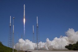
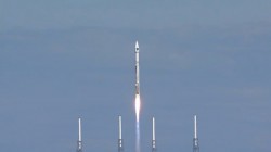
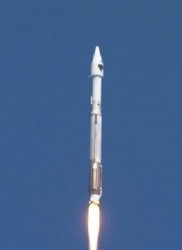
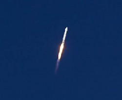
Below are photos from the United Launch Alliance, which supplies the Delta IV rocket and serves as the launch provider for the GPS Directorate.
The ground control system (OCX) that Raytheon is developing for the next-generation GPS program has passed a Pentagon review, reports Reuters. The program will be monitored to ensure it stays on track, a senior Air Force official said on Feb. 6 as reported by the news service.
Major General Roger Teague, director of space programs for the Air Force acquisition chief, said a review by chief arms buyer Frank Kendall went well, but program officials and the contractor got “tough marching orders” to stick to schedule and cost targets.
Raytheon’s program manager Matt Gilligan said the review provided the company with “clear direction, the best technology, and appropriate resources to…deliver OCX on a schedule that meets GPS enterprise needs.”
Kendall had ordered the review after an Air Force restructuring that increased the cost of the program by 80 percent to $1.6 billion.
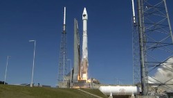
The Delta 4 rocket that will launch the next GPS satellite has been rolled out to the launch pad, reports Spaceflight Now. The satellite itself, GPS IIF-9, will be attached to the rocket in March. The United Launch Alliance vehicle is scheduled for launch March 25.
The launch will be the 371st Delta rocket since 1960 and the 29th Delta 4 since 2002. It also marks the 69th GPS satellite launch and the 55th to use a Delta rocket.
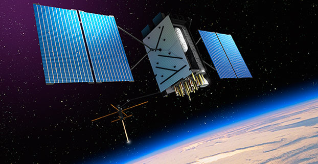
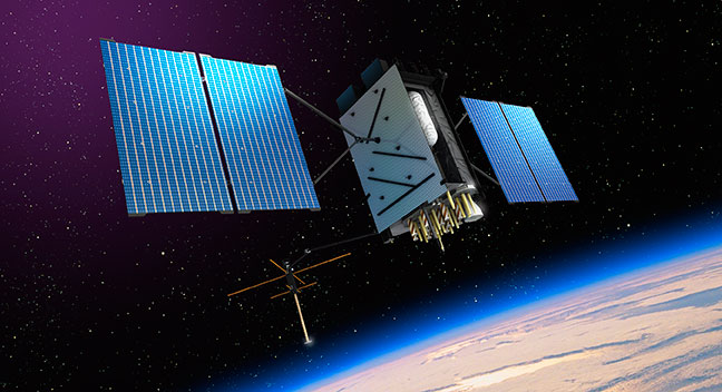
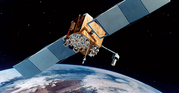
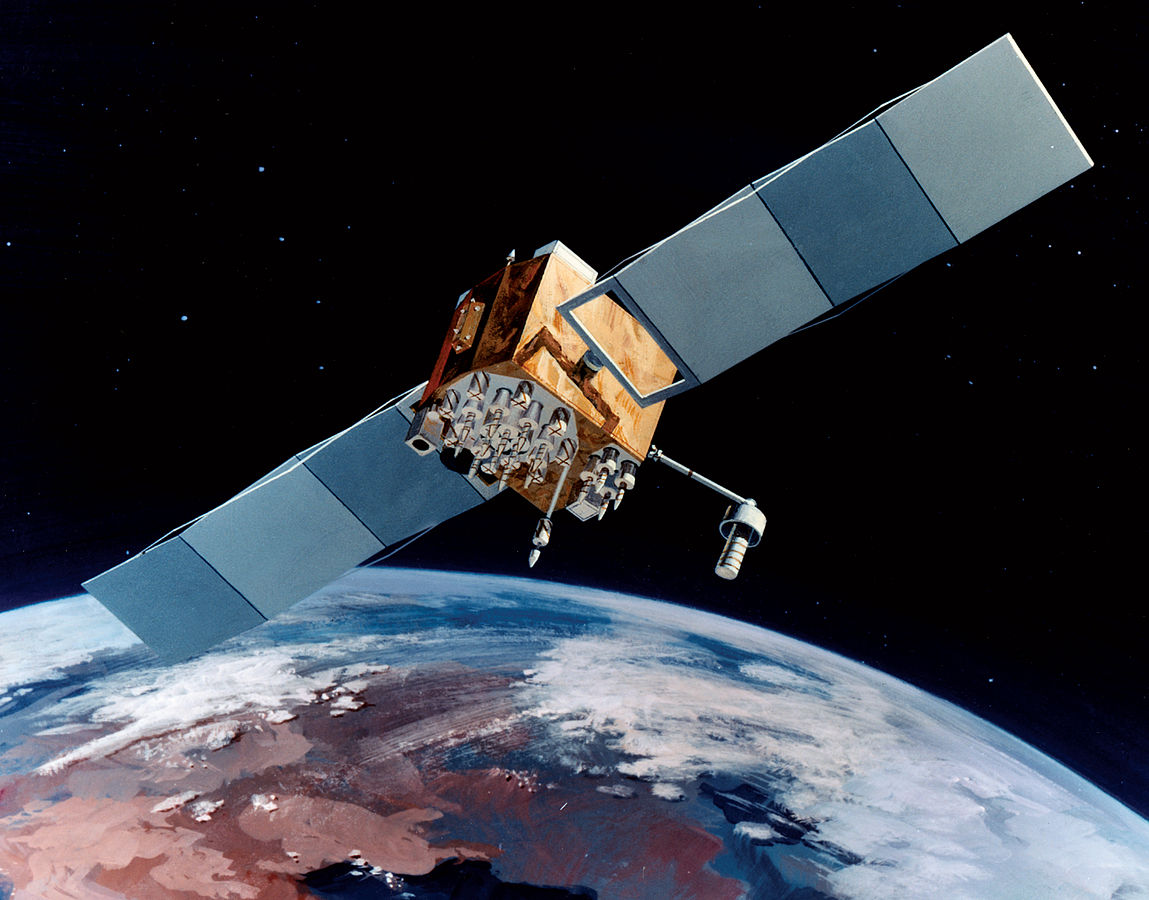
Artist’s rendering of GPS III satellite (courtesy of Lockheed Martin).
Raytheon Company and Lockheed Martin successfully completed the fourth of five planned launch and early orbit exercises to demonstrate new automation capabilities, information assurance and launch readiness of the U.S. Air Force’s next-generation GPS III satellite and Operational Control System (OCX).
Successful completion of Exercise 4, on Oct. 3, represents a key milestone demonstrating the end-to-end capability to automatically transfer data between Raytheon’s OCX and Lockheed Martin’s GPS III satellite. One additional readiness exercise, five launch rehearsals and a mission dress rehearsal are planned prior to launch of the first GPS III satellite with OCX.
The exercise used the latest baseline of Raytheon’s OCX Launch Checkout System (LCS) software featuring integrated information assurance functionality for the first time and the latest version of Lockheed Martin’s GPS III satellite simulator. Exercise 4 successfully demonstrated mission planning and scheduling capabilities with the simulated Air Force Satellite Control Network (AFSCN) for the first time, including a replan scenario that would occur in the event of a launch slip.
The system also automatically generated antenna pointing angles for the simulated AFSCN, which until now have been manually generated. Exercise 4 expands on three previous exercises, introducing maneuver planning and reconstruction capabilities, as well as advanced planning and scheduling with AFSCN assets. The automation of these capabilities will allow GPS operators to spend their time optimizing system performance rather than focusing on routine operations.
“As part of establishing the LCS Block 0 baseline, the completion of Exercise 4 demonstrates the capability of OCX to successfully support a GPS-III satellite launch in an information assurance hardened environment,” said Matthew Gilligan, Raytheon vice president and GPS OCX program manager. “Exercise 4 began the instantiation of vital OCX automation capabilities that give operators their time back in order to focus on mission critical activities, one of the important elements of a modernized GPS.”
“Launch Exercise 4 demonstrated the team’s ability to complete nearly 100 percent of the GPS III space vehicle 1 launch and early orbit mission sequence,” said Mark Stewart, vice president for Lockheed Martin’s Navigation Systems mission area. “The findings the team made during this robust launch exercise will help mature the processes, procedures, and tools necessary to enter our rehearsal phase and ultimately the launch and checkout mission.”
GPS III satellites will deliver three times better accuracy, provide up to eight times improved anti-jamming capabilities, and include enhancements that extend spacecraft life to 15 years, 25 percent longer than the newest Block IIF satellites. GPS III will be the first generation of GPS satellite with a new L1C civil signal designed to make it interoperable with other international global navigation satellite systems. The first GPS III satellite is currently undergoing integration and testing, with final space vehicle delivery planned for late 2015.
OCX is being developed in two blocks using a commercial best practice iterative software development process, with seven iterations in Block 1 and one iteration in Block 2. Exercise 4 was conducted using the recently completed Iteration 1.5 software, representing an early delivery of the final software baseline. Exercise 5, scheduled for 2015, will include critical information assurance features needed to support launch of the first GPS III satellite.
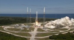
The U.S. Air Force launched the eighth GPS IIF satellite from Cape Canaveral Air Force Station in Florida today at 1:21 Eastern Time, as scheduled. An Atlas V 401 carried the GPS satellite aloft.
GPS IIF-8 is one of the next-generation GPS satellites, incorporating various improvements to provide greater accuracy, increased signals, and enhanced performance for users. With this eighth satellite now launched, only four more Block IIF satellites remain to be placed into orbit. Three are in storage awaiting launch, and one is in production.
“I’m delighted with the outcome of today’s launch. Thanks to the men and women of SMC, the 45th, 50th and 310th Space Wings; Boeing; ULA; the Aerospace Corporation; and the GPS IIF and Atlas V launch teams ceaseless efforts, commitment, dedication, and focus on mission success, we successfully launched the fourth GPS IIF space vehicle this year,” said Col. Bill Cooley, director of Space and Missile Systems Center’s Global Positioning Systems Directorate. “Today’s launch demonstrates our commitment to users around the globe that GPS is the gold standard for position navigation and timing and will continue to deliver capabilities for the foreseeable future,” he said.
After launch, the mission entered a coast phase that lasts about three hours. Following a short second burn of the RL10 engine, the Centaur second stage will deliver the Boeing-built GPS IIF-8 satellite to semi-synchronous orbit over the southern ocean north of Antarctica. Separation takes place about 3 hours, 24 minutes after liftoff.
GPS IIF-8 is the United Launch Alliance‘s fourth GPS launch this year. The mission marks ULA’s 89th mission launched since the company was founded in 2006.
GPS IIF-8 (SVN-69/PRN-03) will replace SVN-51 in the E plane slot 1. SVN-51 will be re-phased from E1 to an auxiliary node at E7 somewhere around SVN-54 currently on station at E4, according to the Air Force Second Space Operations Squadron (2 SOPS). SVN-38/PRN-08 will be taken out of the operational constellation prior to SVN-69 payload initialization and sent to Launch, Anomaly Resolution and Disposal Operations (LADO). PRN-08 will be assigned initially to SVN-49 and set to test.
SVN-38 was launched on November 5, 1997, successfully serving nearly 17 years, 9.5 years beyond its designed service life, due to the diligent efforts of the men and women of the U.S. Air Force. SVN-51 will remain in an auxiliary node once it completes its re-phase journey. The SVN-51 re-phase will take about six months after the initial burn occurs.
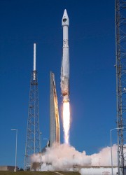
The Air Force is set to launch the eighth GPS IIF satellite from Cape Canaveral Air Force Station in Florida on October 29. The 18-minute launch window opens at 1:21 p.m. EDT.
An Atlas V 401 will launch the GPS IIF-8 mission for the U.S. Air Force.
As described by the Air Force, GPS IIF-8 is one of the next-generation GPS satellites, incorporating various improvements to provide greater accuracy, increased signals, and enhanced performance for users.
GPS IIF-8 will be United Launch Alliance’s fourth GPS launch of 2014 and the 12th of the year. The mission will mark ULA’s 89th mission launched since the company was founded in 2006.
To keep up to speed with updates to the launch countdown, dial the ULA launch hotline at 1-877-852-4321 or join the conversation at www.facebook.com/ulalaunch and twitter.com/ulalaunch; look for the #GPSIIF8 hashtag.
The Air Force Second Space Operations Squadron (2 SOPS) indicates that IIF-8, SVN-69/PRN-03, will replace SVN-51 in the E plane slot 1. SVN-51 will be re-phased from E1 to an auxiliary node at E7 somewhere around SVN-54 currently on station at E4. SVN-38/PRN-08 will be taken out of the operational constellation prior to SVN-69 payload initialization and sent to Launch, Anomaly Resolution and Disposal Operations (LADO). PRN-08 will be assigned initially to SVN-49 and set to test.
SVN-38 was launched on November 5, 1997, successfully serving nearly 17 years, 9.5 years beyond its designed service life, due to the diligent efforts of the men and women of the U.S. Air Force. SVN-51 will remain in an auxiliary node once it completes its re-phase journey. The SVN-51 re-phase will take about six months after the initial burn occurs.
Enter GPS III. The long-awaited navigation payload for the next-generation satellite pulled into its new temporary home over the September 13 weekend, the Lockheed Martin Space Systems facility in Littleton, Colorado. Lockheed is the U.S. Air Force’s prime contractor for the first batch of eight GPS III satellites.
Exelis Geospatial Systems has committed to delivering the payloads for the second, third, and fourth GPS III satellites “right on the heels” of the first, according to Gen. John Hyten, commander of Air Force Space Command. “If that’s the case, in the not-too-distant future GPS III will be in good shape,” he added. The first GPS III launch is now scheduled for 2016.
Exelis has built GPS payloads since the beginning of the program, but found new challenges over the last two years posed by advanced features of the modernized version. “First-time development and integration issues, including design changes to eliminate signal crosstalk” have set back the schedule.
According to reports, Lockheed Martin has a group of initial platforms readied on its production line to take the incoming payloads.
Still ahead, completion of acceptance testing following integration with the first satellite platform.
Earlier this year, Lockheed Martin issued a request for information on alternate payload providers, and received responses from five companies. In June, the Air Force issued a call for contractors interested in building the next batch of GPS IIIs. Northrop Grumman and Boeing have responded.
The seventh GPS-IIF satellite, SVN-68/PRN-09, launched on August 2, was set to healthy and usable Sunday night, according to Rick Hamilton, CGSIC executive secretariat of the USCG Navigation Center. The change brings the number of satellites transmitting the L2C signal to 13, and those transmitting the L5 signal to seven.
The next GPS-IIF satellite, IIF-8/SVN-69, is tentatively scheduled for launch on October 29.
Below is the full text of the Notice Advisory to Navstar Users (NANU).
NOTICE ADVISORY TO NAVSTAR USERS (NANU) 2014071
SUBJ: SVN68 (PRN09) USABLE JDAY 260/2026
1. NANU TYPE: USABINIT
NANU NUMBER: 2014071
NANU DTG: 172024Z SEP 2014
REFERENCE NANU: N/A
REF NANU DTG: N/A
SVN: 68
PRN: 09
START JDAY: 260
START TIME ZULU: 2026
START CALENDAR DATE: 17 SEP 2014
STOP JDAY: N/A
STOP TIME ZULU: N/A
STOP CALENDAR DATE: N/A
2. CONDITION: GPS SATELLITE SVN68 (PRN09) WAS USABLE AS OF JDAY 260

 The government expects to compete future purchases of GPS III satellites, beginning with GPS III SV 11. This competition will maintain the current technical baseline of GPS III and will add additional hosted payloads to increase system accuracy, search and rescue capability, and universal S-band compatibility.